You are currently viewing a new version of our website. To view the old version click .

ISPRS International Journal of Geo-Information, Volume 14, Issue 1

January 2025 - 39 articles

Cover Story: 
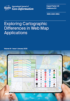
Web map applications are widely used, yet their cartographic design often receives limited attention. This article evaluates eight popular web map applications (Mapy.cz, OpenStreetMap, Google Maps, Bing Maps, HERE Maps, MapQuest, ViaMichelin, and Locus Map) based on six cartographic aspects (Map Key, Map Scale, Map Layout, Navigation Elements, Labels, and Analytical Tools). By identifying inconsistencies in feature representation, such as the absence of certain symbols and variability in others, this study recommends unifying cartographic principles and further user testing to optimize the user interface and experience of web map applications. An interesting finding is the absence of cartographic symbols and labels of some elements in some applications. View this paper
  • Issues are regarded as officially published after their release is announced to the table of contents alert mailing list .
  • You may sign up for email alerts to receive table of contents of newly released issues.
  • PDF is the official format for papers published in both, html and pdf forms. To view the papers in pdf format, click on the "PDF Full-text" link, and use the free Adobe Reader to open them.

Articles (39)

  • Article
  • Open Access
3 Citations
4,155 Views
36 Pages

Real-scene 3D digital campuses are essential for improving the accuracy and effectiveness of spatial data representation, facilitating informed decision-making for university administrators, optimizing resource management, and enriching user engageme...

  • Article
  • Open Access
2 Citations
2,273 Views
26 Pages

HGeoKG: A Hierarchical Geographic Knowledge Graph for Geographic Knowledge Reasoning

  • Tailong Li,
  • Renyao Chen,
  • Yilin Duan,
  • Hong Yao,
  • Shengwen Li and
  • Xinchuan Li

The Geographic Knowledge Graph (GeoKG) serves as an effective method for organizing geographic knowledge, playing a crucial role in facilitating semantic interoperability across heterogeneous data sources. However, existing GeoKGs are limited by a la...

  • Article
  • Open Access
5 Citations
4,853 Views
17 Pages

In this article we present three instruments: (1) a social vulnerability to extreme heat index to identify the areas of a city (and populations thereof) more vulnerable to extreme heat due to climate change (heat islands); (2) a new overall fragility...

  • Article
  • Open Access
2 Citations
3,077 Views
43 Pages

In recent years, shared e-scooters have become increasingly popular as a mode of transportation in urban areas. Shared e-scooters have emerged as a convenient and sustainable transportation option in urban areas, providing users with a flexible and e...

  • Article
  • Open Access
1 Citations
1,934 Views
20 Pages

Spatial optimization is an integral part of GIS and spatial analysis. It involves making various decisions in space, ranging from the location of public facilities to vehicle routing and political districting. While useful, such problems (especially...

  • Review
  • Open Access
11 Citations
3,544 Views
19 Pages

This paper examines the evolution of urban vitality measurement, emphasizing the transformative impact of big data and Internet of Things (IoT) technologies. Traditionally assessed through direct observations and surveys, urban vitality measurement h...

  • Article
  • Open Access
11 Citations
2,511 Views
27 Pages

Revealing Land-Use Dynamics on Thermal Environment of Riverine Cities Under Climate Variability Using Remote Sensing and Geospatial Techniques

  • Nazia Iftakhar,
  • Fakhrul Islam,
  • Mohammad Izhar Hussain,
  • Muhammad Nasar Ahmad,
  • Jinwook Lee,
  • Nazir Ur Rehman,
  • Saleh Qaysi,
  • Nassir Alarifi and
  • Youssef M. Youssef

Urbanized riverine cities in southern Asian developing countries face significant challenges in understanding the spatiotemporal thermal impacts of land use/land cover (LULC) changes driven by rapid urbanization and climatic variability. While previo...

  • Article
  • Open Access
5 Citations
1,444 Views
25 Pages

As monitoring technologies and data collection methodologies advance, landslide disaster data reflects attributes such as diverse sources, heterogeneity, substantial volumes, and stringent real-time requirements. To bolster the data support capabilit...

  • Article
  • Open Access
2 Citations
4,510 Views
17 Pages

Temporal-Spatial Traffic Flow Prediction Model Based on Prompt Learning

  • Siteng Cai,
  • Gang Liu,
  • Jing He,
  • Yulun Du,
  • Zhichao Si and
  • Yunhao Jiang

Traffic flow prediction is one of the most important and attractive topics in geographical information science (GIS), traffic management, and logistics. Traffic flows exhibit significant complexity and dynamics, requiring a thorough understanding of...

  • Article
  • Open Access
5 Citations
2,440 Views
18 Pages

Accurate forecasting of multivariate traffic flow poses formidable challenges, primarily due to the ever-evolving spatio-temporal dynamics and intricate spatial heterogeneity, where the heterogeneity signifies that the correlations among locations ar...

of 4

Get Alerted

Add your email address to receive forthcoming issues of this journal.

XFacebookLinkedIn
ISPRS Int. J. Geo-Inf. - ISSN 2220-9964