Abstract
Barbuda is one of two major islands that comprise the Caribbean nation of Antigua and Barbuda. The island is known for its secluded pink and white sand beaches and, more recently, for Hurricane Irma (September 2017). The category five mega-storm decimated much of the island’s landscape and infrastructure, and the physical damage was widely publicized. Three years after Hurricane Irma, many challenges related to humanitarian aid, fiscal resources, and materials to rebuild remain. There are many natural resource commodity and human social challenges including those related to water resources, agriculture, marine ecosystems, feral animal populations, human health, tourism, and economics. This article includes some of Barbuda’s historical context and identifies a number of current critical challenges and recommendations for activities (approaches) that may advance a number of management practices. For example, the Integrated Watershed Management (IWM) and/or One Health approach(es) include social and fiscal mechanisms to implement programs, policies, legislation, and research in which multiple sectors of Barbuda could communicate and work together to achieve sustainable outcomes. Context is provided to substantiate humanitarian aid, scientific engagement, scientific progress, and political support for a semi-closed cultural socio-ecological island ecosystem at the precipice of change.
1. Introduction
Barbuda is one of two major islands that comprise the Caribbean nation of Antigua and Barbuda [1] located in the West Indies, midway along the Lesser Antilles island chain [2,3] (Figure 1). The Lesser Antilles consist of over 600 tropical islands and cover an area of approximately 14,365 km2 [4]. These islands are grouped into the Leeward Islands, the Windward Islands, and the Leeward (Lesser) Antilles [5]. Each grouping of islands varies widely in terms of geology, soil composition, water security, and vegetation communities. Antigua and Barbuda cover an area of approximately 440 km2 [4]. The 161 km2 island of Barbuda is relatively flat and is predominately composed of limestone rock, with the highest point reaching approximately 38 m above sea level [6]. Approximately 20% of the island comprises shallow lagoons and tidal flats, including the Codrington Lagoon, which is the largest of the lagoons at approximately 20 km2 [7]. Although lacking highly fertile soils, Barbuda has rich marine resources located in the surrounding fringe and barrier reefs [3]. The climate of Barbuda is semi-arid with a total annual precipitation ranging from 750 to over 1000 mm annually. Intra-annual cycles of wet and dry periods [8] are driven by global climate circulations and influenced by the El Niño Southern Oscillation (ENSO) and the Atlantic Multidecadal Oscillation (AMO) [9,10].
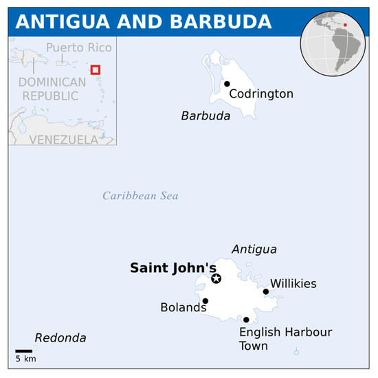
Figure 1.
The Caribbean nation of Antigua and Barbuda (Source: OCHA/ReliefWeb 2013 [11]).
The objectives of this article are to review some of the unique history of Barbuda and its natural resources and to draw attention to a few major current ecological and socioeconomic challenges and needs including (a) fresh water and agriculture, (b) native vegetation, (c) feral livestock, and (d) marine resources and tourism. It is anticipated that this information will mobilize assistance and generate new information that will strengthen the resilience of the Barbuda culture and ecosystem to looming pressures of development and environmental change.
The contemporary economy of Barbuda is largely driven by its abundance of marine resources and tourism [12,13,14]. Currently, the primary marine export is spiny lobster [3]. The increased reliance on marine resources for income is problematic given the current regulations, potential overharvesting, and probable decline of resources attributable to climate change (e.g., increased coral bleaching events) [3]. These challenges, in conjunction with the lack of employment opportunities, have provided impetus to develop tourism on the island [15]. Currently, the people of Barbuda tend to see their island commons as a means of tourism development, rather than for traditional agricultural use [15]. While recent data do not exist for Barbuda, a 2009 report presenting the economy of neighboring Antigua showed that approximately 76% of the nation’s Gross Domestic Product (GDP) is associated with tourism [12]. Barbuda is a member of the Caribbean Communities (CARICOM) and the Organization of Eastern Caribbean States (OECS) [6,12,16,17,18]. The OECS is an economic union comprising ten islands located in the Eastern Caribbean that promotes the unification of economic and trade policies between its member-states. It is dedicated to economic integration and harmony among independent and non-independent Eastern Caribbean states, as well as protecting the legal and human rights of citizens of those states and promoting the effective governance of independent and non-independent Eastern Caribbean states. In the event of a natural disaster affecting states in the sub-region, the OECS plays roles in distributing liability and aids in recovery among the various nations and dependencies of the Eastern Caribbean.
Catastrophe struck Barbuda when a category five mega-hurricane, Irma, made landfall in September 2017, destroying many of the island’s residential buildings and displacing the island’s inhabitants, who were relocated to Antigua [13]. Since the hurricane, there has been great motivation to rebuild and develop in more contemporary integrative ways to manage the island using sustainable and ecologically focused development practices [13,17]. This is important because, with restoration and development, many of Barbuda’s natural resources will require improved planning and management. This is a critical point given the growing tourism industry opportunities and coupled development pressures by the local human population [12,17,19].
As is relatively common of islands in this region, Barbuda has been inhabited by people from different countries and ethnicities, resulting in a deeply rich historical legacy [2]. Like many other islands of the Caribbean, Barbuda was settled by various prehistoric tribes; discovered by Columbus, precipitating use by buccaneers and subsequent European colonization, and slaves were introduced in approximately the late 1600s [16]. Slaves were emancipated in approximately 1834 and remained on the island. Antigua-Barbuda became independent of British rule in 1981. Prior to recent hurricanes, the population of Barbuda was approximately 1800 (at the time of this writing, it is approximately 900), mostly concentrated in Codrington Village, with more than half the population being under the age of eighteen [20]. Ultimately, the island and its distinct natural and cultural attributes are at a historical turning point. There is, therefore, an urgent need for research and investment that will result in more deliberate and intentional approaches of development that are sustainable and conserve the historic way of life and living.
2. Historical Context
The history of Barbuda can be broadly classified into three eras beginning with inhabitation by Amerindian societies (pre-history), British colonialization (1632), and the period since gaining independence (1981) and, thereafter, becoming the state of Antigua and Barbuda [3,21]. In brief, the first recorded settlers of Barbuda were the Siboney [22], archaic age fisher-forager peoples, who settled on the island approximately 5000 years ago. The Siboney relied heavily on the coastal marine resources of Barbuda for survival. This is evident by the remains of their shell mounds, which form distinct geomorphological features along the island’s southern shore [3]. Much later, a second group of settlers, the Saladoid people, arrived on Barbuda in 150 BC [3]. The Saladoid people were responsible for introducing flora and fauna such as sugar cane, apples, and domestic dogs to the island [2,23,24].
Barbuda became a British colony in 1632 and was placed under the control of the Codrington family in 1674 [25]. The Codrington family also owned sugar estates on Antigua, and the family used Barbuda to support their Antiguan properties. During this period, Barbuda provided the Antiguan properties with livestock (horses, cows, sheep, and chicken), and general estate supplies (salt and vegetables) while receiving clothing, some food, and other necessities from Antigua [25]. The environmental conditions of the island, including drought and thin soils, made it difficult for the British to establish large scale plantations similar to the ones on Antigua and other Caribbean islands [3]. Productive small-scale agriculture was, however, successfully implemented by relying on enslaved Africans starting in approximately the late 1600s. The produce from these agricultural activities was used to provide food for the slaves on the plantations in Antigua, giving Barbuda the moniker “the bread basket of Antigua” [3].
Amidst British Colonization, a few of the inhabitants of Barbuda established farms by 1660. Some residents of the island may have participated in small-scale farming of cotton for income and cultivation of subsistence crops like yams, sweet potatoes, maize, pigeon peas, beans, squash, and peanuts [16]. Ultimately, given its small land area and shallow and nutrient-poor soils, broad-scale crop-based agricultural systems were never feasible on Barbuda [6,12,16,18]. In contrast, other Caribbean islands possess soil conditions that are able to sustain a limited crop-based agricultural system revolving around sugarcane (e.g., St. Kitts, St. Nevis, Jamaica, and Barbados) [12,17] or agroforesty systems focused on crops such as banana production (Saint Lucia) [17]. Establishment of forestry practices has been difficult given that the native xerophytic open scrub to scrub forest of Barbuda is made up of species that are not suitable for sustainable silviculture systems [16]. However, the development of forestry operations may not be desirable from a conservation perspective, as silviculture practices may lead to the extinction of numerous endemic species [19].
In addition to small-scale crop production, the enslaved and eventually (approximately 1834) free people of Barbuda developed a complementary herding strategy, successfully overcoming losses in agricultural production during the semi-predictable cycles of drought that frequent the island. These practices, evidenced by the presence of multiple historic stone wells and corrals, allowed continued inhabitation of the island. Barbudans lured livestock to walled wells to capture and export them (mostly to neighboring islands) during times of drought. The export of livestock during drought years provided Barbuda with income from trade, helping to offset the loss of agricultural revenue [3]. During wet periods, communal land tenure allowed livestock to forage, breed unrestrictedly, and drink freely from the wells and sinkholes where water collected. The livestock were periodically rounded up and butchered so that the resulting meat could be exported. During wetter periods, Barbudans resumed crop production and protected crops from grazing cattle with fencing [3].
In 1976, a governing body, the Barbuda Council, was formed even though Barbuda remained under British rule until 1981 when Barbuda, along with Antigua, became an independent state within the Commonwealth of Nations, with Elizabeth II reigning as the first Queen of Antigua and Barbuda [3]. Barbuda has representation in the Antiguan parliament and maintains a locally-elected governing body (The Barbuda Council) separate from Antigua along with separate land governing documents [26]. In the 1980s and 1990s, agricultural activities expanded, resulting in a successful vegetable-export economy in Barbuda, supplying the local islands of St. Kitts, Montserrat, and Antigua. However, many of the historic agricultural activities that made the island self-sufficient have been abandoned in modern times [3]. This has contributed to the continued emigration of people from Barbuda to other parts of the Caribbean and cities in the Global North to seek employment [27].
3. Natural Resources/History
3.1. Geology and Soils
The Lesser Antilles island chain was formed on an unstable region on the Earth’s surface during the Pleistocene. Uplifting caused by two separate volcanic events gave way to coral reef building, which resulted in the formation of Barbuda Island [1,28]. Reef building resulted in the island subsurface consisting of Quaternary limestone and other carbonate rocks [4,28]. As described by Martin-Kaye [28], there are two limestone formations on the island of Barbuda: the Highland Limestone and the Codrington Limestone. The Highland Limestone is a massive limestone with poor intergranular porosity. However, fissures and joints are common throughout the formations, facilitating surface water infiltration during rain events [7,28]. The infiltration of water facilitates high secondary porosity due to the dissolution of limestone to form caves and other karst formations. The Codrington Limestone formation varies more than the Highland Limestone. Many of the limestones that make up this formation are oolitic or pelletoidal, which are the result of either aeolian deposits or storm events [7]. The Codrington Limestone has a higher intergranular porosity than the Highland Limestone due to alternating sand layers among the well cemented layers [7,28]. With little volcanic activity at the surface of Barbuda, the land is flat and dry, with the highest elevation on the island being over 38 m in the highlands of Barbuda [28].
Soils of Barbuda are similar to those found in the limestone regions of Antigua [29]. The soils in the region are divided into three main types based on the geologic region. The Barbuda series is found over the hard limestone of the highland region, which is composed of a reddish kaolinitic clay loam. The Blackmere series is found at lower elevations and consists of a brown clay loam. The Codrington series is a younger soil series consisting of a dark-colored montmorillonitic clay. This series also includes currently developing soils that are prevalent on beach sands and dunes [30].
3.2. Climate and Freshwater Resources
The climate of Barbuda is semi-arid with precipitation occurring in cycles of wet and dry periods [8]. The climate is greatly driven by global climate circulations and influenced by the El Niño Southern Oscillation (ENSO) and the Atlantic Multidecadal Oscillation (AMO) [9,10]. The hydrologic characteristics of the Lesser Antilles varies widely, causing fresh water supplies to vary from island to island [31]. Many of the western islands have relatively high levels of precipitation, sometimes exceeding 3000 mm/year, whereas eastern islands, including Barbuda and Antigua, may only receive approximately 1000 mm/year [32]. Most of Barbuda’s precipitation occurs during the wet season, spanning six months between June and December. Given the periodicity and relatively low precipitation and low elevation of Barbuda, there are no perennial streams or other bodies of freshwater on the island. The groundwater is shallow and groundwater recharge is restricted to approximately the three wettest months of September through November with only 15% to 30% of the annual precipitation reaching the aquifers [32].
3.3. Vegetation
The tropical/subtropical vegetation of Barbuda has been surveyed in various studies [33,34,35,36]. Most recently (1997), the vegetation was classified [37] based on the United States National Vegetation Classification system (http://usnvc.org/). According to this classification, there are 29 vegetation alliances and community associations on Barbuda. Most of the island is covered by evergreen or mixed evergreen–deciduous woody communities, including shrublands and small-statured (10–15 m) forests (with closed canopy) or woodlands (with open canopy). In areas with temporal/seasonal or semi-permanent flooding, these woody communities comprise land-locked and tidally-flooded mangroves. There are small areas of natural perennial grassland and grassland with interspersed trees throughout, which represent succession on abandoned pasturelands [37]. Herbaceous vegetation is also found around salt and freshwater ponds. Distinct, specialized vegetation communities are associated with dunes (sparse herb cover), dry and windy sea cliffs (cactus and thorn scrub), and sinkholes (wet-tropical, broad-leaved evergreen forest only found in the Barbuda Highlands region).
Almost none of these vegetation types represent primary vegetation, owing to centuries of successive waves of modification by introduced crop plants and associated agricultural practices (pre-colonial shifting cultivation to colonial small-scale plantation agriculture) by deliberate or accidental introduction of wild plants and by introduced browsing and grazing animals [35]. Plant species on Barbuda thus comprise native and alien species with ratios variable by vegetation community and with the exact species numbers not yet quantified. However, Horwith and Lindsay [37] listed 300 species in their non-exhaustive list of plants used to characterize Barbuda’s plant communities. In brief, some of the most common species are the native trees loblolly (Pisonia fragrans and P. subcordata), turpentine (Bursera simaruba), and white cedar (Tabebuia pallida) and the non-native logwood (Haematoxylum campechianum), wild tamarind (Leucaena leucocephala), and several species of Acacia (cossie). Succulents, particularly Agave karratto (dagger), Cephalocereus royeni (dildo cactus), and Opuntia spp. (prickly pear), are conspicuous [35].
3.4. Feral Animal Populations
Since the 1700s, livestock has been prevalent on the island. Cattle, donkeys, horses, deer, sheep, goat, and pigs were provided to Antigua as working animals and food during that time period. Game animals including wild boar were imported for hunting. It was reported that, in 1780, there were as many as 8000 sheep, 2000 goats, 600 horses, and 300 deer, with numbers dramatically increasing by 1805 [38]. With the abolishment of slavery and the failure of large-scale agricultural systems on the island, early settlers turned to an alternative method of farming: cattle grazing [8,16,18]. Although some Barbuda residents owned and cared for sheep or goats, the predominant form of livestock on the island was cattle [16]. Raising cattle in Barbuda was not a large-scale capital enterprise like many traditional ranching operations practiced throughout the world [16]. Instead, using cow punching techniques originating from Spanish ranching traditions, Barbudan cattle runners hunted down semi-wild cattle that freely roamed across the island [16,18]. The semi-wild Barbudan cattle were never rounded up, herded, or driven, but instead, they were targeted, caught alive, and brought back to Codrington for export, slaughter, branding, neutering, or earmarking [16]. The cattle acted as a means of “banking” during unfavorable times [16]. There is no current census of the livestock on Barbuda. There are small numbers of cattle, mostly owned but ranging free, predominately in the highlands area. Donkeys were introduced to the Caribbean in the 15th century by European settlers [39] and although, in other countries, they are also used for milk, meat, leather, and medical testing, [40] in Barbuda, they were historically used as working animals and for transportation. Most now travel in feral herds and although there is no current census, Barbudans estimate the number of donkeys to be between 3000 and 15,000. These animals are destructive to vegetation, including the habitat of the Barbudan Warbler (Setophaga subita), which is classified as a near threatened species [41]. Large herds of donkeys, horses, goats, and sheep roam the streets and properties including the school yards of Codrington. These animals pose a concern for the transmission of zoonotic disease [40,42,43] and hinder the development of agriculture on the island.
3.5. Tourism and Fisheries (Summary)
The primary source of GDP on the island of Barbuda other than tourism is the market fueled by the abundance of marine natural resources [12,13,44]. With 107 km of coastline, there is no shortage of ocean access across the island [12]. The near-shoreline of Barbuda includes large populations of coral reefs. The 18 km2 Codrington Lagoon (managed as a national park) is integrated with multiple diverse mangrove stands, acting as a sanctuary for juvenile marine life as well as migratory birds, including the largest nesting population of frigate birds (Fregatidae) in the Caribbean [12,13,14]. A small market exists for fish species like snapper and grouper, but the two most essential fisheries species on Barbuda are the Caribbean spiny lobster (Panulirus argus) and the Queen conch (Lobatus gigas) [12,13].
4. Challenges and Forward Thinking
Barbuda is distinct in the Caribbean. Its rich landscape, including varied vegetation communities, beaches, coral reefs, and inland geological features, has escaped transformation to large-scale agriculture as has occurred on other islands due to its poor soils. However, the ecological and cultural integrity of the island are imminently threatened by a number of factors including a lack of freshwater in sufficient quantity and quality, an overabundance of feral grazers, a lack of effective sewage treatment and other basic infrastructure, and a trend to divert the economy from further developing productive small-scale agriculture for mass tourism. The latter may constitute the largest threat in terms of pressures on natural resources and irreversible alteration of the communal land ownership (i.e., sale to private entities) structure. Communal land ownership passed down through generations is upheld by the Barbuda Land Act (http://laws.gov.ag/acts/2007/a2007-23.pdf). However, given the pressure for land development for tourism, a great deal of work is needed to preserve the culture and natural heritage of Barbuda in ways that sustain the citizens and also the ecological integrity of the island. The following text includes some current challenges and needs that, while not intended to be conclusive, may serve as impetus for assistance, research, and forward thinking policies towards a more resilient future Barbuda.
4.1. Challenges for Fresh Water and Agriculture
Historically, residents of Barbuda relied on shallow groundwater for drinking water. In recent years, most residents started spending a large percentage of their monthly income on bottled water due to waning confidence in the ground water quality. However, due to the semi-fragile state of this water supply based on a high-water table, the thousands of feral animals across the island (donkeys, horses, goats, swine, dogs, etc.), and forecasted climate change, the need for more suitable management practices and sustainable water supplies is greatly needed [31]. Given the pressures on drinkable water, the Town and Country Planning Act requires that any dwelling on the island has a water storage tank that can hold three to four days of drinking water per bedroom [32]. These practices are necessary given the relatively slow groundwater recharge [32]. In recent years, stressed groundwater recharge has been further pressured by increased interest in advancing the tourist industry on the island. The increased demand for water in tourist resorts and hotels has been offset by the recent installation of desalination plants [45]. These plants are expensive to build [31] with limited capacity and distribution to island inhabitants. In addition, there is negligible sewage treatment on most of the island. Domestic sewage consists of septic tanks, soak-a-ways, and pit latrines. Some private entities, such as the resorts or motels, have sewage systems but they also have improper disposal. The lack of sewage treatment and improper disposal of sewage waste holds great potential for the contamination of surface water and groundwater [31]. Broad-scale salinity tests of wells on the island have shown mixed results, though many wells are subject to very high salinity, well over 1000 ppm. No other substantive water quality testing has been reported on the island, though previous opportunistic pathogen studies identified coliform bacteria in most water sources [8,31].
The integrated areas of fresh water and agriculture are presented here given the intrinsic links between them. It is acknowledged that there are many challenges for each, distinctly as well as collectively. These include assessing the pressures that post-hurricane rebuilding coupled with tourism will place on fresh water security (quantity, quality, and timing) as well as agricultural capacity. For example, while the pervasiveness of salinity is relatively well acknowledged on the island, there remains a need to quantify well draw-down and recharge rates to better estimate the fresh water carrying capacity for human consumption, agricultural irrigation, and livestock [8]. Additionally, and of great importance, is the characterization and subsequent modeling of these systems that will greatly aid managers, planners, and developers in their ability to predict outcomes of desired practices. This is important because land managers are often inadequately informed to make management decisions in which sources of impairment are simultaneously shifting due to the combined influences of land use change, rapid ongoing human population growth, and changing environmental conditions. There is, thus, a great need for effective collaborative adaptive management (CAM; or derivatives) efforts utilizing an accepted methodological approach that provides data needed to properly identify and address past, present, and future sources of impairment [46]. A distributed approach to monitor climate as well as surface and groundwater supplies in Barbuda would be of great advantage to current and future planning. Such a design would also advance the understanding of natural, anthropogenic, and mixed natural and human social influences on sources of impairment. The Integrated Watershed Management (IWM) approach provides such a mechanism. The IWM approach includes initiatives that improve areas of concern including (but not limited to) water availability, increased food production, improved livelihood, and sustainability of agro-ecosystems. In many locations (globally) the IWM approach has also been used to address gender issues and generation of social capital and economic benefits for rural populations. The IWM approach therefore includes in-tandem integrated management of human activities and natural resources on a watershed basis. This approach, therefore, facilitates the protection of critical water resources while simultaneously addressing issues such as the current and future impacts of population and/or agricultural growth and climate change [46,47], all of which are issues on Barbuda. Given the scale of the island and its semi closed (watershed-like) ecosystem, an IWM approach to total island management would resolve many of the integrated management challenges of the island.
All food production on Barbuda has an environmental impact, and as the island population and tourism grows, it is critical to balance sufficient high-quality food production with finite resources while minimizing environmental impacts. To achieve an economically and environmentally sustainable food supply, agricultural planners on Barbuda may wish to identify systems and practices that make the best use of available resources and minimize the potential environmental impact [48]. For example, increased nutrient fluxes from agriculture and urbanization (independently, or in combination) have resulted in eutrophication of many water resources globally, including in Chesapeake Bay and the Gulf of Mexico in the United States of America, and this has led to growing hypoxic zones and consequent disturbance of aquatic habitats and human livelihoods. Many wetland hydrologic functions (e.g., runoff regulation, biogeochemical cycling) are strongly related to shallow groundwater–surface water interactions [49,50]. However, land use practices, including agriculture and urbanization, alter hydrologic regimes and the feedback between land use change and climate is dynamic and complex [51]. Given these complexities, a great deal of planning is necessary to develop a robust and sustainable agricultural economy in Barbuda, as most of these information pathways do not currently exist.
Saltwater intrusion is the movement of ocean saltwater into freshwater aquifers due to changes in density and pressure gradients, determined by several factors including elevation and sediment type. Groundwater quality and quantity and subsurface water movement are traditionally measured through terrestrial monitoring wells, of which there many in Barbuda [8]. A common cause of intrusion is over-pumping of freshwater wells which, in turn, drops the level of groundwater, allowing saltwater to flow further inland. Extreme weather events, such as hurricanes, sea level rise, or storm surges can also worsen intrusion. Given the potential ecological and economic impacts, accurately mapping and monitoring where saltwater is in the subsurface is critical for managing freshwater resources in coastal (and island) systems. Work is needed in Barbuda to quantify freshwater well recharge rates (pumping tests), where freshwater may not be too saline to use for irrigation to inform the local municipality and future agriculture. Pumping tests should be used to estimate the hydraulic properties of aquifers, evaluate well performance, and identify aquifer limitations in terms of what maximum rates wells can be pumped [52]. This information is critical to advance deliberate agricultural planning for the island.
In synthesis, there is a critical need for an improved quantitative understanding of pollutants and pollutant-related flows in surface and ground water. Studies must be conducted that will elucidate landscape processes including hill slope forms, channel networks, and the processes responsible for the transport of water, sediments, and pollutants on the island. There is an ongoing need for improved understanding of the interactions of climate change and fresh water cycling. Critical questions need to be addressed concerning changes observed in water availability, timing, and quality and whether specific locations can be identified where the interactions between water availability and human demand are problematic or, conversely, where opportunities may exist for sustainable management (i.e., for agriculture).
4.2. Challenges for Native Vegetation Communities
Of the 29 vegetation alliances and community associations identified on Barbuda, 18 have been identified as vulnerable and two as endangered (i.e., in danger of extirpation) [37]. The causal factors identified at that time included livestock grazing and coastal development, and those factors remain highly relevant today. A challenge for the island of Barbuda is to conduct thorough and complete vegetation mapping for the island via on-the-ground and/or aerial measurements. Mapping of the entire island’s vegetation community is necessary to delineate areas for priority uses. This approach is important, assuming the first and foremost motivations will be to protect unique or sensitive vegetation communities prior to accelerating sprawling or intensive development (urban, rural, agriculture, tourism, etc.). This is a challenging undertaking as vegetation surveys are time-consuming and labor intensive, and there are a number of methods used to quantify vegetation community characteristics. Traditional vegetation survey methods include plot and line intercept methods that yield information on a range of attributes (e.g., species frequency, cover, density) [53]. Data may be collected at the level of individual species (requiring most time and expertise) or at the level of functional types (e.g., based on growth habit: herbaceous (forb, grass), woody (shrub, tree), cover types (bare soil, woody debris, vegetation)), ecological roles (native vs. non-native, or planted annual crops vs. perennial “natural” vegetation), or a combination thereof [54]. These methods can be applied to both terrestrial and, with some modifications, to aquatic plant communities. There have otherwise been very few, if any, intensive (or otherwise) botanical surveys published explicitly for Barbuda.
4.3. Challenges for Feral Livestock
A major concern for agriculture, public health, and animal well-being on Barbuda is the control of feral livestock, including, if not by majority, donkeys. These animals roam onto the airstrip and roads, constituting traffic hazards [55]. They have the potential to transmit zoonotic diseases and threaten biodiversity through the destruction of vegetation and other animals’ habitats and are at risk for starvation in times of severe drought [56]. Efforts are needed to reduce animal populations and restrict their range. Plans are under consideration for the development of a donkey sanctuary similar to others in the Caribbean including on Antigua and St. Johns. There is a need for broad (island) and thorough land use analysis to determine the locations best suited for a donkey sanctuary. This is important given the sanctuary(ies) will require a local water source and sufficient grazing land, as supplemental feed is not available on the island. As has been observed in other parts of the Caribbean [57], cultural sensitivities must be taken into consideration as plans for reductions in donkey populations, including sterilization, are considered.
4.4. Challenges for Marine Resources
Over the past forty years, researchers have noted a decline in the legal populations of lobster catch, which can most likely be attributed to overfishing [12,13]. A general decline has been noted across all marine life surrounding the island, but not all population declines can be attributed to exploitation through overfishing [13,17,19]. Efforts are therefore needed to show rates of decline and causes of decline and make subsequent science-based policy changes for Barbuda marine ecosystems. For example, subsequent to surveying done by Ruttenberg et al. [13], the Waitt Institute submitted survey results to community members and policymakers of Barbuda as argumentation to support new policies towards ocean management. These new policies included establishing one-third of the coastal waters as protected areas across four marine reserves, a temporary ban on fishing in Codrington Lagoon, and fishing for parrotfish was banned island-wide [13]. Work should now be conducted to assess efficacy of those policy change recommendations, generate new information to validate appropriateness, and to guide future management practices. Ultimately, a great deal of marine work is necessary to provide further scientific evidence of the current condition and points of policy that should be enacted to sustain the vibrant coastal marine aquatic communities of the island.
4.5. A One Health Approach
The One Health concept embraces the idea that human, animal, and ecological well-being are intimately connected and must be considered in concert to achieve independent and collective sustainability. Numerous national organizations, including the Center for Disease Control, United States Department of Agriculture, the American Medical Association, and also international agencies including EcoHealth Alliance and the World Health Organization, have adopted a One Health philosophy. It has been applied to a range of issues from the control of zoonotic disease [56,58] and disaster response [59,60] to addressing consequences of climate change [61]. The destruction of infrastructure that occurred on Barbuda during hurricane Irma coupled with the already fragile ecology of the island resulting from overgrazing, competition by feral animals, a water system at high risk of contamination and increasing salinity, and pressure from increasing tourism makes One Health a candidate platform upon which to rebuild. As suggested as an approach for Southeast Asia [62], One Health can serve as a conceptual framework for the management of public health and environmental resources in Barbuda in support of a sustainable common good.
A One Health framework relies on a systems-thinking approach and the coordinated efforts of stakeholders across multiple disciplines, as well governmental agencies and community members [62]. For the island of Barbuda, its small human population (currently less than 1000) and threats to human, animal, and ecological well-being make it an ideal opportunity to demonstrate the efficacy of a One Health approach to community planning. Several factors must be pursued to develop a One Health strategic plan for the island. Among the most important is the need to convene stakeholders to exchange information, identify potential resources that could be shared, and identify needs. For example, a conference or series of workshops could facilitate strategic planning which would be conducted with input from external stakeholders alongside the Barbuda Council and community members. A One Health approach could also serve as a holistic approach to consider policies for economic development on the island. As new resorts are developed and tourism increases, the carrying capacity of the island, in terms of water availability, sewage treatment capacity and waste management, must be evaluated. The ecological impact of construction of a larger airport and new roads should be accessed, and plans should be developed for disease surveillance and controlling the influx of invasive plant and animal species. These many interconnected issues should be considered in-situ. A One Health approach (or similar) could provide this pathway forward.
5. Conclusions
Barbuda is unique among the many islands of the Caribbean. Despite its diminutive size Barbuda has a rich history and multi-cultural society and, unlike other islands, has retained a more pristine character. The (resulting) status as a popular tourist destination will continue to draw in people. Thus, the development of effective resource management practices and sustainable tourism development is key to ensure the persistence of the ecological and cultural integrity of Barbuda. Possible inclusive management programs for the entire island include the Integrated Watershed Management approach and/or the One Health approach. These approaches (integrated or independent) will provide systematic and science-based information that will advance the sustainable management of the island. These systemic approaches are necessary because there are many intermingled aspects of natural resource and human needs now and in the future for the island of Barbuda. At no time in history has a deliberate integrated approach been necessary for the future sustainability of the island natural resource commodities and the Barbudan people. There is now an incalculable need to address challenges presented here, as well as others that may not be. This article provides that context with an accompanying plea for humanitarian aid, scientific engagement, scientific progress, and political support for the island of Barbuda, a unique cultural and ecological system at the precipice of change.
Author Contributions
For the current work, author contributions were as follows: conceptualization, J.A.H.; methodology, J.A.H.; formal analysis, J.A.H.; K.S.; F.P.; Z.H.; J.H.; B.J.M.; investigation, J.A.H.; K.S.; F.P.; Z.H.; J.H.; B.J.M.; resources, J.A.H.; data curation, J.A.H.; writing—original draft preparation, J.A.H.; writing—review and editing, J.A.H.; K.S.; F.P.; Z.H.; J.H.; B.J.M.; visualization, J.A.H.; supervision, J.A.H.; project administration, J.A.H.; funding acquisition, J.A.H. All authors have read and agreed to the published version of the manuscript.
Funding
This work was supported by the National Science Foundation under Award Number OIA-1458952, the USDA National Institute of Food and Agriculture, Hatch project accession number 1011536, and the West Virginia Agricultural and Forestry Experiment Station. Results presented may not reflect the views of the sponsors and no official endorsement should be inferred. The funders had no role in study design, data collection and analysis, decision to publish, or preparation of the manuscript.
Acknowledgments
Special thanks are due to many scientists of the Interdisciplinary Hydrology Laboratory (https://www.researchgate.net/lab/The-Interdisciplinary-Hydrology-Laboratory-Jason-A-Hubbart). The authors also appreciate the feedback of anonymous reviewers whose constructive comments improved the article.
Conflicts of Interest
The authors declare no conflict of interest.
References
- Berleant-Schiller, R.; Lowes, S. Antigua and Barbuda. A Critical Bibliography, 1st ed.; Clio Press: Westport, CT, USA, 1995; Volume 182. [Google Scholar]
- Perdikaris, S.; Grouard, S.; Hambrecht, G.; Hicks, M.; Mebane-Cruz, A.A.; Persaud, R. The caves of barbuda’s eastern coast: Long term occupation, ethnohistory and ritual. Caribb. Connect. 2013, 3, 1–9. [Google Scholar]
- Boger, R.; Perdikaris, S.; Potter, A.; Adams, J. Sustainable resilience in Barbuda: Learning from the past and developing strategies for the future. Int. J. Environ. Sustain. 2016, 12, 1–14. [Google Scholar]
- Allen, C.D. (Ed.) Landscapes and Landforms of the Lesser Antilles. In World Geomorphological Landscapes, 1st ed.; Springer International Publishing: New York, NY, USA, 2017; ISBN 978-3-319-55785-4. [Google Scholar]
- Garmon, W.T.; Allen, C.D.; Groom, K.M. Geologic and Tectonic Background of the Lesser Antilles. In Landscapes and Landforms of the Lesser Antilles; Allen, C.D., Ed.; World Geomorphological Landscapes; Springer International Publishing: Cham, Switzerland, 2017; pp. 7–15. ISBN 978-3-319-55787-8. [Google Scholar]
- Faucher, A.-M.; Bain, A.; Grimes, V. First archaeological evidence for old world crops in the Caribbean: The Presence of Barley on the Island of Barbuda. Hist. Archaeol. 2017, 51, 542–556. [Google Scholar] [CrossRef]
- Wigley, P. The distribution of strontium in limestones on Barbuda, West Indies. Sedimentology 1973, 20, 295–304. [Google Scholar] [CrossRef]
- Boger, R.; Perdikaris, S.; Potter, A.; Mussington, J.; Murphy, R.; Thomas, L.; Gore, C.; Finch, D. Water resources and the historic wells of Barbuda: Tradition, heritage and hope for a sustainable future. Isl. Stud. J. 2014, 9, 327–342. [Google Scholar]
- Giannini, A.; Cane, M.A.; Kushnir, Y. Interdecadal changes in the ENSO teleconnection to the Caribbean region and the North Atlantic oscillation. J. Clim. 2001, 14, 2867–2879. [Google Scholar] [CrossRef]
- Dunstone, N.J.; Smith, D.M.; Booth, B.B.B.; Hermanson, L.; Eade, R. Anthropogenic aerosol forcing of Atlantic tropical storms. Nat. Geosci. 2013, 6, 534–539. [Google Scholar] [CrossRef]
- OCHA/ReliefWeb. Antigua and Barbuda: Location Map (2013). Relief Web/UN Office for the Coordination of Humanitarian Affairs. 2013. Available online: https://reliefweb.int/map/antigua-and-barbuda/antigua-and-barbuda-location-map-2013 (accessed on 26 April 2020).
- Carr, L.M.; Heyman, W.D. Jamaica bound? Marine resources and management at a crossroads in Antigua and Barbuda. Geogr. J. 2009, 175, 17–38. [Google Scholar] [CrossRef]
- Ruttenberg, B.; Caselle, J.E.; Estep, A.J.; Johnson, A.E.; Marhaver, K.L.; Richter, L.J.; Sandin, S.A.; Vermeij, M.J.A.; Smith, J.E.; Grenda, D.; et al. Ecological assessment of the marine ecosystems of Barbuda, West Indies: Using rapid scientific assessment to inform ocean zoning and fisheries management. PLoS ONE 2018, 13. [Google Scholar] [CrossRef]
- Levy, C. History of ornithology in the Caribbean. Ornitol. Neotrop. 2008, 19, 415–426. [Google Scholar]
- Potter, A. The commons as a tourist commodity: Mapping memories and changing sense of place on the Island of Barbuda. In Social Memory and Heritage Tourism Methodologies; Routledge: London, UK, 2015; p. 256. [Google Scholar]
- Berleant-Schiller, R. The social and economic role of cattle in Barbuda. Geogr. Rev. 1977, 67, 299–309. [Google Scholar] [CrossRef]
- Edwards, T.; Yarde, T. The State of Biodiversity in the Caribbean Community: A Review of Progress Towards the Aichi Biodiversity Targets, 1st ed.; United Nations: New York, NY, USA, 2018.
- Sluyter, A. The role of black Barbudans in the establishment of open-range cattle herding in the colonial Caribbean and South Carolina. J. Hist. Geogr. 2009, 35, 330–349. [Google Scholar] [CrossRef][Green Version]
- Zepeda, G.; Lugo, A.E. Towards sustainable forest resource management in the Caribbean. In Proceedings of the sixth meeting of Caribbean Foresters at Martinique, Rio Piedras, Puerto Rico, 20–24 July 1992; p. 55. [Google Scholar]
- Government of Antigua and Barbuda, Ministry of Finance, the Economy, and Public Administration 2011 population and Housing Census for Antigua and Barbuda. Available online: http://caribbean.eclac.org/content/2011-population-and-housing-census-antigua-and-barbuda (accessed on 27 April 2020).
- Potter, A.E.; Sluyter, A. Barbuda: A Caribbean island in transition. Focus Geogr. 2012, 55, 140–145. [Google Scholar] [CrossRef]
- Newsom, L.A.; Wing, E.S. On Land and Sea: Native American Uses of Biological Resources in the West Indies; The University of Alabama Press: Tuscaloosa, AL, USA, 2004. [Google Scholar]
- Newsom, L.A.; Pearshall, D.M. Temporal and spatial trends indicated by a survey of archaeobotanical Data from the Caribbean islands. In People and Plants in Ancient North America; The University of Alabama Press: Tuscaloosa, AL, USA, 2004; p. 322. [Google Scholar]
- Grouard, S.; Perdikaris, S.; Debue, K. Dog burials associated with human burials in the West Indies during the early pre-Columbian ceramic age (500 BC-600 AD). Anthropozoologica 2013, 48, 447–465. [Google Scholar] [CrossRef]
- Tweedy, M.T. A History of Barbuda Under the Codringtons 1738–1833. Master’s Thesis, University of Birmingham, Birmingham, UK, 1981. [Google Scholar]
- Barbuda Land Act, 2007 (No. 23 of 2007). Available online: https://www.ecolex.org/details/legislation/barbuda-land-act-2007-no-23-of-2007-lex-faoc078070/ (accessed on 28 April 2020).
- Potter, A.E.; Sluyter, A. Renegotiating Barbuda’s commons: Recent changes in Barbudan open-range cattle herding. J. Cult. Geogr. 2010, 27, 129–150. [Google Scholar] [CrossRef][Green Version]
- Martin-Kaye, P.H.A. A Summary of the Geology of the Lesser Antilles; Her Majesty’s Stationery Office: London, UK, 1969. [Google Scholar]
- Grant, L.C. Antigua and Barbuda: Country Report to the FAO International Technical Conference on Plant Genetic Resources; Food and Agriculture Organization of the United Nations: Leipzig, Germany, 1996; pp. 1–52. [Google Scholar]
- Cooper, B.; Bowen, V. Integrating management of watershed and coastal areas in small island developing states of the Caribbean. National report for Antigua and Barbuda. Environment division, ministry of tourism and environment: Report of second regional workshop. In Proceedings of the Eleventh Meeting of the Forum of Ministers of Environment of Latin America and the Caribbean; United Nations Environment Programme Caribbean Regional Coordinating Unit, Kingston, Jamaica, 21–23 October 2001; pp. 1–14. [Google Scholar]
- Roebuck, L.; Ferris, N.M.; Baehr, J.; Zettle, S.; Fong, A. Water Resources Assessment of Dominica, Antigua, Barbuda, St. Kitts and Nevis; US Army Corps of Engineers: Washington, DC, USA, 2004. [Google Scholar]
- Chase, V. Water Forum of the Americas: Report of the Caribbean Sub-Region; Interamerican Development Bank: Washington, DC, USA, 2008; p. 60. [Google Scholar]
- Loveless, A.R. The vegetation of Antigua, West Indies. J. Ecol. 1960, 48, 495–527. [Google Scholar] [CrossRef]
- Beard, J.S. The Natural Vegetation of the Windward & Leeward Islands, 1st ed.; Clarendon Press: Oxford, UK, 1949. [Google Scholar]
- Harris, D.R. The Vegetation of Antigua and Barbuda, Leeward Islands, the West Indies; Dept. of Geography, University of California: Berkeley, CA, USA, 1960. [Google Scholar]
- Harris, D.R. Plants, Animals, and Man in the Outer Leeward Islands, West Indies. An Ecological Study of Antigua, Barbuda, and Anguilla; University of California Press: Berkeley, LA, USA, 1968; Volume 48. [Google Scholar]
- Horwith, B.; Lindsay, K. Antigua-Barbuda-Redonda Biodiversity Profile; Island Resources Foundation: St. Thomas, VI, USA, 1997; p. 45. [Google Scholar]
- Dyde, B. A History of Antigua: The Unsuspected Isle; Interlink Pub Group Inc.: London, UK, 2003; ISBN 978-0-333-75169-5. [Google Scholar]
- Borrot-Paez, R.; Woods, C.A. Status and Impacts of Introduced Mammals in the West Indies; Terrestrial Mammals of the West Indies: Contributions; Florida Museum of Natural History and Wacahoota Press: Gainesville, FL, USA, 2011; ISBN 978-0-9653864-7-0. [Google Scholar]
- Ali, M.; Baber, T.; Hussain, F.A.; Nadeem, A. The contribution of donkeys to human health. Equine Vet. J. 2014, 46, 766–767. [Google Scholar] [CrossRef]
- Birdlife International BirdLife International: Partnership for Nature and People. Available online: https://www.birdlife.org/ (accessed on 28 April 2020).
- Julian, R.J. Socio-economic importance of the diagnosis of disease in the backyard species in the Caribbean. Can. Vet. J. 1990, 31, 306–307. [Google Scholar]
- Stone, M.J.; Brown, T.J.; Drobniewski, F.A. Human mycobacterium bovis infections in London and Southeast England. J. Clin. Microbiol. 2012, 50, 164–165. [Google Scholar] [CrossRef][Green Version]
- Brasier, M.; Donahue, J. Barbuda—An emerging reef and lagoon complex on the edge of the Lesser Antilles island are. J. Geol. Soc. 1985, 142, 1101–1117. [Google Scholar] [CrossRef]
- Farrell, D.; Nurse, L.; Moseley, L.L. Managing water resources in the face of climate change: A Caribbean perspective. In Proceedings of the 8th Annual Sir Arthur Lewis Institute of Social and Economic Studies (SALISES) Conference, St. Augustine, Trinidad, 26–28 March 2007; pp. 26–28. [Google Scholar]
- Hubbart, J.A.; Kellner, E.; Zeiger, S. A case-study application of the experimental watershed study design to advance adaptive management of contemporary watersheds. Water 2019, 11, 2355. [Google Scholar] [CrossRef]
- Hubbart, J.A. Considering the future of water resources: A call for investigations that include the cultural anthropology of water. Glob. J. Archaeol. Anthropol. 2018, 3. [Google Scholar] [CrossRef]
- Capper, J.L.; Castañeda-Gutiérrez, E.; Cady, R.A.; Bauman, D.E. The environmental impact of recombinant bovine somatotropin (rbST) use in dairy production. Proc. Natl. Acad. Sci. USA 2008, 105, 9668–9673. [Google Scholar] [CrossRef] [PubMed]
- Zhang, Y.; Li, C.; Trettin, C.C.; Li, H.; Sun, G. An integrated model of soil, hydrology, and vegetation for carbon dynamics in wetland ecosystems. Glob. Biogeochem. Cycles 2002, 16, 1–17. [Google Scholar]
- Krause, S.; Bronstert, A.; Zehe, E. Groundwater–surface water interactions in a North German lowland floodplain—Implications for the river discharge dynamics and riparian water balance. J. Hydrol. 2007, 347, 404–417. [Google Scholar] [CrossRef]
- Dingman, S.L. Phyiscal Hydrology, 2nd ed.; Prentice Hall: Upper Saddle River, NJ, USA, 2002; ISBN 0-13-099695-5. [Google Scholar]
- Woessner, W.W.; Anderson, M.P. The hydro-malaprop and the ground water table. Groundwater 2002, 40, 465. [Google Scholar] [CrossRef]
- Coulloudon, B.; Eshelman, K.; Gianola, J.; Habich, N.; Hughes, L.; Johnson, C.; Pellant, M.; Podborny, P.; Rasmussen, A.; Robles, B.; et al. Sampling Vegetation Attributes, 3rd ed.; U.S. Department of Agriculture: Denver, CO, USA, 1999.
- Hubbart, J.A.; Kellner, E.; Kinder, P.; Stephan, K. Challenges in aquatic physical habitat assessment: Improving conservation and restoration decisions for contemporary watersheds. Challenges 2017, 8, 31. [Google Scholar] [CrossRef]
- News 784 Ecologist Says Donkeys in Barbuda Are out of Control. Available online: https://news784.com/caribbean/ecologist-says-donkeys-in-barbuda-are-out-of-control/ (accessed on 28 April 2020).
- Vokaty, A.; Thomas, R.; Ahmed, S.; van Sauers, A.; Peters, L.L.; Louison, B.; Silva, J.D.; Gikonyo, K.; Rahaman, S.; Pradel, J. Leptospirosis in the Caribbean: A one health approach. Int. J. Infect. Dis. 2016, 53, 63–64. [Google Scholar] [CrossRef]
- Fortwangler, C. A place for the donkey: Natives and aliens in the US Virgin Islands | Request PDF. Landsc. Res. 2009, 34, 205–222. [Google Scholar] [CrossRef]
- Asokan, G.V.; Vanitha, A. Disaster response under one health in the aftermath of Nepal earthquake, 2015. J. Epidemiol. Glob. Health 2017, 7, 91–96. [Google Scholar] [CrossRef]
- Ahmed, N.; Ahmed, S.; Sami, A.S. Adverse health events after natural disasters and the “One Health” approach: Animals as vectors for human disease. Infect. Dis. Health 2019, 24, 177–178. [Google Scholar] [CrossRef] [PubMed]
- Furusawa, M.; Inukai, S. The Great East Japan Earthquake (2011): Using the One Health approach to minimise the impact on the livestock industry and human health. Rev. Sci. Tech. Int. Off. Epizoot. 2019, 38, 103–111. [Google Scholar] [CrossRef] [PubMed]
- Bowen, K.J.; Ebi, K.L. Governing the health risks of climate change: Towards multi-sector responses. Natl. Inst. Environ. Health Sci. 2015, 12, 80–85. [Google Scholar] [CrossRef]
- Binot, A.; Duboz, R.; Promburom, P.; Phimpraphai, W.; Cappelle, J.; Lajaunie, C.; Goutard, F.L.; Pinyopummintr, T.; Figuié, M.; Roger, F.L. A framework to promote collective action within the one health community of practice: Using participatory modelling to enable interdisciplinary, cross-sectoral and multi-level integration. One Health 2015, 1, 44–48. [Google Scholar] [CrossRef] [PubMed]
© 2020 by the authors. Licensee MDPI, Basel, Switzerland. This article is an open access article distributed under the terms and conditions of the Creative Commons Attribution (CC BY) license (http://creativecommons.org/licenses/by/4.0/).