The authors wish to add the following amendments and corrections to their paper published in Environments [1].
- Page 19, Figure 7. In the original version, error bars showing deviations of rainfall from the long term mean and the scale of the Y axis are incorrect. “Linear long term rainfall” should be “linear long term mean monthly rainfall”. For these two reasons, please replace with the following:
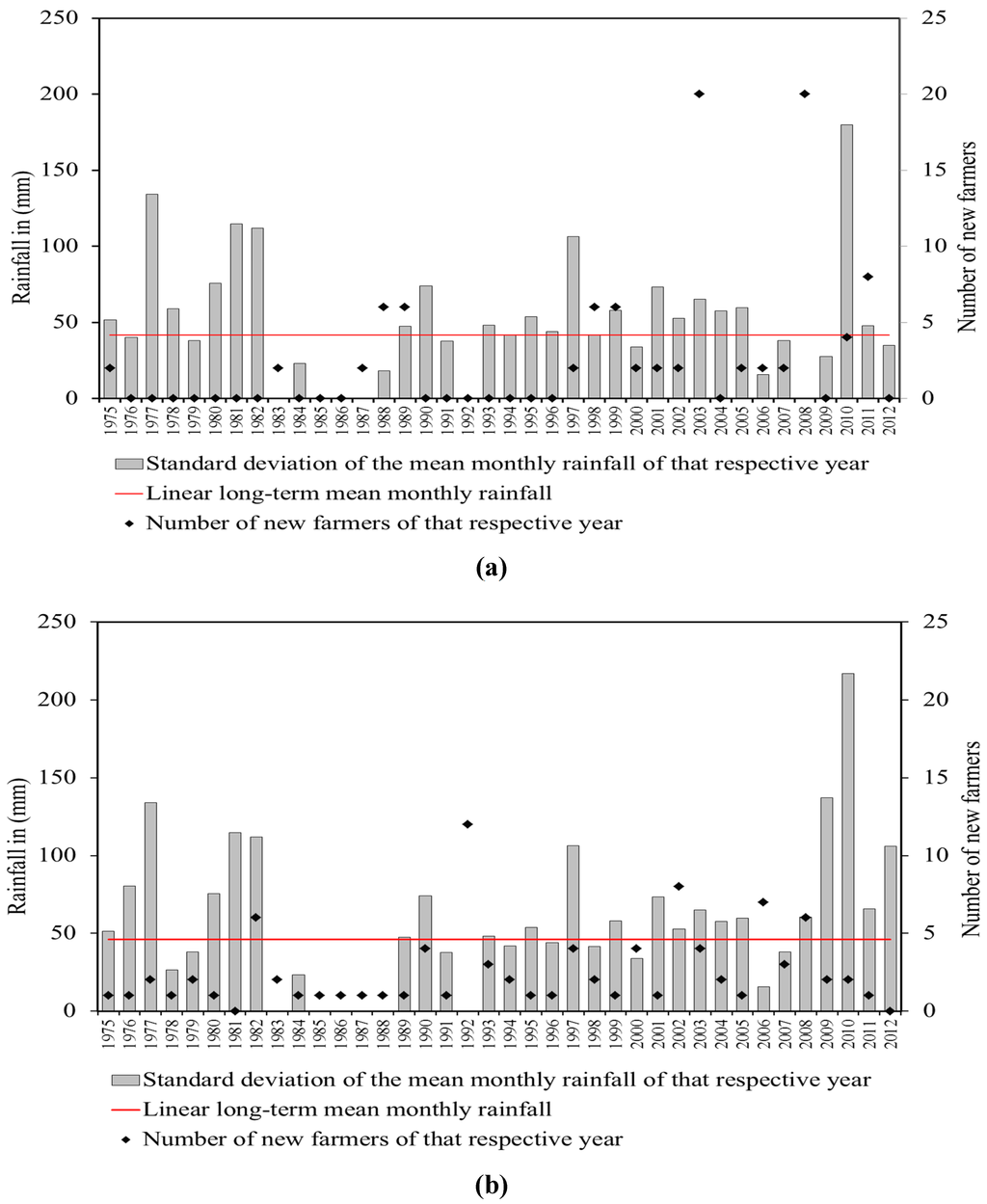
Figure 7.
Standard deviation of mean monthly rainfall and number of new farmers who started cultivation that year in (a) Darito and (b) Mega, Borana, Ethiopia. Ethiopian Meteorological Agency rainfall data were used to compute mean monthly rainfall and standard deviations for the years 1975 to 2012 (2012). The number of new farmers was generated from own survey. Pearson’s correlation coefficient was computed to test the associations between the deviations of the mean monthly rainfall of a respective year with the number of farmers who started farming in that year, in order to check if deviations of the rainfall from the long-term mean influence the number of new farmers starting cultivation in that year or thereafter.

The authors would like to apologize for any inconvenience caused to the readers by these changes.
Reference
- Elias, M.; Hensel, O.; Richter, U.; Hülsebusch, C.; Kaufmann, B.; Wasonga, O. Land Conversion Dynamics in the Borana Rangelands of Southern Ethiopia: An Integrated Assessment Using Remote Sensing Techniques and Field Survey Data. Environments 2015, 2, 1–31. [Google Scholar] [CrossRef]
© 2015 by the authors; licensee MDPI, Basel, Switzerland. This article is an open access article distributed under the terms and conditions of the Creative Commons Attribution license (http://creativecommons.org/licenses/by/4.0/).