Next Issue
Volume 10, February
Previous Issue
Volume 9, December
 
 
remotesensing-logo

Journal Browser

Journal Browser

Remote Sens., Volume 10, Issue 1 (January 2018) – 153 articles

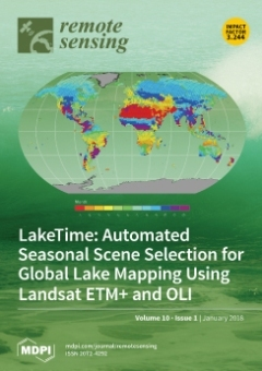
Cover Story (view full-size image): Advances in computing power and the increased availability of high-resolution remote sensing data products have made it possible to map lake surface area at the global scale and monitor changes over time. However, because lake surface area changes seasonally, we must use images acquired from a consistent season in order to isolate long-term changes. At the global scale, this means identifying the hydrological season independently at each location. The LakeTime algorithm uses global hydrological data and a simple water balance model to identify a consistent, ideal lake mapping time for each Landsat tile (Cover Image). When combined with the Landsat archive, we are able to provide nearly complete, seasonally consistent, global coverage for circa 2000 Landsat Enhanced Thematic Mapper Plus (ETM+) and circa 2014 Landsat Operational Land Imager (OLI) imagery. View this paper
  • Issues are regarded as officially published after their release is announced to the table of contents alert mailing list.
  • You may sign up for e-mail alerts to receive table of contents of newly released issues.
  • PDF is the official format for papers published in both, html and pdf forms. To view the papers in pdf format, click on the "PDF Full-text" link, and use the free Adobe Reader to open them.
Order results
Result details
Section
Select all
Export citation of selected articles as:
28 pages, 5909 KiB  
Article
On Statistical Approaches to Generate Level 3 Products from Satellite Remote Sensing Retrievals
by Andrew Zammit-Mangion, Noel Cressie and Clint Shumack
Remote Sens. 2018, 10(1), 155; https://doi.org/10.3390/rs10010155 - 22 Jan 2018
Cited by 21 | Viewed by 5468
Abstract
Satellite remote sensing of trace gases such as carbon dioxide (CO2) has increased our ability to observe and understand Earth’s climate. However, these remote sensing data, specifically Level 2 retrievals, tend to be irregular in space and time, and hence, spatio-temporal [...] Read more.
Satellite remote sensing of trace gases such as carbon dioxide (CO2) has increased our ability to observe and understand Earth’s climate. However, these remote sensing data, specifically Level 2 retrievals, tend to be irregular in space and time, and hence, spatio-temporal prediction is required to infer values at any location and time point. Such inferences are not only required to answer important questions about our climate, but they are also needed for validating the satellite instrument, since Level 2 retrievals are generally not co-located with ground-based remote sensing instruments. Here, we discuss statistical approaches to construct Level 3 products from Level 2 retrievals, placing particular emphasis on the strengths and potential pitfalls when using statistical prediction in this context. Following this discussion, we use a spatio-temporal statistical modelling framework known as fixed rank kriging (FRK) to obtain global predictions and prediction standard errors of column-averaged carbon dioxide based on Version 7r and Version 8r retrievals from the Orbiting Carbon Observatory-2 (OCO-2) satellite. The FRK predictions allow us to validate statistically the Level 2 retrievals globally even though the data are at locations and at time points that do not coincide with validation data. Importantly, the validation takes into account the prediction uncertainty, which is dependent both on the temporally-varying density of observations around the ground-based measurement sites and on the spatio-temporal high-frequency components of the trace gas field that are not explicitly modelled. Here, for validation of remotely-sensed CO2 data, we use observations from the Total Carbon Column Observing Network. We demonstrate that the resulting FRK product based on Version 8r compares better with TCCON data than that based on Version 7r, in terms of both prediction accuracy and uncertainty quantification. Full article
(This article belongs to the Special Issue Remote Sensing of Greenhouse Gases)
Show Figures

Graphical abstract

10 pages, 1301 KiB  
Letter
Image Degradation for Quality Assessment of Pan-Sharpening Methods
by Wen Dou
Remote Sens. 2018, 10(1), 154; https://doi.org/10.3390/rs10010154 - 22 Jan 2018
Cited by 15 | Viewed by 5111
Abstract
Wald’s protocol is the most widely accepted protocol to assess pan-sharpening algorithms. In particular, the synthesis property—which is usually validated on a reduced scale—is thought to be a necessary and sufficient condition of a success image fusion. Usually, the synthesis property is evaluated [...] Read more.
Wald’s protocol is the most widely accepted protocol to assess pan-sharpening algorithms. In particular, the synthesis property—which is usually validated on a reduced scale—is thought to be a necessary and sufficient condition of a success image fusion. Usually, the synthesis property is evaluated at a reduced resolution scale to take the original multispectral (MS) image as reference; thus, the image degradation method that is employed to produce reduced resolution images is crucial. In the past decade, the standard method has been to decimate the low-pass-filtered image where the filter is designed to match the modulation transfer function (MTF) of the sensor. The paper pointed out the deficiency of the method, and proposed a new image degradation method, referred to as method of spatial degradation for fusion validation (MSD4FV), which takes MTF compensation into account based on a simplified MTF model. The simulation results supported the implicit assumption of Wald’s protocol that image fusion performance is invariant among scales if the images have been properly degraded. Full article
(This article belongs to the Section Remote Sensing Image Processing)
Show Figures

Graphical abstract

26 pages, 11882 KiB  
Article
Comparison of the Spatial Characteristics of Four Remotely Sensed Leaf Area Index Products over China: Direct Validation and Relative Uncertainties
by Xinlu Li, Hui Lu, Le Yu and Kun Yang
Remote Sens. 2018, 10(1), 148; https://doi.org/10.3390/rs10010148 - 22 Jan 2018
Cited by 39 | Viewed by 6877
Abstract
Leaf area index (LAI) is a key input for many land surface models, ecological models, and yield prediction models. In order to make the model simulation and/or prediction more reliable and applicable, it is crucial to know the characteristics and uncertainties of remotely [...] Read more.
Leaf area index (LAI) is a key input for many land surface models, ecological models, and yield prediction models. In order to make the model simulation and/or prediction more reliable and applicable, it is crucial to know the characteristics and uncertainties of remotely sensed LAI products before they are input into models. In this study, we conducted a comparison of four global remotely sensed LAI products—Global Land Surface Satellite (GLASS), Global LAI Product of Beijing Normal University (GLOBALBNU), Global LAI Map of Chinese Academy of Sciences (GLOBMAP), and Moderate-resolution Imaging Spectrometer (MODIS) LAI, while the former three products are newly developed by three Chinese research groups on the basis of the MODIS land reflectance product over China between 2001 and 2011. Direct validation by comparing the four products to ground LAI observations both globally and over China demonstrates that GLASS LAI shows the best performance, with R2 = 0.70 and RMSE = 0.96 globally and R2 = 0.94 and RMSE = 0.61 over China; MODIS performs worst (R2 = 0.55, RMSE = 1.23 globally and R2 = 0.03, RMSE = 2.12 over China), and GLOBALBNU and GLOBMAP performs moderately. Comparison of the four products shows that they are generally consistent with each other, giving the smallest spatial correlation coefficient of 0.7 and the relative standard deviation around the order of 0.3. Compared with MODIS LAI, GLOBALBNU LAI is the most similar, followed by GLASS LAI and GLOBMAP. Large differences mainly occur in southern regions of China. LAI difference analysis indicates that evergreen needleleaf forest (ENF), woody savannas (SAV) biome types and temperate dry hot summer, temperate warm summer dry winter and temperate hot summer no dry season climate types correspond to high standard deviation, while ENF and grassland (GRA) biome types and temperate warm summer dry winter and cold dry winter warm summer climate types are responsible for the large relative standard deviation of the four products. Our results indicate that although the three newly developed products have improved the accuracy of LAI estimates, much work remains to improve the LAI products especially in ENF, SAV, and GRA regions and temperate climate zones. Findings from our study can provide guidance to communities regarding the performance of different LAI products over mainland China. Full article
(This article belongs to the Special Issue Earth Observations for Addressing Global Challenges)
Show Figures

Graphical abstract

24 pages, 9013 KiB  
Article
Onboard Spectral and Spatial Cloud Detection for Hyperspectral Remote Sensing Images
by Haoyang Li, Hong Zheng, Chuanzhao Han, Haibo Wang and Min Miao
Remote Sens. 2018, 10(1), 152; https://doi.org/10.3390/rs10010152 - 20 Jan 2018
Cited by 24 | Viewed by 6796
Abstract
The accurate onboard detection of clouds in hyperspectral images before lossless compression is beneficial. However, conventional onboard cloud detection methods are not applicable all the time, especially for shadowed clouds or darkened snow-covered surfaces that are not identified in normalized difference snow index [...] Read more.
The accurate onboard detection of clouds in hyperspectral images before lossless compression is beneficial. However, conventional onboard cloud detection methods are not applicable all the time, especially for shadowed clouds or darkened snow-covered surfaces that are not identified in normalized difference snow index (NDSI) tests. In this paper, we propose a new spectral-spatial classification strategy to enhance the performance of an orbiting cloud screen obtained on hyperspectral images by integrating a threshold exponential spectral angle map (TESAM), adaptive Markov random field (aMRF) and dynamic stochastic resonance (DSR). TESAM is applied to roughly classify cloud pixels based on spectral information. Then aMRF is used to do optimal process by using spatial information, which improved the classification performance significantly. Nevertheless, misclassifications occur due to noisy data in the onboard environments, and DSR is employed to eliminate noise data produced by aMRF in binary labeled images. We used level 0.5 data from Hyperion as a dataset, and the average tested accuracy of the proposed algorithm was 96.28% by test. This method can provide cloud mask for the on-going EO-1 and related satellites with the same spectral settings without manual intervention. Experiments indicate that the proposed method has better performance than the conventional onboard cloud detection methods or current state-of-the-art hyperspectral classification methods. Full article
(This article belongs to the Section Remote Sensing Image Processing)
Show Figures

Graphical abstract

24 pages, 23379 KiB  
Article
New Insights for Detecting and Deriving Thermal Properties of Lava Flow Using Infrared Satellite during 2014–2015 Effusive Eruption at Holuhraun, Iceland
by Muhammad Aufaristama, Armann Hoskuldsson, Ingibjorg Jonsdottir, Magnus Orn Ulfarsson and Thorvaldur Thordarson
Remote Sens. 2018, 10(1), 151; https://doi.org/10.3390/rs10010151 - 20 Jan 2018
Cited by 20 | Viewed by 11811
Abstract
A new lava field was formed at Holuhraun in the Icelandic Highlands, north of Vatnajökull glacier, in 2014–2015. It was the largest effusive eruption in Iceland for 230 years, with an estimated lava bulk volume of ~1.44 km3 covering an area of [...] Read more.
A new lava field was formed at Holuhraun in the Icelandic Highlands, north of Vatnajökull glacier, in 2014–2015. It was the largest effusive eruption in Iceland for 230 years, with an estimated lava bulk volume of ~1.44 km3 covering an area of ~84 km2. Satellite-based remote sensing is commonly used as preliminary assessment of large scale eruptions since it is relatively efficient for collecting and processing the data. Landsat-8 infrared datasets were used in this study, and we used dual-band technique to determine the subpixel temperature (Th) of the lava. We developed a new spectral index called the thermal eruption index (TEI) based on the shortwave infrared (SWIR) and thermal infrared (TIR) bands allowing us to differentiate thermal domain within the lava flow field. Lava surface roughness effects are accounted by using the Hurst coefficient (H) for deriving the radiant flux ( Φ rad ) and the crust thickness (Δh). Here, we compare the results derived from satellite images with field measurements. The result from 2 December 2014 shows that a temperature estimate (1096 °C; occupying area of 3.05 m2) from a lava breakout has a close correspondence with a thermal camera measurement (1047 °C; occupying area of 4.52 m2). We also found that the crust thickness estimate in the lava channel during 6 September 2014 (~3.4–7.7 m) compares closely with the lava height measurement from the field (~2.6–6.6 m); meanwhile, the total radiant flux peak is underestimated (~8 GW) compared to other studies (~25 GW), although the trend shows good agreement with both field observation and other studies. This study provides new insights for monitoring future effusive eruption using infrared satellite images. Full article
(This article belongs to the Section Remote Sensing in Geology, Geomorphology and Hydrology)
Show Figures

Graphical abstract

14 pages, 5499 KiB  
Article
L-Band Temporal Coherence Assessment and Modeling Using Amplitude and Snow Depth over Interior Alaska
by Yusuf Eshqi Molan, Jin-Woo Kim, Zhong Lu and Piyush Agram
Remote Sens. 2018, 10(1), 150; https://doi.org/10.3390/rs10010150 - 20 Jan 2018
Cited by 12 | Viewed by 5057
Abstract
Interferometric synthetic aperture radar (InSAR) provides the capability to detect surface deformation. Numerous processing approaches have been developed to improve InSAR results and overcome its limitations. Regardless of the processing methodology, however, temporal decorrelation is a major obstacle for all InSAR applications, especially [...] Read more.
Interferometric synthetic aperture radar (InSAR) provides the capability to detect surface deformation. Numerous processing approaches have been developed to improve InSAR results and overcome its limitations. Regardless of the processing methodology, however, temporal decorrelation is a major obstacle for all InSAR applications, especially over vegetated areas and dynamic environments, such as Interior Alaska. Temporal coherence is usually modeled as a univariate exponential function of temporal baseline. It has been, however, documented that temporal variations in surface backscattering due to the change in surface parameters, i.e., dielectric constant, roughness, and the geometry of scatterers, can result in gradual, seasonal, or sudden decorrelations and loss of InSAR coherence. The coherence models introduced so far have largely neglected the effect of the temporal change in backscattering on InSAR coherence. Here, we introduce a new temporal decorrelation model that considers changes in surface backscattering by utilizing the relative change in SAR intensity between two images as a proxy for the change in surface scattering parameters. The model also takes into account the decorrelation due to the change in snow depth between two images. Using the L-band Advanced Land Observation Satellite (ALOS-2) Phased Array type L-band Synthetic Aperture Radar (PALSAR-2) data, the model has been assessed over forested and shrub landscapes in Delta Junction, Interior Alaska. The model decreases the RMS error of temporal coherence estimation from 0.18 to 0.09 on average. The improvements made by the model have been statistically proved to be significant at the 99% confidence level. Additionally, the model shows that the coherence of forested areas are more prone to changes in backscattering than shrub landscape. The model is based on L-band data and may not be expanded to C-band or X-band InSAR observations. Full article
(This article belongs to the Special Issue Advances in SAR: Sensors, Methodologies, and Applications)
Show Figures

Graphical abstract

20 pages, 3132 KiB  
Article
A Satellite-Based Model for Simulating Ecosystem Respiration in the Tibetan and Inner Mongolian Grasslands
by Rong Ge, Honglin He, Xiaoli Ren, Li Zhang, Pan Li, Na Zeng, Guirui Yu, Liyun Zhang, Shi-Yong Yu, Fawei Zhang, Hongqin Li, Peili Shi, Shiping Chen, Yanfen Wang, Xiaoping Xin, Yaoming Ma, Mingguo Ma, Yu Zhang and Mingyuan Du
Remote Sens. 2018, 10(1), 149; https://doi.org/10.3390/rs10010149 - 19 Jan 2018
Cited by 15 | Viewed by 5510
Abstract
It is important to accurately evaluate ecosystem respiration (RE) in the alpine grasslands of the Tibetan Plateau and the temperate grasslands of the Inner Mongolian Plateau, as it serves as a sensitivity indicator of regional and global carbon cycles. Here, we [...] Read more.
It is important to accurately evaluate ecosystem respiration (RE) in the alpine grasslands of the Tibetan Plateau and the temperate grasslands of the Inner Mongolian Plateau, as it serves as a sensitivity indicator of regional and global carbon cycles. Here, we combined flux measurements taken between 2003 and 2013 from 16 grassland sites across northern China and the corresponding MODIS land surface temperature (LST), enhanced vegetation index (EVI), and land surface water index (LSWI) to build a satellite-based model to estimate RE at a regional scale. First, the dependencies of both spatial and temporal variations of RE on these biotic and climatic factors were examined explicitly. We found that plant productivity and moisture, but not temperature, can best explain the spatial pattern of RE in northern China’s grasslands; while temperature plays a major role in regulating the temporal variability of RE in the alpine grasslands, and moisture is equally as important as temperature in the temperate grasslands. However, the moisture effect on RE and the explicit representation of spatial variation process are often lacking in most of the existing satellite-based RE models. On this basis, we developed a model by comprehensively considering moisture, temperature, and productivity effects on both temporal and spatial processes of RE, and then, we evaluated the model performance. Our results showed that the model well explained the observed RE in both the alpine (R2 = 0.79, RMSE = 0.77 g C m−2 day−1) and temperate grasslands (R2 = 0.75, RMSE = 0.60 g C m−2 day−1). The inclusion of the LSWI as the water-limiting factor substantially improved the model performance in arid and semi-arid ecosystems, and the spatialized basal respiration rate as an indicator for spatial variation largely determined the regional pattern of RE. Finally, the model accurately reproduced the seasonal and inter-annual variations and spatial variability of RE, and it avoided overestimating RE in water-limited regions compared to the popular process-based model. These findings provide a better understanding of the biotic and climatic controls over spatiotemporal patterns of RE for two typical grasslands and a new alternative up-scaling method for large-scale RE evaluation in grassland ecosystems. Full article
(This article belongs to the Section Biogeosciences Remote Sensing)
Show Figures

Figure 1

25 pages, 3214 KiB  
Article
Hyperspectral Shallow-Water Remote Sensing with an Enhanced Benthic Classifier
by Rodrigo A. Garcia, Zhongping Lee and Eric J. Hochberg
Remote Sens. 2018, 10(1), 147; https://doi.org/10.3390/rs10010147 - 19 Jan 2018
Cited by 46 | Viewed by 6249
Abstract
Hyperspectral remote sensing inversion models utilize spectral information over optically shallow waters to retrieve optical properties of the water column, bottom depth and reflectance, with the latter used in benthic classification. Accuracy of these retrievals is dependent on the spectral endmember(s) used to [...] Read more.
Hyperspectral remote sensing inversion models utilize spectral information over optically shallow waters to retrieve optical properties of the water column, bottom depth and reflectance, with the latter used in benthic classification. Accuracy of these retrievals is dependent on the spectral endmember(s) used to model the bottom reflectance during the inversion. Without prior knowledge of these endmember(s) current approaches must iterate through a list of endmember—a computationally demanding task. To address this, a novel lookup table classification approach termed HOPE-LUT was developed for selecting the likely benthic endmembers of any hyperspectral image pixel. HOPE-LUT classifies a pixel as sand, mixture or non-sand, then the latter two are resolved into the three most likely classes. Optimization subsequently selects the class (out of the three) that generated the best fit to the remote sensing reflectance. For a coral reef case, modeling results indicate very high benthic classification accuracy (>90%) for depths less than 4 m of common coral reef benthos. These accuracies decrease substantially with increasing depth due to the loss of bottom information, especially the spectral signatures. We applied this technique to hyperspectral airborne imagery of Heron Reef, Great Barrier Reef and generated benthic habitat maps with higher classification accuracy compared to standard inversion models. Full article
(This article belongs to the Section Remote Sensing Image Processing)
Show Figures

Graphical abstract

13 pages, 14597 KiB  
Communication
Mineral Mapping Using the Automatized Gaussian Model (AGM)—Application to Two Industrial French Sites at Gardanne and Thann
by Rodolphe Marion and Véronique Carrère
Remote Sens. 2018, 10(1), 146; https://doi.org/10.3390/rs10010146 - 19 Jan 2018
Cited by 8 | Viewed by 5499
Abstract
The identification and mapping of the mineral composition of by-products and residues on industrial sites is a topic of growing interest because it may provide information on plant-processing activities and their impact on the surrounding environment. Imaging spectroscopy can provide such information based [...] Read more.
The identification and mapping of the mineral composition of by-products and residues on industrial sites is a topic of growing interest because it may provide information on plant-processing activities and their impact on the surrounding environment. Imaging spectroscopy can provide such information based on the spectral signatures of soil mineral markers. In this study, we use the automatized Gaussian model (AGM), an automated, physically based method relying on spectral deconvolution. Originally developed for the short-wavelength infrared (SWIR) range, it has been extended to include information from the visible and near-infrared (VNIR) range to take iron oxides/hydroxides into account. We present the results of its application to two French industrial sites: (i) the Altéo Environnement site in Gardanne, southern France, dedicated to the extraction of alumina from bauxite; and (ii) the Millennium Inorganic Chemicals site in Thann, eastern France, which produces titanium dioxide from ilmenite and rutile, and its associated Séché Éco Services site used to neutralize the resulting effluents, producing gypsum. HySpex hyperspectral images were acquired over Gardanne in September 2013 and an APEX image was acquired over Thann in June 2013. In both cases, reflectance spectra were measured and samples were collected in the field and analyzed for mineralogical and chemical composition. When applying the AGM to the images, both in the VNIR and SWIR ranges, we successfully identified and mapped minerals of interest characteristic of each site: bauxite, Bauxaline® and alumina for Gardanne; and red and white gypsum and calcite for Thann. Identifications and maps were consistent with in situ measurements. Full article
(This article belongs to the Section Remote Sensing in Geology, Geomorphology and Hydrology)
Show Figures

Figure 1

18 pages, 5863 KiB  
Article
Trend Detection for the Extent of Irrigated Agriculture in Idaho’s Snake River Plain, 1984–2016
by Eric W. Chance, Kelly M. Cobourn and Valerie A. Thomas
Remote Sens. 2018, 10(1), 145; https://doi.org/10.3390/rs10010145 - 19 Jan 2018
Cited by 11 | Viewed by 4499
Abstract
Understanding irrigator responses to changes in water availability is critical for building strategies to support effective management of water resources. Using remote sensing data, we examine farmer responses to seasonal changes in water availability in Idaho’s Snake River Plain for the time series [...] Read more.
Understanding irrigator responses to changes in water availability is critical for building strategies to support effective management of water resources. Using remote sensing data, we examine farmer responses to seasonal changes in water availability in Idaho’s Snake River Plain for the time series 1984–2016. We apply a binary threshold based on the seasonal maximum of the Normalized Difference Moisture Index (NDMI) using Landsat 5–8 images to distinguish irrigated from non-irrigated lands. We find that the NDMI of irrigated lands increased over time, consistent with trends in irrigation technology adoption and increased crop productivity. By combining remote sensing data with geospatial data describing water rights for irrigation, we show that the trend in NDMI is not universal, but differs by farm size and water source. Farmers with small farms that rely on surface water are more likely than average to have a large contraction (over −25%) in irrigated area over the 33-year period of record. In contrast, those with large farms and access to groundwater are more likely than average to have a large expansion (over +25%) in irrigated area over the same period. Full article
(This article belongs to the Section Remote Sensing in Agriculture and Vegetation)
Show Figures

Graphical abstract

18 pages, 11465 KiB  
Article
Building Extraction in Very High Resolution Remote Sensing Imagery Using Deep Learning and Guided Filters
by Yongyang Xu, Liang Wu, Zhong Xie and Zhanlong Chen
Remote Sens. 2018, 10(1), 144; https://doi.org/10.3390/rs10010144 - 19 Jan 2018
Cited by 356 | Viewed by 19722
Abstract
Very high resolution (VHR) remote sensing imagery has been used for land cover classification, and it tends to a transition from land-use classification to pixel-level semantic segmentation. Inspired by the recent success of deep learning and the filter method in computer vision, this [...] Read more.
Very high resolution (VHR) remote sensing imagery has been used for land cover classification, and it tends to a transition from land-use classification to pixel-level semantic segmentation. Inspired by the recent success of deep learning and the filter method in computer vision, this work provides a segmentation model, which designs an image segmentation neural network based on the deep residual networks and uses a guided filter to extract buildings in remote sensing imagery. Our method includes the following steps: first, the VHR remote sensing imagery is preprocessed and some hand-crafted features are calculated. Second, a designed deep network architecture is trained with the urban district remote sensing image to extract buildings at the pixel level. Third, a guided filter is employed to optimize the classification map produced by deep learning; at the same time, some salt-and-pepper noise is removed. Experimental results based on the Vaihingen and Potsdam datasets demonstrate that our method, which benefits from neural networks and guided filtering, achieves a higher overall accuracy when compared with other machine learning and deep learning methods. The method proposed shows outstanding performance in terms of the building extraction from diversified objects in the urban district. Full article
(This article belongs to the Special Issue Deep Learning for Remote Sensing)
Show Figures

Graphical abstract

18 pages, 1962 KiB  
Article
Downscaling GRACE Remote Sensing Datasets to High-Resolution Groundwater Storage Change Maps of California’s Central Valley
by Michelle E. Miro and James S. Famiglietti
Remote Sens. 2018, 10(1), 143; https://doi.org/10.3390/rs10010143 - 19 Jan 2018
Cited by 87 | Viewed by 11637
Abstract
NASA’s Gravity Recovery and Climate Experiment (GRACE) has already proven to be a powerful data source for regional groundwater assessments in many areas around the world. However, the applicability of GRACE data products to more localized studies and their utility to water management [...] Read more.
NASA’s Gravity Recovery and Climate Experiment (GRACE) has already proven to be a powerful data source for regional groundwater assessments in many areas around the world. However, the applicability of GRACE data products to more localized studies and their utility to water management authorities have been constrained by their limited spatial resolution (~200,000 km2). Researchers have begun to address these shortcomings with data assimilation approaches that integrate GRACE-derived total water storage estimates into complex regional models, producing higher-resolution estimates of hydrologic variables (~2500 km2). Here we take those approaches one step further by developing an empirically based model capable of downscaling GRACE data to a high-resolution (~16 km2) dataset of groundwater storage changes over a portion of California’s Central Valley. The model utilizes an artificial neural network to generate a series of high-resolution maps of groundwater storage change from 2002 to 2010 using GRACE estimates of variations in total water storage and a series of widely available hydrologic variables (PRISM precipitation and temperature data, digital elevation model (DEM)-derived slope, and Natural Resources Conservation Service (NRCS) soil type). The neural network downscaling model is able to accurately reproduce local groundwater behavior, with acceptable Nash-Sutcliffe efficiency (NSE) values for calibration and validation (ranging from 0.2445 to 0.9577 and 0.0391 to 0.7511, respectively). Ultimately, the model generates maps of local groundwater storage change at a 100-fold higher resolution than GRACE gridded data products without the use of computationally intensive physical models. The model’s simulated maps have the potential for application to local groundwater management initiatives in the region. Full article
(This article belongs to the Special Issue Remote Sensing of Groundwater from River Basin to Global Scales)
Show Figures

Graphical abstract

20 pages, 4781 KiB  
Article
Dependence of C-Band Backscatter on Ground Temperature, Air Temperature and Snow Depth in Arctic Permafrost Regions
by Helena Bergstedt, Simon Zwieback, Annett Bartsch and Marina Leibman
Remote Sens. 2018, 10(1), 142; https://doi.org/10.3390/rs10010142 - 19 Jan 2018
Cited by 22 | Viewed by 6125
Abstract
Microwave remote sensing has found numerous applications in areas affected by permafrost and seasonally frozen ground. In this study, we focused on data obtained by the Advanced Scatterometer (ASCAT, C-band) during winter periods when the ground is assumed to be frozen. This paper [...] Read more.
Microwave remote sensing has found numerous applications in areas affected by permafrost and seasonally frozen ground. In this study, we focused on data obtained by the Advanced Scatterometer (ASCAT, C-band) during winter periods when the ground is assumed to be frozen. This paper discusses the relationships of ASCAT backscatter with snow depth, air and ground temperature through correlations and the analysis of covariance (ANCOVA) to quantify influences on backscatter values during situations of frozen ground. We studied sites in Alaska, Northern Canada, Scandinavia and Siberia. Air temperature and snow depth data were obtained from 19 World Meteorological Organization (WMO) and 4 Snow Telemetry (SNOTEL) stations. Ground temperature data were obtained from 36 boreholes through the Global Terrestrial Network for Permafrost Database (GTN-P) and additional records from central Yamal. Results suggest distinct differences between sites with and without underlying continuous permafrost. Sites characterized by high freezing indices (>4000 degree-days) have consistently stronger median correlations of ASCAT backscatter with ground temperature for all measurement depths. We show that the dynamics in winter-time backscatter cannot be solely explained through snow processes, but are also highly correlated with ground temperature up to a considerable depth (60 cm). These findings have important implications for both freeze/thaw and snow water equivalent retrieval algorithms based on C-band radar measurements. Full article
(This article belongs to the Special Issue Cryospheric Remote Sensing II)
Show Figures

Graphical abstract

19 pages, 3791 KiB  
Article
Target Recognition in SAR Images Based on Information-Decoupled Representation
by Ming Chang and Xuqun You
Remote Sens. 2018, 10(1), 138; https://doi.org/10.3390/rs10010138 - 19 Jan 2018
Cited by 16 | Viewed by 5504
Abstract
This paper proposes an automatic target recognition (ATR) method for synthetic aperture radar (SAR) images based on information-decoupled representation. A typical SAR image of a ground target can be divided into three parts: target region, shadow and background. From the aspect of SAR [...] Read more.
This paper proposes an automatic target recognition (ATR) method for synthetic aperture radar (SAR) images based on information-decoupled representation. A typical SAR image of a ground target can be divided into three parts: target region, shadow and background. From the aspect of SAR target recognition, the target region and shadow contain discriminative information. However, they also include some confusing information because of the similarities of different targets. The background mainly contains redundant information, which has little contribution to the target recognition. Because the target segmentation may impair the discriminative information in the target region, the relatively simpler shadow segmentation is performed to separate the shadow region for information decoupling. Then, the information-decoupled representations are generated, i.e., the target image, shadow and original image. The background is retained in the target image, which represents the coupling of target backscattering and background. The original image and generated target image are classified using the sparse representation-based classification (SRC). Then, their classification results are combined by a score-level fusion for target recognition. The shadow image is not used because of its lower discriminability and possible segmentation errors. To evaluate the performance of the proposed method, extensive experiments are conducted on the Moving and Stationary Target Acquisition and Recognition (MSTAR) dataset under both standard operating condition (SOC) and various extended operating conditions (EOCs). The proposed method can correctly classify 10 classes of targets with the percentage of correct classification (PCC) of 94.88% under SOC. With the PCCs of 93.15% and 75.03% under configuration variance and 45° depression angle, respectively, the superiority of the proposed is demonstrated in comparison with other methods. The robustness of the proposed method to both uniform and nonuniform shadow segmentation errors is validated with the PCCs over 93%. Moreover, with the maximum average precision of 0.9580, the proposed method is more effective than the reference methods on outlier rejection. Full article
(This article belongs to the Section Remote Sensing Image Processing)
Show Figures

Figure 1

19 pages, 30570 KiB  
Article
Aerosol Optical Depth Retrieval over East Asia Using Himawari-8/AHI Data
by Wenhao Zhang, Hui Xu and Fengjie Zheng
Remote Sens. 2018, 10(1), 137; https://doi.org/10.3390/rs10010137 - 19 Jan 2018
Cited by 48 | Viewed by 7533
Abstract
This paper presents a new algorithm to retrieve the aerosol optical depth (AOD) from a Himawari-8 Advanced Himawari Imager (AHI). Six typical aerosol models that derived from the long-term ground-based observations of East Asia are used in AOD retrieval. To accurately determine the [...] Read more.
This paper presents a new algorithm to retrieve the aerosol optical depth (AOD) from a Himawari-8 Advanced Himawari Imager (AHI). Six typical aerosol models that derived from the long-term ground-based observations of East Asia are used in AOD retrieval. To accurately determine the surface reflectance, improved channel relationships between red, blue, and shortwave infrared (SWIR) are built up according to the infrared Normalized Difference Vegetation Index (NDVISWIR). Based on the new derived aerosol models and improved channel relationships, AOD over East Asian is retrieved by using the AHI data. The results are compared with Moderate Resolution Imaging Spectroradiometer (MODIS) aerosol products (MOD04 and MYD04) and yielded a correlation coefficient lager than 0.8 (R = 0.87 and 0.92, respectively). In addition, the retrieved AOD values are also validated by ground-based measurements at 12 Aerosol Robotic Network (AERONET) locations and revealed a good agreement between them (R = 0.86). Full article
(This article belongs to the Special Issue Aerosol Remote Sensing)
Show Figures

Graphical abstract

25 pages, 8879 KiB  
Article
Impacts on the Urban Environment: Land Cover Change Trajectories and Landscape Fragmentation in Post-War Western Area, Sierra Leone
by Solomon Peter Gbanie, Amy L. Griffin and Alec Thornton
Remote Sens. 2018, 10(1), 129; https://doi.org/10.3390/rs10010129 - 19 Jan 2018
Cited by 52 | Viewed by 8720
Abstract
An influential underlying driver of human-induced landscape change is civil war and other forms of conflict that cause human displacement. Internally displaced persons (IDPs) increase environmental pressures at their destination locations while reducing them at their origins. This increased pressure presents an environment [...] Read more.
An influential underlying driver of human-induced landscape change is civil war and other forms of conflict that cause human displacement. Internally displaced persons (IDPs) increase environmental pressures at their destination locations while reducing them at their origins. This increased pressure presents an environment for increased land cover change (LCC) rates and landscape fragmentation. To test whether this hypothesis is correct, this research sought to understand LCC dynamics in the Western Area of Sierra Leone from 1976 to 2011, a period including pre-conflict, conflict, and post-conflict eras, using Landsat and SPOT satellite imagery. A trajectory analysis of classified images compared LCC trajectories before and during the war (1976–2000) with after the war (2003–2011). Over the 35-year period, the built-up land class rapidly increased, in parallel with an increase in urban and peri-urban agriculture. During the war, urban and peri-urban agriculture became a major livelihood activity for displaced rural residents to make the region food self-sufficient, especially when the war destabilised food production activities. The reluctance of IDPs to return to their rural homes after the war caused an increased demand for land driven by housing needs. Meanwhile, protected forest and other forest declined. A significant finding to emerge from this research is that landscape fragmentation increased in conjunction with declining forest cover while built-up areas aggregated. This has important implications for the region’s flora, fauna, and human populations given that other research has shown that landscape fragmentation affects the landscape’s ability to provide important ecosystem services. Full article
(This article belongs to the Special Issue Remote Sensing of Urban Agriculture and Land Cover)
Show Figures

Figure 1

20 pages, 28594 KiB  
Article
Analysis of Azimuthal Variations Using Multi-Aperture Polarimetric Entropy with Circular SAR Images
by Feiteng Xue, Yun Lin, Wen Hong, Qiang Yin, Bingchen Zhang, Wenjie Shen and Yue Zhao
Remote Sens. 2018, 10(1), 123; https://doi.org/10.3390/rs10010123 - 19 Jan 2018
Cited by 12 | Viewed by 4583
Abstract
In conventional synthetic aperture radar (SAR), sensors with a fixed look angle are assumed, and the scattering properties are considered as invariant in the azimuth. In some new SAR modes such as wide-angle SAR and circular SAR (CSAR), the azimuthal angle of view [...] Read more.
In conventional synthetic aperture radar (SAR), sensors with a fixed look angle are assumed, and the scattering properties are considered as invariant in the azimuth. In some new SAR modes such as wide-angle SAR and circular SAR (CSAR), the azimuthal angle of view is much larger. Anisotropic targets which have different physical shapes from different angles of view are difficult to interpret in the traditional observation model if variations remain unconsidered. Meanwhile, SAR polarimetry is a powerful tool to analyze and interpret targets’ scattering properties. Anisotropic targets can be precisely described with polarimetric signatures from different angles of view. In this paper, polarimetric data is separated into sub-apertures to provide polarimetric properties from different angles of view. A multi-aperture observation model which contains full polarimetric information from all angles of view is then established. Based on the multi-aperture observation model, multi-aperture polarimetric entropy (MAPE) is defined and is suggested as an extension of polarimetric entropy in multi-aperture situations. MAPE describes both targets’ polarimetric properties and variations across sub-apertures. Variations across the azimuth are analyzed and anisotropic and isotropic targets are identified by MAPE. MAPE can be used in many polarimetric wide angle and CSAR applications. Potential applications in target discrimination and classification are discussed. The effectiveness and advantages of MAPE are demonstrated with polarimetric CSAR data acquired from the Institute of Electronics, Chinese Academy of Sciences airborne CSAR system at P-band. Full article
(This article belongs to the Special Issue Uncertainty in Remote Sensing Image Analysis)
Show Figures

Figure 1

20 pages, 9749 KiB  
Article
Portraying Urban Functional Zones by Coupling Remote Sensing Imagery and Human Sensing Data
by Wei Tu, Zhongwen Hu, Lefei Li, Jinzhou Cao, Jincheng Jiang, Qiuping Li and Qingquan Li
Remote Sens. 2018, 10(1), 141; https://doi.org/10.3390/rs10010141 - 18 Jan 2018
Cited by 106 | Viewed by 9163
Abstract
Portraying urban functional zones provides useful insights into understanding complex urban systems and establishing rational urban planning. Although several studies have confirmed the efficacy of remote sensing imagery in urban studies, coupling remote sensing and new human sensing data like mobile phone positioning [...] Read more.
Portraying urban functional zones provides useful insights into understanding complex urban systems and establishing rational urban planning. Although several studies have confirmed the efficacy of remote sensing imagery in urban studies, coupling remote sensing and new human sensing data like mobile phone positioning data to identify urban functional zones has still not been investigated. In this study, a new framework integrating remote sensing imagery and mobile phone positioning data was developed to analyze urban functional zones with landscape and human activity metrics. Landscapes metrics were calculated based on land cover from remote sensing images. Human activities were extracted from massive mobile phone positioning data. By integrating them, urban functional zones (urban center, sub-center, suburbs, urban buffer, transit region and ecological area) were identified by a hierarchical clustering. Finally, gradient analysis in three typical transects was conducted to investigate the pattern of landscapes and human activities. Taking Shenzhen, China, as an example, the conducted experiment shows that the pattern of landscapes and human activities in the urban functional zones in Shenzhen does not totally conform to the classical urban theories. It demonstrates that the fusion of remote sensing imagery and human sensing data can characterize the complex urban spatial structure in Shenzhen well. Urban functional zones have the potential to act as bridges between the urban structure, human activity and urban planning policy, providing scientific support for rational urban planning and sustainable urban development policymaking. Full article
Show Figures

Graphical abstract

20 pages, 11558 KiB  
Article
An Accelerated Backprojection Algorithm for Monostatic and Bistatic SAR Processing
by Heng Zhang, Jiangwen Tang, Robert Wang, Yunkai Deng, Wei Wang and Ning Li
Remote Sens. 2018, 10(1), 140; https://doi.org/10.3390/rs10010140 - 18 Jan 2018
Cited by 22 | Viewed by 4374
Abstract
The backprojection (BP) algorithm has been applied to every SAR mode due to its great focusing quality and adaptability. However, the BP algorithm suffers from immense computational complexity. To improve the efficiency of the conventional BP algorithm, several fast BP (FBP) algorithms, such [...] Read more.
The backprojection (BP) algorithm has been applied to every SAR mode due to its great focusing quality and adaptability. However, the BP algorithm suffers from immense computational complexity. To improve the efficiency of the conventional BP algorithm, several fast BP (FBP) algorithms, such as the fast factorization BP (FFBP) and Block_FFBP, have been developed in recent studies. In the derivation of Block_FFBP, range data are divided into blocks, and the upsampling process is performed using an interpolation kernel instead of a fast Fourier transform (FFT), which reduces the processing efficiency. To circumvent these limitations, an accelerated BP algorithm based on Block_FFBP is proposed. In this algorithm, a fixed number of pivots rather than the beam centers is applied to construct the relationship of the propagation time delay between the “new” and “old” subapertures. Partition in the range dimension is avoided, and the range data are processed as a bulk. This accelerated BP algorithm benefits from the integrated range processing scheme and is extended to bistatic SAR processing. In this sense, the proposed algorithm can be referred to simply as MoBulk_FFBP for the monostatic SAR case and BiBulk_FFBP for the bistatic SAR case. Furthermore, for monostatic and azimuth-invariant bistatic SAR cases where the platform runs along a straight trajectory, the slant range mapping can be expressed in a continuous and analytical form. Real data from the spaceborne/stationary bistatic SAR experiment with TerraSAR-X operating in the staring spotlight mode and from the airborne spotlight SAR experiment acquired in 2016 are used to validate the performances of BiBulk_FFBP and MoBulk_FFBP, respectively. Full article
(This article belongs to the Special Issue Advances in SAR: Sensors, Methodologies, and Applications)
Show Figures

Graphical abstract

15 pages, 8383 KiB  
Article
End-to-End Airplane Detection Using Transfer Learning in Remote Sensing Images
by Zhong Chen, Ting Zhang and Chao Ouyang
Remote Sens. 2018, 10(1), 139; https://doi.org/10.3390/rs10010139 - 18 Jan 2018
Cited by 168 | Viewed by 11065
Abstract
Airplane detection in remote sensing images remains a challenging problem due to the complexity of backgrounds. In recent years, with the development of deep learning, object detection has also obtained great breakthroughs. For object detection tasks in natural images, such as the PASCAL [...] Read more.
Airplane detection in remote sensing images remains a challenging problem due to the complexity of backgrounds. In recent years, with the development of deep learning, object detection has also obtained great breakthroughs. For object detection tasks in natural images, such as the PASCAL (Pattern Analysis, Statistical Modelling and Computational Learning) VOC (Visual Object Classes) Challenge, the major trend of current development is to use a large amount of labeled classification data to pre-train the deep neural network as a base network, and then use a small amount of annotated detection data to fine-tune the network for detection. In this paper, we use object detection technology based on deep learning for airplane detection in remote sensing images. In addition to using some characteristics of remote sensing images, some new data augmentation techniques have been proposed. We also use transfer learning and adopt a single deep convolutional neural network and limited training samples to implement end-to-end trainable airplane detection. Classification and positioning are no longer divided into multistage tasks; end-to-end detection attempts to combine them for optimization, which ensures an optimal solution for the final stage. In our experiment, we use remote sensing images of airports collected from Google Earth. The experimental results show that the proposed algorithm is highly accurate and meaningful for remote sensing object detection. Full article
Show Figures

Figure 1

22 pages, 7397 KiB  
Article
Tracking Snow Variations in the Northern Hemisphere Using Multi-Source Remote Sensing Data (2000–2015)
by Yunlong Wang, Xiaodong Huang, Hui Liang, Yanhua Sun, Qisheng Feng and Tiangang Liang
Remote Sens. 2018, 10(1), 136; https://doi.org/10.3390/rs10010136 - 18 Jan 2018
Cited by 42 | Viewed by 6093
Abstract
Multi-source remote sensing data were used to generate 500-m resolution cloud-free daily snow cover images for the Northern Hemisphere. Simultaneously, the spatial and temporal dynamic variations of snow in the Northern Hemisphere were evaluated from 2000 to 2015. The results indicated that (1) [...] Read more.
Multi-source remote sensing data were used to generate 500-m resolution cloud-free daily snow cover images for the Northern Hemisphere. Simultaneously, the spatial and temporal dynamic variations of snow in the Northern Hemisphere were evaluated from 2000 to 2015. The results indicated that (1) the maximum, minimum, and annual average snow-covered area (SCA) in the Northern Hemisphere exhibited a fluctuating downward trend; the variation of snow cover in the Northern Hemisphere had well-defined inter-annual and regional differences; (2) the average SCA in the Northern Hemisphere was the largest in January and the smallest in August; the SCA exhibited a downward trend for the monthly variations from February to April; and the seasonal variation in the SCA exhibited a downward trend in the spring, summer, and fall in the Northern Hemisphere (no pronounced variation trend in the winter was observed) during the 2000–2015 period; (3) the spatial distribution of the annual average snow-covered day (SCD) was related to the latitudinal zonality, and the areas exhibiting an upward trend were mainly at the mid to low latitudes with unstable SCA variations; and (4) the snow reduction was significant in the perennial SCA in the Northern Hemisphere, including high-latitude and high-elevation mountainous regions (between 35° and 50°N), such as the Tibetan Plateau, the Tianshan Mountains, the Pamir Plateau in Asia, the Alps in Europe, the Caucasus Mountains, and the Cordillera Mountains in North America. Full article
(This article belongs to the Special Issue Snow Remote Sensing)
Show Figures

Graphical abstract

28 pages, 5146 KiB  
Article
Identifying Forest Impacted by Development in the Commonwealth of Virginia through the Use of Landsat and Known Change Indicators
by Matthew N. House and Randolph H. Wynne
Remote Sens. 2018, 10(1), 135; https://doi.org/10.3390/rs10010135 - 18 Jan 2018
Cited by 1 | Viewed by 3637
Abstract
This study examines the effectiveness of using the Normalized Difference Vegetation Index (NDVI) derived from 1326 different Landsat Thematic Mapper and Enhanced Thematic Mapper images in finding low density development within the Commonwealth of Virginia’s forests. Individual NDVI images were stacked by year [...] Read more.
This study examines the effectiveness of using the Normalized Difference Vegetation Index (NDVI) derived from 1326 different Landsat Thematic Mapper and Enhanced Thematic Mapper images in finding low density development within the Commonwealth of Virginia’s forests. Individual NDVI images were stacked by year for the years 1995–2011 and the yearly maximum for each pixel was extracted, resulting in a 17-year image stack of all yearly maxima (a 98.7% data reduction). Using location data from housing starts and well permits, known previously forested housing starts were isolated from all other forest disturbance types. Samples from development disturbances and other forest disturbances, as well as from undisturbed forest, were used to derive vegetation index thresholds enabling separation of disturbed forest from undisturbed forest. Disturbances, once identified, could be separated into Development Disturbances and Non-Development Disturbances using a classification tree and only two variables from the Disturbance Detection and Diagnostics (D3) algorithm: the maximum NDVI in the available recovery period and the slope between the NDVI value at the time of the disturbance and the maximum NDVI in the available recovery period. Low density development disturbances of previous forest land cover had an F-measure, combining precision and recall into a single class-specific accuracy (β = 1), of 0.663. We compared our results to the NLCD 2001–2011 land cover changes from any forest (classes 41, 42, 43, and 90) to any developed (classes 21, 22, 23, and 24), resulting in an F-measure of 0.00 for the same validation points. Landsat time series stacks thus show promise for identifying even the small changes associated with low density development that have been historically overlooked/underestimated by prior mapping efforts. However, further research is needed to ensure that (1) the approach will work in other forest biomes and (2) enabling detection of these important, but spatially and spectrally subtle, disturbances still ensures accurate detection of other forest disturbances. Full article
(This article belongs to the Section Forest Remote Sensing)
Show Figures

Graphical abstract

21 pages, 14664 KiB  
Article
Water Loss Due to Increasing Planted Vegetation over the Badain Jaran Desert, China
by Xunhe Zhang, Nai’ang Wang, Zunyi Xie, Xuanlong Ma and Alfredo Huete
Remote Sens. 2018, 10(1), 134; https://doi.org/10.3390/rs10010134 - 18 Jan 2018
Cited by 22 | Viewed by 6342
Abstract
Water resources play a vital role in ecosystem stability, human survival, and social development in drylands. Human activities, such as afforestation and irrigation, have had a large impact on the water cycle and vegetation in drylands over recent years. The Badain Jaran Desert [...] Read more.
Water resources play a vital role in ecosystem stability, human survival, and social development in drylands. Human activities, such as afforestation and irrigation, have had a large impact on the water cycle and vegetation in drylands over recent years. The Badain Jaran Desert (BJD) is one of the driest regions in China with increasing human activities, yet the connection between human management and the ecohydrology of this area remains largely unclear. In this study, we firstly investigated the ecohydrological dynamics and their relationship across different spatial scales over the BJD, using multi-source observational data from 2001 to 2014, including: total water storage anomaly (TWSA) from Gravity Recovery and Climate Experiment (GRACE), normalized difference vegetation index (NDVI) from Moderate Resolution Imaging Spectroradiometer (MODIS), lake extent from Landsat, and precipitation from in situ meteorological stations. We further studied the response of the local hydrological conditions to large scale vegetation and climatic dynamics, also conducting a change analysis of water levels over four selected lakes within the BJD region from 2011. To normalize the effect of inter-annual variations of precipitation on vegetation, we also employed a relationship between annual average NDVI and annual precipitation, or modified rain-use efficiency, termed the RUEmo. A focus of this study is to understand the impact of the increasing planted vegetation on local ecohydrological systems over the BJD region. Results showed that vegetation increases were largely found to be confined to the areas intensely influenced by human activities, such as croplands and urban areas. With precipitation patterns remaining stable during the study period, there was a significant increasing trend in vegetation greenness per unit of rainfall, or RUEmo over the BJD, while at the same time, total water storage as measured by satellites has been continually decreasing since 2003. This suggested that the increased trend in vegetation and apparent increase in RUEmo can be attributed to the extraction of ground water for human-planted irrigated vegetation. In the hinterland of the BJD, we identified human-planted vegetation around the lakes using MODIS observations and field investigations. Four lake basins were chosen to validate the relationship between lake levels and planted vegetation. Our results indicated that increasing human-planted vegetation significantly increased the water loss over the BJD region. This study highlights the value of combining observational data from space-borne sensors and ground instruments to monitor the ecohydrological dynamics and the impact of human activities on water resources and ecosystems over the drylands. Full article
(This article belongs to the Special Issue Remote Sensing of Arid/Semiarid Lands)
Show Figures

Graphical abstract

22 pages, 12811 KiB  
Article
Unsupervised Clustering Method for Complexity Reduction of Terrestrial Lidar Data in Marshes
by Chuyen Nguyen, Michael J. Starek, Philippe Tissot and James Gibeaut
Remote Sens. 2018, 10(1), 133; https://doi.org/10.3390/rs10010133 - 18 Jan 2018
Cited by 17 | Viewed by 5817
Abstract
Accurate characterization of marsh elevation and landcover evolution is important for coastal management and conservation. This research proposes a novel unsupervised clustering method specifically developed for segmenting dense terrestrial laser scanning (TLS) data in coastal marsh environments. The framework implements unsupervised clustering with [...] Read more.
Accurate characterization of marsh elevation and landcover evolution is important for coastal management and conservation. This research proposes a novel unsupervised clustering method specifically developed for segmenting dense terrestrial laser scanning (TLS) data in coastal marsh environments. The framework implements unsupervised clustering with the well-known K-means algorithm by applying an optimization to determine the “k” clusters. The fundamental idea behind this novel framework is the application of multi-scale voxel representation of 3D space to create a set of features that characterizes the local complexity and geometry of the terrain. A combination of point- and voxel-generated features are utilized to segment 3D point clouds into homogenous groups in order to study surface changes and vegetation cover. Results suggest that the combination of point and voxel features represent the dataset well. The developed method compresses millions of 3D points representing the complex marsh environment into eight distinct clusters representing different landcover: tidal flat, mangrove, low marsh to high marsh, upland, and power lines. A quantitative assessment of the automated delineation of the tidal flat areas shows acceptable results considering the proposed method is unsupervised with no training data. Clustering results based on K-means are also compared to results based on the Self Organizing Map (SOM) clustering algorithm. Results demonstrate that the developed multi-scale voxelization approach and representative feature set are transferrable to other clustering algorithms, thereby providing an unsupervised framework for intelligent scene segmentation of TLS point cloud data in marshes. Full article
(This article belongs to the Special Issue 3D Modelling from Point Clouds: Algorithms and Methods)
Show Figures

Graphical abstract

14 pages, 16161 KiB  
Article
Automatic Ship Detection in Remote Sensing Images from Google Earth of Complex Scenes Based on Multiscale Rotation Dense Feature Pyramid Networks
by Xue Yang, Hao Sun, Kun Fu, Jirui Yang, Xian Sun, Menglong Yan and Zhi Guo
Remote Sens. 2018, 10(1), 132; https://doi.org/10.3390/rs10010132 - 18 Jan 2018
Cited by 460 | Viewed by 17980
Abstract
Ship detection has been playing a significant role in the field of remote sensing for a long time, but it is still full of challenges. The main limitations of traditional ship detection methods usually lie in the complexity of application scenarios, the difficulty [...] Read more.
Ship detection has been playing a significant role in the field of remote sensing for a long time, but it is still full of challenges. The main limitations of traditional ship detection methods usually lie in the complexity of application scenarios, the difficulty of intensive object detection, and the redundancy of the detection region. In order to solve these problems above, we propose a framework called Rotation Dense Feature Pyramid Networks (R-DFPN) which can effectively detect ships in different scenes including ocean and port. Specifically, we put forward the Dense Feature Pyramid Network (DFPN), which is aimed at solving problems resulting from the narrow width of the ship. Compared with previous multiscale detectors such as Feature Pyramid Network (FPN), DFPN builds high-level semantic feature-maps for all scales by means of dense connections, through which feature propagation is enhanced and feature reuse is encouraged. Additionally, in the case of ship rotation and dense arrangement, we design a rotation anchor strategy to predict the minimum circumscribed rectangle of the object so as to reduce the redundant detection region and improve the recall. Furthermore, we also propose multiscale region of interest (ROI) Align for the purpose of maintaining the completeness of the semantic and spatial information. Experiments based on remote sensing images from Google Earth for ship detection show that our detection method based on R-DFPN representation has state-of-the-art performance. Full article
(This article belongs to the Special Issue Deep Learning for Remote Sensing)
Show Figures

Graphical abstract

21 pages, 19273 KiB  
Article
Geospatial Object Detection in High Resolution Satellite Images Based on Multi-Scale Convolutional Neural Network
by Wei Guo, Wen Yang, Haijian Zhang and Guang Hua
Remote Sens. 2018, 10(1), 131; https://doi.org/10.3390/rs10010131 - 18 Jan 2018
Cited by 137 | Viewed by 15745
Abstract
Daily acquisition of large amounts of aerial and satellite images has facilitated subsequent automatic interpretations of these images. One such interpretation is object detection. Despite the great progress made in this domain, the detection of multi-scale objects, especially small objects in high resolution [...] Read more.
Daily acquisition of large amounts of aerial and satellite images has facilitated subsequent automatic interpretations of these images. One such interpretation is object detection. Despite the great progress made in this domain, the detection of multi-scale objects, especially small objects in high resolution satellite (HRS) images, has not been adequately explored. As a result, the detection performance turns out to be poor. To address this problem, we first propose a unified multi-scale convolutional neural network (CNN) for geospatial object detection in HRS images. It consists of a multi-scale object proposal network and a multi-scale object detection network, both of which share a multi-scale base network. The base network can produce feature maps with different receptive fields to be responsible for objects with different scales. Then, we use the multi-scale object proposal network to generate high quality object proposals from the feature maps. Finally, we use these object proposals with the multi-scale object detection network to train a good object detector. Comprehensive evaluations on a publicly available remote sensing object detection dataset and comparisons with several state-of-the-art approaches demonstrate the effectiveness of the presented method. The proposed method achieves the best mean average precision (mAP) value of 89.6%, runs at 10 frames per second (FPS) on a GTX 1080Ti GPU. Full article
(This article belongs to the Section Remote Sensing Image Processing)
Show Figures

Graphical abstract

24 pages, 5113 KiB  
Article
A Zipf’s Law-Based Method for Mapping Urban Areas Using NPP-VIIRS Nighttime Light Data
by Wenjia Wu, Hongrui Zhao and Shulong Jiang
Remote Sens. 2018, 10(1), 130; https://doi.org/10.3390/rs10010130 - 18 Jan 2018
Cited by 27 | Viewed by 5437
Abstract
A significant difficulty in urban studies is obtaining urban areas. Nighttime light (NTL) data provide efficient approaches to map urban areas. Previous methods have utilized visual particularities of cities with ancillary data to obtain the optimal thresholds. How cities behave differently from rural [...] Read more.
A significant difficulty in urban studies is obtaining urban areas. Nighttime light (NTL) data provide efficient approaches to map urban areas. Previous methods have utilized visual particularities of cities with ancillary data to obtain the optimal thresholds. How cities behave differently from rural areas should be considered. A Zipf’s law-based method is proposed to bootstrap the optimal threshold based on the statistical properties of a Zipf’s law model on continuous thresholds at the country scale. In our method, the Zipf’s law model is utilized to quantify fractal, self-organized, and agglomeration behaviors of cities. The three-phase cluster dynamics are discovered and the abrupt transition between Phase 1 and Phase 2 denotes the rural-urban demarcation point. The urban areas are derived by the proposed method from the Suomi National Polar-Orbiting Partnership Visible Infrared Imaging Radiometer Suite (NPP-VIIRS) NTL data in 2013 in China. An accuracy assessment is conducted to compare it with the GlobeLand30-2010 data and the overall accuracy has directly confirmed the effectiveness of the method. The validation using point of interest (POI) data verifies that the urban areas show strong responses to social interactions and production with R2 values of 0.91 and 0.92, respectively, implying that the city areas extracted by our method can be a proxy for human activities. Comparisons with existing methods validate the effectiveness and high degree of automation of the proposed method in mapping urban areas at the country level. According to our analyses, the Zipf’s law-based method shows great potential to provide a universal criterion to map urban areas from the perspective of the behaviors of urban systems without ancillary data, and a valuable tool for spatial and temporal urban studies. Full article
Show Figures

Graphical abstract

1 pages, 171 KiB  
Addendum
Addendum: Arvor, D. et al. Monitoring Rainfall Patterns in the Southern Amazon with PERSIANN-CDR Data: Long-Term Characteristics and Trends. Remote Sens. 2017, 9, 889
by Damien Arvor, Beatriz M. Funatsu, Véronique Michot and Vincent Dubreuil
Remote Sens. 2018, 10(1), 128; https://doi.org/10.3390/rs10010128 - 18 Jan 2018
Viewed by 2650
Abstract
After publication of the paper [1] it was found that the Acknowledgments section did not mention the institutions that supported this research [...]
Full article
19 pages, 17419 KiB  
Article
Role of El Niño Southern Oscillation (ENSO) Events on Temperature and Salinity Variability in the Agulhas Leakage Region
by Morgan L. Paris and Bulusu Subrahmanyam
Remote Sens. 2018, 10(1), 127; https://doi.org/10.3390/rs10010127 - 18 Jan 2018
Cited by 6 | Viewed by 6753
Abstract
This study explores the relationship between the Agulhas Current system and El Niño Southern Oscillation (ENSO) events. Specifically, it addresses monthly to yearly variations in Agulhas leakage where the Agulhas Current sheds waters into the Atlantic Ocean, in turn affecting meridional overturning circulation [...] Read more.
This study explores the relationship between the Agulhas Current system and El Niño Southern Oscillation (ENSO) events. Specifically, it addresses monthly to yearly variations in Agulhas leakage where the Agulhas Current sheds waters into the Atlantic Ocean, in turn affecting meridional overturning circulation (MOC). Sea surface temperature (SST) data from the National Oceanic and Atmospheric Administration’s (NOAA) Advanced Very High Resolution Radiometer (AVHRR) combined with sea surface salinity (SSS) from Soil Moisture Ocean Salinity (SMOS) and Simple Ocean Data Assimilation (SODA) reanalysis are used to explore changes in Agulhas leakage dynamics. Agulhas leakage is anomalously warm in response to El Niño and anomalously cool in response to La Niña. The corresponding SSS signal shows both a primary and secondary signal response. At first, the SSS signal of Agulhas leakage is anomalously fresh in response to El Niño, but this primary signal is replaced by a secondary anomalously saline signal. In response to La Niña, the primary SSS signal of Agulhas leakage is anomalously saline, while the secondary SSS signal is anomalously fresh. The lag between the peak of ENSO and the response in SST and the corresponding primary SSS signal of Agulhas leakage is about 20 months, followed by the secondary SSS signal at a lag of about 26 months. In general, increasing ENSO strength increases the extremes of the resulting anomalous SST and SSS signal and impacts the Agulhas leakage region earlier during El Niño and slightly later during La Niña. Full article
(This article belongs to the Special Issue Sea Surface Temperature Retrievals from Remote Sensing)
Show Figures

Graphical abstract

22 pages, 5775 KiB  
Article
Stability Assessment of the (A)ATSR Sea Surface Temperature Climate Dataset from the European Space Agency Climate Change Initiative
by David I. Berry, Gary K. Corlett, Owen Embury and Christopher J. Merchant
Remote Sens. 2018, 10(1), 126; https://doi.org/10.3390/rs10010126 - 18 Jan 2018
Cited by 9 | Viewed by 6498
Abstract
Sea surface temperature is a key component of the climate record, with multiple independent records giving confidence in observed changes. As part of the European Space Agencies (ESA) Climate Change Initiative (CCI) the satellite archives have been reprocessed with the aim of creating [...] Read more.
Sea surface temperature is a key component of the climate record, with multiple independent records giving confidence in observed changes. As part of the European Space Agencies (ESA) Climate Change Initiative (CCI) the satellite archives have been reprocessed with the aim of creating a new dataset that is independent of the in situ observations, and stable with no artificial drift (<0.1 K decade−1 globally) or step changes. We present a method to assess the satellite sea surface temperature (SST) record for step changes using the Penalized Maximal t Test (PMT) applied to aggregate time series. We demonstrated the application of the method using data from version EXP1.8 of the ESA SST CCI dataset averaged on a 7 km grid and in situ observations from moored buoys, drifting buoys and Argo floats. The CCI dataset was shown to be stable after ~1994, with minimal divergence (~0.01 K decade−1) between the CCI data and in situ observations. Two steps were identified due to the failure of a gyroscope on the ERS-2 satellite, and subsequent correction mechanisms applied. These had minimal impact on the stability due to having equal magnitudes but opposite signs. The statistical power and false alarm rate of the method were assessed. Full article
(This article belongs to the Special Issue Sea Surface Temperature Retrievals from Remote Sensing)
Show Figures

Graphical abstract

Previous Issue
Next Issue
Back to TopTop