Review on Urban Heat Island in China: Methods, Its Impact on Buildings Energy Demand and Mitigation Strategies


Abstract
1. Introduction
2. Generic Viewpoints on UHI
2.1. Concepts of UHI, UHII and UCI
2.2. UHI Contributing Factors
3. Methods of Studying UHI
3.1. Meteorological Observation
3.2. Fixed Measurements or Mobile Traverse Methods
3.3. Remote Sensing Methods
3.4. Numerical Simulation Methods
4. UHI Status and its Impact on Building Energy Consumption in China
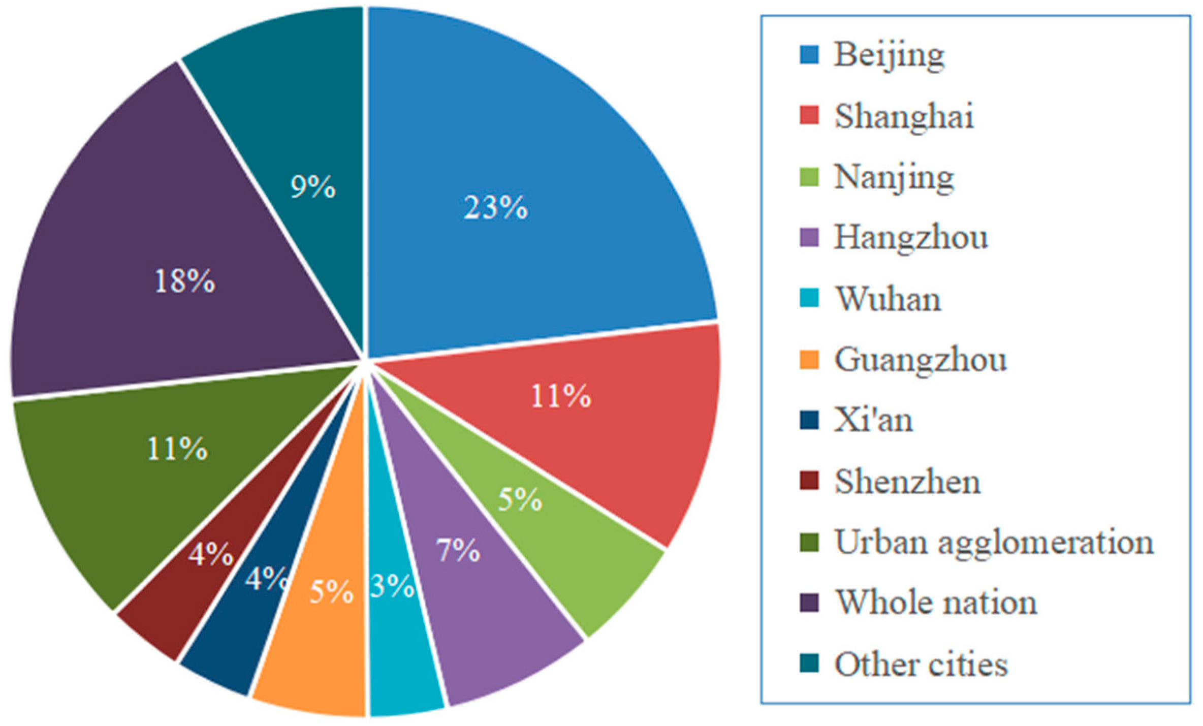
4.1. UHI Status in China
4.2. Impact of the UHI on Building Energy Consumption in China
5. Review of UHI Mitigation Strategies in China
5.1. Urban Greening
5.1.1. Urban Green Spaces
5.1.2. Green Roofs
5.1.3. Vertical Greenery
5.2. Urban Morphology
5.3. Cool Material
5.3.1. Cool Roof and Cool Coatings on Building Surfaces
5.3.2. Cool Pavement
5.4. Water Bodies
5.5. Urban Ventilation
6. Discussion
7. Conclusions
- (1)
- In these research methods for studying UHI, the meteorological data methods are usually used to study long-term UHI phenomena in cities, whereas the fixed measurements or mobile traverse methods can directly collect the micro-climatic parameters and thus can obtain high-quality historical time series of temperature. Remote sensing methods provide an advantage that can get a large spatial distribution of UHI considering the characteristics of satellite data with wide coverage and open access. Compared to other methods, numerical simulation methods have the advantage of performing comparative studies for different scenarios. The average annual SUHI is higher than CUHI in China. SUHII in the summer and winter days is higher in southern Chinese cities than that in northern cities, while SUHII in the summer and winter nights has the opposite geographic distribution.
- (2)
- The formation, development, and evolution of UHI are influenced by many factors, including materials of buildings and open spaces, anthropogenic heat, evaporating surfaces, canyon geometry, and architectural design and layout, etc. Rising temperatures in cities could increase cooling energy consumption and seriously affect human health and well-being. To be specific, the UHI effect exacerbates cooling energy consumption in southern China, where the buildings are dominated by air conditioning, whereas in north China, where the heating in the winter is a major concern, the UHI effect helps reducing buildings energy consumption. The influence of UHI on building energy consumption is related to the local microclimate, the urban characteristics of the area where the building is located, and the type of building.
- (3)
- The mitigation strategies to UHI in China, such as urban greening (including UGS, green roofs, and vertical greenery), urban morphology indicators, cool materials (including cool pavement, cool roof, and cool coatings on building surfaces), water bodies, and urban ventilation were reviewed and discussed. We found that UGS can form a cold island larger than its own boundary during the daytime of summer, and its cooling effect depends on vegetation types, canopy density, and the size and shape of UGS. Green roofs and vertical greenery have a significant cooling effect on the high-density buildings, and roof greening combined with night ventilation can significantly reduce indoor temperature and heat gain during the cooling period. Compared with cities in northern China, cool materials are more suitable for hot cities. It should be noted that green roofs, vertical greenery, and cool roofs have the potential to increase buildings’ heating needs during winter. GR performs better than a cool roof in non-insulated buildings, while vertical greenery of high-rise buildings has a better cooling effect than the green roof. The cooling effect of water bodies is related to the area, shape, and location of water bodies, landscape shape index, and the proportion of the surrounding buildings. The cooling effect is better when the water combined with UGS or water and UGS are connected under ventilation channels. Urban morphology indicators, such as building density, SVF, floor area ratio, etc., have a strong relationship with the UHI effect. Therefore, the rational planning of these indicators hence can increase airflow and heat dissipation in cities.
Author Contributions
Funding
Institutional Review Board Statement
Informed Consent Statement
Data Availability Statement
Conflicts of Interest
Nomenclature
| ANN | Artificial neural network |
| BEM | Building energy models |
| BLUHI | Boundary layer urban heat island |
| CFD | Computational fluid dynamics |
| CLUHI | Canopy layer urban heat island |
| DGF | Direct green facade |
| DSGF | Double-skin green facade |
| EGR | Extensive green roof |
| FMMTM | Fixed measurements or mobile traverses methods |
| GR | Green roofs |
| IGR | Intensive green roof |
| ISA | Impervious surface area |
| ISAR | Impervious surface area ratio |
| LAI | Leaf area index |
| LULC | Land use and land cover |
| LST | Land surface temperature |
| LWS | Living walls system |
| MDM | Meteorological data methods |
| NCCI | Normalized cooling capability index |
| NDBI | Normalized difference building index |
| NDVI | Normalized difference vegetation index |
| NSM | Numerical simulation methods |
| NWP | Numerical weather prediction |
| PCI | Park cool island |
| RSM | Remote sensing methods |
| SEB | Surface energy balance |
| SUHI | Surface urban heat island |
| SVF | Sky view factors |
| UGS | Urban green spaces |
| UCI | Urban cool island |
| UCII | Urban cooling island intensity |
| UCMs | Urban canopy models |
| UHI | Urban heat island |
| UHII | Urban heat island intensity |
| VG | Vertical greening |
| VGS | Vertical greening system |
| WCI | Water cooling island |
| NDBI | Normalized difference building index |
References
- Jamei, Y.; Rajagopalan, P.; Sun, Q. Spatial structure of surface urban heat island and its relationship with vegetation and built-up areas in Melbourne, Australia. Sci. Total Environ. 2019, 659, 1335–1351. [Google Scholar] [CrossRef] [PubMed]
- Mathew, A.; Khandelwal, S.; Kaul, N. Spatial and Temporal Variations of Urban Heat Island Effect and the effect of Percentage Impervious Surface Area and Elevation on Land Surface Temperature: Study of Chandigarh City, India. Sustain. Cities Soc. 2016, 26, 264–277. [Google Scholar] [CrossRef]
- United Nations. World Urbanization Prospects: The 2013 Revision; United Nations: New York, NY, USA, 2014. [Google Scholar]
- Marando, F.; Salvatori, E.; Sebastiani, A.; Fusaro, L.; Manes, F. Regulating Ecosystem Services and Green Infrastructure: Assessment of Urban Heat Island effect mitigation in the municipality of Rome, Italy. Ecol. Model. 2019, 392, 92–102. [Google Scholar] [CrossRef]
- Sun, Y.; Gao, C.; Li, J.; Wang, R.; Liu, J. Evaluating urban heat island intensity and its associated determinants of towns and cities continuum in the Yangtze River Delta Urban Agglomerations. Sustain. Cities Soc. 2019, 50, 101659. [Google Scholar] [CrossRef]
- Zhao, X.; Jiang, H.; Wang, H.; Zhao, J.; Qiu, Q.; Tapper, N.; Hua, L. Remotely sensed thermal pollution and its relationship with energy consumption and industry in a rapidly urbanizing Chinese city. Energy Policy 2013, 57, 398–406. [Google Scholar] [CrossRef]
- Papamanolis, N. The main characteristics of the urban climate and the air quality in Greek cities. Urban Clim. 2015, 12, 49–64. [Google Scholar] [CrossRef]
- Salvati, A.; Coch Roura, H.; Cecere, C. Assessing the urban heat island and its energy impact on residential buildings in Mediterranean climate: Barcelona case study. Energy Build. 2017, 146, 38–54. [Google Scholar] [CrossRef]
- Taleghani, M. Outdoor thermal comfort by different heat mitigation strategies-A review. Renew. Sustain. Energy Rev. 2018, 81, 2011–2018. [Google Scholar] [CrossRef]
- Nematchoua, M.K.; Yvon, A.; Roy, S.E.J.; Ralijaona, G.; Mamiharijaona, R.; Razafinjaka, J.N.; Tefy, R. A review on energy consumption in the residential and commercial buildings located in tropical regions of Indian Ocean: A case of Madagascar island. J. Energy Storage 2019, 24, 100748. [Google Scholar] [CrossRef]
- Orimoloye, I.R.; Mazinyo, S.P.; Kalumba, A.M.; Ekundayo, O.Y.; Nel, W. Implications of climate variability and change on urban and human health: A review. Cities 2019, 91, 213–223. [Google Scholar] [CrossRef]
- Qi, J.D.; He, B.J.; Wang, M.; Zhu, J.; Fu, W.C. Do grey infrastructures always elevate urban temperature? No, utilizing grey infrastructures to mitigate urban heat island effects. Sustain. Cities Soc. 2019, 46, 101392. [Google Scholar] [CrossRef]
- Yang, X.; Yao, L.; Peng, L.L.H.; Jiang, Z.; Jin, T.; Zhao, L. Evaluation of a diagnostic equation for the daily maximum urban heat island intensity and its application to building energy simulations. Energy Build. 2019, 193, 160–173. [Google Scholar] [CrossRef]
- Santamouris, M. Using cool pavements as a mitigation strategy to fight urban heat island-A review of the actual developments. Renew. Sustain. Energy Rev. 2013, 26, 224–240. [Google Scholar] [CrossRef]
- Zinzi, M.; Carnielo, E. Impact of urban temperatures on energy performance and thermal comfort in residential buildings. The case of Rome, Italy. Energy Build. 2017, 157, 20–29. [Google Scholar] [CrossRef]
- Li, X.; Zhou, Y.; Yu, S.; Jia, H.; Li, H.; Li, W. Urban heat island impacts on building energy consumption: A review of approaches and findings. Energy 2019, 174, 407–419. [Google Scholar] [CrossRef]
- Ghobadi, A.; Khosravi, M.; Tavousi, T. Surveying of Heat waves Impact on the Urban Heat Islands: Case study, the Karaj City in Iran. Urban Clim. 2018, 24, 600–615. [Google Scholar] [CrossRef]
- Kotharkar, R.; Ramesh, A.; Bagade, A. Urban Heat Island studies in South Asia: A critical review. Urban Clim. 2018, 24, 1011–1026. [Google Scholar] [CrossRef]
- Ward, K.; Lauf, S.; Kleinschmit, B.; Endlicher, W. Heat waves and urban heat islands in Europe: A review of relevant drivers. Sci. Total Environ. 2016, 569–570, 527–539. [Google Scholar] [CrossRef]
- Mavrogianni, A.; Davies, M.; Batty, M.; Belcher, S.E.; Bohnenstengel, S.I.; Carruthers, D.; Chalabi, Z.; Croxford, B.; Demanuele, C.; Evans, S.; et al. The comfort, energy and health implications of London’s urban heat island. Build. Serv. Eng. Res. T 2011, 32, 35–52. [Google Scholar] [CrossRef]
- Bowler, D.E.; Buyung-Ali, L.; Knight, T.M.; Pullin, A.S. Urban greening to cool towns and cities: A systematic review of the empirical evidence. Landsc. Urban Plan. 2010, 97, 147–155. [Google Scholar] [CrossRef]
- Gago, E.J.; Roldan, J.; Pacheco-Torres, R.; Ordóñez, J. The city and urban heat islands: A review of strategies to mitigate adverse effects. Renew. Sustain. Energy Rev. 2013, 25, 749–758. [Google Scholar] [CrossRef]
- Lai, D.; Liu, W.; Gan, T.; Liu, K.; Chen, Q. A review of mitigating strategies to improve the thermal environment and thermal comfort in urban outdoor spaces. Sci. Total Environ. 2019, 661, 337–353. [Google Scholar] [CrossRef]
- Sun, R.; Lü, Y.; Yang, X.; Chen, L. Understanding the variability of urban heat islands from local background climate and urbanization. J. Clean. Prod. 2019, 208, 743–752. [Google Scholar] [CrossRef]
- Zhou, D.; Zhao, S.; Liu, S.; Zhang, L. Spatiotemporal trends of terrestrial vegetation activity along the urban development intensity gradient in China’s 32 major cities. Sci. Total Environ. 2014, 488–489, 136–145. [Google Scholar] [CrossRef] [PubMed]
- Zhou, D.; Zhang, L.; Hao, L.; Sun, G.; Liu, Y.; Zhu, C. Spatiotemporal trends of urban heat island effect along the urban development intensity gradient in China. Sci. Total Environ. 2016, 544, 617–626. [Google Scholar] [CrossRef] [PubMed]
- Mirzaei, P.A. Recent challenges in modeling of urban heat island. Sustain. Cities Soc. 2015, 19, 200–206. [Google Scholar] [CrossRef]
- Morris, K.I.; Salleh, S.A.; Chan, A.; Ooi MC, G.; Abakr, A.; Oozeer, M.Y.; Duda, M. Computational study of urban heat island of Putrajaya, Malaysia. Sustain. Cities Soc. 2015, 19, 359–372. [Google Scholar] [CrossRef]
- Effat, H.A.; Hassan, O.A.K. Change detection of urban heat islands and some related parameters using multi-temporal Landsat images; a case study for Cairo city, Egypt. Urban Clim. 2014, 10, 171–188. [Google Scholar] [CrossRef]
- Santamouris, M. Analyzing the heat island magnitude and characteristics in one hundred Asian and Australian cities and regions. Sci. Total Environ. 2015, 512–513, 582–598. [Google Scholar] [CrossRef]
- Zhao, S.; Zhou, D.; Liu, S. Data concurrency is required for estimating urban heat island intensity. Environ. Pollut. 2016, 208, 118–124. [Google Scholar] [CrossRef]
- Jahangir, M.S.; Moghim, S. Assessment of the urban heat island in the city of Tehran using reliability methods. Atmos. Res. 2019, 225, 144–156. [Google Scholar] [CrossRef]
- Ramakreshnan, L.; Aghamohammadi, N.; Fong, C.S.; Ghaffarianhoseini, A.; Ghaffarianhoseini, A.; Wong, L.P.; Hassan, N.; Sulaiman, N.M. A critical review of Urban Heat Island phenomenon in the context of Greater Kuala Lumpur, Malaysia. Sustain. Cities Soc. 2018, 39, 99–113. [Google Scholar] [CrossRef]
- Oke, T.R. The heat island of the urban boundary layer: Characteristics, causes and effects. In Wind Climate in Cities; Cermak, J.E., Davenport, A.G., Plate, E.J., Viegas, D.X., Eds.; Kluwer Academic: Dordrecht, The Netherlands, 1995; pp. 81–107. [Google Scholar]
- Voogt, J.A.; Oke, T.R. Complete urban surface temperatures. J. Appl. Meteorol. 1997, 36, 1117–1132. [Google Scholar] [CrossRef]
- Deilami, K.; Kamruzzaman, M.; Liu, Y. Urban heat island effect: A systematic review of spatio-temporal factors, data, methods, and mitigation measures. Int. J. Appl. Earth Obs. Geoinf. 2018, 67, 30–42. [Google Scholar] [CrossRef]
- Kotharkar, R.; Bagade, A. Evaluating urban heat island in the critical local climate zones of an Indian city. Landsc. Urban Plan. 2018, 169, 92–104. [Google Scholar] [CrossRef]
- Luo, Y.; Li, Q.; Yang, K.; Xie, W.; Zhou, X.; Shang, C.; Xu, Y.; Zhang, Y.; Zhang, C. Thermodynamic analysis of air-ground and water-ground energy exchange process in urban space at micro scale. Sci. Total Environ. 2019, 694, 133612. [Google Scholar]
- Mirzaei, P.A.; Haghighat, F. Approaches to study Urban Heat Island-Abilities and limitations. Build. Environ. 2010, 45, 2192–2201. [Google Scholar] [CrossRef]
- Li, Z.L.; Tang, B.H.; Wu, H.; Ren, H.; Yan, G.; Wan, Z.; Trigo, I.F.; Sobrino, J. Satellite-derived land surface temperature: Current status and perspectives. Remote Sens. Environ. 2013, 131, 14–37. [Google Scholar] [CrossRef]
- Song, J.; Du, S.; Feng, X.; Guo, L. The relationships between landscape compositions and land surface temperature: Quantifying their resolution sensitivity with spatial regression models. Landsc. Urban Plan. 2014, 123, 145–157. [Google Scholar] [CrossRef]
- Shaker, R.R.; Altman, Y.; Deng, C.; Vaz, E.; Forsythe, K.W. Investigating urban heat island through spatial analysis of New York City streetscapes. J. Clean. Prod. 2019, 233, 972–992. [Google Scholar] [CrossRef]
- Theophilou, M.K.; Serghides, D. Estimating the characteristics of the Urban Heat Island Effect in Nicosia, Cyprus, using multiyear urban and rural climatic data and analysis. Energy Build. 2015, 108, 137–144. [Google Scholar] [CrossRef]
- Lazzarini, M.; Marpu, P.R.; Ghedira, H. Temperature-land cover interactions: The inversion of urban heat island phenomenon in desert city areas. Remote Sens. Environ. 2013, 130, 136–152. [Google Scholar] [CrossRef]
- Rotem-Mindali, O.; Michael, Y.; Helman, D.; Lensky, I.M. The role of local land-use on the urban heat island effect of Tel Aviv as assessed from satellite remote sensing. Appl. Geogr. 2015, 56, 145–153. [Google Scholar] [CrossRef]
- Lai, J.; Zhan, W.; Huang, F.; Quan, J.; Hu, L.; Gao, L.; Ju, W. Does quality control matter? Surface urban heat island intensity variations estimated by satellite-derived land surface temperature products. ISPRS J. Photogramm. Remote Sens. 2018, 139, 212–227. [Google Scholar] [CrossRef]
- Levermore, G.; Parkinson, J.; Lee, K.; Laycock, P.; Lindley, S. The increasing trend of the urban heat island intensity. Urban Clim. 2018, 24, 360–368. [Google Scholar] [CrossRef]
- Mathew, A.; Khandelwal, S.; Kaul, N.; Chauhan, S. Analyzing the diurnal variations of land surface temperatures for surface urban heat island studies: Is time of observation of remote sensing data important? Sustain. Cities Soc. 2018, 40, 194–213. [Google Scholar] [CrossRef]
- Jin, M.; Shepherd, J.M.; Zheng, W. Urban Surface Temperature Reduction via the Urban Aerosol Direct Effect: A Remote Sensing and WRF Model Sensitivity Study. Adv. Meteorol. 2010, 2010, 1–14. [Google Scholar] [CrossRef]
- Zhao, L.; Lee, X.; Smith, R.B.; Oleson, K. Strong contributions of local background climate to urban heat islands. Nature 2014, 511, 216–219. [Google Scholar] [CrossRef]
- Sun, R.; Chen, A.; Chen, L.; Lü, Y. Cooling effects of wetlands in an urban region: The case of Beijing. Ecol. Indic. 2012, 20, 57–64. [Google Scholar] [CrossRef]
- Rasul, A.; Balzter, H.; Smith, C. Spatial variation of the daytime Surface Urban Cool Island during the dry season in Erbil, Iraqi Kurdistan, from Landsat 8. Urban Clim. 2015, 14, 176–186. [Google Scholar] [CrossRef]
- Rasul, A.; Balzter, H.; Smith, C. Diurnal and seasonal variation of surface urban cool and heat islands in the semi-arid city of Erbil. Iraq. Climate 2016, 4, 42. [Google Scholar] [CrossRef]
- Rizvi, S.H.; Alam, K.; Iqbal, J. Spatio-temporal variations in urban heat island and its interaction with heat wave. J. Atmos. Solar-Terr. Phys. 2019, 185, 50–57. [Google Scholar] [CrossRef]
- Yang, X.; Li, Y.; Luo, Z.; Chan, P.W. The urban cool island phenomenon in a high-rise high-density city and its mechanisms. Int. J. Climatol. 2016, 37, 890–904. [Google Scholar] [CrossRef]
- Nunez, M.; Oke, T.R. The energy balance of urban canyon. J. Appl. Meteorol. 1977, 16, 11–19. [Google Scholar] [CrossRef]
- Chen, S.; Hu, D.; Wong, M.S.; Ren, H.; Cao, S.; Yu, C.; Ho, H.C. Characterizing spatiotemporal dynamics of anthropogenic heat fluxes: A 20-year case study in Beijing-Tianjin-Hebei region in China. Environ. Pollut. 2019, 249, 923–931. [Google Scholar] [CrossRef]
- Giridharan, R.; Emmanuel, R. The impact of urban compactness, comfort strategies and energy consumption on tropical urban heat island intensity: A review. Sustain. Cities Soc. 2018, 40, 677–687. [Google Scholar] [CrossRef]
- Memon, R.A.; Leung, D.Y.C.; Liu, C.H. An investigation of urban heat island intensity (UHII) as an indicator of urban heating. Atmos. Res. 2009, 94, 491–500. [Google Scholar] [CrossRef]
- Zeng, F.; Gao, N. Use of an Energy Balance Model for Studying Urban Surface Temperature at Microscale. Procedia Eng. 2017, 205, 2956–2966. [Google Scholar] [CrossRef]
- Christen, A.; Voogt, R. Energy and radiation balance of a central European city. Int. J. Climatol. 2004, 24, 1395–1421. [Google Scholar] [CrossRef]
- Brandsma, T.; Wolters, D. Measurement and Statistical Modeling of the Urban Heat Island of the City of Utrecht (the Netherlands). J. Appl. Meteorol. Climatol. 2012, 51, 1046–1060. [Google Scholar] [CrossRef]
- Mohan, M.; Kikegawa, Y.; Gurjar, B.R.; Bhati, S.; Kandya, A.; Ogawa, K. Urban Heat Island Assessment for a Tropical Urban Airshed in India. Atmos. Clim. Sci. 2012, 2, 127–138. [Google Scholar] [CrossRef]
- Hu, Y.; Hou, M.; Jia, C.; Zhen, X.; Xu, Y. Comparison of surface and canopy urban heat islands within megacities of eastern China. ISPRS J. Photogramm. Remote Sens. 2019, 156, 160–168. [Google Scholar] [CrossRef]
- Yang, P.; Ren, G.; Hou, W. Impact of daytime precipitation duration on urban heat island intensity over Beijing city. Urban Clim. 2019, 28, 1–13. [Google Scholar] [CrossRef]
- Grigoraș, G.; Urițescu, B. Land Use/Land Cover changes dynamics and their effects on Surface Urban Heat Island in Bucharest, Romania. Int. J. Appl. Earth Obs. Geoinf. 2019, 80, 115–126. [Google Scholar] [CrossRef]
- Hong, J.W.; Hong, J.; Kwon, E.; Yoon, D.K. Temporal dynamics of urban heat island correlated with the socioeconomic development over the past half-century in Seoul, Korea. Environ. Pollut. 2019, 254, 112934. [Google Scholar] [CrossRef]
- Pandey, A.K.; Singh, S.; Berwal, S.; Kumar, D.; Pandey, P.; Prakash, A.; Lodhi, N.; Maithani, S.; Jain, V.K.; Kumar, K. Spatio-temporal variations of urban heat island over Delhi. Urban Clim. 2014, 10, 119–133. [Google Scholar] [CrossRef]
- Zhang, J.; Gou, Z.; Lu, Y.; Lin, P. The impact of sky view factor on thermal environments in urban parks in a subtropical coastal city of Australia. Urban For. Urban Green. 2019, 44, 126422. [Google Scholar] [CrossRef]
- Qiao, Z.; Tian, G.; Xiao, L. Diurnal and seasonal impacts of urbanization on the urban thermal environment: A case study of Beijing using MODIS data. ISPRS J. Photogramm. Remote Sens. 2013, 85, 93–101. [Google Scholar] [CrossRef]
- Toparlar, Y.; Blocken, B.; Vos, P.; Heijst, G.J.F.V.; Janssen, W.D.; Hooff, T.V.; Montazeri, H.; Timmermans, H.J.P. CFD simulation and validation of urban microclimate: A case study for Bergpolder Zuid, Rotterdam. Build. Environ. 2015, 83, 79–90. [Google Scholar] [CrossRef]
- Soltani, A.; Sharifi, E. Daily variation of urban heat island effect and its correlations to urban greenery: A case study of Adelaide. Front. Archit. Res. 2017, 6, 529–538. [Google Scholar] [CrossRef]
- Yin, C.; Yuan, M.; Lu, Y.; Huang, Y.; Liu, Y. Effects of urban form on the urban heat island effect based on spatial regression model. Sci. Total Environ. 2018, 634, 696–704. [Google Scholar] [CrossRef] [PubMed]
- Busato, F.; Lazzarin, R.M.; Noro, M. Three years of study of the Urban Heat Island in Padua: Experimental results. Sustain. Cities Soc. 2014, 10, 251–258. [Google Scholar] [CrossRef]
- Cao, Z.; Wu, Z.; Liu, L.; Chen, Y.; Zou, Y. Assessing the relationship between anthropogenic heat release warming and building characteristics in Guangzhou: A sustainable development perspective. Sci. Total Environ. 2019, 695, 133759. [Google Scholar] [CrossRef] [PubMed]
- Xu, Y.; Zhou, D.; Li, Z. Research on Characteristic Analysis of Urban Heat Island in Multi-scales and Urban Planning Strategies. Procedia Eng. 2016, 169, 175–182. [Google Scholar] [CrossRef]
- Li, H.; Zhou, Y.; Wang, X.; Zhou, X.; Zhang, H.; Sodoudi, S. Quantifying urban heat island intensity and its physical mechanism using WRF/UCM. Sci. Total Environ. 2019, 650, 3110–3119. [Google Scholar] [CrossRef]
- Min, M.; Lin, C.; Duan, X.; Jin, Z.; Zhang, L. Spatial distribution and driving force analysis of urban heat island effect based on raster data: A case study of the Nanjing metropolitan area, China. Sustain. Cities Soc. 2019, 50, 101637. [Google Scholar] [CrossRef]
- Zeleňáková, M.; Purcz, P.; Hlavatá, H.; Blišťan, P. Climate Change in Urban Versus Rural Areas. Procedia Eng. 2015, 119, 1171–1180. [Google Scholar] [CrossRef]
- Founda, D.; Pierros, F.; Petakis, M.; Zerefos, C. Interdecadal variations and trends of the Urban Heat Island in Athens (Greece) and its response to heat waves. Atmos. Res. 2015, 161–162, 1–13. [Google Scholar] [CrossRef]
- Hou, Y.; Chen, B.; Yang, X.; Liang, P. Observed Climate Change in East China during 1961–2007. Adv. Clim. Chang. Res. 2013, 4, 84–91. [Google Scholar]
- Sun, Y.; Zhang, X.; Ren, G.; WZwiers, F.; Hu, T. Contribution of urbanization to warming in China. Nat. Clim. Chang. 2016, 6, 706–709. [Google Scholar] [CrossRef]
- Jiang, S.; Wang, K.; Mao, Y. Rapid Local Urbanization around Most Meteorological Stations Explain the Observed Daily Asymmetric Warming Rates across China from 1985 to 2017. J. Clim. 2020, 33, 9045–9061. [Google Scholar] [CrossRef]
- Yao, R.; Luo, Q.; Luo, Z.; Jiang, L.; Yang, Y. An integrated study of urban microclimates in Chongqing, China: Historical weather data, transverse measurement and numerical simulation. Sustain. Cities Soc. 2015, 14, 187–199. [Google Scholar] [CrossRef]
- Li, G.; Zhang, X.; Mirzaei, P.A.; Zhang, J.; Zhao, Z. Urban heat island effect of a typical valley city in China: Responds to the global warming and rapid urbanization. Sustain. Cities Soc. 2018, 38, 736–745. [Google Scholar] [CrossRef]
- Peng, S.; Feng, Z.; Liao, H.; Huang, B.; Peng, S.; Zhou, T. Spatial-temporal pattern of, and driving forces for, urban heat island in China. Ecol. Indic. 2019, 96, 127–132. [Google Scholar] [CrossRef]
- Ramamurthy, P.; Sangobanwo, M. Inter-annual variability in urban heat island intensity over 10 major cities in the United States. Sustain. Cities Soc. 2016, 26, 65–75. [Google Scholar] [CrossRef]
- Yang, W.; Wong, N.H.; Jusuf, S.K. Thermal comfort in outdoor urban spaces in Singapore. Build. Environ. 2013, 59, 426–435. [Google Scholar] [CrossRef]
- Giannopoulou, K.; Livada, I.; Santamouris, M.; Saliari, M.; Assimakopoulos, M.; Caouris, Y.G. On the characteristics of the summer urban heat island in Athens, Greece. Sustain. Cities Soc. 2011, 1, 16–28. [Google Scholar] [CrossRef]
- Kantzioura, A.; Kosmopoulos, P.; Zoras, S. Urban surface temperature and microclimate measurements in Thessaloniki. Energy Build. 2012, 44, 63–72. [Google Scholar] [CrossRef]
- Liu, J.; Niu, J.; Xia, Q. Combining measured thermal parameters and simulated wind velocity to predict outdoor thermal comfort. Build. Environ. 2016, 105, 185–197. [Google Scholar] [CrossRef]
- Dorigon, L.P.; Amorim, M.C. Spatial modeling of an urban Brazilian heat island in a tropical continental climate. Urban Clim. 2019, 28, 100461. [Google Scholar] [CrossRef]
- Aflaki, A.; Mirnezhad, M.; Ghaffarianhoseini, A.; Ghaffarianhoseini, A.; Omrany, H.; Wang, Z.; Akbari, H. Urban heat island mitigation strategies: A state-of-the-art review on Kuala Lumpur, Singapore and Hong Kong. Cities 2017, 62, 131–145. [Google Scholar] [CrossRef]
- Liu, L.; Lin, Y.; Liu, J.; Wang, L.; Wang, D.; Shui, T.; Chen, X.; Wu, Q. Analysis of local-scale urban heat island characteristics using an integrated method of mobile measurement and GIS-based spatial interpolation. Build. Environ. 2017, 117, 191–207. [Google Scholar] [CrossRef]
- Wang, Y.; Ni, Z.; Chen, S.; Xia, B. Microclimate regulation and energy saving potential from different urban green infrastructures in a subtropical city. J. Clean. Prod. 2019, 226, 913–927. [Google Scholar] [CrossRef]
- Yang, F.; Lau, S.S.Y.; Qian, F. Summertime heat island intensities in three high-rise housing quarters in inner-city Shanghai China: Building layout, density and greenery. Build. Environ. 2010, 45, 115–134. [Google Scholar] [CrossRef]
- Jin, C.; Bai, X.; Luo, T.; Zou, M. Effects of green roofs’ variations on the regional thermal environment using measurements and simulations in Chongqing, China. Urban For. Urban Green. 2018, 29, 223–237. [Google Scholar] [CrossRef]
- Chen, Y.C.; Yao, C.K.; Honjo, T.; Lin, T.P. The application of a high-density street-level air temperature observation network (HiSAN): Dynamic variation characteristics of urban heat island in Tainan, Taiwan. Sci. Total Environ. 2018, 626, 555–566. [Google Scholar] [CrossRef] [PubMed]
- El-Hattab, M.; Amany, S.M.; Lamia, G.E. GEL Monitoring and assessment of urban heat islands over the Southern region of Cairo Governorate, Egypt. Egypt. J. Remote Sens. Space Sci. 2018, 21, 311–323. [Google Scholar]
- de Faria Peres, L.; de Lucena, A.J.; Rotunno Filho, O.C.; de Almeida França, J.R. The urban heat island in Rio de Janeiro, Brazil, in the last 30 years using remote sensing data. Int. J. Appl. Earth Obs. Geoinf. 2018, 64, 104–116. [Google Scholar] [CrossRef]
- Shirani-Bidabadi, N.; Nasrabadi, T.; Faryadi, S.; Larijani, A.; Roodposhti, M.S. Evaluating the spatial distribution and the intensity of urban heat island using remote sensing, case study of Isfahan city in Iran. Sustain. Cities Soc. 2019, 45, 686–692. [Google Scholar] [CrossRef]
- Rani, M.; Kumar, P.; Pandey, P.C.; Srivastava, P.K.; Chaudhary, B.S.; Tomar, V.; Mandal, V.P. Multi-Temporal NDVI and Surface Temperature Analysis for Urban Heat Island inbuilt surrounding of Sub-humid Region: A Case Study of two Geographical Regions. Remote Sens. Appl. Soc. Environ. 2018, 10, 163–172. [Google Scholar] [CrossRef]
- Silva, J.S.; Silva, R.M.; Santos CA, G. Spatiotemporal impact of land use/land cover changes on urban heat islands: A case study of Paço do Lumiar, Brazil. Build. Environ. 2018, 136, 279–292. [Google Scholar] [CrossRef]
- Yao, R.; Wang, L.; Huang, X.; Niu, Y.; Chen, Y.; Niu, Z. The influence of different data and method on estimating the surface urban heat island intensity. Ecol. Indic. 2018, 89, 45–55. [Google Scholar] [CrossRef]
- Zhang, Y.; Sun, L. Spatial-temporal impacts of urban land use land cover on land surface temperature: Case studies of two Canadian urban areas. Int. J. Appl. Earth Obs. Geoinf. 2019, 75, 171–181. [Google Scholar] [CrossRef]
- Dwivedi, A.; Khire, M.V. Application of Split-Window Algorithm to study Urban Heat Island Effect in Mumbai through Land Surface Temperature approach. Sustain. Cities Soc. 2018, 41, 865–877. [Google Scholar] [CrossRef]
- Shi, Y.; Katzschner, L.; Ng, E. Modelling the fine-scale spatiotemporal pattern of urban heat island effect using land use regression approach in a megacity. Sci. Total Environ. 2017, 618, 891–904. [Google Scholar] [CrossRef]
- Li, H.; Zhou, Y.; Li, X.; Meng, L.; Wang, X.; Wu, S.; Sodoudi, S. A new method to quantify surface urban heat island intensity. Sci. Total Environ. 2017, 624, 262–272. [Google Scholar] [CrossRef]
- Wang, J.; Huang, B.; Fu, D.; Atkinson, P.M.; Zhang, X. Response of urban heat island to future urban expansion over the Beijing-Tianjin-Hebei metropolitan area. Appl. Geogr. 2016, 70, 26–36. [Google Scholar] [CrossRef]
- Ye, C.; Liu, Y.; Quan, W.; Liu, W.; Liu, C. Application of Urban Thermal Environment Monitoring Based on Remote Sensing in Beijing. Procedia Environ. Sci. 2011, 11, 1424–1433. [Google Scholar]
- Huang, F.; Zhan, W.; Voogt, J.; Hu, L.; Wang, Z.; Quan, J.; Ju, W.; Guo, Z. Temporal upscaling of surface urban heat island by incorporating an annual temperature cycle model: A tale of two cities. Remote Sens. Environ. 2016, 186, 1–12. [Google Scholar] [CrossRef]
- Sheng, L.; Hu, H.; You, H.; Gu, Q.; Hu, H. Comparison of the urban heat island intensity quantified by using air temperature and Landsat land surface temperature in Hangzhou, China. Ecol. Indic. 2017, 72, 738–746. [Google Scholar] [CrossRef]
- Yao, R.; Wang, L.; Huang, X.; Niu, Z.; Liu, F.; Wang, Q. Temporal trends of surface urban heat islands and associated determinants in major Chinese cities. Sci. Total Environ. 2017, 609, 742–754. [Google Scholar] [CrossRef] [PubMed]
- Yao, R.; Wang, L.; Huang, X.; Zhang, W.; Li, J.; Niu, Z. Interannual variations in surface urban heat island intensity and associated drivers in China. J. Environ. Manag. 2018, 222, 86–94. [Google Scholar] [CrossRef] [PubMed]
- Yue, W.; Qiu, S.; Xu, H.; Xu, X.; Zhang, L. Polycentric urban development and urban thermal environment: A case of Hangzhou, China. Landsc. Urban Plan. 2019, 189, 58–70. [Google Scholar] [CrossRef]
- Zhou, D.; Zhao, S.; Liu, S.; Zhang, L.; Zhu, C. Surface urban heat island in China’s 32 major cities: Spatial patterns and drivers. Remote Sens. Environ. 2014, 152, 51–61. [Google Scholar] [CrossRef]
- Liu, S.; Zang, Z.; Wang, W.; Wu, Y. Spatial-temporal evolution of urban heat Island in Xi’an from 2006 to 2016. Phys. Chem. Earth 2019, 110, 185–194. [Google Scholar] [CrossRef]
- Zhang, H.; Qi, Z.; Ye, X.; Cai, Y.; Ma, W. Analysis of land use/land cover change, population shift, and their effects on spatiotemporal patterns of urban heat islands in metropolitan Shanghai, China. Appl. Geogr. 2013, 44, 121–133. [Google Scholar] [CrossRef]
- Meng, Q.; Zhang, L.; Sun, Z.; Meng, F.; Wang, L.; Sun, Y. Characterizing spatial and temporal trends of surface urban heat island effect in an urban main built-up area: A 12-year case study in Beijing, China. Remote Sens. Environ. 2017, 204, 826–837. [Google Scholar] [CrossRef]
- Lin, Y.; Jim, C.Y.; Deng, J.; Wang, Z. Urbanization effect on spatiotemporal thermal patterns and changes in Hangzhou (China). Build. Environ. 2018, 145, 166–176. [Google Scholar] [CrossRef]
- Yu, Z.; Yao, Y.; Yang, G.; Wang, X.; Vejre, H. Spatiotemporal patterns and characteristics of remotely sensed region heat islands during the rapid urbanization (1995–2015) of Southern China. Sci. Total Environ. 2019, 674, 242–254. [Google Scholar] [CrossRef]
- Kong, F.; Yin, H.; James, P.; Hutyra, L.R.; He, H.S. Effects of spatial pattern of greenspace on urban cooling in a large metropolitan area of eastern China. Landsc. Urban Plan. 2014, 128, 35–47. [Google Scholar] [CrossRef]
- Du, H.; Song, X.; Jiang, H.; Kan, Z.; Wang, Z.; Cai, Y. Research on the cooling island effects of water body: A case study of Shanghai, China. Ecol. Indic. 2016, 67, 31–38. [Google Scholar] [CrossRef]
- Sun, R.; Chen, L. Effects of green space dynamics on urban heat islands: Mitigation and diversification. Ecosyst. Serv. 2017, 23, 38–46. [Google Scholar] [CrossRef]
- Cai, Y.; Chen, Y.; Tong, C. Spatiotemporal evolution of urban green space and its impact on the urban thermal environment based on remote sensing data: A case study of Fuzhou City, China. Urban For. Urban Green. 2019, 41, 333–343. [Google Scholar] [CrossRef]
- Wang, W.; Liu, K.; Tang, R.; Wang, S. Remote sensing image-based analysis of the urban heat island effect in Shenzhen, China. Phys. Chem. Earth 2019, 110, 168–175. [Google Scholar] [CrossRef]
- Li, J.; Song, C.; Cao, L.; Zhu, F.; Meng, X.; Wu, J. Impacts of landscape structure on surface urban heat islands: A case study of Shanghai, China. Remote Sens. Environ. 2011, 115, 3249–3263. [Google Scholar] [CrossRef]
- Wu, H.; Ye, L.; Shi, W.; Clarke, K.C. Assessing the effects of land use spatial structure on urban heat islands using HJ-1B remote sensing imagery in Wuhan, China. Int. J. Appl. Earth Obs. Geoinf. 2014, 32, 67–78. [Google Scholar] [CrossRef]
- Du, H.; Wang, D.; Wang, Y.; Zhao, X.; Qin, F.; Cai, Y. Influences of land cover types, meteorological conditions, anthropogenic heat and urban area on surface urban heat island in the Yangtze River Delta Urban Agglomeration. Sci. Total Environ. 2016, 571, 461–470. [Google Scholar] [CrossRef]
- Xu, D.; Chen, R. Comparison of urban heat island and urban reflection in Nanjing City of China. Sustain. Cities Soc. 2017, 31, 26–36. [Google Scholar] [CrossRef]
- Dai, Z.; Guldmann, J.M.; Hu, Y. Spatial regression models of park and land-use impacts on the urban heat island in central Beijing. Sci. Total Environ. 2018, 626, 1136–1147. [Google Scholar] [CrossRef]
- Yu, Z.; Yao, Y.; Yang, G.; Wang, X.; Vejre, H. Strong contribution of rapid urbanization and urban agglomeration development to regional thermal environment dynamics and evolution. For. Ecol. Manag. 2019, 446, 214–225. [Google Scholar] [CrossRef]
- Chen, W.; Zhang, Y.; Gao, W.; Zhou, D. The Investigation of Urbanization and Urban Heat Island in Beijing Based on Remote Sensing. Procedia Soc. Behav. Sci. 2016, 216, 141–150. [Google Scholar] [CrossRef]
- Guo, G.; Zhou, X.; Wu, Z.; Xiao, R.; Chen, Y. Characterizing the impact of urban morphology heterogeneity on land surface temperature in Guangzhou, China. Environ. Model. Softw. 2016, 84, 427–439. [Google Scholar] [CrossRef]
- Yue, W.; Liu, X.; Zhou, Y.; Liu, Y. Impacts of urban configuration on urban heat island: An empirical study in China mega-cities. Sci. Total Environ. 2019, 671, 1036–1046. [Google Scholar] [CrossRef]
- Zhou, D.; Bonafoni, S.; Zhang, L.; Wang, R. Remote sensing of the urban heat island effect in a highly populated urban agglomeration area in East China. Sci. Total Environ. 2018, 628, 415–429. [Google Scholar] [CrossRef]
- Li, Z.; Liu, L.; Dong, X.; Liu, J. The study of regional thermal environments in urban agglomerations using a new method based on metropolitan areas. Sci. Total Environ. 2019, 672, 370–380. [Google Scholar] [CrossRef]
- Chang, H.; Xiang, C.; Duan, C.; Wan, Z.; Liu, Y.; Zheng, Y.; Shang, Y.; Liu, M.; Shu, S. Study on the thermal performance and wind environment in a residential community. Int. J. Hydrogen Energy 2016, 41, 15868–15878. [Google Scholar] [CrossRef]
- Li, X.X.; Norford, L.K. Evaluation of cool roof and vegetations in mitigating urban heat island in a tropical city, Singapore. Urban Clim. 2016, 16, 59–74. [Google Scholar] [CrossRef]
- Toparlar, Y.; Blocken, B.; Maiheu, B.; van Heijst, G.J.F. A review on the CFD analysis of urban microclimate. Renew. Sustain. Energy Rev. 2017, 80, 1613–1640. [Google Scholar] [CrossRef]
- Morini, E.; Touchaei, A.G.; Rossi, F.; Cotana, F.; Akbari, H. Evaluation of albedo enhancement to mitigate impacts of urban heat island in Rome (Italy) using WRF meteorological model. Urban Clim. 2018, 24, 551–566. [Google Scholar] [CrossRef]
- Liu, X.; Tian, G.; Feng, J.; Wang, J.; Kong, L. Assessing summertime urban warming and the cooling efficacy of adaptation strategy in the Chengdu-Chongqing metropolitan region of China. Sci. Total Environ. 2018, 610, 1092–1102. [Google Scholar] [CrossRef]
- Giannaros, T.M.; Melas, D.; Daglis, I.A.; Keramitsoglou, I.; Kourtidis, K. Numerical study of the urban heat island over Athens (Greece) with the WRF model. Atmos. Environ. 2013, 73, 103–111. [Google Scholar] [CrossRef]
- Tsoka, S.; Tsikaloudaki, A.; Theodosiou, T. Analyzing the ENVI-met microclimate model’s performance and assessing cool materials and urban vegetation applications-a review. Sustain. Cities Soc. 2018, 43, 55–76. [Google Scholar] [CrossRef]
- Garuma, G.F. Review of urban surface parameterizations for numerical climate models. Urban Clim. 2017, 24, 830–851. [Google Scholar] [CrossRef]
- Battista, G.; de Lieto Vollaro, R.; Zinzi, M. Assessment of urban overheating mitigation strategies in a square in Rome, Italy. Solar Energy 2019, 180, 608–621. [Google Scholar] [CrossRef]
- Wang, Y.; Berardi, U.; Akbari, H. Comparing the effects of Urban Heat Island Mitigation Strategies for Toronto, Canada. Energy and Build. 2015, 114, 2–19. [Google Scholar] [CrossRef]
- Allegrini, J.; Dorer, V.; Carmeliet, J. Influence of morphologies on the microclimate in urban neighbourhoods. J. Wind Eng. Ind. Aerodyn. 2015, 144, 108–117. [Google Scholar] [CrossRef]
- Allegrini, J.; Carmeliet, J. Simulations of local heat islands in Zürich with coupled CFD and building energy models. Urban Clim. 2017, 24, 340–359. [Google Scholar] [CrossRef]
- Allegrini, J.; Orehounig, K.; Mavromatidis, G.; Ruesch, F.; Dorer, V.; Evins, R. A review of modelling approaches and tools for the simulation of district-scale energy systems. Renew. Sustain. Energy Rev. 2015, 52, 1391–1404. [Google Scholar] [CrossRef]
- Wong, M.S.; Nichol, J.E.; To, P.H.; Wang, J. A simple method for designation of urban ventilation corridors and its application to urban heat island analysis. Build. Environ. 2010, 45, 1880–1889. [Google Scholar] [CrossRef]
- Touchaei, A.G.; Wang, Y. Characterizing urban heat island in Montreal (Canada)-Effect of urban morphology. Sustain. Cities Soc. 2015, 19, 395–402. [Google Scholar] [CrossRef]
- de Souza, D.O.; dos Santos Alvalá, R.C.; do Nascimento, M.G. Urbanization effects on the microclimate of Manaus: A modeling study. Atmos. Res. 2016, 167, 237–248. [Google Scholar] [CrossRef]
- Takebayashi, H.; Senoo, M. Analysis of the relationship between urban size and heat island intensity using WRF model. Urban Clim. 2018, 24, 287–298. [Google Scholar] [CrossRef]
- Taleb, D.; Abu-Hijleh, B. Urban heat islands: Potential effect of organic and structured urban configurations on temperature variations in Dubai, UAE. Renew. Energy 2013, 50, 747–762. [Google Scholar] [CrossRef]
- Taleghani, M.; Sailor, D.J.; Tenpierik, M. Thermal assessment of heat mitigation strategies: The case of Portland State University, Oregon, USA. Build. Environ. 2014, 73, 138–150. [Google Scholar] [CrossRef]
- Noro, M.; Lazzarin, R. Urban heat island in Padua, Italy: Simulation analysis and mitigation strategies. Urban Clim. 2015, 14, 187–196. [Google Scholar] [CrossRef]
- O’Malley Christopher Piroozfar, P.; Farr, E.R.P.; Pomponi, F. Urban Heat Island (UHI) mitigating strategies: A case-based comparative analysis. Sustain. Cities Soc. 2015, 19, 222–235. [Google Scholar] [CrossRef]
- Peron, F.; De Maria, M.M.; Spinazzè, F.; Mazzali, U. An analysis of the urban heat island of Venice mainland. Sustain. Cities Soc. 2015, 19, 300–309. [Google Scholar] [CrossRef]
- Lin, B.S.; Lin, C.T. Preliminary study of the influence of the spatial arrangement of urban parks on local temperature reductionr. Urban For. Urban Green. 2016, 20, 348–357. [Google Scholar] [CrossRef]
- Wang, Y.; Akbari, H. The effects of street tree planting on Urban Heat Island mitigation in Montreal. Sustain. Cities Soc. 2016, 27, 122–128. [Google Scholar] [CrossRef]
- Lu, J.; Li, Q.; Zeng, L.; Chen, J.; Liu, G.; Li, Y.; Li, W.; Huang, K. A micro-climatic study on cooling effect of an urban park in a hot and humid climate. Sustain. Cities Soc. 2017, 32, 513–522. [Google Scholar] [CrossRef]
- Herath, H.M.P.I.K.; Halwatura, R.U.; Jayasinghe, G.Y. Evaluation of green infrastructure effects on tropical Sri Lankan urban context as an urban heat island adaptation strategy. Urban For. Urban Green. 2018, 29, 212–222. [Google Scholar] [CrossRef]
- Berardi, U. The outdoor microclimate benefits and energy saving resulting from green roofs retrofits. Energy Build. 2016, 121, 217–229. [Google Scholar] [CrossRef]
- Heidarinejad, M.; Gracik, S.; Roudsari, M.S.; Nikkho, S.K.; Liu, J.; Liu, K.; Pitchorov, G.; Srebric, J. Influence of Building Surface Solar Irradiance on Environmental Temperatures in Urban Neighborhoods. Sustain. Cities Soc. 2016, 26, 186–202. [Google Scholar] [CrossRef]
- Yang, Y.K.; Kang, I.S.; Chung, M.H.; Kim, S.; Park, J.C. Effect of PCM cool roof system on the reduction in urban heat island phenomenon. Build. Environ. 2017, 122, 411–421. [Google Scholar] [CrossRef]
- Kolokotsa, D.; Santamouris, M.; Zerefos, S.C. Green and cool roofs’ urban heat island mitigation potential in European climates for office buildings under free floating conditions. Solar Energy 2013, 95, 118–130. [Google Scholar] [CrossRef]
- Rajagopalan, P.; Lim, K.C.; Jamei, E. Urban heat island and wind flow characteristics of a tropical city. Solar Energy 2014, 107, 159–170. [Google Scholar] [CrossRef]
- Martin, M.; Afshari, A.; Armstrong, P.R.; Norford, L.K. Estimation of urban temperature and humidity using a lumped parameter model coupled with an EnergyPlus model. Energy Build. 2015, 96, 221–235. [Google Scholar] [CrossRef]
- Gobakis, K.; Kolokotsa, D.; Synnefa, A.; Saliari, M.; Giannopoulou, K.; Santamouris, M. Development of a model for urban heat island prediction using neural network techniques. Sustain. Cities Soc. 2011, 1, 104–115. [Google Scholar] [CrossRef]
- Lee, Y.Y.; Kim, J.T.; Yun, G.Y. The neural network predictive model for heat island intensity in Seoul. Energy Build. 2016, 110, 353–361. [Google Scholar] [CrossRef]
- Parsaee, M.; Joybari, M.M.; Mirzaei, P.A.; Haghighat, F. Urban heat island, urban climate maps and urban development policies and action plans. Environ. Technol. Innov. 2019, 14, 100341. [Google Scholar] [CrossRef]
- Hu, Z.; Yu, B.; Chen, Z.; Li, T.; Liu, M. Numerical investigation on the urban heat island in an entire city with an urban porous media model. Atmos. Environ. 2012, 47, 509–518. [Google Scholar] [CrossRef]
- Schlünzen, K.H.; Grawe, D.; Bohnenstengel, S.I.; Schlüter, I.; Koppmann, R. Joint modelling of obstacle induced mesoscale changes-current limits challenges. J. Wind Eng. Ind. Aerodyn 2011, 99, 217–225. [Google Scholar] [CrossRef]
- Ashtiani, A.; Mirzaei, P.A.; Haghighat, F. Indoor thermal condition in urban heat island: Comparison of the artificial neural network and regression methods prediction. Energy Build. 2014, 76, 597–604. [Google Scholar] [CrossRef]
- Wang, Y.; Gu, A.; Zhang, A. Recent development of energy supply and demand in China, and energy sector prospects through 2030. Energy Policy 2011, 39, 6745–6759. [Google Scholar] [CrossRef]
- Yan, Z.; Wang, J.; Xia, J.; Feng, J. Review of recent studies of the climatic effects of urbanization in China. Adv. Clim. Chang. Res. 2016, 7, 154–168. [Google Scholar] [CrossRef]
- Li, L.; Chen, C.; Xie, S.; Huang, C.; Cheng, Z.; Wang, H.; Wang, Y.; Huang, H.; Lu, J.; Dhakal, S. Energy demand and carbon emissions under different development scenarios for Shanghai, China. Energy Policy 2010, 38, 4797–4807. [Google Scholar] [CrossRef]
- Tan, Y.; Xu, H.; Zhang, X. Sustainable urbanization in China: A comprehensive literature review. Cities 2016, 55, 82–93. [Google Scholar] [CrossRef]
- Yao, J.; Zhu, N. Enhanced supervision strategies for effective reduction of building energy consumption-A case study of Ningbo. Energy Build. 2011, 43, 2197–2202. [Google Scholar] [CrossRef]
- Cui, Y.; Yan, D.; Hong, T.; Ma, J. Temporal and spatial characteristics of the urban heat island in Beijing and the impact on building design and energy performance. Energy 2017, 130, 286–297. [Google Scholar] [CrossRef]
- Liu, L.; Liu, J.; Lin, Y. Spatial-temporal Analysis of the Urban Heat Island of a Subtropical City by Using Mobile Measurement. Procedia Eng. 2016, 169, 55–63. [Google Scholar] [CrossRef]
- Cui, L.; Shi, J. Urbanization and its environmental effects in Shanghai, China. Urban Clim. 2012, 2, 1–15. [Google Scholar] [CrossRef]
- Chen, F.; Yang, X.; Zhu, W. WRF simulations of urban heat island under hot-weather synoptic conditions: The case study of Hangzhou City, China. Atmos. Res. 2014, 138, 364–377. [Google Scholar] [CrossRef]
- Saadatian, O.; Sopian, K.; Salleh, E.; Lim, C.H.; Riffat, S.; Saadatian, E.; Toudeshki, A.; Sulaiman, M.Y. A review of energy aspects of green roofs. Renew. Sustain. Energy Rev. 2013, 23, 155–168. [Google Scholar] [CrossRef]
- Wong, S.L.; Wan, K.K.W.; Yang, L.; Lam, J.C. Changes in bioclimates in different climates around the world and implications for the built environment. Build. Environ. 2012, 57, 214–222. [Google Scholar] [CrossRef]
- Zhou, Y.; Eom, J.; Clarke, L. The effect of global climate change, population distribution, and climate mitigation on building energy use in the U.S. and China. Clim. Chang. 2013, 119, 979–992. [Google Scholar] [CrossRef]
- Morakinyo, T.E.; Ren, C.; Shi, Y.; Lau, K.K.L.; Tong, H.W.; Choy, C.W.; Ng, E. Estimates of the Impact of Extreme Heat Events on Cooling Energy Demand in Hong Kong. Renew. Energy 2019, 142, 73–84. [Google Scholar] [CrossRef]
- Chan, A.L.S. Developing a modified typical meteorological year weather file for Hong Kong taking into account the urban heat island effect. Build. Environ. 2011, 46, 2434–2441. [Google Scholar] [CrossRef]
- Zhou, Y.; Zhuang, Z.; Yang, F.; Yu, Y.; Xie, X. Urban morphology on heat island and building energy consumption. Procedia Eng. 2017, 205, 2401–2406. [Google Scholar] [CrossRef]
- Onishi, A.; Cao, X.; Ito, T.; Shi, F.; Imura, H. Evaluating the potential for urban heat-island mitigation by greening parking lots. Urban For. Urban Green. 2010, 9, 323–332. [Google Scholar] [CrossRef]
- Tan, Z.; Lau, K.L.; Ng, E. Urban tree design approaches for mitigating daytime urban heat island effects in a high-density urban environment. Energy Build. 2015, 114, 265–274. [Google Scholar] [CrossRef]
- Xu, X.; Sun, S.; Liu, W.; García, E.H.; He, L.; Cai, Q.; Xu, S.; Wang, J.; Zhu, J. The cooling and energy saving effect of landscape design parameters of urban park in summer: A case of Beijing, China. Energy Build. 2017, 149, 91–100. [Google Scholar] [CrossRef]
- Du, X.; Li, Q. The Effect of Pearl River on Summer Urban Thermal Environment of Guangzhou. Procedia Eng. 2017, 205, 1785–1791. [Google Scholar] [CrossRef]
- Yan, H.; Wu, F.; Dong, L. Influence of a large urban park on the local urban thermal environment. Sci. Total Environ. 2018, 622–623, 882–891. [Google Scholar] [CrossRef] [PubMed]
- Chang, C.R.; Li, M.H. Effects of urban parks on the local urban thermal environment. Urban For. Urban Green. 2014, 13, 672–681. [Google Scholar] [CrossRef]
- Kong, F.; Sun, C.; Liu, F.; Yin, H.; Jiang, F.; Pu, Y.; Cavan, G.; Synthina, S.; Middel, A.; Dronova, I. Energy saving potential of fragmented green spaces due to their temperature regulating ecosystem services in the summer. Appl. Energy 2016, 183, 1428–1440. [Google Scholar] [CrossRef]
- Zhang, B.; Xie, G.; Gao, J.; Yang, Y. The cooling effect of urban green spaces as a contribution to energy-saving and emission-reduction: A case study in Beijing, China. Build. Environ. 2014, 76, 37–43. [Google Scholar] [CrossRef]
- Xiao, X.D.; Dong, L.; Yan, H.; Yang, N.; Xiong, Y. The influence of the spatial characteristics of urban green space on the urban heat island effect in Suzhou Industrial Park. Sustain. Cities Soc. 2018, 40, 428–439. [Google Scholar] [CrossRef]
- Du, H.; Cai, Y.; Zhou, F.; Jiang, H.; Jiang, W.; Xu, Y. Urban blue-green space planning based on thermal environment simulation: A case study of Shanghai, China. Ecol. Indic. 2019, 106, 105501. [Google Scholar] [CrossRef]
- Beni, M.A.; Zhang, B.; Xie, G.; Xu, J. Impact of urban park’s tree, grass and waterbody on microclimate in hot summer days: A case study of Olympic Park in Beijing, China. Urban For. Urban Green. 2018, 32, 1–6. [Google Scholar] [CrossRef]
- Tong, S.; Wong, N.H.; Tan, C.L.; Jusuf, S.K.; Ignatius, M.; Tan, E. Impact of urban morphology on microclimate and thermal comfort in northern China. Solar Energy 2017, 155, 212–223. [Google Scholar] [CrossRef]
- Besir, A.B.; Cuce, E. Green roofs and facades: A comprehensive review. Renew. Sustain. Energy Rev. 2018, 82, 915–939. [Google Scholar] [CrossRef]
- Kokogiannakis, G.; Tietje, A.; Darkwa, J. The role of Green Roofs on Reducing Heating and Cooling Loads: A Database across Chinese Climates. Procedia Environ. Sci. 2011, 11, 604–610. [Google Scholar] [CrossRef]
- Wong, J.K.W.; Lau, S.K. From the ‘urban heat island’ to the ‘green island’? A preliminary investigation into the potential of retrofitting green roofs in Mongkok district of Hong Kong. Habitat Int. 2013, 39, 25–35. [Google Scholar] [CrossRef]
- Luo, H.; Huang, B.; Liu, X.; Zhang, K. Green Roof Assessment by GIS and Google Earth. Procedia Environ. Sci. 2011, 10, 2307–2313. [Google Scholar] [CrossRef][Green Version]
- Chen, C.F. Performance evaluation and development strategies for green roofs in Taiwan: A review. Ecol. Eng. 2013, 52, 51–58. [Google Scholar] [CrossRef]
- Kokogiannakis, G.; Darkwa, J. Support for the integration of green roof constructions within Chinese building energy performance policies. Energy 2014, 65, 71–79. [Google Scholar] [CrossRef]
- He, Y.; Yu, H.; Ozaki, A.; Dong, N.; Zheng, S. Long-term thermal performance evaluation of green roof system based on two new indexes: A case study in Shanghai area. Build. Environ. 2017, 120, 13–28. [Google Scholar] [CrossRef]
- Tam, V.W.Y.; Wang, J.; Le, K.N. Thermal insulation and cost effectiveness of green-roof systems: An empirical study in Hong Kong. Build. Environ. 2016, 110, 46–54. [Google Scholar] [CrossRef]
- Susca, T. Green roofs to reduce building energy use? A review on key structural factors of green roofs and their efects on urban climate. Build. Environ. 2019, 162, 106273. [Google Scholar] [CrossRef]
- Cao, J.; Hu, S.; Dong, Q.; Liu, L.; Wang, Z. Green roof cooling contributed by plant species with different photosynthetic strategies. Energy Build. 2019, 195, 45–50. [Google Scholar] [CrossRef]
- Peng, L.L.H.; Jim, C.Y. Economic evaluation of green-roof environmental benefits in the context of climate change: The case of Hong Kong. Urban For. Urban Green. 2015, 14, 554–561. [Google Scholar] [CrossRef]
- Gao, Y.; Shi, D.; Levinson, R.; Guo, R.; Lin, C.; Ge, J. Thermal performance and energy savings of white and sedum-tray garden roof: A case study in a Chongqing office building. Energy Build. 2017, 156, 343–359. [Google Scholar] [CrossRef]
- Tang, M.; Zheng, X. Experimental study of the thermal performance of an extensive green roof on sunny summer days. Appl. Energy 2019, 242, 1010–1021. [Google Scholar] [CrossRef]
- Li, Z.; Chow, D.H.C.; Yao, J.; Zheng, X.; Zhao, W. The effectiveness of adding horizontal greening and vertical greening to courtyard areas of existing buildings in the hot summer cold winter region of China: A case study for Ningbo. Energy Build. 2019, 196, 227–239. [Google Scholar] [CrossRef]
- He, Y.; Yu, H.; Ozaki, A.; Dong, N.; Zheng, S. Influence of plant and soil layer on energy balance and thermal performance of green roof system. Energy 2017, 141, 1285–1299. [Google Scholar] [CrossRef]
- Zeng, C.; Bai, X.; Sun, L.; Zhang, Y.; Yuan, Y. Optimal parameters of green roofs in representative cities of four climate zones in China: A simulation study. Energy Build. 2017, 150, 118–131. [Google Scholar] [CrossRef]
- Jiang, L.; Tang, M. Thermal analysis of extensive green roofs combined with night ventilation for space cooling. Energy Build. 2017, 156, 238–249. [Google Scholar] [CrossRef]
- Ran, J.; Tang, M. Passive cooling of the green roofs combined with night-time ventilation and walls insulation in hot and humid regions. Sustain. Cities Soc. 2018, 38, 466–475. [Google Scholar] [CrossRef]
- Cheng, C.Y.; Cheung, K.K.S.; Chu, L.M. Thermal performance of a vegetated cladding system on facade walls. Build. Environ. 2010, 45, 1779–1787. [Google Scholar] [CrossRef]
- Omrany, H.; Ghaffarianhoseini, A.; Ghaffarianhoseini, A.; Raahemifar, K.; Tookey, J. Application of passive wall systems for improving the energy effciency in buildings: A comprehensive review. Renew. Sustain. Energy Rev. 2016, 62, 1252–1269. [Google Scholar] [CrossRef]
- Safikhani, T.; Abdullah, A.M.; Ossen, D.R.; Baharvand, M. A review of energy characteristic of vertical greenery systems. Renew. Sustain. Energy Rev. 2014, 40, 450–462. [Google Scholar] [CrossRef]
- Ling, T.Y.; Chiang, Y.C. Well-being, health and urban coherence-advancing vertical greening approach toward resilience: A design practice consideration. J. Clean. Prod. 2018, 182, 187–197. [Google Scholar] [CrossRef]
- Zaid, S.M.; Perisamy, E.; Hussein, H.; Myeda, N.E.; Zainon, N. Vertical Greenery System in urban tropical climate and its carbon sequestration potential: A review. Ecol. Indic. 2018, 91, 57–70. [Google Scholar] [CrossRef]
- Wong, I.; Baldwin, A.N. Investigating the potential of applying vertical green walls to high-rise residential buildings for energy-saving in sub-tropical region. Build. Environ. 2016, 97, 34–39. [Google Scholar] [CrossRef]
- Yin, H.; Kong, F.; Middel, A.; Dronova, I.; Xu, H.; James, P. Cooling effect of direct green facades during hot summer days: An observational study in Nanjing, China using TIR and 3DPC data. Build. Environ. 2017, 116, 195–206. [Google Scholar] [CrossRef]
- Dahanayake, K.C.; Chow, C.L.; Hou, G.L. Selection of suitable plant species for energy efficient Vertical Greenery Systems (VGS). Energy Procedia 2017, 142, 2473–2478. [Google Scholar] [CrossRef]
- Medl, A.; Stangl, R.; Florineth, F. Vertical greening systems-A review on recent technologies and research advancement. Build. Environ. 2017, 125, 227–239. [Google Scholar] [CrossRef]
- Seyam, S. The impact of greenery systems on building energy: Systematic review. J. Build. Eng. 2019, 26, 100887. [Google Scholar] [CrossRef]
- Pan, L.; Chu, L.M. Energy saving potential and life cycle environmental impacts of a vertical greenery system in Hong Kong: A case study. Build. Environ. 2016, 96, 293–300. [Google Scholar] [CrossRef]
- Zhang, L.; Deng, Z.; Liang, L.; Zhang, Y.; Meng, Q.; Wang, J.; Santamouris, M. Thermal behavior of a vertical green facade and its impact on the indoor and outdoor thermal environment. Energy Build. 2019, 204, 109502. [Google Scholar] [CrossRef]
- Dahanayake, K.W.D.K.C.; Chow, C.L. Studying the potential of energy saving through vertical greenery systems: Using EnergyPlus simulation program. Energy Build. 2017, 138, 47–59. [Google Scholar] [CrossRef]
- Chen, Q.; Li, B.; Liu, X. An experimental evaluation of the living wall system in hot and humid climate. Energy Build. 2013, 61, 298–307. [Google Scholar] [CrossRef]
- He, Y.; Yu, H.; Ozaki, A.; Dong, N.; Zheng, S. An investigation on the thermal and energy performance of living wall system in Shanghai area. Energy Build. 2017, 140, 324–335. [Google Scholar] [CrossRef]
- Li, C.; Wei, J.; Li, C. Influence of foliage thickness on thermal performance of green facades in hot and humid climate. Energy Build. 2019, 199, 72–87. [Google Scholar] [CrossRef]
- Pan, L.; Wei, S.; Chu, L.M. Orientation effect on thermal and energy performance of vertical greenery systems. Energy Build. 2018, 175, 102–112. [Google Scholar] [CrossRef]
- Yang, F.; Yuan, F.; Qian, F.; Zhuang, Z.; Yao, J. Summertime thermal and energy performance of a double-skin green facade: A case study in Shanghai. Sustain. Cities Soc. 2018, 39, 43–51. [Google Scholar] [CrossRef]
- Xing, Q.; Hao, X.; Lin, Y.; Tan, H.; Yang, K. Experimental investigation on the thermal performance of a vertical greening system with green roof in wet and cold climates during winter. Energy Build. 2019, 183, 105–117. [Google Scholar] [CrossRef]
- Zhao, C.; Fu, G.; Liu, X.; Fu, F. Urban planning indicators, morphology and climate indicators: A case study for a north-south transect of Beijing, China. Build. Environ. 2011, 46, 1174–1183. [Google Scholar] [CrossRef]
- Zhou, X.; Chen, H. Impact of urbanization-related land use land cover changes and urban morphology changes on the urban heat island phenomenon. Sci. Total Environ. 2018, 635, 1467–1476. [Google Scholar] [CrossRef]
- Hu, Y.; White, M.; Ding, W. An Urban Form Experiment on Urban Heat Island Effect in High Density Area. Procedia Eng. 2016, 169, 166–174. [Google Scholar] [CrossRef]
- Liang, Z.; Wu, S.; Wang, Y.; Wei, F.; Huang, J.; Shen, J.; Li, S. The relationship between urban form and heat island intensity along the urban development gradients. Sci. Total Environ. 2019, 708, 135011. [Google Scholar] [CrossRef] [PubMed]
- Wei, R.; Song, D.; Wong, N.H.; Martin, M. Impact of Urban Morphology Parameters on Microclimate. Procedia Eng. 2016, 169, 142–149. [Google Scholar] [CrossRef]
- Lin, P.; Lau, S.S.Y.; Qin, H.; Gou, Z. Effects of urban planning indicators on urban heat island: A case study of pocket parks in high-rise high-density environment. Landsc. Urban Plan. 2017, 168, 48–60. [Google Scholar] [CrossRef]
- Tong, S.; Wong, N.H.; Jusuf, S.K.; Tan, C.L.; Wong, H.F.; Ignatius, M.; Tan, E. Study on correlation between air temperature and urban morphology parameters in built environment in northern China. Build. Environ. 2018, 127, 239–249. [Google Scholar] [CrossRef]
- Xu, D.; Zhou, D.; Wang, Y.; Xu, W.; Yang, Y. Field measurement study on the impacts of urban spatial indicators on urban climate in a Chinese basin and static-wind city. Build. Environ. 2018, 147, 482–494. [Google Scholar] [CrossRef]
- Huang, X.; Wang, Y. Investigating the effects of 3D urban morphology on the surface urban heat island effect in urban functional zones by using high-resolution remote sensing data: A case study of Wuhan, Central China. ISPRS J. Photogramm. Remote Sens. 2019, 152, 119–131. [Google Scholar] [CrossRef]
- Shi, Y.; Song, Z.; Zhang, W.; Song, J.; Qu, J.; Wang, Z.; Li, Y.; Xu, L.; Lin, J. Physicochemical properties of dirt-resistant cool white coatings for building energy efficiency. Solar Energy Mater. Solar Cells 2013, 110, 133–139. [Google Scholar] [CrossRef]
- Zhang, L.; Fukuda, H.; Liu, Z. The value of cool roof as a strategy to mitigate urban heat island effect: A contingent valuation approach. J. Clean. Prod. 2019, 228, 770–777. [Google Scholar] [CrossRef]
- Gao, Y.; Xu, J.; Yang, S.; Tang, X.; Zhou, Q.; Ge, J.; Xu, T.; Levinson, R. Cool roofs in China: Policy review, building simulations, and proof-of-concept experiments. Energy Policy 2014, 74, 190–214. [Google Scholar] [CrossRef]
- Han, A.; Ye, M.; Liu, L.; Feng, W.; Zhao, M. Estimating thermal performance of cool coatings colored with high near-infrared reflective inorganic pigments: Iron doped La2Mo2O7 compounds. Energy Build. 2014, 84, 698–703. [Google Scholar] [CrossRef]
- Lu, S.; Chen, Y.; Liu, S.; Kong, X. Experimental research on a novel energy efficiency roof coupled with PCM and cool materials. Energy Build. 2016, 127, 159–169. [Google Scholar] [CrossRef]
- Qin, Y.; Liang, J.; Tan, K.; Li, F. A side by side comparison of the cooling effect of building blocks with retro-reflective and diffuse-reflective walls. Solar Energy 2016, 133, 172–179. [Google Scholar] [CrossRef]
- Yuan, J.; Emura, K.; Farnham, C. A study on the durability of a glass bead retro-reflective material applied to building facades. Progress Org. Coat. 2018, 120, 36–48. [Google Scholar] [CrossRef]
- Meng, X.; Luo, T.; Wang, Z.; Zhang, W.; Yan, B.; Ouyang, J. Effect of retro-reflective materials on building indoor temperature conditions and heat flow analysis for walls. Energy Build. 2016, 127, 488–498. [Google Scholar] [CrossRef]
- Chen, J.; Wang, H.; Zhu, H. Analytical approach for evaluating temperature field of thermal modified asphalt pavement and urban heat island effect. Appl. Therm. Eng. 2017, 113, 739–748. [Google Scholar] [CrossRef]
- Jiang, L.; Wang, L.; Wang, S. A novel solar reflective coating with functional gradient multilayer structure for cooling asphalt pavements. Constr. Build. Mater. 2019, 210, 13–21. [Google Scholar] [CrossRef]
- Qin, Y. A review on the development of cool pavements to mitigate urban heat island effect. Renew. Sustain. Energy Rev. 2015, 52, 445–459. [Google Scholar] [CrossRef]
- Liu, Y.; Li, T.; Peng, H. A new structure of permeable pavement for mitigating urban heat island. Sci. Total Environ. 2018, 634, 1119–1125. [Google Scholar] [CrossRef]
- Chen, J.; Zhou, Z.; Wu, J.; Hou, S.; Liu, M. Field and laboratory measurement of albedo and heat transfer for pavement materials. Constr. Build. Mater. 2019, 202, 46–57. [Google Scholar] [CrossRef]
- Qin, Y. Urban canyon albedo and its implication on the use of reflective cool pavements. Energy Build. 2015, 96, 86–94. [Google Scholar] [CrossRef]
- Chen, J.; Chu, R.; Wang, H.; Zhang, L.; Chen, X.; Du, Y. Alleviating urban heat island effect using high-conductivity permeable concrete pavement. J. Clean. Prod. 2019, 237, 117722. [Google Scholar] [CrossRef]
- Du, Y.; Han, Z.; Chen, J.; Liu, W. A novel strategy of inducing solar absorption and accelerating heat release for cooling asphalt pavement. Solar Energy 2018, 159, 125–133. [Google Scholar]
- Jiang, W.; Xiao, J.; Yuan, D.; Lu, H.; Xu, S.; Huang, Y. Design and experiment of thermoelectric asphalt pavements with power-generation and temperature-reduction functions. Energy Build. 2018, 169, 39–47. [Google Scholar] [CrossRef]
- Yang, L.; Qian, F.; Song, D.X.; Zheng, K.J. Research on Urban Heat-Island Effect. Procedia Eng. 2016, 169, 11–18. [Google Scholar] [CrossRef]
- Li, A.; Deng, W.; Kong, B.; Song, M.; Feng, W.; Lu, X.; Lei, G.; Bai, J. A comparative analysis on spatial patterns and processes of three typical wetland ecosystems in 3H area, China. Procedia Environ. Sci. 2010, 2, 315–332. [Google Scholar] [CrossRef]
- Syafii, N.I.; Ichinose, M.; Kumakura, E.; Jusuf, S.K.; Chigusa, K.; Wong, N.H. Thermal environment assessment around bodies of water in urban canyons: A scale model study. Sustain. Cities Soc. 2017, 34, 79–89. [Google Scholar] [CrossRef]
- Cheng, L.; Guan, D.; Zhou, L.; Zhao, Z.; Zhou, J. Urban cooling island effect of main river on a landscape scale in Chongqing, China. Sustain. Cities Soc. 2019, 47, 101501. [Google Scholar] [CrossRef]
- Wang, C.; Zhu, W. Analysis of the Impact of Urban Wetland on Urban Temperature Based on Remote Sensing Technology. Procedia Environ. Sci. 2011, 10, 1546–1552. [Google Scholar]
- Xue, Z.; Hou, G.; Zhang, Z.; Lyu, X.; Jiang, M.; Zou, Y.; Shen, X.; Wang, J.; Liu, X. Quantifying the cooling-effects of urban and peri-urban wetlands using remote sensing data: Case study of cities of Northeast China. Landsc. Urban Plan. 2019, 182, 92–100. [Google Scholar] [CrossRef]
- Xu, X.; Liu, S.; Sun, S.; Zhang, W.; Liu, Y.; Lao, Z.; Guo, G.; Smith, K.; Cui, Y.; Liu, W.; et al. Evaluation of Energy Saving Potential of an Urban Green Space and its Water Bodies. Energy Build. 2019, 2019, 58–70. [Google Scholar] [CrossRef]
- Sun, R.; Chen, L. How can urban water bodies be designed for climate adaptation? Landsc. Urban Plan. 2012, 105, 27–33. [Google Scholar] [CrossRef]
- Wu, C.; Li, J.; Wang, C.; Song, C.; Song, C.; Chen, Y.; Finka, M.; Rosa, D.L. Understanding the relationship between urban blue infrastructure and land surface temperature. Sci. Total Environ. 2019, 694, 133742. [Google Scholar] [CrossRef] [PubMed]
- Cai, Z.; Han, G.; Chen, M. Do water bodies play an important role in the relationship between urban form and land surface temperature? Sustain. Cities Soc. 2018, 39, 487–498. [Google Scholar] [CrossRef]
- Wu, D.; Wang, Y.; Fan, C.; Xia, B. Thermal environment effects and interactions of reservoirs and forests as urban blue-green infrastructures. Ecol. Indic. 2018, 91, 657–663. [Google Scholar] [CrossRef]
- Hsieh, C.M.; Huang, H.C. Mitigating urban heat islands: A method to identify potential wind corridor for cooling and ventilation. Comput. Environ. Urban Syst. 2016, 57, 130–143. [Google Scholar] [CrossRef]
- Su, N.; Zhou, D.; Jiang, X. Study on the Application of Ventilation Corridor Planning in Urban New Area-A Case Study of Xixian New Area. Procedia Eng. 2016, 169, 340–349. [Google Scholar] [CrossRef]
- Yang, L.; Li, Y. Thermal conditions and ventilation in an ideal city model of Hong Kong. Energy Build. 2011, 43, 1139–1148. [Google Scholar] [CrossRef]
- Luo, Y.; He, J.; Ni, Y. Analysis of urban ventilation potential using rule-based modeling. Comput. Environ. Urban Syst. 2017, 66, 13–22. [Google Scholar] [CrossRef]
- Ren, C.; Yang, R.; Cheng, C.; Xing, P.; Fang, X.; Zhang, S.; Wang, H.; Shi, Y.; Zhang, X.; Kwok, Y.T.; et al. Creating breathing cities by adopting urban ventilation assessment and wind corridor plan-The implementation in Chinese cities. J. Wind Eng. Ind. Aerodyn. 2018, 182, 170–188. [Google Scholar] [CrossRef]
- Xu, D.; Zhou, D. Research on the Planning Methods of Mitigating Summer Urban Heat Island Effects among Basin Cities—A Case Study at Xi’an, China. Procedia Eng. 2016, 169, 248–255. [Google Scholar] [CrossRef]
- Guo, F.; Zhu, P.; Wang, S.; Duan, D.; Jin, Y. Improving Natural Ventilation Performance in a High-Density Urban District: A Building Morphology Method. Procedia Eng. 2017, 205, 952–958. [Google Scholar] [CrossRef]
- Wang, W.; Ng, E.; Yuan, C.; Raasch, S. Large-eddy simulations of ventilation for thermal comfort-A parametric study of generic urban configurations with perpendicular approaching winds. Urban Clim. 2017, 20, 202–227. [Google Scholar] [CrossRef]
- Qiao, Z.; Xu, X.; Wu, F.; Luo, W.; Wang, F.; Liu, L.; Sun, Z. Urban ventilation network model: A case study of the core zone of capital function in Beijing metropolitan area. J. Clean. Prod. 2017, 168, 526–535. [Google Scholar] [CrossRef]
- Wu, Z.; Chen, R.; Meadows, M.E.; Sengupta, D.; Xu, D. Changing urban green spaces in Shanghai: Trends, drivers and policy implications. Land Use Policy 2019, 87, 104080. [Google Scholar] [CrossRef]
- Morakinyo, T.E.; Lai, A.; Lau, K.K.L.; Ng, E. Thermal benefits of vertical greening in a high-density city: Case study of Hong Kong. Urban For. Urban Green. 2019, 37, 42–55. [Google Scholar] [CrossRef]


| Research Topics | Satellite Type | References |
|---|---|---|
| UHII variations (diurnal, seasonal and interannual) | Landsat TM/ETM+; MODIS | Ye et al. [110]; Qiao et al. [70]; Zhou et al. [25]; Huang et al. [111]; Li et al. [108]; Sheng et al. [112]; Yao et al. [113]; Yao et al. [114]; Lai et al. [46]; Yue et al. [115]; Zhou et al. [116]; Hu et al. [64]; Liu et al. [117]; Sun et al. [24] |
| UHI spatial patterns | Landsat TM/ETM+; MODIS | Zhang et al. [118]; Zhou [116]; Zhou et al. [26]; Meng et al. [119]; Lin et al. [120]; Liu et al. [117]; Peng et al. [86]; Yu et al. [121] |
| Cooling effects of UCI | ASTER; IKONOS; Landsat-8-OLI/TIRS; QuickBird | Sun et al. [51]; Kong et al. [122]; Du et al. [123]; Sun and Chen [124]; Cai et al. [125]; Wang et al. [126]; Yu et al. [121] |
| LULC and UHI | Landsat TM/ETM+; MODIS; HJ-1B; Landsat-8-TIRS; DMSP/OLS | Li et al. [127]; Zhang et al. [118]; Wu et al. [128]; Du et al. [129]; Wang [109]; Xu et al. [130]; Dai et al. [131]; Min et al. [78]; Wang et al. [126]; Yue et al. [115]; Yu et al. [132] |
| Related factors of urban development and UHI | Landsat TM/ETM+; MODIS | Chen et al. [133]; Yao et al. [114]; Zhou et al. [116] |
| Urban morphology and UHI | Landsat TM/ETM+/OLI; MODIS | Guo et al. [134]; Yue et al. [135] |
| Regional thermal environments of urban agglomerations | MODIS | Du et al. [129]; Wang et al. [109]; Zhou et al. [136]; Li et al. [137]; Sun et al. [5]; Yu et al. [121]; Yu et al. [132] |
| Building characteristics and anthropogenic heat release | MODIS | Cao et al. [75] |
| Tools or Model | Scales⭐ | Type of Study UHI | Characteristics | Limitations | References |
|---|---|---|---|---|---|
| NWP models (MM5, WRF etc.) | Mesoscale | BLUHI | Large area coverage. Works for mesoscale phenomena. | Coarse resolution. | Wong et al. [151]; Touchaei et al. [152]; Souza et al. [153]; Liu et al. [142]; Morini et al. [141]; Takebayashi et al. [154]; Li et al. [77] |
| UCMs (such as TEB, BRAMS model) | Microscale | CLUHI | Reproduce the SEB, canyon air temperature and surface temperature. | Over-simplify the models of fluid flow and convective heat transfer.Weak in detail presentation of airflow around the buildings. | Mirzaei et al. [27]; Zeng and Gao [60] |
| ENVI-met | Microscale | CLUHI, SUHI | Have the ability to calculate the microclimatic dynamics of complex urban structures and calculate flow around and between buildings and heat exchange processes between the various surfaces. | The simplification of building facades to a single, averaged heat transfer coefficient. The lack of horizontal soil transfer within the model that potentially affects accurate calculations of soil heat storage. The applied turbulence models tending to overestimate the turbulent production in high acceleration area. | Taleb et al. [155]; Taleghani et al. [156]; Noro et al. [157]; O’Malley et al. [158]; Peron et al. [159]; Lin et al. [160]; Wang et al. [161]; Lu et al. [162]; Herath et al. [163]; Berardi et al. [164] |
| CFD (ANSYS Fluent/CFX, OpenFOAM, PHOENICS etc.) | Microscale, Building scale, Indoor environment | CLUHI, SUHI | Can explicitly resolve complicated urban land-atmosphere interactions. High spatial flow-field resolution can be obtained in regions of interest. | Simplifications to the urban geometry have to be made. Limited domain sizes due to the extensive computational cost. The accuracy of simulation results relies heavily on the boundary and initial condition settings. | Wong et al. [151]; Mirzaei et al. [27]; Heidarinejad et al. [165]; Allegrini et al. [149]; Yang et al. [166] |
| BEM (EnergyPlus, DOE2, eQUEST, ESP-r, TRNSYS, IESVirtual Environment) | Building scale, Indoor environment | SUHI | Widely employed in individual buildings or isolated building envelopes. | Models are simplistic in representing the mutual impact on a building with its surrounding area. | Kolokotsa et al. [167]; Rajagopalan et al. [168]; Martin et al. [169]; Mirzaei et al. [27] |
| Statistical models (ANN model, Regression methods) | Microscale, Building scale | CLUHI | Widely implemented to correlate the complex and large-scale characteristic of a city to the UHI. | Validated for a particular location and inapplicable to other regions. Results depend on available data due to the data-driven process. | Gobakis et al. [170]; Mirzaei et al. [27]; Lee et al. [171]; Parsaee et al. [172] |
| Urban porous media model | Microscale | CLUHI | Represent the macroscopic dynamic and thermodynamic effects of the building cluster on the urban airflow. | Incapable of demonstrating the detailed microscopic characteristics of the flow and temperature fields around individual building. | Hu et al. [173] |
| MITRAS | Mesoscale, Microscale | CLUHI | In addition to wind, temperature, humidity and tracer concentrations also equations for cloud- and rainwater and for chemical reactions are solved. Can be coupled with mesoscale models to account for the large-scale phenomena in microclimate simulations. | Have a rather low typical spatial resolution of a few meters. | Schlünzen et al. [174]; Allegrini et al. [148] |
| City | UHI Type | Considered Different Altitude | Approach⭐ | UHII (°C) | |||||
|---|---|---|---|---|---|---|---|---|---|
| Minimum | Maximum | Mean | Day Time | Night Time | Reference | ||||
| Beijing | CLUHI | Yes | MDM | 8 | Cui et al. [181] | ||||
| SUHI | RSM | 2.33 ± 0.18 | Hu et al. [64] | ||||||
| CLUHI | Yes | MDM | 1.45 ± 0.54 | 1.58 | 3.01 | Hu et al. [64] | |||
| Chongqing | CLUHI | FMMTM; NSM | 2.5 | Yao et al. [88] | |||||
| Shenzhen | CLUHI | FMMTM | −1 | 3 | 0–2 | Liu et al. [182] | |||
| CLUHI | FMMTM | 1.2–1.4 | 2.5–2.8 | Wang et al. [95] | |||||
| CLUHI | MDM; FMMTM | 3 | −1 to +1.5 | Liu et al. [94] | |||||
| Shanghai | SUHI | RSM | 1.3 | Cui et al. [183] | |||||
| SUHI | RSM | 2.23 ± 0.11 | Hu et al. [64] | ||||||
| CLUHI | Yes | MDM | 0.93 ± 0.41 | 2.95 | 1.41 | Hu et al. [64] | |||
| Hangzhou | BLUHI | NSM | 1.6 | 0.74 | Chen et al. [184] | ||||
| Shenyang | SUHI | RSM | 6.69 | Yao et al. [113] | |||||
| Guangzhou | SUHI | RSM | 2.13 ± 0.21 | Hu et al. [64] | |||||
| CLUHI | Yes | MDM | 0.89 ± 0.58 | 2.6 | 1.82 | Hu et al. [64] | |||
| Yangtze River Delta Urban Agglomeration | SUHI | RSM | 0.53 | 0.84 | 0.98 | 0.5 | Du et al. [129] | ||
| China’s 31 major cities | SUHI | RSM | 4.09 | Yao et al. [113] | |||||
| China’s 32 major cities | SUHI | RSM | 0.01–1.87 | 0.35–1.95 | Zhou et al. [116] | ||||
Publisher’s Note: MDPI stays neutral with regard to jurisdictional claims in published maps and institutional affiliations. |
© 2021 by the authors. Licensee MDPI, Basel, Switzerland. This article is an open access article distributed under the terms and conditions of the Creative Commons Attribution (CC BY) license (http://creativecommons.org/licenses/by/4.0/).
Share and Cite
Tian, L.; Li, Y.; Lu, J.; Wang, J. Review on Urban Heat Island in China: Methods, Its Impact on Buildings Energy Demand and Mitigation Strategies. Sustainability 2021, 13, 762. https://doi.org/10.3390/su13020762
Tian L, Li Y, Lu J, Wang J. Review on Urban Heat Island in China: Methods, Its Impact on Buildings Energy Demand and Mitigation Strategies. Sustainability. 2021; 13(2):762. https://doi.org/10.3390/su13020762
Chicago/Turabian StyleTian, Liu, Yongcai Li, Jun Lu, and Jue Wang. 2021. "Review on Urban Heat Island in China: Methods, Its Impact on Buildings Energy Demand and Mitigation Strategies" Sustainability 13, no. 2: 762. https://doi.org/10.3390/su13020762
APA StyleTian, L., Li, Y., Lu, J., & Wang, J. (2021). Review on Urban Heat Island in China: Methods, Its Impact on Buildings Energy Demand and Mitigation Strategies. Sustainability, 13(2), 762. https://doi.org/10.3390/su13020762