Next Issue
Volume 3, December
Previous Issue
Volume 3, June


Fire, Volume 3, Issue 3 (September 2020) – 28 articles

Cover Story (view full-size image): 
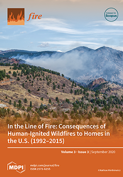
The Sunshine Canyon fire burned 62 acres within the wildland–urban interface (WUI) of Boulder, Colorado, USA in March of 2017. In the three days that this small human-caused wildfire actively burned, it threatened 1000s of residential homes and cost upwards of $1 million to suppress. Mietkiewicz et al. illustrate that while the WUI is only a small portion of the U.S. land area, it is a source of over one-third of all wildfires, which are almost exclusively human-started. From 1992 to 2015, wildfires starting in the WUI cumulatively threatened 60 million residential homes within 1 km of burn perimeters. Wildfires similar to the Sunshine Canyon fire are more common and cumulatively more threatening to residential WUI communities than previously expected and pose an increasing concern under a changing climate. View this paper
  • Issues are regarded as officially published after their release is announced to the table of contents alert mailing list.
  • You may sign up for e-mail alerts to receive table of contents of newly released issues.
  • PDF is the official format for papers published in both, html and pdf forms. To view the papers in pdf format, click on the "PDF Full-text" link, and use the free Adobe Reader to open them.
Order results
Result details
Section
Select all
Export citation of selected articles as:
9 pages, 3618 KiB  
Letter
Effects of Prescribed Burn on Nutrient and Dissolved Organic Matter Characteristics in Peatland Shallow Groundwater
by Julia Orlova, David Olefeldt, Jonathan H. Yasinski and Axel E. Anderson
Fire 2020, 3(3), 53; https://doi.org/10.3390/fire3030053 - 16 Sep 2020
Cited by 2 | Viewed by 2952
Abstract
Wildfires are a common disturbance in boreal regions and have the potential to affect the waterborne export of organic matter and nutrients from burned catchments. To understand the effect of fire on shallow groundwater chemistry in a forested peatland in northern Alberta, Canada, [...] Read more.
Wildfires are a common disturbance in boreal regions and have the potential to affect the waterborne export of organic matter and nutrients from burned catchments. To understand the effect of fire on shallow groundwater chemistry in a forested peatland in northern Alberta, Canada, shallow groundwater monitoring wells were sampled before and after a prescribed burn. The samples were collected from control and treatment wells between May and August 2019. The results indicate no differences in dissolved organic matter concentration and chemical composition between wells in burned and unburned sections but substantially increased nutrient concentrations were found in the burned section. Here, the levels of phosphorus increased and did not return to pre-fire levels at the end of the monitoring period, while the levels of inorganic nitrogen increased and returned to pre-fire levels within a few months. With increasing wildfire activity, or as a result of prescribed burns in the Boreal Plains, we may see implications for downstream water quality, including lake trophic status. Full article
(This article belongs to the Special Issue Boreal Fire-Fuels Interactions)
Show Figures

Figure 1

14 pages, 2341 KiB  
Article
Modeling Wildland Firefighter Travel Rates by Terrain Slope: Results from GPS-Tracking of Type 1 Crew Movement
by Patrick R. Sullivan, Michael J. Campbell, Philip E. Dennison, Simon C. Brewer and Bret W. Butler
Fire 2020, 3(3), 52; https://doi.org/10.3390/fire3030052 - 15 Sep 2020
Cited by 7 | Viewed by 4339
Abstract
Escape routes keep firefighters safe by providing efficient evacuation pathways from the fire line to safety zones. Effectively utilizing escape routes requires a precise understanding of how much time it will take firefighters to traverse them. To improve this understanding, we collected GPS-tracked [...] Read more.
Escape routes keep firefighters safe by providing efficient evacuation pathways from the fire line to safety zones. Effectively utilizing escape routes requires a precise understanding of how much time it will take firefighters to traverse them. To improve this understanding, we collected GPS-tracked travel rate data from US Interagency Hotshot “Type 1” Crews during training in 2019. Firefighters were tracked while hiking, carrying standard loads (e.g., packs, tools, etc.) along trails with a precisely-measured terrain slope derived from airborne lidar. The effects of the slope on the instantaneous travel rate were assessed by three models generated using non-linear quantile regression, representing low (bottom third), moderate (middle third), and high (upper third) rates of travel, which were validated using k-fold cross-validation. The models peak at about a −3° (downhill) slope, similar to previous slope-dependent travel rate functions. The moderate firefighter travel rate model mostly predicts faster movement than previous slope-dependent travel rate functions, suggesting that firefighters generally move faster than non-firefighting personnel while hiking. Steepness was also found to have a smaller effect on firefighter travel rates than previously predicted. The travel rate functions produced by this study provide guidelines for firefighter escape route travel rates and allow for more accurate and flexible wildland firefighting safety planning. Full article
Show Figures

Graphical abstract

16 pages, 6126 KiB  
Article
Simulated Fire Behavior and Fine-Scale Forest Structure Following Conifer Removal in Aspen-Conifer Forests in the Lake Tahoe Basin, USA
by Justin P. Ziegler, Chad M. Hoffman, Brandon M. Collins, Jonathan W. Long, Christa M. Dagley and William Mell
Fire 2020, 3(3), 51; https://doi.org/10.3390/fire3030051 - 09 Sep 2020
Cited by 4 | Viewed by 2862
Abstract
Quaking aspen is found in western forests of the United States and is currently at risk of loss due to conifer competition at within-stand scales. Wildfires in these forests are impactful owing to conifer infilling during prolonged fire suppression post-Euro-American settlement. Here, restoration [...] Read more.
Quaking aspen is found in western forests of the United States and is currently at risk of loss due to conifer competition at within-stand scales. Wildfires in these forests are impactful owing to conifer infilling during prolonged fire suppression post-Euro-American settlement. Here, restoration cuttings seek to impact wildfire behavior and aspen growing conditions. In this study, we explored how actual and hypothetical cuttings with a range of conifer removal intensity altered surface fuel and overstory structure at stand and fine scales. We then simulated wildfires, examining fire behavior and effects on post-fire forest structures around aspen trees. We found that conifer removal constrained by lower upper diameter limits (<56 cm) had marginal effects on surface fuel and overstory structure, likely failing to enhance resource conditions sufficiently to sustain aspen. Increasing the diameter limit also led to a higher likelihood of fire spread and a higher rate of spread, owing to greater within-canopy wind speed, though crown fire activity decreased. Our simulations suggest heavier treatments could facilitate reintroduction of fire while also dampening the effects of wildfires on forest structure. Cutting specifications that relax diameter limits and remove a substantial portion of conifer overstory could better promote aspen restoration and mitigate fire hazard. Full article
Show Figures

Figure 1

20 pages, 11008 KiB  
Article
In the Line of Fire: Consequences of Human-Ignited Wildfires to Homes in the U.S. (1992–2015)
by Nathan Mietkiewicz, Jennifer K. Balch, Tania Schoennagel, Stefan Leyk, Lise A. St. Denis and Bethany A. Bradley
Fire 2020, 3(3), 50; https://doi.org/10.3390/fire3030050 - 07 Sep 2020
Cited by 53 | Viewed by 33990
Abstract
With climate-driven increases in wildfires in the western U.S., it is imperative to understand how the risk to homes is also changing nationwide. Here, we quantify the number of homes threatened, suppression costs, and ignition sources for 1.6 million wildfires in the United [...] Read more.
With climate-driven increases in wildfires in the western U.S., it is imperative to understand how the risk to homes is also changing nationwide. Here, we quantify the number of homes threatened, suppression costs, and ignition sources for 1.6 million wildfires in the United States (U.S.; 1992–2015). Human-caused wildfires accounted for 97% of the residential homes threatened (within 1 km of a wildfire) and nearly a third of suppression costs. This study illustrates how the wildland-urban interface (WUI), which accounts for only a small portion of U.S. land area (10%), acts as a major source of fires, almost exclusively human-started. Cumulatively (1992–2015), just over one million homes were within human-caused wildfire perimeters in the WUI, where communities are built within flammable vegetation. An additional 58.8 million homes were within one kilometer across the 24-year record. On an annual basis in the WUI (1999–2014), an average of 2.5 million homes (2.2–2.8 million, 95% confidence interval) were threatened by human-started wildfires (within the perimeter and up to 1-km away). The number of residential homes in the WUI grew by 32 million from 1990–2015. The convergence of warmer, drier conditions and greater development into flammable landscapes is leaving many communities vulnerable to human-caused wildfires. These areas are a high priority for policy and management efforts that aim to reduce human ignitions and promote resilience to future fires, particularly as the number of residential homes in the WUI grew across this record and are expected to continue to grow in coming years. Full article
(This article belongs to the Special Issue Wildfire Hazard and Risk Assessment)
Show Figures

Graphical abstract

20 pages, 2469 KiB  
Article
Forest Fire Regime in a Mediterranean Ecosystem: Unraveling the Mutual Interrelations between Rainfall Seasonality, Soil Moisture, Drought Persistence, and Biomass Dynamics
by Nunzio Romano and Nadia Ursino
Fire 2020, 3(3), 49; https://doi.org/10.3390/fire3030049 - 03 Sep 2020
Cited by 7 | Viewed by 2553
Abstract
Frequent and severe droughts typically intensify wildfires provided that there is enough fuel in situ. The extent to which climate change may influence the fire regime and long time-scale hydrological processes may soften the effect of inter-annual climate change and, more specifically, whether [...] Read more.
Frequent and severe droughts typically intensify wildfires provided that there is enough fuel in situ. The extent to which climate change may influence the fire regime and long time-scale hydrological processes may soften the effect of inter-annual climate change and, more specifically, whether soil-water retention capacity can alleviate the harsh conditions resulting from droughts and affect fire regimes, are still largely unexplored matters. The research presented in this paper is a development of a previous investigation and shows in what way, and to what extent, rainfall frequency, dry season length, and hydraulic response of different soil types drive forest fires toward different regimes while taking into consideration the typical seasonality of the Mediterranean climate. The soil-water holding capacity, which facilitates biomass growth in between fire events and hence favors fuel production, may worsen the fire regime as long dry summers become more frequent, such that the ecosystem’s resilience to climate shifts may eventually be undermined. Full article
Show Figures

Figure 1

5 pages, 843 KiB  
Viewpoint
Using a Multi-Century Post-Fire Chronosequence to Develop Criteria to Distinguish Prior and Bowman’s (2020) Post-Fire Obligate Coloniser and Fire-Intolerant Flora
by Carl R. Gosper and Suzanne M. Prober
Fire 2020, 3(3), 48; https://doi.org/10.3390/fire3030048 - 03 Sep 2020
Cited by 3 | Viewed by 2184
Abstract
Prior and Bowman added a new dimension to existing frameworks of post-fire responses of woody plants, by including the trait of colonisation ability (C) for those taxa which neither resprout (Rf−) nor produce seedlings (Sf−) after fire. Specifically, they [...] Read more.
Prior and Bowman added a new dimension to existing frameworks of post-fire responses of woody plants, by including the trait of colonisation ability (C) for those taxa which neither resprout (Rf−) nor produce seedlings (Sf−) after fire. Specifically, they recognised distinctions between: (i) post-fire obligate colonisers, being species that neither resprout nor produce seedlings from persistent seed banks post-fire but are able to colonise burnt areas through dispersal from unburnt populations, and (ii) fire-intolerant, which are unable to recover after fire by either resprouting, seeding or colonisation. We use data on temporal and spatial patterns of colonisation of Rf−Sf− mistletoes from a chronosequence study with an exceptionally long span of times since fire as a practical example of the delineation of post-fire obligate coloniser and fire-intolerant species. We propose that when a population of a species is burnt, if the species is unable to regularly colonise and reach reproductive maturity in burnt areas spatially distant from fire edges within plausible and regularly-occurring maximum fire-return intervals for the now-burnt community type, it would be classified as fire-intolerant. In our examples, Lysiana meets the criteria for fire-intolerant in obligate-seeder eucalypt woodland, while Amyema is classed as a post-fire obligate coloniser. Full article
Show Figures

Graphical abstract

1 pages, 152 KiB  
Retraction
Retraction: Winoto-Lewin, S. and Sanger, J. et al. Propensities of Old Growth, Mature and Regrowth Wet Eucalypt Forest, and Eucalyptus Nitens Plantation, to Burn during Wildfire and Suffer Fire-Induced Crown Death. Fire 2020, 3, 13
by Suyanti Winoto-Lewin, Jennifer C. Sanger and James B. Kirkpatrick
Fire 2020, 3(3), 47; https://doi.org/10.3390/fire3030047 - 28 Aug 2020
Viewed by 6144
Abstract
The authors were informed of some errors in the categorization of forest types by a colleague [...] Full article
11 pages, 2490 KiB  
Technical Note
Easy-To-Interpret Procedure to Analyze Fire Seasonality and the Influence of Land Use in Fire Occurrence: A Case Study in Central Italy
by Sofia Bajocco, Carlotta Ferrara, Daniela Guglietta and Carlo Ricotta
Fire 2020, 3(3), 46; https://doi.org/10.3390/fire3030046 - 26 Aug 2020
Cited by 5 | Viewed by 2351
Abstract
Fire frequency and fire seasonality are among the main components of the fire regime. In the Mediterranean Basin, climate directly drives fire occurrence, controlling fuel flammability and determining the fire-prone conditions, so that intense fires prevail during the dry and warm season of [...] Read more.
Fire frequency and fire seasonality are among the main components of the fire regime. In the Mediterranean Basin, climate directly drives fire occurrence, controlling fuel flammability and determining the fire-prone conditions, so that intense fires prevail during the dry and warm season of the year. However, humans also play a direct role in wildfire regimes, severely altering fuel features, fire policies and land-use management, as well as the timing and location of fire ignitions, to such an extent that anthropogenic activities have overcome the role of climate in shaping fire regimes. The main purpose of this work is to propose a graphical tool capable of identifying the most fire-prone portions of the territory and to explore the differences between the summer and winter fire risk; to this end, we analyzed the seasonal fire risk in the Latium region (central Italy) and its drivers in terms of land-use types, by using a fuel phenology framework. The results demonstrated that climate is not the main cause of bimodal seasonality in fire occurrence and that the existence of two annual fire seasons in Latium is strongly correlated with how humans use fire as a land management tool. The proposed approach may represent an easy-to-interpret pyrogeographical framework applicable in any environment and updatable over time, useful for identifying spatial gradients, and for recognizing fire regime temporal patterns. Full article
Show Figures

Figure 1

25 pages, 7357 KiB  
Article
Mitigating Source Water Risks with Improved Wildfire Containment
by Benjamin M. Gannon, Yu Wei and Matthew P. Thompson
Fire 2020, 3(3), 45; https://doi.org/10.3390/fire3030045 - 21 Aug 2020
Cited by 8 | Viewed by 4571
Abstract
In many fire-prone watersheds, wildfire threatens surface drinking water sources with eroded contaminants. We evaluated the potential to mitigate the risk of degraded water quality by limiting fire sizes and contaminant loads with a containment network of manager-developed Potential fire Operational Delineations (PODs) [...] Read more.
In many fire-prone watersheds, wildfire threatens surface drinking water sources with eroded contaminants. We evaluated the potential to mitigate the risk of degraded water quality by limiting fire sizes and contaminant loads with a containment network of manager-developed Potential fire Operational Delineations (PODs) using wildfire risk transmission methods to partition the effects of stochastically simulated wildfires to within and out of POD burning. We assessed water impacts with two metrics—total sediment load and frequency of exceeding turbidity limits for treatment—using a linked fire-erosion-sediment transport model. We found that improved fire containment could reduce wildfire risk to the water source by 13.0 to 55.3% depending on impact measure and post-fire rainfall. Containment based on PODs had greater potential in our study system to reduce total sediment load than it did to avoid degraded water quality. After containment, most turbidity exceedances originated from less than 20% of the PODs, suggesting strategic investments to further compartmentalize these areas could improve the effectiveness of the containment network. Similarly, risk transmission varied across the POD boundaries, indicating that efforts to increase containment probability with fuels reduction would have a disproportionate effect if prioritized along high transmission boundaries. Full article
(This article belongs to the Special Issue Wildfire Hazard and Risk Assessment)
Show Figures

Figure 1

19 pages, 290 KiB  
Perspective
Prescribed Burns in California: A Historical Case Study of the Integration of Scientific Research and Policy
by Rebecca Miller
Fire 2020, 3(3), 44; https://doi.org/10.3390/fire3030044 - 19 Aug 2020
Cited by 5 | Viewed by 10474
Abstract
Over the past century, scientific understanding of prescribed burns in California’s forests transitioned from being interpreted as ecologically harmful to highly beneficial. The state’s prescribed burn policies mirrored this evolution. Harold Biswell, a University of California at Berkeley ecologist, studied prescribed burns and [...] Read more.
Over the past century, scientific understanding of prescribed burns in California’s forests transitioned from being interpreted as ecologically harmful to highly beneficial. The state’s prescribed burn policies mirrored this evolution. Harold Biswell, a University of California at Berkeley ecologist, studied prescribed burns and became a major advocate for their use during the 1950s and 1960s. Drawing primarily on archival materials from Biswell and the state government, this historical case study presents an example of how a scientist successfully contributed to integrating research into policy and practice through consistent and targeted science communication to gain allies among environmental organizations, local stakeholders, and governments. Though at first isolated by his academic peers for proposing that fire could provide environmental benefits in forests, Biswell continued conducting and sharing his research and findings with academic and non-academic audiences. Over several decades, Biswell engaged in conversations which ultimately advanced policy changes at the state level to expand the use of prescribed burns. Despite lacking a formal role in government, Biswell used his academic platform to promote the policy implications of his research. Current and future researchers can draw on these lessons to advocate effectively for other science-informed policies. Full article
(This article belongs to the Collection Rethinking Wildland Fire Governance: A Series of Perspectives)
19 pages, 4594 KiB  
Article
A Geospatial Framework to Assess Fireline Effectiveness for Large Wildfires in the Western USA
by Benjamin M. Gannon, Matthew P. Thompson, Kira Z. Deming, Jude Bayham, Yu Wei and Christopher D. O’Connor
Fire 2020, 3(3), 43; https://doi.org/10.3390/fire3030043 - 18 Aug 2020
Cited by 11 | Viewed by 4161
Abstract
Quantifying fireline effectiveness (FLE) is essential to evaluate the efficiency of large wildfire management strategies to foster institutional learning and improvement in fire management organizations. FLE performance metrics for incident-level evaluation have been developed and applied to a small set of wildfires, but [...] Read more.
Quantifying fireline effectiveness (FLE) is essential to evaluate the efficiency of large wildfire management strategies to foster institutional learning and improvement in fire management organizations. FLE performance metrics for incident-level evaluation have been developed and applied to a small set of wildfires, but there is a need to understand how widely they vary across incidents to progress towards targets or standards for performance evaluation. Recent efforts to archive spatially explicit fireline records from large wildfires facilitate the application of these metrics to a broad sample of wildfires in different environments. We evaluated fireline outcomes (burned over, held, not engaged) and analyzed incident-scale FLE for 33 large wildfires in the western USA from the 2017 and 2018 fire seasons. FLE performance metrics varied widely across wildfires and often aligned with factors that influence suppression strategy. We propose a performance evaluation framework based on both the held to engaged fireline ratio and the total fireline to perimeter ratio. These two metrics capture whether fireline was placed in locations with high probability of engaging with the wildfire and holding and the relative level of investment in containment compared to wildfire growth. We also identify future research directions to improve understanding of decision quality in a risk-based framework. Full article
Show Figures

Figure 1

20 pages, 2808 KiB  
Article
Predictive Modeling of Wildfire Occurrence and Damage in a Tropical Savanna Ecosystem of West Africa
by Jean-Luc Kouassi, Narcisse Wandan and Cheikh Mbow
Fire 2020, 3(3), 42; https://doi.org/10.3390/fire3030042 - 12 Aug 2020
Cited by 4 | Viewed by 4347
Abstract
Wildfires are a major environmental, economic, and social threat. In Central Côte d’Ivoire, they are among the biggest environmental and forestry problems during the dry season. National authorities do not have tools and methods to predict spatial and temporal fire proneness over large [...] Read more.
Wildfires are a major environmental, economic, and social threat. In Central Côte d’Ivoire, they are among the biggest environmental and forestry problems during the dry season. National authorities do not have tools and methods to predict spatial and temporal fire proneness over large areas. This study, based on the use of satellite historical data, aims to develop an appropriate model to forecast wildfire occurrence and burnt areas in each ecoregion of the N’Zi River Watershed. We used an autoregressive integrated moving average (ARIMA) model to simulate and forecast the number of wildfires and burnt area time series in each ecoregion. Nineteen years of monthly datasets were trained and tested. The model performance assessment combined Ljung–Box statistics, residuals, and autocorrelation analysis coupled with cross-validation using three forecast errors—namely, root mean square error, mean absolute error, and mean absolute scaled error—and observed–simulated data analysis. The results showed that the ARIMA models yielded accurate forecasts of the test dataset in all ecoregions and highlighted the effectiveness of the ARIMA models to forecast the total number of wildfires and total burnt area estimation in the future. The forecasts of possible wildfire occurrence and extent of damages in the next four years will help decision-makers and wildfire managers to take actions to reduce the exposure and the vulnerability of ecosystems and local populations to current and future pyro-climatic hazards. Full article
Show Figures

Figure 1

13 pages, 1216 KiB  
Article
Navigating the Wildfire–Pandemic Interface: Public Perceptions of COVID-19 and the 2020 Wildfire Season in Arizona
by Catrin M. Edgeley and Jack T. Burnett
Fire 2020, 3(3), 41; https://doi.org/10.3390/fire3030041 - 09 Aug 2020
Cited by 13 | Viewed by 4921
Abstract
COVID-19 has complicated wildfire management and public safety for the 2020 fire season. It is unclear whether COVID-19 has impacted the ability of residents in the wildland–urban interface to prepare for and evacuate from wildfire, or the extent to which residents feel their [...] Read more.
COVID-19 has complicated wildfire management and public safety for the 2020 fire season. It is unclear whether COVID-19 has impacted the ability of residents in the wildland–urban interface to prepare for and evacuate from wildfire, or the extent to which residents feel their household’s safety has been affected. Several areas with high wildfire risk are also experiencing record numbers of COVID-19 cases, including the state of Arizona in the southwestern United States. We conducted a mixed-mode survey of households in close proximity to two recent wildfires in rural Arizona to better understand whether residents living in the wildland–urban interface perceive COVID-19 as a factor in wildfire safety. Preliminary data suggest that the current challenges around collective action to address wildfire risk may be further exacerbated due to COVID-19, and that the current pandemic has potentially widened existing disparities in household capacity to conduct wildfire risk mitigation activities in the wildland–urban interface. Proactive planning for wildfire has also increased perceived ability to practice safe distancing from others during evacuation, highlighting the benefits that household planning for wildfire can have on other concurrent hazards. Parallels in both the wildfire and pandemic literature highlight vast opportunities for future research that can expand upon and advance our findings. Full article
Show Figures

Figure 1

12 pages, 2215 KiB  
Article
Using Digital Technology to Protect Health in Prolonged Poor Air Quality Episodes: A Case Study of the AirRater App during the Australian 2019–20 Fires
by Sharon L. Campbell, Penelope J. Jones, Grant J. Williamson, Amanda J. Wheeler, Christopher Lucani, David M. J. S. Bowman and Fay H. Johnston
Fire 2020, 3(3), 40; https://doi.org/10.3390/fire3030040 - 04 Aug 2020
Cited by 17 | Viewed by 5162
Abstract
In the southern hemisphere summer of 2019–20, Australia experienced its most severe bushfire season on record. Smoke from fires affected 80% of the population, with large and prolonged exceedances of the Australian National Air Quality Standard for fine particulate matter (PM2.5) [...] Read more.
In the southern hemisphere summer of 2019–20, Australia experienced its most severe bushfire season on record. Smoke from fires affected 80% of the population, with large and prolonged exceedances of the Australian National Air Quality Standard for fine particulate matter (PM2.5) recorded in all major population centers. We examined if AirRater, a free smartphone app that reports air quality and tracks user symptoms in near real-time, assisted those populations to reduce their smoke exposure and protect their health. We distributed an online survey to over 13,000 AirRater users to assess how they used this information during the 2019–20 bushfire season, and why it was helpful to aid decision-making in reducing personal smoke exposure. We received responses from 1732 users (13.3%). Respondents reported the app was highly useful, supporting informed decision-making regarding daily activities during the smoke-affected period. Commonly reported activities supported by information provided through the app were staying inside (76%), rescheduling or planning outdoor activities (64%), changing locations to less affected areas (29%) and informing decisions on medication use (15%). Innovative and easy-to-use smartphone apps such as AirRater, that provide individual-level and location-specific data, can enable users to reduce their exposure to environmental hazards and therefore protect their health. Full article
Show Figures

Figure 1

19 pages, 1761 KiB  
Article
Flammability Characteristics of Surface Fuels in a Longleaf Pine (Pinus palustris Mill.) Woodland
by Raien K. Emery and Justin L. Hart
Fire 2020, 3(3), 39; https://doi.org/10.3390/fire3030039 - 04 Aug 2020
Cited by 6 | Viewed by 3285
Abstract
To investigate fuel flammability, we quantified burning characteristics of 21 fuel categories in a longleaf pine (Pinus palustris Mill.) woodland in central Alabama, USA. Litter was burned under controlled laboratory conditions. Flammability characteristics, including resistance to ignition, flaming duration, smoldering duration, maximum [...] Read more.
To investigate fuel flammability, we quantified burning characteristics of 21 fuel categories in a longleaf pine (Pinus palustris Mill.) woodland in central Alabama, USA. Litter was burned under controlled laboratory conditions. Flammability characteristics, including resistance to ignition, flaming duration, smoldering duration, maximum flame height, and percent consumption, were measured. The fuels were hierarchically clustered into five groups of similar flammability characteristics that explained 89% of the variance. Percent consumption and maximum flame height values ranged from 7% ± 1 standard errors (SE) and 12 cm ± 1 SE for the low flammability group (bark and charcoal), to 86% ± 1 SE and 62 cm ± 3 SE for the high flammability group (bracken fern (Pteridium latiusculum (Desv.) Hieron. ex R.E.Fr. = {syn: P. aquilinum}), grass, and fire-facilitating oak (Quercus spp.) leaves). Results support observed flammability differences between fuel types such as oak and pine (Pinus spp.) litter, and duff, and provide a previously unquantified comparison of surface fuels comprehensive of a longleaf pine community. Further, clustering analysis indicated that plant species that become abundant post-disturbance may help maintain fire-vegetation feedbacks in the absence of pine litter. Understanding flammability characteristics of surface fuels may further inform prescribed fire application in stands where fuels have been altered. Full article
Show Figures

Graphical abstract

13 pages, 1895 KiB  
Article
Potential COVID-19 Outbreak in Fire Camp: Modeling Scenarios and Interventions
by Matthew P Thompson, Jude Bayham and Erin Belval
Fire 2020, 3(3), 38; https://doi.org/10.3390/fire3030038 - 01 Aug 2020
Cited by 9 | Viewed by 8145
Abstract
The global COVID-19 pandemic will pose unique challenges to the management of wildland fire in 2020. Fire camps may provide an ideal setting for the transmission of SARS-CoV-2, the virus that causes COVID-19. However, intervention strategies can help minimize disease spread and reduce [...] Read more.
The global COVID-19 pandemic will pose unique challenges to the management of wildland fire in 2020. Fire camps may provide an ideal setting for the transmission of SARS-CoV-2, the virus that causes COVID-19. However, intervention strategies can help minimize disease spread and reduce the risk to the firefighting community. We developed a COVID-19 epidemic model to highlight the risks posed by the disease during wildland fire incidents. Our model accounts for the transient nature of the population on a wildland fire incident, which poses unique risks to the management of communicable diseases in fire camps. We used the model to assess the impact of two types of interventions: the screening of a firefighter arriving on an incident, and social distancing measures. Our results suggest that both interventions are important to mitigate the risks posed by the SARS-CoV-2 virus. However, screening is relatively more effective on short incidents, whereas social distancing is relatively more effective during extended campaigns. We conclude with a discussion of model limitations and potential extensions to the model. Full article
Show Figures

Figure 1

11 pages, 7449 KiB  
Case Report
Using Infrared Imagery to Assess Fire Behaviour in a Mulched Fuel Bed in Black Spruce Forests
by Brett Moore, Dan K. Thompson, Dave Schroeder, Joshua M. Johnston and Steven Hvenegaard
Fire 2020, 3(3), 37; https://doi.org/10.3390/fire3030037 - 31 Jul 2020
Cited by 3 | Viewed by 2296
Abstract
An experimental fire was conducted in one-year-old mulched (masticated) boreal fuels, where all aboveground biomass was mulched with no stems removed or left standing. Typical mulching practices remove remnant biomass; leaving biomass in situ reduces overall management input. While fuel quantities were not [...] Read more.
An experimental fire was conducted in one-year-old mulched (masticated) boreal fuels, where all aboveground biomass was mulched with no stems removed or left standing. Typical mulching practices remove remnant biomass; leaving biomass in situ reduces overall management input. While fuel quantities were not explicitly reduced, availability of fuels to fire was reduced. Infrared imagery was obtained to quantify rate of spread and intensity to a 1 m resolution. In-stand totalizing heat flux sensors allowed for the observation of energy release near the surface. When compared with the pre-treatment fuel-type M-2 (mixedwood, 50% conifer), rates of spread were reduced 87% from an expected 8 m min−1 to observed values 1.2 m min−1. Intensity was also reduced from 5000 kWm−1 to 650kWm−1 on average. Intermittent gusts caused surges of fire intensity upwards of 5000 kW m−1 as captured by the infrared imagery. With reference to a logging slash fuel type, observed spread rates declined by 87% and intensity 98%. Independent observations of energy release rates from the radiometers showed similar declines. As mulching is a prevalent fuel management technique in Alberta, Canada, future studies will contribute to the development of a fire behaviour prediction model. Full article
(This article belongs to the Special Issue Boreal Fire-Fuels Interactions)
Show Figures

Figure 1

10 pages, 5549 KiB  
Article
Meteorological Profiling in the Fire Environment Using UAS
by Matthew J. Brewer and Craig B. Clements
Fire 2020, 3(3), 36; https://doi.org/10.3390/fire3030036 - 31 Jul 2020
Cited by 10 | Viewed by 3299
Abstract
With the increase in commercially available small unmanned aircraft systems (UAS), new observations in extreme environments are becoming more obtainable. One such application is the fire environment, wherein measuring both fire and atmospheric properties are challenging. The Fire and Smoke Model Evaluation Experiment [...] Read more.
With the increase in commercially available small unmanned aircraft systems (UAS), new observations in extreme environments are becoming more obtainable. One such application is the fire environment, wherein measuring both fire and atmospheric properties are challenging. The Fire and Smoke Model Evaluation Experiment offered the unique opportunity of a large controlled wildfire, which allowed measurements that cannot generally be taken during an active wildfire. Fire–atmosphere interactions have typically been measured from stationary instrumented towers and by remote sensing systems such as lidar. Advances in UAS and compact meteorological instrumentation have allowed for small moving weather stations that can move with the fire front while sampling. This study highlights the use of DJI Matrice 200, which was equipped with a TriSonica Mini Wind and Weather station sonic anemometer weather station in order to sample the fire environment in an experimental and controlled setting. The weather station was mounted on to a carbon fiber pole extending off the side of the platform. The system was tested against an RM-Young 81,000 sonic anemometer, mounted at 6 and 2 m above ground levelto assess any bias in the UAS platform. Preliminary data show that this system can be useful for taking vertical profiles of atmospheric variables, in addition to being used in place of meteorological tower measurements when suitable. Full article
(This article belongs to the Special Issue Unmanned Aircraft in Fire Research and Management)
Show Figures

Figure 1

23 pages, 2876 KiB  
Review
Stand-Level Fuel Reduction Treatments and Fire Behaviour in Canadian Boreal Conifer Forests
by Jennifer L. Beverly, Sonja E. R. Leverkus, Hilary Cameron and Dave Schroeder
Fire 2020, 3(3), 35; https://doi.org/10.3390/fire3030035 - 27 Jul 2020
Cited by 22 | Viewed by 5803
Abstract
Stand-level fuel reduction treatments in the Canadian boreal zone are used predominantly in community protection settings to alter the natural structure of dominant boreal conifer stands such as black spruce (Picea mariana (Mill.) BSP), jack pine (Pinus banksiana Lamb.) and lodgepole [...] Read more.
Stand-level fuel reduction treatments in the Canadian boreal zone are used predominantly in community protection settings to alter the natural structure of dominant boreal conifer stands such as black spruce (Picea mariana (Mill.) BSP), jack pine (Pinus banksiana Lamb.) and lodgepole pine (Pinus contorta Dougl. ex Loud. var. latifolia). The aim of these fuel treatments is to inhibit the development of fast-spreading, high-intensity crown fires that naturally occur in boreal forest ecosystems. We document fuel treatment design standards used in boreal forests in Canada and review data requirements and methodological approaches for investigating fuel treatment effects on fire behaviour. Through a series of illustrative examples and summaries of empirical observations, we explore the implications of data and modelling assumptions used to estimate fire behaviour in fuel-treated areas and identify insights about fuel treatment effectiveness in boreal conifer stands. Fuel treatments in black spruce, jack pine and lodgepole pine stands were generally effective at reducing modelled and observed fire behaviour and inhibiting crown fire development and spread under low to moderate fire weather conditions. Evidence suggests that fuel treatments in these fuel types will be ineffective when rates of spread and wind speeds are very high or extreme. High surface fuel loads combined with the relatively short stature of boreal conifer trees can further undermine fuel treatment efforts. Priority areas for future study include examining alternatives for managing surface fuel loads in treated stands, exploring the viability of alternative horizontal fuel reduction protocols such as clumped fuel configurations, and integrating suppression and containment strategies within the fuel treatment planning and design process. Full article
(This article belongs to the Special Issue Boreal Fire-Fuels Interactions)
Show Figures

Figure 1

25 pages, 3736 KiB  
Article
Fire Behaviour Observation in Shrublands in Nova Scotia, Canada and Assessment of Aids to Operational Fire Behaviour Prediction
by Anne-Claude Pepin and Mike Wotton
Fire 2020, 3(3), 34; https://doi.org/10.3390/fire3030034 - 26 Jul 2020
Cited by 1 | Viewed by 3798
Abstract
Parks Canada, in collaboration with Nova Scotia Lands and Forests and Natural Resources Canada, documented shrub fire behaviour in multiple plots burned over two periods: a spring period in June 2014 and a summer period in July 2017. The study area, located within [...] Read more.
Parks Canada, in collaboration with Nova Scotia Lands and Forests and Natural Resources Canada, documented shrub fire behaviour in multiple plots burned over two periods: a spring period in June 2014 and a summer period in July 2017. The study area, located within Cape Breton Highlands National Park, comprised fifteen burn units (20 m by 20 m in size). Each unit was ignited by line ignition and burned under a wide range of conditions. Pre-burn fuel characteristics were measured across the site and used to estimate pre-fire fuel load and post-fire fuel consumption. This fuel complex was similar to many flammable shrub types around the world, results show that this shrub fuel type had high elevated fuel loads (3.17 ± 0.84 kg/m2) composed of exposed live and dead stunted black spruce as well as ericaceous shrubs, mainly Kalmia angustifolia (evergreen) and Rhodora canadensis (deciduous). Data show that the dead moisture content in this fuel complex is systematically lower than expected from the traditional relationship between FFMC and moisture content in the Canadian Fire Weather Index System but was statistically correlated with Equilibrium Moisture Content. A significant inverse relationship between bulk density and fire rate of spread was observed as well as a clear seasonal effect between the spring burns and the summer burns, which is likely attributable to the increase in bulk density in the summer. Unlike most shrub research, wind and dead moisture content did not have a statistically significant association with fire spread rates. However, we believe this to be due to noise in wind data and small dataset. Rate of spread as high as 14 m/min and flame lengths over 4 m were recorded under Initial Spread Index values of 6.4 and relative humidity of 54%. A comparison with a number of well-known shrubland spread rate prediction models was made. An aid to operational fire prediction behaviour is proposed, using a fuel type from the Canadian Fire Prediction System (O-1b) and a modified estimate of fuel moisture of the elevated fuel in the fuel complex. Full article
(This article belongs to the Special Issue Boreal Fire-Fuels Interactions)
Show Figures

Graphical abstract

37 pages, 14984 KiB  
Article
Numerical Fire Spread Simulation Based on Material Pyrolysis—An Application to the CHRISTIFIRE Phase 1 Horizontal Cable Tray Tests
by Tristan Hehnen, Lukas Arnold and Saverio La Mendola
Fire 2020, 3(3), 33; https://doi.org/10.3390/fire3030033 - 24 Jul 2020
Cited by 9 | Viewed by 3791
Abstract
A general procedure is described to generate material parameter sets to simulate fire propagation in horizontal cable tray installations. Cone Calorimeter test data are processed in an inverse modelling approach. Here, parameter sets are generated procedurally and serve as input for simulations conducted [...] Read more.
A general procedure is described to generate material parameter sets to simulate fire propagation in horizontal cable tray installations. Cone Calorimeter test data are processed in an inverse modelling approach. Here, parameter sets are generated procedurally and serve as input for simulations conducted with the Fire Dynamics Simulator (FDS). The simulation responses are compared with the experimental data and ranked based on their fitness. The best fitness was found for a test condition of 50 kW/m2. Low flux conditions 25 kW/m2 and less exhibited difficulties to be accurately simulated. As a validation step, the best parameter sets are then utilised to simulate fire propagation within a horizontal cable tray installation and are compared with experimental data. It is important to note, the inverse modelling process is focused on the Cone Calorimeter and not aware of the actual validation step. Despite this handicap, the general features in the fire development can be reproduced, however not exact. The fire in the tray simulation extinguishes earlier and the total energy release is slightly higher when compared to the experiment. The responses of the material parameter sets are briefly compared with a selection of state of the art procedures. Full article
Show Figures

Figure 1

20 pages, 5575 KiB  
Article
Fire Suppression Impacts on Fuels and Fire Intensity in the Western U.S.: Insights from Archaeological Luminescence Dating in Northern New Mexico
by Christopher I. Roos, Tammy M. Rittenour, Thomas W. Swetnam, Rachel A. Loehman, Kacy L. Hollenback, Matthew J. Liebmann and Dana Drake Rosenstein
Fire 2020, 3(3), 32; https://doi.org/10.3390/fire3030032 - 20 Jul 2020
Cited by 17 | Viewed by 5298
Abstract
Here, we show that the last century of fire suppression in the western U.S. has resulted in fire intensities that are unique over more than 900 years of record in ponderosa pine forests (Pinus ponderosa). Specifically, we use the heat-sensitive luminescence [...] Read more.
Here, we show that the last century of fire suppression in the western U.S. has resulted in fire intensities that are unique over more than 900 years of record in ponderosa pine forests (Pinus ponderosa). Specifically, we use the heat-sensitive luminescence signal of archaeological ceramics and tree-ring fire histories to show that a recent fire during mild weather conditions was more intense than anything experienced in centuries of frequent wildfires. We support this with a particularly robust set of optically stimulated luminescence measurements on pottery from an archaeological site in northern New Mexico. The heating effects of an October 2012 CE prescribed fire reset the luminescence signal in all 12 surface samples of archaeological ceramics, whereas none of the 10 samples exposed to at least 14 previous fires (1696–1893 CE) revealed any evidence of past thermal impact. This was true regardless of the fire behavior contexts of the 2012 CE samples (crown, surface, and smoldering fires). It suggests that the fuel characteristics from fire suppression at this site have no analog during the 550 years since the depopulation of this site or the 350 years of preceding occupation of the forested landscape of this region. Full article
Show Figures

Figure 1

23 pages, 6189 KiB  
Article
Integrating Remote Sensing Methods and Fire Simulation Models to Estimate Fire Hazard in a South-East Mediterranean Protected Area
by Panteleimon Xofis, Pavlos Konstantinidis, Iakovos Papadopoulos and Georgios Tsiourlis
Fire 2020, 3(3), 31; https://doi.org/10.3390/fire3030031 - 19 Jul 2020
Cited by 13 | Viewed by 3320
Abstract
Unlike low intensity fire which promotes landscape heterogeneity and important ecosystem services, large high-intensity wildfires constitute a significant destructive factor despite the increased amount of resources allocated to fire suppression and the improvement of firefighting tactics and levels of organization. Wildfires also affect [...] Read more.
Unlike low intensity fire which promotes landscape heterogeneity and important ecosystem services, large high-intensity wildfires constitute a significant destructive factor despite the increased amount of resources allocated to fire suppression and the improvement of firefighting tactics and levels of organization. Wildfires also affect properties, while an increasing number of fatalities are also associated with wildfires. It is now widely accepted that an effective wildfire management strategy can no longer rely on fire suppression alone. Scientific advances on fire behavior simulation and the increasing availability of remote sensing data, along with advanced systems of fire detection can significantly reduce fire hazards. In the current study remote sensing data and methods, and fire behavior simulation models are integrated to assess the fire hazard in a protected area of the southeast Mediterranean region and its surroundings. A spatially explicit fire hazard index was generated by combining fire intensity estimations and proxies of fire ignition probability. The results suggest that more than 50% of the study area, and the great majority of the protected area, is facing an extremely high hazard for a high-intensity fire. Pine forest formations, characterized by high flammability, low canopy base height and a dense shrub understory are facing the most critical hazard. The results are discussed in relation to the need for adopting an alternative wildfire management strategy. Full article
(This article belongs to the Special Issue Wildfire Hazard and Risk Assessment)
Show Figures

Figure 1

16 pages, 3222 KiB  
Article
Study of Fuel-Smoke Dynamics in a Prescribed Fire of Boreal Black Spruce Forest through Field-Deployable Micro Sensor Systems
by Quamrul Huda, David Lyder, Marty Collins, Dave Schroeder, Dan K. Thompson, Ginny Marshall, Alberto J. Leon, Ken Hidalgo and Masum Hossain
Fire 2020, 3(3), 30; https://doi.org/10.3390/fire3030030 - 12 Jul 2020
Viewed by 2803
Abstract
Understanding the combustion dynamics of fuels, and the generation and propagation of smoke in a wildland fire, can inform short-range and long-range pollutant transport models, and help address and mitigate air quality concerns in communities. Smoldering smoke can cause health issues in nearby [...] Read more.
Understanding the combustion dynamics of fuels, and the generation and propagation of smoke in a wildland fire, can inform short-range and long-range pollutant transport models, and help address and mitigate air quality concerns in communities. Smoldering smoke can cause health issues in nearby valley bottoms, and can create hazardous road conditions due to low-visibility. We studied near-field smoke dynamics in a prescribed fire of 3.4 hectares of land in a boreal black spruce forest in central Alberta. Smoke generated from the fire was monitored through a network of five field-deployable micro sensor systems. Sensors were placed within 500–1000 m of the fire area at various angles in downwind. Smoke generated from flaming and smoldering combustions showed distinct characteristics. The propagation rates of flaming and smoldering smoke, based on the fine particulate (PM2.5) component, were 0.8 and 0.2 m/s, respectively. The flaming smoke was characterized by sharp rise of PM2.5 in air with concentrations of up to 940 µg/m3, followed by an exponential decay with a half-life of ~10 min. Smoldering combustion related smoke contributed to PM2.5 concentrations above 1000 µg/m3 with slower decay half-life of ~18 min. PM2.5 emissions from the burn area during flaming and smoldering phases, integrated over the combustion duration of 2.5 h, were ~15 and ~16 kilograms, respectively, as estimated by our mass balance model. Full article
(This article belongs to the Special Issue Boreal Fire-Fuels Interactions)
Show Figures

Graphical abstract

25 pages, 6268 KiB  
Article
Evaluating the Ability of FARSITE to Simulate Wildfires Influenced by Extreme, Downslope Winds in Santa Barbara, California
by Katelyn Zigner, Leila M. V. Carvalho, Seth Peterson, Francis Fujioka, Gert-Jan Duine, Charles Jones, Dar Roberts and Max Moritz
Fire 2020, 3(3), 29; https://doi.org/10.3390/fire3030029 - 10 Jul 2020
Cited by 27 | Viewed by 6670
Abstract
Extreme, downslope mountain winds often generate dangerous wildfire conditions. We used the wildfire spread model Fire Area Simulator (FARSITE) to simulate two wildfires influenced by strong wind events in Santa Barbara, CA. High spatial-resolution imagery for fuel maps and hourly wind downscaled to [...] Read more.
Extreme, downslope mountain winds often generate dangerous wildfire conditions. We used the wildfire spread model Fire Area Simulator (FARSITE) to simulate two wildfires influenced by strong wind events in Santa Barbara, CA. High spatial-resolution imagery for fuel maps and hourly wind downscaled to 100 m were used as model inputs, and sensitivity tests were performed to evaluate the effects of ignition timing and location on fire spread. Additionally, burn area rasters from FARSITE simulations were compared to minimum travel time rasters from FlamMap simulations, a wildfire model similar to FARSITE that holds environmental variables constant. Utilization of two case studies during strong winds revealed that FARSITE was able to successfully reconstruct the spread rate and size of wildfires when spotting was minimal. However, in situations when spotting was an important factor in rapid downslope wildfire spread, both FARSITE and FlamMap were unable to simulate realistic fire perimeters. We show that this is due to inherent limitations in the models themselves, related to the slope-orientation relative to the simulated fire spread, and the dependence of ember launch and land locations. This finding has widespread implications, given the role of spotting in fire progression during extreme wind events. Full article
Show Figures

Figure 1

18 pages, 4589 KiB  
Article
Recent Crown Thinning in a Boreal Black Spruce Forest Does Not Reduce Spread Rate nor Total Fuel Consumption: Results from an Experimental Crown Fire in Alberta, Canada
by Dan K. Thompson, Dave Schroeder, Sophie L. Wilkinson, Quinn Barber, Greg Baxter, Hilary Cameron, Rex Hsieh, Ginny Marshall, Brett Moore, Razim Refai, Chris Rodell, Tom Schiks, Gregory J. Verkaik and Jessica Zerb
Fire 2020, 3(3), 28; https://doi.org/10.3390/fire3030028 - 09 Jul 2020
Cited by 18 | Viewed by 4078
Abstract
A 3.6 ha experimental fire was conducted in a black spruce peatland forest that had undergone thinning the year prior. After 50 m of spread in a natural stand at 35–60 m min−1, the crown fire (43,000 kW m−1 intensity [...] Read more.
A 3.6 ha experimental fire was conducted in a black spruce peatland forest that had undergone thinning the year prior. After 50 m of spread in a natural stand at 35–60 m min−1, the crown fire (43,000 kW m−1 intensity using Byram’s method) encountered the 50% stem removal treatment; spread rates in the treatment were 50–60 m min−1. Fuel consumption in the control (2.75 kg m−2) was comparable to the treatment (2.35 kg m−2). Proxy measurements of fire intensity using in-stand heat flux sensors as well as photogrammetric flame heights had detected intensity reductions to 30–40% of the control. Crown fuel load reductions (compensated by higher surface fuel load) appear to be the most significant contributor to the decline in intensity, despite drier surface fuels in the treatment. The burn depth of 5 cm in moss and organic soil did not differ between control and treatment. These observations point to the limited effectiveness (likely reductions in crown fire intensity but not spread rate) of stem removal in boreal black spruce fuel types with high stem density, low crown base height and high surface fuel load. The observed fire behaviour impacts differ from drier conifer forests across North America. Full article
(This article belongs to the Special Issue Boreal Fire-Fuels Interactions)
Show Figures

Figure 1

14 pages, 219 KiB  
Article
Frametown: Addressing Declining Volunteerism through Empowering Female Engagement
by Scotty Dunlap
Fire 2020, 3(3), 27; https://doi.org/10.3390/fire3030027 - 07 Jul 2020
Viewed by 2571
Abstract
The goal of this research is to identify the drivers that have resulted in an exceptionally high level of female engagement in the Frametown Volunteer Fire Department (FVFD) in the rural community of Frametown, West Virginia. Females comprise only 11% of the volunteer [...] Read more.
The goal of this research is to identify the drivers that have resulted in an exceptionally high level of female engagement in the Frametown Volunteer Fire Department (FVFD) in the rural community of Frametown, West Virginia. Females comprise only 11% of the volunteer fire service in the US, however, they comprise approximately 60% of the Frametown Volunteer Fire Department, including the Chief, President, and Secretary. Structured interviews were used to investigate factors that have led to recruitment and retention of female volunteers. Interviews were conducted with 24 of the department’s 29 members with representation from female (n = 14) and male members (n = 10). Male members were included in the study to gain meaningful information from both gender perspectives as their story-telling added context to the evolution and current organizational culture of the department. Themes from the interviews included organic growth of the department, a sense of service to the community, a mentoring family environment, a heightened level of compassion as a value women bring to the fire department, and gender inclusiveness within the department as key recruitment and retention factors. The results of this study may provide insight into how other volunteer fire departments can increase female volunteers, particularly in an age of declining volunteerism. Full article
24 pages, 6025 KiB  
Article
PROPAGATOR: An Operational Cellular-Automata Based Wildfire Simulator
by Andrea Trucchia, Mirko D’Andrea, Francesco Baghino, Paolo Fiorucci, Luca Ferraris, Dario Negro, Andrea Gollini and Massimiliano Severino
Fire 2020, 3(3), 26; https://doi.org/10.3390/fire3030026 - 06 Jul 2020
Cited by 25 | Viewed by 6612
Abstract
PROPAGATOR is a stochastic cellular automaton model for forest fire spread simulation, conceived as a rapid method for fire risk assessment. The model uses high-resolution information such as topography and vegetation cover considering different types of vegetation. Input parameters are wind speed and [...] Read more.
PROPAGATOR is a stochastic cellular automaton model for forest fire spread simulation, conceived as a rapid method for fire risk assessment. The model uses high-resolution information such as topography and vegetation cover considering different types of vegetation. Input parameters are wind speed and direction and the ignition point. Dead fine fuel moisture content and firebreaks—fire fighting strategies can also be considered. The fire spread probability depends on vegetation type, slope, wind direction and speed, and fuel moisture content. The fire-propagation speed is determined through the adoption of a Rate of Spread model. PROPAGATOR simulates independent realizations of one stochastic fire propagation process, and at each time-step gives as output a map representing the probability of each cell of the domain to be affected by the fire. These probabilities are obtained computing the relative frequency of ignition of each cell. The model capabilities are assessed by reproducing a set of past Mediterranean fires occurred in different countries (Italy and Spain), using when available the real fire fighting patterns. PROPAGATOR simulated such scenarios with affordable computational resources and with short CPU-times. The outputs show a good agreement with the real burned areas, demonstrating that the PROPAGATOR can be useful for supporting decisions in Civil Protection and fire management activities. Full article
Show Figures

Figure 1

Previous Issue
Next Issue
Back to TopTop