

Resources, Volume 11, Issue 11 (November 2022) – 8 articles
Cover Story (view full-size image):
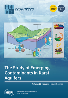
The open nature of karst aquifers makes them susceptible to rapidly transporting contaminants from the surface in dissolved and particulate forms. The principal aim of this review is to contribute to filling the gap in the knowledge regarding major concerns affecting karst aquifers in addition to the understanding of their vulnerabilities and dynamics. The principal groundwater pollutants of relevance are detailed in the work. Emerging pollutants such as microplastics, still poorly studied in groundwater systems, were also considered. Case studies for each typology of pollutant were highlighted. The final considerations underline an approach for studying karst environments that is more focused on understanding the dynamics and links among different pollutant inputs and their drivers than on individual sources. View this paper
- Issues are regarded as officially published after their release is announced to the table of contents alert mailing list.
- You may sign up for e-mail alerts to receive table of contents of newly released issues.
- PDF is the official format for papers published in both, html and pdf forms. To view the papers in pdf format, click on the "PDF Full-text" link, and use the free Adobe Reader to open them.
Previous Issue
Next Issue