The authors wish to make the following corrections to their paper [1]: Replace Figure 2 from Google Earth By Mr. D. Kapur with satellite map created by TGIS Laboratories.
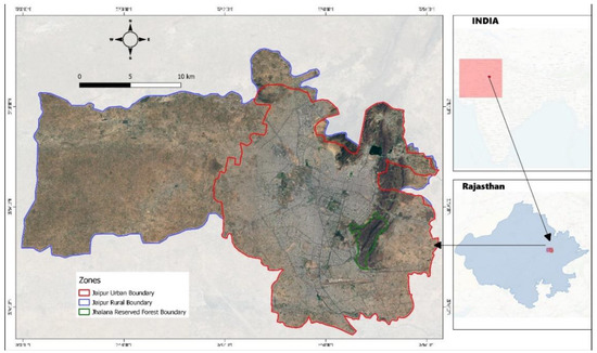
Figure 2.
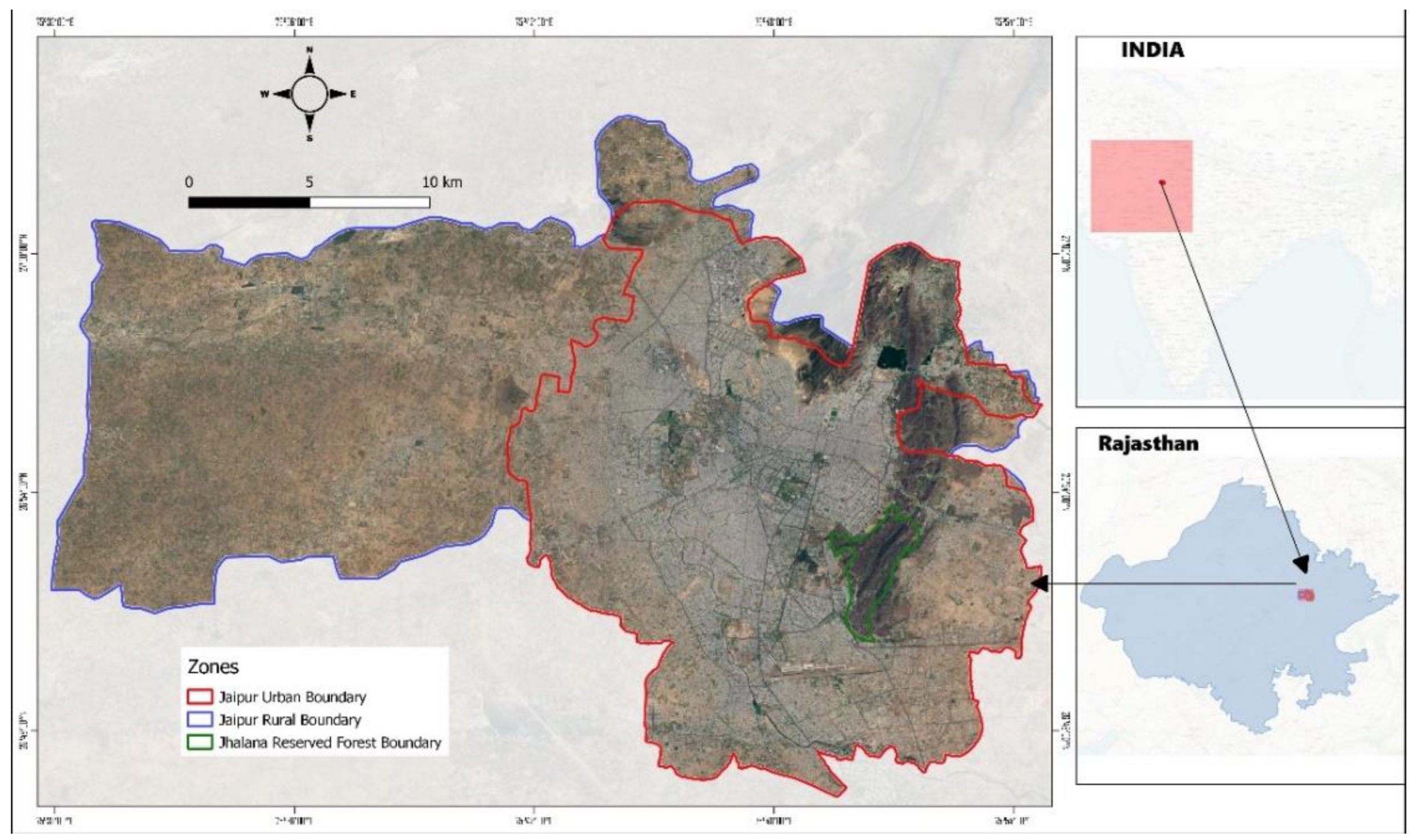
Satellite map of the study area showing the Urban (red), Rural (blue), and Jhalana Reserve Forest (green) zones of the conurbation of Jaipur. The IMD (Indian Meteorological Department) records the meteorological variables continuously at weather stations, including at Jaipur (Sanganer) weather station (Table 2; [23]). Map courtesy of TGIS laboratory.
Figure 2.
Satellite map of the study area showing the Urban (red), Rural (blue), and Jhalana Reserve Forest (green) zones of the conurbation of Jaipur. The IMD (Indian Meteorological Department) records the meteorological variables continuously at weather stations, including at Jaipur (Sanganer) weather station (Table 2; [23]). Map courtesy of TGIS laboratory.
Reference
- Yosef, R.; Rakholia, S.; Mehta, A.; Bhatt, A.; Kumbhojkar, S. Land Surface Temperature Regulation Ecosystem Service: A Case Study of Jaipur, India, and the Urban Island of Jhalana Reserve Forest. Forests 2022, 13, 1101. [Google Scholar] [CrossRef]
Publisher’s Note: MDPI stays neutral with regard to jurisdictional claims in published maps and institutional affiliations. |
© 2022 by the authors. Licensee MDPI, Basel, Switzerland. This article is an open access article distributed under the terms and conditions of the Creative Commons Attribution (CC BY) license (https://creativecommons.org/licenses/by/4.0/).