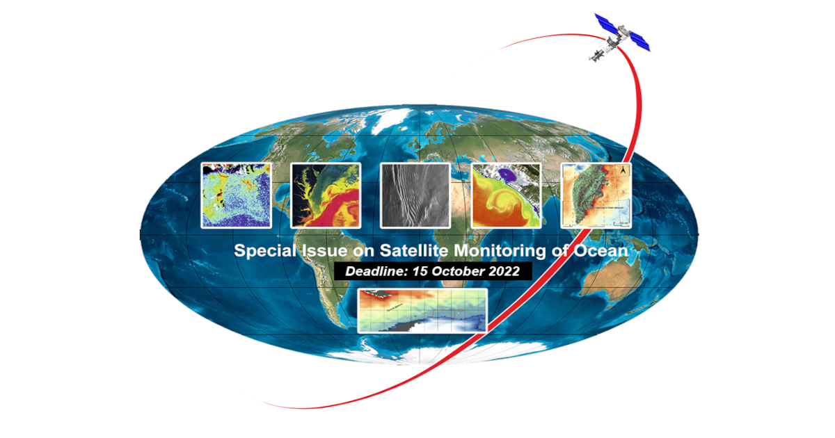
Satellite Monitoring of Ocean

A special issue of Journal of Marine Science and Engineering (ISSN 2077-1312). This special issue belongs to the section "Physical Oceanography".

Deadline for manuscript submissions: closed (15 October 2022) | Viewed by 22861

Special Issue Editor


E-Mail Website
Guest Editor
Institute for Scientific Research of Aerospace Monitoring "AEROCOSMOS", Moscow, Russian Federation
Interests: physical fundamentals of satellite research of the Earth; ocean optics, sea surface radar studies, remote sensing of the aquatic environment; retrieval of wave spectra from the spectra of optical images of the sea surface; satellite monitoring of anomalous natural and anthropogenic processes and phenomena in the seas and oceans (environmental accidents, intense deep discharges, large-scale oil spills, etc.); remote diagnostics of deep processes in the seas and oceans by their manifestations on the surface and in the near-surface layer; satellite research of the Arctic and Antarctic; processing of large data flows from satellites for remote monitoring of seas and oceans
Special Issues, Collections and Topics in MDPI journals

Special Issue Information

Dear Colleagues,

This Special Issue of JMSE focuses on satellite monitoring of the ocean, which is rapidly evolving with the growing capabilities of state-of-the-art systems for remote sensing of the Earth from space and methods of satellite information processing. The issue contains articles dedicated to modern approaches to solving problems of remote diagnostics of processes on the surface, in the near-surface layer, and in the deep layers of the ocean. Particular attention is paid to the use of satellite methods for the analysis of various anomalous phenomena in the seas and oceans. The physical features of the formation of signal fields in ocean remote sensing facilities and methods to retrieve significant parameters of the aquatic environment, which provide objective information about the state of the seas and oceans, are considered. The possibilities of using passive and active methods and means operating in various ranges of the spectrum of electromagnetic waves for monitoring processes and phenomena in the ocean are shown. The results of the study of anthropogenic and natural impacts on sea areas, based on the analysis of satellite images obtained in the optical and microwave ranges of the spectrum, are presented. The capabilities of methods and assets for processing large flows of satellite information to solve problems of satellite oceanography, including in the waters of the Arctic and Southern Oceans, are analyzed. The issues of assimilation of remote sensing data in numerical ocean models are considered. Application of satellite monitoring techniques and facilities to study physical features of energy exchange between the agitated sea surface, the dynamic near-surface layer of the atmosphere, and deep processes, taking into account the nonlinear interaction of surface waves, are considered.

Prof. Dr. Valery Bondur
Guest Editor

Manuscript Submission Information

Manuscripts should be submitted online at www.mdpi.com by registering and logging in to this website. Once you are registered, click here to go to the submission form. Manuscripts can be submitted until the deadline. All submissions that pass pre-check are peer-reviewed. Accepted papers will be published continuously in the journal (as soon as accepted) and will be listed together on the special issue website. Research articles, review articles as well as short communications are invited. For planned papers, a title and short abstract (about 100 words) can be sent to the Editorial Office for announcement on this website.

Submitted manuscripts should not have been published previously, nor be under consideration for publication elsewhere (except conference proceedings papers). All manuscripts are thoroughly refereed through a single-blind peer-review process. A guide for authors and other relevant information for submission of manuscripts is available on the Instructions for Authors page. Journal of Marine Science and Engineering is an international peer-reviewed open access monthly journal published by MDPI.

Please visit the Instructions for Authors page before submitting a manuscript. The Article Processing Charge (APC) for publication in this open access journal is 2600 CHF (Swiss Francs). Submitted papers should be well formatted and use good English. Authors may use MDPI's English editing service prior to publication or during author revisions.

Keywords

  • satellite oceanography
  • satellite image processing
  • ocean remote sensing
  • sea surface spectra
  • retrieval of wave spectra
  • internal waves
  • ocean disasters
  • environmental monitoring
  • remote sensing data assimilation
  • numerical ocean models

Benefits of Publishing in a Special Issue

  • Ease of navigation: Grouping papers by topic helps scholars navigate broad scope journals more efficiently.
  • Greater discoverability: Special Issues support the reach and impact of scientific research. Articles in Special Issues are more discoverable and cited more frequently.
  • Expansion of research network: Special Issues facilitate connections among authors, fostering scientific collaborations.
  • External promotion: Articles in Special Issues are often promoted through the journal's social media, increasing their visibility.
  • e-Book format: Special Issues with more than 10 articles can be published as dedicated e-books, ensuring wide and rapid dissemination.

Further information on MDPI's Special Issue polices can be found here.

Published Papers (10 papers)

Order results
Result details
Select all
Export citation of selected articles as:

Research

23 pages, 10578 KiB  
Article
Study of Intensive Anthropogenic Impacts of Submerged Wastewater Discharges on Marine Water Areas Using Satellite Imagery
by Valery Bondur and Viktor Zamshin
J. Mar. Sci. Eng. 2022, 10(11), 1759; https://doi.org/10.3390/jmse10111759 - 15 Nov 2022
Cited by 1 | Viewed by 1691
Abstract
This paper focuses on a detailed analysis of coastal waters under the conditions of the intense anthropogenic impacts of submerged wastewater discharges, using optical and radar satellite images. The features of the intense anthropogenic impacts on the coastal waters of the northern part [...] Read more.
This paper focuses on a detailed analysis of coastal waters under the conditions of the intense anthropogenic impacts of submerged wastewater discharges, using optical and radar satellite images. The features of the intense anthropogenic impacts on the coastal waters of the northern part of the Black Sea were studied, based on the processing and analysis of systematized archival satellite and sea truth data (2015–2021). Techniques based on the formation and analysis of the spatial (2-dimensional) spectra of optical and radar satellite images, normalized radar cross-section (NRCS), and the normalized spectral index are proposed. It is convincingly shown that these techniques make it possible to register and interpret the changes in the spatial structure of wind waves, as well as the changes in the optical spectral characteristics caused by submerged wastewater discharge due to the complex hydrodynamic and hydro-optical impact. A comprehensive analysis of the results of the processing of the heterogeneous satellite and sea truth data was carried out using a geographic information system. It was found that surface disturbances caused by anthropogenic impacts due to submerged wastewater discharges were detected by local “quasi-monochromatic” spectral maxima caused by the generation of short-period internal waves (wavelengths from ~30 m to ~165 m). These maxima can be registered by high-resolution optical and radar imagery. NRCS anomalies (2–4 dB contrasts), due to the surfactant films, floating jets, and turbulence related to wastewater discharge, are registered and described, as are the changes in the spectral radiance distributions in the blue and green bands of the electromagnetic spectrum. Full article
(This article belongs to the Special Issue Satellite Monitoring of Ocean)
Show Figures

Figure 1

14 pages, 10275 KiB  
Article
Backscattering Statistics of Labeled Sentinel-1 Wave Mode Imagettes for Ten Geophysical Phenomena
by Ziyue Dai, Huimin Li, Chen Wang and Yijun He
J. Mar. Sci. Eng. 2022, 10(11), 1594; https://doi.org/10.3390/jmse10111594 - 28 Oct 2022
Cited by 1 | Viewed by 1540
Abstract
Synthetic aperture radar (SAR) is a sensor that is proven to have great potential in observing atmospheric and oceanic phenomena at high-spatial resolutions (∼10 m). The statistics of SAR backscattering that describe the image characteristics are essential to help interpret the properties of [...] Read more.
Synthetic aperture radar (SAR) is a sensor that is proven to have great potential in observing atmospheric and oceanic phenomena at high-spatial resolutions (∼10 m). The statistics of SAR backscattering that describe the image characteristics are essential to help interpret the properties of the geophysical processes. In this study, we took advantage of a hand-labeled database of ten commonly observed geophysical processes created based on the Sentinel-1 wave mode vignettes to document the SAR backscattering statistics. The probability density function (PDF), normalized variance, skewness, and kurtosis were investigated among the ten labeled categories. We found that the NRCS PDFs differ between types, implying the influences of these large-scale features on the radar backscattering distribution. The statistical parameters exhibited distinct variations among classes at the two incidence angles of 23.5 and 36.5. In particular, the normalized variance of low wind area at 23.5 exceeded other phenomena by an order of magnitude. This lays the basis for directly identifying the SAR images of low wind areas in terms of this parameter. Sea ice and rain cells at 36.5 span within a similar range of kurtosis values, much higher than the other groups. While sea ice could be excluded using a latitude threshold, the rain cells are readily detected. The global percentage map of directly identified rain cells is consistent with the deep-learning results but with higher efficiency. The influence of these large-scale atmospheric and oceanic features on radar backscattering statistics must be considered in the future wave retrieval algorithm for improved accuracy. Full article
(This article belongs to the Special Issue Satellite Monitoring of Ocean)
Show Figures

Figure 1

19 pages, 4926 KiB  
Article
Advantage of Regional Algorithms for the Chlorophyll-a Concentration Retrieval from In Situ Optical Measurements in the Kara Sea
by Elena Korchemkina, Dmitriy Deryagin, Mariia Pavlova, Anna Kostyleva, Igor E. Kozlov and Svetlana Vazyulya
J. Mar. Sci. Eng. 2022, 10(11), 1587; https://doi.org/10.3390/jmse10111587 - 27 Oct 2022
Cited by 2 | Viewed by 1716
Abstract
The data of the sea reflectance coefficient were obtained during the cruise of the R/V “Akademik Ioffe” (10 August–8 September 2021) in the Kara Sea beyond the Arctic Circle. A total of 28 measurements of sea reflectance were performed in different conditions ranging [...] Read more.
The data of the sea reflectance coefficient were obtained during the cruise of the R/V “Akademik Ioffe” (10 August–8 September 2021) in the Kara Sea beyond the Arctic Circle. A total of 28 measurements of sea reflectance were performed in different conditions ranging from estuarine zones to open ocean. In addition, at 10 stations, water samples were taken, and chlorophyll-a concentrations were determined using the fluorometric method. In situ reflectance data were compared to satellite data (MODIS Aqua/Terra, Sentinel OLCI 3A/B, VIIRS SNPP) obtained within 24 h before and after the measurement. It was shown that, in general, an overestimation of remote sensing reflectance is observed in short-wave channels (412, 443, 469 nm for MODIS; 410, 412.5, 442.5 for OLCI) and underestimation in long-wave channels (708.75, 753.75 nm for OLCI). The obtained in situ chlorophyll-a concentrations were compared with the results of standard models (GIOP, OC2, OC3, OC4), and regional algorithms (semi-analytical MHI, empirical K17) were applied to the in situ and remotely sensed reflectances. In the cases of GIOP and OC4, unrealistic concentrations of chlorophyll-a were obtained. Regional algorithms developed earlier, specifically for the Kara Sea, showed good correlation (0.6 and 0.76) with in situ measurements. Despite the approximately 20% overestimation of chlorophyll-a by both regional algorithms, they can be used to obtain chlorophyll-a concentrations in the Kara Sea in a concentration range of <1 mg/m3. Full article
(This article belongs to the Special Issue Satellite Monitoring of Ocean)
Show Figures

Figure 1

22 pages, 5193 KiB  
Article
Validation of the Satellite Method for Measuring Spectra of Spatially Inhomogeneous Sea Waves
by Valery Bondur, Vladimir Dulov, Vladimir Kozub, Alexander Murynin, Maria Yurovskaya and Yury Yurovsky
J. Mar. Sci. Eng. 2022, 10(10), 1510; https://doi.org/10.3390/jmse10101510 - 17 Oct 2022
Cited by 4 | Viewed by 1596
Abstract
A method for retrieving 2D spatial spectra of sea wave elevations and slopes from high resolution (about 1 m) satellite imagery has been developed that also allows for assessing sea wave angular distributions. A validation of the suggested method was carried out based [...] Read more.
A method for retrieving 2D spatial spectra of sea wave elevations and slopes from high resolution (about 1 m) satellite imagery has been developed that also allows for assessing sea wave angular distributions. A validation of the suggested method was carried out based on the results from a comprehensive experiment that included both satellite imaging of the Black Sea water area and sea truth under controlled conditions. The retrieval of spatial wave spectra from fragments of a satellite image and comparison with the results of measuring the frequency spectra from sea truth data obtained using an array of string wave recorders were carried out. Wave spectra from remote and in situ data are consistent in the frequency range of 0.2–1.1 Hz, corresponding to wavelengths from 1.3 to 39 m. Full article
(This article belongs to the Special Issue Satellite Monitoring of Ocean)
Show Figures

Figure 1

18 pages, 5666 KiB  
Article
Features of the Field of Internal Waves on the Abkhazian Shelf of the Black Sea according to Remote Sensing Data and In Situ Measurements
by Andrey Serebryany, Elizaveta Khimchenko, Viktor Zamshin and Oleg Popov
J. Mar. Sci. Eng. 2022, 10(10), 1342; https://doi.org/10.3390/jmse10101342 - 21 Sep 2022
Cited by 6 | Viewed by 1753
Abstract
The field of internal waves in the Black Sea is quite significant. The Black Sea shelf is of particular interest, but it has not been studied enough in some specific regions. For example, a narrow and steep shelf of Abkhazia has been poorly [...] Read more.
The field of internal waves in the Black Sea is quite significant. The Black Sea shelf is of particular interest, but it has not been studied enough in some specific regions. For example, a narrow and steep shelf of Abkhazia has been poorly explored. Particularly unexplored are the actual parameters and causes of the generation of internal waves in this area. In this article, we have attempted to fill this gap by analyzing remote sensing data and in situ data. An analysis of a set of optical multispectral satellite images (Sentinel-2, Landsat-8) and a collection of sea-truth data of the shelf zone of Abkhazia was carried out to identify features of internal wave fields of this region. In situ data were acquired over 9 years using ADCP, CTD, and SVP probes and moored stations with point and line temperature sensors. It is shown that internal waves are widespread on the Abkhazian shelf. They appear as trains of short-period waves (as a rule, soliton-like). The quantitative parameters and features of internal waves are shown and analyzed. The form of manifestation and direction of internal wave trains’ travel depend on the mechanisms of their origin, among which are the transformations of inertial internal waves, generation by river plumes, and submesoscale structures. In general, the article is the most complete and relevant study of the field of internal waves on the shelf of Abkhazia. Full article
(This article belongs to the Special Issue Satellite Monitoring of Ocean)
Show Figures

Figure 1

16 pages, 5536 KiB  
Article
New Features of Bragg and Non-Polarized Radar Backscattering from Film Slicks on the Sea Surface
by Stanislav Aleksandrovich Ermakov, Irina Andreevna Sergievskaya, Leonid Mikhailovich Plotnikov, Ivan Aleksandrovich Kapustin, Olga Arkadyevna Danilicheva, Alexander Viktorovich Kupaev and Alexander Andreevich Molkov
J. Mar. Sci. Eng. 2022, 10(9), 1262; https://doi.org/10.3390/jmse10091262 - 7 Sep 2022
Cited by 2 | Viewed by 1648
Abstract
Suppression of radar backscattering from the sea surface has been studied in field experiments with surfactant films carried out from an Oceanographic Platform on the Black Sea and from onboard a research vessel on the Gorky Water Reservoir using an X-C-S-band two co-polarized [...] Read more.
Suppression of radar backscattering from the sea surface has been studied in field experiments with surfactant films carried out from an Oceanographic Platform on the Black Sea and from onboard a research vessel on the Gorky Water Reservoir using an X-C-S-band two co-polarized radar instrument. Bragg and non-polarized (non-Bragg) radar backscatter components, BC and NBC, respectively, were retrieved when measuring the radar backscatter at vertical (VV-) and horizontal (HH-) polarizations. New features of microwave backscattering from the sea surface have been revealed, including a non-monotonic dependence of radar backscatter suppression (contrasts) in slicks on azimuth angle and particularities of BC contrasts on radar wave number. Namely, it is demonstrated that the backscatter contrasts achieve maximum values at azimuth angles in between the upwind and crosswind radar look directions, and BC contrasts increase with radar wave number along the wind and decrease in the crosswind directions. The suppression of BC is discussed in the frame of Bragg’s theory of microwave scattering and of a simple model of the wind wave spectrum, while the suppression of NBC is considered associated with the micro-breaking of wind waves. The obtained new features of radar contrasts can be used for the identification and characterization of marine films. Full article
(This article belongs to the Special Issue Satellite Monitoring of Ocean)
Show Figures

Figure 1

14 pages, 3742 KiB  
Article
Towards an Algorithm for Retrieval of the Parameters of the Marine Atmospheric Boundary Layer at High Wind Speeds Using Collocated Aircraft and Satellite Remote Sensing
by Evgeny Poplavsky, Nikita Rusakov, Olga Ermakova, Daniil Sergeev and Yuliya Troitskaya
J. Mar. Sci. Eng. 2022, 10(8), 1136; https://doi.org/10.3390/jmse10081136 - 18 Aug 2022
Cited by 5 | Viewed by 2233
Abstract
A method has been developed for the retrieval of the atmospheric boundary layer parameters in tropical cyclones, namely the dynamic speed, the wind speed at a 10 m height, and the roughness parameter. For the analysis, the wind speed profiles were obtained from [...] Read more.
A method has been developed for the retrieval of the atmospheric boundary layer parameters in tropical cyclones, namely the dynamic speed, the wind speed at a 10 m height, and the roughness parameter. For the analysis, the wind speed profiles were obtained from NOAA GPS-dropsondes and collocated with the data from the Stepped-Frequency Microwave Radiometer (SFMR). The parameters of the atmospheric boundary layer from the GPS-dropsonde data were obtained by taking into account the self-similarity of the velocity defect profile. The emissivity, determined from the radiometric measurement data, was calibrated to the field data from the GPS-dropsondes. Empirical relations between the wind speed, dynamic wind speed, and aerodynamic drag coefficient with the surface emissivity have been proposed. Based on a comparison of the measured dynamic parameters and the surface emissivity, empirical formulas have also been proposed. From an analysis of cross-polarized Sentinel-1 SAR images and collocated SFMR measurements for hurricanes Irma (2017/09/07) and Maria (2017/09/21 and 2017/09/23), we have obtained the dependences of the NRCS on the ocean surface emissivity, surface wind speed, and friction velocity. These results could potentially be used to improve the algorithm for the retrieval of boundary layer parameters in tropical cyclones from remote sensing data. Full article
(This article belongs to the Special Issue Satellite Monitoring of Ocean)
Show Figures

Figure 1

13 pages, 4507 KiB  
Article
Sea Level Change in the Canary Current System during the Satellite Era
by Nerea Marrero-Betancort, Javier Marcello, Dionisio Rodríguez-Esparragón and Santiago Hernández-León
J. Mar. Sci. Eng. 2022, 10(7), 936; https://doi.org/10.3390/jmse10070936 - 8 Jul 2022
Cited by 2 | Viewed by 3507
Abstract
Understanding the causes of global sea level rise is considered as an important goal of climate research on a regional scale, especially around islands, owing to their vulnerability to this phenomenon. In the case of the Canary Islands, these alterations entail an increase [...] Read more.
Understanding the causes of global sea level rise is considered as an important goal of climate research on a regional scale, especially around islands, owing to their vulnerability to this phenomenon. In the case of the Canary Islands, these alterations entail an increase in territorial risks. The Canary Islands span the transitional zone linking the Northwest African upwelling system and the open ocean waters of the subtropical gyre. Here, we used satellite altimeter data to perform a detailed statistical analysis of sea level anomaly from 1993 to 2019. A seasonal study was carried out at two different regions and sea level anomaly was compared with temperature variability in the area. A total rise in the sea level of around 7.94 cm was obtained for the last 27 years in both areas. Sea level anomaly was strongly influenced by sea surface temperature, as expected. In addition, we found differences between the annual cycle in the open ocean and the upwelling zone, showing different patterns in both sites. The expected increase in sea level for the year 2050 in the coastal zone of the archipelago was estimated to be 18.10 cm, affecting the coastal economy of the islands, which is strongly based on the use of beaches for tourism. Full article
(This article belongs to the Special Issue Satellite Monitoring of Ocean)
Show Figures

Figure 1

18 pages, 2189 KiB  
Article
Estimation of Total Suspended Matter Concentration of Ha Long Bay, Vietnam, from Formosat-5 Image
by Pham-Minh Chau and Chi-Kuei Wang
J. Mar. Sci. Eng. 2022, 10(3), 441; https://doi.org/10.3390/jmse10030441 - 18 Mar 2022
Cited by 1 | Viewed by 2436
Abstract
This study proposes the use of spatial high-resolution Formosat-5 (FS5) images for estimating total suspended matter (TSM) concentrations in a coastal region. Although many atmospheric correction methods are available, none of them are proposed to apply to FS5. Therefore, to remove the atmospheric [...] Read more.
This study proposes the use of spatial high-resolution Formosat-5 (FS5) images for estimating total suspended matter (TSM) concentrations in a coastal region. Although many atmospheric correction methods are available, none of them are proposed to apply to FS5. Therefore, to remove the atmospheric effect, we performed a linear regression between the digital number (DN) of an FS5 image and the Landsat-8 Operational Land Imager (OLI) level-2 remote-sensing reflectance (Rrs) by using 160 samples of five ground targets. The ground targets, namely roof material, asphalt, water, vegetation, and other materials (sand and soil), were assumed to have negligible differences within 24 h. The results show that the linear model used for computing FS5 reflectance exhibited good coefficients of determination (R2) ranging from 0.87 to 0.96 for blue, green, red, and near-infrared bands. Next, in situ TSM measurements were not collected during the FS5 overpassing in Ha Long Bay, Vietnam, so we used two existing algorithms with a red band to estimate the TSM concentration. These algorithms developed for different coastal waters exhibited satisfactory agreement between derived field data and observed TSM concentrations with R2 ranging from 0.86 to 0.95. We also cross-checked the accuracy of the FS5-derived TSM concentration through comparison with an OLI-derived TSM image. The OLI-derived TSM image was validated and discussed for Vietnamese coastal waters, including Ha Long Bay. Lastly, based on comparisons between FS5- and OLI-derived TSM images in terms of spatial distribution, histograms, and root mean square error, we indicated the FS5 images after the removal of atmospheric effects could be totally used for estimating TSM in coastal water regions. Full article
(This article belongs to the Special Issue Satellite Monitoring of Ocean)
Show Figures

Figure 1

16 pages, 5374 KiB  
Article
Surface Chlorophyll-A Fronts in the Yellow and Bohai Seas Based on Satellite Data
by Lu Xia, Hao Liu, Lei Lin and Yueqi Wang
J. Mar. Sci. Eng. 2021, 9(11), 1301; https://doi.org/10.3390/jmse9111301 - 20 Nov 2021
Cited by 6 | Viewed by 2769
Abstract
Chlorophyll fronts are important to monitor and map the oceanic front, especially in the season when sea surface temperature (SST) fronts weaken. In this study, surface chlorophyll-a (chl-a) fronts in the Yellow and Bohai seas were characterized for the first time using satellite [...] Read more.
Chlorophyll fronts are important to monitor and map the oceanic front, especially in the season when sea surface temperature (SST) fronts weaken. In this study, surface chlorophyll-a (chl-a) fronts in the Yellow and Bohai seas were characterized for the first time using satellite data. Five distinct chl-a fronts (i.e., the Bohai Strait, Shandong Peninsula, Jiangsu, Liaodong Peninsula, and Korean Peninsula fronts) were observed in summer along the 40 m isobaths and faded in other seasons. Notably, these fronts coincided with SST fronts. Strong chl-a fronts emerged during summer due to chl-a blooms in eutrophic coastal waters paired with surface chl-a fading in strongly stratified offshore waters and coastal physical fronts. Although SST fronts were strong during winter, light limitation and strong vertical mixing in offshore waters led to low chl-a in both coastal and offshore waters, suppressing chl-a front formation. Both chl-a and SST fronts coincided with steep seabed slopes (slope ratio > 1), suggesting that seabed slope may be an indicator of oceanic front location. Full article
(This article belongs to the Special Issue Satellite Monitoring of Ocean)
Show Figures

Figure 1

Back to TopTop