

GeoHazards, Volume 3, Issue 1 (March 2022) – 7 articles
Cover Story (view full-size image):
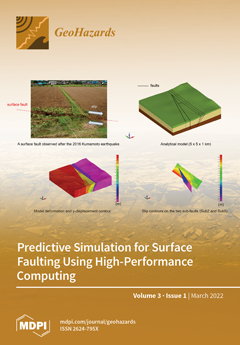
Numerical simulations based on continuum mechanics are promising methods for the estimation of surface fault displacements. We developed a parallel finite element method program to perform such simulations and applied the program to reproduce the 2016 Kumamoto earthquake, where surface rupture was observed. The simulation reproduced the occurrence of secondary surface ruptures in the target area, and calculated surface slips are comparable in magnitude with observation. Moreover, multiple predictive simulations provided the effect of slip distribution on the main fault on the likelihood of triggered secondary faults. View this paper
- Issues are regarded as officially published after their release is announced to the table of contents alert mailing list.
- You may sign up for e-mail alerts to receive table of contents of newly released issues.
- PDF is the official format for papers published in both, html and pdf forms. To view the papers in pdf format, click on the "PDF Full-text" link, and use the free Adobe Reader to open them.
Previous Issue
Next Issue