1. Introduction
With the development of waterway transportation, the increase in the number, tonnage, and speed of ships has raised the possibility of ship collision, especially in complex waterways [
1,
2]. Therefore, more scientific and efficient collision warning and collision avoidance decisions are needed in today’s water navigation scenarios. At present, ships have been widely installed with traffic sensing devices such as an automatic identification system (AIS) and a shipborne radar, and most complex or important waterways have been equipped with vessel traffic service (VTS), whose purpose is to obtain more navigation information to ensure the safe navigation of ships. However, ship collisions still exist and have not decreased with the advances in navigation technology [
3]. This may be due to a combination of factors such as insufficient experience of ship navigators, sudden collision situations, and high thresholds for advanced equipment analysis [
4]. The International Regulations for Preventing Collisions at Sea (COLREG) is implemented by the International Maritime Organization (IMO), and some navigation regulations are implemented in some complex waterways, such as the Regulations for Preventing Collisions in Inland Rivers of the People’s Republic of China in the Yangtze River waterway. Nevertheless, these rules are qualitative and do not have quantitative collision prediction thresholds to assist in judgment in order to reduce the subjective judgment of navigators.
Several methods have been proposed to identify the risk of ship collision. In the mid-20th century, concepts such as Distance to Closest Point of Approach (DCPA), Time to Closest Point of Approach (TCPA), and Ship Domain were used to make decisions on ship collision avoidance [
5,
6]. Zheng and Wu [
7,
8,
9] proposed the concepts of space collision risk and time collision risk, which considered the main factors that reflect risk levels of collision between ships, such as DCPA, TCPA, safety distance, and the latest avoidance point, to establish their respective collision avoidance risk models. Sotiralis et al. [
10] proposed a quantitative risk analysis method based on Bayesian networks by considering human factors more adequately, which integrates elements from the Technique for Retrospective and Predictive Analysis of Cognitive Errors, focusing on analyzing human-induced collision accidents. Abebe et al. [
3] proposed a ship collision risk index estimation model based on the Dempster–Shafer theory and its accuracy and fast calculation were verified by comparing it with different machine learning methods. Pietrzykowski et al. [
11] proposed an integrated, comprehensive system of an Autonomous Surface Vessel dedicated to ships with various degrees of autonomy, and tests were conducted under the actual operating conditions of ships. Perera and Soares [
12] proposed a collision risk detection and quantification methodology that can be implemented in a modem-integrated bridge system. Ozturk and Cicek [
13] believe that the risk assessment of wind, current, and wave height on a ship’s dynamic cannot be ignored.
More advantageously, ship domain models can promote the rapid identification of ship navigation collision avoidance, and their boundaries determine the accuracy of ships’ collision avoidance. As early as 1963, a symmetric elliptical ship domain model centered around the own ship using the ship’s radar information was first proposed and widely applied [
14]. Goodwin [
5] divides the ship domain into three different-sized sectors based on ship lights. Van der Tak and Spaans [
15] established a ship domain model based on previous research, in which the center of the elliptical ship domain has a forward offset from the position of the ship, and the bow of the ship was deflected, resulting in an area of approximately equal to the three-sector areas of the Goodwin model. Coldwell [
16] established the ship domain model in overtaking and encountering situations by observing the traffic of over 200 ships in the 19 nautical mile waterways of the Humber River in the UK. Zhu et al. [
17] proposed a multi-vessel collision risk assessment model based on the Coldwell ship domain model. Wen et al. [
18] obtained the shape and size of specific types of ship domains in typical inland waterways by observing AIS-based grid density maps and analyzing grid density data, in which the ship domain in real life is quite different from the theoretical prediction. The shape of the ship domain in typical inland waters takes the form of an asymmetrically shaped ellipse, with its major axis coinciding with the ship’s central line.
With the widespread application of modern AIS technology, research on the ship domain based on AIS has become increasingly meaningful. Qi et al. [
19] established a ship domain model and obtained boundary curves of the ship domain under different avoidance degrees by utilizing AIS data from Qiongzhou Strait. Hansen et al. [
20] estimated the minimum ship domain where a navigator feels comfortable by observing the AIS data of ships sailing in southern Danish waters for four years. Szlapczynski and Szlapczynska [
21] proposed a ship collision risk model based on the concept of ship domain and considered the related domain-based collision risk parameters, such as degree of domain violation, the relative speed of the two vessels, combination of the vessels’ courses, arena violations, and encounter complexity. Feng et al. [
22] proposed a quantitatively evaluated method of the collision risks combining information entropy, which integrated the K-means clustering based on AIS data. Liu et al. [
23] proposed a systematic method based on the dynamic ship domain model to detect possible collision scenarios and identify the distributions of collision risk hot spots in a given area. Du et al. [
24] proposed a data ship domain concept and an analytical framework based on AIS, in which the ship domain explicitly incorporates the dynamic nature of the encounter process and the navigator’s evasive maneuvers. Liu et al. [
25] proposed a quantitative method for the analysis of ship collision risk, in which a kinematics feature-based vessel conflict ranking operator was introduced, and both the static and dynamic information of AIS data were considered to evaluate ship collision risk. Silveira et al. [
26] introduced a method to define AIS data-based empirical polygonal ship domains, which can fit the empirical domain better. He et al. [
27] proposed a dynamic collision avoidance path planning algorithm for complex multi-ship encounters based on the A-star algorithm and the quaternion ship domain from AIS data. Zhang et al. [
28] proposed an interpretable knowledge-based decision support method to guide ship collision avoidance decisions with a knowledge base based on the ordinary practice of seamen using AIS data.
In summary, on the one hand, these studies mainly focus on open water areas, and there is a lack of empirical research on ship navigation risks based on complex inland waterways. On the other hand, research methods based on statistical analysis use actual traffic flow data. Early research was mostly based on radar data, and in recent years, it has shifted towards AIS data. However, for research on risk identification with ship domains in complex waterways, qualitative research is often used, and data containing ship navigation information is rarely used for quantitative research. Thus, while taking the risk identification computations in complex waterways, a ship domain model considering the characteristics of navigation separation based on AIS data needs to be developed.
In this paper, a risk identification method is established based on the collision risk detection line and the safety distance boundary of the ship domain to provide real-time and fast guidance for collision avoidance control during navigation in complex waterways.
Section 2 provides an overall description of the proposed risk identification method,
Section 3 introduces the process of establishing a ship domain model, and
Section 4 introduces collision risk classification algorithms based on the ship domain model.
Section 5 validates this method using real ship data. In this way, we can evaluate the collision risk of ship navigation based on AIS data and assist ship navigation by providing a collision avoidance decision-making basis for navigators.
3. The Ship Domain Model of Navigation in Complex Waterways
The selected data is sourced from AIS onboard equipment on the ship “Channel 1”, which includes over 2.7 million AIS and GPS data records of the ships from March 2023 to July 2023 in the Wuhan reach of the Yangtze River.
3.1. Preprocessing of AIS Data
There are some abnormal data in the initial AIS data, so it is necessary to exclude these abnormal data from the selected AIS data, such as ship position anomalies (not within the navigation waterway, with speed but unchanged position), speed anomalies, and heading anomalies, etc. Preprocessing of AIS data mainly includes data cleaning and data repairing. Data repairing mainly involves linear interpolation of the data, with an interpolation interval of 2 s. In addition, the research focuses on the state of the ship during navigation, and it is necessary to determine the current sailing state of the ship based on its speed. Therefore, AIS data with a speed less than 0.5 m/s is considered a parked state, which is excluded. Meanwhile, considering the size characteristics of the ship domain in complex waterways, ships within a 1 km range centered around the own ship are selected as the research object for the encounter situation. The processed AIS data will be used for subsequent calculations of the ship distribution density map.
3.2. Scatter Distribution Map of the Target Ships
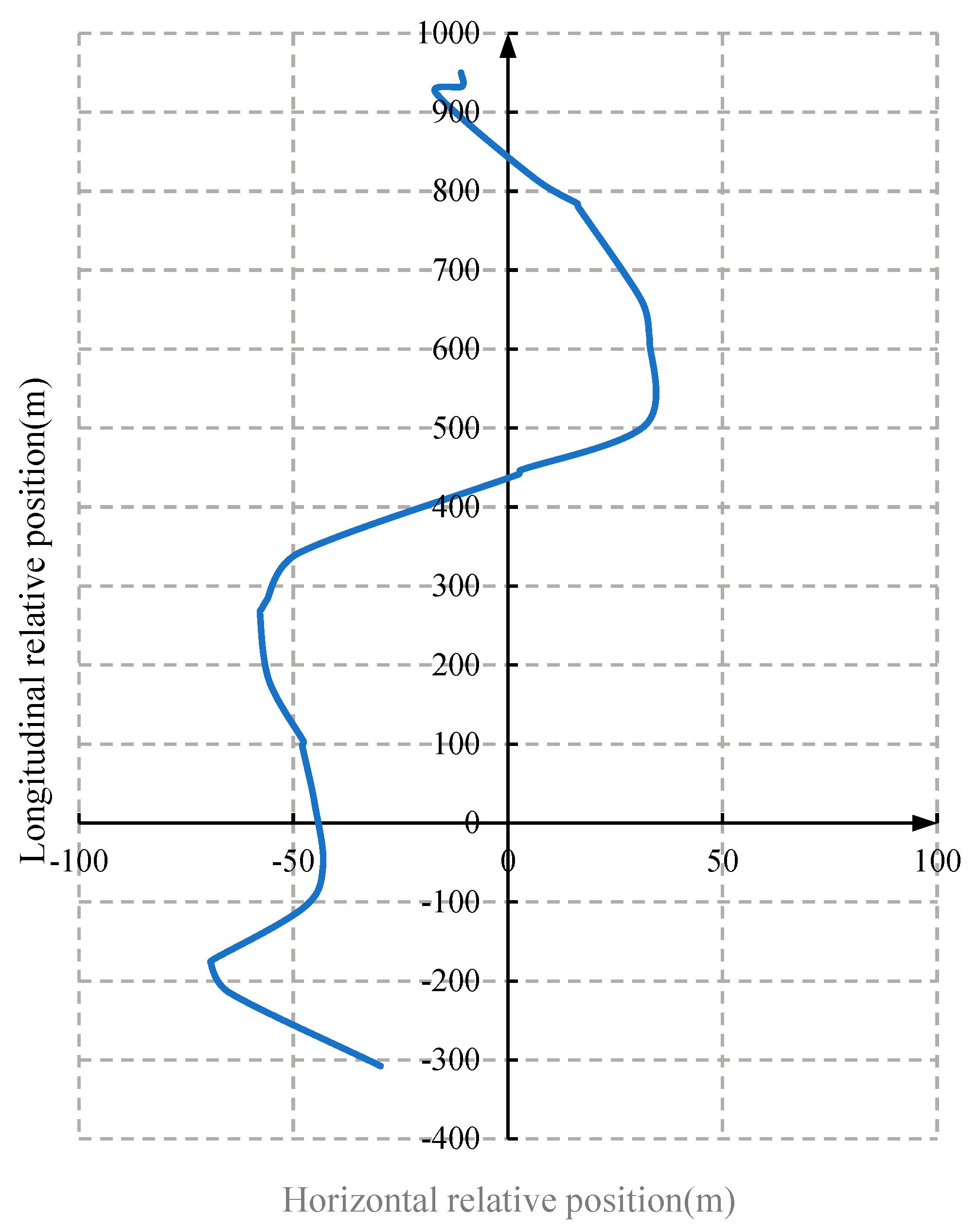
Based on historical AIS data, a coordinate system relative to the nearby water area of a ship is established, with the ship’s position as the coordinate origin and its heading as the longitudinal axis direction. The relative orientation is calculated from the longitude, latitude, and heading of the ship and the longitude and latitude of the target ship.
Firstly, the relative distance and relative orientation of the two ships at a certain time can be calculated by the longitude and latitude of the ships.
Secondly, to ensure that the own ship’s position is the coordinate origin and its heading is the longitudinal axis direction, it is necessary to perform coordinate conversion on the heading of other ships while the own ship is sailing to obtain the relative orientation, which ensures the accuracy of the selected statistical samples.
Finally, based on the calculated relative distance and relative orientation, a scatter distribution map of target ships can be visualized and displayed, as shown in
Figure 2.
Figure 2 shows that there is a sparse distribution area of ship positions near the origin, which is the ship domain of the own ship.
3.3. Distribution Density Map around the Ship
To improve the accuracy of describing the distribution of target ships around the own ship, the Scatter distribution map of target ships was converted into a distribution density map for analysis, in which the density value of coordinate points is the number of ship points within a unit distance divided by the area. When the unit distance is selected as 5 m, the conversion of the distribution density map is shown in
Figure 3.
By calculating the density of each coordinate point around the own ship and setting color legends based on the density, a grid density map of the own ship is obtained. The shape and size of the own ship domain can be obtained by analyzing density map data, as detailed in
Section 3.5.
Figure 3b shows an area in the center of the image with a density much lower than other surrounding spaces, which is classified as the ship domain of the own ship for safe navigation. The ship domain is all in an asymmetric elliptical shape, with the major axis of the ellipse parallel to the bow direction, and the center of the ellipse deviates from the center of the ship domain (the coordinate origin). The center of the ellipse in the ship domain is located to the left rear of the center of the ship.
In addition, there are banded high-density areas of ships on both sides of the own ship domain. The “Channel 1” researched is a command ship for channel work, with a total length of 49.60 m, a molded width of 9.3 m, and a molded depth of 3.1 m, which is much faster than other cargo ships sailing in the Yangtze River. The power system of the ship is two C32 twelve-cylinder V-type four-stroke engines produced by Caterpillar in the United States, with a cruising speed of up to 35 km per hour. Therefore, the own ship often navigates close to the centerline of the waterway and is often in a situation of overtaking other ships. When the right chord of the own ship overtook another ship, it should maintain a distance of about 50 m, which is consistent with the banded high-density area of ships within a range of 0 to 200 m on the right side of the origin, and these ships are overtaking ships sailing in the same direction on the right side of the own ship. On the other side, there is also another banded high-density area of ships within the range of 50 to 250 m on the left side of the own ship, which is the encounter of ships sailing in the opposite direction on the left side of the centerline of the waterway. The distance between ships encountered on the port side and the own ship is generally greater than 100 m.
Therefore, the shape and scale of the ship domain in typical complex waterways are significantly different from that in the wide waters of the sea, as well as different from that based on the traditional theoretical analysis. The shape of the ship domain is significantly influenced by its navigation behavior.
3.4. Distribution Density Map with Different Encounter Situations
To ensure the safety of Yangtze River vessel navigation, provide navigation efficiency, and promote shipping development, Yangtze River vessel navigation has implemented segmented waterway navigation and fixed route navigation.
The segmented waterway navigation includes two-way navigation and one-way navigation, and a crossing zone is set up.
During the implementation of two-way navigation, ships follow the prescribed route and try to navigate on the side of the waterway as much as possible in order to maintain sufficient safety distance in case of an encounter. When overtaking, the slow ship should navigate on one side of the channel, while the fast ship should overtake the slow ship on the centerline side of the waterway as parallel as possible and maintain sufficient lateral distance to prevent the occurrence of ship suction. The overtaking ship should first pass through the stern of the overtaking ship and then carry out overtaking. After overtaking another ship, the overtaking ship should not immediately turn to cross the front of the other ship to avoid creating an urgent situation.
During the implementation of one-way navigation, it is stipulated that ships should pass through in one direction and are prohibited from giving way to each other. Ships should navigate laterally within the designated lateral navigation area, strengthen the lookout, and steer with caution.
Due to ships navigating in different lanes along the Yangtze River, the surrounding ships are classified into two categories: in the same and opposite directions for analysis.
Figure 4 shows the relative heading distribution of surrounding ships based on the own ship’s heading, in which 77.5% of the ships have relative heading between −180 degrees to −160 degrees, −20 degrees to 20 degrees, and 160 degrees to 180 degrees. Therefore, the relative heading of the ship is selected with data from −20 degrees to 20 degrees as the same direction data and data from −180 degrees to −160 degrees and 160 degrees to 180 degrees as the opposite direction data for distribution density statistical analysis of ship.
Firstly, the scatter distribution map of target ships around the own ship in the same direction can be obtained by selecting data from −20 degrees to 20 degrees for the relative heading of ships as co-heading data, as shown in
Figure 5.
Considering that the navigation diversion of the Yangtze River’s inland rivers will change left and right with the flow conditions of the channel, the scatter distribution map will be symmetrically supplemented along the x = 0 line to calculate the distribution density map, as shown in
Figure 6.
Then, the scatter distribution map of target ships around the own ship in the opposite direction can be obtained by selecting data from −180 degrees to −160 degrees and 60 degrees to 180 degrees for the relative heading of ships as opposing navigation data, as shown in
Figure 7.
Similarly, the scatter distribution map will be symmetrically supplemented along the x = 0 line to calculate the distribution density map, as shown in
Figure 8.
It can be seen that when sailing in the same direction, the navigation behavior of the own ship is mostly following or overtaking, and the space in the ship domain presents a situation of short front and long back (in a word, the center of the ship domain moves backward), and the space on both sides is relatively narrow due to the influence of lane width.
When sailing in the opposite direction, the navigation behavior of the own ship is mostly encountering behavior, and the space in the ship domain presents a situation of the long front and short back (in a word, the center of the ship domain moves forward), and the space on both sides is relatively wide due to the influence of lane width.
3.5. The Mathematical Models of Ship Domain in Complex Waterways
Considering the characteristics of ship navigation in complex waterways, the elliptical ship domain is chosen as the basic graphic, as shown in
Figure 9.
The coordinate system is established with the own ship as the origin, the right transverse direction as the x-axis direction, and the heading direction of the own ship as the y-axis direction.
In this coordinate system, the boundary equation of the own ship domain is given by
where
a is the radius length of the elliptical ship-type field in the positive and negative directions of the
x-axis, m;
b is the radius length of the elliptical ship-type field in the positive and negative directions of the y-axis;
x0 is the eccentric coordinate in the
x-axis direction, m;
y0 is the eccentric coordinate in the
y-axis direction, m.
To determine the size of the ship field, the following process was carried out:
① In the distribution density map, select the density data of ships in the same and opposite directions separately and generate the cross-section of
x0 = 0 (the center of ship domain) section. Observe the changes in the ship domain under different cutting thresholds to determine the appropriate threshold value. Therefore, a cutting threshold of 40% was selected as the size of the ship domain at the same direction, and the eccentricity points in the same direction ship domain were determined to be (0, −140), with a major axis radius
b = 360 m; a cutting threshold of 15% was selected as the size of the ship domain in the opposing direction, and the eccentricity points in the same direction ship domain were determined to be (0, 160), with a major axis radius
b = 350 m, as shown in
Figure 10.
② Select the density data in
Figure 6b, and generate the cross-section of
y = −140 (the center of the same direction ship domain) section; Select the density data in
Figure 8b, and generate the cross-section of
y = 160 (the center of the opposing direction ship domain) section, as shown in
Figure 11. A cutting threshold of 40% was selected as the size of the ship domain, and the width a of the same direction sailing ship domain is 30 m, and the width a of the opposite direction sailing ship domain is 70 m.
The mathematical formulas for normalized density in
Figure 10 and
Figure 11 are given by
where
ρ(
x,
y) is the ship density at the left point of (
x,
y); select a unit distance of 5 m and calculate the density value of each coordinate point by dividing the number of ship points within the unit distance by the area.
③ When judging whether there is a risk of collision solely based on the ship domain, it may result in the two ships being unable to pass at a safe distance in the complex waterway, so expand the values of
a and
b in the ship domain by
k times to increase an external safety distance boundary and improve the safety of ships during encounters. The equation of the safe distance boundary of the ship domain is given by
where
ka and
kb are taken between [1, 2]. By visual comparative analysis, when sailing in the same direction,
ka = 1.5 and
kb = 1; when sailing in the opposite direction,
ka = 1.15 and
kb = 1.28, as shown in
Figure 12.
The equation of the safe distance boundary of the ship domain is defined as Formula (3). According to research conducted with experienced navigators and Wen’s research [
18], the safe distance between the own ship and the target ship ahead in the same direction is about 200 m in the Yangtze River. In
Figure 10a, the Normalized ship distribution density corresponding to a distance of 200 m from the target ship ahead is about 40%. Therefore, we chose a cutting threshold of 40% in
Figure 10 and
Figure 11. However, in
Figure 10b, choosing a cutting threshold of 40% is clearly inappropriate, so a moderate cutting threshold of 15% was chosen to determine the eccentric position of the ellipse. In order to ensure the availability of the final ship domain, adjustments are made in the Formula (3) through
ka and
kb.


 ,
, 
