Article

A Multi-Scale Spatial Difference Approach to Estimating Topography Correlated Atmospheric Delay in Radar Interferograms

1
College of Resources, Shandong University of Science and Technology, Taian 271000, China
2
Chinese Academy of Surveying and Mapping, Beijing 100830, China
3
Beijing Key Laboratory of Urban Spatial Information Engineering, Beijing 100038, China
*
Author to whom correspondence should be addressed.
Remote Sens. 2023, 15(8), 2115; https://doi.org/10.3390/rs15082115
Submission received: 25 February 2023 / Revised: 10 April 2023 / Accepted: 14 April 2023 / Published: 17 April 2023
(This article belongs to the Special Issue Monitoring Subtle Ground Deformation of Geohazards from Space)

Abstract

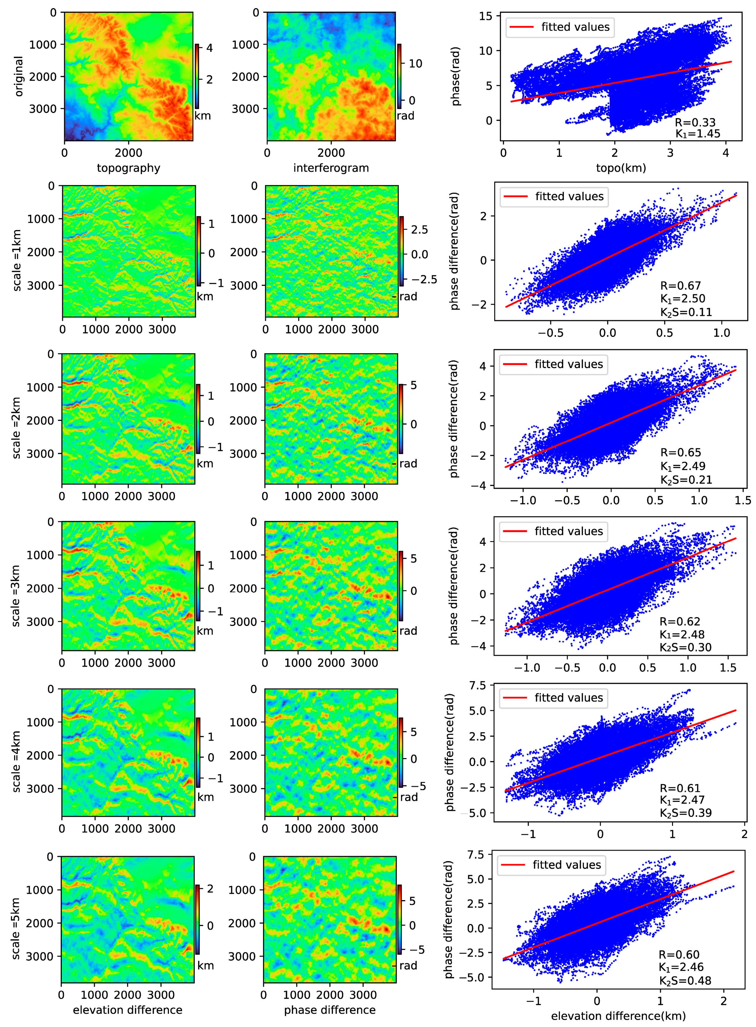
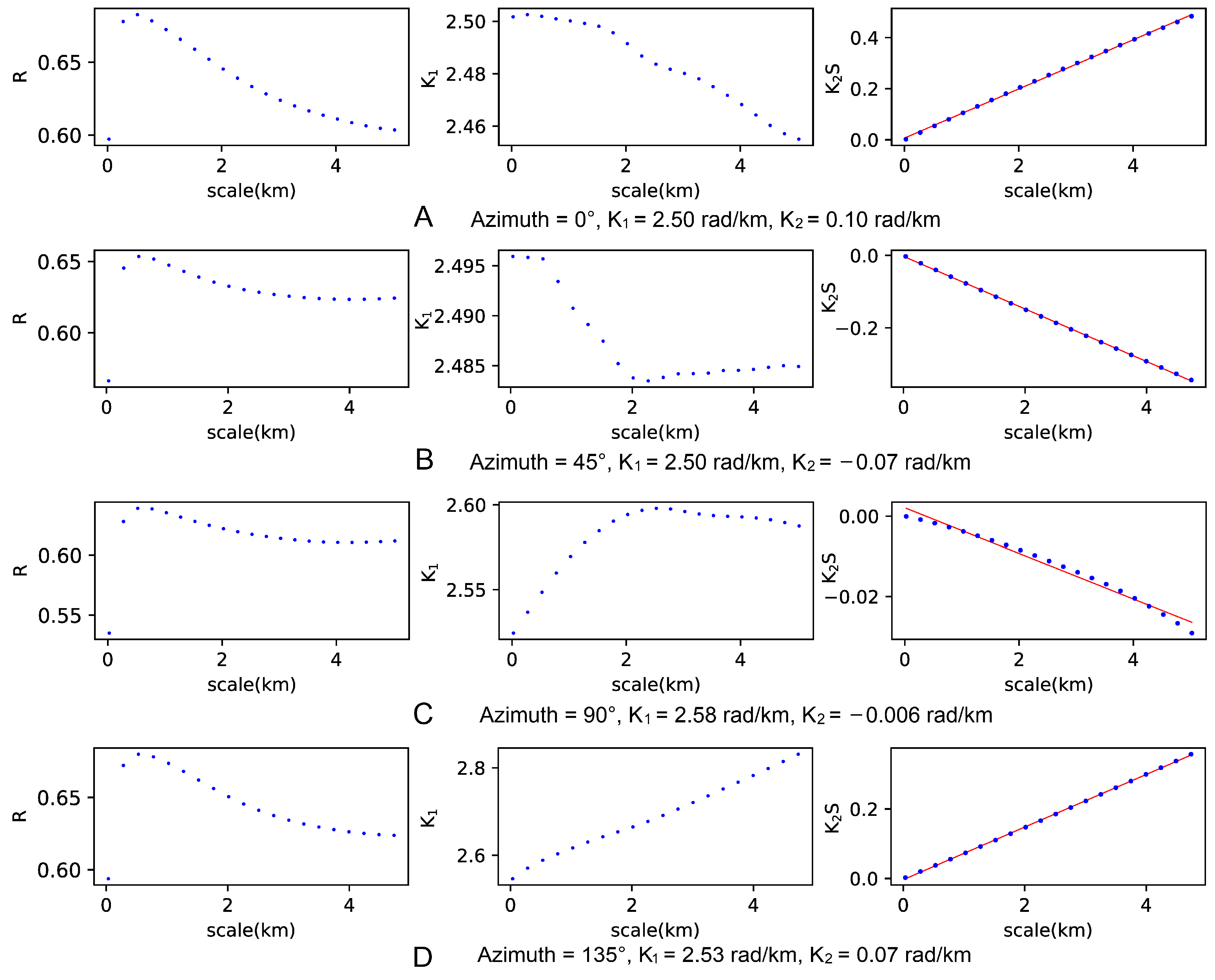
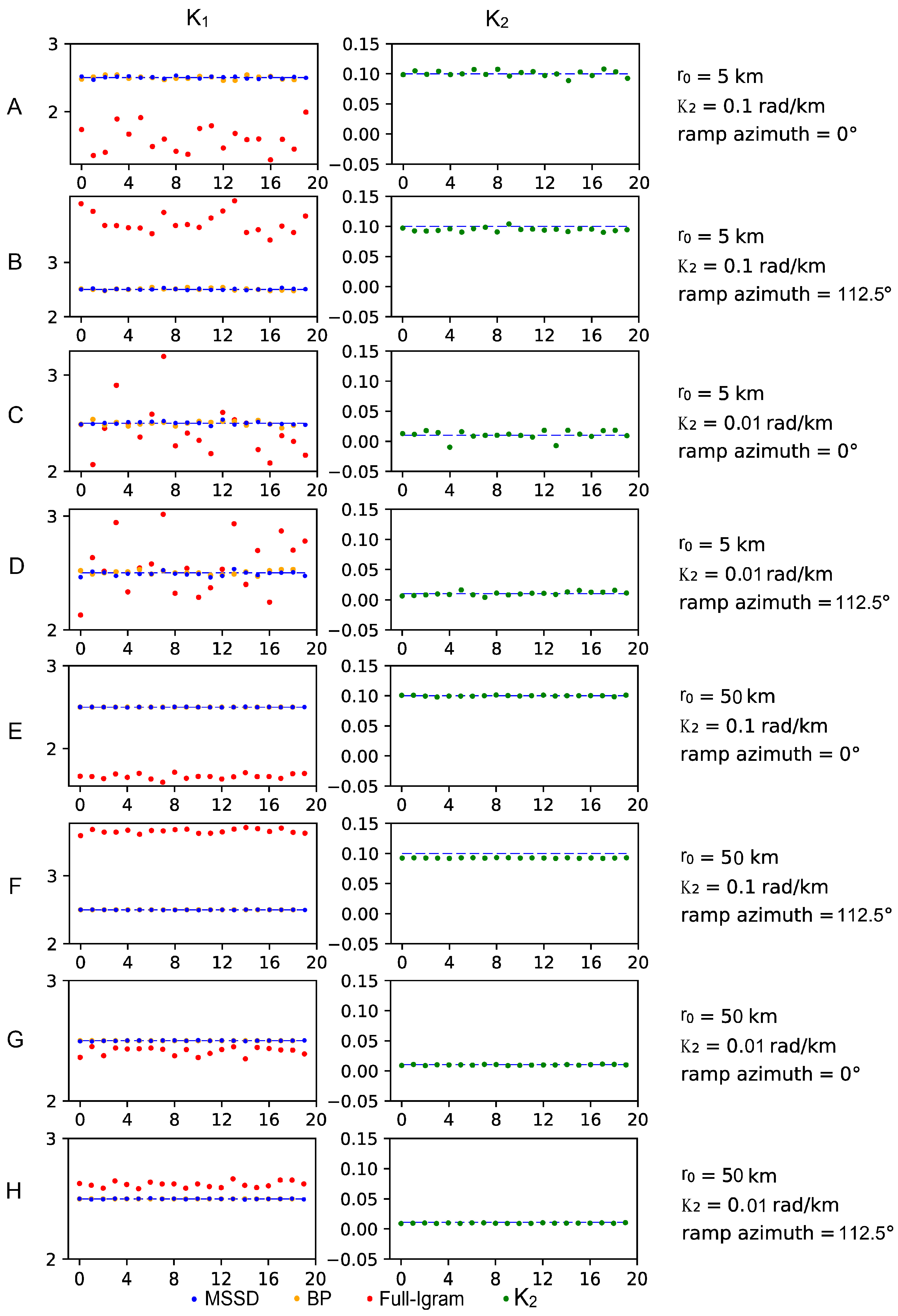
The Interferometric Synthetic Aperture Radar (InSAR) has been widely used as a powerful technique for monitoring land surface deformations over the last three decades. InSAR observations can be plagued by atmospheric phase delays; some have a roughly linear relationship with the ground elevation, which can be approximated using a linear model. However, the estimation results of this linear relationship are sometimes affected by phase ramps such as orbital errors, tidal loading, etc. In this study, we present a new approach to estimate the transfer function of vertical stratification phase delays and the transfer function of phase ramps. Our method uses the idea of multi-scale spatial differences to decompose the atmospheric phase delay into the vertical stratification component, phase ramp component, and other features. This decomposition makes the correlation between the vertical stratification phase delays and topography more significant and stable. This can establish the correlation between the different scales and phase ramps. We demonstrate our approach using a synthetic test and two real interferograms. In the synthetic test, the transfer functions estimated by our method were closer to the design values than those estimated by the full interferogram–topography correlation approach and the band-pass filtering approach. In the first real interferogram, out of the 9 sub-regions corrected by the proposed method, 7 sub-regions were outperformed the full interferogram–topography correlation approach, and 8 sub-regions were superior to the band-pass filtering method. Our technique offers a greater correction effect and robustness for coseismic deformation signals in the second real interferogram.
Keywords: InSAR; interferogram; troposphere delays; multi-scale spatial difference; Sierra Nevada mountains; Menyuan earthquake InSAR; interferogram; troposphere delays; multi-scale spatial difference; Sierra Nevada mountains; Menyuan earthquake