Article

Estimation of Coastal Wetland Soil Organic Carbon Content in Western Bohai Bay Using Remote Sensing, Climate, and Topographic Data


1
College of Mining Engineering, North China University of Science and Technology, Tangshan 063210, China
2
Tangshan Key Laboratory of Resources and Environmental Remote Sensing, Tangshan 063210, China
3
Hebei Industrial Technology Institute of Mine Ecological Remediation, Tangshan 063210, China
4
Collaborative Innovation Center of Green Development and Ecological Restoration of Mineral Resources, Tangshan 063210, China
5
College of Computer and Information Sciences, Fujian Agriculture and Forestry University, Fuzhou 350002, China
*
Author to whom correspondence should be addressed.
These authors contributed equally to this work.
Remote Sens. 2023, 15(17), 4241; https://doi.org/10.3390/rs15174241
Submission received: 18 August 2023 / Accepted: 26 August 2023 / Published: 29 August 2023
(This article belongs to the Special Issue Remote Sensing for Wetland Restoration)

Abstract

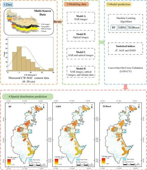
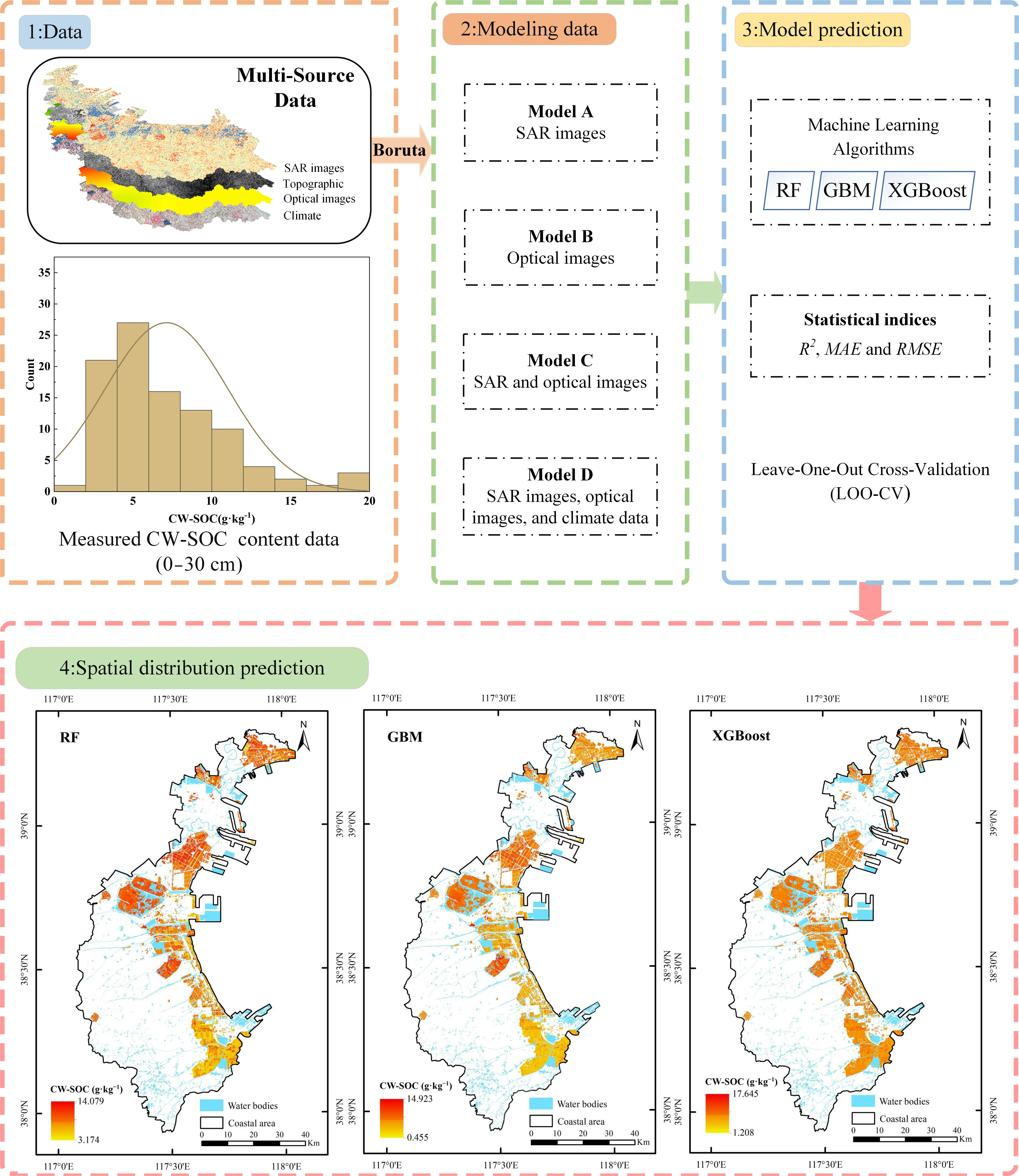
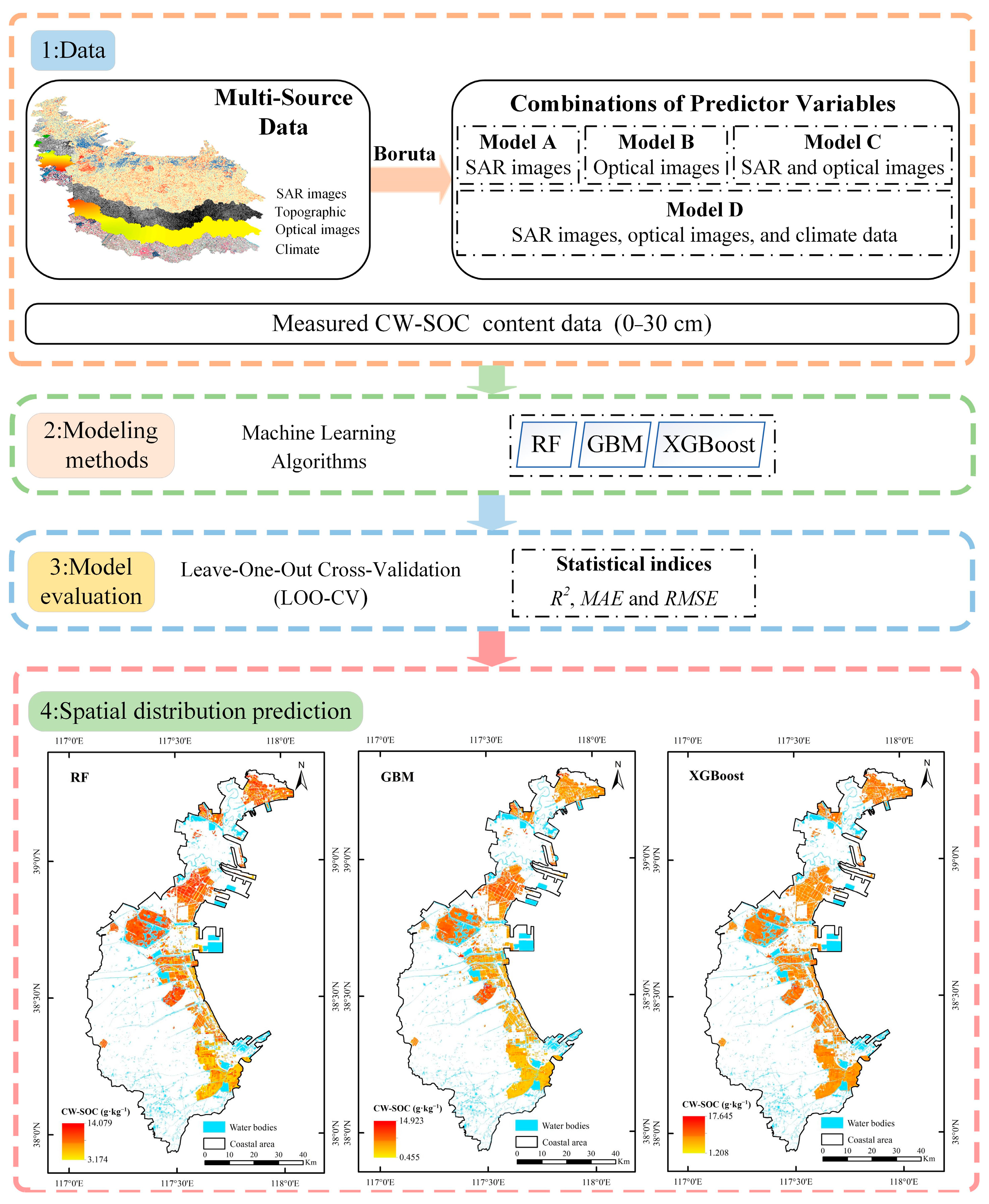
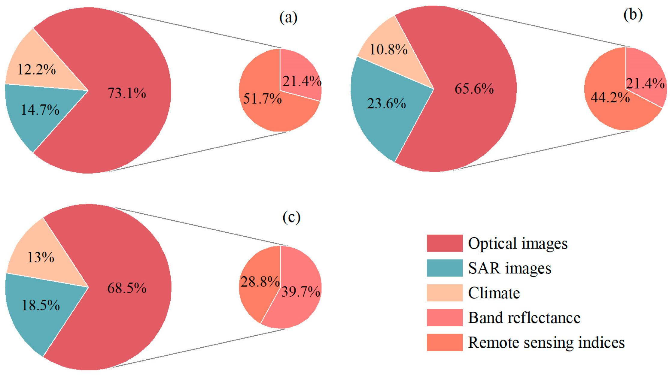
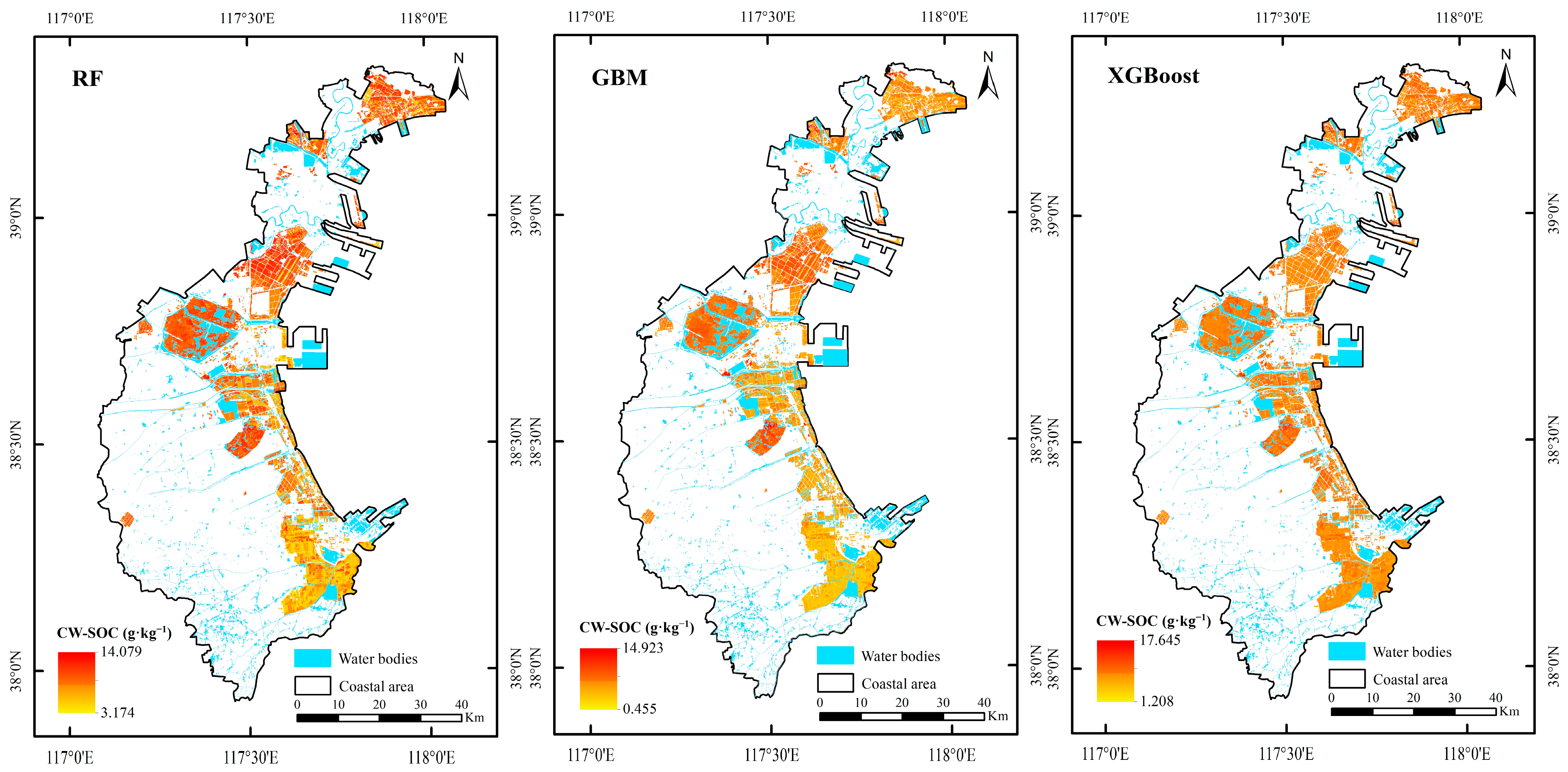
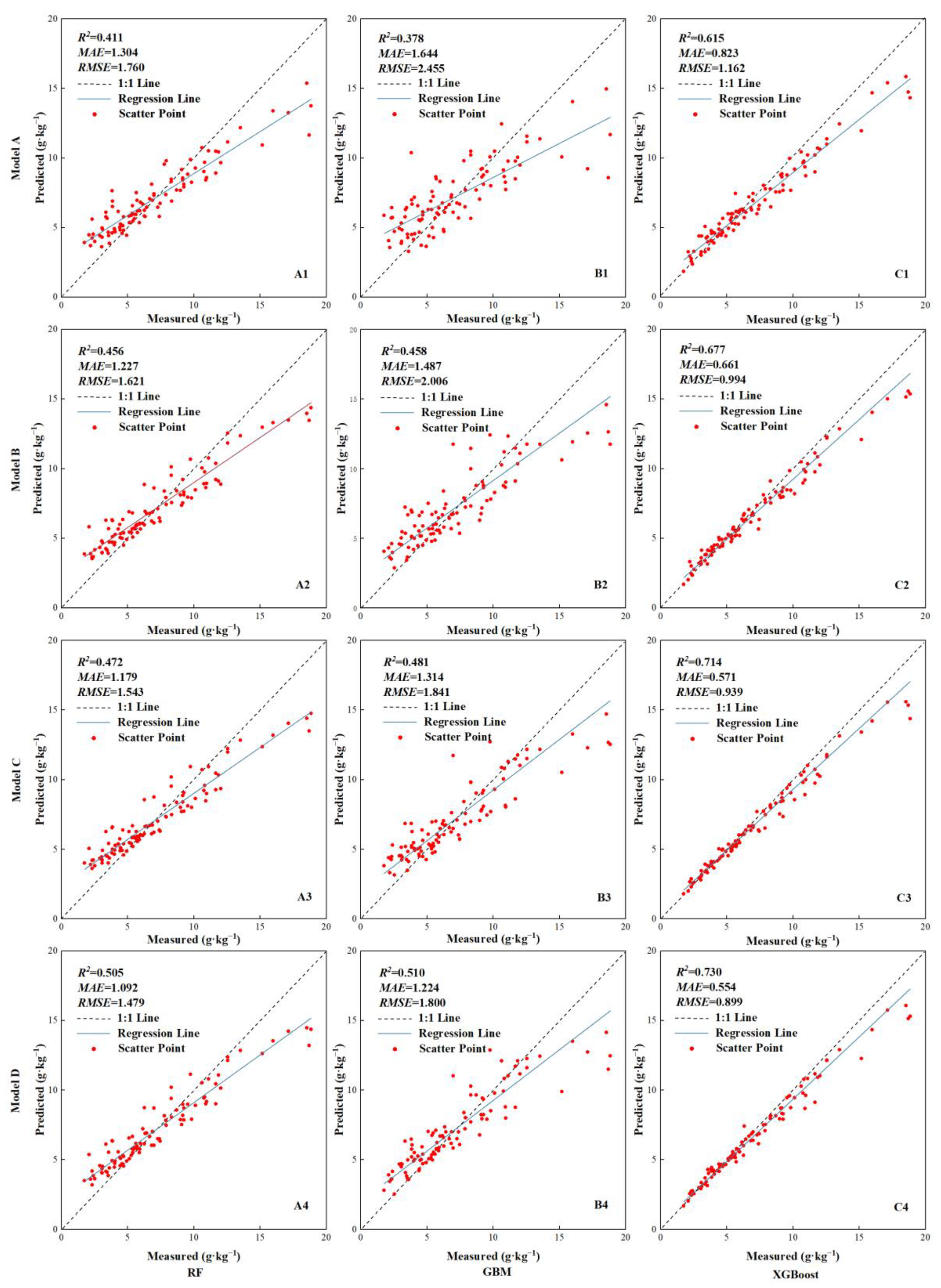
Coastal wetland soil organic carbon (CW-SOC) is crucial for wetland ecosystem conservation and carbon cycling. The accurate prediction of CW-SOC content is significant for soil carbon sequestration. This study, which employed three machine learning (ML) methods, including random forest (RF), gradient boosting machine (GBM), and extreme gradient boosting (XGBoost), aimed to estimate CW-SOC content using 98 soil samples, SAR images, optical images, and climate and topographic data. Three statistical metrics and leave-one-out cross-validation were used to evaluate model performance. Optimal models using different ML methods were applied to predict the spatial distribution of CW-SOC content. The results showed the following: (1) The models built using optical images had higher predictive accuracy than models built using synthetic aperture radar (SAR) images. The model that combined SAR images, optical images, and climate data demonstrated the highest prediction accuracy. Compared to the model using only optical images and SAR images, the prediction accuracy was improved by 0.063 and 0.115, respectively. (2) Regardless of the combination of predictive variables, the XGBoost method achieved higher prediction accuracy than the RF and GBM methods. (3) Optical images were the main explanatory variables for predicting CW-SOC content, explaining more than 65% of the variability. (4) The CW-SOC content predicted by the three ML methods showed similar spatial distribution characteristics. The central part of the study area had higher CW-SOC content, while the southern and northern regions had lower levels. This study accurately predicted the spatial distribution of CW-SOC content, providing data support for ecological environmental protection and carbon neutrality of coastal wetlands.
Keywords: random forest; gradient boosting machine; extreme gradient boosting; Sentinel-1A; Sentinel-2A; CW-SOC content inversion random forest; gradient boosting machine; extreme gradient boosting; Sentinel-1A; Sentinel-2A; CW-SOC content inversion
Graphical Abstract