Article

Analysis of Spatial and Temporal Changes in Vegetation Cover and Driving Forces in the Yan River Basin, Loess Plateau


1
College of Geography and Environmental Science, Henan University, Kaifeng 475004, China
2
Key Laboratory of Geospatial Technology for the Middle and Lower Yellow River Regions, Ministry of Education, Henan University, Kaifeng 475004, China
3
Henan Industrial Technology Academy of Spatio-Temporal Big Data, Henan University, Kaifeng 475004, China
4
Henan Technology Innovation Center of Spatial-Temporal Big Data, Henan University, Kaifeng 475004, China
*
Author to whom correspondence should be addressed.
Remote Sens. 2023, 15(17), 4240; https://doi.org/10.3390/rs15174240
Submission received: 26 July 2023 / Revised: 23 August 2023 / Accepted: 25 August 2023 / Published: 29 August 2023

Abstract

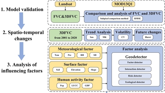

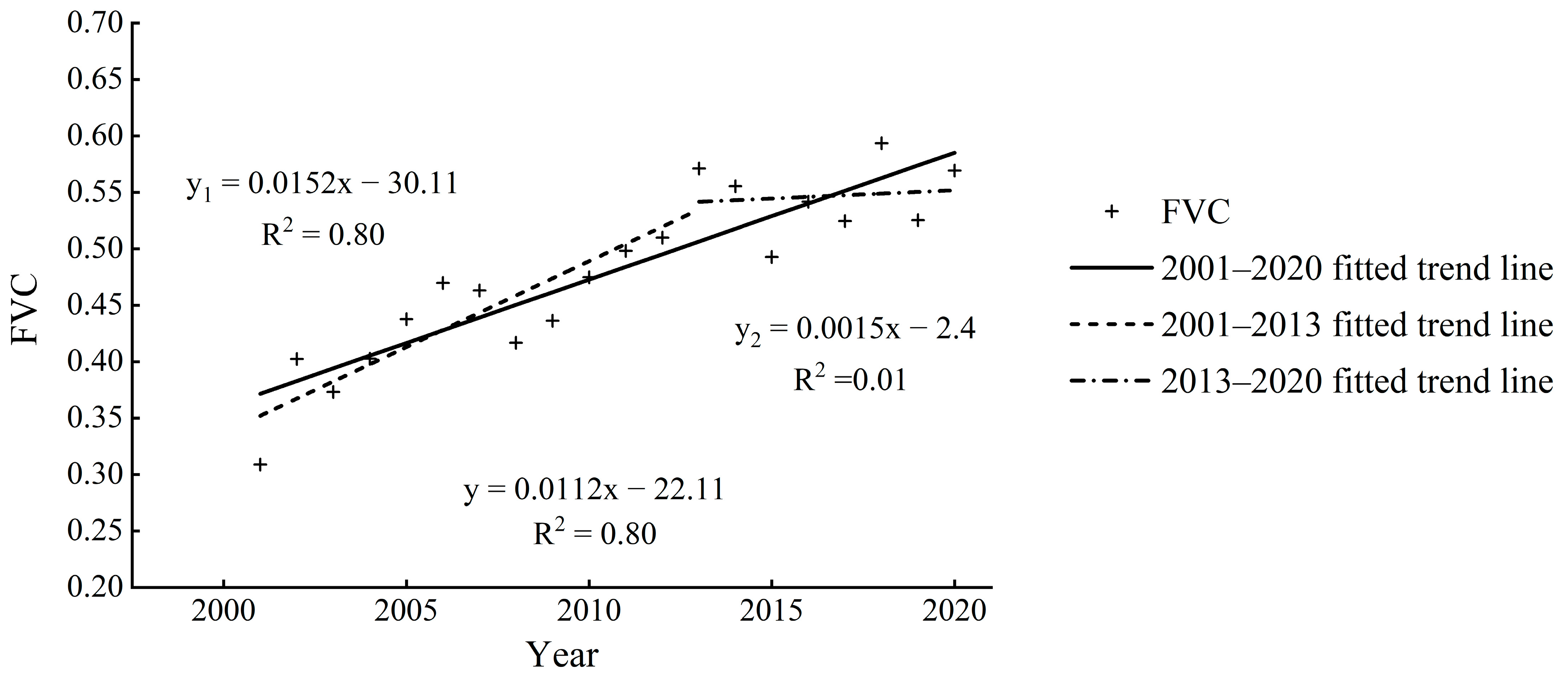
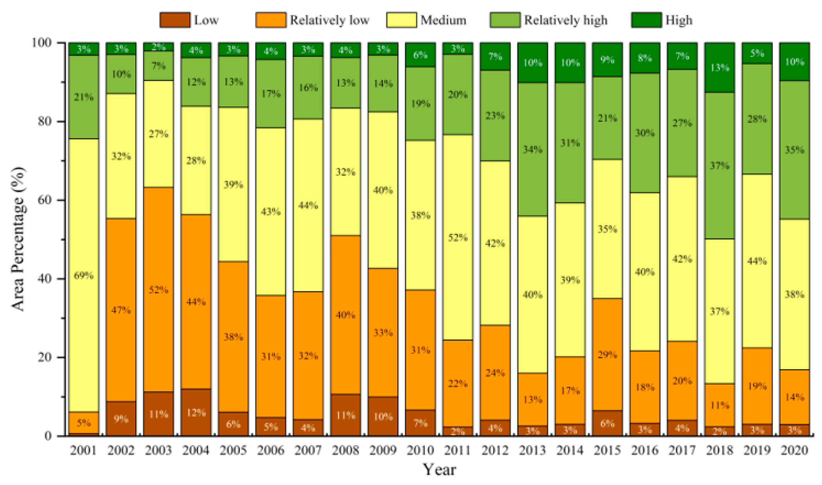
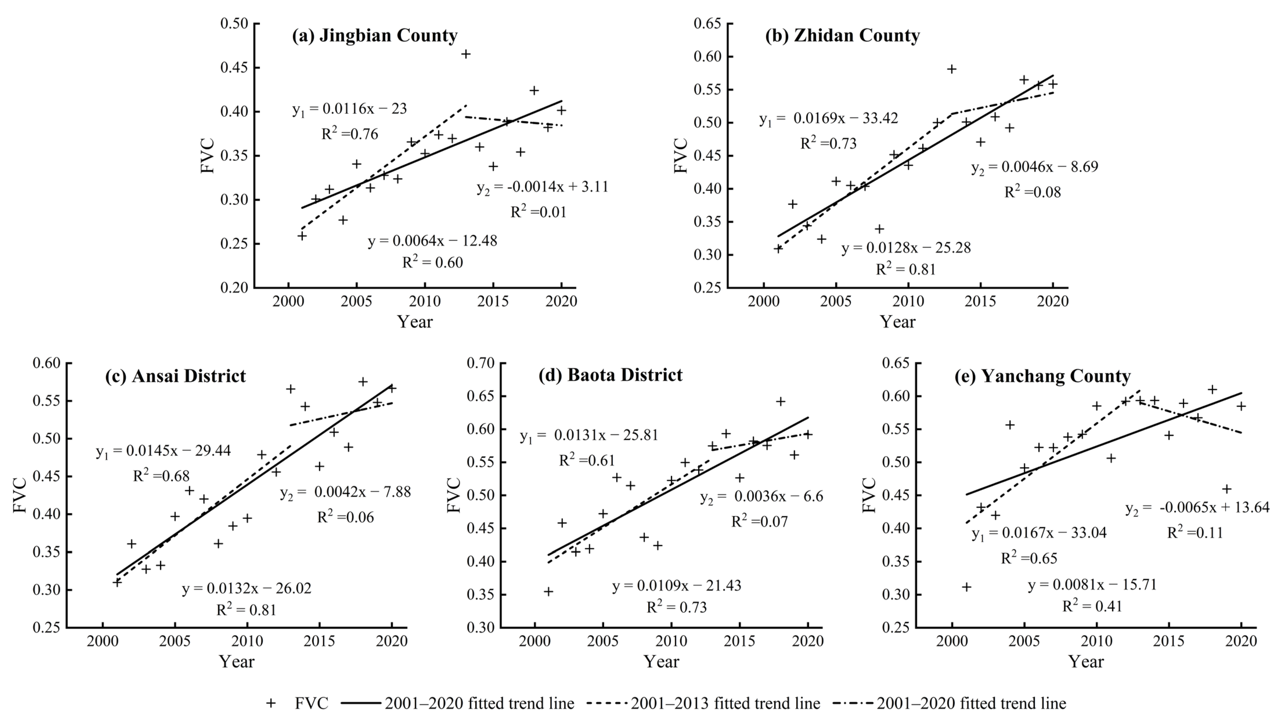
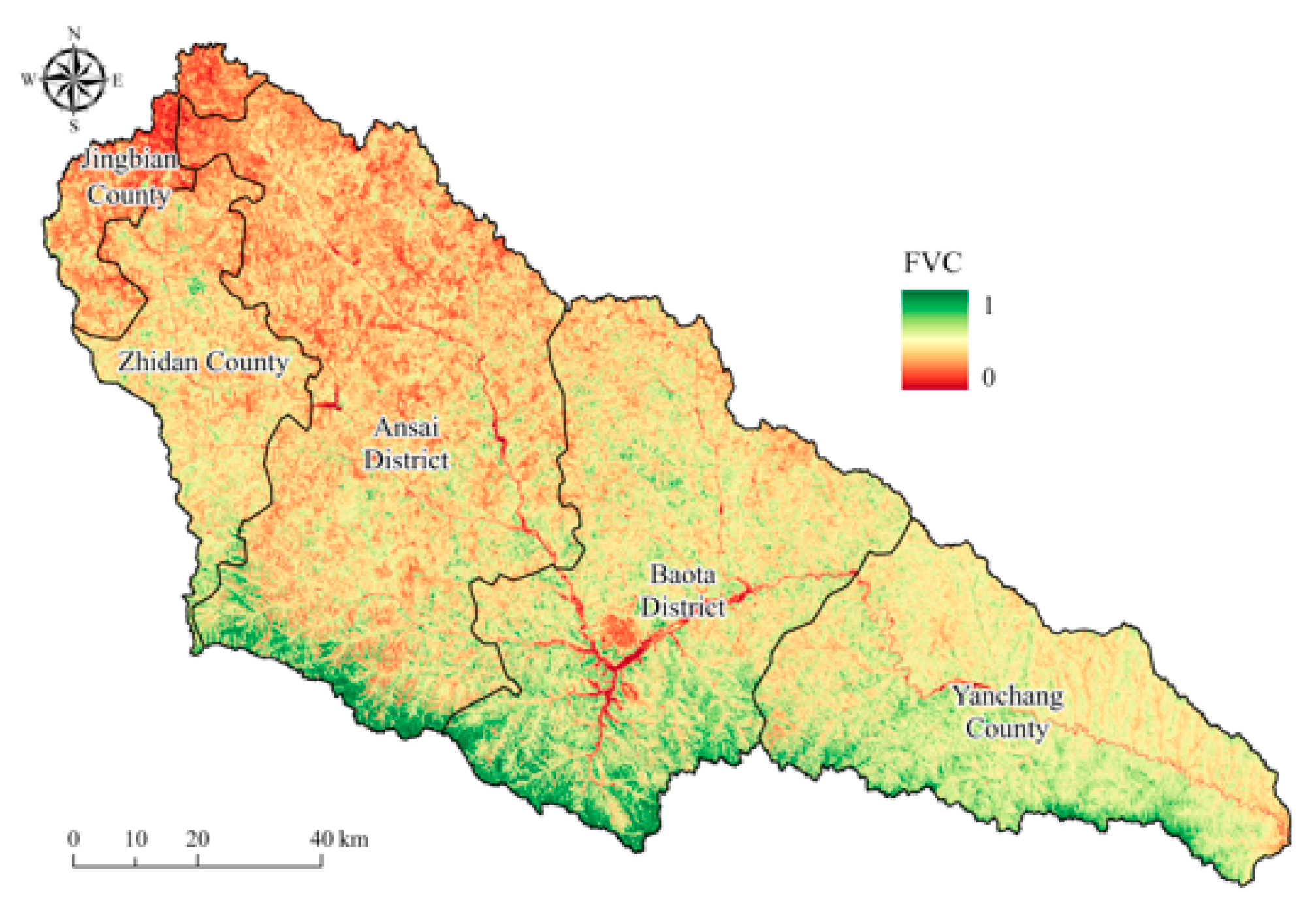
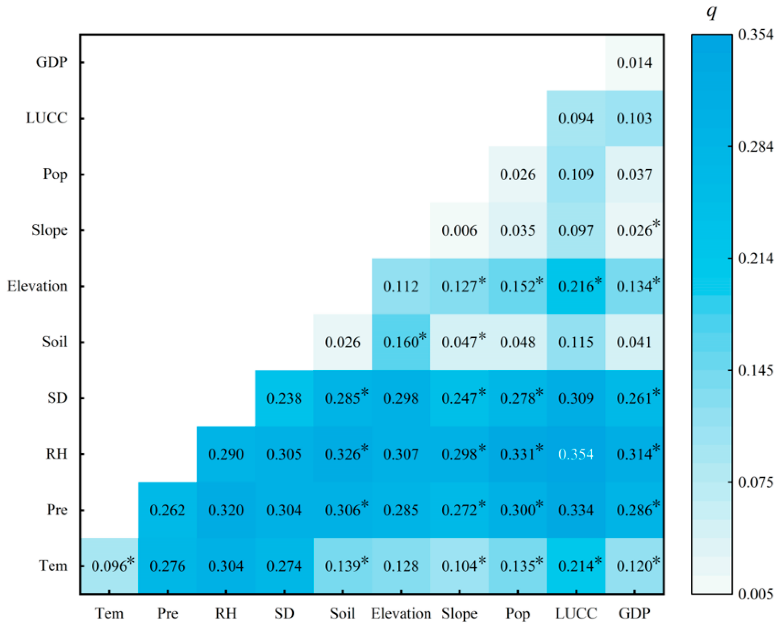
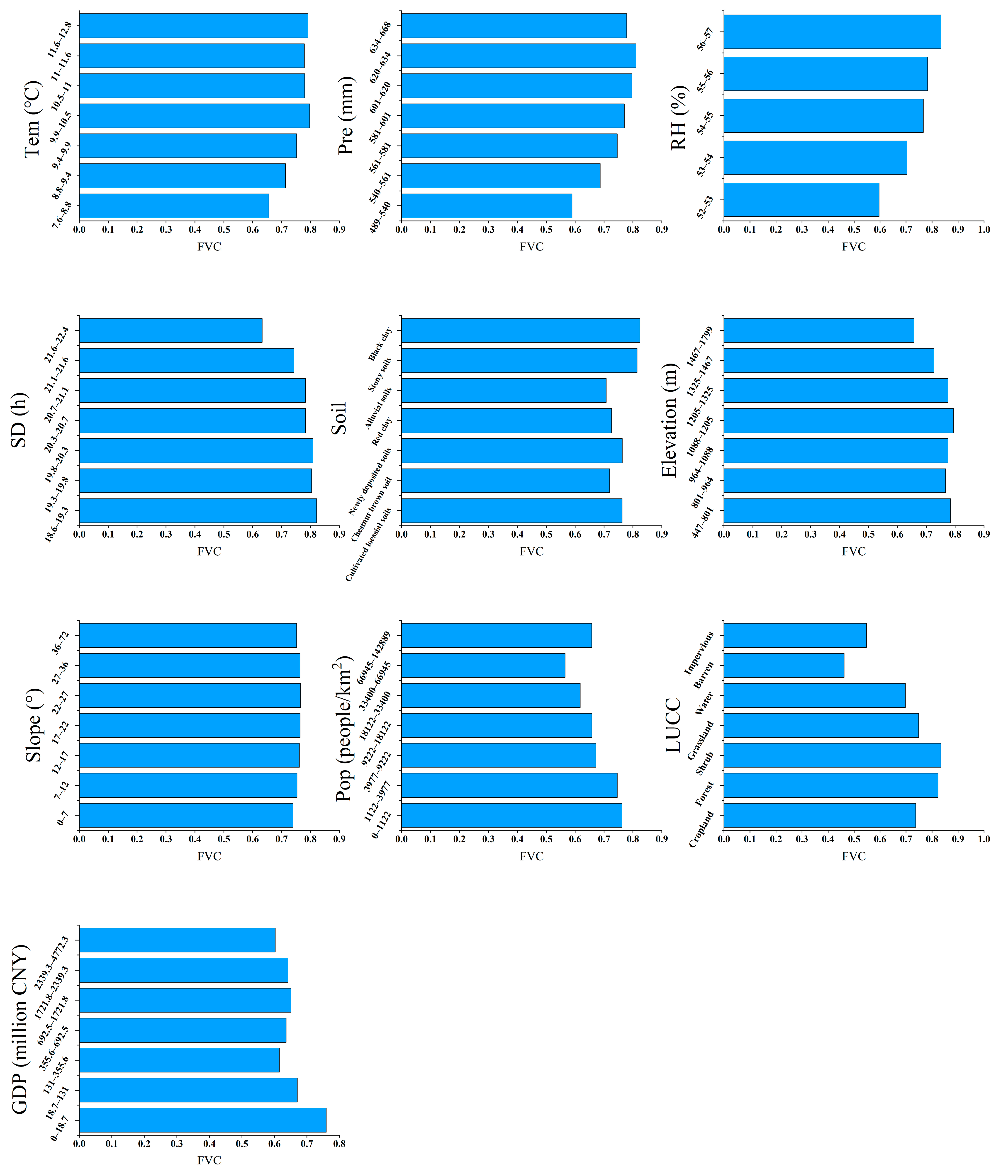
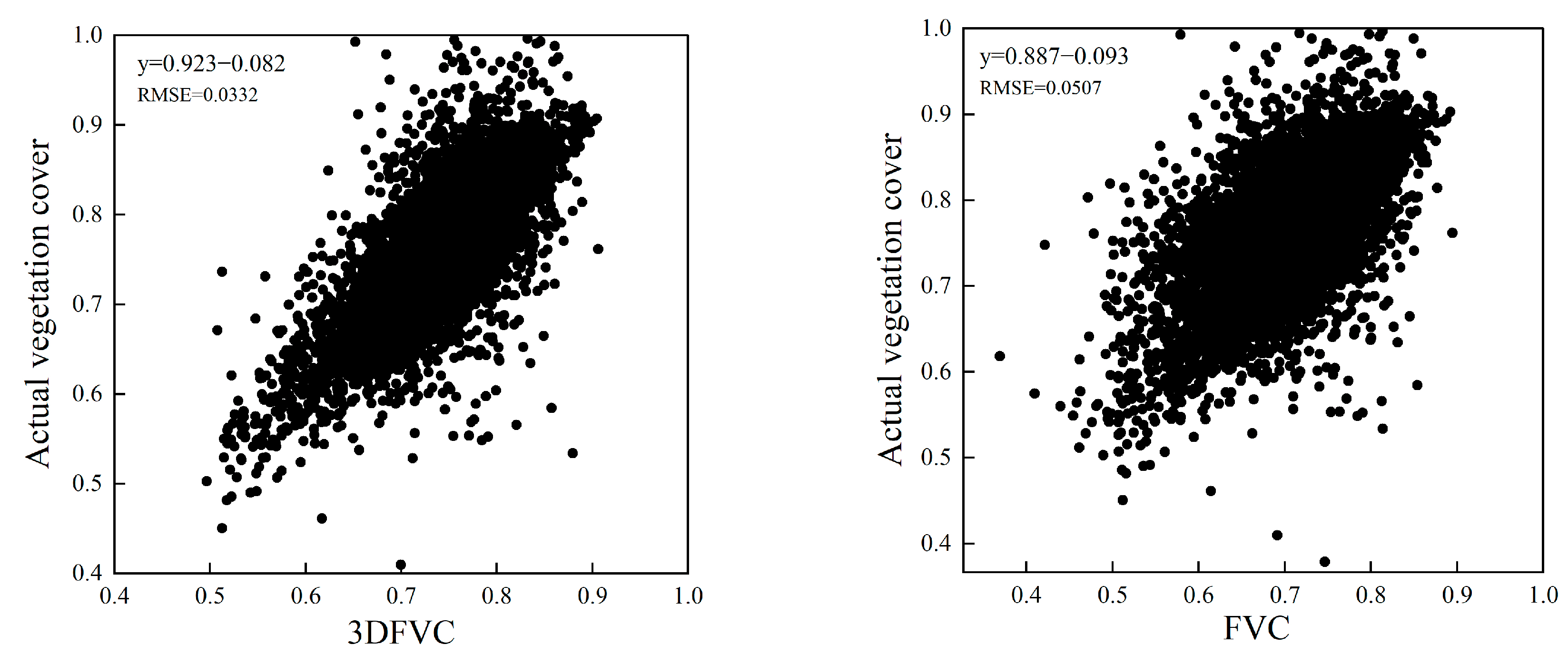
The Yan River Basin of the Loess Plateau is a key region for ensuring the environmental protection and sustainable development of the Yellow River Basin. Therefore, it is essential to identify how vegetation cover has changed and determine the factors that have driven these changes. In this study, we applied a three-dimensional vegetation cover model to examine the spatiotemporal variation characteristics of vegetation cover at the watershed scale in the Yan River Basin from 2001 to 2020 and forecast future trends. Subsequently, the driving forces of fractional vegetation cover (FVC) change were quantified based on meteorological, surface, and anthropogenic factors to explore the common driving relationships among these factors. (1) The accuracy of 3DFVC is better than that of FVC in the Yanhe River Basin, where the terrain is complex. (2) The temporal change trends indicated that the vegetation cover in the Yan River Basin significantly recovered and the basin FVC increased rapidly from 2001 to 2013 (S = 0.0152/a, p < 0.01) and increased gradually from 2013 to 2020 (S = 0.0015/a). The main reason for the increase in vegetation cover was the enhanced growth of medium FVC. (3) The vegetation spatial distribution showed that the FVC values varied substantially from north to south, indicating spatial heterogeneity, and 83.9% of the area presented a trend of increasing vegetation. Furthermore, vegetation cover was predicted to improve in the future. (4) The spatial heterogeneity of FVC was mainly influenced by relative humidity and rainfall, and the spatial variations in FVC were mainly determined by climate factors. Land use and cover change variations, which are influenced by human activities, represent major factors underlying the observed spatial heterogeneity. Most interactions between driving factors showed two-way enhancement or non-linear enhancement, with relative humidity and land use patterns presenting the strongest explanatory power. This study provides a scientific basis for vegetation conservation in the Yan River Basin and contributes theoretical support for decision-making regarding ecological environmental protection in the Loess Plateau and sustainable development in the Yellow River Basin.
Keywords: 3DFVC; spatiotemporal analysis; human activities; Geodetector; GEE; Yan River Basin 3DFVC; spatiotemporal analysis; human activities; Geodetector; GEE; Yan River Basin
Graphical Abstract