

4D (Multi-Temporal) Remote Sensing: Opportunities, Challenges and Issues for Environmental Monitoring over Time
A special issue of Remote Sensing (ISSN 2072-4292). This special issue belongs to the section "Environmental Remote Sensing".
Deadline for manuscript submissions: closed (15 July 2025) | Viewed by 9300
Special Issue Editors

Interests: SfM; LiDAR; UAS; digital terrain analysis; geomorphometry; hydrology; sediment dynamics

Interests: image orientation; LiDAR; mobile mapping systems; semantic segmentation of point clouds

Interests: high resolution topography; geomorphic change detection; remote sensing; historical-SfM; sediment transport

Interests: SfM photogrammetry; UAS; soil spectroscopy; remote sensing

Interests: geomorphometry; geomorphic change detection; high-resolution topography; landslides; gullies; fluvial geomorphology
Special Issues, Collections and Topics in MDPI journals
Special Issue Information
Dear Colleagues,
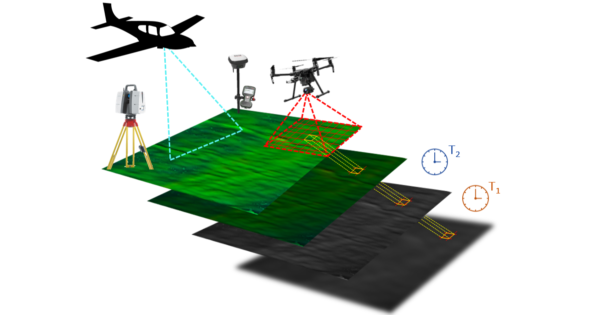
In recent decades, multitemporal high-resolution topography (HRT; e.g., photogrammetry, LiDAR, GNSS) data sets are becoming increasingly available, improving our ability and opportunities to monitor landscape evolution at different scales and times. Indeed, some HRT techniques allow performing multitemporal (4D) surveys with adequate frequency to detect changes at an appropriately temporal scale at which surface processes operate. However, in order to obtain comparable results over time, it is necessary to implement methodologies and workflows that consider the issues associated with 4D surveys (e.g., the assessment of accuracy and uncertainties and the use of appropriate georeferencing and co-registration approaches). Moreover, topographic surveying platforms, georeferencing systems, and processing tools have seen important developments in the last two decades; therefore, HRT data acquired at different epochs may be characterized by different accuracy and precision over time. As a consequence, old “legacy” data sets and recent surveys can often show comparison problems, especially when multitemporal data are not homogeneous in terms of quality and uncertainties.
This Special Issue invites studies involving 4D surveys or datasets, focusing on in-depth assessment and comparison of current solutions or developing new methodologies for comparing multitemporal data acquired at different scales in various environmental contexts (e.g., steep slopes, agricultural, glacial) and possibly with diverse techniques. Topics may cover any type of technology, from historical data (e.g., historical images) to novel HRT techniques (e.g., UAS-LiDAR). Hence, multisource data integration (e.g., multispectral, hyperspectral, and thermal), multiscale approaches or studies focused on data fusion and comparison of HRT techniques are welcome. Articles may address but are not limited to the following monitoring applications:
- Geomorphological changes;
- Soil erosion process;
- Land use changes;
- Agricultural and crop dynamics;
- Forest changes;
- Glacial and periglacial dynamics.
Dr. Sara Cucchiaro
Dr. Eleonora Maset
Dr. Manel Llena
Dr. He Zhang
Dr. Mihai Niculita
Guest Editors
Manuscript Submission Information
Manuscripts should be submitted online at www.mdpi.com by registering and logging in to this website. Once you are registered, click here to go to the submission form. Manuscripts can be submitted until the deadline. All submissions that pass pre-check are peer-reviewed. Accepted papers will be published continuously in the journal (as soon as accepted) and will be listed together on the special issue website. Research articles, review articles as well as short communications are invited. For planned papers, a title and short abstract (about 250 words) can be sent to the Editorial Office for assessment.
Submitted manuscripts should not have been published previously, nor be under consideration for publication elsewhere (except conference proceedings papers). All manuscripts are thoroughly refereed through a single-blind peer-review process. A guide for authors and other relevant information for submission of manuscripts is available on the Instructions for Authors page. Remote Sensing is an international peer-reviewed open access semimonthly journal published by MDPI.
Please visit the Instructions for Authors page before submitting a manuscript. The Article Processing Charge (APC) for publication in this open access journal is 2700 CHF (Swiss Francs). Submitted papers should be well formatted and use good English. Authors may use MDPI's English editing service prior to publication or during author revisions.
Keywords
- high-resolution topography
- co-registration
- structure from motion
- LiDAR
- UAS
- PPK and RTK-GNSS surveys
- data fusion
- geomorphic change detection
- historical-structure from motion photogrammetry
Benefits of Publishing in a Special Issue
- Ease of navigation: Grouping papers by topic helps scholars navigate broad scope journals more efficiently.
- Greater discoverability: Special Issues support the reach and impact of scientific research. Articles in Special Issues are more discoverable and cited more frequently.
- Expansion of research network: Special Issues facilitate connections among authors, fostering scientific collaborations.
- External promotion: Articles in Special Issues are often promoted through the journal's social media, increasing their visibility.
- Reprint: MDPI Books provides the opportunity to republish successful Special Issues in book format, both online and in print.
Further information on MDPI's Special Issue policies can be found here.