Article

Analyses of MODIS Land Cover/Use and Wildfires in Italian Regions Since 2001

by
Ebrahim Ghaderpour
1,2,*,
Francesca Bozzano
1,2,
Gabriele Scarascia Mugnozza
1,2 and
Paolo Mazzanti
1,2
1
Department of Earth Sciences & CERI Research Centre, Sapienza University of Rome, P.le Aldo Moro, 5, 00185 Rome, Italy
2
NHAZCA s.r.l., Via Vittorio Bachelet, 12, 00185 Rome, Italy
*
Author to whom correspondence should be addressed.
Land 2025, 14(7), 1443; https://doi.org/10.3390/land14071443
Submission received: 18 June 2025 / Revised: 3 July 2025 / Accepted: 8 July 2025 / Published: 10 July 2025
(This article belongs to the Special Issue Integration of Remote Sensing and GIS for Land Use Change Assessment)

Abstract

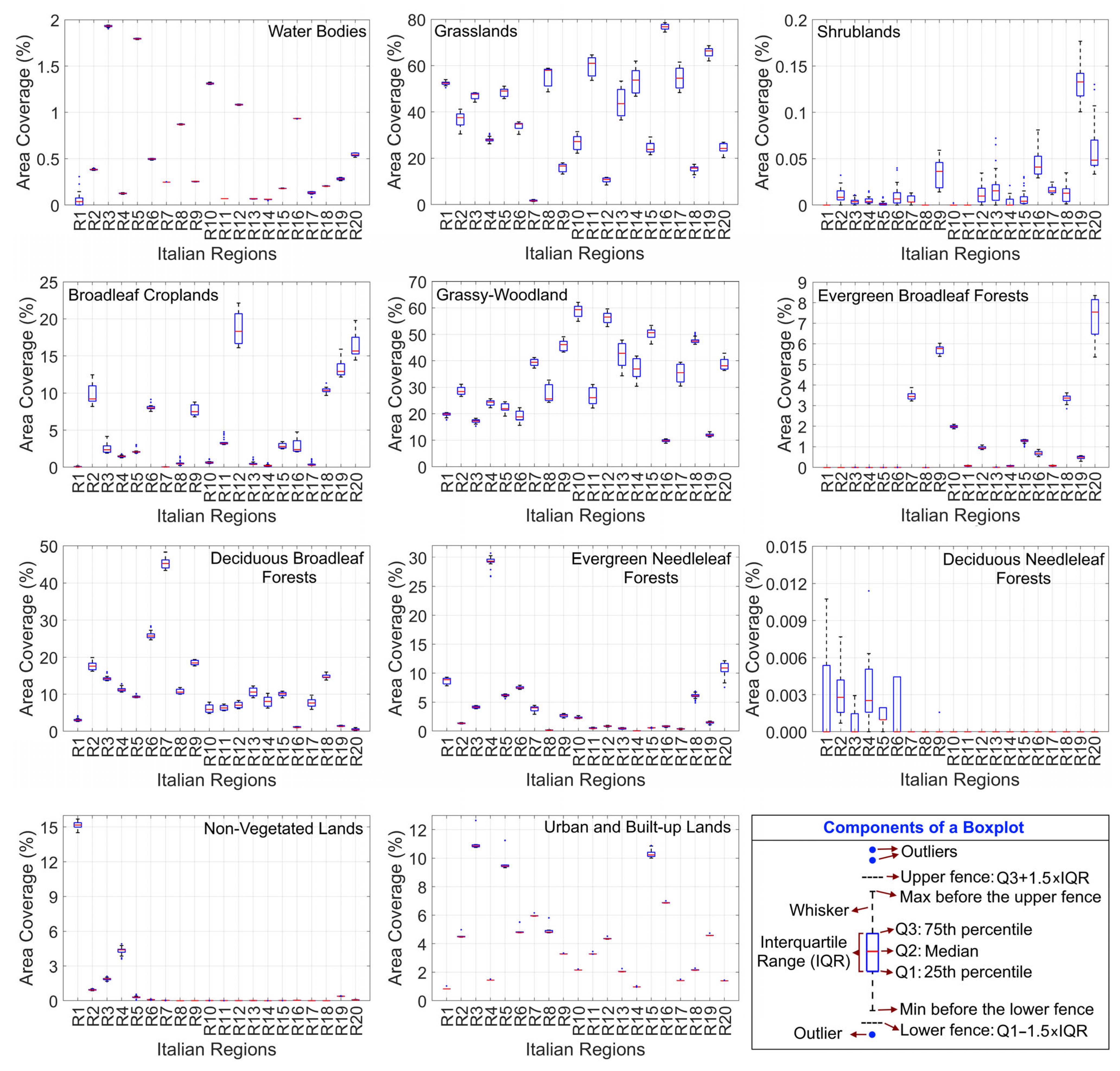
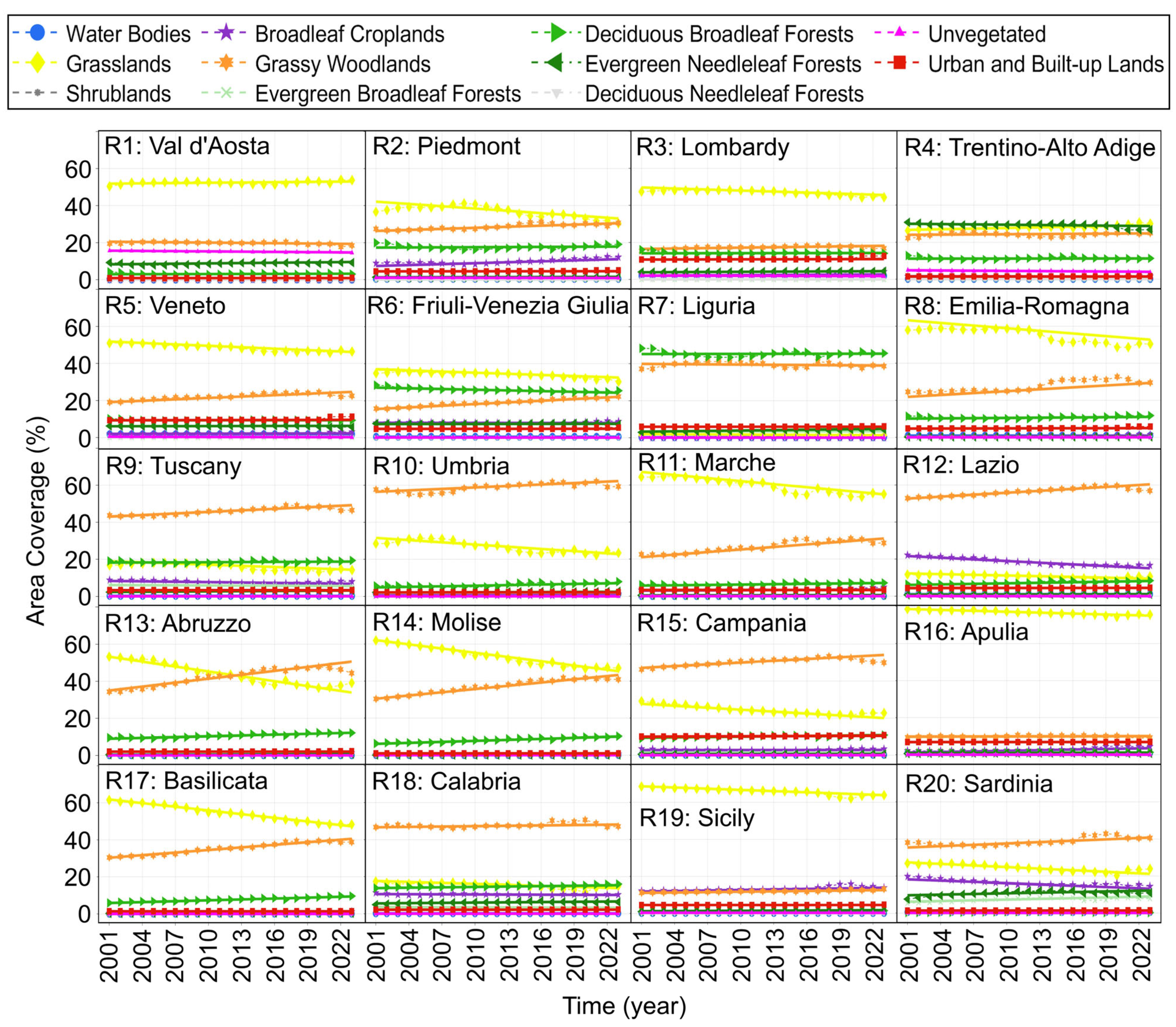
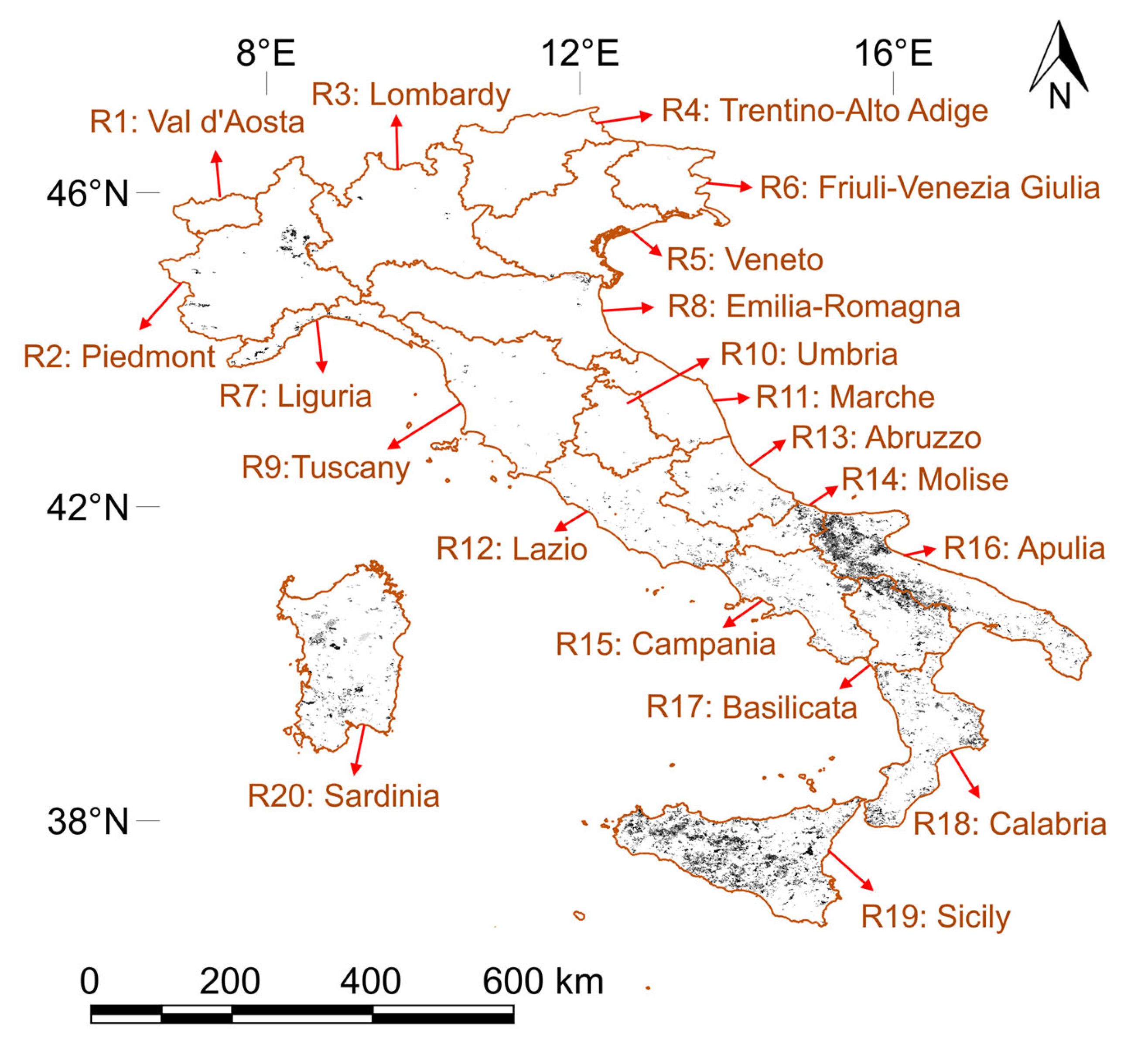
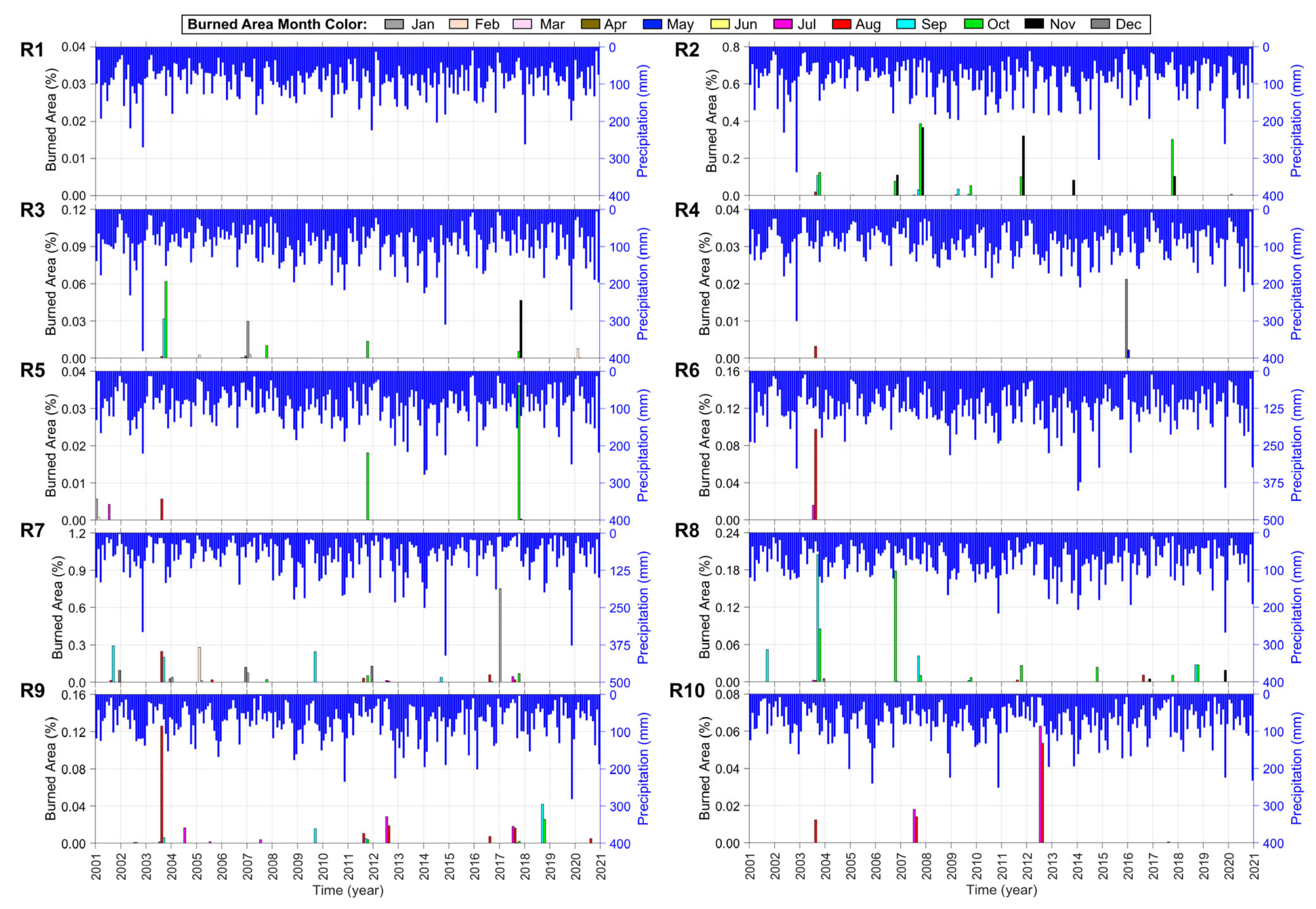
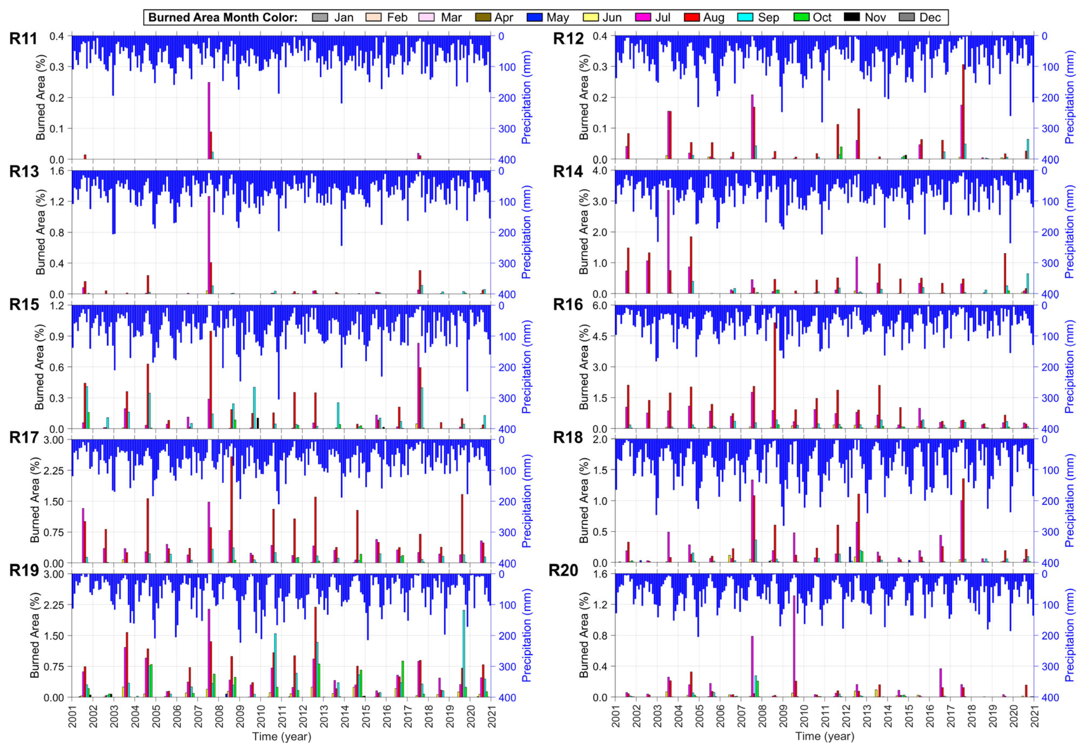
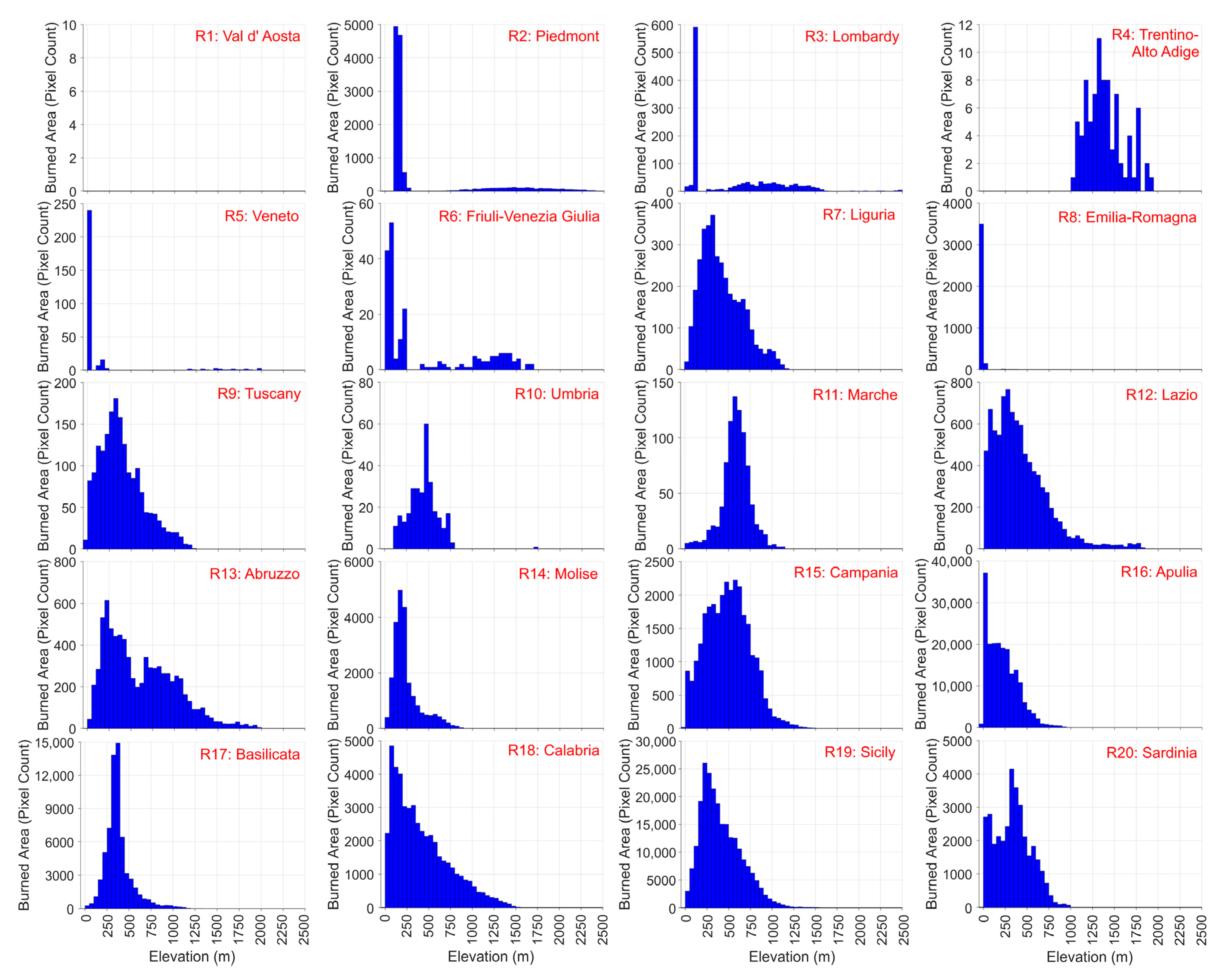
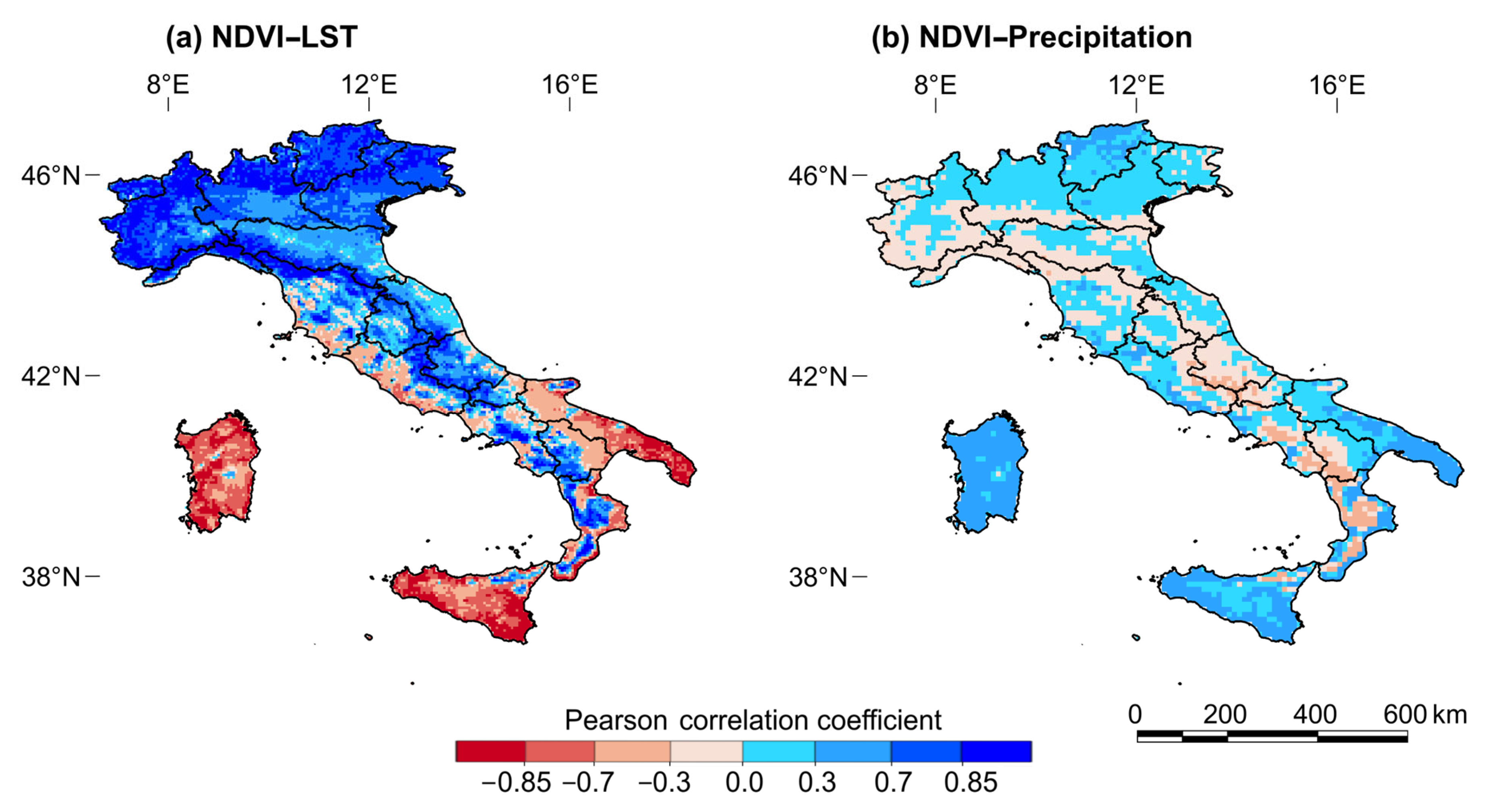
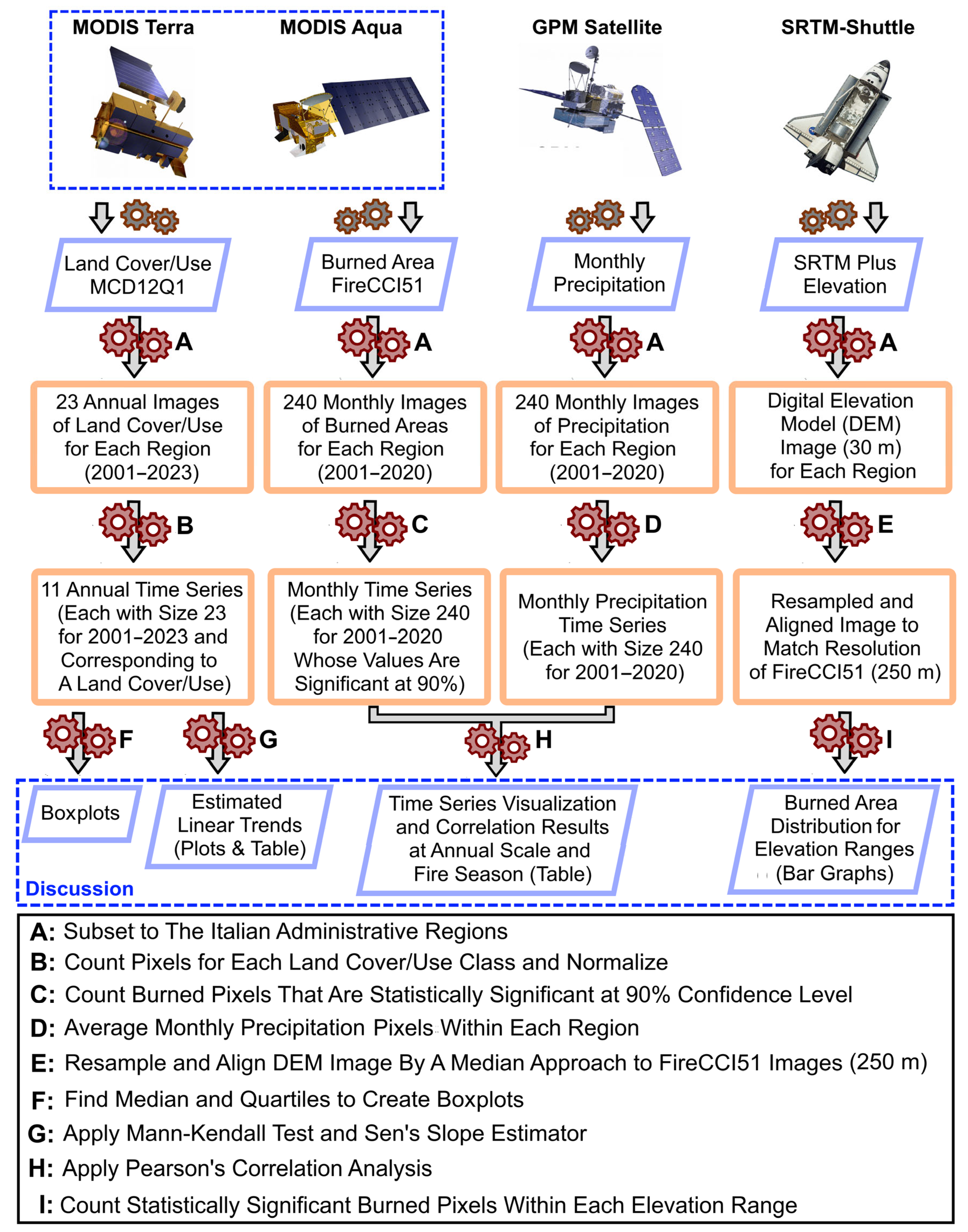
Monitoring land cover/use dynamics and wildfire occurrences is very important for land management planning and risk mitigation practices. In this research, moderate-resolution imaging spectroradiometer (MODIS) annual land cover images for the period 2001–2023 are utilized for the twenty administrative regions of Italy. Monthly MODIS burned area images are utilized for the period 2001–2020 to study wildfire occurrences across these regions. In addition, monthly Global Precipitation Measurement images for the period 2001–2020 are employed to estimate correlations between precipitation and burned areas annually and seasonally. Boxplots are produced to show the distributions of each land cover/use type within the regions. The non-parametric Mann–Kendall trend test and Sen’s slope are applied to estimate a linear trend, with statistical significance being evaluated for each land cover/use time series of size 23. Pearson’s correlation method is applied for correlation analysis. It is found that grasslands and woodlands have been declining and increasing in most regions, respectively, most significantly in Abruzzo (−0.88%/year for grasslands and 0.71%/year for grassy woodlands). The most significant and frequent wildfires have been observed in southern Italy, particularly in Basilicata, Apulia, and Sicily, mainly in grasslands. The years 2007 and 2017 experienced severe wildfires in the southern regions, mainly during July and August, due to very hot and dry conditions. Negative Pearson’s correlations are estimated between precipitation and burnt areas, with the most significant one being for Basilicata during the fire season (r = −0.43). Most of the burned areas were mainly within the elevation range of 0–500 m and the lowlands of Apulia. In addition, for the 2001–2020 period, a high positive correlation (r > 0.7) is observed between vegetation and land surface temperature, while significant negative correlations between these variables are observed for Apulia (r ≈ −0.59), Sicily (r ≈ −0.69), and Sardinia (r ≈ −0.74), and positive correlations (r > 0.25) are observed between vegetation and precipitation in these three regions. This study’s findings can guide land managers and policymakers in developing or maintaining a sustainable environment.
Keywords: burned area; forest; Italy; land surface temperature; precipitation; time series; trend analysis; vegetation burned area; forest; Italy; land surface temperature; precipitation; time series; trend analysis; vegetation