Article

Decadal and Heterogeneous Deformation of Breakwater Dams and Reclaimed Lands in Xuwei Port Revealed by Radar Interferometry Measurements


1
School of Geosciences and Info-Physics, Central South University, Changsha 410083, China
2
Hunan Research Institute of Water Resources and Hydropower, Changsha 410007, China
3
Hunan Engineering Research Center for Dam Safety and Disease Prevention & Control, Changsha 410007, China
4
Department of Land Surveying and Geo-Informatics, The Hong Kong Polytechnic University, Hong Kong, China
5
Geomatics Engineering Lab., Public Works Department, Faculty of Engineering, Cairo University, Al Giza 12613, Egypt
*
Author to whom correspondence should be addressed.
Remote Sens. 2025, 17(16), 2778; https://doi.org/10.3390/rs17162778
Submission received: 17 July 2025 / Revised: 8 August 2025 / Accepted: 8 August 2025 / Published: 11 August 2025
(This article belongs to the Special Issue Advances in Surface Deformation Monitoring Using SAR Interferometry)

Abstract

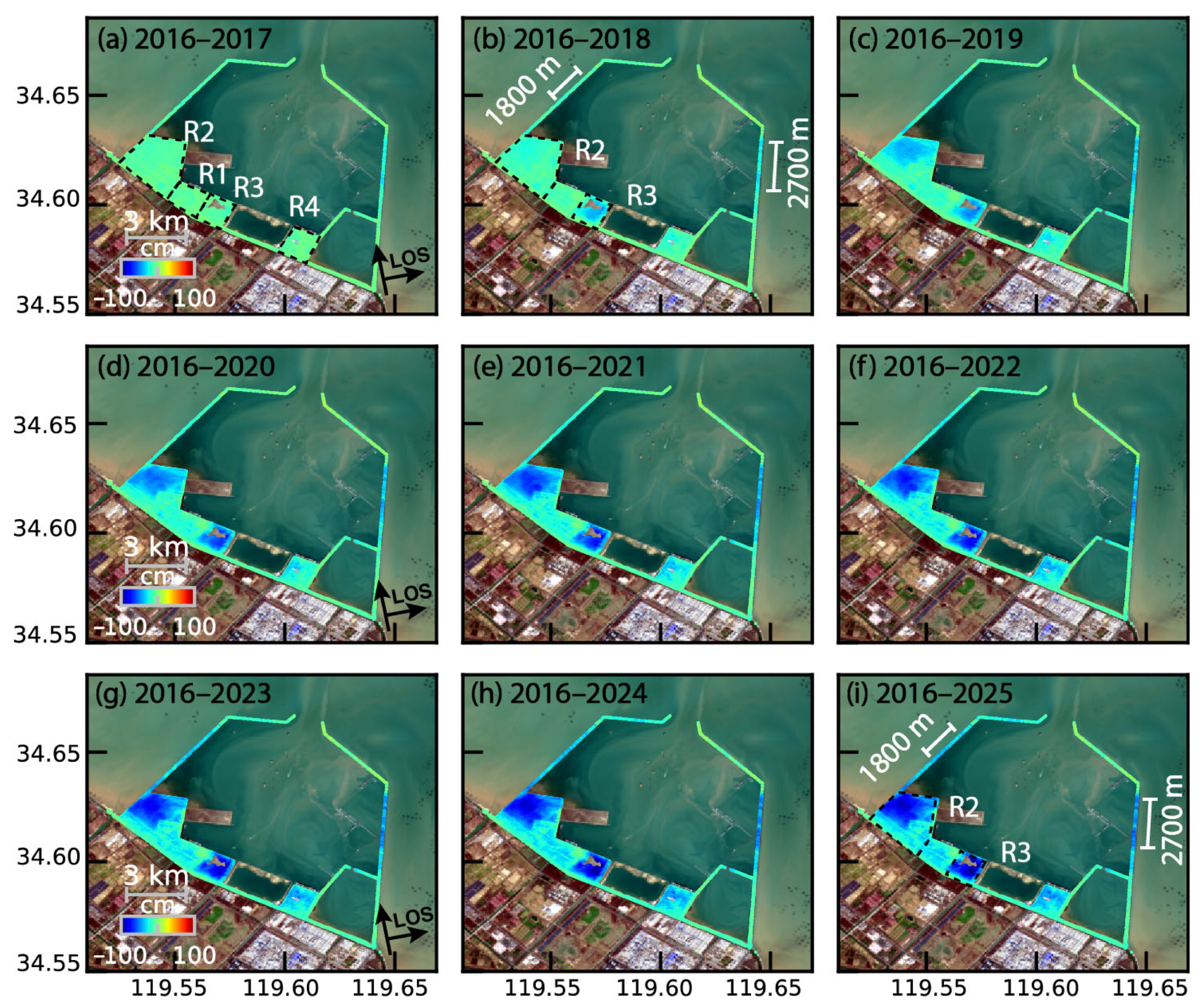
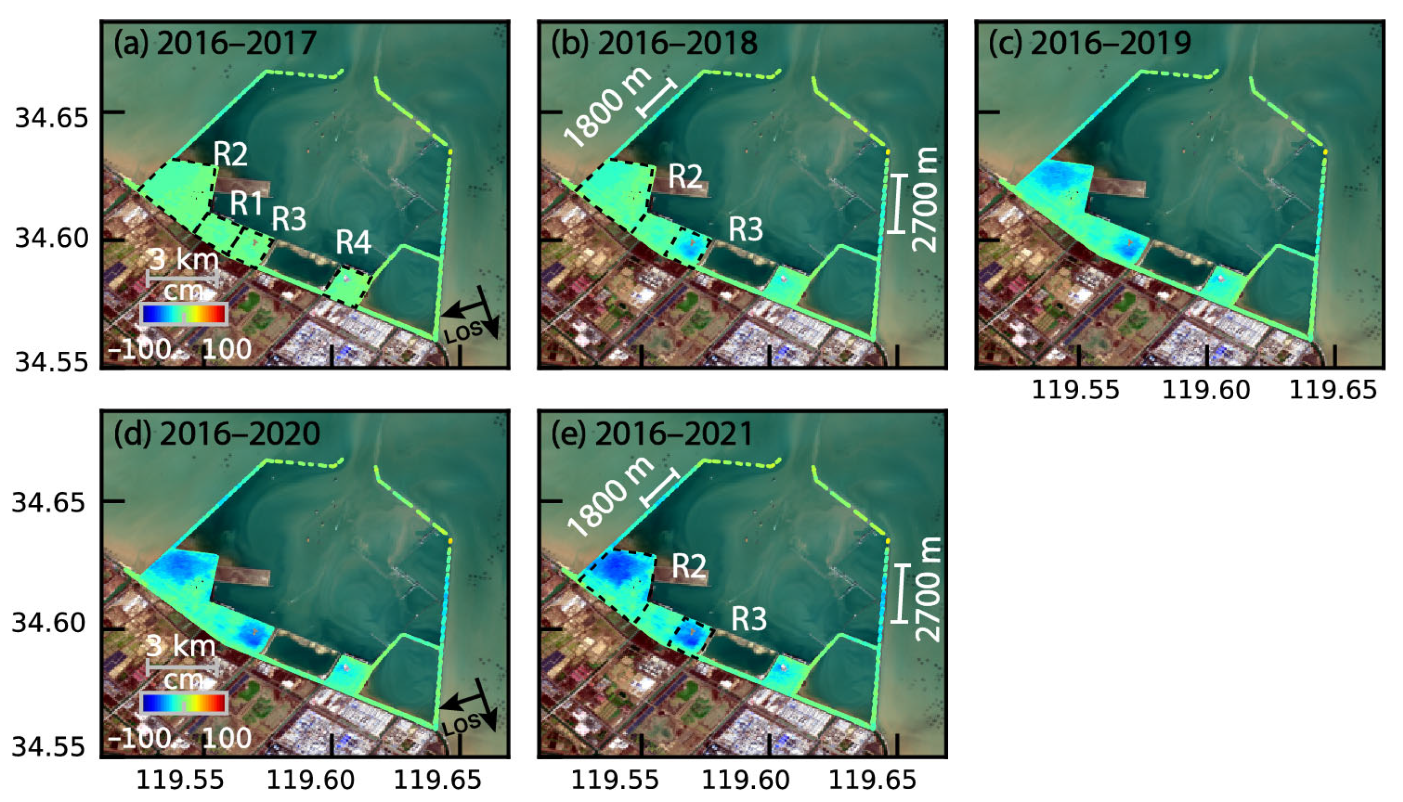
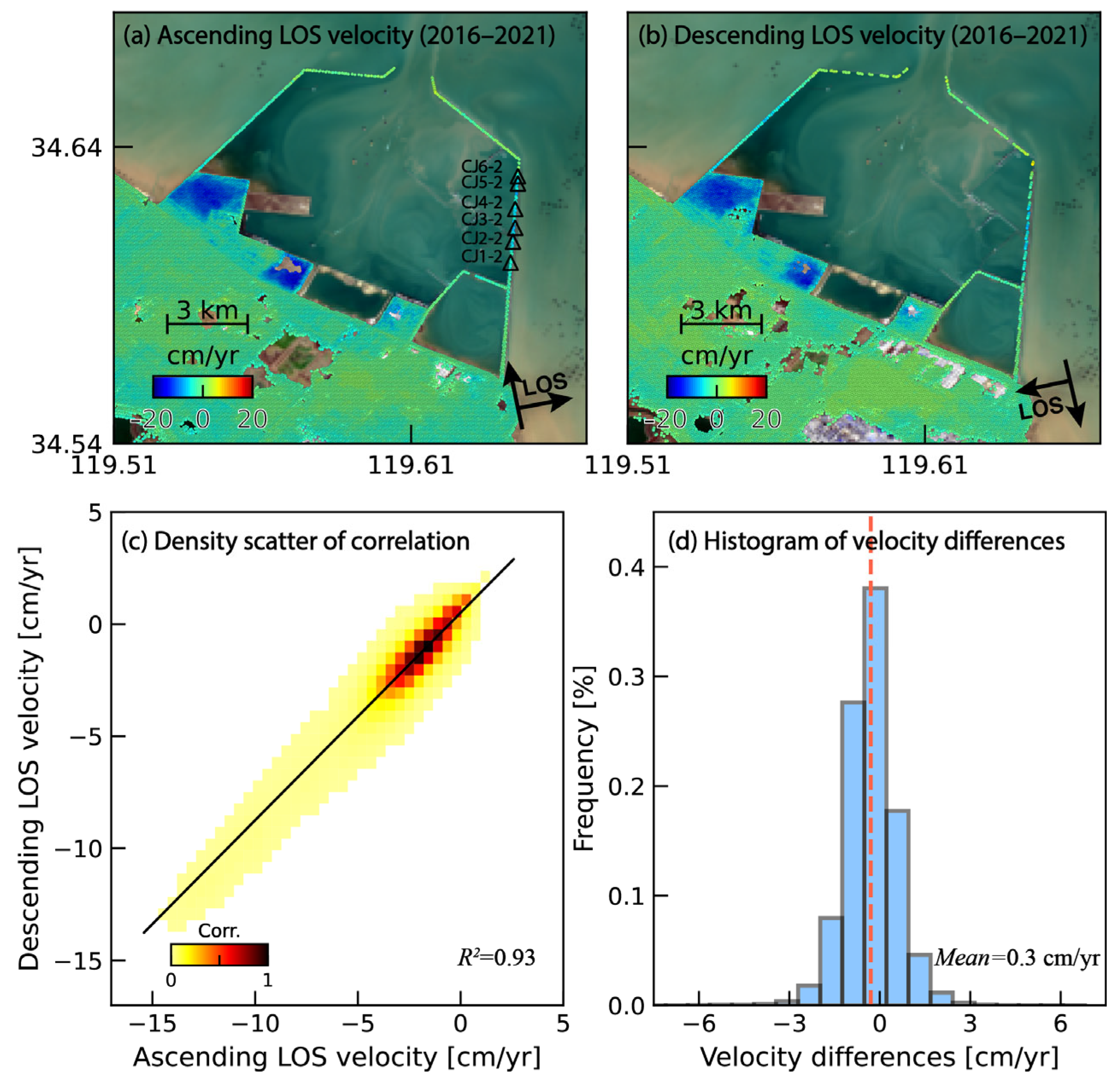
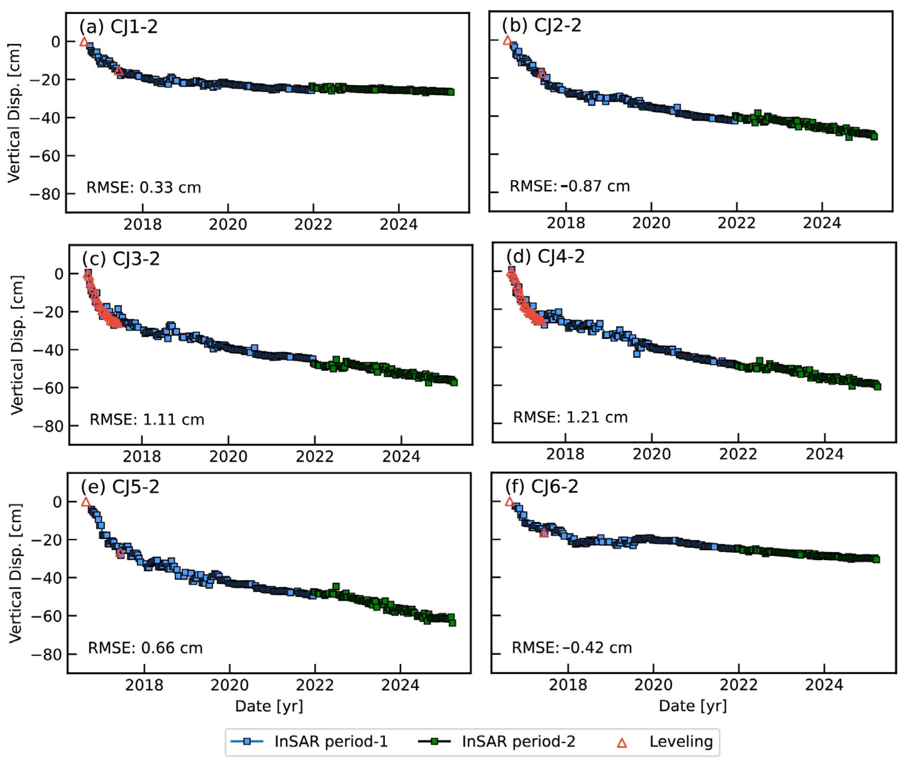
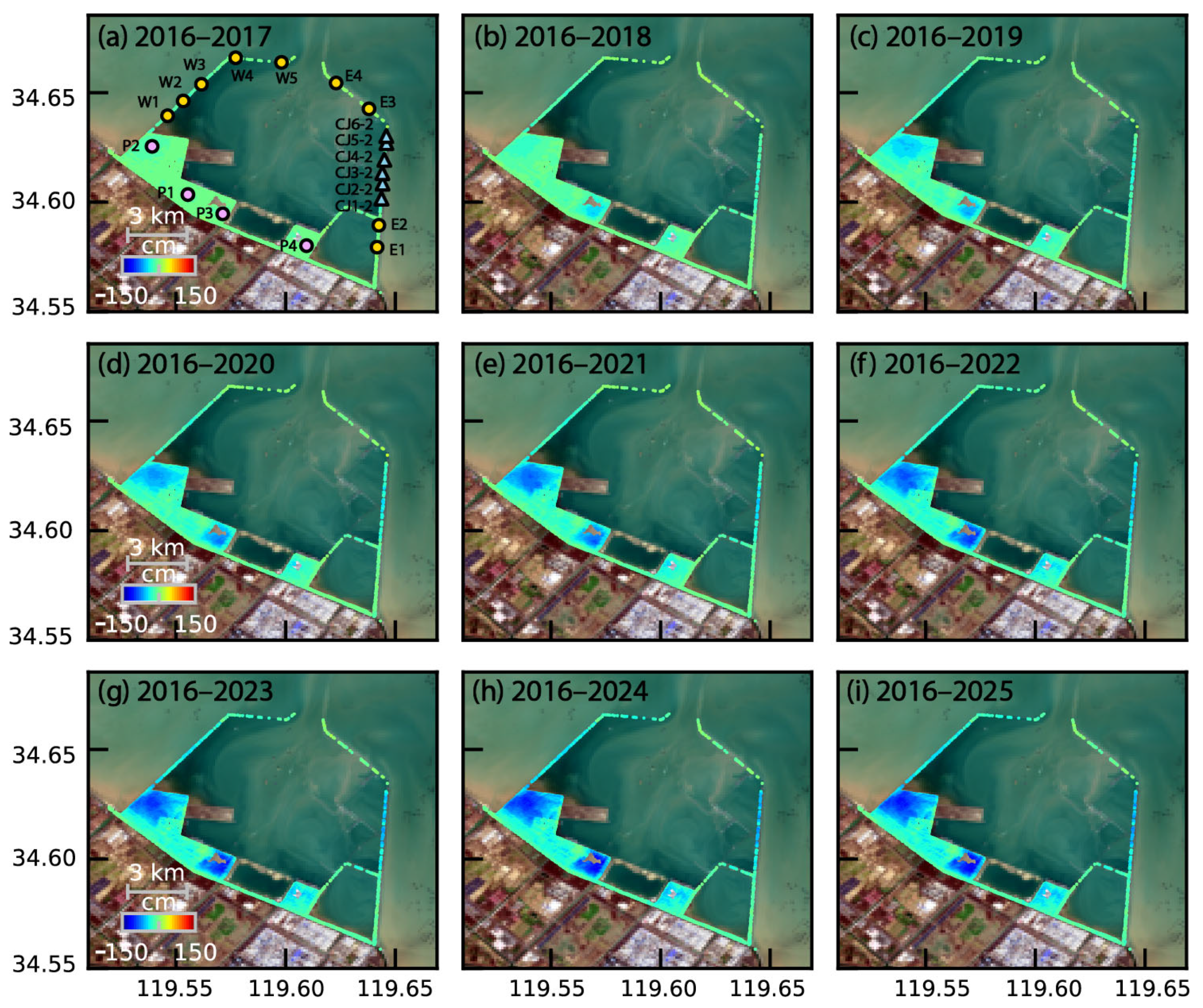
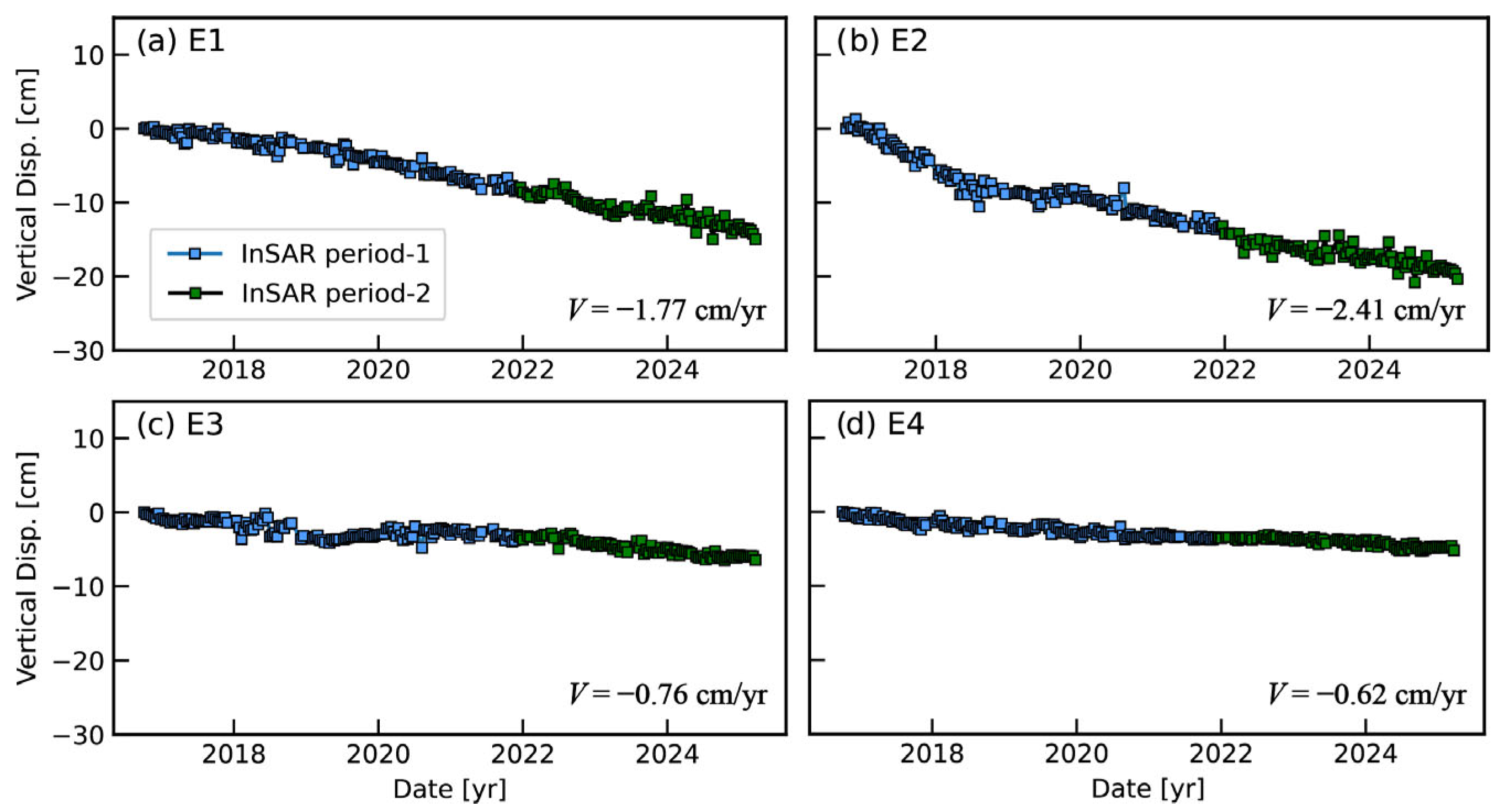
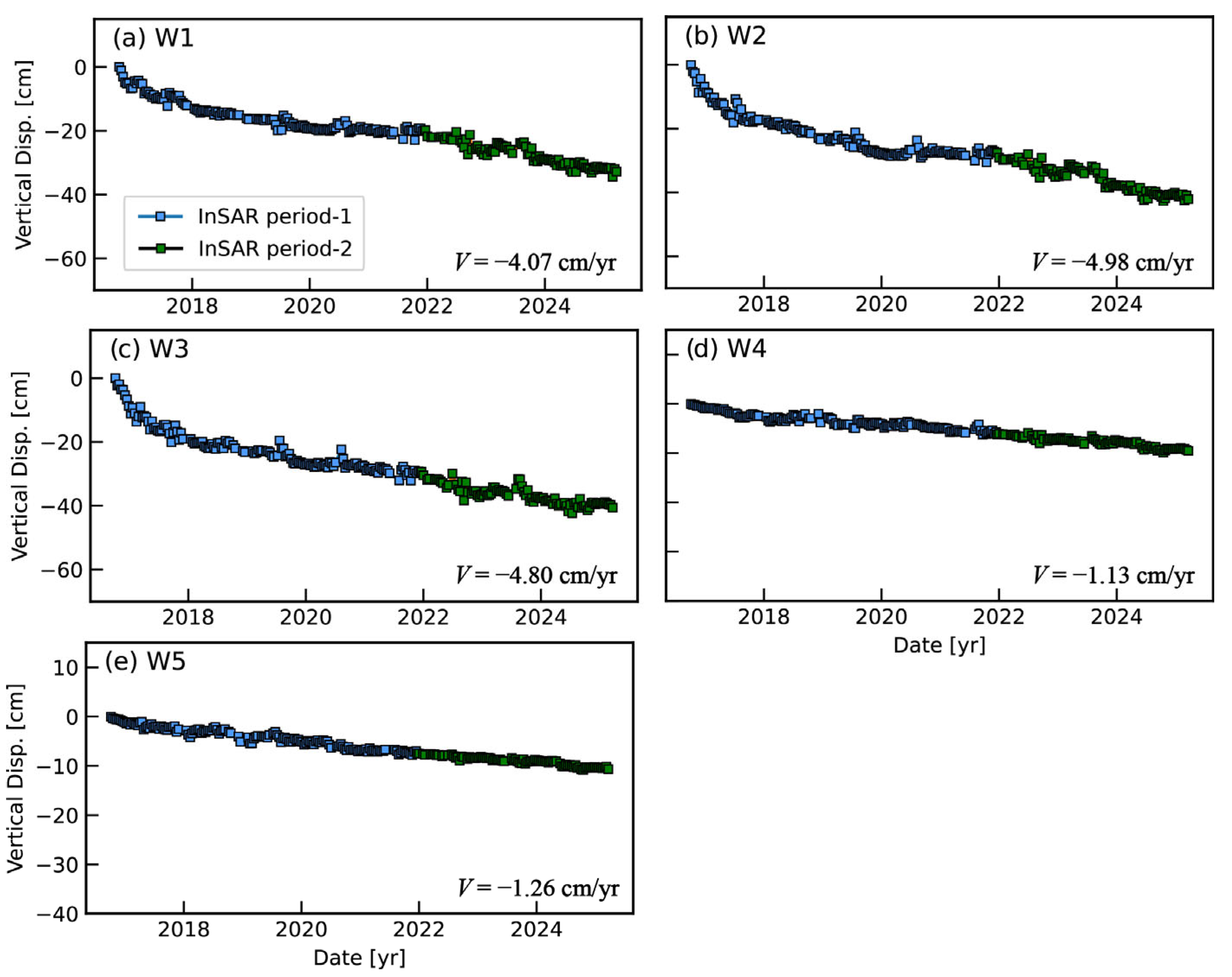
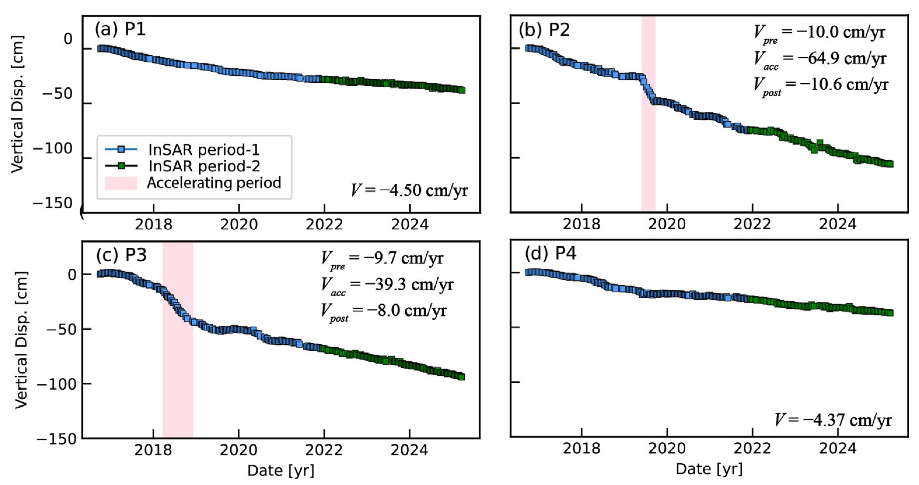
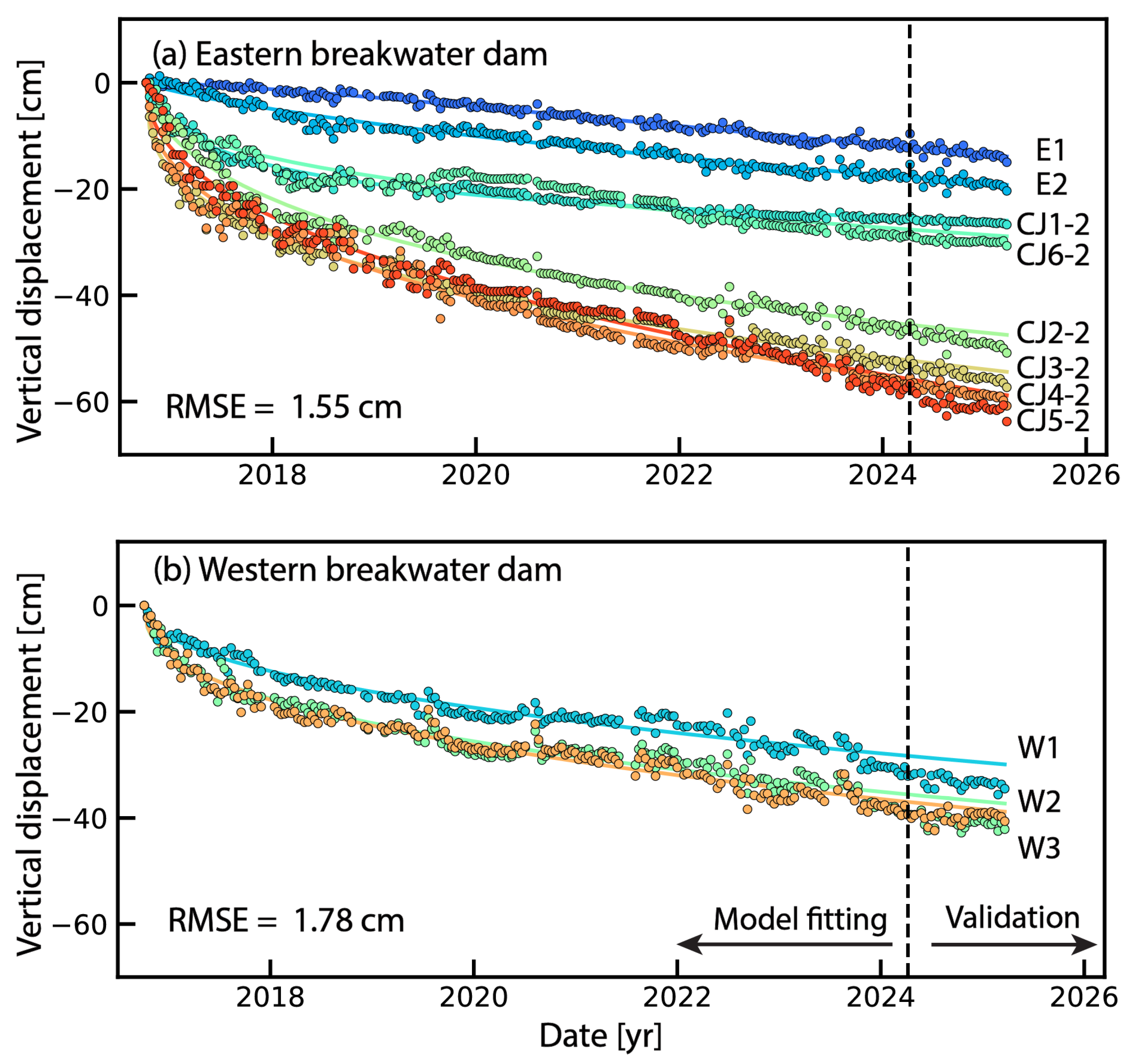
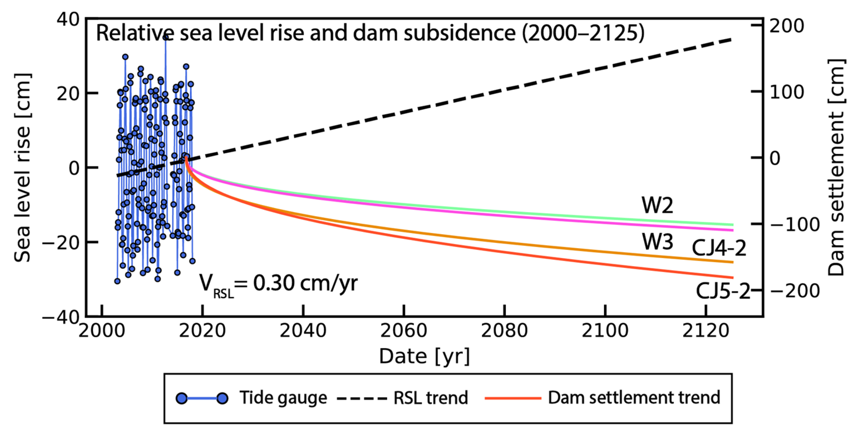
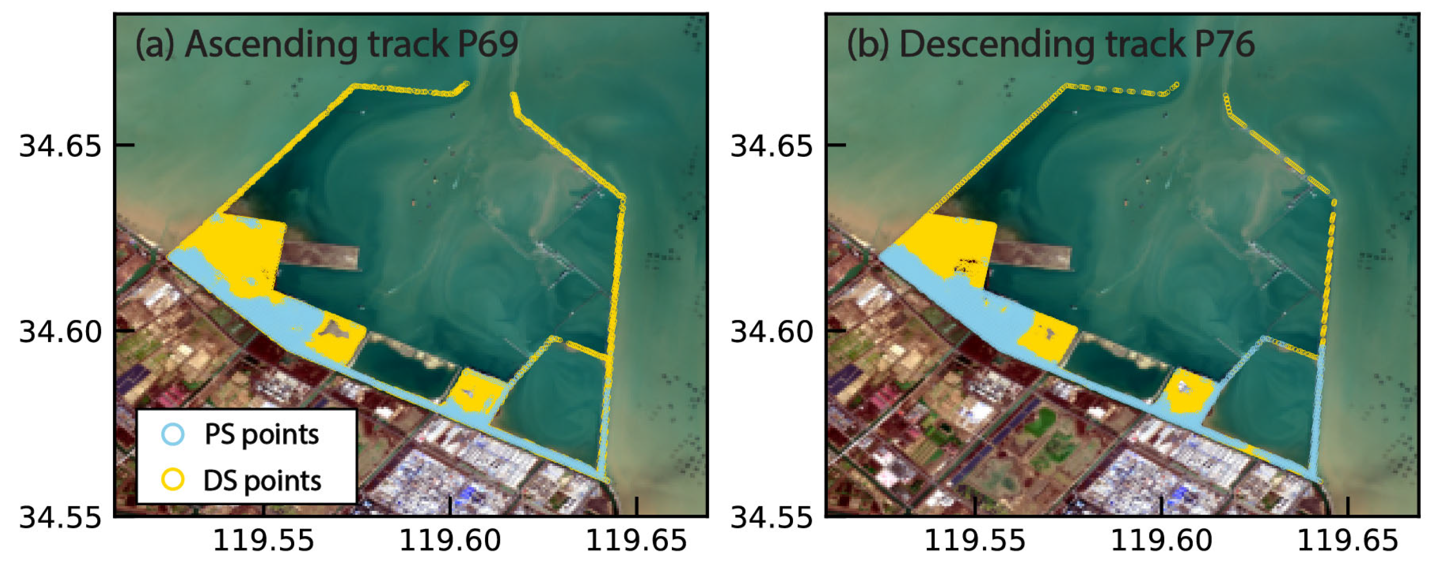
Breakwater dams are critical infrastructures that protect the safety of ports. However, these coastal structures are facing the compounding threats of sea level rise, storm surge, and dam subsidence. Heterogeneous deformations in these infrastructures arise from differential construction sequencing, sediment consolidation, and filling materials, yet traditional in situ monitoring remains spatially limited or even unavailable to trace back and continuously monitor deformation evolutions. In contrast, Interferometric Synthetic Aperture Radar (InSAR) offers valuable insights in providing the spatially and temporally covered dam deformation. In this study, we used two Sentinel-1 tracks from 2016 to 2025, and the persistent and distributed scatterers InSAR methods to map the long-term deformation of Xuwei Port, Lianyungang, China. We utilized six sites of leveling measurements to validate the InSAR-derived vertical deformation and indicate Root Mean Square Errors (RMSEs) ranging from −0.9–1.2 cm. We find, for the rock-sand filled section, the deformations show consolidating subsidence ranging from −63.8 cm to −40.6 cm. In contrast, the concrete tubular structure remains stable, with cumulative deformation ranging from −10.6 cm to −5.2 cm. The enclosing reclaimed land undergoes a period of accelerated settlement with subsidence rates of −64.9–−39.3 cm/yr, which are higher than original subsidence rates of −10.1–−9.7 cm/yr. Additionally, we integrated the consolidation model and tide gauge to quantify that the freeboard will decrease to 0.08–0.31 m in the following 100 years with the continuous sea level rise and dam subsidence. This study benefits our understandings of coastal dam and reclaimed land. It highlights InSAR as a valuable tool to evaluate the critical risk between sea level rise and coastal infrastructure subsidence.
Keywords: deformation monitoring; InSAR; breakwater dam; reclaimed land; subsidence; sea level rise deformation monitoring; InSAR; breakwater dam; reclaimed land; subsidence; sea level rise