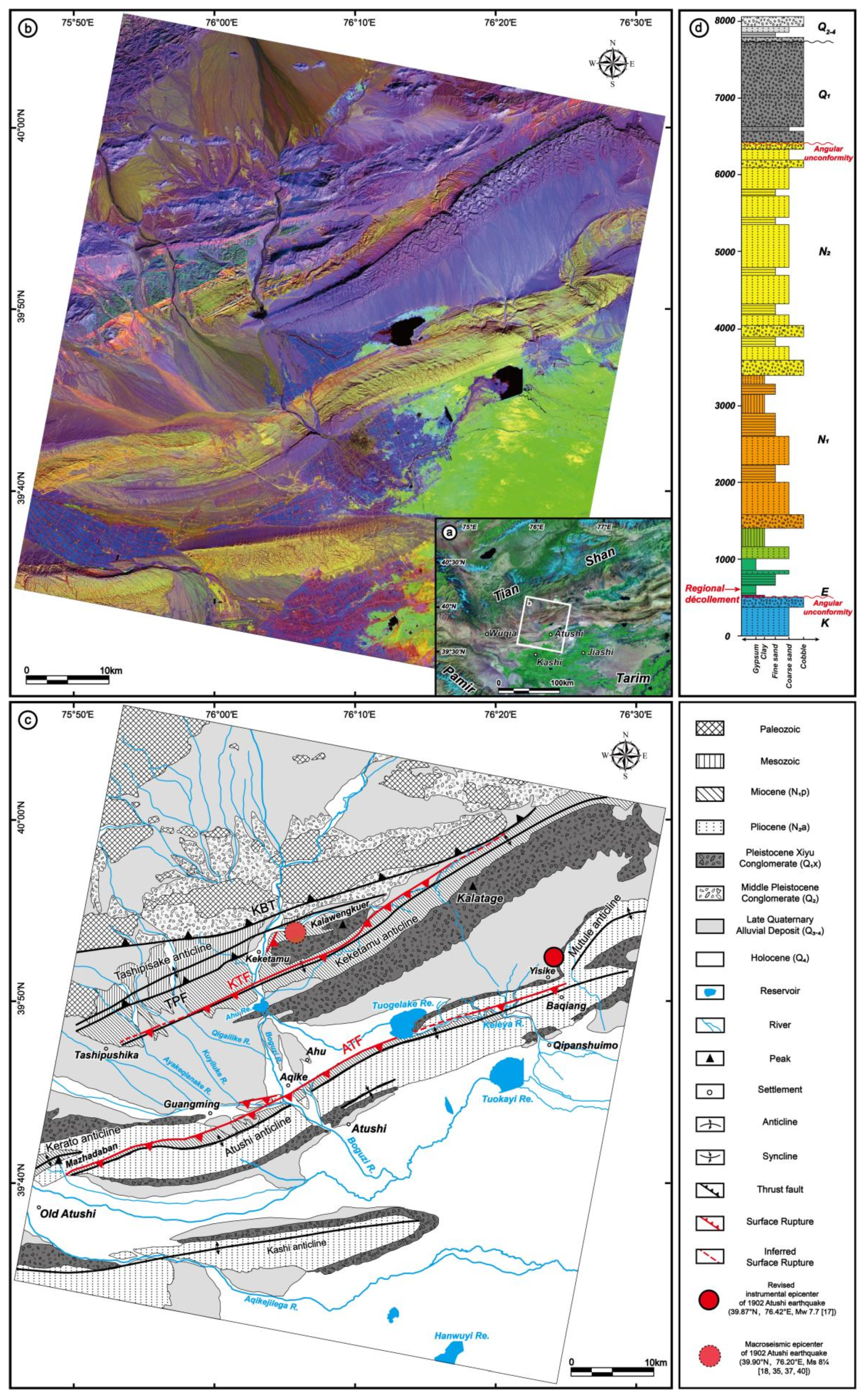
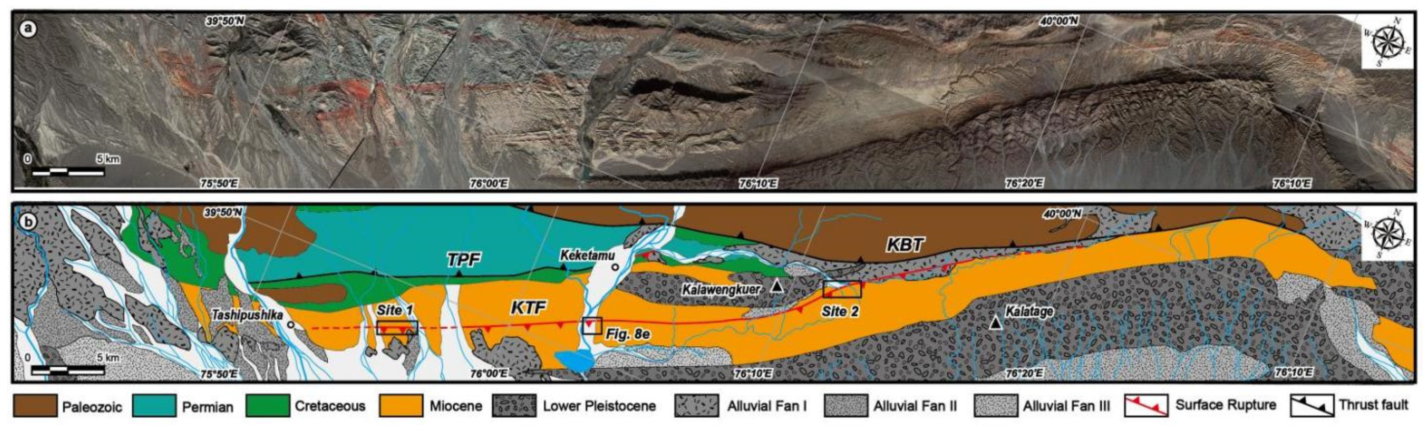
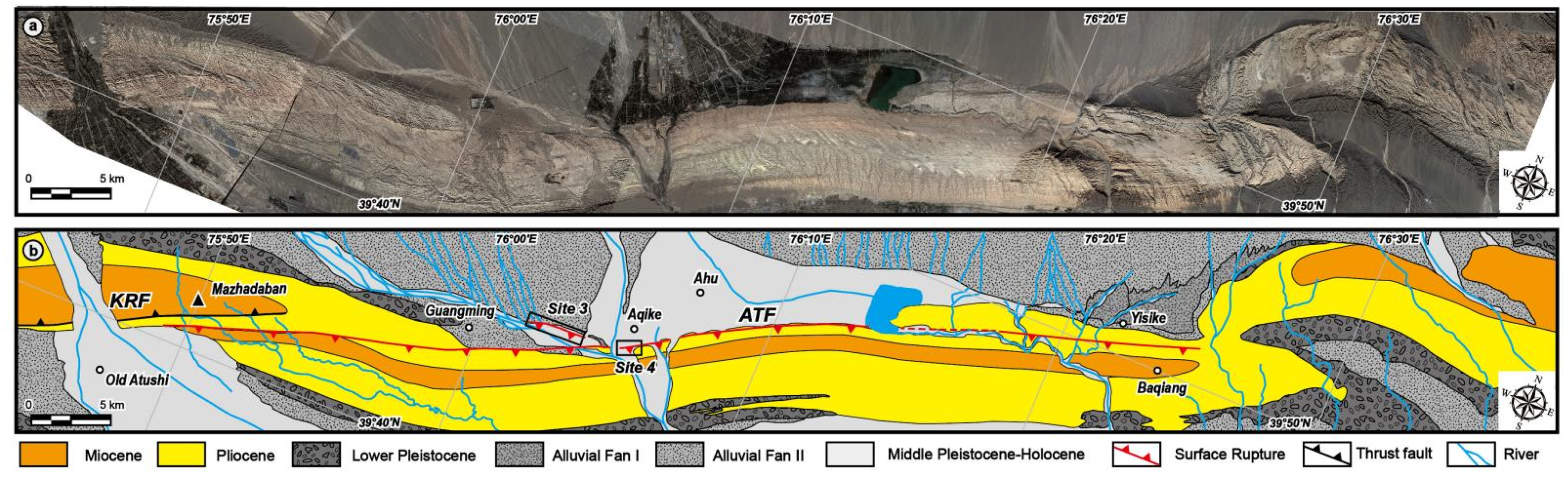
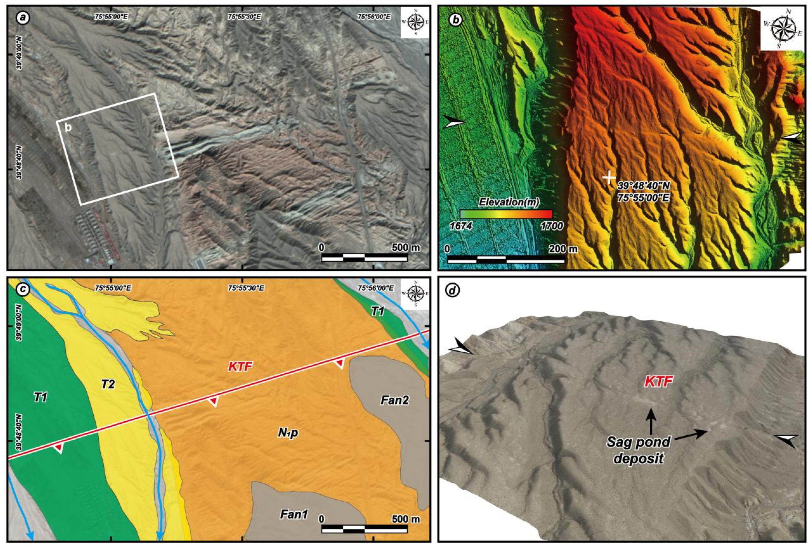
Surface Deformation Associated with the 22 August 1902 Mw 7.7 Atushi Earthquake in the Southwestern Tian Shan, Revealed from Multiple Remote Sensing Data
Abstract
Share and Cite
Chen, Q.; Fu, B.; Shi, P.; Li, Z. Surface Deformation Associated with the 22 August 1902 Mw 7.7 Atushi Earthquake in the Southwestern Tian Shan, Revealed from Multiple Remote Sensing Data. Remote Sens. 2022, 14, 1663. https://doi.org/10.3390/rs14071663
Chen Q, Fu B, Shi P, Li Z. Surface Deformation Associated with the 22 August 1902 Mw 7.7 Atushi Earthquake in the Southwestern Tian Shan, Revealed from Multiple Remote Sensing Data. Remote Sensing. 2022; 14(7):1663. https://doi.org/10.3390/rs14071663
Chicago/Turabian StyleChen, Qingyu, Bihong Fu, Pilong Shi, and Zhao Li. 2022. "Surface Deformation Associated with the 22 August 1902 Mw 7.7 Atushi Earthquake in the Southwestern Tian Shan, Revealed from Multiple Remote Sensing Data" Remote Sensing 14, no. 7: 1663. https://doi.org/10.3390/rs14071663
APA StyleChen, Q., Fu, B., Shi, P., & Li, Z. (2022). Surface Deformation Associated with the 22 August 1902 Mw 7.7 Atushi Earthquake in the Southwestern Tian Shan, Revealed from Multiple Remote Sensing Data. Remote Sensing, 14(7), 1663. https://doi.org/10.3390/rs14071663