Article

Detection of Spatial and Temporal Patterns of Liana Infestation Using Satellite-Derived Imagery
by
Chris J. Chandler
*,
Geertje M. F. van der Heijden
,
Doreen S. Boyd
and
Giles M. Foody
School of Geography, University of Nottingham, University Park, Nottingham NG7 2RD, UK
*
Author to whom correspondence should be addressed.
Remote Sens. 2021, 13(14), 2774; https://doi.org/10.3390/rs13142774
Submission received: 11 June 2021 / Revised: 30 June 2021 / Accepted: 12 July 2021 / Published: 14 July 2021
(This article belongs to the Special Issue Feature Paper Special Issue on Ecological Remote Sensing)

Abstract

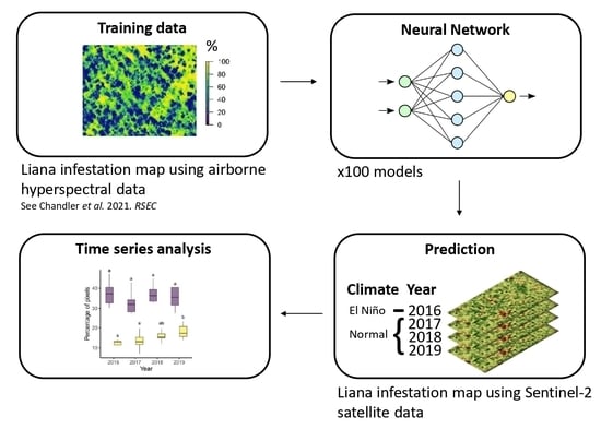
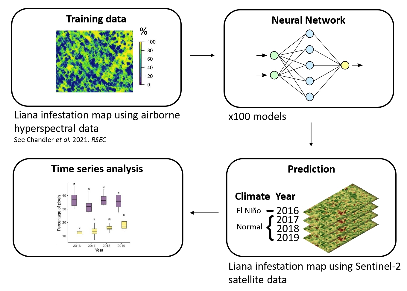
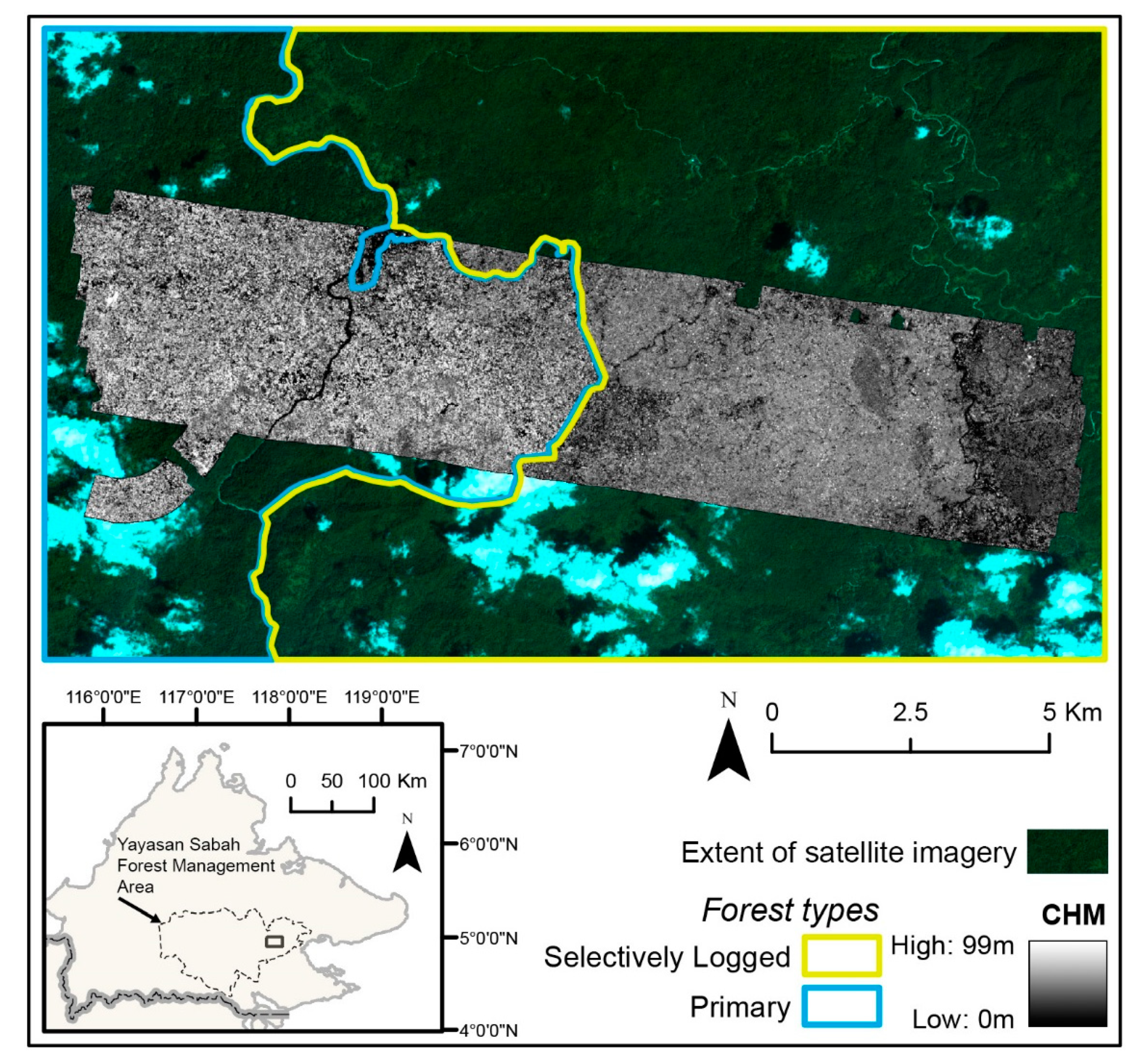
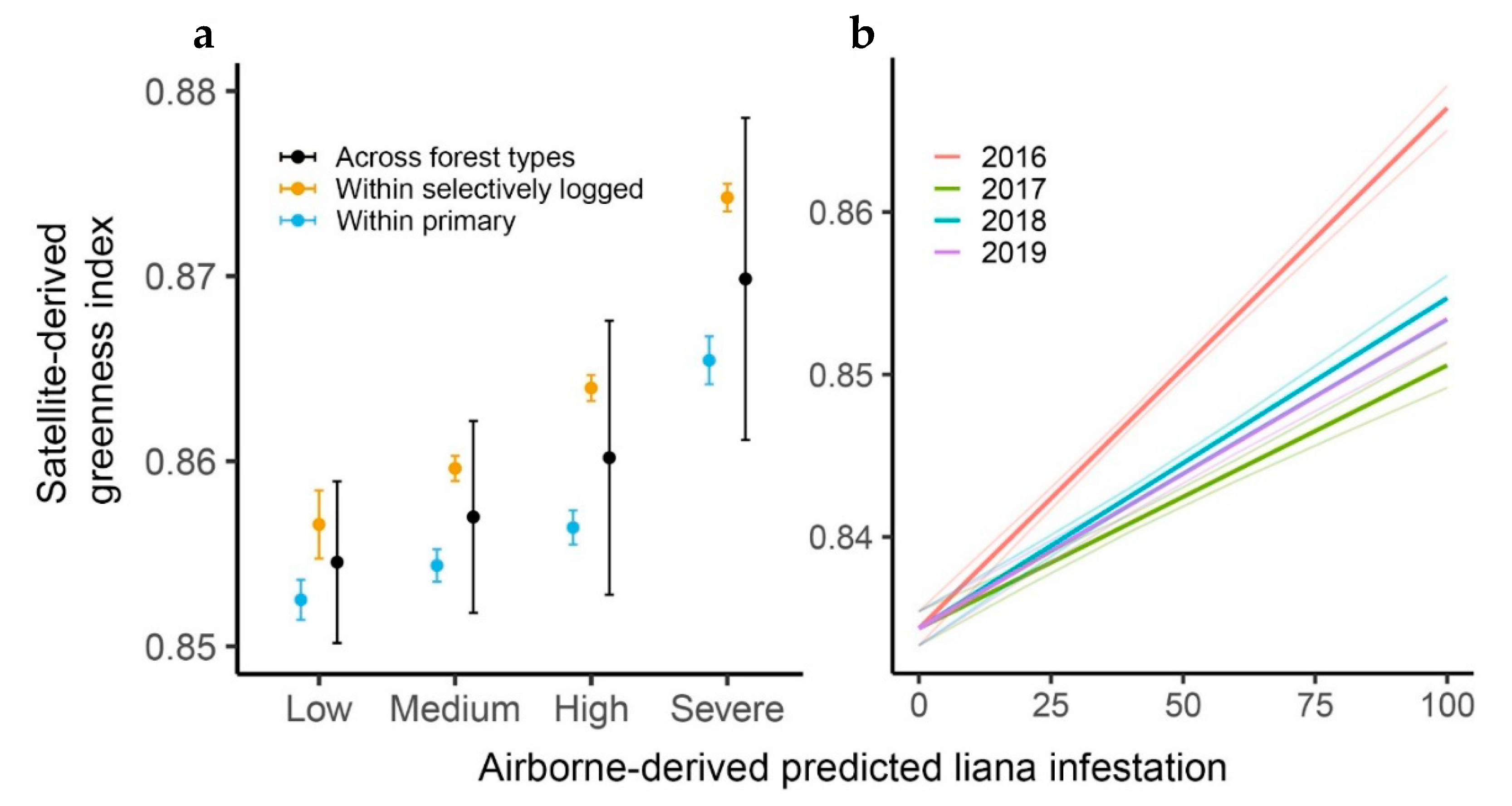
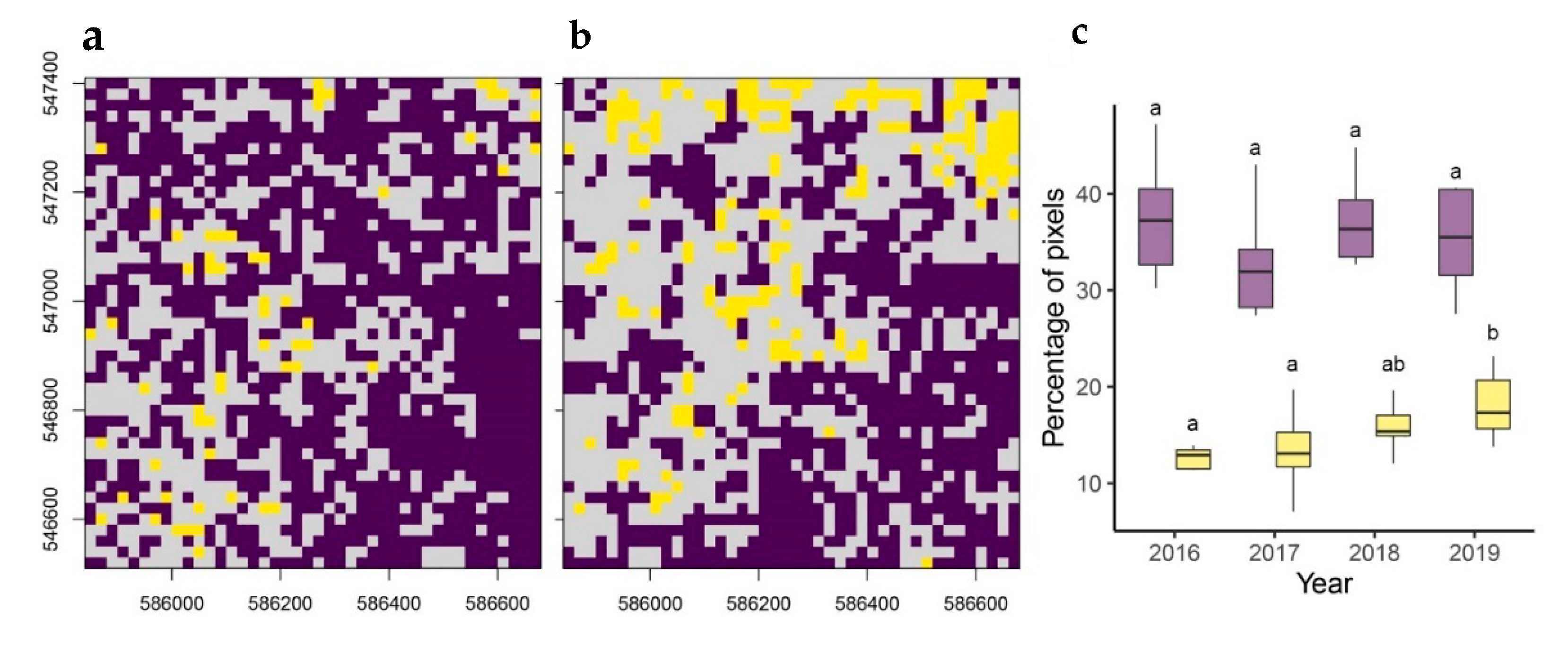
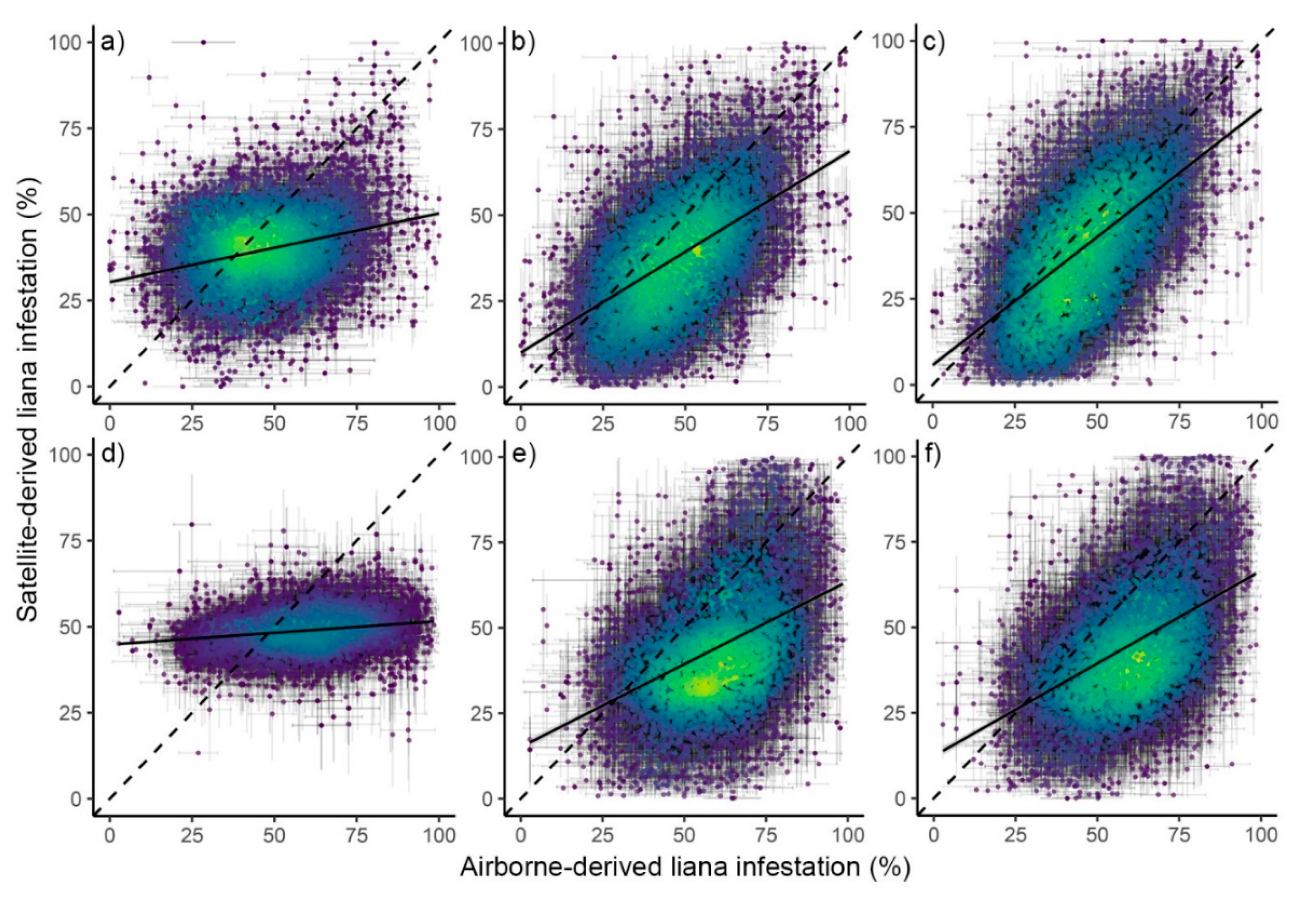
Lianas (woody vines) play a key role in tropical forest dynamics because of their strong influence on tree growth, mortality and regeneration. Assessing liana infestation over large areas is critical to understand the factors that drive their spatial distribution and to monitor change over time. However, it currently remains unclear whether satellite-based imagery can be used to detect liana infestation across closed-canopy forests and therefore if satellite-observed changes in liana infestation can be detected over time and in response to climatic conditions. Here, we aim to determine the efficacy of satellite-based remote sensing for the detection of spatial and temporal patterns of liana infestation across a primary and selectively logged aseasonal forest in Sabah, Borneo. We used predicted liana infestation derived from airborne hyperspectral data to train a neural network classification for prediction across four Sentinel-2 satellite-based images from 2016 to 2019. Our results showed that liana infestation was positively related to an increase in Greenness Index (GI), a simple metric relating to the amount of photosynthetically active green leaves. Furthermore, this relationship was observed in different forest types and during (2016), as well as after (2017–2019), an El Niño-induced drought. Using a neural network classification, we assessed liana infestation over time and showed an increase in the percentage of severely (>75%) liana infested pixels from 12.9% ± 0.63 (95% CI) in 2016 to 17.3% ± 2 in 2019. This implies that reports of increasing liana abundance may be more wide-spread than currently assumed. This is the first study to show that liana infestation can be accurately detected across closed-canopy tropical forests using satellite-based imagery. Furthermore, the detection of liana infestation during both dry and wet years and across forest types suggests this method should be broadly applicable across tropical forests. This work therefore advances our ability to explore the drivers responsible for patterns of liana infestation at multiple spatial and temporal scales and to quantify liana-induced impacts on carbon dynamics in tropical forests globally.
Keywords: airborne hyperspectral and LiDAR; aseasonal forest; Greenness Index; liana infestation; Sentinel-2 imagery airborne hyperspectral and LiDAR; aseasonal forest; Greenness Index; liana infestation; Sentinel-2 imagery
Graphical Abstract