Article

Multiple Data Products Reveal Long-Term Variation Characteristics of Terrestrial Water Storage and Its Dominant Factors in Data-Scarce Alpine Regions
1
College of Water Resources and Civil Engineering, China Agricultural University, Beijing 100083, China
2
Center for Agricultural Water Research in China, China Agricultural University, Beijing 100083, China
3
Hydro-Climate Extremes Lab (H-CEL), Ghent University, 9000 Ghent, Belgium
4
College of Water Sciences, Beijing Normal University, Beijing 100875, China
5
Beijing Key Laboratory of Urban Hydrological Cycle and Sponge City Technology, Beijing 100875, China
*
Author to whom correspondence should be addressed.
Remote Sens. 2021, 13(12), 2356; https://doi.org/10.3390/rs13122356
Submission received: 13 April 2021 / Revised: 7 June 2021 / Accepted: 11 June 2021 / Published: 16 June 2021
(This article belongs to the Special Issue Remote Sensing of Hydrological Processes: Modelling and Applications)

Abstract

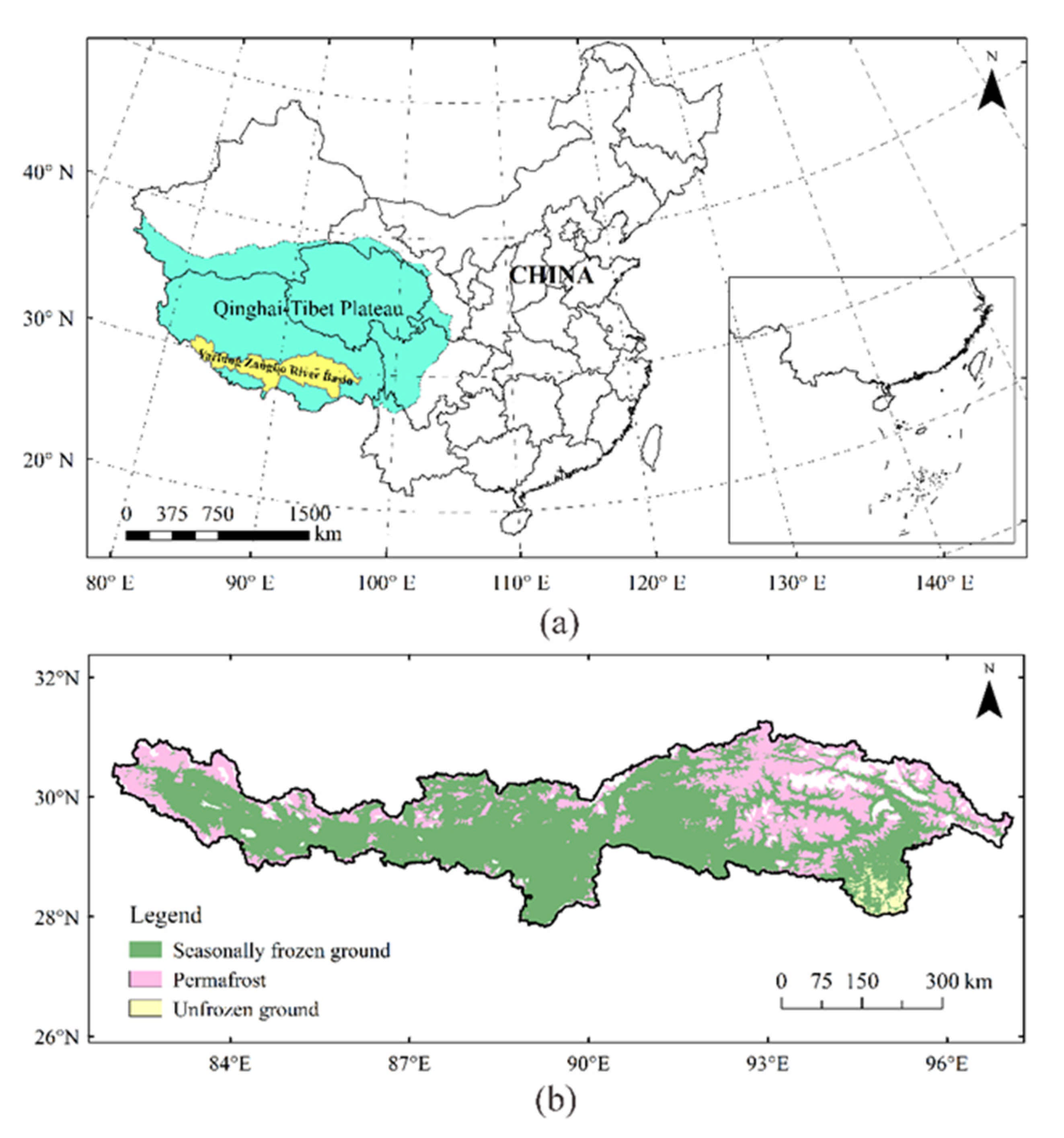
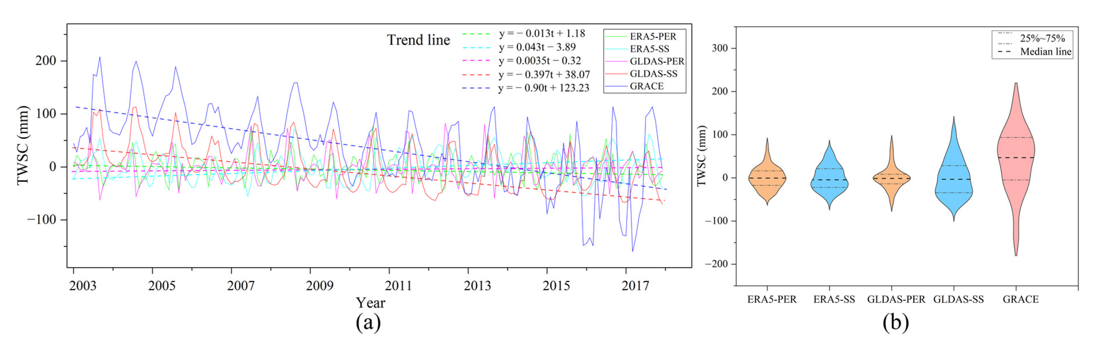
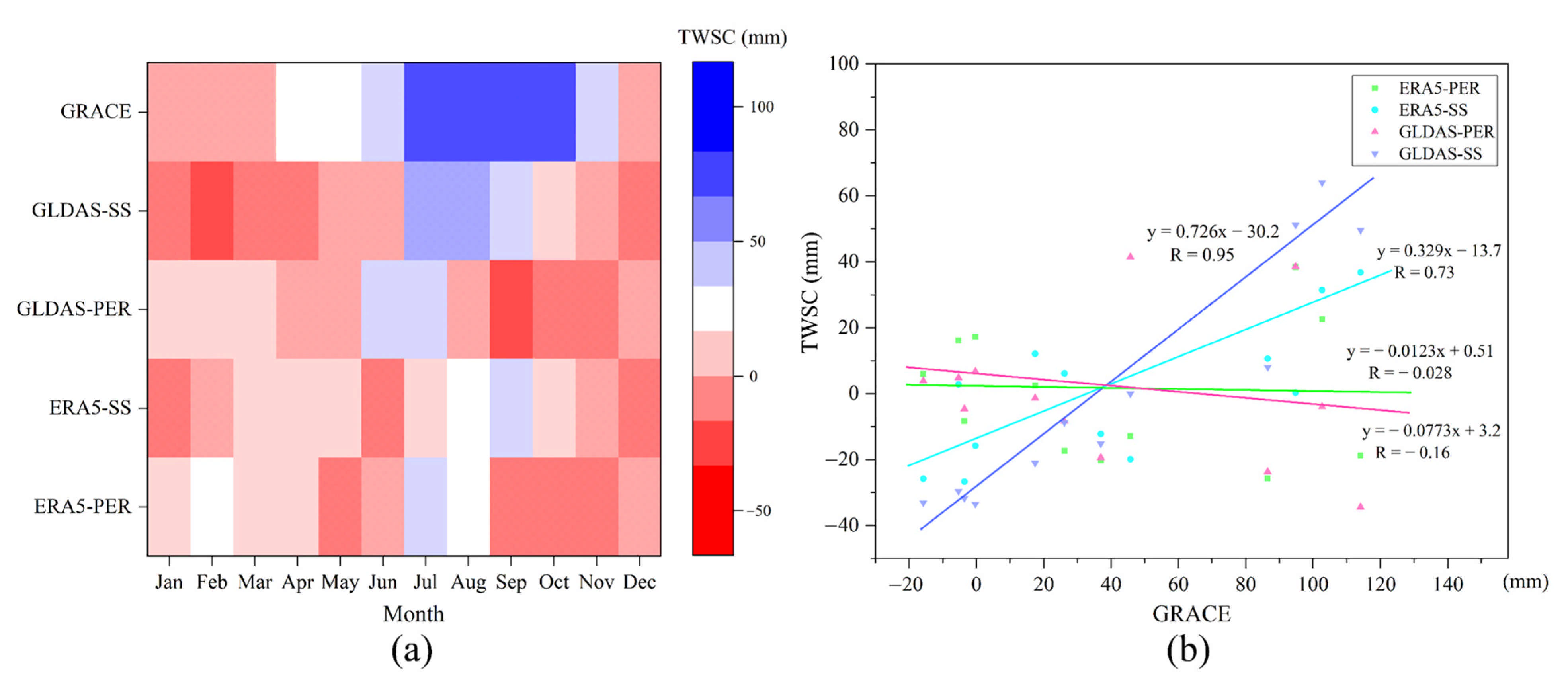
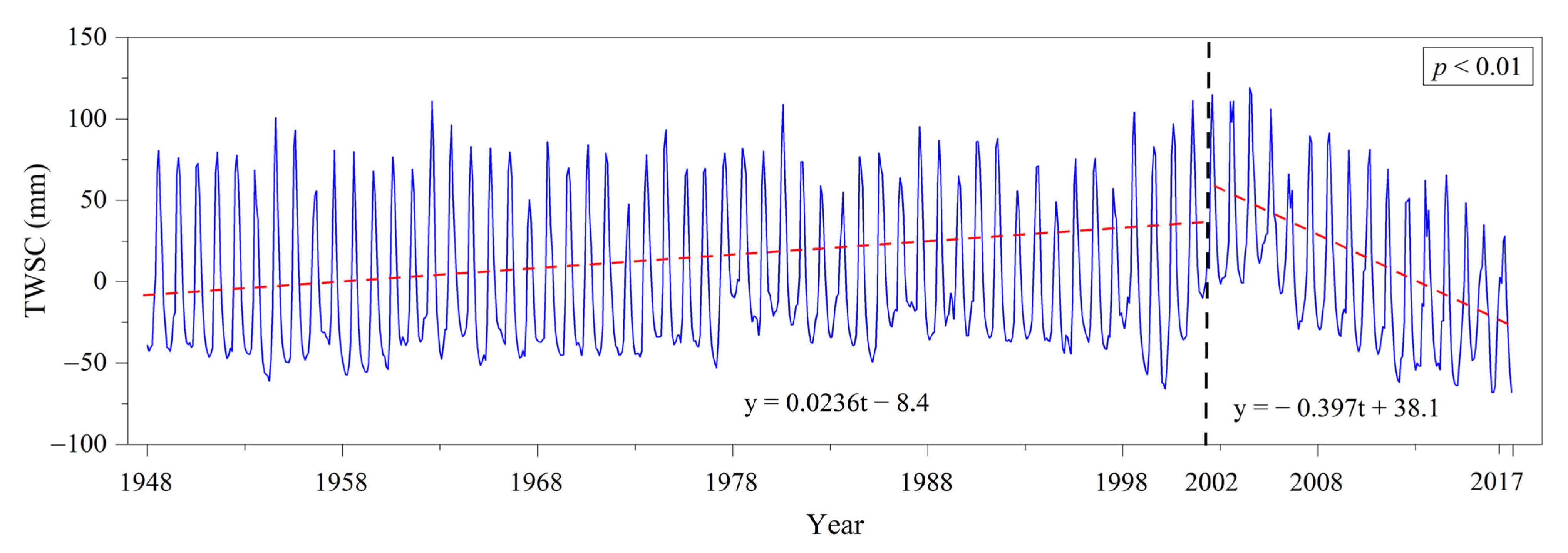
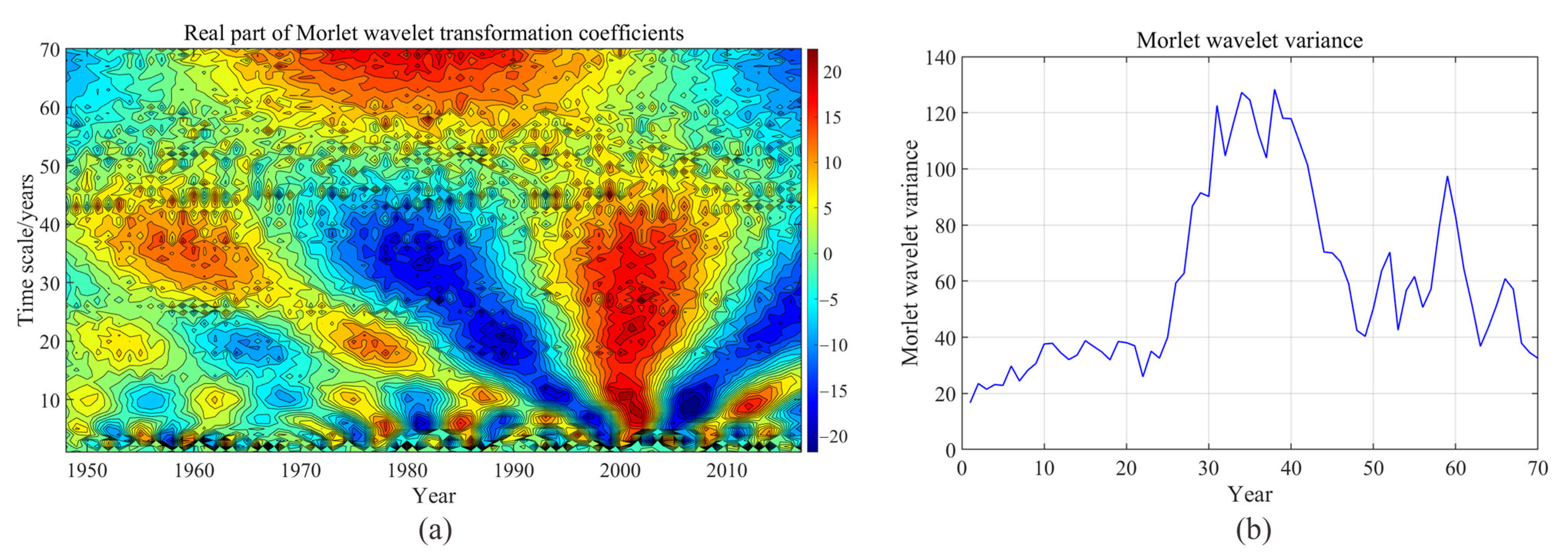
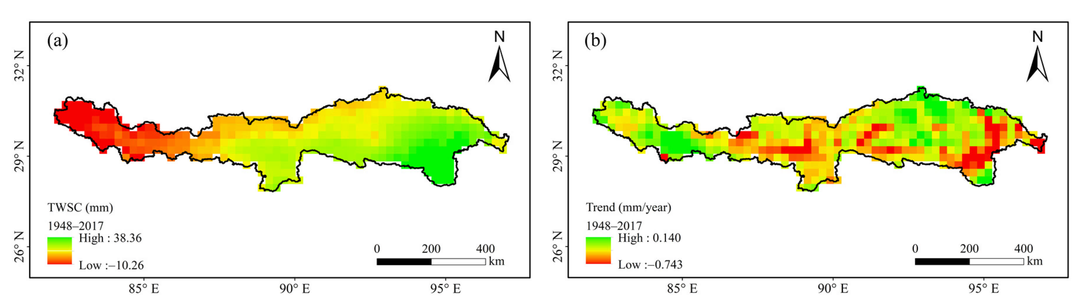
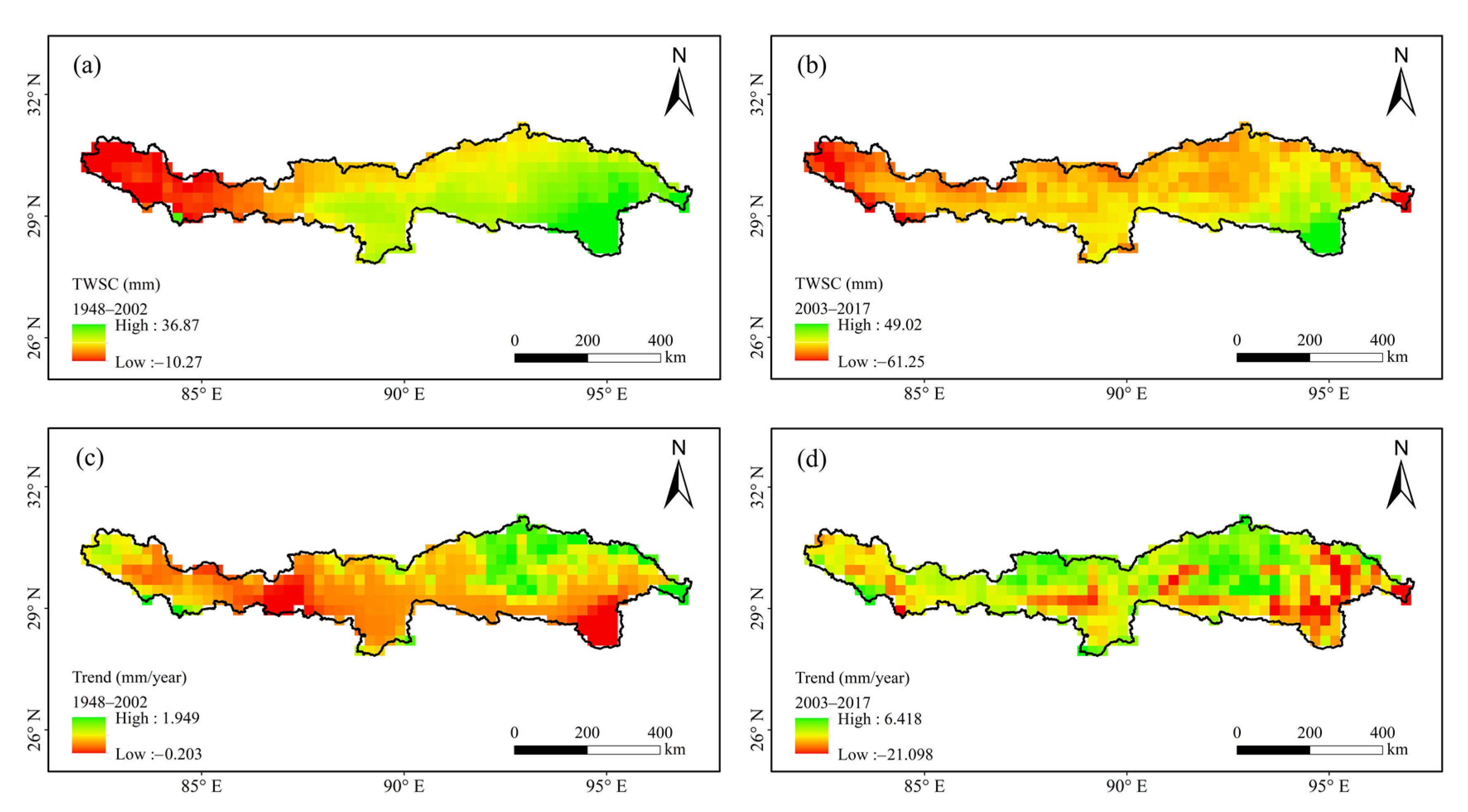
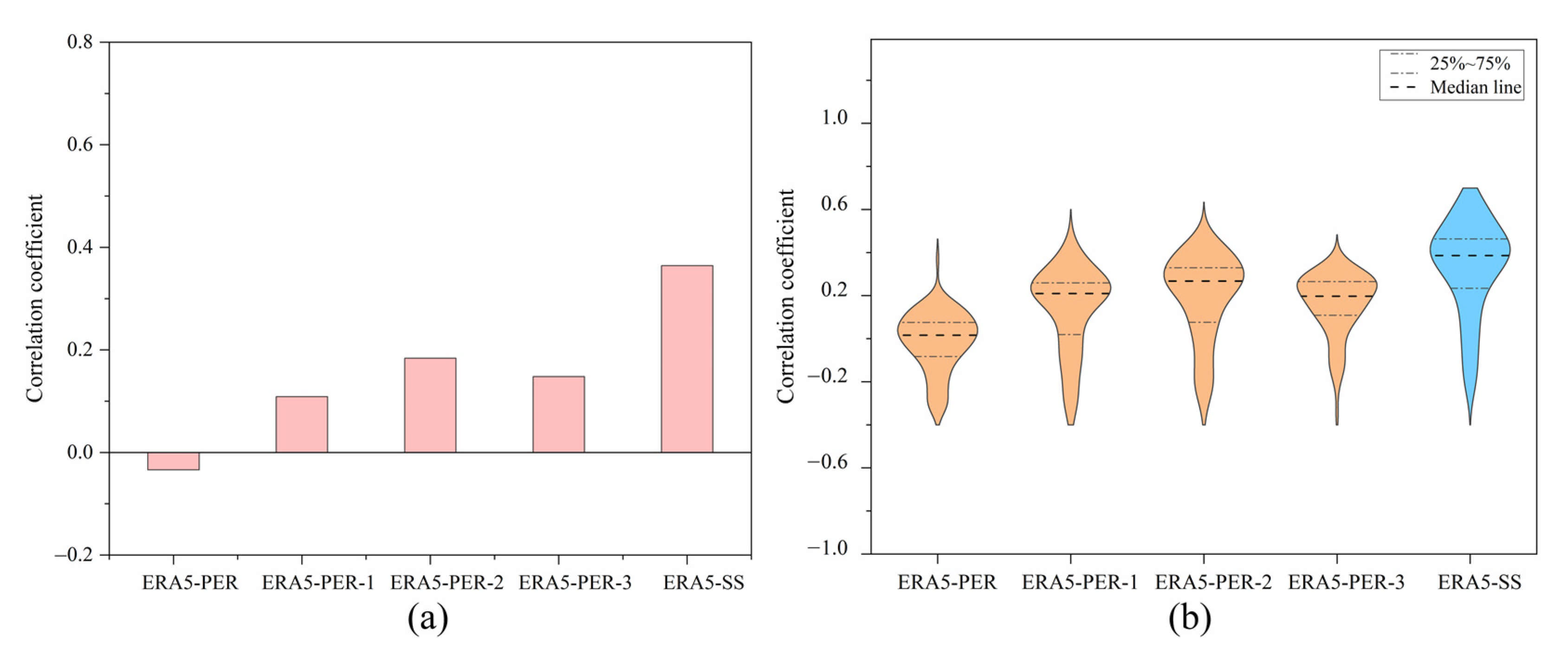
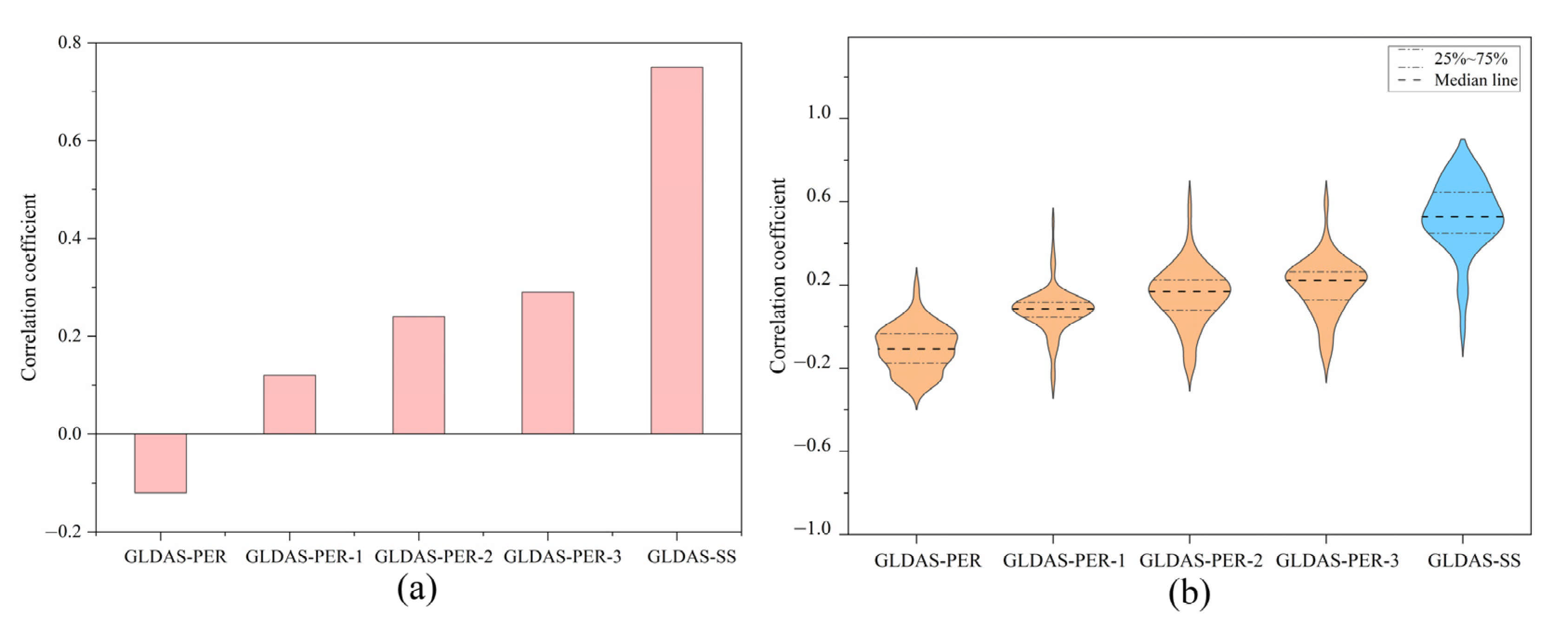
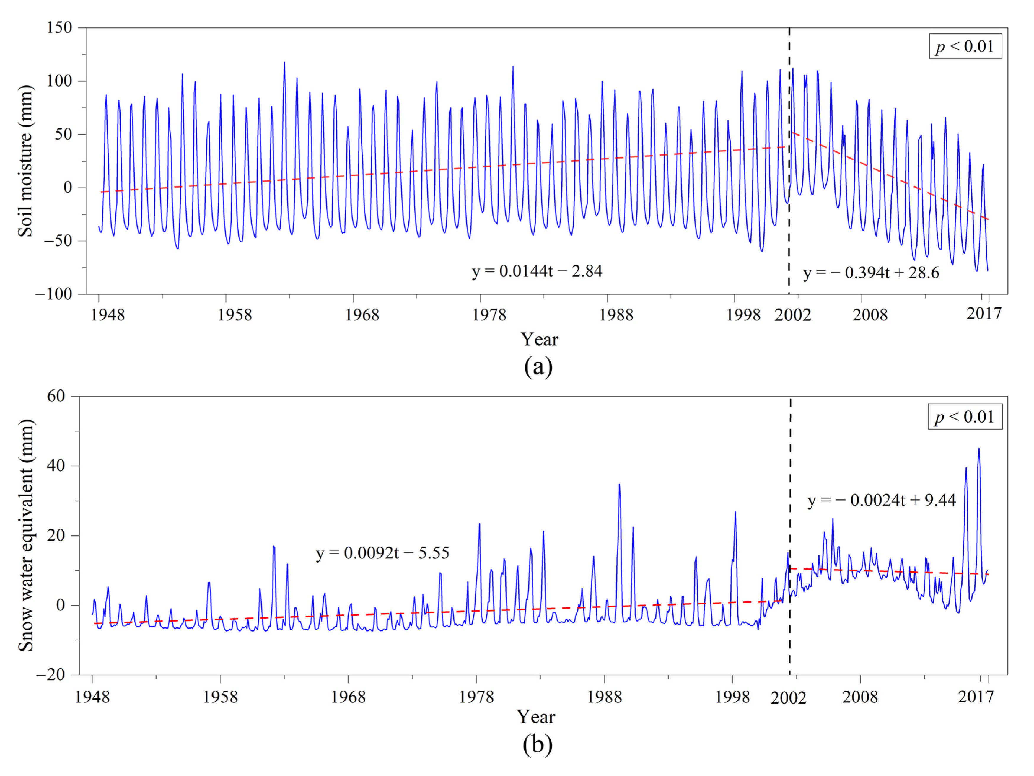
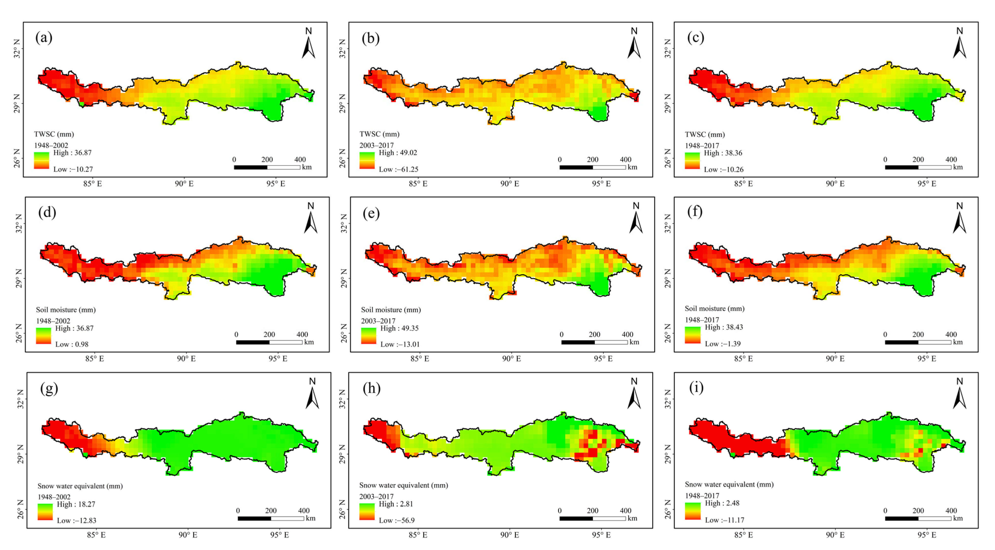
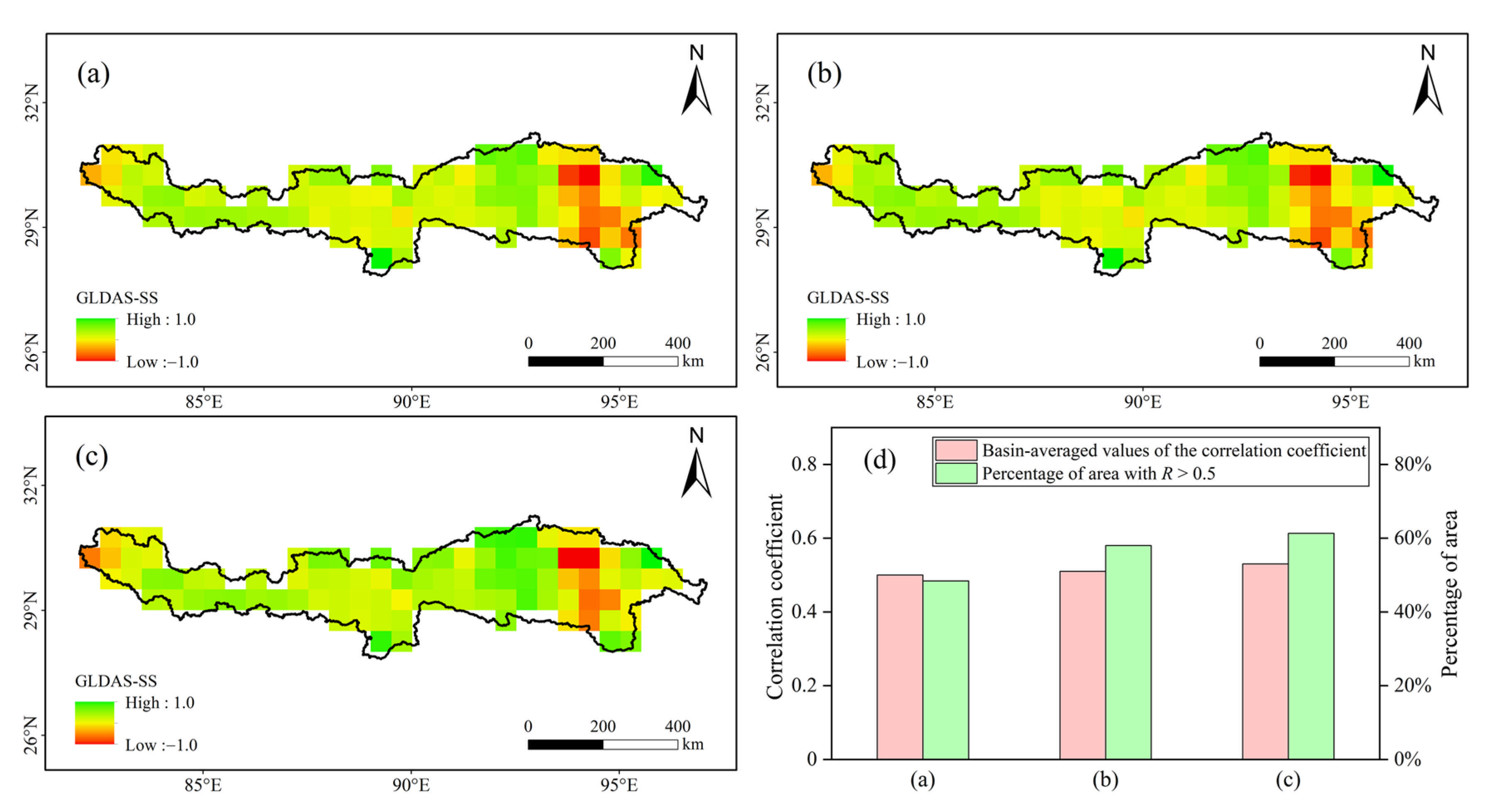
As the “Water Tower of Asia” and “The Third Pole” of the world, the Qinghai–Tibet Plateau (QTP) shows great sensitivity to global climate change, and the change in its terrestrial water storage has become a focus of attention globally. Differences in multi-source data and different calculation methods have caused great uncertainty in the accurate estimation of terrestrial water storage. In this study, the Yarlung Zangbo River Basin (YZRB), located in the southeast of the QTP, was selected as the study area, with the aim of investigating the spatio-temporal variation characteristics of terrestrial water storage change (TWSC). Gravity Recovery and Climate Experiment (GRACE) data from 2003 to 2017, combined with the fifth-generation reanalysis product of the European Centre for Medium-Range Weather Forecasts (ERA5) data and Global Land Data Assimilation System (GLDAS) data, were adopted for the performance evaluation of TWSC estimation. Based on ERA5 and GLDAS, the terrestrial water balance method (PER) and the summation method (SS) were used to estimate terrestrial water storage, obtaining four sets of TWSC, which were compared with TWSC derived from GRACE. The results show that the TWSC estimated by the SS method based on GLDAS is most consistent with the results of GRACE. The time-lag effect was identified in the TWSC estimated by the PER method based on ERA5 and GLDAS, respectively, with 2-month and 3-month lags. Therefore, based on the GLDAS, the SS method was used to further explore the long-term temporal and spatial evolution of TWSC in the YZRB. During the period of 1948–2017, TWSC showed a significantly increasing trend; however, an abrupt change in TWSC was detected around 2002. That is, TWSC showed a significantly increasing trend before 2002 (slope = 0.0236 mm/month, p < 0.01) but a significantly decreasing trend (slope = −0.397 mm/month, p < 0.01) after 2002. Additional attribution analysis on the abrupt change in TWSC before and after 2002 was conducted, indicating that, compared with the snow water equivalent, the soil moisture dominated the long-term variation of TWSC. In terms of spatial distribution, TWSC showed a large spatial heterogeneity, mainly in the middle reaches with a high intensity of human activities and the Parlung Zangbo River Basin, distributed with great glaciers. The results obtained in this study can provide reliable data support and technical means for exploring the spatio-temporal evolution mechanism of terrestrial water storage in data-scarce alpine regions.
Keywords: climate change; TWSC; GRACE; ERA5; GLDAS; Qinghai–Tibet Plateau; Yarlung Zangbo River Basin climate change; TWSC; GRACE; ERA5; GLDAS; Qinghai–Tibet Plateau; Yarlung Zangbo River Basin