Topic Editors

Istituto Nazionale di Geofisica e Vulcanologia (INGV), Via di Vigna Murata 605, 00143 Roma, Italy
Dr. Daniela Pantosti
Istituto Nazionale di Geofisica e Vulcanologia (INGV), Via di Vigna Murata 605, 00143 Roma, Italy

Geomorphological Processes of Continental Landscapes in Tectonically Active Areas

Abstract submission deadline
31 October 2025
Manuscript submission deadline
31 December 2025
Viewed by
2515

Topic Information

Dear Colleagues,

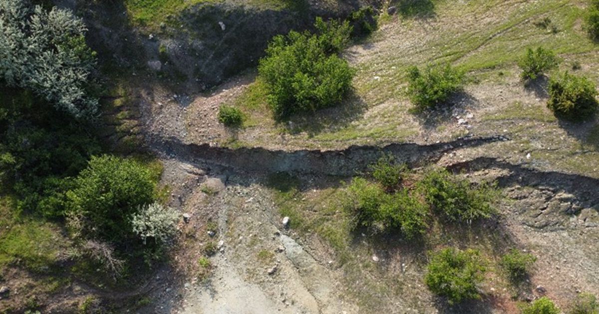
We are pleased to announce the Topic "Geomorphological Processes of Continental Landscapes in Tectonically Active Areas", which will bring together papers from different fields of Earth sciences that depict the changes in the configuration of the Earth’s surface due to endogenic and exogenic forces triggered by active tectonics. The aim of the collection is to highlight recent advances in tectonic geomorphology, earthquake geology, and quantitative geomorphology by means of geochronology, geophysics, paleoseismology, structural geology, and geological mapping tools. The Topic focuses on the mechanism and speed of the sedimentary and geomorphological processes of continental landscapes in tectonically active areas. In more detail, it will provide a venue for the Quaternary evolution of tectonic-related processes at different time scales, especially through:

  • Analysis of landscape morpho-evolution (i.e., the relationship between tectonic processes and superficial modeling);
  • Morphotectonic and structural analysis of active fault systems;
  • Analysis of the geological surface effects caused by earthquakes in the near-fault and far-field;
  • Reconstruction of the offset distributions and displacement rates along the short- and long-term (late-Quaternary and Quaternary) faults;
  • 2D and 3D reconstruction of fault-controlled continental basins and their tectonic–sedimentary evolution;
  • Determination of the Holocene record of seismic events;
  • Local and regional coseismic and long-term dislocation field estimates;

The aim is to characterize the geometric and behavioral parameters (i.e., slip accumulation and recurrence modeling) of active fault systems as they are essential inputs for the evaluation of seismic hazards.

Dr. Stefano Pucci
Dr. Daniela Pantosti
Topic Editors

Keywords

  • earthquake
  • faulting
  • dislocation field
  • tectonic landforms
  • active tectonics
  • geomorphology

Participating Journals

Journal Name Impact Factor CiteScore Launched Year First Decision (median) APC
GeoHazards
geohazards
- 2.6 2020 19 Days CHF 1000 Submit
Geosciences
geosciences
2.4 5.3 2011 23.5 Days CHF 1800 Submit
Quaternary
quaternary
2.3 3.3 2018 43.4 Days CHF 1600 Submit
Remote Sensing
remotesensing
4.2 8.3 2009 23.9 Days CHF 2700 Submit

Preprints.org is a multidisciplinary platform offering a preprint service designed to facilitate the early sharing of your research. It supports and empowers your research journey from the very beginning.

MDPI Topics is collaborating with Preprints.org and has established a direct connection between MDPI journals and the platform. Authors are encouraged to take advantage of this opportunity by posting their preprints at Preprints.org prior to publication:

  1. Share your research immediately: disseminate your ideas prior to publication and establish priority for your work.
  2. Safeguard your intellectual contribution: Protect your ideas with a time-stamped preprint that serves as proof of your research timeline.
  3. Boost visibility and impact: Increase the reach and influence of your research by making it accessible to a global audience.
  4. Gain early feedback: Receive valuable input and insights from peers before submitting to a journal.
  5. Ensure broad indexing: Web of Science (Preprint Citation Index), Google Scholar, Crossref, SHARE, PrePubMed, Scilit and Europe PMC.

Published Papers (2 papers)

Order results
Result details
Journals
Select all
Export citation of selected articles as:
15 pages, 11281 KiB  
Article
Assessment of the Tectonic Activity of the Muong La–Bac Yen–Cho Bo Fault (Northwest Vietnam) by Analysis of Geomorphological Indices
by Phung Thi Thu Hang, Renat Shakirov, Bui Van Thom, Lê Van Dung, Nadezhda Syrbu, Tran Trung Hieu, Phung Thi Ngoc Anh, Tran Hoang Yen, Elena Maltseva, Andrey Kholmogorov, Nguyen Huu Tuyen and Vu Hoa An
GeoHazards 2025, 6(2), 16; https://doi.org/10.3390/geohazards6020016 - 1 Apr 2025
Viewed by 308
Abstract
The Muong La–Bac Yen–Cho Bo fault is one of the seismic faults in the northwest region of Vietnam. Neo-tectonic activities and exogenous processes have influenced the drainage system and topographic–geomorphologic features on both walls of the fault. The results of topographic analysis and [...] Read more.
The Muong La–Bac Yen–Cho Bo fault is one of the seismic faults in the northwest region of Vietnam. Neo-tectonic activities and exogenous processes have influenced the drainage system and topographic–geomorphologic features on both walls of the fault. The results of topographic analysis and geomorphological indices have confirmed the active tectonics of the fault during the Neo-tectonic period (Pliocene–Quaternary, about 5 million years). The valley floor width-to-height ratio (Vf) of less than 0.5 indicates the “rejuvenation” of the streams and the obvious influence of tectonic activities on the two walls of the studied fault. The Hypsometric curve (HC) in the study area has a straight–convex shape and the basins on the northeast wall have hypsometric integral index values ranging from 0.46 to 0.481, which are lower and more convex than those of the southwest wall. The Mountain-front sinuosity index (Smf) from 1.92 to 3.28 along the foot slope of the Hoang Lien Son range (the segment from Than Uyen to Bac Yen and Phu Yen) and the highly variable stream-length gradient index (SL) value on the northeast wall signify the relative tectonic uplift on the northeast wall of the fault. The deformed geomorphological indications (steep cliffs, slip surfaces, etc.) in the field confirm the active tectonics of the Muong La–Bac Yen–Cho Bo fault during the Neo-tectonic period. Full article
Show Figures

Figure 1

12 pages, 6717 KiB  
Article
Identification and Verification of the Movement of the Hidden Active Fault Using Electrical Resistivity Tomography and Excavation
by Rungroj Arjwech, Sutatcha Hongsresawat, Suriyachai Chaisuriya, Jetsadarat Rattanawannee, Pitsanupong Kanjanapayont and Winit Youngme
Geosciences 2024, 14(8), 196; https://doi.org/10.3390/geosciences14080196 - 24 Jul 2024
Cited by 2 | Viewed by 1285
Abstract
Identifying the movement of the branches of the hidden Thakhek fault in Thailand is challenging due to the absence of evident landforms indicating an active fault. In this study, we analyzed a digital elevation model (DEM) to identify potential landforms. A 2D Electrical [...] Read more.
Identifying the movement of the branches of the hidden Thakhek fault in Thailand is challenging due to the absence of evident landforms indicating an active fault. In this study, we analyzed a digital elevation model (DEM) to identify potential landforms. A 2D Electrical Resistivity Tomography (ERT) survey was conducted to locate the hidden Thakhek fault. The results reveal vivid images of resistivity contrast, interpreted as two reverse faults, with mudstone exhibiting low resistivity in the middle, flanked by thick sediment layers with higher resistivity. Three trenches were excavated perpendicular to the two interpreted reverse faults. The displacement of reverse faulting appears to have shifted mudstone over Quaternary sediments, with vertical offsets revealed in trenches NWY-1, NWY-2, and NWY-3. This movement could be identified as a positive flower structure. Additionally, lakes are identified as a negative flower structure along the traces. These features result from strike-slip strains under a locally appropriate compressional and extensional environment in a shearing strike-slip fault. Full article
Show Figures

Figure 1

Back to TopTop