sustainability-logo

Journal Browser

Journal Browser

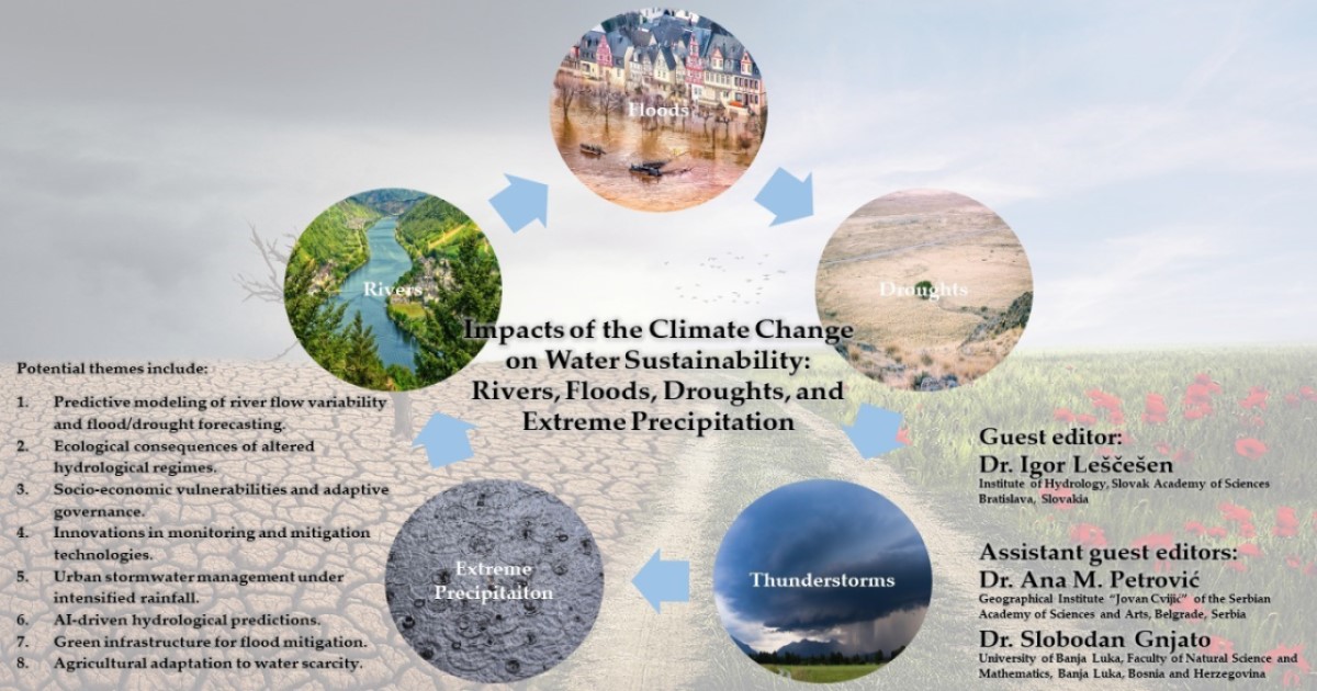
Impacts of Climate Change on Water Sustainability: Rivers, Floods, Droughts, and Extreme Precipitation

A special issue of Sustainability (ISSN 2071-1050). This special issue belongs to the section "Sustainable Water Management".

Deadline for manuscript submissions: 30 November 2026 | Viewed by 11362

Special Issue Editors


E-Mail Website
Guest Editor
Institute of Hydrology, Slovak Academy of Sciences, Dúbravská Cesta 9, 841 04 Bratislava, Slovakia
Interests: hydrology; climatology; environmental science; natural disasters

E-Mail Website
Guest Editor
Geographical Institute “Jovan Cvijić” of the Serbian Academy of Sciences and Arts, Đure Jakšića 9, 11000 Belgrade, Serbia
Interests: physical geography; natural hazards; environment; hydrology of torrents; torrential floods; soil erosion; water resources

E-Mail Website
Guest Editor
Faculty of Natural Sciences and Mathematics, University of Banja Luka, 78 000 Banjaluka, Bosnia and Herzegovina
Interests: physical geography; climatology; hydrology; ecology

Special Issue Information

Dear Colleagues,

Climate change is significantly altering hydrological systems, intensifying extreme events such as floods, droughts, and erratic precipitation patterns. These changes pose critical challenges for water sustainability, requiring a deeper understanding of shifting river flow regimes, increasing flood risks, prolonged droughts, and their socio-ecological consequences. This Special Issue of Sustainability focuses on advancing research on climate-driven disruptions to water systems by using innovative methodologies, improved climate and hydrological models, and state-of-the-art statistical and machine-learning approaches. We welcome contributions from diverse geographic regions that explore predictive models of river flow variability, flood and drought forecasts, and the socio-economic impacts of hydrological extremes. Studies emphasizing adaptive management strategies, green infrastructure, and AI-driven hydrological predictions are particularly encouraged. By integrating interdisciplinary research—from physical sciences to socio-economic analyses—this Special Issue aims to reduce uncertainties in climate impact assessments and support resilient water resource management. We invite original research articles, case studies, and reviews that provide insights into regional vulnerabilities, ecosystem responses, and governance frameworks for climate adaptation. Through this collective effort, we seek to enhance global strategies for mitigating risks and building sustainable climate-resilient water systems for the future. Potential themes include, but are not limited to, the following:

  1. Predictive modeling of river flow variability and flood/drought forecasting.
  2. The ecological consequences of altered hydrological regimes.
  3. Socio-economic vulnerabilities and adaptive governance.
  4. Innovations in monitoring and mitigation technologies.
  5. Urban stormwater management under intensified rainfall.
  6. AI-driven hydrological predictions.
  7. Green infrastructure for flood mitigation.
  8. Agricultural adaptation to water scarcity.

We look forward to receiving your contributions.

Dr. Igor Leščešen
Dr. Ana M. Petrović
Dr. Slobodan Gnjato
Guest Editors

Manuscript Submission Information

Manuscripts should be submitted online at www.mdpi.com by registering and logging in to this website. Once you are registered, click here to go to the submission form. Manuscripts can be submitted until the deadline. All submissions that pass pre-check are peer-reviewed. Accepted papers will be published continuously in the journal (as soon as accepted) and will be listed together on the special issue website. Research articles, review articles as well as short communications are invited. For planned papers, a title and short abstract (about 250 words) can be sent to the Editorial Office for assessment.

Submitted manuscripts should not have been published previously, nor be under consideration for publication elsewhere (except conference proceedings papers). All manuscripts are thoroughly refereed through a single-blind peer-review process. A guide for authors and other relevant information for submission of manuscripts is available on the Instructions for Authors page. Sustainability is an international peer-reviewed open access semimonthly journal published by MDPI.

Please visit the Instructions for Authors page before submitting a manuscript. The Article Processing Charge (APC) for publication in this open access journal is 2400 CHF (Swiss Francs). Submitted papers should be well formatted and use good English. Authors may use MDPI's English editing service prior to publication or during author revisions.

Keywords

  • climate change
  • water sustainability
  • flood risk management
  • drought resilience
  • extreme precipitation
  • hydrological modeling
  • river ecosystems
  • hydroclimatic extremes
  • socio-ecological impacts

Benefits of Publishing in a Special Issue

  • Ease of navigation: Grouping papers by topic helps scholars navigate broad scope journals more efficiently.
  • Greater discoverability: Special Issues support the reach and impact of scientific research. Articles in Special Issues are more discoverable and cited more frequently.
  • Expansion of research network: Special Issues facilitate connections among authors, fostering scientific collaborations.
  • External promotion: Articles in Special Issues are often promoted through the journal's social media, increasing their visibility.
  • Reprint: MDPI Books provides the opportunity to republish successful Special Issues in book format, both online and in print.

Further information on MDPI's Special Issue policies can be found here.

Published Papers (8 papers)

Order results
Result details
Select all
Export citation of selected articles as:

Research

Jump to: Review

21 pages, 11497 KB  
Article
Spatiotemporal Characteristics of Meteorological Drought in Henan Province, Central China, Using the Standardized Precipitation Evapotranspiration Index
by Junhui Yan, Sai Zhao, Xinxin Liu, Zhijia Gu, Gaohan Xu, Maidinamu Reheman and Tong Zhu
Sustainability 2026, 18(7), 3220; https://doi.org/10.3390/su18073220 - 25 Mar 2026
Viewed by 433
Abstract
Drought is a complex natural hazard with severe impacts on ecosystems, agriculture, water resources, and socio-economic stability. Understanding its spatiotemporal evolution is critical for effective drought monitoring and prevention. This study analyzed drought characteristics in Henan province from 1961 to 2023 using the [...] Read more.
Drought is a complex natural hazard with severe impacts on ecosystems, agriculture, water resources, and socio-economic stability. Understanding its spatiotemporal evolution is critical for effective drought monitoring and prevention. This study analyzed drought characteristics in Henan province from 1961 to 2023 using the Standardized Precipitation Evapotranspiration Index (SPEI), calculated from daily meteorological data at 111 meteorological stations. Drought was examined at annual and seasonal scales across multiple time scales, including the 1-month time scale (SPEI1), 3-month time scale (SPEI3), and 12-month time scale (SPEI12), and future trends were assessed using Theil–Sen Median and Hurst exponent analyses. Key findings revealed the following: (1) Drought frequency showed a non-significant increasing trend overall, but drought intensity increased significantly, with severe and extreme droughts becoming more frequent. Most areas are projected to continue aridification. (2) Winter recorded the highest frequency and occurrence of droughts, followed by autumn and summer. Except for summer, moderate and severe droughts increased across all seasons. Extreme droughts increased significantly across all seasons, especially in spring and autumn. (3) High annual drought frequency was concentrated in the northwest, north, and east. Spatial patterns varied by drought severity: slight droughts were more common in the north, moderate droughts in the central–east, severe droughts in the west and south, and extreme droughts in the southwest and north. (4) Empirical Orthogonal Function (EOF) analysis revealed three main spatial modes: a uniform regional pattern, a southeast–northwest contrast, and a central–eastern opposition. Shorter time scales provided more detailed spatial patterns, while longer scales better reflected interannual characteristics of drought and flood variations. This study offers valuable insights for improving drought assessment and supporting risk management and policy decisions. Full article
Show Figures

Figure 1

21 pages, 6399 KB  
Article
Future Hydrological Drought and Water Sustainability in the Sava River Basin: Machine Learning Projections Under Climate Change Scenarios
by Igor Leščešen, Milan Josić, Slobodan Gnjato, Ana M. Petrović and Zbyněk Bajtek
Sustainability 2026, 18(6), 2678; https://doi.org/10.3390/su18062678 - 10 Mar 2026
Viewed by 532
Abstract
Hydrological drought projections are crucial for climate-resilient water management; however, many basins lack calibrated process-based models that can readily be forced with climate scenarios. This study develops a purely data-driven framework to forecast the Streamflow Drought Index (SDI) from standardized meteorological indices and [...] Read more.
Hydrological drought projections are crucial for climate-resilient water management; however, many basins lack calibrated process-based models that can readily be forced with climate scenarios. This study develops a purely data-driven framework to forecast the Streamflow Drought Index (SDI) from standardized meteorological indices and to assess future drought regimes under different emission pathways. We used a 60-year monthly record (1961–2020) of the Standardized Precipitation Index (SPI), the Standardized Temperature Index (STI), the Standardized Precipitation–Evapotranspiration Index (SPEI), and the SDI for the Sava River Basin. Correlation analysis showed that the SDI is primarily controlled by the short-lag SPI (0–1 months), whereas the STI and SPEI play a minor role. Several machine learning models were tested for one-month-ahead SDI prediction; a Random Forest (RF) with hyperparameters optimized by TimeSeriesSplit cross-validation, combined with linear-scaling bias correction, clearly outperformed XGBoost, Elastic Net, support vector regression, and a multilayer perceptron. On the independent test period (2009–2020), the RF achieved MAE ≈ 0.62, RMSE ≈ 0.83, NSE ≈ 0.49, and KGE ≈ 0.65. Using SPI/STI/SPEI projections from RCP2.6, RCP4.5, and RCP8.5, the RF produced monthly SDI projections for 2021–2050, revealing increasingly frequent, severe, and persistent streamflow droughts with higher emissions. The results demonstrate that carefully tuned ensemble tree models driven solely by standardized climate indices can provide skilful and interpretable SDI projections for drought risk assessment, supporting sustainable, climate-resilient water resources planning and adaptation in this transboundary basin. Full article
Show Figures

Figure 1

19 pages, 2855 KB  
Article
River Water Quality of Major Rivers in Slovenia in the Context of Climate Change
by Mario Krzyk, Lana Radulović and Mojca Šraj
Sustainability 2026, 18(3), 1338; https://doi.org/10.3390/su18031338 - 29 Jan 2026
Viewed by 582
Abstract
Climate change affects surface water quality parameters, including river quality. This study analyses changes in climate parameters, specifically air temperature and solar radiation, and their impact on river water temperature. It also examines how changes in river water temperature and organic matter load [...] Read more.
Climate change affects surface water quality parameters, including river quality. This study analyses changes in climate parameters, specifically air temperature and solar radiation, and their impact on river water temperature. It also examines how changes in river water temperature and organic matter load affect oxygen saturation levels, a key indicator of river water quality. Using water quality data, the status as well as temporal and spatial trends of the analysed parameters were assessed for the period between 2007 and 2024 on the three largest Slovenian rivers: the Drava, Mura, and Sava. Relative importance analysis of temperature and biochemical oxygen demand (BOD) using the Random Forest machine learning method showed that water temperature in the analysed rivers has an impact ranging from 51% to 66% on predicting oxygen saturation. The selected approach to analysing watercourse quality parameters enables the assessment of the impact of these parameters on river water quality. Based on these results, it will be possible to implement appropriate measures promptly to achieve sustainable river management by establishing a strategy that, under climate change conditions, safeguards water quality and maintains ecosystem protection, ensuring long-term ecological and socio-economic benefits. Full article
Show Figures

Figure 1

29 pages, 9267 KB  
Article
Floods as a Consequence of Climate Change: Comprehensive Meteorological and Hydrological Analysis of the 2024 Flood Course in the Bóbr River Basin (Southwestern Poland)
by Paweł Tomczyk, Mirosław Wiatkowski, Robert Kasperek, Łukasz Gruss and Ryszard Pokładek
Sustainability 2025, 17(23), 10640; https://doi.org/10.3390/su172310640 - 27 Nov 2025
Viewed by 2230
Abstract
Flooding is a phenomenon that has become more frequent in recent years due to climate change. This also includes Poland, where a flood occurred in 2024 due to the inflow of the Genoese low. The main objective of the article is to comprehensively [...] Read more.
Flooding is a phenomenon that has become more frequent in recent years due to climate change. This also includes Poland, where a flood occurred in 2024 due to the inflow of the Genoese low. The main objective of the article is to comprehensively characterize this phenomenon in the Bóbr River Basin. To achieve this objective, available hourly hydro-meteorological data from stations monitored by the Polish Institute of Meteorology and Water Management were used. On this basis, the duration, magnitude, scale of the flood, and selected runoff measures were determined. Data shows that the flood was caused by rainfall, which occurred at the highest intensity between 13.09 and 15.09. The duration of the flood was 536 h, assuming warning levels as boundary points. The average duration of the flood in all stations was 125.32 h, and its average magnitude (ratio of the highest level to the alert level)—1.53. The 10-point flood scale adopted in the article indicates that the flood affected the area around Jelenia Góra the most (average 3.10 for the entire basin). In 6 out of 22 stations, the highest water flow measurements in history were recorded in 2024. The area around Jelenia Góra was selected as the region most exposed to flooding. This work can be a compendium of knowledge in the field of understanding the mechanisms related to flooding. It may be important in the context of formulating the future water policy, developing documents related to flood protection, adaptation to climate change and sustainable development goals. Full article
Show Figures

Graphical abstract

30 pages, 22873 KB  
Article
An Innovative Holistic Framework for Drought Analysis: Integrating Temporal and Spatial Perspectives for Improved Drought Risk Assessment
by Ahmad Abu Arra, Mehmet Emin Birpınar, Şükrü Ayhan Gazioğlu and Eyüp Şişman
Sustainability 2025, 17(22), 10264; https://doi.org/10.3390/su172210264 - 17 Nov 2025
Cited by 1 | Viewed by 877
Abstract
The existing literature has studied and addressed the limitations of traditional drought evaluation methods, which often depend on one station without considering the spatiotemporal integration, resulting in an incomplete drought assessment. Given these limitations, this research proposes a new approach using the Specific [...] Read more.
The existing literature has studied and addressed the limitations of traditional drought evaluation methods, which often depend on one station without considering the spatiotemporal integration, resulting in an incomplete drought assessment. Given these limitations, this research proposes a new approach using the Specific Period (SP) and Precipitation Index (PI) concepts and aims to provide new perspectives for drought analysis. The methodology focuses on integrating all stations within the study area, allowing for a more comprehensive understanding of the evolution and characteristics of drought at each month. The Standardized Precipitation Index (SPI) at Konya Endorheic Basin (KEB) is used in this research to define drought events at multiple time scales, both for the SPI and Run theories. The main objective is to develop an innovative holistic framework for drought evaluation. The results demonstrate that the new approach improves the accuracy and consistency of drought detection compared to traditional methods. The results showed that drought durations ranged from 23 to 29 months for SPI-12 in regions such as Cihanbeyli, Ereğli, and Seydisehir. In contrast, regions such as Aksaray and Konya Havalimanı emerged as the least affected, with positive PI values between +0.14 and +0.19, compared to negative values of −0.71 to −0.83 in Seydisehir, Ereğli, and Cihanbeyli, indicating spatial variations in drought evolution within the KEB. This research provides a more comprehensive framework for monitoring drought in semi-arid regions, supporting water resource management policies and climate change adaptation and mitigation plans. Full article
Show Figures

Figure 1

30 pages, 11564 KB  
Article
Evaluating ERA5-LAND and IMERG-NASA Products for Drought Analysis: Implications for Sustainable Water Resource Management
by Ahmad Abu Arra, Mehmet Emin Birpınar and Eyüp Şişman
Sustainability 2025, 17(16), 7529; https://doi.org/10.3390/su17167529 - 20 Aug 2025
Cited by 4 | Viewed by 2540
Abstract
Given the growing adverse effects of drought on water resources, agriculture, and various sectors, assessing and evaluating drought and producing high-quality drought maps despite the data scarcity to better understand its impacts and develop effective mitigation strategies is essential. Considering the existing gaps [...] Read more.
Given the growing adverse effects of drought on water resources, agriculture, and various sectors, assessing and evaluating drought and producing high-quality drought maps despite the data scarcity to better understand its impacts and develop effective mitigation strategies is essential. Considering the existing gaps related to drought evaluation, especially in scarce data regions, this research aims to evaluate the efficiency of acceptable time period for drought studies (10–20 years), evaluate the performance of ERA5-LAND and IMERG-NASA precipitation data in estimating the Standardized Precipitation Index (SPI) using different statistical metrics and the innovative drought classification matrix (IDCM), and finally produce and compare high-quality and accurate drought characteristics maps resulted from in situ stations, ERA5-LAND, and IMERG-NASA. The Kocaeli province in Türkiye, which has limited data and is a scarce data region, has been selected as an application. The results ensure that an acceptable time period can be sufficient and provide reliable accuracy for assessing drought with RMSE ranging between 0.09 and 0.23 standard deviation and IDCM ranging between 85% and 97%. NASA IMERG data gave more accurate drought results than ERA5-LAND, and the Pearson correlation ranges between 0.57 and 0.89. Also, in situ data showed longer drought duration, while ERA5-LAND and NASA had higher intensity. This article enables policymakers and decision-makers to manage and plan water resources within the city boundary, ensuring sustainable agricultural, economic, and industrial activities and supporting effective climate change adaptation strategies. Full article
Show Figures

Figure 1

27 pages, 906 KB  
Article
Opinions and Knowledge About Drought Among Young People in Krakow (Southern Poland)
by Katarzyna Baran-Gurgul, Karolina Łach and Karol Haduch
Sustainability 2025, 17(11), 5085; https://doi.org/10.3390/su17115085 - 1 Jun 2025
Viewed by 1445
Abstract
Recurrent droughts in Poland necessitate an increase in public awareness regarding their causes, consequences, and mitigation strategies. Education plays a crucial role in this process. The aim of this study was to analyze the knowledge and opinions of primary school students and university [...] Read more.
Recurrent droughts in Poland necessitate an increase in public awareness regarding their causes, consequences, and mitigation strategies. Education plays a crucial role in this process. The aim of this study was to analyze the knowledge and opinions of primary school students and university students from Krakow regarding drought. To assess their understanding, a survey was conducted, including multiple-choice questions and Likert-scale-based questions. A comparative analysis was performed to identify differences between the two groups, focusing on the relationship between the level of education and drought awareness. This study highlighted the need to intensify climate education at both the school and university levels. Furthermore, it emphasized the necessity of broader discussions on the risks associated with extreme weather events (including droughts) and the importance of actively supporting youth engagement in climate-related initiatives. Full article
Show Figures

Figure 1

Review

Jump to: Research

30 pages, 2720 KB  
Review
A Review of Precipitation Use Efficiency: Integrative Analysis of Ecological Connotation, Quantification Methods, and Driving Factors
by Shuai Zou, Lingyu Cao, Fanxiang Meng, Ennan Zheng, Tianxiao Li, Gang Li and Mo Li
Sustainability 2026, 18(8), 3851; https://doi.org/10.3390/su18083851 - 13 Apr 2026
Viewed by 428
Abstract
Precipitation Use Efficiency (PUE) is a key ecological indicator for evaluating how vegetation converts precipitation into biomass or productivity. A thorough analysis of its quantification methods and driving mechanisms is of great significance for improving regional precipitation use efficiency and ensuring agricultural and [...] Read more.
Precipitation Use Efficiency (PUE) is a key ecological indicator for evaluating how vegetation converts precipitation into biomass or productivity. A thorough analysis of its quantification methods and driving mechanisms is of great significance for improving regional precipitation use efficiency and ensuring agricultural and ecological water security. In this study, we conducted a comprehensive literature search without time restrictions in the Web of Science and China National Knowledge Infrastructure (CNKI) databases, using “Precipitation Use Efficiency” and “PUE” as core keywords. After retrieval, a strict “independent dual-screening plus cross-checking” procedure was adopted with unified inclusion and exclusion criteria to ensure literature quality. Only highly relevant and methodologically rigorous studies were retained, resulting in a final set of 80 eligible publications. Key information was systematically extracted using content analysis, followed by integrated summarization and inductive analysis. This paper systematically illustrates the ecological connotation of PUE, compares diverse quantification and research methods with their applicable conditions, analyzes spatiotemporal differentiation characteristics and multidimensional driving mechanisms, summarizes practical approaches for PUE improvement, and reviews current research limitations. It represents a systematic integration and refinement of the research framework of precipitation use efficiency. The results can provide targeted theoretical support for revealing the driving mechanisms of PUE and promoting the efficient utilization of precipitation resources. Full article
Show Figures

Figure 1

Back to TopTop