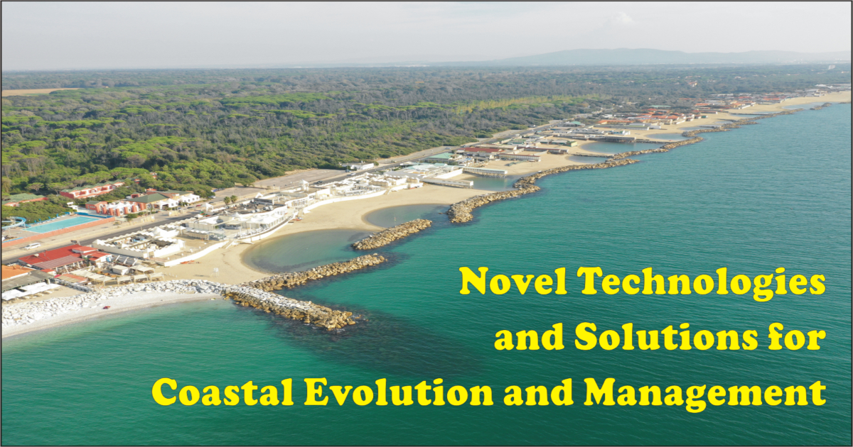
Novel Technologies and Solutions for Coastal Evolution and Management

A special issue of Journal of Marine Science and Engineering (ISSN 2077-1312). This special issue belongs to the section "Coastal Engineering".

Deadline for manuscript submissions: closed (10 April 2022) | Viewed by 21761

Special Issue Editors


E-Mail Website
Guest Editor
Department of Earth Sciences, University of Pisa, 56126 Pisa, Italy
Interests: coastal morphodynamics; strandplain evolution; geoarchaeology; sedimentology; coarse beach; clast RFDI identification
Special Issues, Collections and Topics in MDPI journals

Special Issue Information

Dear Colleagues,

Coastal areas are in need of continuous specialized studies, especially considering the projections about sea level rise, which predict unsettling scenarios within the next decades. However, the evolution of coasts is the result of many processes, often acting on short temporal scales. Lately, strong attention has been dedicated to approaches to coastal zone management that encourage multidisciplinary studies.

In recent years, several novel technologies have emerged whose roles can be crucial to better understand the processes acting on coastal areas. These include pervasive monitoring systems based on the Internet of Things paradigm as well as remote sensing techniques exploiting drones, and Surface and Underwater vehicles. All these technologies are leading to a more accurate definition of coastal processes.

The purpose of the Special Issue is to publish the most interesting and innovative research about the proposed subjects, providing short turn-around time regarding reviewing and publishing.

High-quality papers related to one of the following topics will be taken into consideration for publication.

  • Coastal zone management
  • Sediment transport
  • Nearshore processes
  • Effects of coastal protection structures
  • Case studies about best practice implementation
  • Remote sensing for coastal areas
  • Internet of Things architectures for coastal areas
  • Drones and vehicles for coastal monitoring
  • Sediment tracing techniques and technologies
  • Data analysis tools for coast management

Dr. Duccio Bertoni
Dr. Alessandro Pozzebon
Guest Editors

Manuscript Submission Information

Manuscripts should be submitted online at www.mdpi.com by registering and logging in to this website. Once you are registered, click here to go to the submission form. Manuscripts can be submitted until the deadline. All submissions that pass pre-check are peer-reviewed. Accepted papers will be published continuously in the journal (as soon as accepted) and will be listed together on the special issue website. Research articles, review articles as well as short communications are invited. For planned papers, a title and short abstract (about 100 words) can be sent to the Editorial Office for announcement on this website.

Submitted manuscripts should not have been published previously, nor be under consideration for publication elsewhere (except conference proceedings papers). All manuscripts are thoroughly refereed through a single-blind peer-review process. A guide for authors and other relevant information for submission of manuscripts is available on the Instructions for Authors page. Journal of Marine Science and Engineering is an international peer-reviewed open access monthly journal published by MDPI.

Please visit the Instructions for Authors page before submitting a manuscript. The Article Processing Charge (APC) for publication in this open access journal is 2600 CHF (Swiss Francs). Submitted papers should be well formatted and use good English. Authors may use MDPI's English editing service prior to publication or during author revisions.

Keywords

  • Coastal zone management
  • Sediment transport
  • Nearshore processes
  • Coastal protection
  • Modelling
  • Drones
  • Surface Vehicles
  • Underwater vehicles
  • Internet of Things
  • Sediment tracing

Benefits of Publishing in a Special Issue

  • Ease of navigation: Grouping papers by topic helps scholars navigate broad scope journals more efficiently.
  • Greater discoverability: Special Issues support the reach and impact of scientific research. Articles in Special Issues are more discoverable and cited more frequently.
  • Expansion of research network: Special Issues facilitate connections among authors, fostering scientific collaborations.
  • External promotion: Articles in Special Issues are often promoted through the journal's social media, increasing their visibility.
  • e-Book format: Special Issues with more than 10 articles can be published as dedicated e-books, ensuring wide and rapid dissemination.

Further information on MDPI's Special Issue polices can be found here.

Published Papers (7 papers)

Order results
Result details
Select all
Export citation of selected articles as:

Research

24 pages, 7976 KiB  
Article
Post-Nourishment Changes of an Artificial Gravel Pocket Beach Using UAV Imagery
by Andrea Tadić, Igor Ružić, Nino Krvavica and Suzana Ilić
J. Mar. Sci. Eng. 2022, 10(3), 358; https://doi.org/10.3390/jmse10030358 - 3 Mar 2022
Cited by 8 | Viewed by 2244
Abstract
Monitoring and analysis of changes in the volume and area of nourished beaches is crucial to inform any beach renourishment programme. The aim of this study is to utilise UAV surveys and SfM photogrammetry to assess the beach nourishment performance of an artificial [...] Read more.
Monitoring and analysis of changes in the volume and area of nourished beaches is crucial to inform any beach renourishment programme. The aim of this study is to utilise UAV surveys and SfM photogrammetry to assess the beach nourishment performance of an artificial gravel beach exposed to a range of external forcing, including storms. The paper presents results from nineteen UAV surveys conducted between January 2020 and January 2021 at Ploče, an artificial beach in Rijeka (Croatia). The beach was nourished twice and eleven storm events, ranging from weak to strong, were recorded during this period. The Agisoft Metashape software was used to obtain point clouds and digital elevation models (DEMs) from UAV images; Matlab and CloudCompare were used for further analysis of the DEMs. The accuracy and precision of the DEMs was assessed and uncertainty levels of ±5 cm were applied to all derived DEMs. The study provides new insights into the response of the emerged part of the beach to storms. Predictably, the largest changes were recorded after the first storm following beach nourishment. The longshore variability in the beach response to storms was identified from full 3D point clouds. Most of the lost sediment was from the east side of the beach, while the rest of the beach aligned with the predominant wave direction through cross-shore and longshore processes. Offshore/onshore sediment exchange between the lower and upper beach face on the western side manifested itself in beach profile steepening and berm formations. Overall, changes in beach volume and area were small, indicating that this artificial beach is relatively stable. The embayed layout following the natural coastal configuration appears to be effective in retaining nourished sediment on the beach. This work highlights the need to consider pocket embayed beaches in three dimensions, as traditional transect studies can overlook the three-dimensional behaviour. This study also highlighted the wider potential of UAVs and SfM for studies of high-resolution elevation changes on natural and artificial beaches, as well as for coastal monitoring of beach nourishment. Full article
(This article belongs to the Special Issue Novel Technologies and Solutions for Coastal Evolution and Management)
Show Figures

Figure 1

14 pages, 3723 KiB  
Article
Application of Artificial Neural Networks to Predict Beach Nourishment Volume Requirements
by Damjan Bujak, Tonko Bogovac, Dalibor Carević, Suzana Ilic and Goran Lončar
J. Mar. Sci. Eng. 2021, 9(8), 786; https://doi.org/10.3390/jmse9080786 - 21 Jul 2021
Cited by 9 | Viewed by 2425
Abstract
The volume of material required for the construction of new and expansion of existing beach sites is an important parameter for coastal management. This information may play a crucial role when deciding which beach sites to develop. This work examines whether artificial neural [...] Read more.
The volume of material required for the construction of new and expansion of existing beach sites is an important parameter for coastal management. This information may play a crucial role when deciding which beach sites to develop. This work examines whether artificial neural networks (ANNs) can predict the spatial variability of nourishment requirements on the Croatian coast. We use survey data of the nourishment volume requirements and gravel diameter from 2016 to 2020, fetch length, beach area and orientation derived from national maps which vary from location to location due to a complex coastal configuration on the East Adriatic coast, and wind, tide, and rainfall data from nearby meteorological/oceanographic stations to train and test ANNs. The results reported here confirm that an ANN can adequately predict the spatial variability of observed nourishment volumes (R and MSE for the test set equal 0.87 and 2.24 × 10⁴, respectively). The contributions of different parameters to the ANN’s predictive ability were examined. Apart from the most obvious parameters like the beach length and the beach areas, the fetch length proved to be the most important input contribution to ANN’s predictive ability, followed by the beach orientation. Fetch length and beach orientation are parameters governing the wind wave height and direction and hence are proxies for forcing. Full article
(This article belongs to the Special Issue Novel Technologies and Solutions for Coastal Evolution and Management)
Show Figures

Figure 1

17 pages, 4767 KiB  
Article
Fine Spatial Scale, Frequent Morphological Monitoring of Urbanised Beaches to Improve Coastal Management
by Kelis M. Hinestroza-Mena, Vladimir G. Toro, Gloria S. Londoño-Colorado, Valeria Chávez, Julieth K. García-Blanco and Rodolfo Silva
J. Mar. Sci. Eng. 2021, 9(5), 550; https://doi.org/10.3390/jmse9050550 - 19 May 2021
Cited by 4 | Viewed by 2806
Abstract
Between 1959 and 2010, a coastline retreat of 2.4 m/year and erosion of up to 174 m were recorded around Turbo, in northern Colombia. This degraded coastal system is the result of a poorly planned coastal defence scheme, combined with a lack of [...] Read more.
Between 1959 and 2010, a coastline retreat of 2.4 m/year and erosion of up to 174 m were recorded around Turbo, in northern Colombia. This degraded coastal system is the result of a poorly planned coastal defence scheme, combined with a lack of formal technical methodologies for diagnosis and monitoring. The coastal system cannot provide the protection services required by the local community. From 2017 to 2019, the group monitored urban beach profiles in a small area close to the town of Turbo, in the wet and the dry seasons, as part of a coastline analysis to identify morphodynamic trends in the area. The results show a net shoreline accretion of up to 30 m and positive sedimentary accumulation of up to 45.8 m3/m. To the north of the study area, sediment accumulation is evident at the Turbo River Delta. The 34 coastal protection structures in the study area have a high k index (~0.7), suggesting that they are the main drivers controlling the trend of sediment accumulation. The correlation of geomorphological, oceanographic, and anthropic variables related to the presence of coastal structures, is necessary in order to set up efficient coastal protection schemes. Full article
(This article belongs to the Special Issue Novel Technologies and Solutions for Coastal Evolution and Management)
Show Figures

Figure 1

13 pages, 4680 KiB  
Article
Multi-Decadal Deltaic Land-Surface Changes: Gauging the Vulnerability of a Selection of Mediterranean and Black Sea River Deltas
by Edward J. Anthony, Manon Besset, Florin Zainescu and François Sabatier
J. Mar. Sci. Eng. 2021, 9(5), 512; https://doi.org/10.3390/jmse9050512 - 9 May 2021
Cited by 5 | Viewed by 2203
Abstract
Areal changes over delta surfaces determined by land and water ratios are a promising tool for identifying spatial and temporal changes in deltas that may reveal subsidence and shoreline erosion. Such changes can also provide the basis for more detailed studies on variations [...] Read more.
Areal changes over delta surfaces determined by land and water ratios are a promising tool for identifying spatial and temporal changes in deltas that may reveal subsidence and shoreline erosion. Such changes can also provide the basis for more detailed studies on variations in land-cover and vegetation. Changes in land and water areas over a 35-year period (1984–2019) were determined for a selection of ten river deltas in the Mediterranean (Nile, Rhône, Po, Ebro, Moulouya, Ceyhan-Seyhan, Medjerdja, Ombrone, Arno) and the Black Sea (Danube), with a particular focus on aspects of subsidence and shoreline erosion. With the exception of the Ombrone, Arno, and Moulouya, and to lesser extent the Medjerdja, where notable changes dominate in the coastal zone and are tantamount to net erosion, the spatial pattern is largely dominated by delta-plain changes characterized by increasing areas of water. The pattern reflects a mix of shoreline erosion, land-use and land-cover changes, such as the ecological restoration of wetlands, but also increasing subsidence in these deltas, all of which have been exposed to a declining fluvial sediment supply due to human influence. The use of data on land-water ratios needs to be complemented by more detailed studies devoted to each delta in order to clearly disentangle changes related to land-use, vegetation, and subsidence. It is also important to determine how wetlands are interpreted in such ratios, as these important ecological elements are sensitive to ratio variations. It would also be interesting in future studies to examine how these variations play out over time, notably in deltas where changes have been significant over the period 1984–2019. Full article
(This article belongs to the Special Issue Novel Technologies and Solutions for Coastal Evolution and Management)
Show Figures

Figure 1

16 pages, 5762 KiB  
Article
The Use of News Information Published in Newspapers to Estimate the Impact of Coastal Storms at a Regional Scale
by Amanda Sancho-García, Jorge Guillén, Vicente Gracia, Ana Carlota Rodríguez-Gómez and Belén Rubio-Nicolás
J. Mar. Sci. Eng. 2021, 9(5), 497; https://doi.org/10.3390/jmse9050497 - 4 May 2021
Cited by 7 | Viewed by 2157
Abstract
The evaluation of coastal damage caused by storms is not straightforward and different approaches can be applied. In this study, damage caused by extreme storms is evaluated at a regional scale based on news information published in regional newspapers. The data derived from [...] Read more.
The evaluation of coastal damage caused by storms is not straightforward and different approaches can be applied. In this study, damage caused by extreme storms is evaluated at a regional scale based on news information published in regional newspapers. The data derived from the news are compared with hydrodynamic parameters to check the reliability of this methodology as a preliminary” fast approach” to evaluate storm damage and to identify hotspots along the coast. This methodology was applied to the two most extreme storms ever recorded along the Spanish Mediterranean coast, which occurred in January 2017 and January 2020, severely impacting the coast and causing significant community concerns. The news information from different media sources was processed and weighted to describe the resulting erosion, inundation, sand accumulation, and destruction of infrastructures. Moreover, an accuracy index for scoring the quality of the information was proposed. In spite of some limitations of the method, the resulting regional coastal hazard landscape of damage provides a rapid overview of the intensity and distribution of the damage and enables one to identify the location of potential hotspots for the analyzed extreme storm events. The results show that estimated damage intensity is better related to maximum wave energy than cumulative wave energy during a storm, and that beach characteristics should also be included for understanding the distribution of coastal damage. Full article
(This article belongs to the Special Issue Novel Technologies and Solutions for Coastal Evolution and Management)
Show Figures

Figure 1

27 pages, 6795 KiB  
Article
The Importance of Geotechnical Evaluation and Shoreline Evolution in Coastal Vulnerability Index Calculations
by Vasileios Boumboulis, Dionysios Apostolopoulos, Nikolaos Depountis and Konstantinos Nikolakopoulos
J. Mar. Sci. Eng. 2021, 9(4), 423; https://doi.org/10.3390/jmse9040423 - 14 Apr 2021
Cited by 17 | Viewed by 5327
Abstract
The aim of this specific study is to present a new weighted Coastal Vulnerability Index (CVIWF), with an emphasis given to the geotechnical evaluation and shoreline evolution rate measured through high-resolution remote sensing, which seem to be the most interfering variables [...] Read more.
The aim of this specific study is to present a new weighted Coastal Vulnerability Index (CVIWF), with an emphasis given to the geotechnical evaluation and shoreline evolution rate measured through high-resolution remote sensing, which seem to be the most interfering variables in CVI calculations. As a pilot area for the application of the new CVIWF, the Gulf of Patras in Western Greece was selected, which is suffering erosion problems due to climate change, the sea level rising and human intervention. The new CVIWF, which was applied in this research, includes the following innovations: (1) the use of geotechnical characterization instead of geological–geomorphological characterization, (2) the use of high-resolution remote sensing data for the detection of shoreline evolution rate and (3) the insertion of a specific weighted geotechnical factor in the CVIWF formula. The results from the application of the unweighted CVI show that percentages of 20.13%, 20.47%, 24.56%, 29.39% and 5.45% of the gulf’s shoreline are under the regime of very low, low, moderate, high and very high vulnerability, respectively. On the other hand, the corresponding results from the application of the weighted CVIWF show a percentage of 14.59%, 25.91%, 20.04, 36.48% and 2.98, respectively. Full article
(This article belongs to the Special Issue Novel Technologies and Solutions for Coastal Evolution and Management)
Show Figures

Figure 1

27 pages, 47227 KiB  
Article
The Management of the Beach-Cast Seagrass Wracks—A Numerical Modelling Approach
by Andrea Cucco, Giovanni Quattrocchi, Walter Brambilla, Augusto Navone, Pieraugusto Panzalis and Simone Simeone
J. Mar. Sci. Eng. 2020, 8(11), 873; https://doi.org/10.3390/jmse8110873 - 3 Nov 2020
Cited by 11 | Viewed by 2452
Abstract
Seagrass wrack are commonly found on the beach face of the sandy shore all around the world and often persists in situ during the whole year, favouring the emergence of conflicts for the use of the sandy coasts for bathing or for other [...] Read more.
Seagrass wrack are commonly found on the beach face of the sandy shore all around the world and often persists in situ during the whole year, favouring the emergence of conflicts for the use of the sandy coasts for bathing or for other recreational purposes. As a consequence, these deposits are often removed from the beach during the summer months, temporary stocked, and relocated on the shore face in the next autumn or winter season. The selection of the sites on the shoreline where the leaves should be released before the storms season is often an issue, considering the optimization needs between the transportation costs and the oceanographic features of the dumping site. In this study, a numerical approach was proposed to identify the most suitable areas for the autumnal repositioning of the seagrass wracks for two beaches of Sardinia, an island located in the Western Mediterranean Sea where Posidonia oceanica (L. Delile, 1813) is the most widespread seagrass species. The method is based on the use of hydrodynamic, wave, and particle tracking models and provides important indications useful for the management of this type of practice that can be extended to all different type of beaches along the Mediterranean coasts. Full article
(This article belongs to the Special Issue Novel Technologies and Solutions for Coastal Evolution and Management)
Show Figures

Figure 1

Back to TopTop