Review

Multispectral Remote Sensing of Wetlands in Semi-Arid and Arid Areas: A Review on Applications, Challenges and Possible Future Research Directions

Department of Earth Science, Institute for Water Studies, University of the Western Cape, Private Bag X17, Bellville 7535, South Africa
*
Author to whom correspondence should be addressed.
Remote Sens. 2020, 12(24), 4190; https://doi.org/10.3390/rs12244190
Submission received: 3 November 2020 / Revised: 14 December 2020 / Accepted: 18 December 2020 / Published: 21 December 2020
(This article belongs to the Special Issue Wetland Landscape Change Mapping Using Remote Sensing)

Abstract

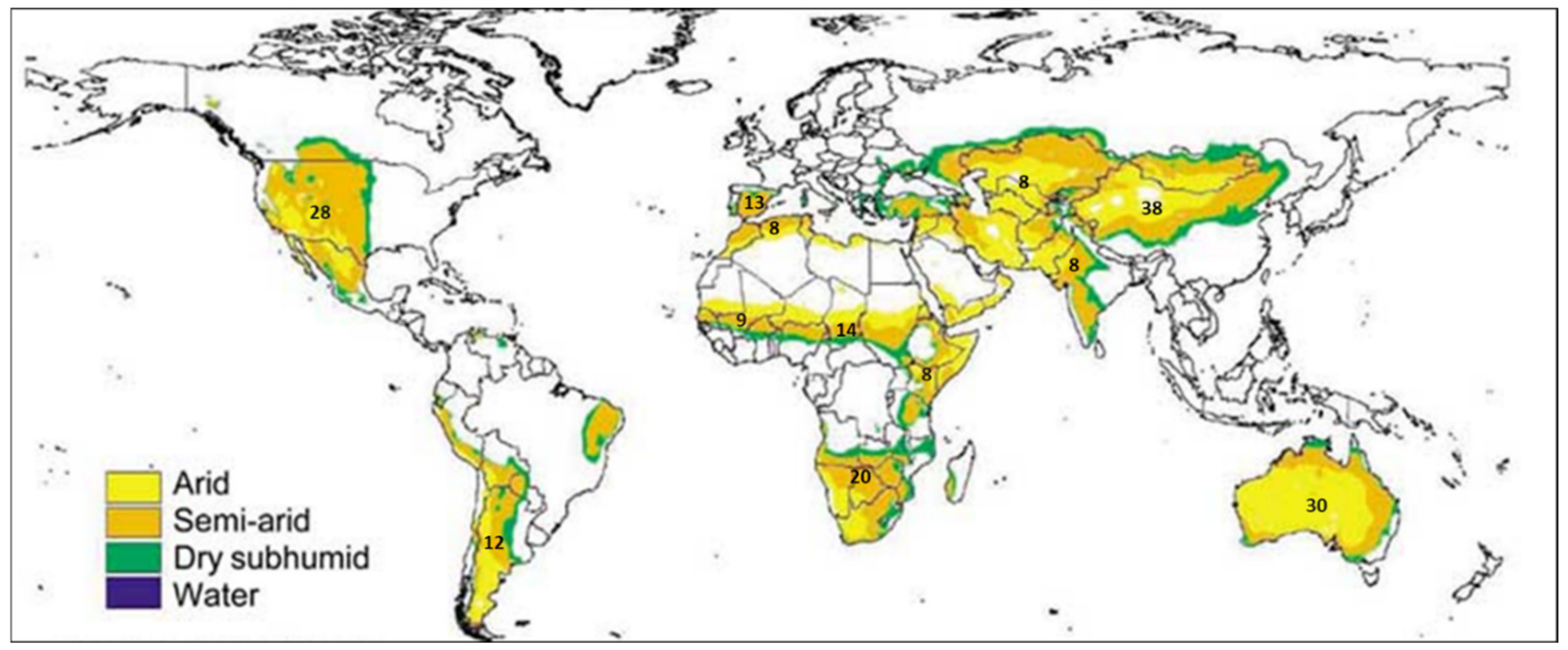
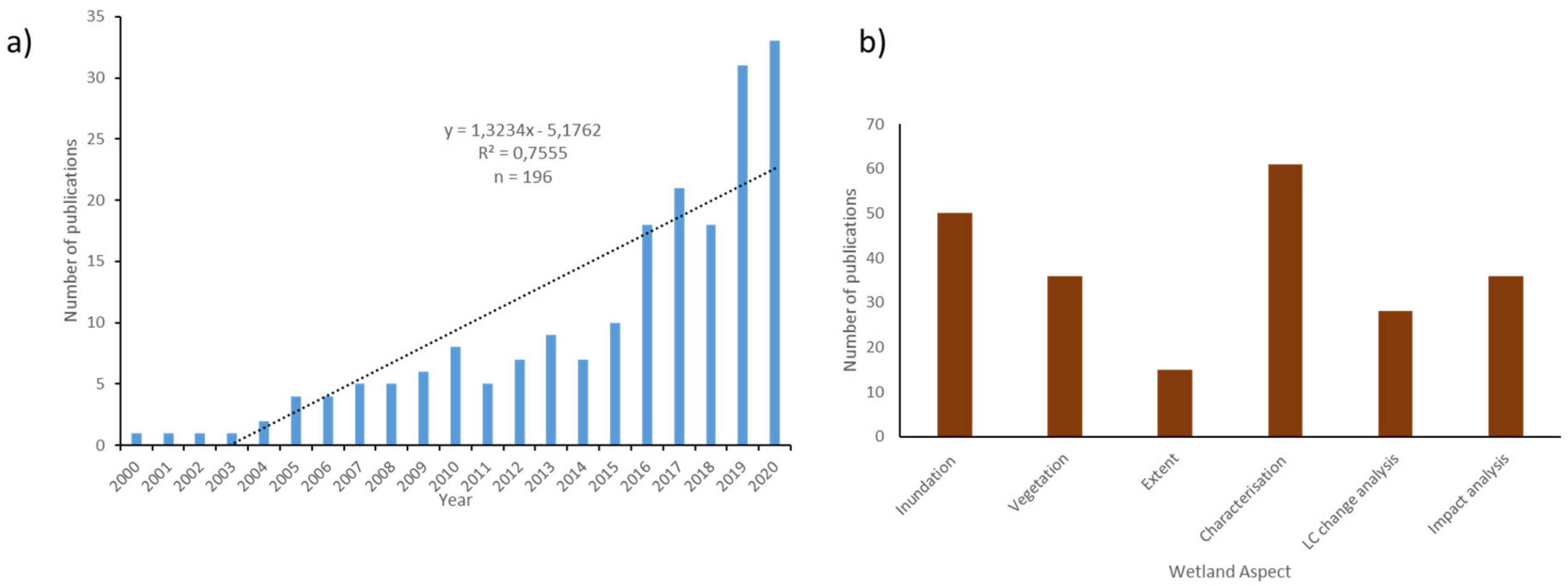
Wetlands are ranked as very diverse ecosystems, covering about 4–6% of the global land surface. They occupy the transition zones between aquatic and terrestrial environments, and share characteristics of both zones. Wetlands play critical roles in the hydrological cycle, sustaining livelihoods and aquatic life, and biodiversity. Poor management of wetlands results in the loss of critical ecosystems goods and services. Globally, wetlands are degrading at a fast rate due to global environmental change and anthropogenic activities. This requires holistic monitoring, assessment, and management of wetlands to prevent further degradation and losses. Remote-sensing data offer an opportunity to assess changes in the status of wetlands including their spatial coverage. So far, a number of studies have been conducted using remotely sensed data to assess and monitor wetland status in semi-arid and arid regions. A literature search shows a significant increase in the number of papers published during the 2000–2020 period, with most of these studies being in semi-arid regions in Australia and China, and few in the sub-Saharan Africa. This paper reviews progress made in the use of remote sensing in detecting and monitoring of the semi-arid and arid wetlands, and focuses particularly on new insights in detection and monitoring of wetlands using freely available multispectral sensors. The paper firstly describes important characteristics of wetlands in semi-arid and arid regions that require monitoring in order to improve their management. Secondly, the use of freely available multispectral imagery for compiling wetland inventories is reviewed. Thirdly, the challenges of using freely available multispectral imagery in mapping and monitoring wetlands dynamics like inundation, vegetation cover and extent, are examined. Lastly, algorithms for image classification as well as challenges associated with their uses and possible future research are summarised. However, there are concerns regarding whether the spatial and temporal resolutions of some of the remote-sensing data enable accurate monitoring of wetlands of varying sizes. Furthermore, it was noted that there were challenges associated with the both spatial and spectral resolutions of data used when mapping and monitoring wetlands. However, advancements in remote-sensing and data analytics provides new opportunities for further research on wetland monitoring and assessment across various scales.
Keywords: data integration; inundation; multispectral imagery; semi-arid; seasonal wetlands; vegetation dynamics data integration; inundation; multispectral imagery; semi-arid; seasonal wetlands; vegetation dynamics