Article

A Hybrid Multi-Product Framework for Spatiotemporal Built-Up Expansion Mapping Across Contrasting Physiographic Landscapes of Nepal Using Sentinel-2 and Google Earth Engine

by
Madhu Sudan Adhikari
1,
Subash Ghimire
1 and
Dev Raj Paudyal
2,*
1
Department of Geomatics Engineering, School of Engineering, Kathmandu University, Dhulikhel 45200, Nepal
2
School of Science, Engineering and Digital Technologies, University of Southern Queensland (UniSQ), Toowoomba, QLD 4350, Australia
*
Author to whom correspondence should be addressed.
ISPRS Int. J. Geo-Inf. 2026, 15(9), 426; https://doi.org/10.3390/ijgi15090426
Submission received: 1 July 2026 / Revised: 1 September 2026 / Accepted: 15 September 2026 / Published: 17 September 2026
(This article belongs to the Special Issue Spatial Data Science and Knowledge Discovery)

Abstract

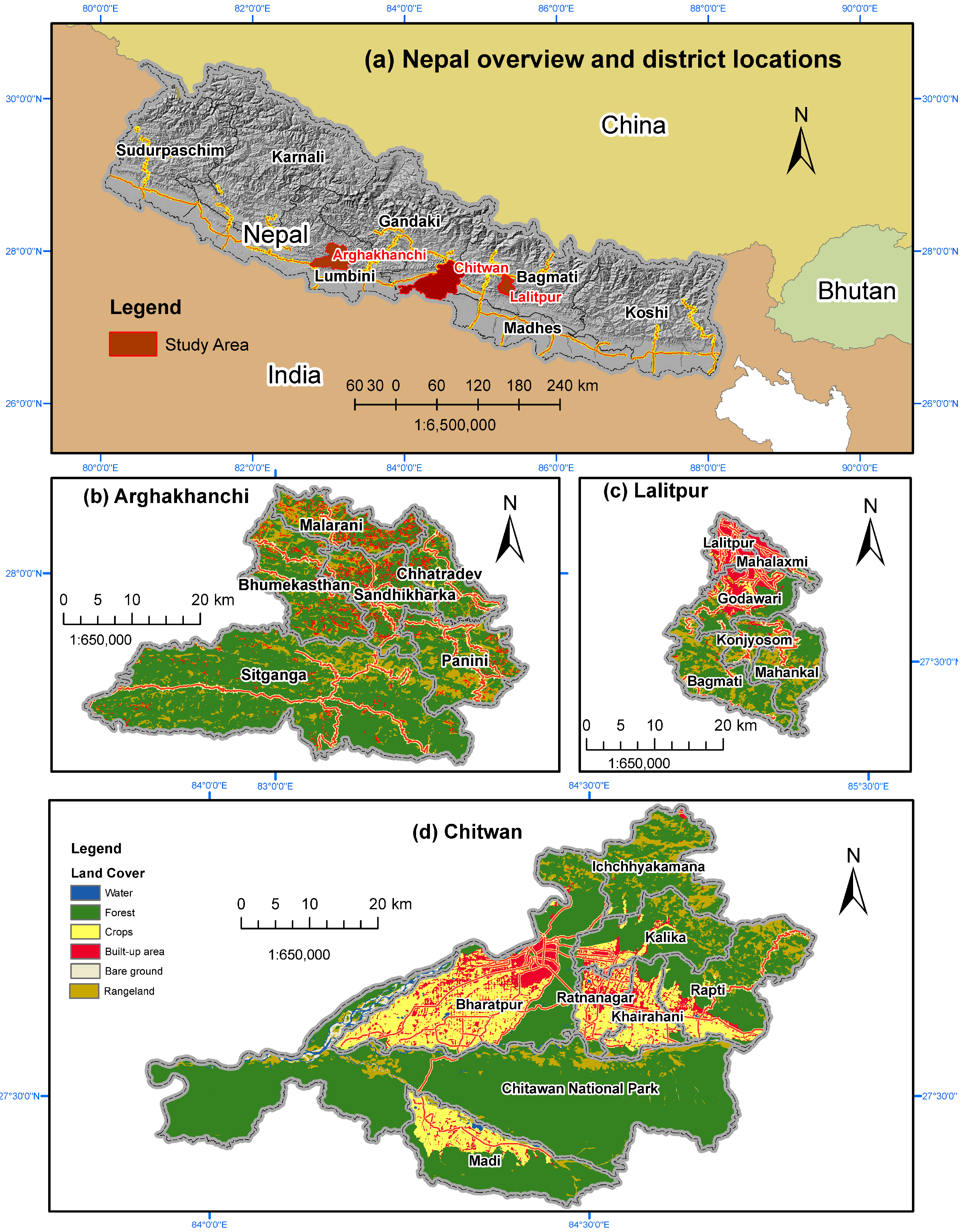
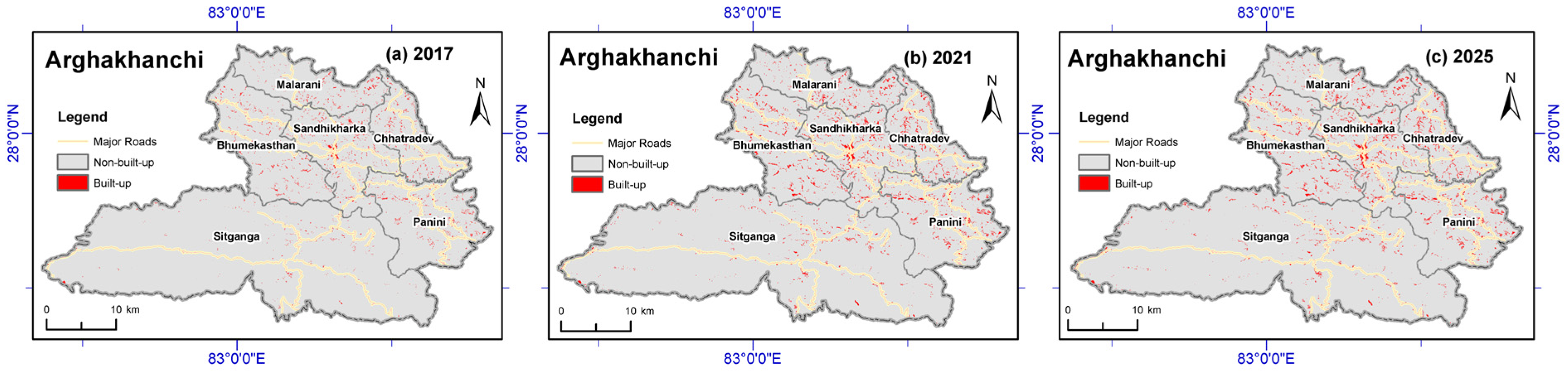
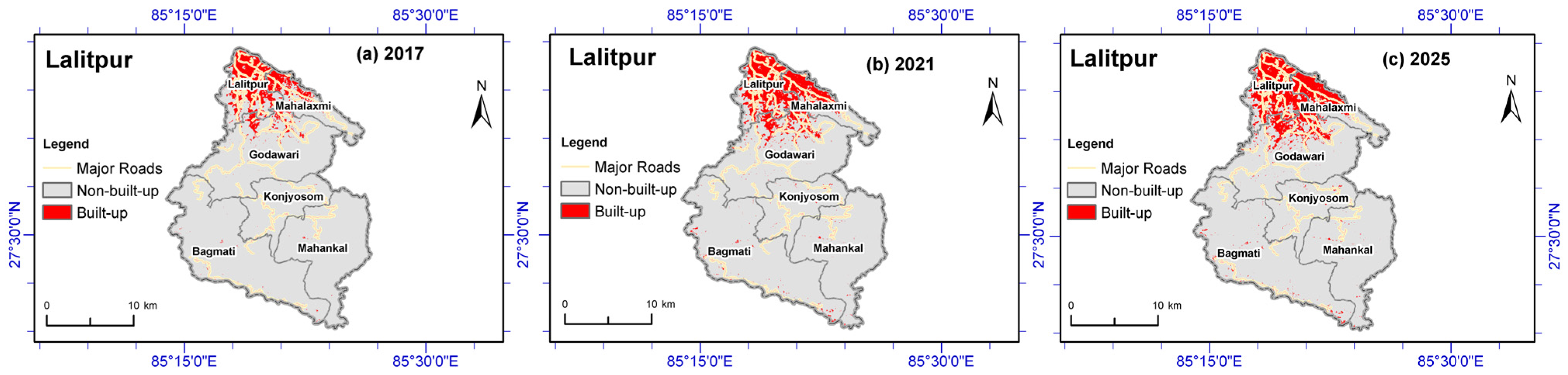
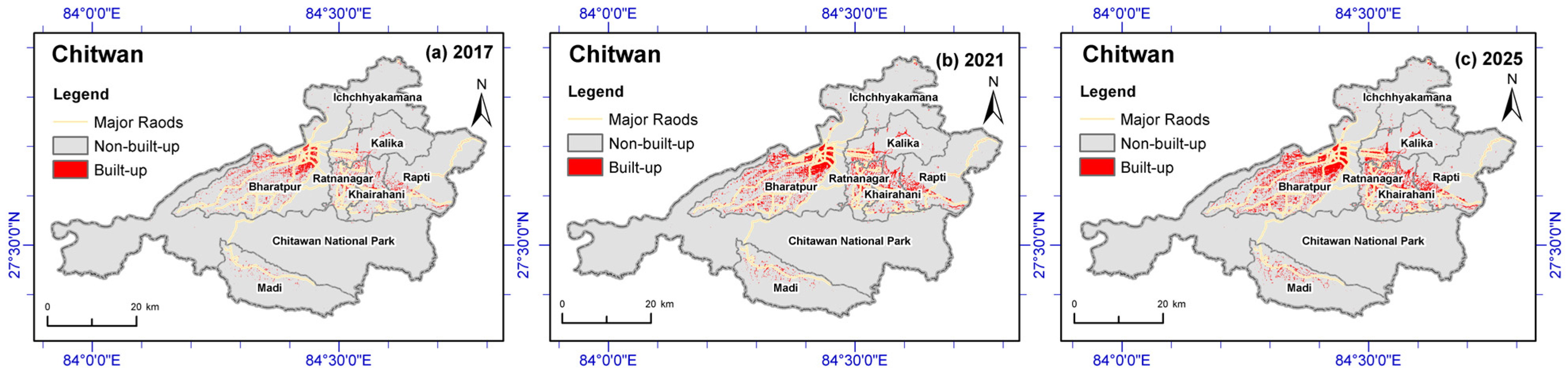
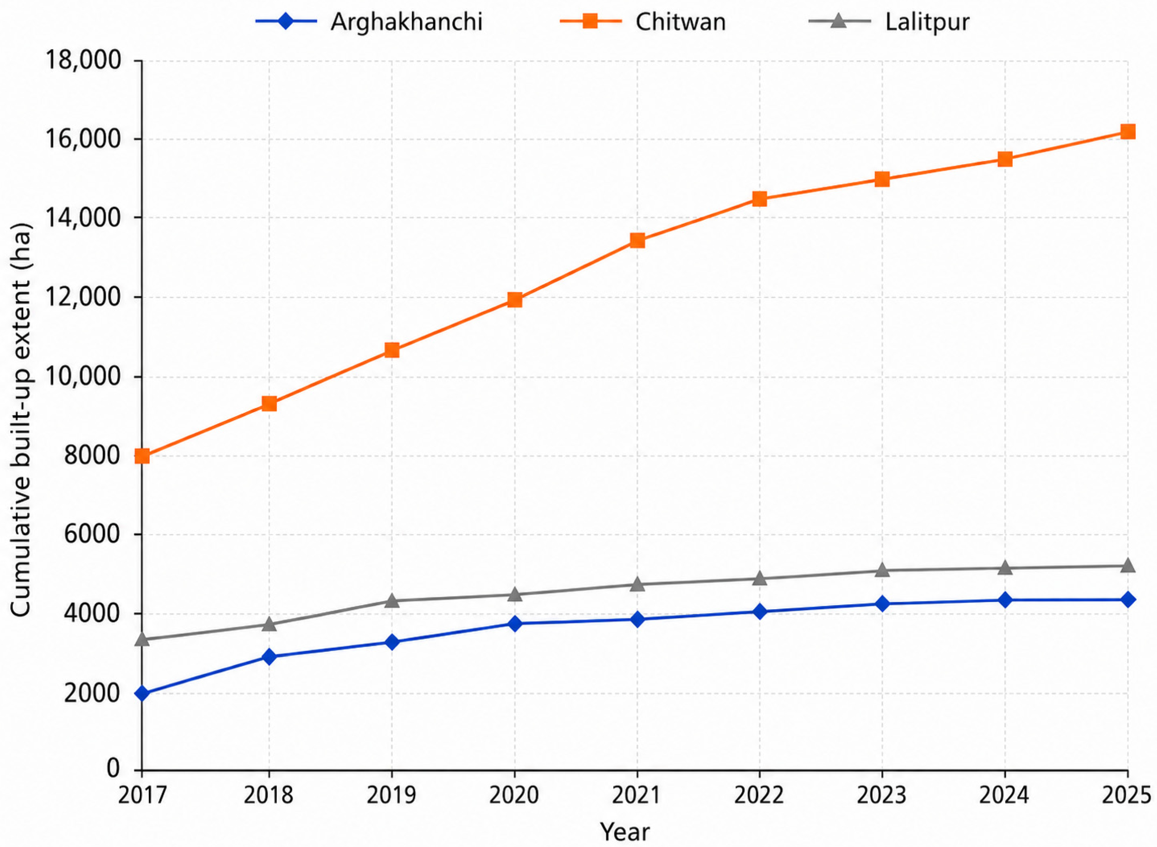
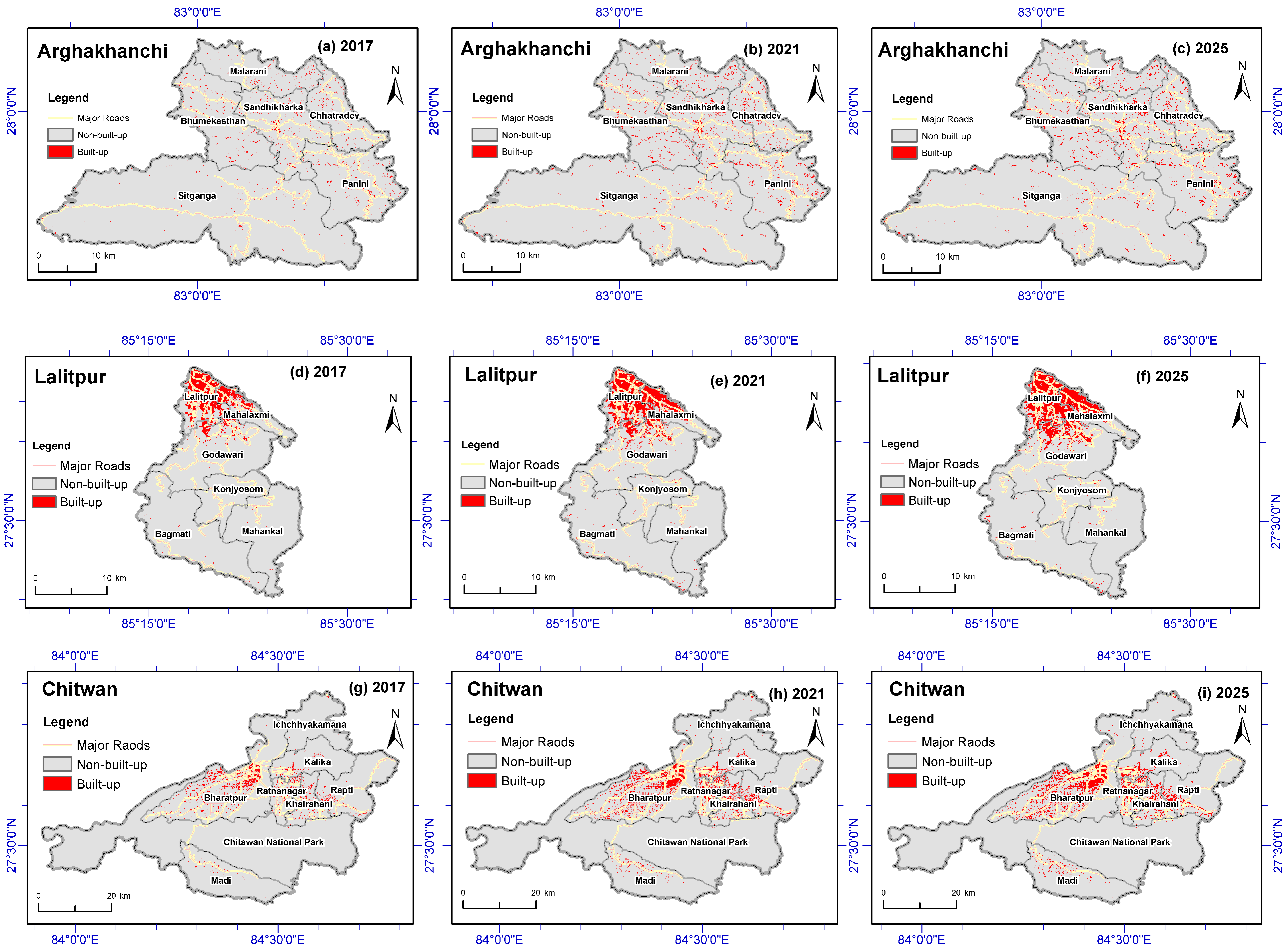
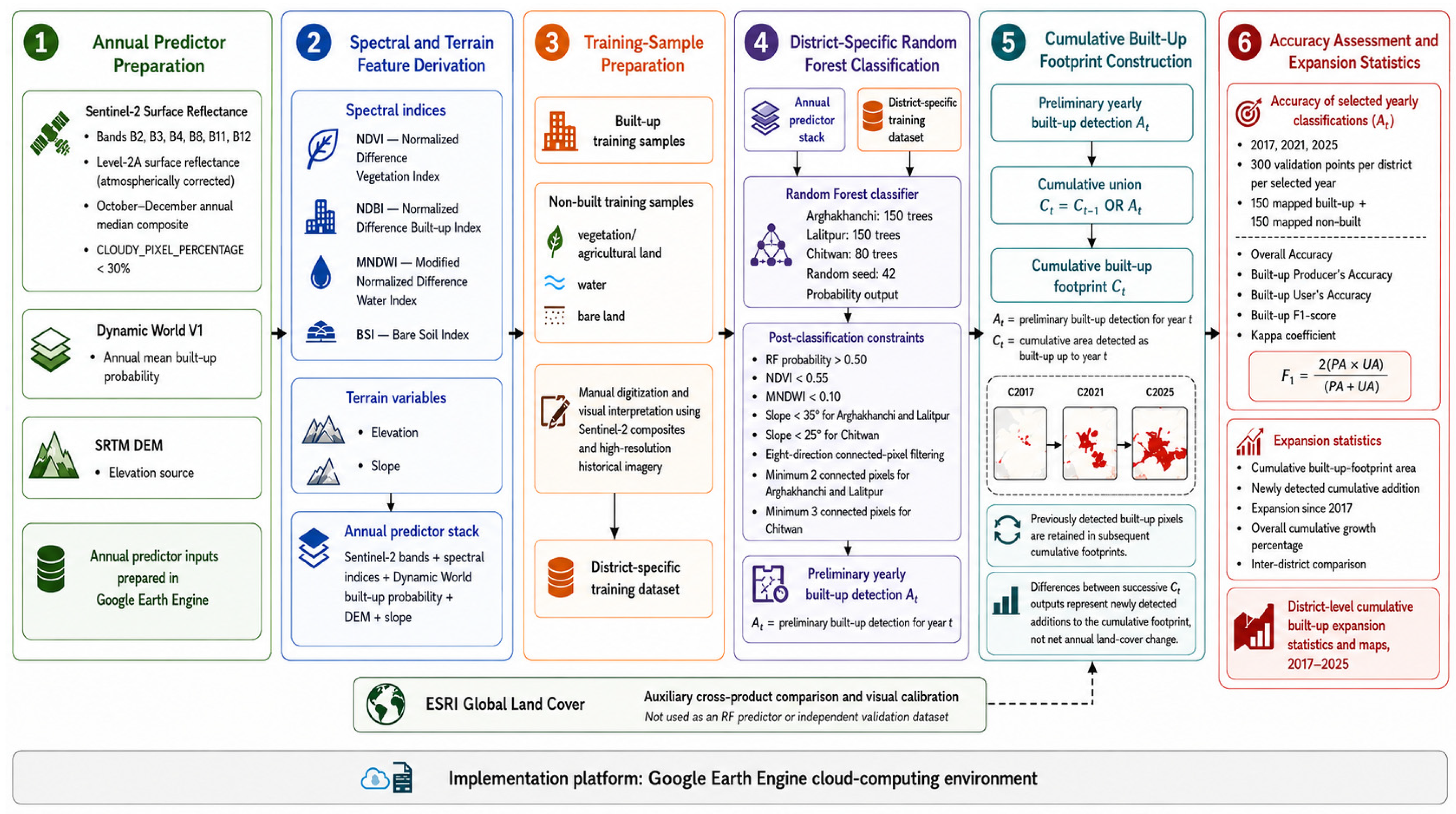
Built-up expansion is reshaping landscapes across Nepal; however, consistent multi-temporal mapping remains challenging due to rugged terrain, fragmented settlements, and heterogeneous land-cover conditions. This study develops and evaluates a multi-product and terrain-informed workflow in Google Earth Engine for mapping built-up expansion across three physiographically contrasting districts of Nepal: Arghakhanchi, Lalitpur, and Chitwan, from 2017 to 2025. Annual predictor stacks were generated by integrating Sentinel-2 spectral bands and derived indices, Dynamic World built-up probabilities, and SRTM-derived elevation and slope variables. ESRI Global Land Cover datasets were used separately for auxiliary cross-product comparison and assessment of the mapped outputs. Preliminary yearly built-up masks were generated using district- and year-specific Random Forest classifications, followed by the post-classification constraints, and were subsequently integrated through cumulative expansion mapping. Accuracy assessment for 2017, 2021, and 2025 yielded overall accuracy values of 86.4–92.4%, built-up F1-scores of 84.7–91.3%, and Kappa coefficients of 0.81–0.91. Between 2017 and 2025, cumulative built-up extent expanded by 8054.65 ha in Chitwan, 2406.20 ha in Arghakhanchi, and 2215.96 ha in Lalitpur; Arghakhanchi recorded the highest proportional increase (117.6%). The mapped expansion was comparatively dispersed in Arghakhanchi, concentrated within metropolitan and peri-urban areas in Lalitpur, and broader and corridor-oriented in Chitwan. Because previously detected built-up pixels were retained in subsequent cumulative outputs, the resulting extents were non-decreasing by construction and did not represent demolition or other land use reversals. Consequently, annual built-up expansion should not be interpreted as net annual land-cover change. The proposed framework provides a practical and transferable approach for comparative built-up expansion monitoring and urban growth assessment across contrasting physiographic settings.
Keywords: built-up expansion; cumulative built-up extent; annual built-up expansion; multi-product mapping; terrain-informed classification; Google Earth Engine; random forest; Sentinel-2 built-up expansion; cumulative built-up extent; annual built-up expansion; multi-product mapping; terrain-informed classification; Google Earth Engine; random forest; Sentinel-2