Article

The Impact of COVID-19 on Crime: A Spatial Temporal Analysis in Chicago
1
College of Resources and Environmental Science, Hunan Normal University, Changsha 410081, China
2
Key Laboratory of Geospatial Big Data Mining and Applications, Changsha 410081, China
3
School of Resources and Environmental Science, Wuhan University, 129 Luoyu Road, Wuhan 430079, China
*
Author to whom correspondence should be addressed.
ISPRS Int. J. Geo-Inf. 2021, 10(3), 152; https://doi.org/10.3390/ijgi10030152
Submission received: 29 January 2021 / Revised: 27 February 2021 / Accepted: 7 March 2021 / Published: 10 March 2021

Abstract

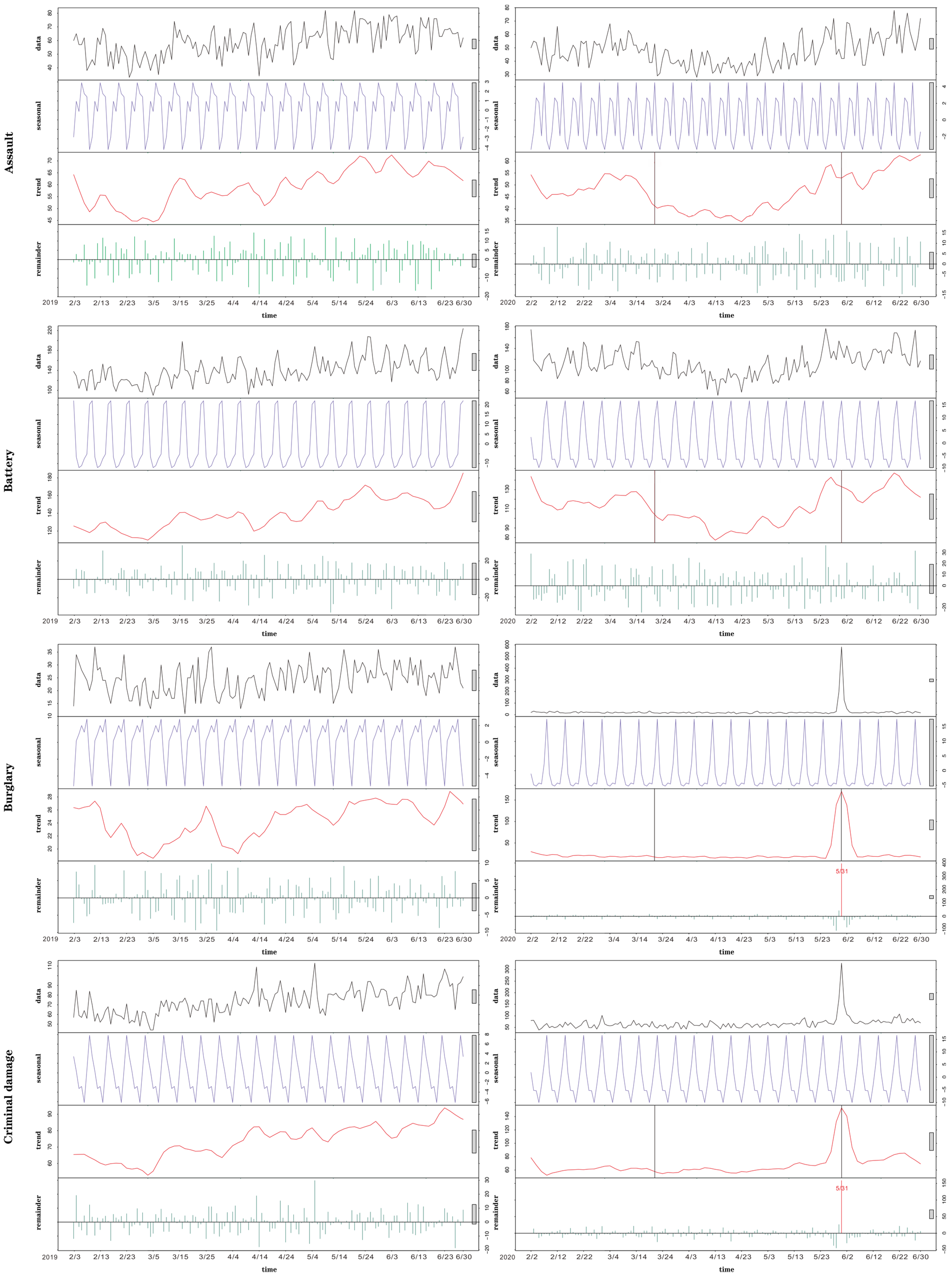
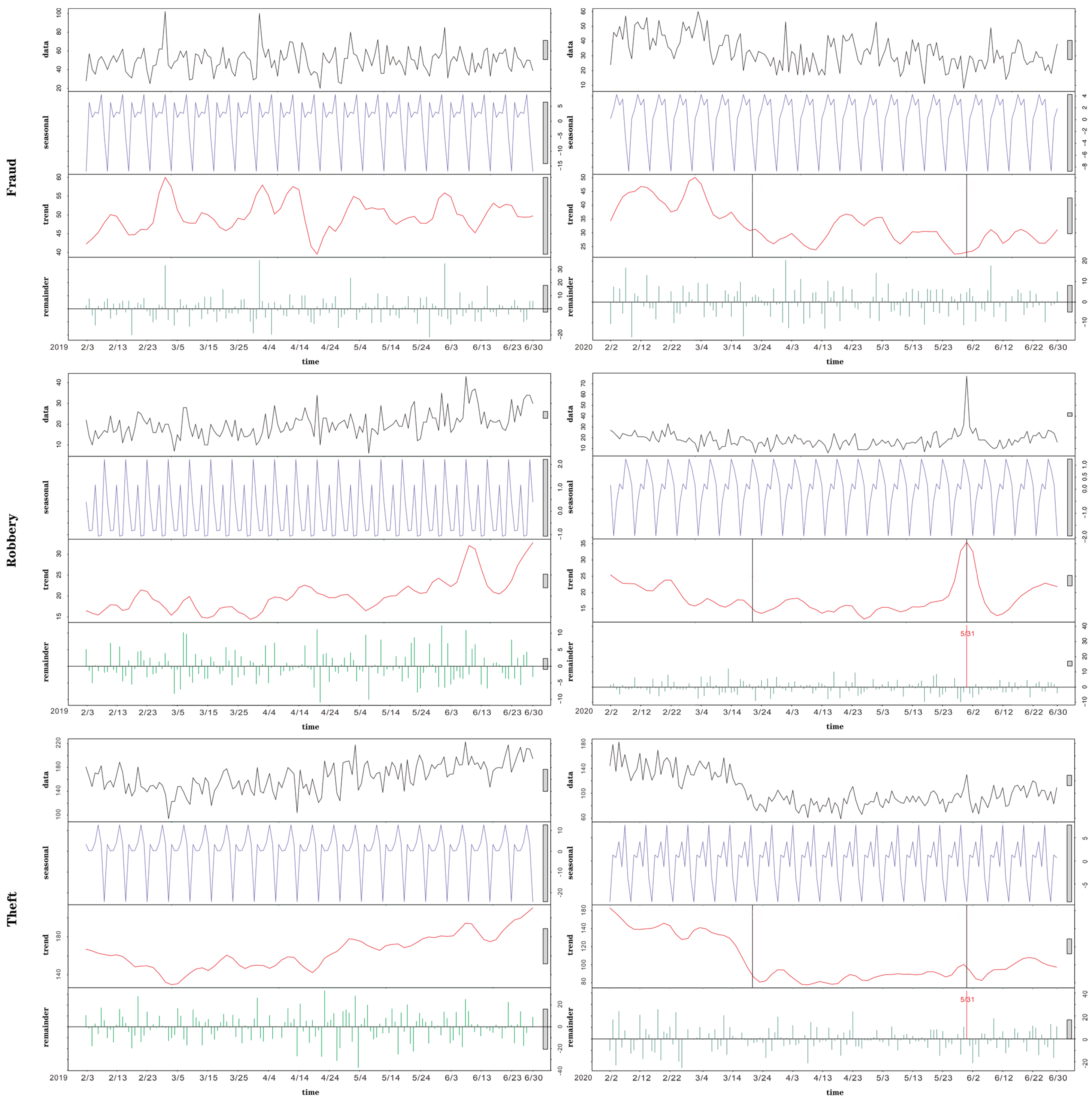

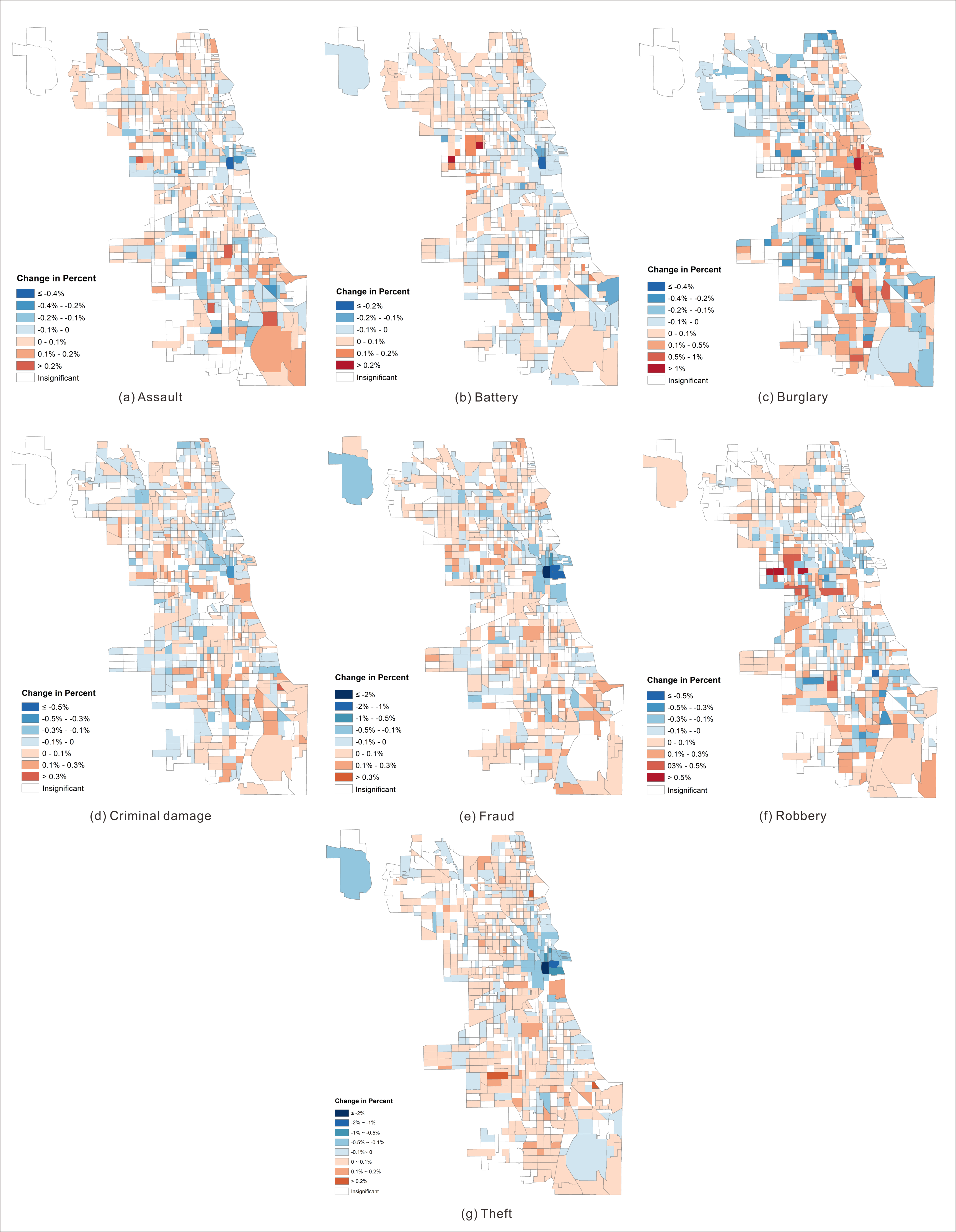
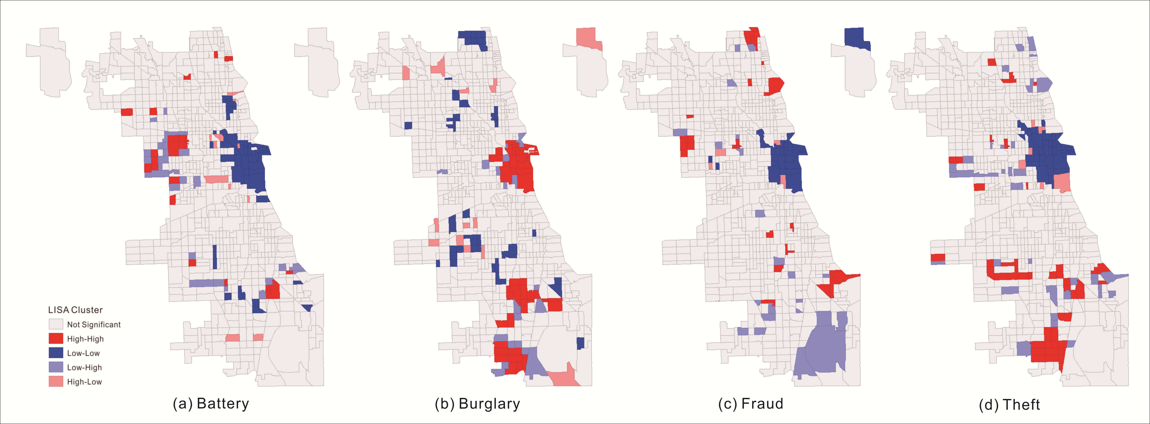
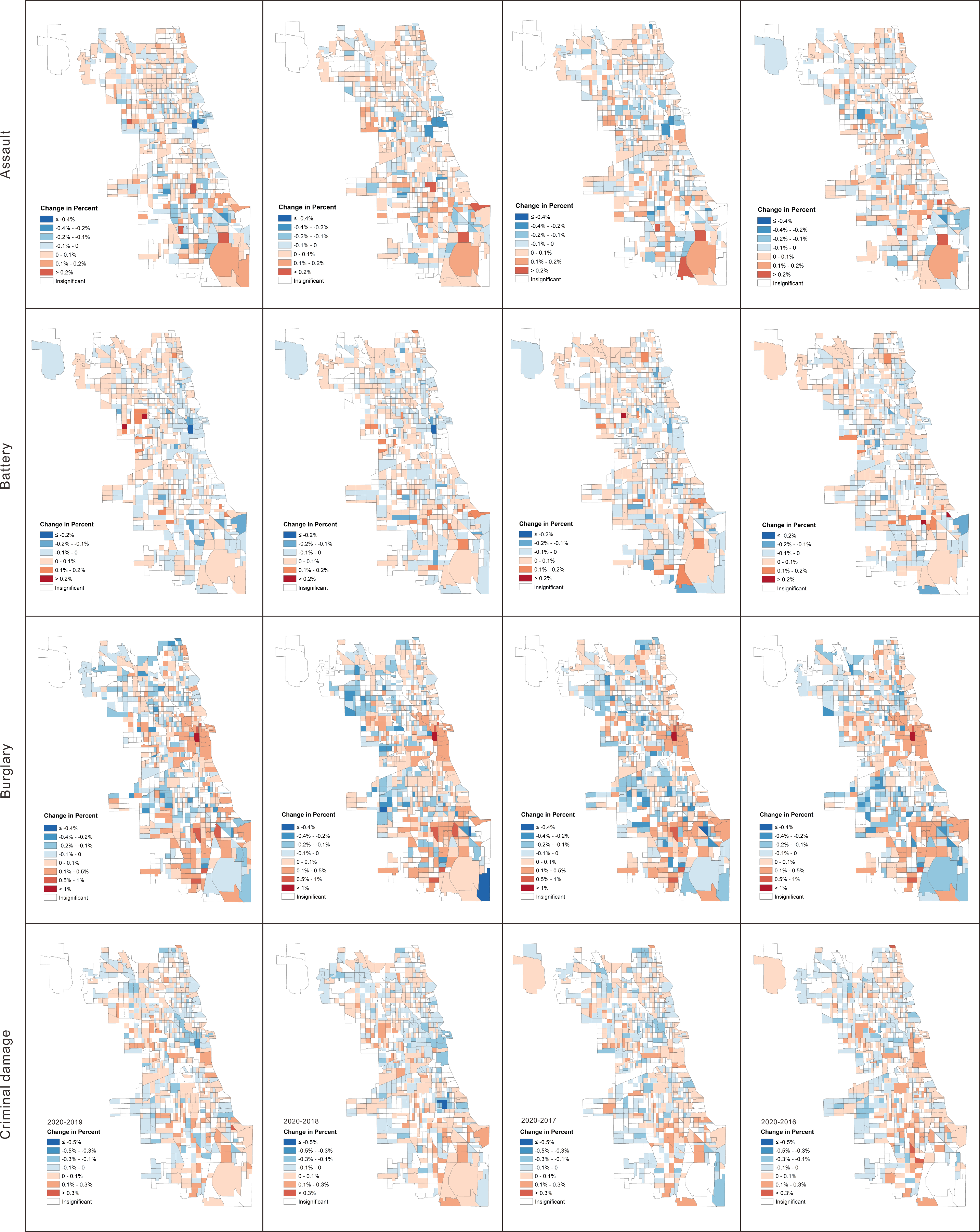
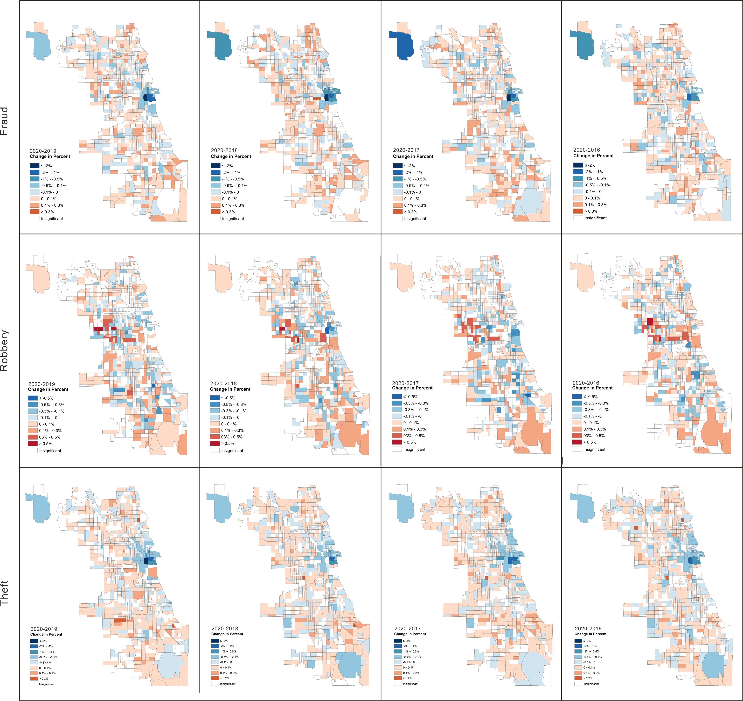
The coronavirus disease 2019 (COVID-19) pandemic has had tremendous and extensive impacts on the people’s daily activities. In Chicago, the numbers of crime fell considerably. This work aims to investigate the impacts that COVID-19 has had on the spatial and temporal patterns of crime in Chicago through spatial and temporal crime analyses approaches. The Seasonal-Trend decomposition procedure based on Loess (STL) was used to identify the temporal trends of different crimes, detect the outliers of crime events, and examine the periodic variations of crime distributions. The results showed a certain phase pattern in the trend components of assault, battery, fraud, and theft. The largest outlier occurred on 31 May 2020 in the remainder components of burglary, criminal damage, and robbery. The spatial point pattern test (SPPT) was used to detect the similarity between the spatial distribution patterns of crime in 2020 and those in 2019, 2018, 2017, and 2016, and to analyze the local changes in crime on a micro scale. It was found that the distributions of crime significantly changed in 2020 and local changes in theft, battery, burglary, and fraud displayed an aggregative cluster downtown. The results all claim that spatial and temporal patterns of crime changed significantly affected by COVID-19 in Chicago, and they offer constructive suggestions for local police departments or authorities to allocate their available resources in response to crime.
Keywords: pandemics; crime; spatial temporal analysis; STL; SPPT pandemics; crime; spatial temporal analysis; STL; SPPT