Article

Surveying and High-Resolution Topography of the Ochtiná Aragonite Cave Based on TLS and Digital Photogrammetry


1
Institute of Geodesy, Cartography and GIS, Faculty of Mining, Ecology, Process Control and Geotechnologies, Technical University of Košice, Park Komenského 19, 040 01 Košice, Slovakia
2
Department of Geography, Faculty of Education, Catholic University in Ružomberok, Hrabovská cesta 1, 031 04 Ružomberok, Slovakia
3
State Nature Conservancy of the Slovak Republic, Slovak Caves Administration, Hodžova 11, 031 01 Liptovský Mikuláš, Slovakia
*
Author to whom correspondence should be addressed.
Appl. Sci. 2020, 10(13), 4633; https://doi.org/10.3390/app10134633
Submission received: 27 May 2020 / Revised: 1 July 2020 / Accepted: 2 July 2020 / Published: 4 July 2020

Abstract

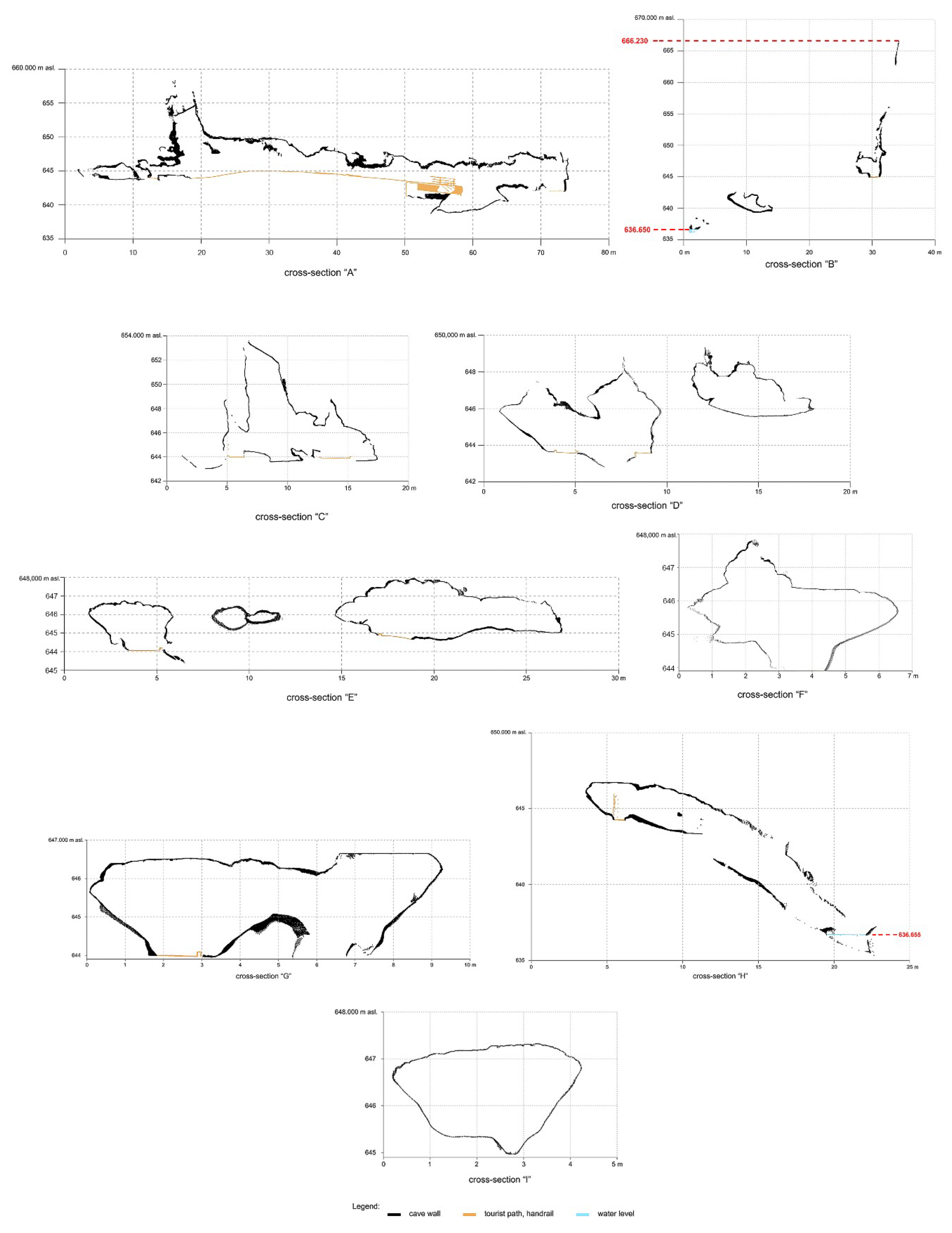
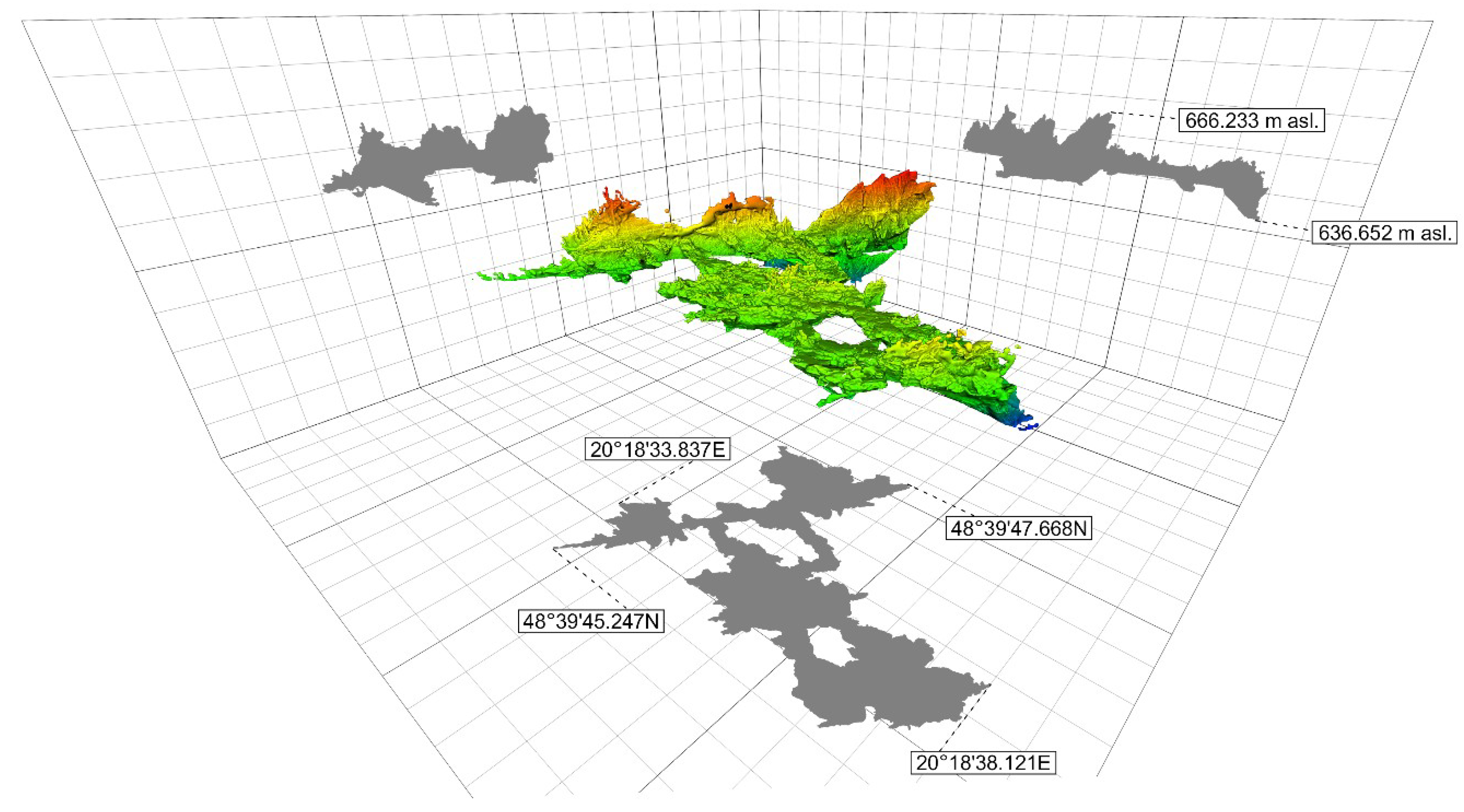
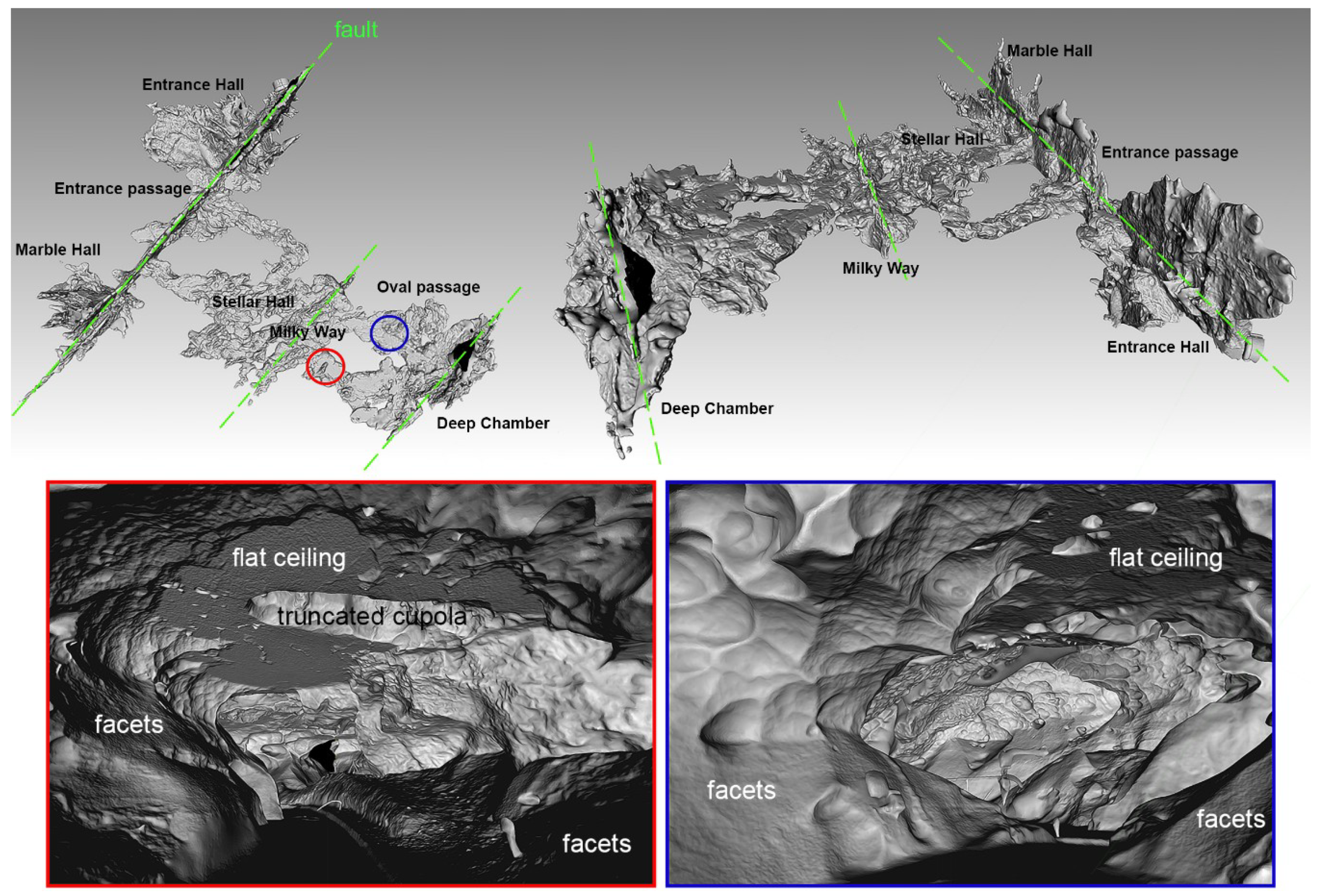
The Ochtiná Aragonite Cave (Slovakia, Central Europe) is a world-famous karst phenomenon of significant geological, geomorphological, and mineralogical values. Its specific origin is determined by particular lithological and hydrogeological conditions of the Ochtiná karst formed in lenses of Paleozoic crystalline limestones, partly metasomatically altered to ankerite and siderite. Although the cave is only 300 m long, it represents a combined labyrinth consisting in parallel tectonically controlled halls and passages, that are largely interconnected through transverse conduits of phreatic and epiphreatic morphology with many medium- and small-scale forms originated in slowly moving or standing water (flat solution ceilings, wall inward-inclined facets, water table notches, convectional cupolas, and spongework-like hollows). The highly dissected and irregular morphologies of the cave were surveyed with terrestrial laser scanning and digital photogrammetry. Both used surveying technologies proved to be suitable for quick and accurate mapping of the complicated cave pattern. While terrestrial laser scanning can provide a rapid survey of larger and more complex areas with results delivered directly in the field, digital photogrammetry is able to generate very high-resolution models with quality photo-texture for mapping of small-scale morphologies. Several data on cave morphometry were generated from terrestrial laser scanning (e.g., the area of cave ground plan, the peripheral surface of underground spaces, and their volume). The new detailed map, sections, and 3D model create an innovation platform for a more detailed study on the morphology and genesis of this unusual cave also for its environmental protection and use in tourism.
Keywords: 3D mapping; terrestrial laser scanning; structure-from-motion; cave morphology; morphostratigraphy; flat ceiling; cupola; facets; cusped depression 3D mapping; terrestrial laser scanning; structure-from-motion; cave morphology; morphostratigraphy; flat ceiling; cupola; facets; cusped depression