A Spatial and Temporal Correlation between Remotely Sensing Evapotranspiration with Land Use and Land Cover
Abstract
:1. Introduction
2. Materials and Methods
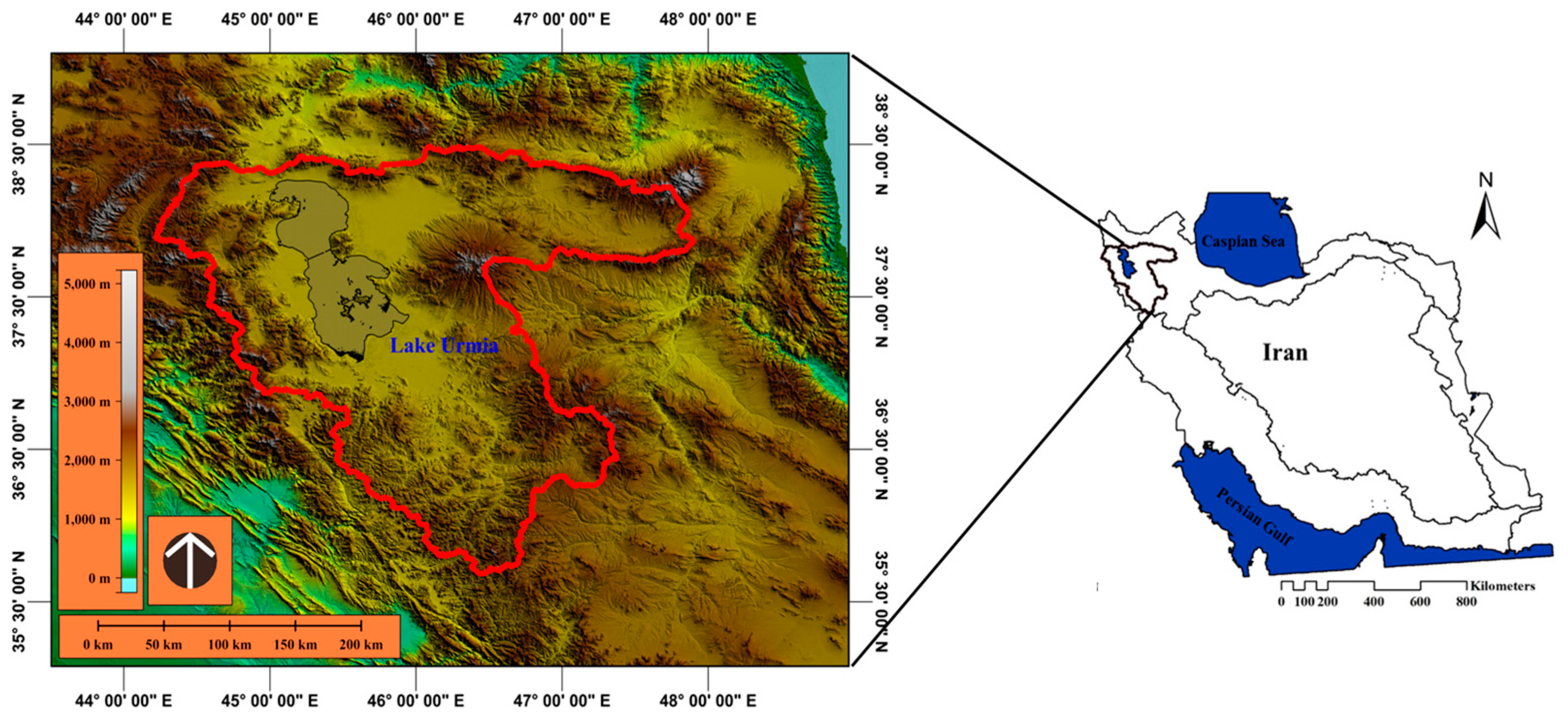
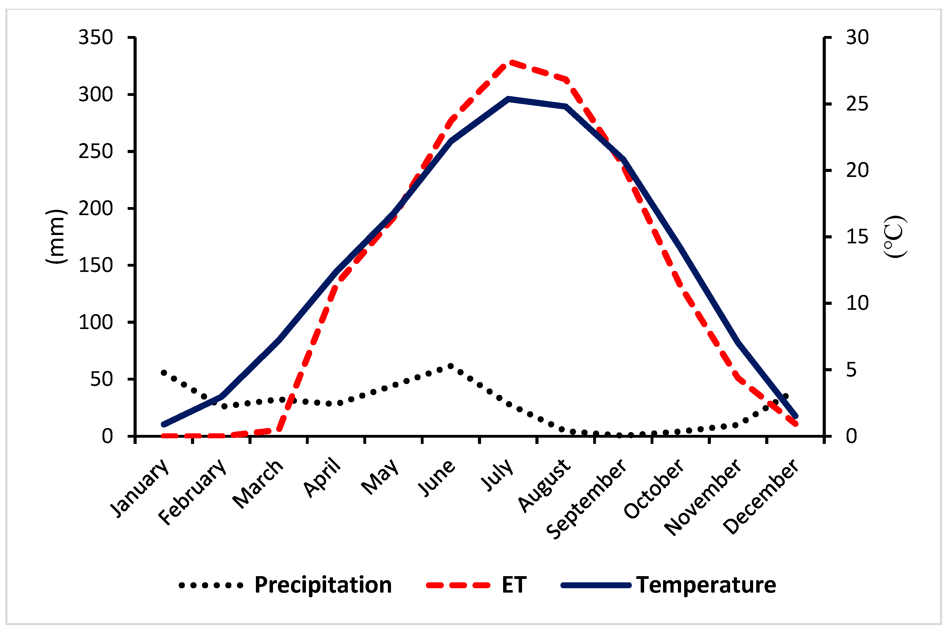
2.1. Study Area Description
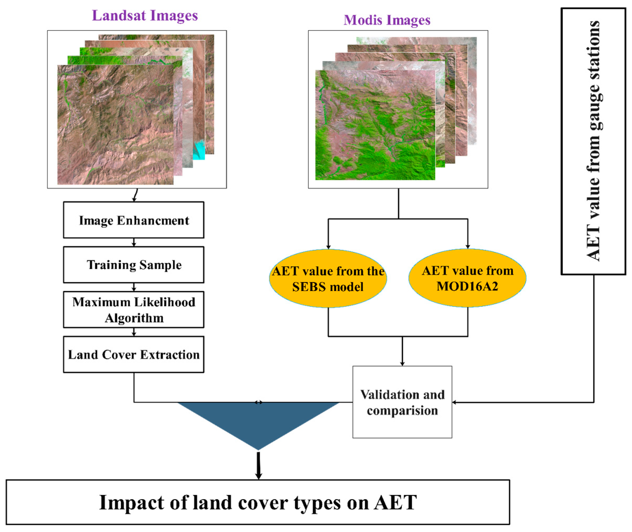
2.2. Research Methods
2.2.1. Image Preprocessing
2.2.2. Land Use/Cover Classification
2.2.3. The SEBS Model Description
2.2.4. MOD16A2 AET Product
3. Results
3.1. Land Use/Cover Assessment
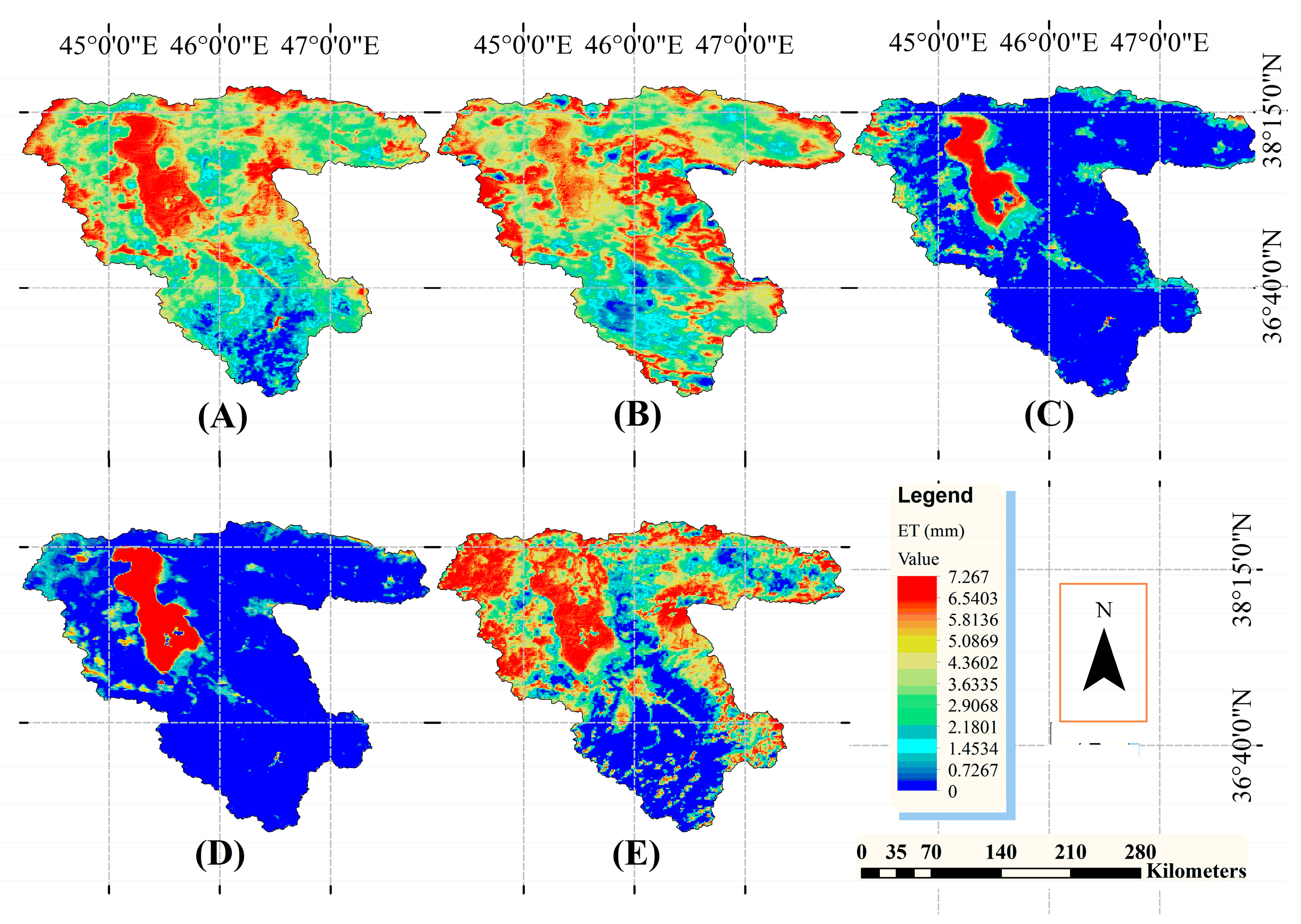
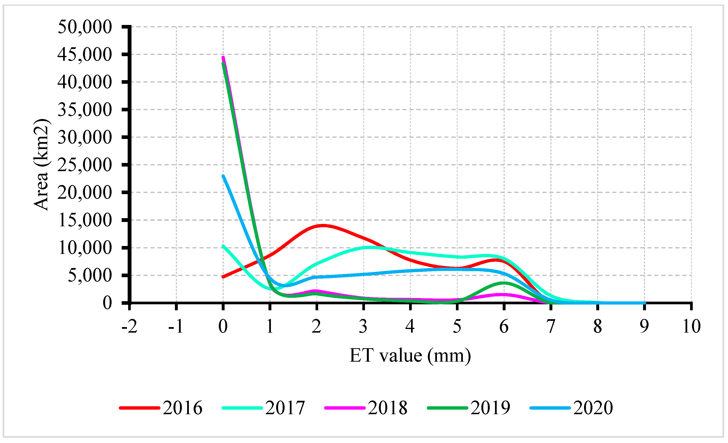
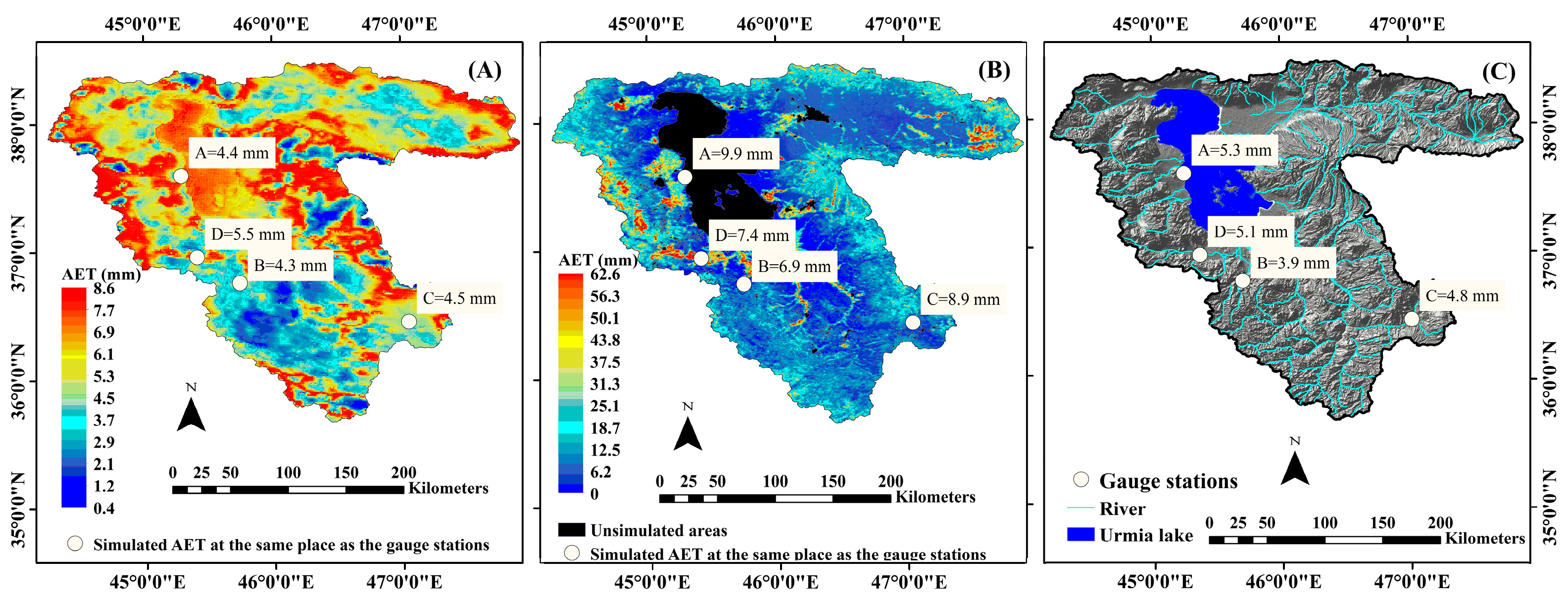
3.2. Retrieval AET from the SEBS
3.3. AET and LULC Relationship
3.4. Comparison of AET Values Obtained in Different LULC Types
4. Discussion
5. Conclusions
Author Contributions
Funding
Data Availability Statement
Conflicts of Interest
References
- Chemura, A.; Rwasoka, D.; Mutanga, O.; Dube, T.; Mushore, T. The impact of land-use/land cover changes on water balance of the heterogeneous Buzi sub-catchment, Zimbabwe. Remote Sens. Appl. Soc. Environ. 2020, 18, 100292. [Google Scholar] [CrossRef]
- Senkondo, W.; Tumbo, M.; Lyon, S.W. On the Evolution of Hydrological Modelling for Water Resources in Eastern Africa. Remote Sens. 2018, 11, 1–26. [Google Scholar] [CrossRef]
- Tian, X.; Van der Tol, C.; Su, Z.; Li, Z.; Chen, E.; Li, X.; Yan, M.; Chen, X.; Wang, X.; Pan, X.; et al. Simulation of Forest Evapotranspiration Using Time-Series Parameterization of the Surface Energy Balance System (SEBS) over the Qilian Mountains. Remote Sens. 2015, 7, 15822–15843. [Google Scholar] [CrossRef] [Green Version]
- Li, Z.L.; Tang, R.; Wan, Z.; Bi, Y.; Zhou, C.; Tang, B.; Zhang, X. A Review of Current Methodologies for Regional Evapotranspiration Estimation from Remotely Sensed Data. Sensors 2009, 9, 3801–3853. Available online: https://www.mdpi.com/1424-8220/9/5/3801 (accessed on 19 May 2009). [CrossRef] [PubMed] [Green Version]
- Zhigang, S.; Wang, Q.; Batkhishig, O.; Ouyang, Z. Relationship between Evapotranspiration and Land Surface Temperature under Energy- and Water-Limited Conditions in Dry and Cold Climates. Adv. Meteorol. 2016, 2016, 55386680. [Google Scholar] [CrossRef] [Green Version]
- Pan, X.; Liu, S.; Yang, Y.; You, C.; Yang, Z.; Xie, W.; Li, T. Spatio-Temporal Characteristics of the Evapotranspiration in the Lower Mekong River Basin during 2008–2017. Remote Sens. 2022, 14, 2609. Available online: https://www.mdpi.com/2072-4292/14/11/2609 (accessed on 29 May 2022). [CrossRef]
- Aguilos, M.; Stahl, C.; Burban, B.; Hérault, B.; Courtois, E.; Coste, S.; Bonal, D. Interannual and Seasonal Variations in Ecosystem Transpiration and Water Use Efficiency in a Tropical Rainforest. Forests 2018, 10, 14. Available online: https://www.mdpi.com/1999-4907/10/1/14 (accessed on 26 December 2018). [CrossRef] [Green Version]
- Christoffersen, B.O.; Restrepo-Coupe, N.; Arain, M.A.; Baker, I.T.; Cestaro, B.P.; Ciais, P.; Saleska, S.R. Mechanisms of water supply and vegetation demand govern the seasonality and magnitude of evapotranspiration in Amazonia and Cerrado. Agric. For. Meteorol. 2014, 191, 33–50. [Google Scholar] [CrossRef]
- Liu, Q.; Wang, T.; Han, Q.; Sun, S.; Liu, C.Q.; Chen, X. Diagnosing environmental controls on actual evapotranspiration and evaporative fraction in a water-limited region from northwest China. J. Hydrol. 2019, 578, 124045. [Google Scholar] [CrossRef]
- Ma, N.; Zhang, Y.; Guo, Y.; Gao, H.; Zhang, H.; Wang, Y. Environmental and biophysical controls on the evapotranspiration over the highest alpine steppe. J. Hydrol. 2015, 529, 980–992. [Google Scholar] [CrossRef]
- Marques, T.V.; Mendes, K.; Mutti, P.; Medeiros, S.; Silva, L.; Perez-Marin, A.M.; Bezerra, B. Environmental and biophysical controls of evapotranspiration from Seasonally Dry Tropical Forests (Caatinga) in the Brazilian Semiarid. Agric. For. Meteorol. 2020, 287, 107957. [Google Scholar] [CrossRef]
- Rubert, G.C.D.; de Arruda Souza, V.; Zimmer, T.; Veeck, G.P.; Mergen, A.; Bremm, T.; Roberti, D.R. Patterns and Controls of the Latent and Sensible Heat Fluxes in the Brazilian Pampa Biome. Atmosphere 2021, 13, 23. Available online: https://www.mdpi.com/2073-4433/13/1/23 (accessed on 24 December 2021). [CrossRef]
- Nouri, H.; Beecham, S.; Kazemi, F.; Hassanli, A.M.; Anderson, S. Remote Sensing Techniques for Predicting Evapotranspiration from Mixed Vegetated Surfaces. Hydrolo. Earth Syst. Sci. Discuss. 2013, 10, 3897–3925. Available online: https://www.hydrol-earth-syst-sci-discuss.net/10/3897/2013/ (accessed on 25 March 2013). [CrossRef]
- Thomthwaite, C.W.; Mather, J.R. Instructions and tables for computing potential evapotranspiration and the water balance. Publ. Climatol. 1957, 10, 185–310. [Google Scholar]
- DeBruin, H.A.R. Time to Think: Reflections of a Pre-Pensioned Scintillometer Researcher. Bull Am. Meteorol. Soc. 2009, 90, 17–26. [Google Scholar] [CrossRef]
- Jin, X.; Zhu, X.; Xue, Y. Satellite-Based Analysis of Regional Evapotranspiration Trends in a Semi-Arid Area. Int. J. Remote Sens. 2019, 40, 3267–3288. [Google Scholar] [CrossRef]
- Sun, R.; Gao, X.; Liu, C.M.; Li, W.X. Evapotranspiration Estimation in the Yellow River Basin, China Using Integrated NDVI Data. Int. J. Remote Sens. 2004, 25, 2523–2534. [Google Scholar] [CrossRef]
- Senkondo, W.; Munishi, S.E.; Tumbo, M.; Nobert, J.; Lyon, S.W. Comparing Remotely-Sensed Surface Energy Balance Evapotranspiration Estimates in Heterogeneous and Data-Limited Regions: A Case Study of Tanzania’s Kilombero Valley. Remote Sens. 2019, 11, 1289. Available online: https://www.mdpi.com/2072-4292/11/11/1289 (accessed on 30 May 2019). [CrossRef] [Green Version]
- Cleugh, H.A.; Leuning, R.; Mu, Q.; Steven, W. Running. Regional Evaporation Estimates from Flux Tower and MODIS Satellite Data. Remote Sens. Environ. 2007, 106, 285–304. [Google Scholar] [CrossRef]
- Wang, K.; Wang, P.; Li, Z.; Cribb, M.; Sparrow, M.A. simple method to estimate actual evapotranspiration from a combination of net radiation, vegetation index, and temperature. J. Geophys. Res. Atmos. 2007, 112, 1–14. [Google Scholar] [CrossRef]
- Bastiaanssen, W.G.M.; Menenti, M.; Feddes, R.A.; Holtslag, A.M. A remot sensing Surface Energy Balance Algorithm for Land (SEBAL): 1. Formulation. J. Hydrol. 1998, 213, 198–212. [Google Scholar] [CrossRef]
- Roerink, G.J.; Su, Z.; Menenti, M. S-SEBI: A Simple Remote Sensing Algorithm to Estimate the Surface Energy Balance. Phys. Chem. Earth Part B Hydrol. Ocean. Atmos. 2000, 25, 147–157. [Google Scholar] [CrossRef]
- Su, Z. The Surface Energy Balance System (SEBS) for Estimation of Turbulent Heat Fluxes. Hydrol. Earth Syst. Sci. 2002, 6, 85–99. [Google Scholar] [CrossRef]
- Allen, R.G.; Tasumi, M.; Trezza, R. Satellite-based energy balance for mapping evapotranspiration with internalized calibration (METRIC)—Model. J. Irrig. Drain. Eng. 2007, 133, 380–394. [Google Scholar] [CrossRef]
- Shuttleworth, W.J.; Wallace, J.S. Evaporation from Sparse Crops—An Energy Combination Theory. Q. J. R. Meteorol. Soc. 1985, 111, 839–855. [Google Scholar] [CrossRef]
- Kustas, W.P.; John, M. Norman. Evaluation of Soil and Vegetation Heat Flux Predictions Using a Simple Two-Source Model with Radiometric Temperatures for Partial Canopy Cover. Agric. For. Meteorol. 1999, 94, 13–29. [Google Scholar] [CrossRef]
- Norman, J.M.; Kustas, W.P.; Humes, K.S. Source Approach for Estimating Soil and Vegetation Energy Fluxes in Observations of Directional Radiometric Surface Temperature. Agric. For. Meteorol. 1995, 77, 263–293. [Google Scholar] [CrossRef]
- Su, Z.; Pelgrum, H.; Menenti, M. Aggregation Effects of Surface Heterogeneity in Land Surface Processes. Hydrol. Earth Syst. Sci. 1999, 3, 549–563. [Google Scholar] [CrossRef] [Green Version]
- Crago, R.D. Comparison of the Evaporative Fraction and the Priestley- Taylor α for Parameterizing Daytime Evaporation. Water Resour. Res. 1996, 32, 1403–1409. [Google Scholar] [CrossRef]
- Li, G.; Zhang, F.; Jing, Y.; Liu, Y.; Sun, G. Response of evapotranspiration to changes in land use and land cover and climate in China during 2001–2013. Sci. Total Environ. 2017, 596, 256–265. [Google Scholar] [CrossRef] [PubMed]
- Liu, Y.; Zhuang, Q.; Chen, M.; Pan, Z.; Tchebakova, N.; Sokolov, A.; Parfenova, E. Response of evapotranspiration and water availability to changing climate and land cover on the Mongolian Plateau during the 21st century. Glob. Planet. Chang. 2013, 108, 85–99. [Google Scholar] [CrossRef]
- Rahimi, S.; Gholami Sefidkouhi, M.A.; Raeini-Sarjaz, M.; Valipour, M. Estimation of Actual Evapotranspiration by Using MODIS Images (a Case Study: Tajan Catchment). Archive. Agron. Soil Sci. 2015, 61, 695–709. [Google Scholar] [CrossRef]
- Hong, Y. Actual Evapotranspiration Estimation for Different Land Use and Land Cover in Urban Regions Using Landsat 5 Data. J. Appl. Remote Sens. 2010, 4, 041873. [Google Scholar] [CrossRef]
- Allen, R.G.; Pereira, L.S.; Howell, T.A.; Jensen, M.E. Evapotranspiration information reporting: I. Factors governing measurement accuracy. Agric. Water Manag. 2011, 98, 899–920. [Google Scholar] [CrossRef] [Green Version]
- Degano, M.F.; Rivas, R.E.; Carmona, F.; Niclos, R.; Sanchez, J.M. Evaluation of the MOD16A2 Evapotranspiration Product in an Agricultural Area of Argentina, the Pampas Region. Egypt. J. Remote Sens. Space Sci. 2021, 24, 319–328. [Google Scholar] [CrossRef]
- Li, Z.; Liu, X.; Ma, T.; Kejia, D.; Zhou, Q.; Yao, B.; Niu, T. Retrieval of the surface evapotranspiration patterns in the alpine grassland–wetland ecosystem applying SEBAL model in the source region of the Yellow River, China. Ecol. Model. 2013, 270, 64–75. [Google Scholar] [CrossRef]
- Sriwongsitanon, N.; Suwawong, T.; Thianpopirug, S.; Williams, J.; Jia, L.; Bastiaanssen, W. Validation of seven global remotely sensed ET products across Thailand using water balance measurements and land use classifications. J. Hydrol. Reg. Stud. 2020, 30, 100709. [Google Scholar] [CrossRef]
- Wang, Y.; Liu, Y.; Jin, J. Contrast Effects of Vegetation Cover Change on Evapotranspiration during a Revegetation Period in the Poyang Lake Basin, China. Forests 2018, 9, 217. [Google Scholar] [CrossRef] [Green Version]
- Gibson, L.A.; Jarmain, C.; Su, Z.; Eckardt, F.E. Estimating Evapotranspiration Using Remote Sensing and the Surface Energy Balance System—A South African Perspective. Water Sa 2013, 39, 477–484. [Google Scholar] [CrossRef] [Green Version]
- Srivastava, A.; Sahoo, B.; Raghuwanshi, N.S.; Singh, R. Evaluation of Variable-Infiltration Capacity Model and MODIS-Terra Satellite-Derived Grid-Scale Evapotranspiration Estimates in a River Basin with Tropical Monsoon-Type Climatology. J. Irrig. Drain Eng. 2017, 143, 04017028. [Google Scholar] [CrossRef] [Green Version]
- Autovino, D.; Minacapilli, M.; Provenzano, G. Modelling bulk surface resistance by MODIS data and assessment of MOD16A2 evapotranspiration product in an irrigation district of Southern Italy. Agri. Wat. Manag. 2016, 167, 86–94. [Google Scholar] [CrossRef]
- Cawse-Nicholson, K.; Braverman, A.; Kang, E.L.; Li, M.; Johnson, M.; Halverson, G.; Anderson, M.; Hain, C.; Gunson, M.; Hook, S. Sensitivity and uncertainty quantification for the ECOSTRESS evapotranspiration algorithm—DisALEXI. Int. J. Appl. Earth. Obs. Geoinformation 2020, 89, 102088. [Google Scholar] [CrossRef]
- Jung, H.C.; Getirana, A.; Arsenault, K.R.; Holmes, T.R.H.; McNally, A. Uncertainties in Evapotranspiration Estimates over West Africa. Remote Sens. 2019, 11, 892. [Google Scholar] [CrossRef] [Green Version]
- Baba Jafary, H.; Paymazd, S.; Moghadasi, M. Estimation of Actual Evapotranspiration of Urmia Lake Basin Using SEBS Remote Sensing Algorithm and AVHR Sensor Im-Ages. Echo Hydrol. 2015, 5, 1285–1296. [Google Scholar] [CrossRef]
- Bagheri, M.H. Remote Sensing Technology Assessment in Basin Water Scale. In Determining the Purpose of Underground Water Consumption Case Study: Lake Urmia Basin; Elsevier Ltd.: Amsterdam, The Netherlands, 2011. [Google Scholar] [CrossRef]
- Ziaee, R.; Moghaddasi, M.; Payamzad, S.; Bagheri, M.H. Estimation and Evaluation of Evaporation from Water Levels Using the SEBS Remote Sensing Algorithm and Comparison with SEBAL Algorithm, Case Study: Lake Urmia; Elsevier Inc.: Amsterdam, The Netherlands, 2014. [Google Scholar] [CrossRef]
- Vahed, S.Z.; Forouhandeh, H.; Hassanzadeh, S.; Klenk, H.P.; Hejazi, M.A.; Hejazi, M.S. Isolation and characterization of halophilic bacteria from Urmia Lake in Iran. Microbiology 2011, 80, 834–841. [Google Scholar] [CrossRef]
- Daneshi, A.; Panahi, M.; Masoomi, S.; Vafakhah, M.; Azadi, H. Assessment of Non-Monetary Facilities in Urmia Lake Basin under PES Scheme: A Rehabilitation Solution for the Dry Lake in Iran. ENVI 2021, 23, 10141–10172. [Google Scholar] [CrossRef]
- Khoshnoodmotlagh, S.; Verrelst, J.; Daneshi, A.; Mirzaei, M.; Azadi, H.; Haghighi, M.; Hatamimanesh, M.; Marofi, S. Transboundary Basins Need More Attention: Anthropogenic Impacts on Land Cover Changes in Aras River Basin, Monitoring and Prediction. Remote Sens. 2020, 12, 3329. [Google Scholar] [CrossRef]
- Al-Ahmadi, F.S.; Hames, A.S. Comparison of four classification methods to extract land use and land cover from raw satellite images for some remote arid areas, Kingdom of Saudi Arabia. Earth Sci. 2009, 20, 167–191. [Google Scholar] [CrossRef]
- Rawat, J.S.; Kumar, M. Monitoring land use/cover change using remote sensing and GIS techniques: A case study of Hawalbagh block, district Almora, Uttarakhand, India. Egypt. J. Remote Sens. Space Sci. 2015, 18, 77–84. [Google Scholar] [CrossRef] [Green Version]
- Sun, J.; Yang, J.; Zhang, C.; Yun, W.; Qu, J. Automatic remotely sensed image classification in a grid environment based on the maximum likelihood method. Math. Comput. Model 2013, 58, 573–581. [Google Scholar] [CrossRef]
- Kwast, V.H.; De Jong, S.M. Modelling Evapotranspiration Using the Surface Energy Balance System (SEBS) and Landsat TM Data (Rabat Region, Morocco). EARSeL Workshop Remote Sens. Dev. Ctries. 2004. [Google Scholar]
- Shunlin, L.; Dongdong, W.; Tao, H.; Yunyue, Y. Remote sensing of earth’s energy budget: Synthesis and review. Int. J. Digi. Earth 2019, 12, 737–780. [Google Scholar] [CrossRef] [Green Version]
- Byun, K.; Liaqat, U.W.; Choi, M. Dual-Model Approaches for Evapotranspiration Analyses over Homo- and Heterogeneous Land Surface Conditions. Agric. For. Meteorol. 2014, 197, 169–187. [Google Scholar] [CrossRef]
- Farokhnia, A.; Moradi, S.; Delvar, M. Study of Land Use Change in the Urmia Lake Water Shed Based on Landsat- TM Images and Pixel-Based and Object-Based Classification Techniques. Iran. J. Irrig. Drain. 2018, 12, 823–839. [Google Scholar]
- Kamali, M.; Yuneszadeh, S. Analysing Land Use Change within the Lake Urmia Basin Using Satellite Images. Plan. Resour. Mbilization Unit Urmia Lake Restor. Program 2015, 71. (In Persian) [Google Scholar]
- Pourmohammadi, S.; Dasturani, M.T.; Mokhtari, M.H.; Rahimian, M.H. Determination and Zoning of Actual Evapotranspiration by Remote Sensing Technique and Sabal Theme Algorithm (Case Study: Manshad Watershed in Yazd Province). Watershed Manag. Sci. Eng. 2011, 4, 21–30. [Google Scholar]
- Jahangir, M.H.; Arast, M. Remote Sensing Products for Predicting Actual Evapotranspiration and Water Stress Footprints under Different Land Cover. J. Clean. Prod. 2020, 266, 121818. [Google Scholar] [CrossRef]



| Data Type | Dataset | Date | Source Reference | Band Number | Calculation Method | |
|---|---|---|---|---|---|---|
| Satellite images | Landsat | Landsat 8 OLI (path/row: 168/33, 169/33, 168/34, 169/34, and 168/35, 169/35 | 14 June 2016 | WGS84 | 2,3,4,5 | - |
| 14 June 2017 | - | - | ||||
| 14 June 2018 | - | - | ||||
| 14 June 2019 | - | - | ||||
| 14 June 2020 | - | - | ||||
| MODIS | MOD021KM, MOD16A2, MOD03 | 14 June 2016 | WGS84 | 1,2,3,4,5,7,17,18,19,31,32 | - | |
| 14 June 2017 | - | - | ||||
| 14 June 2018 | - | - | ||||
| 14 June 2019 | - | - | ||||
| 14 June 2020 | - | - | ||||
| Evaporation | Ground gauge | From 8th June to 14th June of each year | Point data | - | Accumulative | |
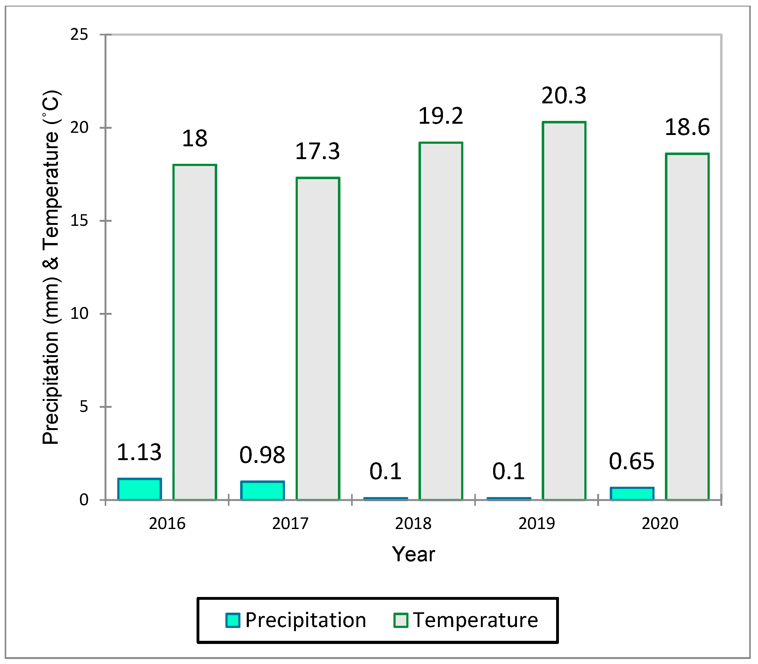
| Precipitation | Ground gauge | From 8th June to 14th June of each year | - | - | Accumulative | |
| Temperature | Ground gauge | From 8th June to 14th June of each year | - | - | Average | |
| LULC | Interpretation Criterion | Image | Photograph |
|---|---|---|---|
| water bodies | At least 60% of area is covered by permanent water bodies |  |  |
| Shrublands | Dominated by woody perennials (1–2 m height) 10–60% cover | 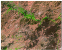 | 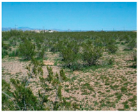 |
| Savannas | Tree cover 10–30% (canopy > 2 m) | 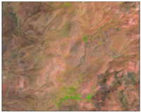 |  |
| Grasslands | Dominated by herbaceous annuals (<2 m) | 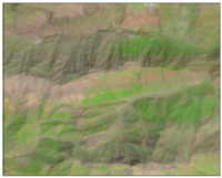 |  |
| Wetlands | Permanently inundated lands with 30–60% water cover and >10% vegetated cover | 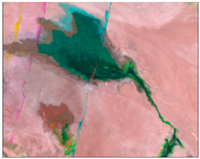 | 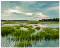 |
| Croplands | At least 60% of area is cultivated cropland | 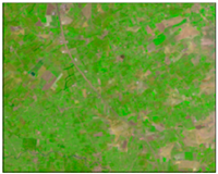 | 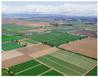 |
| Urban | At least 30% impervious surface area including building materials, asphalt and vehicles | 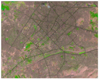 |  |
| Non-Vegetated | At least 60% of area is non-vegetated barren (sand, rock, soil) or permanent snow and ice with less than 10% vegetation | 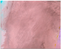 | 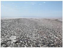 |
| Year | LULC Class | Water Body | Shrub Land | Savanah | Grassland | Wetland | Cropland | Urban | Non-Vegetated | Overall Accuracy |
|---|---|---|---|---|---|---|---|---|---|---|
| 2016 | Produce’s Accuracy (%) | 96.6 | 67.4 | 75 | 79.3 | 93.4 | 68.8 | 67.2 | 80.5 | 86 |
| 2017 | Produce’s Accuracy (%) | 98.3 | 76.3 | 72.8 | 72.1 | 95.7 | 68.5 | 70.3 | 83.6 | 89.6 |
| 2018 | Produce’s Accuracy (%) | 98.7 | 72.5 | 77.9 | 74.6 | 94.6 | 68.8 | 73.4 | 79.6 | 92.7 |
| 2019 | Produce’s Accuracy (%) | 99.1 | 76.7 | 74.1 | 72.3 | 95.8 | 66.2 | 72.4 | 82.7 | 90 |
| 2020 | Produce’s Accuracy (%) | 96.5 | 73.6 | 69.3 | 74.4 | 96.2 | 66.4 | 65.8 | 78.6 | 83.2 |
| Station Name | 2016 | 2017 | 2018 | 2019 | 2020 | R2 (GWR) | R2 (OLS) |
|---|---|---|---|---|---|---|---|
| gauge #A | 5.6 | 5.3 | 1.8 | 4.3 | 1.1 | - | - |
| SEBS model | 4.7 | 4.4 | 2 | 5.4 | 2.2 | 0.779 | 0.741 |
| MOD16a2 | 7.9 | 9.9 | 8.6 | 7.4 | 4.2 | 0.404 | 0.434 |
| gauge #B | 4.9 | 3.9 | 4.3 | 2.1 | 3.8 | - | - |
| SEBS model | 4.2 | 4.3 | 3.8 | 2.5 | 4.3 | 0.732 | 0.712 |
| MOD16A2 | 9.3 | 6.9 | 5.3 | 3.9 | 9.4 | 0.470 | 0.435 |
| gauge #C | 2.1 | 4.8 | 1.6 | 0.3 | 4.2 | - | - |
| SEBS model | 1.8 | 4.5 | 0.9 | 0.8 | 4.7 | 0.968 | 0.846 |
| MOD16A2 | 6.3 | 8.9 | 5.7 | 6.2 | 6.4 | 0.509 | 0.476 |
| gauge #D | 4.8 | 5.1 | 4.9 | 4.4 | 6.3 | - | - |
| SEBS model | 5.2 | 5.5 | 4.2 | 3.7 | 6.4 | 0.767 | 0.713 |
| MOD16A2 | 6.7 | 7.4 | 4.3 | 7.3 | 9.2 | 0.365 | 0.370 |
Disclaimer/Publisher’s Note: The statements, opinions and data contained in all publications are solely those of the individual author(s) and contributor(s) and not of MDPI and/or the editor(s). MDPI and/or the editor(s) disclaim responsibility for any injury to people or property resulting from any ideas, methods, instructions or products referred to in the content. |
© 2023 by the authors. Licensee MDPI, Basel, Switzerland. This article is an open access article distributed under the terms and conditions of the Creative Commons Attribution (CC BY) license (https://creativecommons.org/licenses/by/4.0/).
Share and Cite
Khoshnood, S.; Lotfata, A.; Mombeni, M.; Daneshi, A.; Verrelst, J.; Ghorbani, K. A Spatial and Temporal Correlation between Remotely Sensing Evapotranspiration with Land Use and Land Cover. Water 2023, 15, 1068. https://doi.org/10.3390/w15061068
Khoshnood S, Lotfata A, Mombeni M, Daneshi A, Verrelst J, Ghorbani K. A Spatial and Temporal Correlation between Remotely Sensing Evapotranspiration with Land Use and Land Cover. Water. 2023; 15(6):1068. https://doi.org/10.3390/w15061068
Chicago/Turabian StyleKhoshnood, Sajad, Aynaz Lotfata, Maryam Mombeni, Alireza Daneshi, Jochem Verrelst, and Khalil Ghorbani. 2023. "A Spatial and Temporal Correlation between Remotely Sensing Evapotranspiration with Land Use and Land Cover" Water 15, no. 6: 1068. https://doi.org/10.3390/w15061068
APA StyleKhoshnood, S., Lotfata, A., Mombeni, M., Daneshi, A., Verrelst, J., & Ghorbani, K. (2023). A Spatial and Temporal Correlation between Remotely Sensing Evapotranspiration with Land Use and Land Cover. Water, 15(6), 1068. https://doi.org/10.3390/w15061068


