Article

Methodology for Monitoring Silting and the Coastline of Small Ports Using Sentinel-2 Images: The Case of Port Cap Djinet Algeria

by
Hocine Dahmani
1,*,
Fouzia Houma Bachari
1,
François Marin
2 and
Nour Islam Bachari
3
1
Laboratory of Marine and Coastal Ecosystems (ECOSYSMarL), Higher National School of Marine Sciences and Coastal Management, University Campus Dely Ibrahim, Bois des Cars, PB 19, Algiers 16320, Algeria
2
Laboratory of Waves and Complex Media (LOMC), Le Havre Normandy University, UMR 6294 CNRS, 76600 Le Havre, France
3
Laboratory of Biological Oceanography and Marine Environment (LOBEM), Faculty of Biology, University of Sciences and Technology Houari Boumediene, BP 32 El-Alia Bab Ezzouar, Algiers 16111, Algeria
*
Author to whom correspondence should be addressed.
Remote Sens. 2024, 16(15), 2764; https://doi.org/10.3390/rs16152764
Submission received: 26 May 2024 / Revised: 16 July 2024 / Accepted: 23 July 2024 / Published: 29 July 2024

Abstract

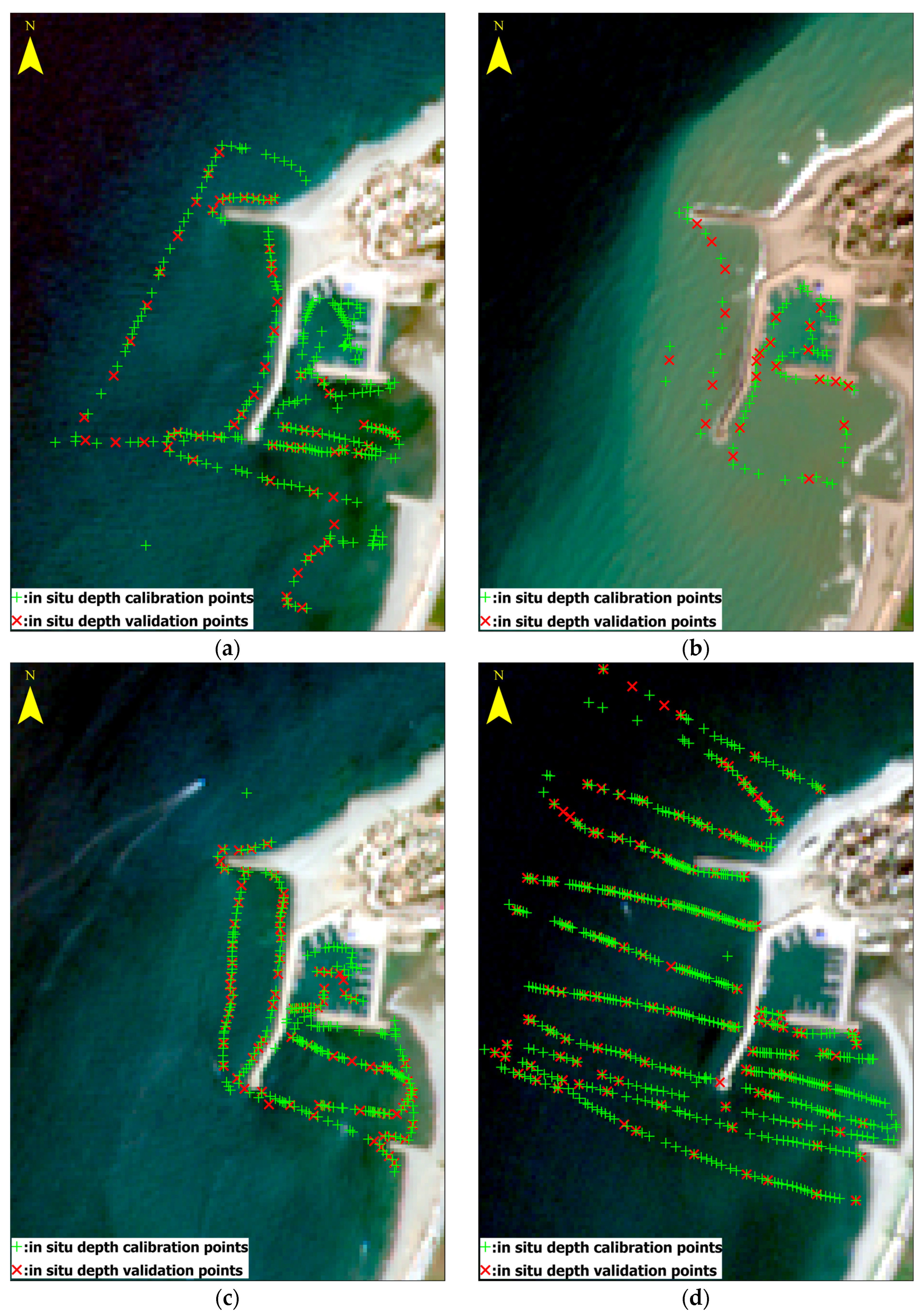
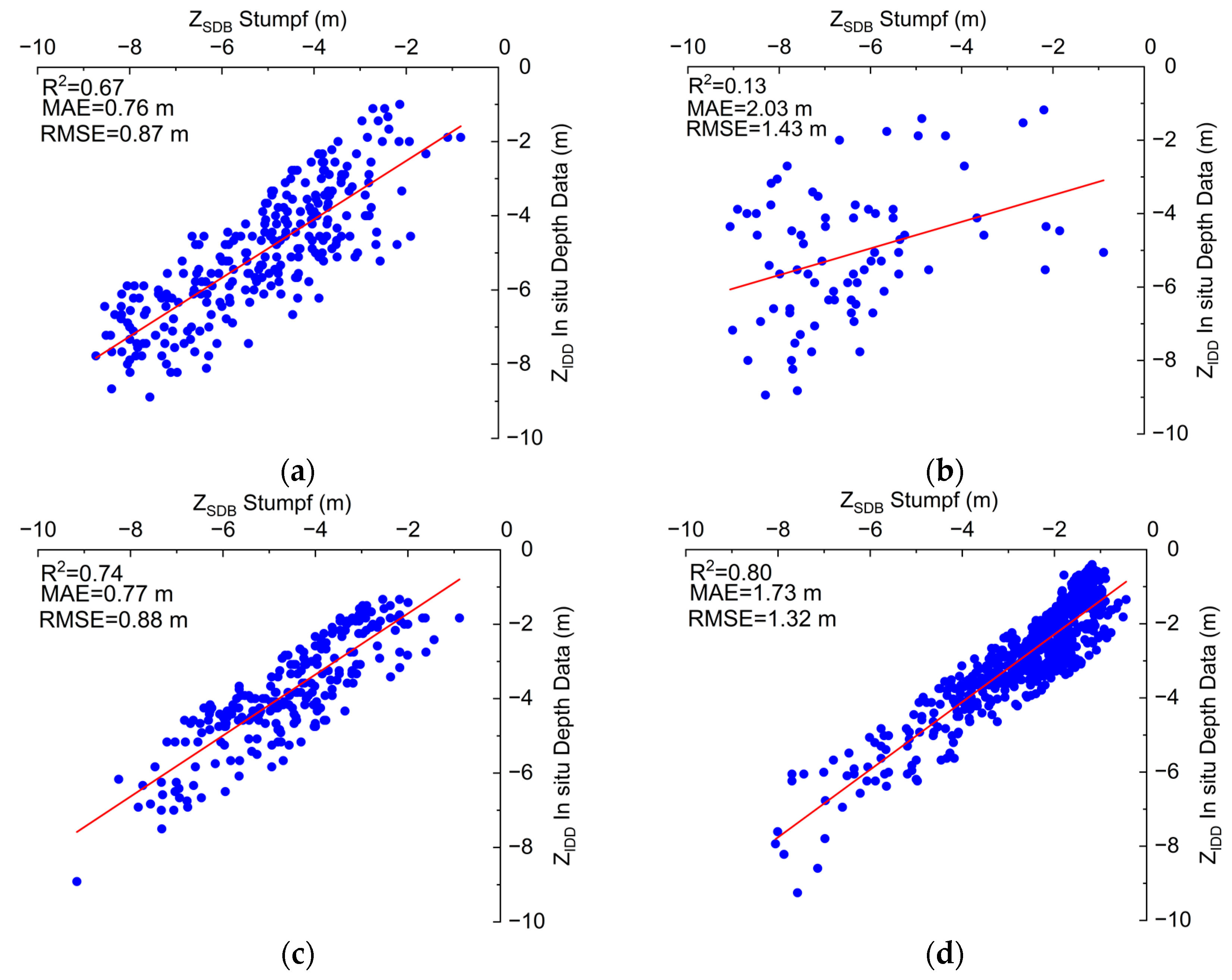
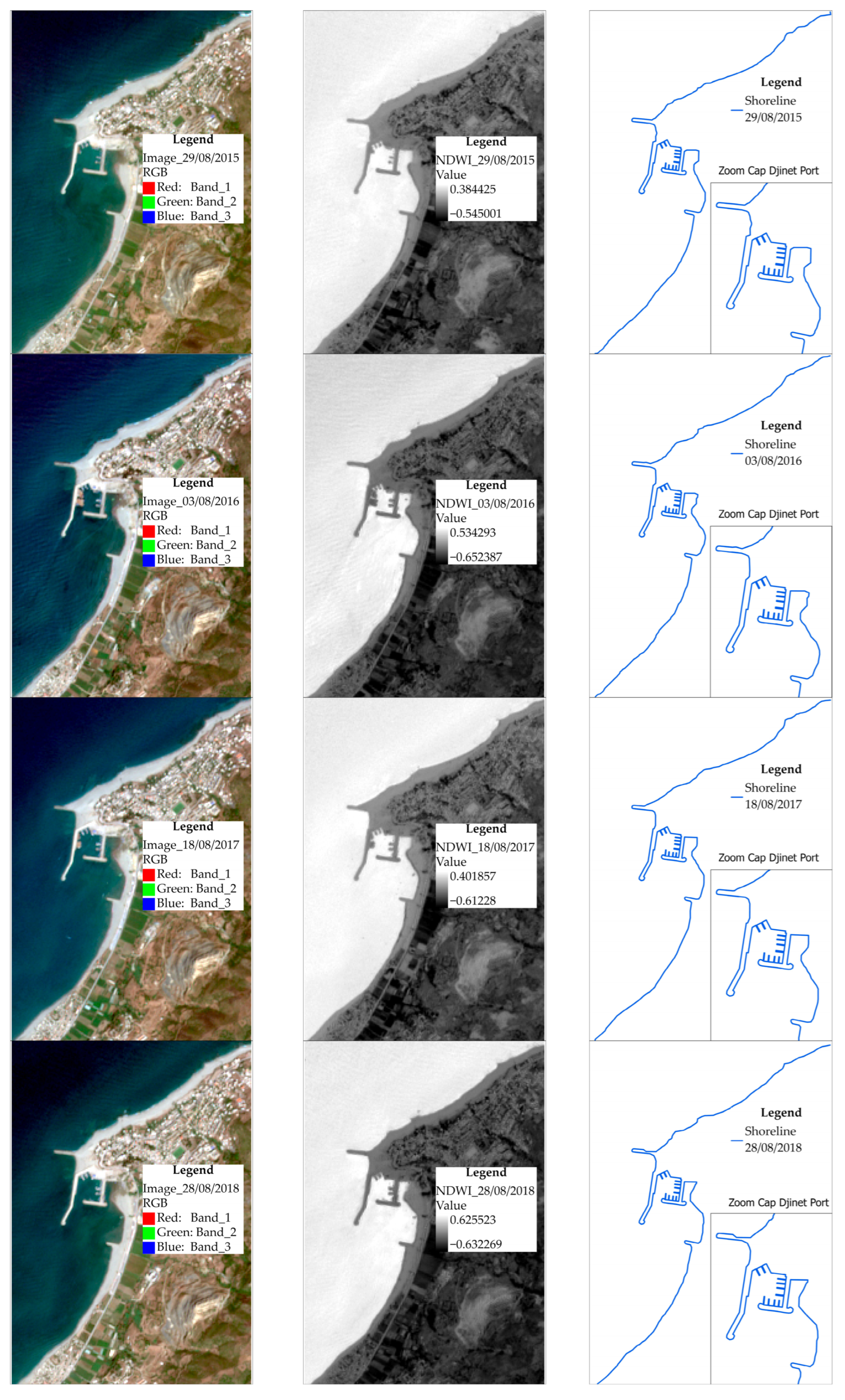
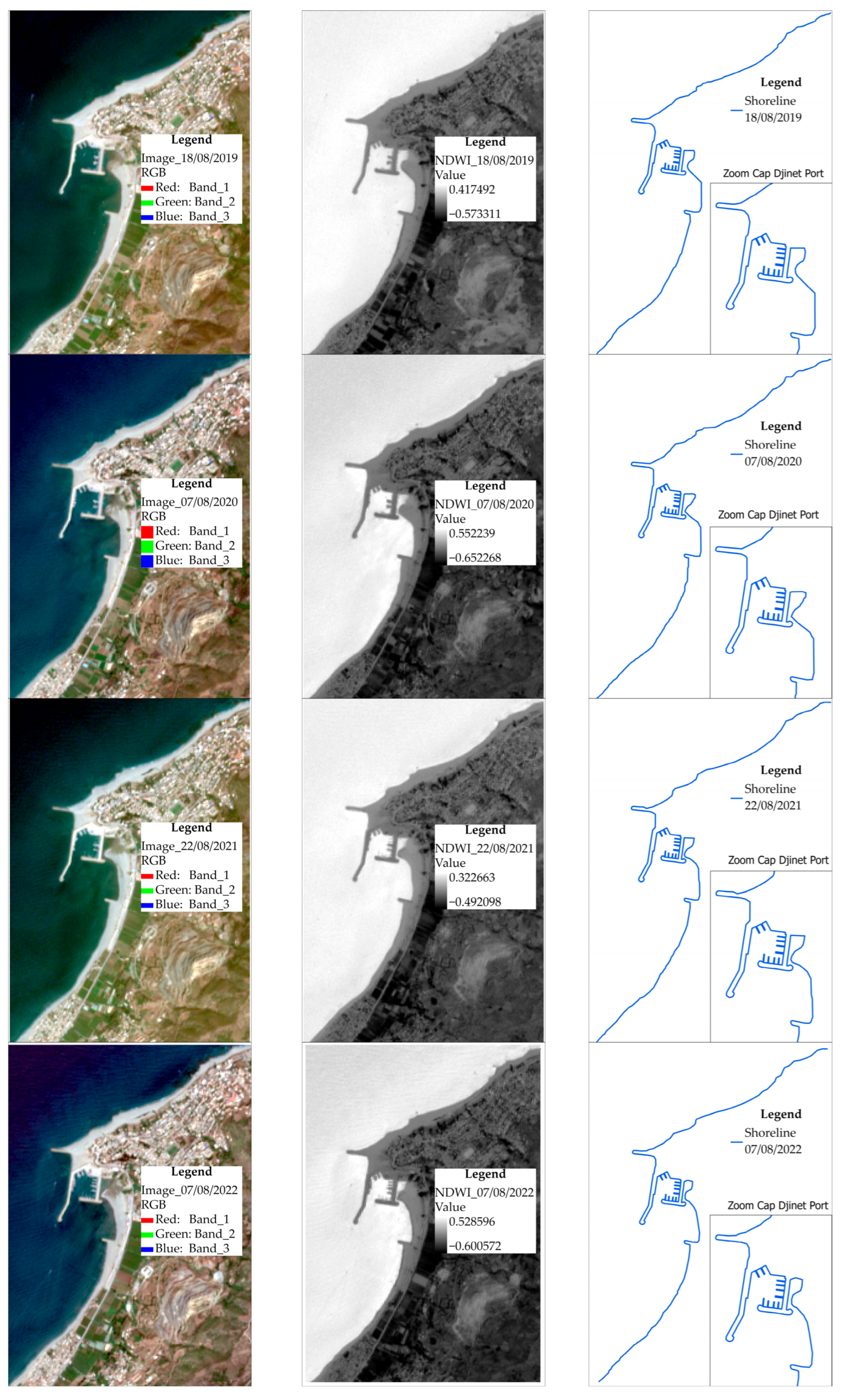
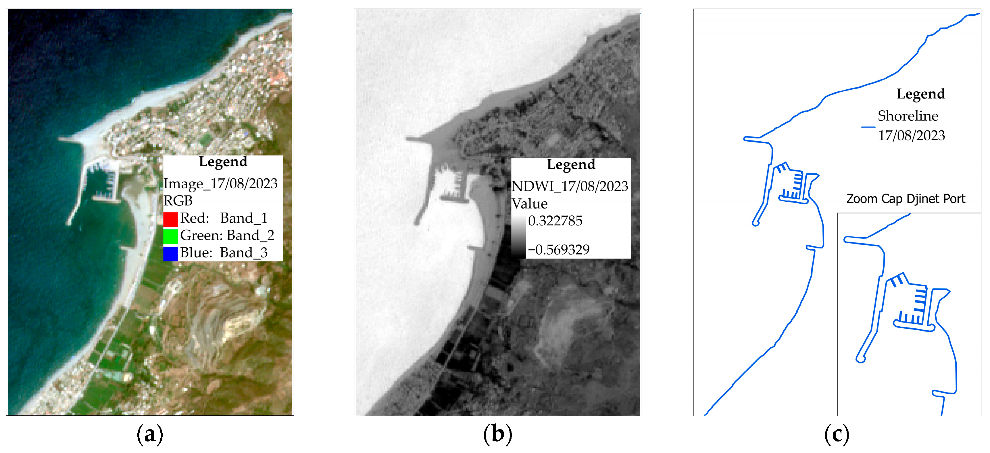
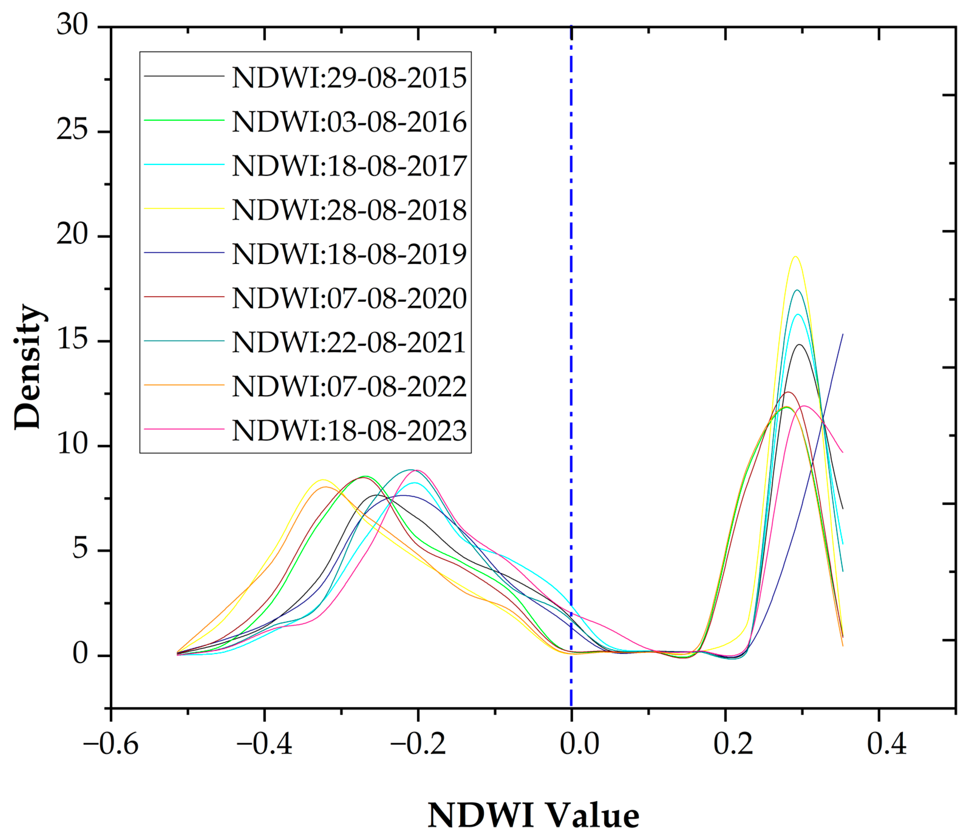
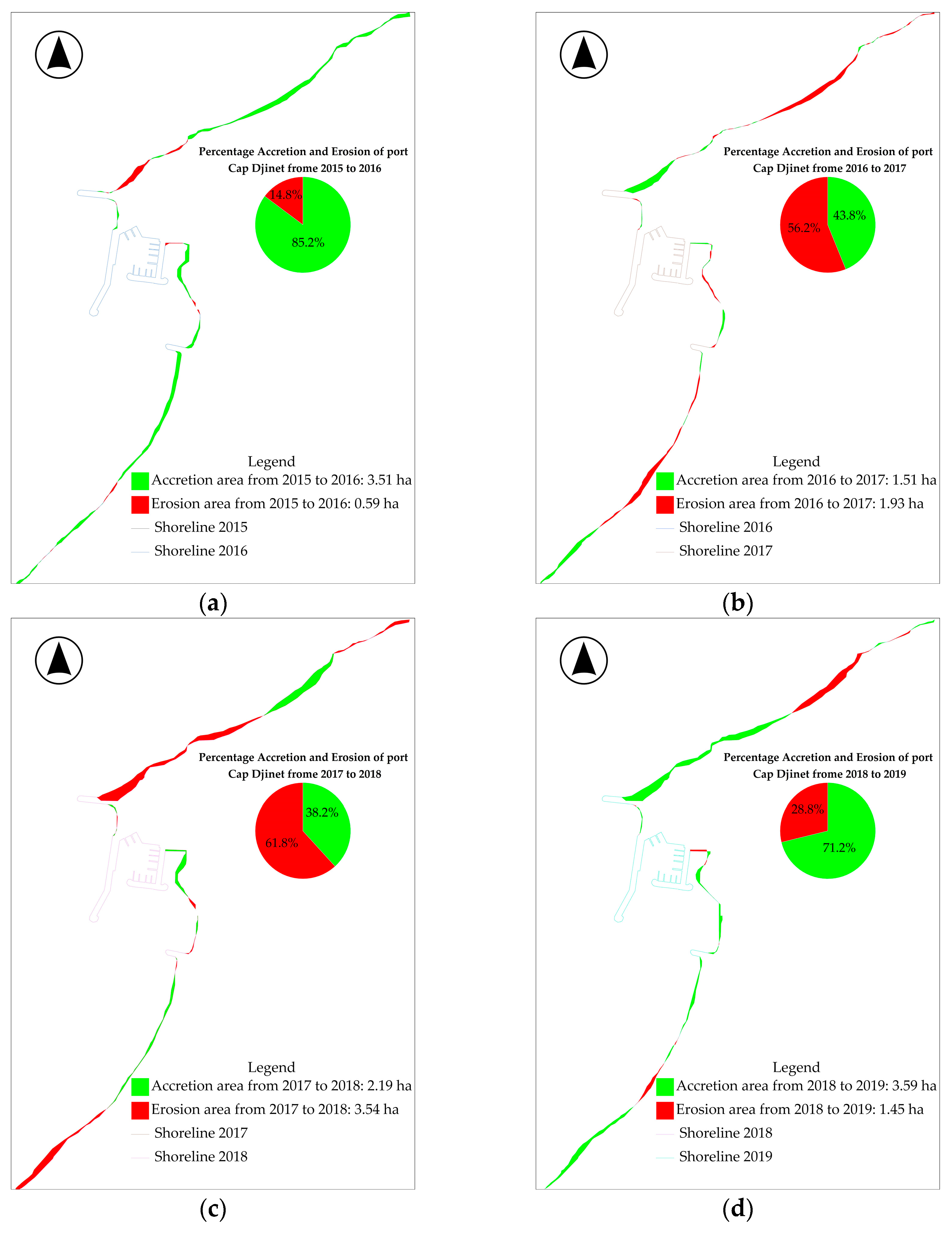
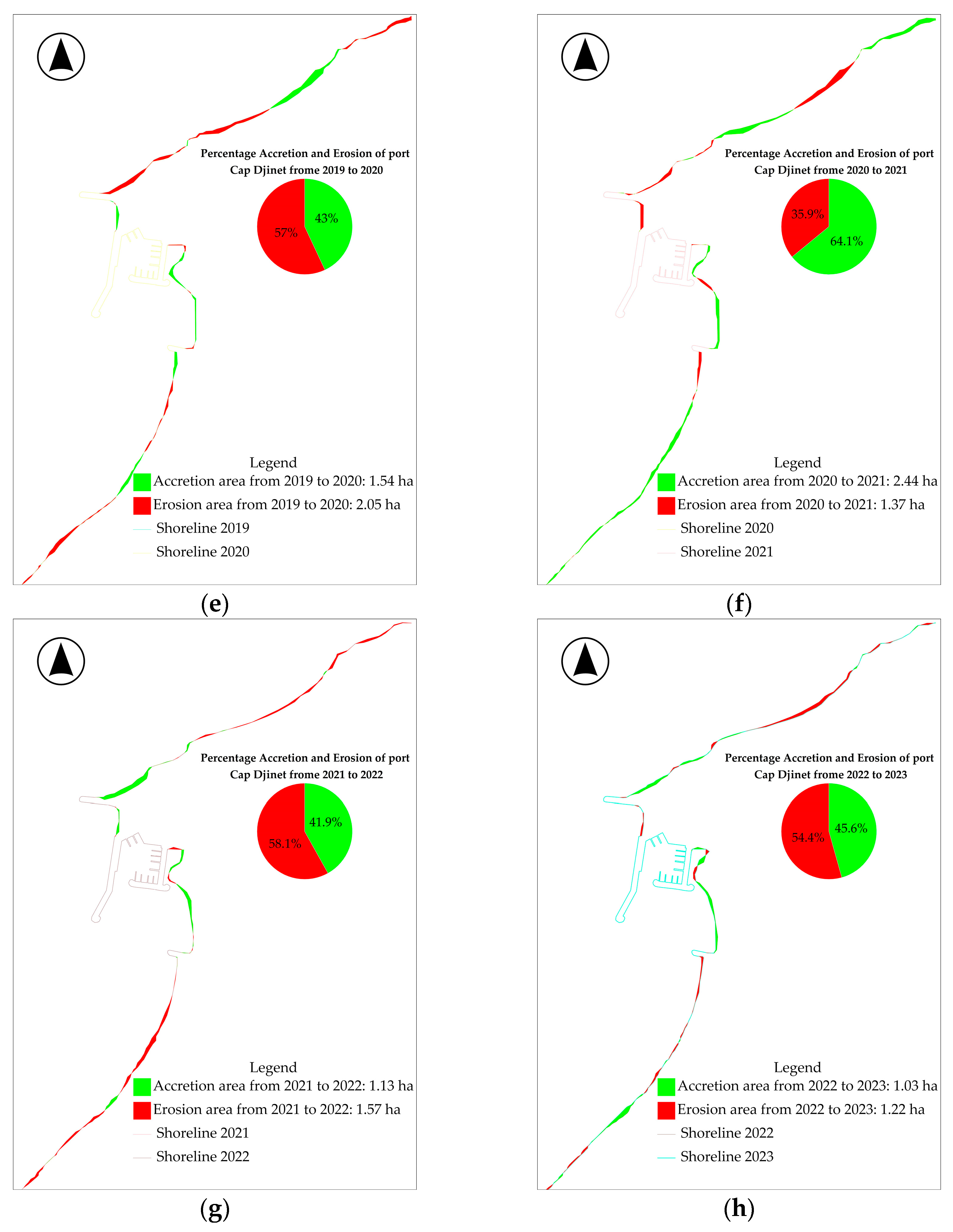
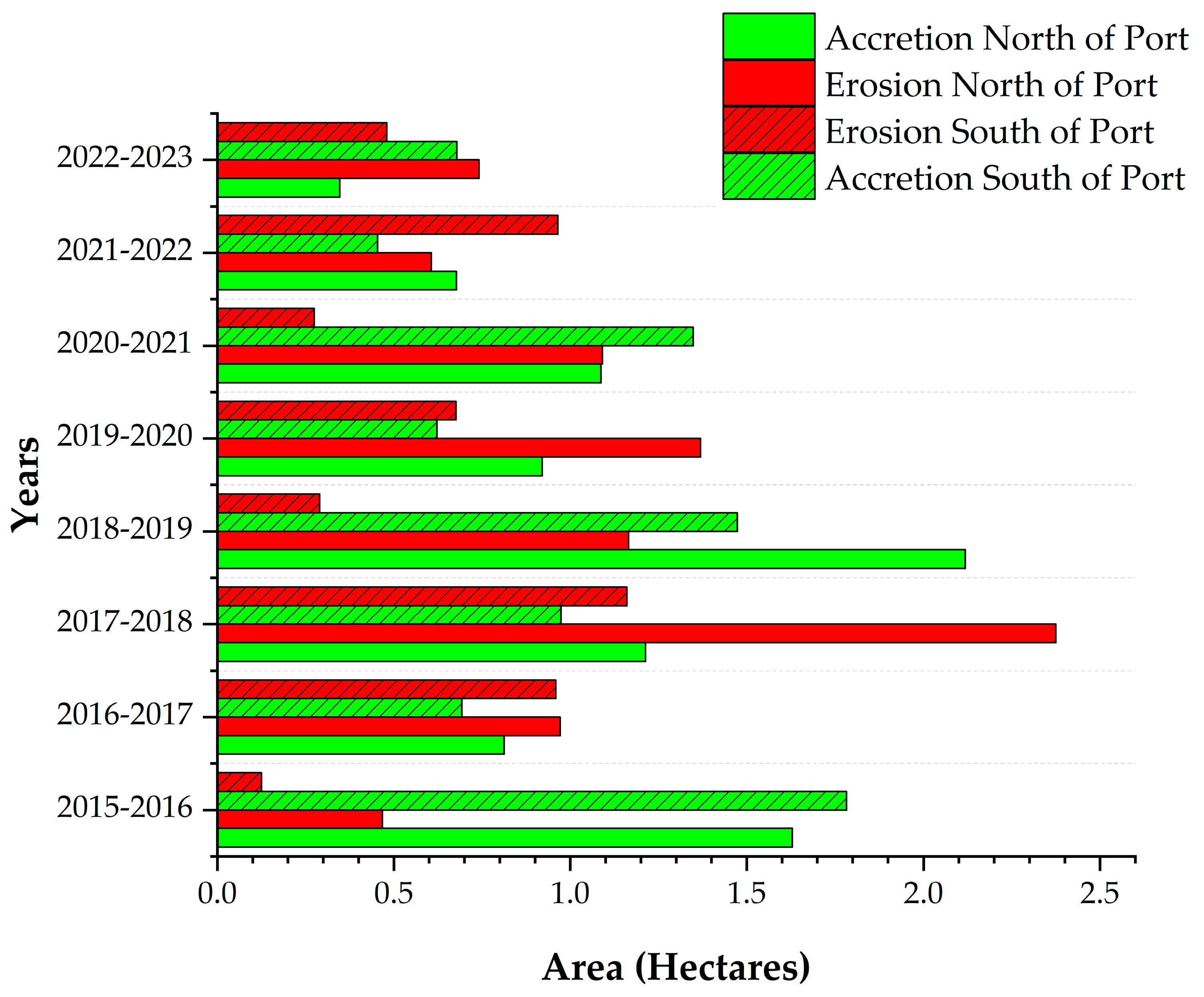
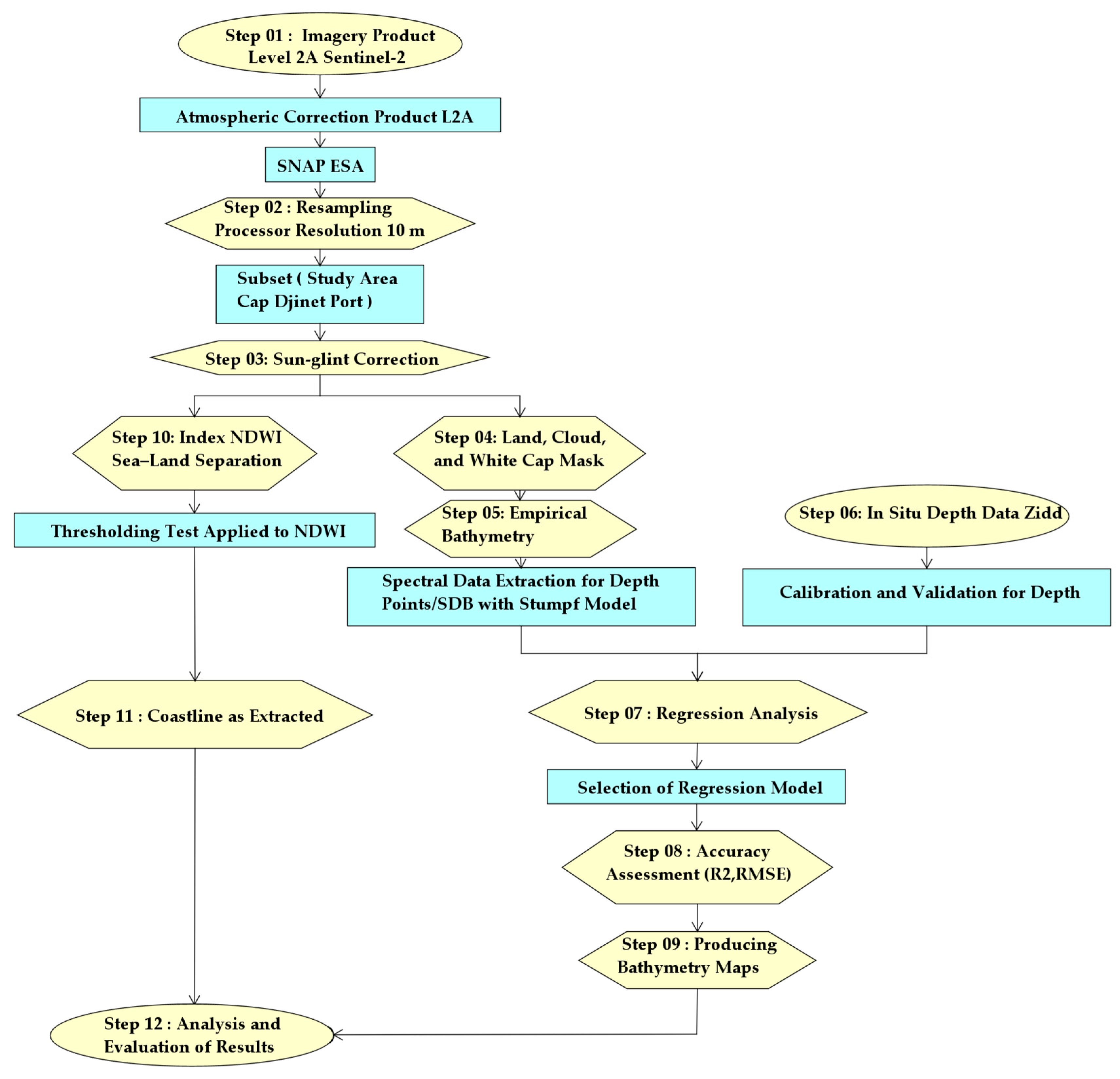
One of the ports most affected by the phenomenon of silting in Algeria is the port of Cap Djinet. In order to consider the monitoring of this port over a period of 8 years between 2015 and 2023, the twin Sentinel-2 A/B satellites were used. After image pre-processing, the bathymetry was estimated using the algorithm developed by Stumpf and extraction of the coastline was conducted using the normalized difference water index (NWDI). As part of this work, four bathymetric surveys were conducted in situ in four different periods, the results of which then correlated with those of the Stumpf model applied to satellite images. The results of the regression analysis are consistent and show good correlation coefficients (R2) between 0.67 and 0.80 and root-mean-square error (RMSE) values between 0.87 m and 1.32 m, except for images captured under turbid water conditions. The maximum accretion surface is 2.12 ha to the north of the port, estimated for the period from 2018 to 2019, and 1.78 ha to the south for 2015 to 2016. The maximum erosion surface is 2.37 ha to the north of the port for the period from 2017 to 2018 and 1.16 ha to the south from 2017 to 2018. Therefore, the amplitude of accretion and erosion is greater to the north of the port than to the south. The present study demonstrates the ability of Sentinel-2 satellites to monitor silting and coastline changes in the vicinity of this port, which could help to address the effects of climate change and human activities in order to protect the marine ecosystem.
Keywords: silting; Cap Djinet port; Sentinel-2; bathymetry; accretion; erosion; Stumpf method; SDB (satellite-derived bathymetry); NDWI (normalized difference water index) silting; Cap Djinet port; Sentinel-2; bathymetry; accretion; erosion; Stumpf method; SDB (satellite-derived bathymetry); NDWI (normalized difference water index)