Article

Unsupervised Color-Based Flood Segmentation in UAV Imagery

by
Georgios Simantiris
and
Costas Panagiotakis
*,†
Department of Management Science and Technology, Hellenic Mediterranean University, P.O. Box 128, 72100 Agios Nikolaos, Greece
*
Author to whom correspondence should be addressed.
These authors contributed equally to this work.
Remote Sens. 2024, 16(12), 2126; https://doi.org/10.3390/rs16122126
Submission received: 15 April 2024 / Revised: 23 May 2024 / Accepted: 8 June 2024 / Published: 12 June 2024
(This article belongs to the Special Issue Computer Vision-Based Methods and Tools in Remote Sensing)

Abstract

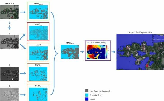
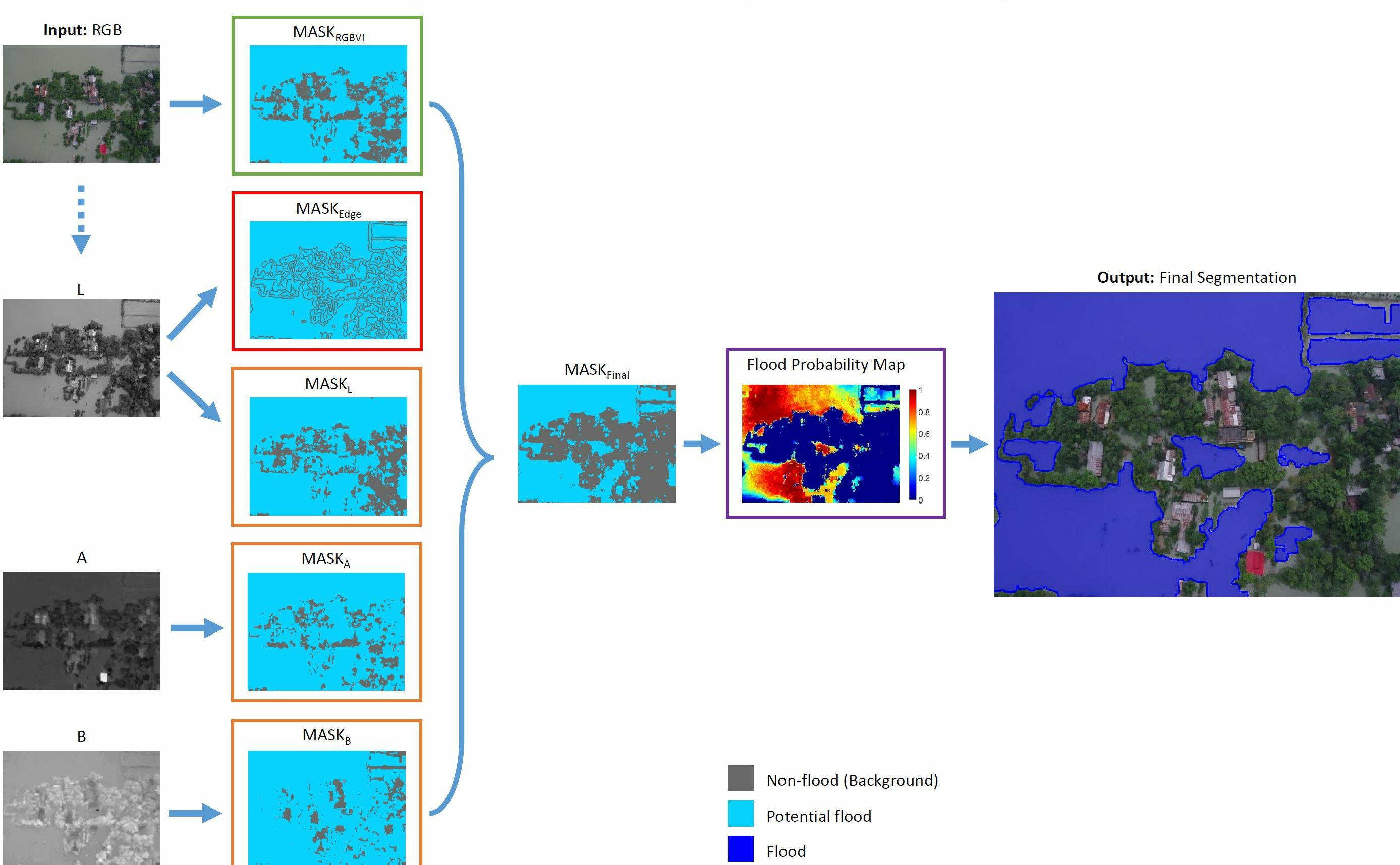
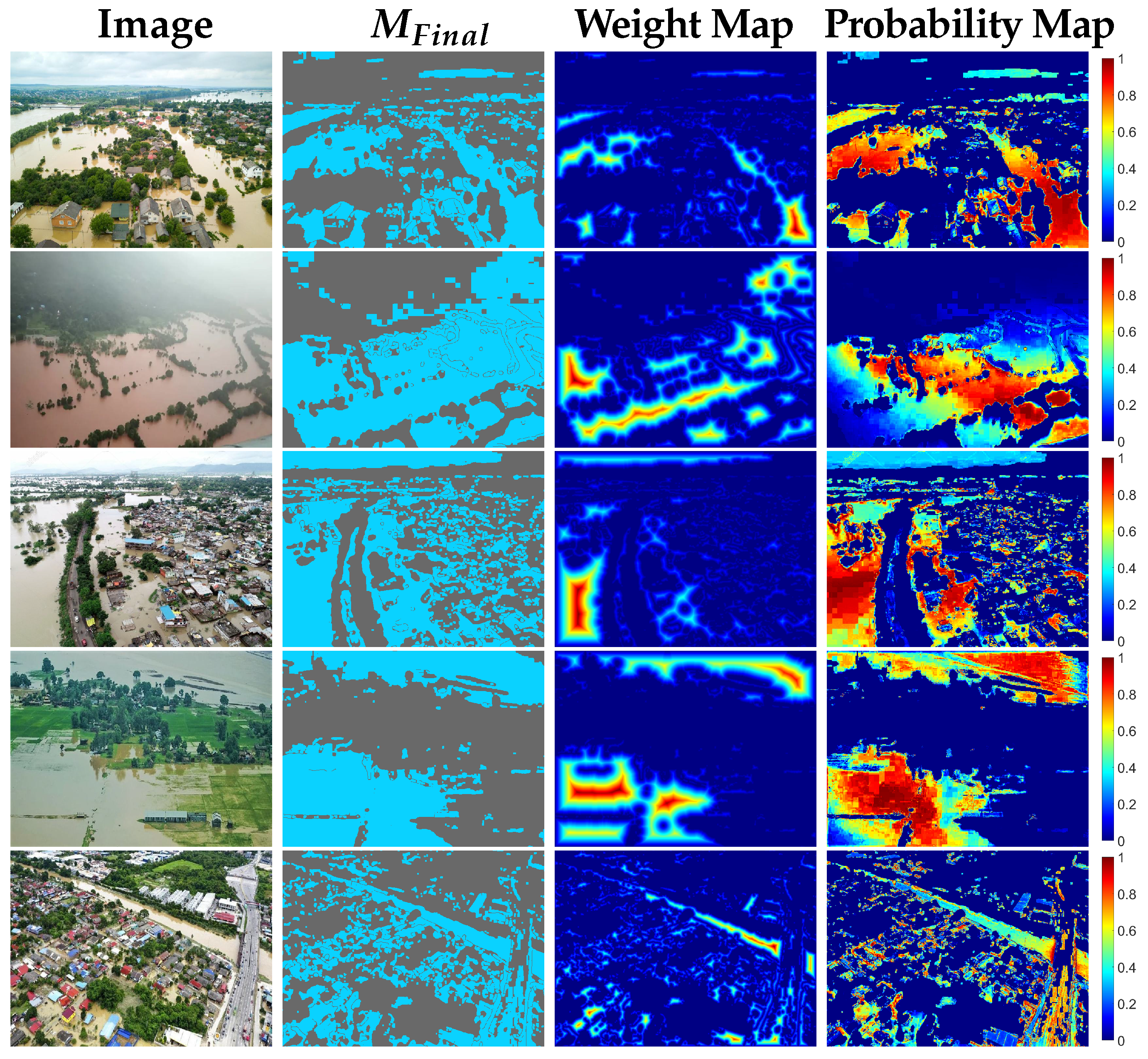
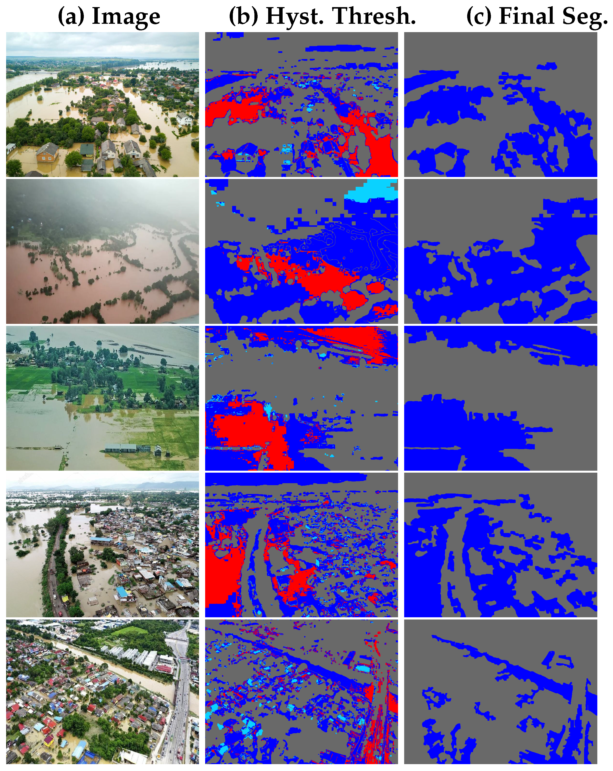
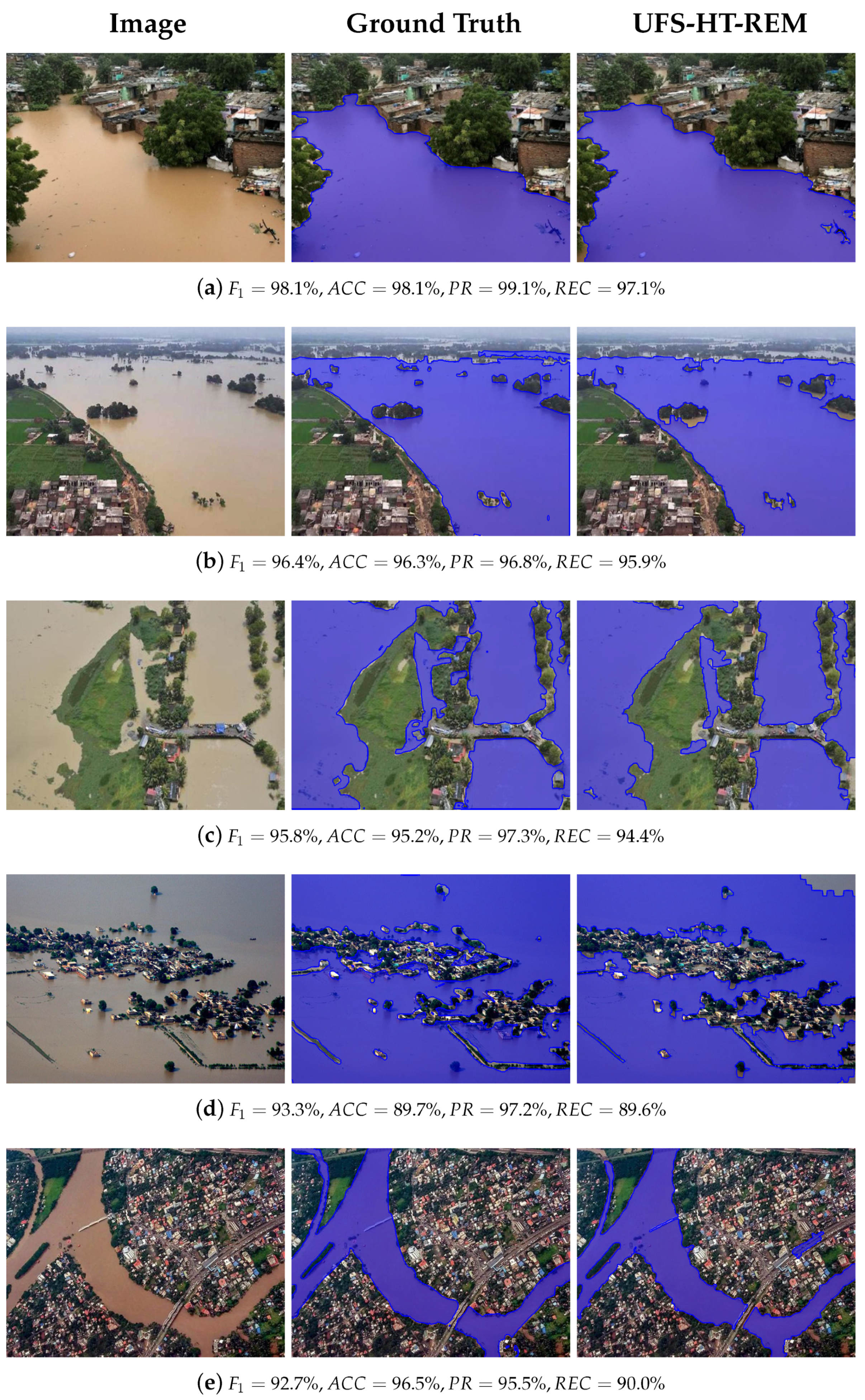
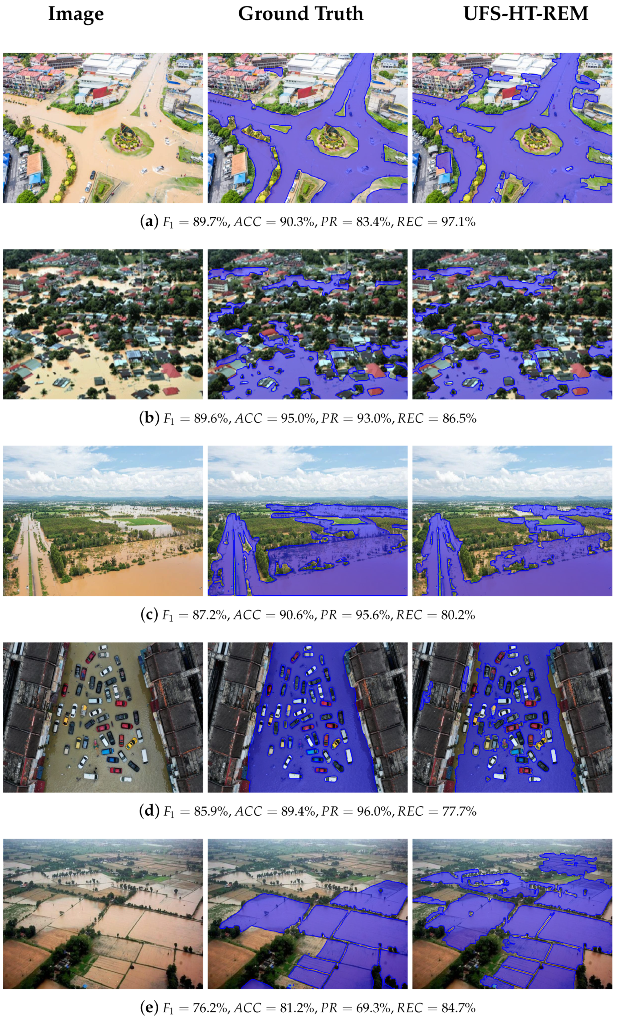
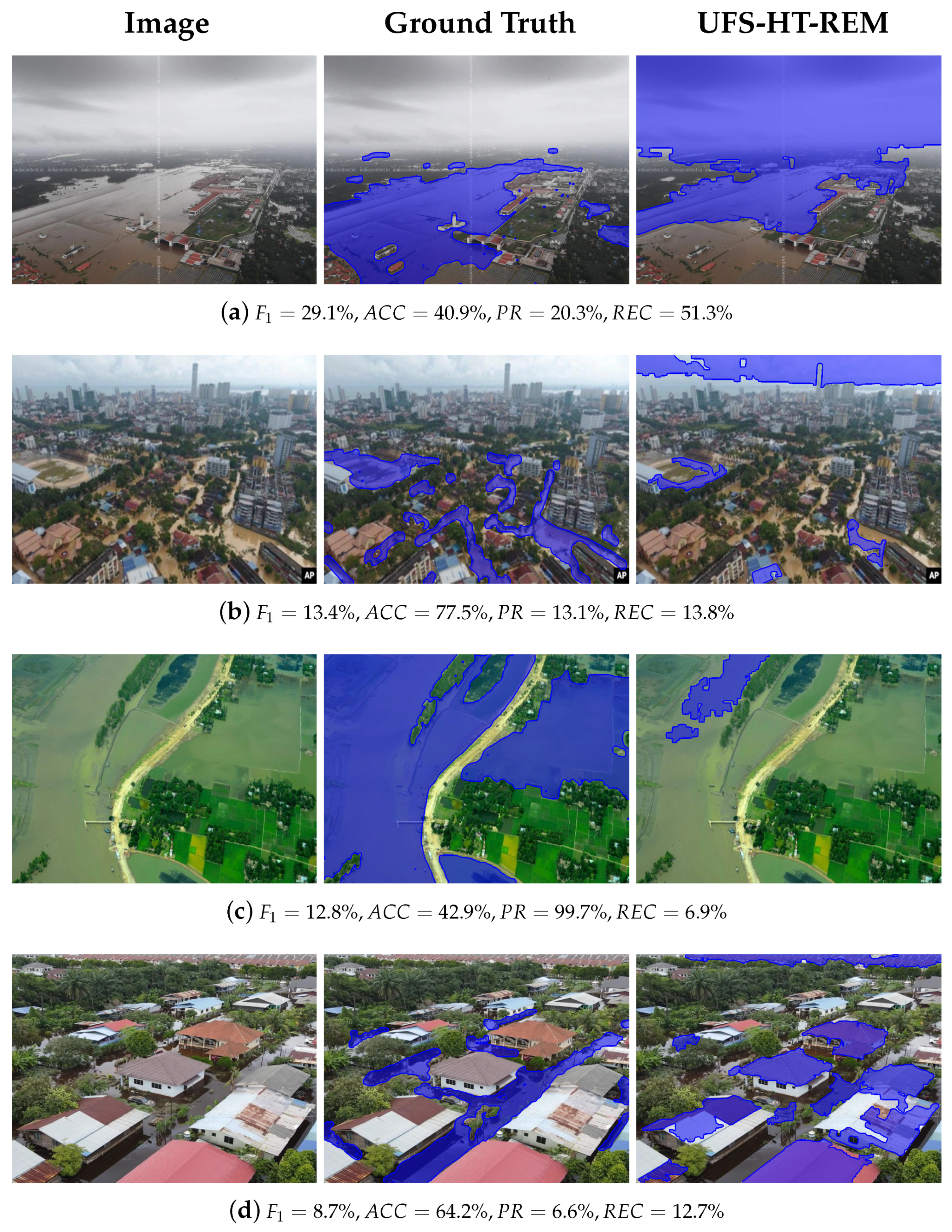
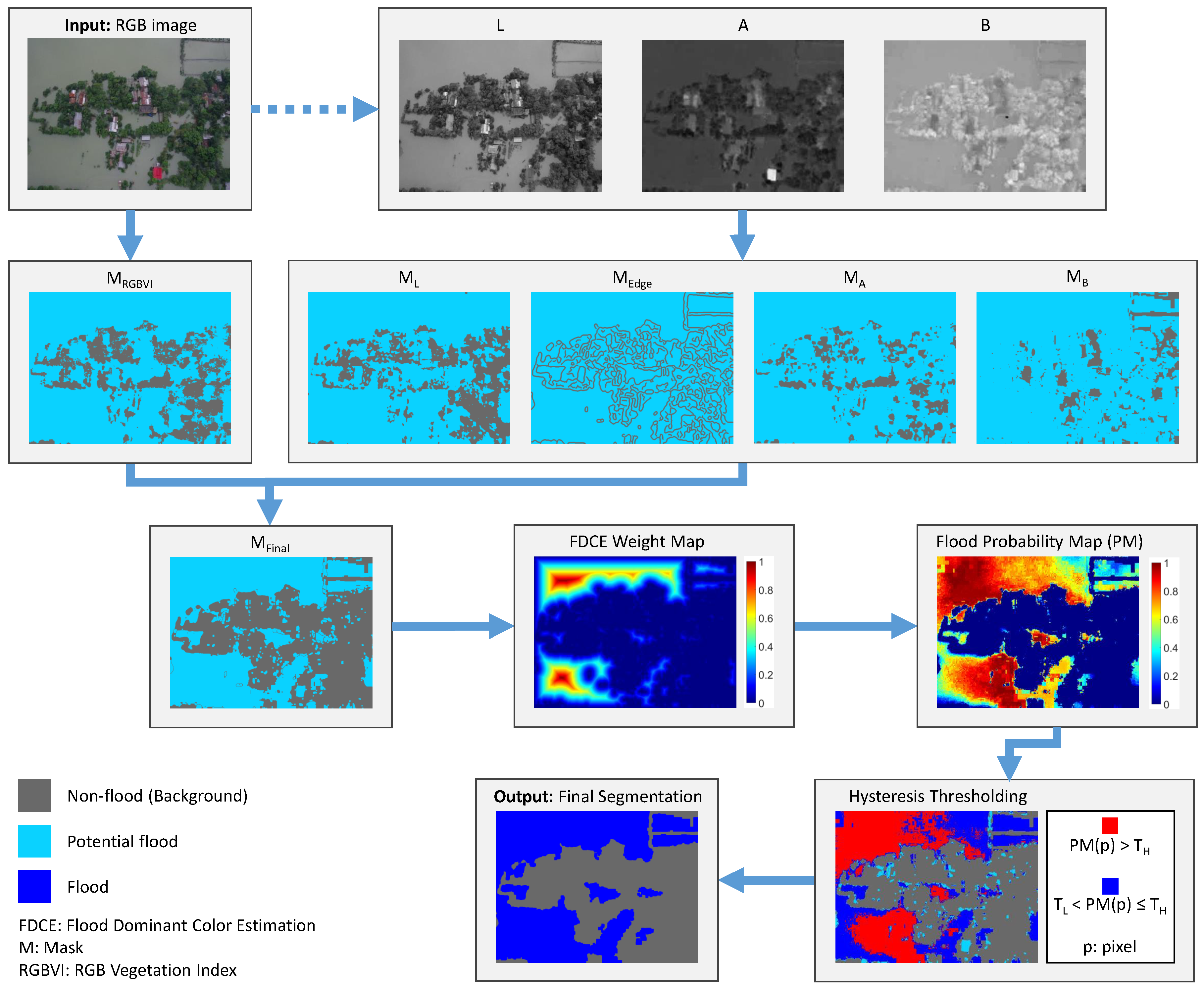
We propose a novel unsupervised semantic segmentation method for fast and accurate flood area detection utilizing color images acquired from unmanned aerial vehicles (UAVs). To the best of our knowledge, this is the first fully unsupervised method for flood area segmentation in color images captured by UAVs, without the need of pre-disaster images. The proposed framework addresses the problem of flood segmentation based on parameter-free calculated masks and unsupervised image analysis techniques. First, a fully unsupervised algorithm gradually excludes areas classified as non-flood, utilizing calculated masks over each component of the LAB colorspace, as well as using an RGB vegetation index and the detected edges of the original image. Unsupervised image analysis techniques, such as distance transform, are then applied, producing a probability map for the location of flooded areas. Finally, flood detection is obtained by applying hysteresis thresholding segmentation. The proposed method is tested and compared with variations and other supervised methods in two public datasets, consisting of 953 color images in total, yielding high-performance results, with 87.4% and 80.9% overall accuracy and F1-score, respectively. The results and computational efficiency of the proposed method show that it is suitable for onboard data execution and decision-making during UAV flights.
Keywords: flood detection; image segmentation; remote sensing; unmanned aerial vehicle (UAV); unsupervised segmentation flood detection; image segmentation; remote sensing; unmanned aerial vehicle (UAV); unsupervised segmentation
Graphical Abstract