


Abstract
The navigation and positioning of multi-autonomous underwater vehicles (AUVs) in the complex and variable marine environment is a significant and much-needed area of attention, especially considering the fact that cooperative navigation technology is the essential method for multiple AUVs to solve positioning problems. When the extended Kalman filter (EKF) is applied for underwater cooperative localization, the outliers in the sensor observations cause unknown errors in the measurement system due to deep-sea environmental factors, which are difficult to calibrate and cause a significant reduction in the co-location accuracy of AUVs, and can even cause problems with a divergence of estimation error. In this paper, we proposed a cooperative navigation method of the EKF algorithm based on the combined observation of multiple AUVs. Firstly, the corresponding cooperative navigation model is established, and the corresponding measurement model is designed. Then, the EKF model based on combined observation is designed and constructed, and the unknown error is eliminated by introducing a previously measured value. Finally, simulation tests and lake experiments are designed to verify the effectiveness of the algorithm. The results indicate that the EKF algorithm based on combined observation can approximately eliminate errors and improve the accuracy of cooperative localization when the unknown measurement error cannot be calibrated by common EKF methods. The effect of state estimation is improved, and the accuracy of co-location can be effectively improved to avoid serious declines in—and divergence of—estimation accuracy.
1. Introduction
Autonomous underwater vehicles (AUVs) are a class of important autonomous navigation carriers for human exploration of the marine environment. AUVs have a high degree of autonomy, flexibility, and remote navigation capabilities in marine resources exploration, underwater exploration, data acquisition, and other aspects of a wide range of applications [1,2,3,4]. With the rapid development of air- and land-based navigation technology, underwater navigation technology is also progressing rapidly [5,6,7,8,9,10]. However, due to the complexity of the underwater environment, there is still a gap between the navigation and positioning accuracy of underwater vehicles compared to those of air and land, and for the time being, underwater navigation has become an important issue in the field of AUV research [11,12,13,14].
Underwater high-precision navigation is key to AUVs’ mission, and the specific navigation methods applied by AUVs vary depending on the area in which they navigate underwater [15,16,17]. When an AUV sails in an offshore area (water depth <300 m), navigation technologies such as radio navigation (RADNAV) and global navigation satellite systems (GNSS) can be used from time to time; in the near-sea area (from the seabed <100 m), terrain matching navigation can be considered; and when sailing in deep-water environments, it is difficult to obtain the above-mentioned navigation information [18,19]. To sum up, even if there are more sensors, there are still many limitations and deficiencies in the independent operation of AUVs underwater. However, multiple AUVs can use their navigation sensors to obtain corresponding measurement information and then combine underwater acoustic communication technology with underwater acoustic detection technology to share this information and measure the relative positions of adjacent AUVs and obtain navigation parameters by fusing information. Cooperative navigation enables highly accurate underwater positioning and navigation, easily accomplishing complex tasks that would be difficult for a single AUV to perform, and the simplicity of the system and the flexibility of the range of use have led to a wide focus of researchers on cooperative underwater positioning of multiple AUVs [20,21,22].
The key object of research in multi-AUV cooperative navigation is the information fusion algorithm shared among the system’s AUVs, and most of the existing multi-AUV cooperative positioning methods comprise improved Kalman filter (KF) algorithms combined with measurement data from underwater navigation sensors. The model of a multi-AUV cooperative localization system is often nonlinear. Therefore, an extended Kalman filter (EKF) or unscented Kalman filter (UKF) is usually used for state estimation [23,24,25].
The problem of cooperative navigation and positioning is a state estimation problem, and the accurate acquisition of observation information is key to realizing the optimal state estimation of cooperative navigation [26]. At present, the use of hydroacoustic communication devices to obtain relative observations, such as relative distance, between individual AUVs is the most effective and reliable measurement method [27,28,29]. However, AUVs are used in complex marine environments where the cooperative navigation of multiple sensors can be affected by harsh conditions and instability of measurement sensors, causing unknown system noise and resulting in unknown measurement system errors. This inevitably leads to the destruction of effective observation information, and the extended KF filtering algorithm cannot accurately estimate and correct this unknown measurement system error, thus directly leading to a significant decrease in filtering accuracy and stability or even divergence. Ref. [30] describes how, in acoustic ranging-based cooperative navigation, sensors are subjected to temperature, salinity, depth, current, and other factors in the underwater environment, which makes the statistical characteristics of the measured sensor noise inaccurate and generates unknown measurement system errors. In the framework of Kalman filters, these methods require that the statistical characteristics of process noise and measurement noise are known and fixed during cooperative localization [31,32]. However, this unknown measurement system error is difficult to calibrate with the common EKF algorithm and, therefore, leads directly to a reduction in filter accuracy or even divergence [33]. Ref. [34] presented the use of attenuated adaptive filtering to achieve adjustment of the weights of new measurements, but the process of calculating the scalar asymptotic factor is too cumbersome. Adaptive filters based on great likelihood can correct the second-order moments of statistical properties of noise but rely on accurate estimates of the new interest covariance [35]. The above-mentioned works all emphasize the influence of measurement error information on the state estimation effect. To improve the robustness of state estimation regarding measurement errors, it is still necessary to further seek a more reliable and effective co-location algorithm. In Ref. [36], Sheng has proposed a novel transfer alignment method based on combined double-time observations with velocity and attitude to address the problem of static flexural deformation causing measurement system errors, successfully eliminating this unknown system error, effectively improving filter performance, and increasing the accuracy of transfer alignment. However, the linear KF cannot be applied to multi-AUV cooperative navigation [37].
To solve the above problems, we need to redesign the cooperative navigation algorithm, and realize the optimal state estimation of cooperative navigation by filtering and optimizing the measurement information with errors. In this paper, we proposed a cooperative navigation method of the EKF algorithm based on the combined observation of multiple AUVs. The improved EKF algorithm model was designed and constructed to eliminate errors in the measurement system by combining previously measured information with information from the current moment; current observations subtracted from the last observation are used as new measurements for the improved algorithm. The final results of the simulation and experiments verify the feasibility and effectiveness of the algorithm in the field of cooperative localization for AUVs.
The rest of this paper is organized as follows: In Section 2, the formulation of a discrete-time nonlinear model of the cooperative positioning system and the corresponding standard EKF algorithm are described. In Section 3, by analysis and comparison with the common algorithm, the improved EKF based on combined observation is proposed and derived and is specifically applied to cooperative navigation for AUVs. In Section 4, a simulation test and lake tests are designed, and the results verify the feasibility and effectiveness of the algorithm. Finally, conclusions are presented in Section 5.
4. Experimental Validation and Discussion
4.1. Simulation Test
4.1.1. Test Setting
According to the previous analysis, this section uses the MATLAB platform to simulate the new EKF method and verifies the performance and effectiveness of the improved cooperative navigation algorithm [50].
First, a multi-AUV cooperative navigation system is established, which consists of three AUVs, starting from three different positions and attitudes, and moving uniformly in a certain area. The starting attitude of the three AUVs is the same, but the starting position is different, and the three AUVs operate at a depth of −100 m underwater. The true linear velocity of the three AUVs is 10 m/s. The true angular velocities are 2 °/s.
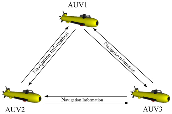
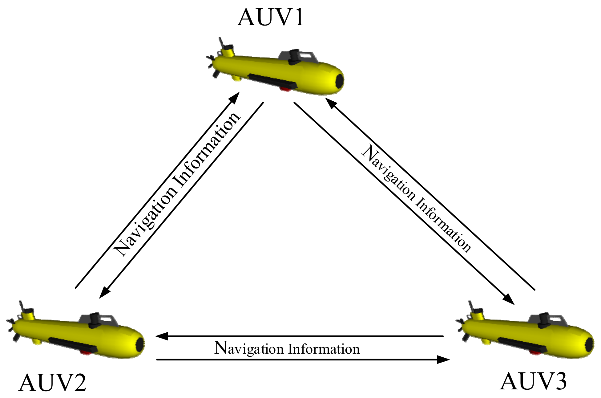
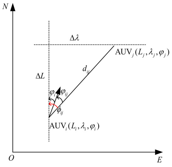
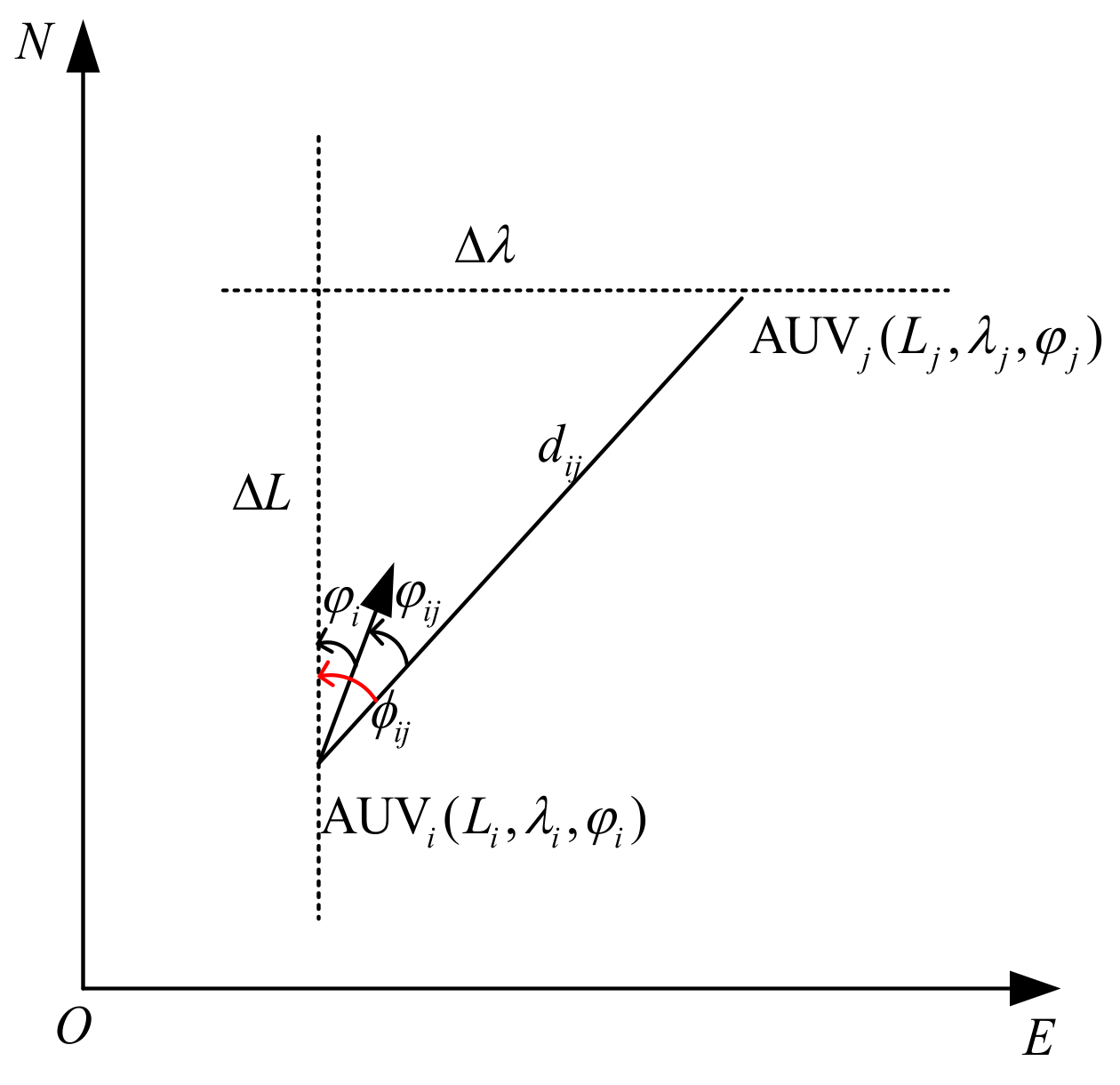
In practice, the multi-AUV cooperative navigation system does not need to be equipped with different precision navigation equipment. Therefore, in the parallel cooperative navigation system in this section, all AUVs have the same configuration, and each AUV has the same or equal-precision navigation system and underwater acoustic communication equipment. The cooperative navigation system is a network system composed of multiple AUVs, as shown in Figure 1. While each AUV relies on SINS for autonomous navigation in the deep-sea environment, it cannot obtain other external auxiliary information such as GNSS. However, each AUV can continuously integrate the navigation information of adjacent AUVs, set the system update frequency of mutual observation , and observe and transmit the mutual distance and relative azimuth angle to each other. We adopt different information fusion algorithms to achieve cooperative navigation for comparison.
When there are unknown errors in the measurement system, the improved EKF based on combined observation and the common EKF are compared, and the error of in the relative distance measurement equation is set to a value of 20 m. The common EKF and the combined-observation EKF are used to fuse information for cooperative navigation, respectively. A total of 100 statistically independent realizations are composed using Monte Carlo simulation and only one of these simulations is given in this paper. The simulation time is 1000 s.
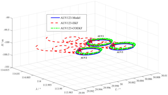
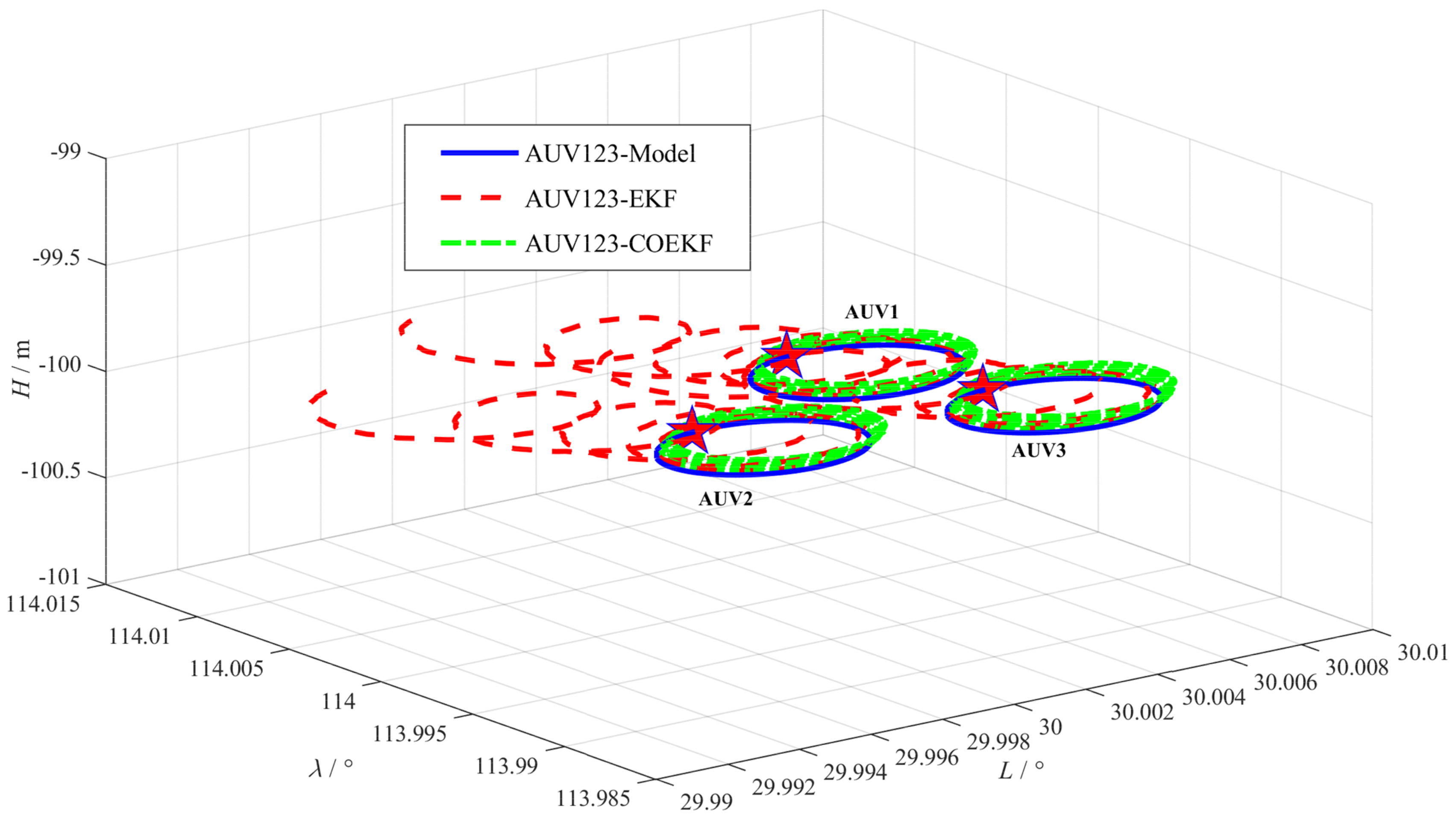
The estimated trajectories of the three AUVs against the reference used by the common EKF and the combined-observation EKF (COEKF) methods are shown in Figure 3. In this figure, the three blue solid lines indicate the model trajectories of the three AUVs; the three red lines show the trajectory estimated by the common EFK method when there is a measurement error ; and the three green lines show the trajectory estimated by the COEKF when there is a measurement error .
Figure 3.
The estimated trajectories of three AUVs.
4.1.2. Results of the Test
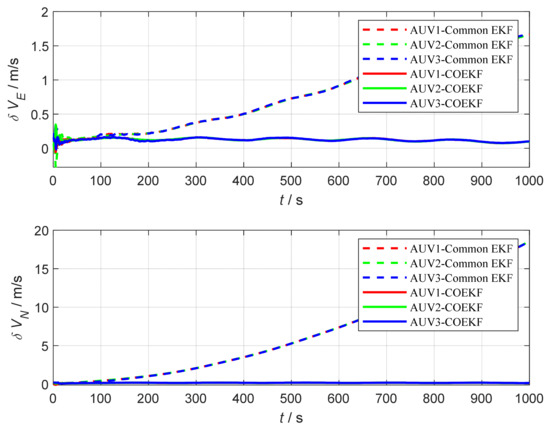
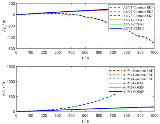
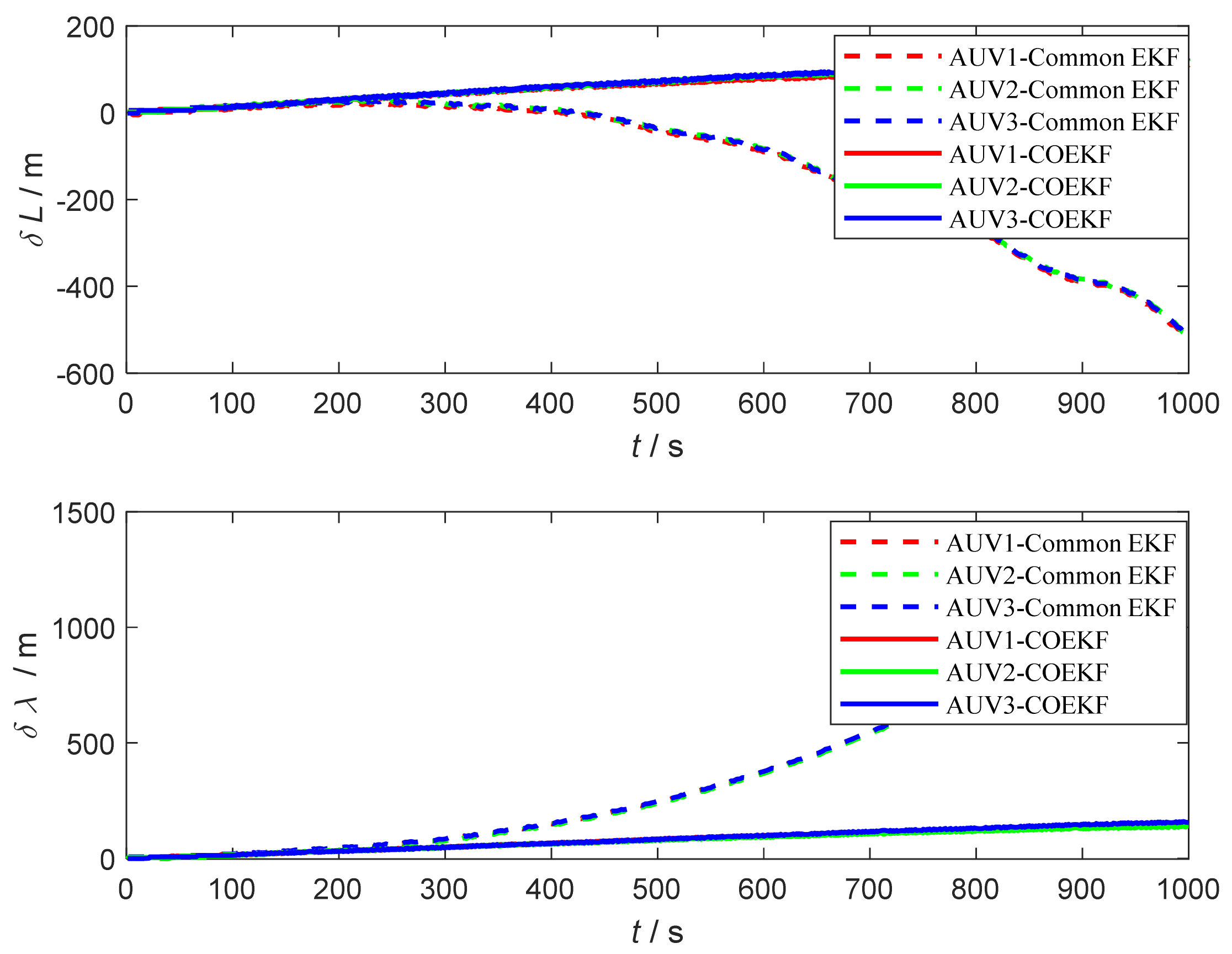
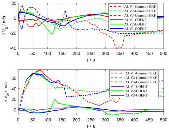
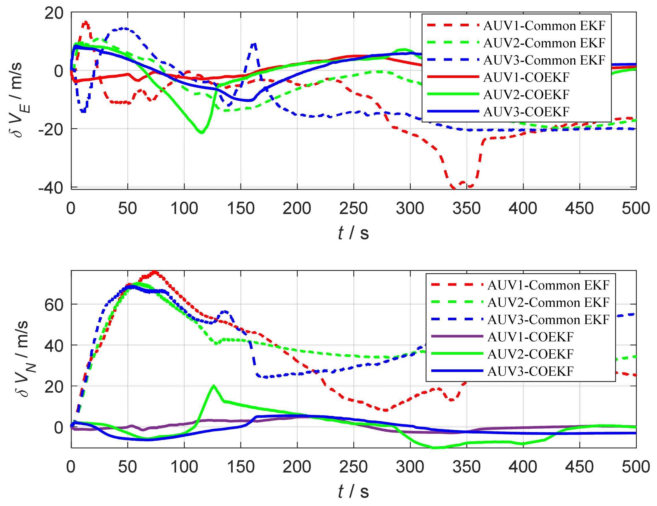
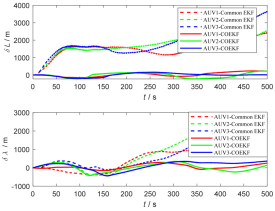
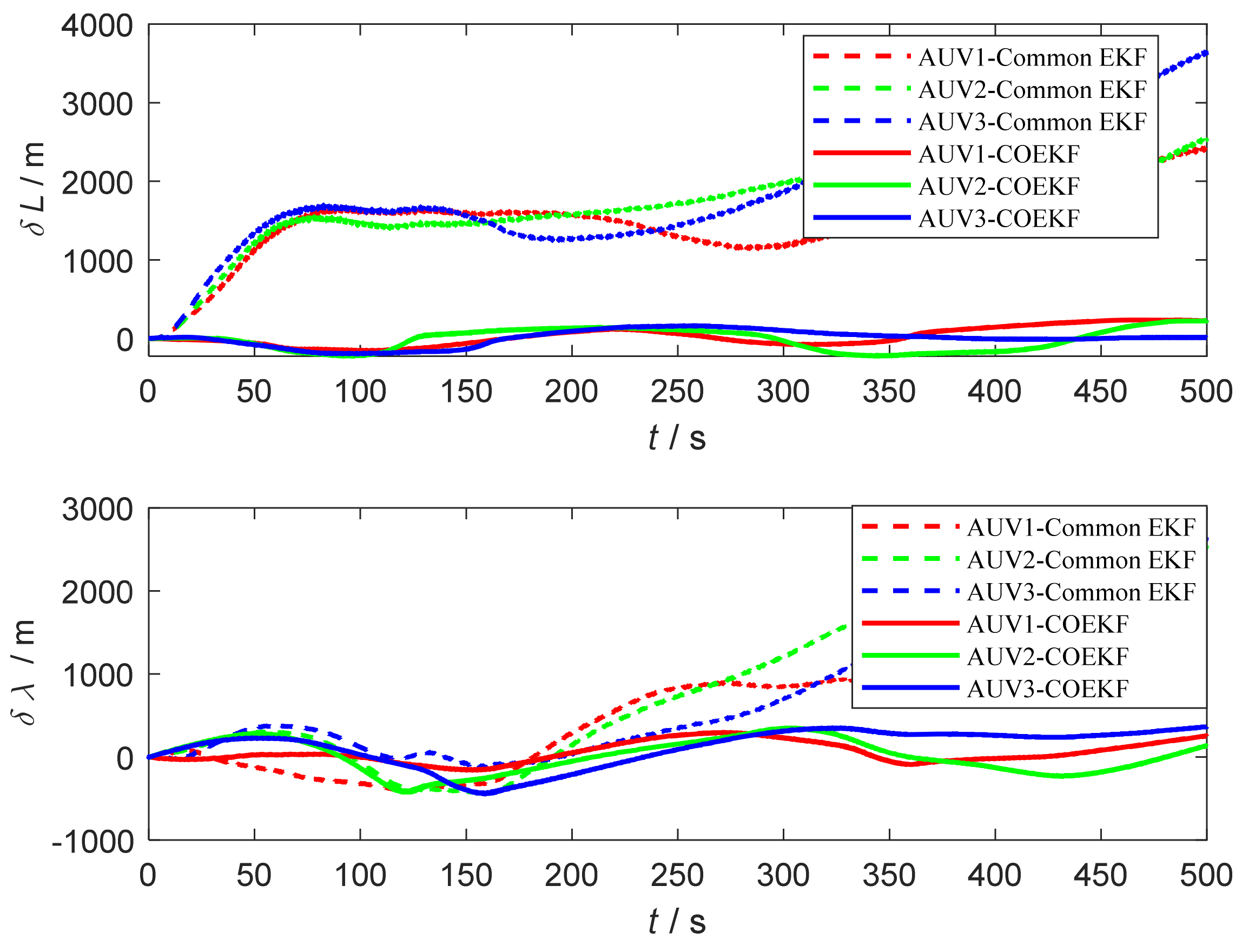
The velocity and position errors of the three AUVs are shown in Figure 4 and Figure 5, respectively. In Figure 4 and Figure 5, the blue, red, and green dotted lines indicate the cooperative positioning error curves of AUV1, AUV2, and AUV3 based on the common EKF, respectively. The red, green, and blue solid lines indicate the cooperative positioning error curves of AUV1, AUV2, and AUV3 based on the combined-observation EKF, respectively.
Figure 4.
Velocity error comparison curve.
Figure 5.
Position error comparison curve.
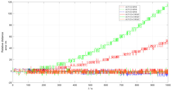
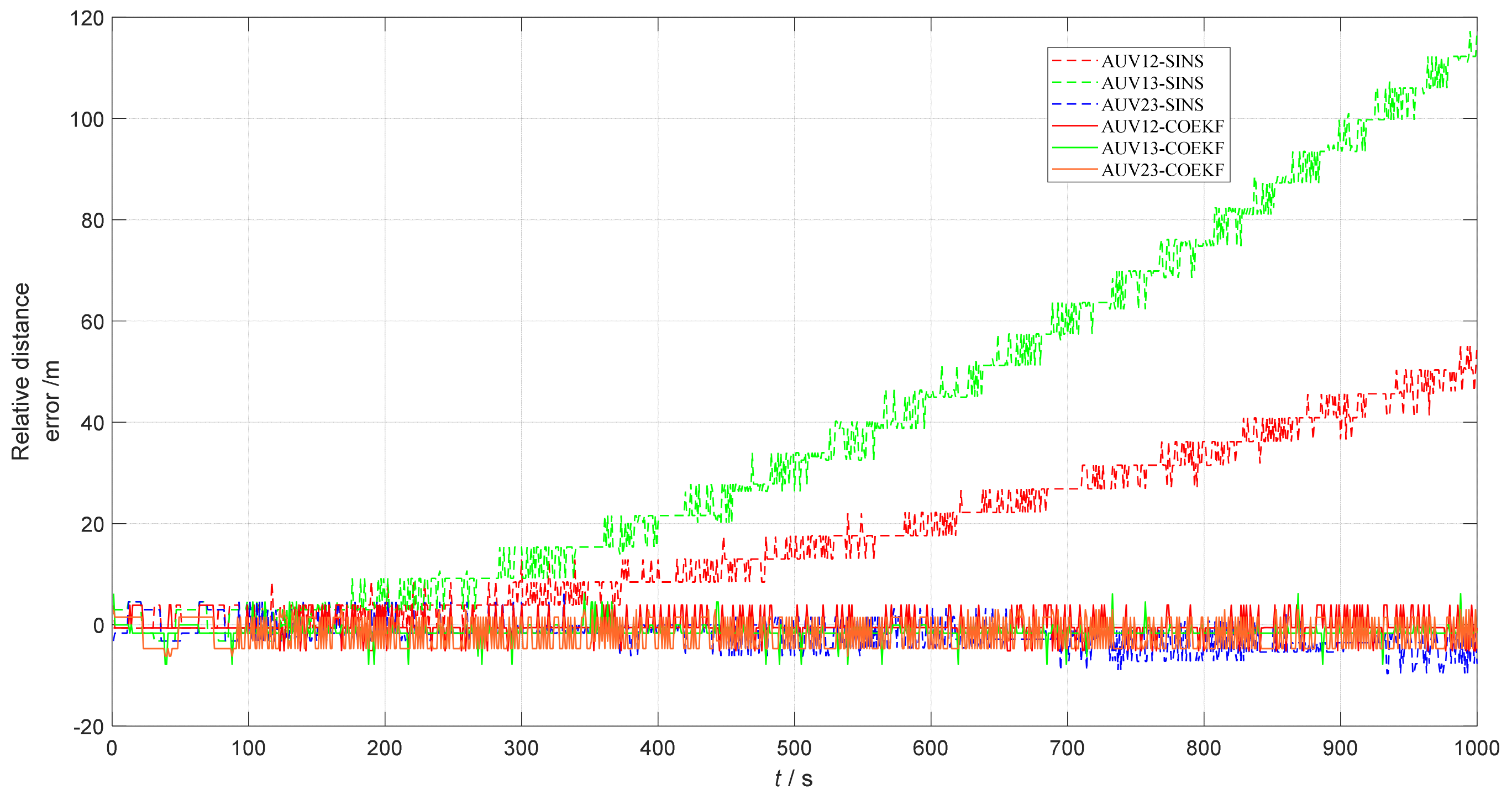
The relative horizontal distance error curves for cooperative multi-AUV navigation based on the combined-observation EKF are shown in Figure 6; the red, green, and blue dashed lines show the relative horizontal distance error curves between AUV1 and AUV2, between AUV1 and AUV3, and between AUV2 and AUV3, respectively, when autonomous navigation is based on pure SINS. The red, green, and yellow solid lines show the relative horizontal distance error curves between the individual AUVs based on the combined-observation EKF for cooperative navigation. The horizontal distance error statistics for multi-AUV cooperative navigation based on the combined-observation EKF are shown in Table 1.
Figure 6.
Relative horizontal distance error for multi-AUV cooperative navigation.
Table 1.
Relative distance error statistics.
From Figure 4 and Figure 5, it can be seen that the velocity and position errors of the common EKF for cooperative navigation have a rapid tendency to disperse over time when there are unknown errors in the measurement system and the cooperative navigation relies only on relative observation information. As mentioned in the introduction, cooperative navigation is closely related to state estimation, and unknown errors in measurement equations lead to a decrease in estimation accuracy or even divergence [36]. Therefore, the combined-observation EKF can successfully eliminate the unknown error of the measurement system, effectively using the relative observation information between AUVs to delay the dispersion of cooperative navigation errors, and eliminating the influence of the measurement system errors on the dispersion of cooperative navigation errors. In addition to this, the horizontal positioning distance between the AUVs based on the combined-observation EKF algorithm can maintain high accuracy, as can be seen in Figure 6 and Table 1.
In summary, the simulation test results show that when there are unknown errors in the measurement system, the multi-AUV cooperative navigation and positioning algorithm based on the combined-observation EKF can effectively eliminate the influence of unknown errors, effectively use the relative observation information to delay the dispersion of navigation errors, improve the cooperative navigation and positioning accuracy to a certain extent, and has a high degree of flexibility and reliability.
4.2. Lake Experiments
4.2.1. Experiment Setting
The simulation test results above have proved that the combined-observation EKF algorithm proposed in this paper can effectively eliminate the measurement system error and, thus, can delay the dispersion of navigation errors. To continue to test the performance of the algorithm in practical engineering applications, we carried out lake experiments at Yuandang Lake in Suzhou city, using navigation data from three 9-ton surface boats for algorithm validation.
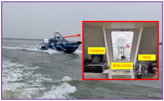
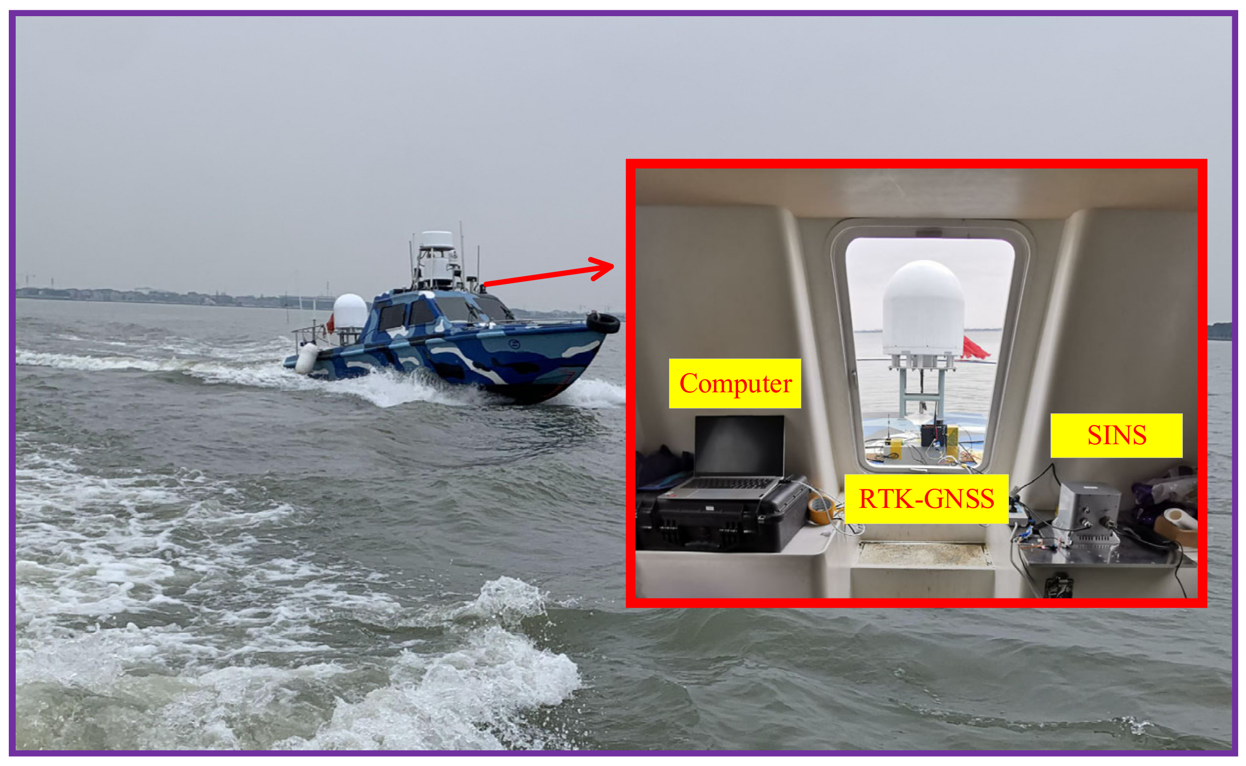
In this cooperative experiment, the reference value of each boat’s navigation position is provided by real-time kinematic (RTK) differential positioning data. The boats are equipped with a certain type of strapdown inertial navigation system, a RTK-GNSS receiver, and a navigation computer. The equipment diagram is shown in Figure 7. The equipment parameters of the SINS are shown in Table 2; the RTK-GNSS receiver includes a base station and multiple mobile terminals. The differential GNSS plane positioning accuracy is better than 0.5 m, the RTK plane positioning accuracy is 1 cm + 1 ppm, and the signal coverage area after access to the network is represented as a 10 km circle.
Figure 7.
Equipment and platforms in the boat.
Table 2.
Sensor errors.
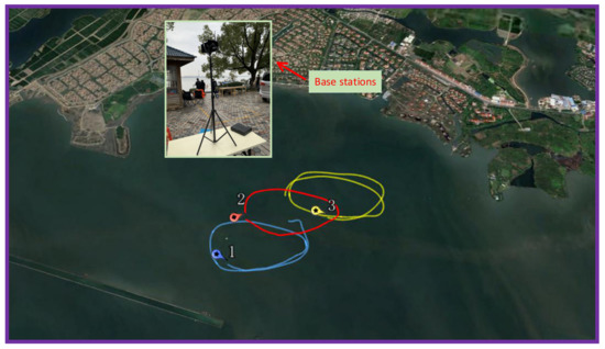
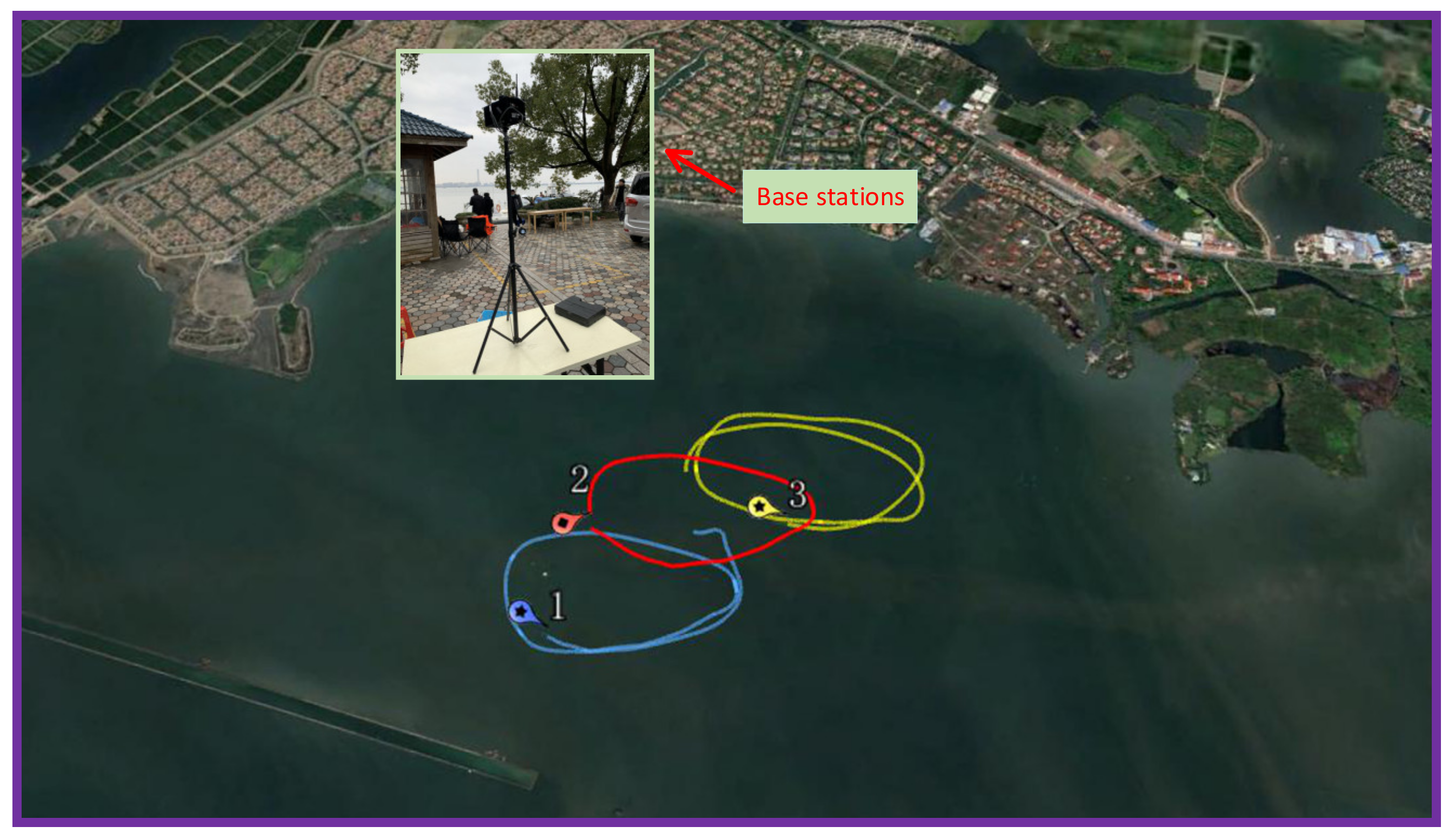
Before the cooperative navigation of the boats, the SINS of each boat independently completes the initial alignment. In the initial alignment process, the boats use GNSS to complete the analytical rough alignment and then use the GNSS position and velocity measurement to achieve fine alignment [51]. After the initial alignment of the SINS is completed, the SINS is used as the onboard equipment to obtain measurement information stably. Due to the lack of available ranging data between boats, the inter-ship ranging reference value is obtained by the difference in the position reference values at the corresponding time, adding 0.2% of the Gaussian white noise of the ranging value to simulate cooperative information. To obtain comparison results of different cooperative navigation algorithms for the unknown error of the measurement system, following Ref. [22], an error is added to the measurement system. To simulate multiple AUVs that cannot acquire GNSS signals underwater, each boat broadcasts to the other boats during the algorithm validation process, relying only on the relative measurement information shared between each boat for cooperative navigation, and each boat’s information broadcast frequency is set to 1 Hz. We used GNSS for clock synchronization before sailing, and sailing data comprising three segments of 500 s of circular motion after 2 h of sailing away from the pier were selected for algorithm verification, and the trajectory schematic is shown in Figure 8.
Figure 8.
Schematic diagram of the trajectory.
4.2.2. Results of the Lake Experiment
The velocity and position errors of the three boats’ cooperative navigation are shown in Figure 9 and Figure 10, respectively. In Figure 9 and Figure 10, the blue, red, and green dotted lines indicate the cooperative positioning error curves of Boat 1, Boat 2, and Boat 3 based on the conventional EKF, respectively. The red, green, and blue solid lines indicate the cooperative positioning error curves of each boat based on the combined-observation EKF.
Figure 9.
Velocity error comparison curve.
Figure 10.
Position error comparison curve.
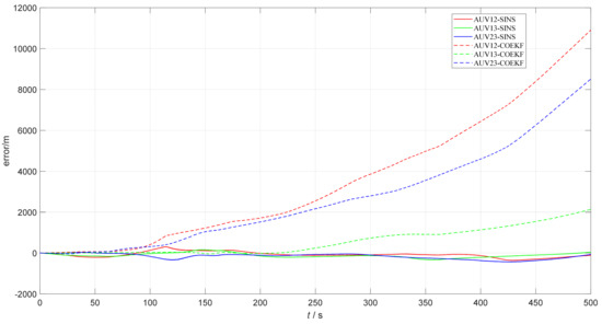
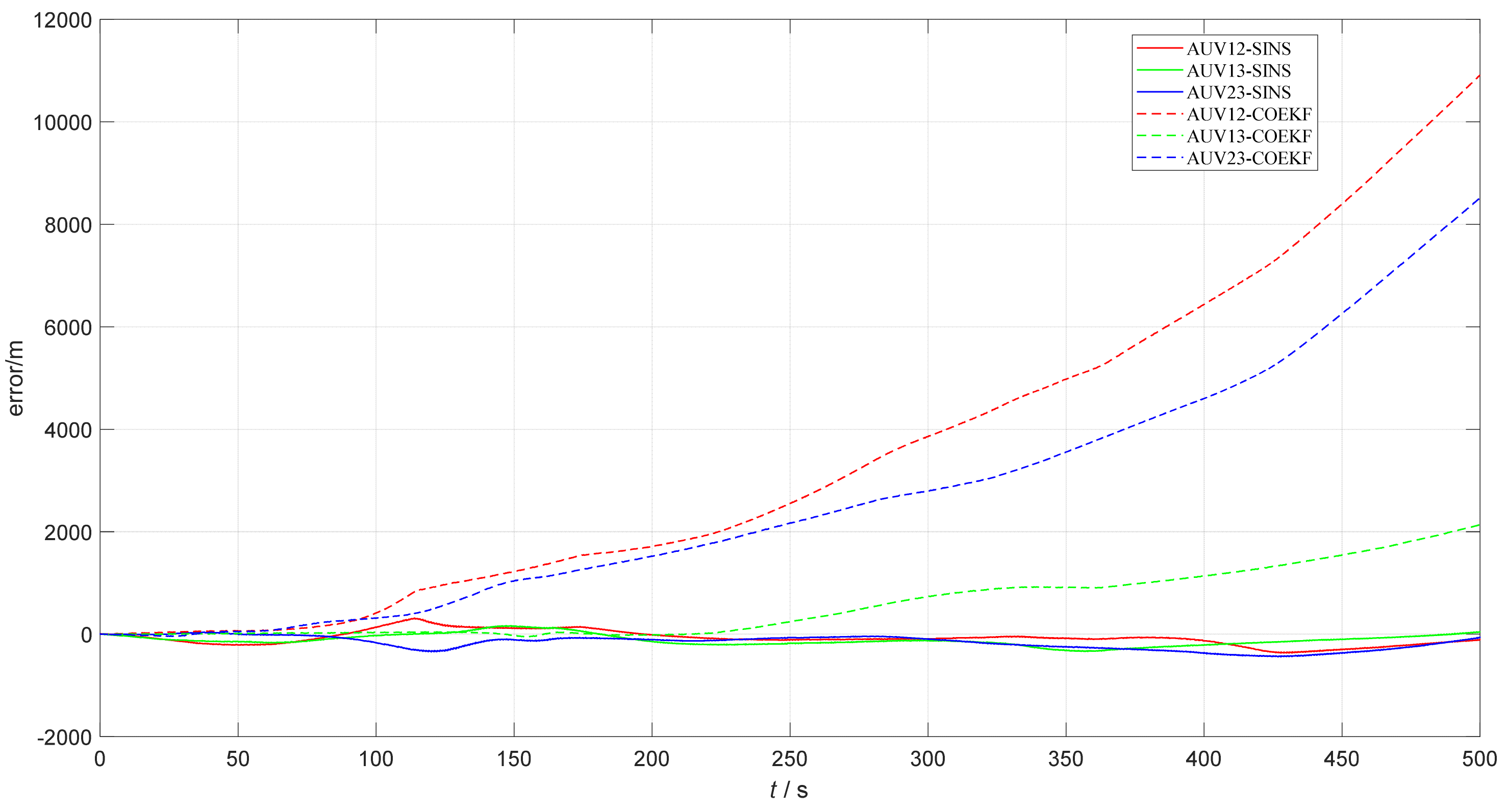
The relative horizontal distance error curves for cooperative multi-boat navigation based on the combined-observation EKF are shown in Figure 11; the red, green, and blue dashed lines show the relative horizontal distance error curves between Boat 1 and Boat 2, between Boat 1 and Boat 3, and between Boat 2 and Boat 3, respectively, when autonomous navigation is based on pure SINS. The red, green, and blue solid lines show the relative horizontal distance error curves between the individual boats based on the combined-observation EKF for cooperative navigation.
Figure 11.
Relative horizontal distance error for multi-boat cooperative navigation.
From the results of the lake experiment in Figure 9 and Figure 10, we can find that when there is a measurement error in the actual measurement test of cooperative navigation, the position error based on the common EKF algorithm has a certain amount of error offset, and each shows a divergent trend; this shows that the common EKF cannot eliminate the influence of errors of the measurement system.
However, in these figures, it can be seen that the error value of the combined-observation EKF is smaller, and the respective error values are closer, which is more effective for the error processing of the measurement system. The horizontal distance error statistics for multi-AUV cooperative navigation based on the combined-observation EKF are shown in Table 3. It can be seen that, compared with Table 1, the error index is higher. Because the actual test is different from the ideal environment of the simulation, there are environmental factors and related sensor influences, such as GPS interference, that directly affect the measurement of the ideal position, but the performance of different algorithms under the same conditions can still show the superiority of the improved algorithm.
Table 3.
Relative distance error statistics.
To sum up, this section verifies the feasibility and effectiveness of the multi-AUV cooperative navigation algorithm based on the combined-observation EKF proposed in this paper through simulation tests and lake experiments.
5. Conclusions
In this study, a cooperative navigation method based on a combined-observation algorithm is presented to solve the problem that unknown errors of measurement system are difficult to calibrate by common EKF methods, which affects the accuracy of multi-AUV cooperative navigation. The concept of combined observation is introduced into the underwater multi-AUV cooperative nonlinear system and re-establishes the EKF model. In the observation process of the algorithm, the measurement sampling values of the current moment and the previous moment are included. The combined observation can approximately eliminate the measurement system error at the algorithm level, avoid the impact of the measurement system errors on the performance of the filter, and improve the accuracy of cooperative navigation. Therefore, each AUV has the capability of bounded navigation and positioning errors, which can effectively reduce the impact of measurement system errors on the system’s navigation and positioning accuracy. Finally, the effectiveness and reliability of the improved algorithm are proven by simulation tests and lake experiments, respectively.
Author Contributions
G.S. and X.L. provided the core idea for this study. G.S. and Y.S. implemented the method and carried out the experimental evaluation. G.S. wrote the main manuscript. X.L., Y.S., G.S., X.C. and H.L. provided comments and suggestions for this paper. All authors have read and agreed to the published version of the manuscript.
Funding
This work was supported in part by the National Natural Science Foundation of China (Grant No. 51979041, 61973079, 41631175) and the Joint Fund Project of Equipment Preliminary Research and the Ministry of Education (6141A02011906).
Acknowledgments
We thank all the scientists and principal researchers who prepared and provided the research data. We would also like to thank our colleagues from the School of Instrument Science and Engineering who provided profound insights and expertise to our research.
Conflicts of Interest
The authors declare no conflict of interest.
Abbreviations
The following abbreviations are used in this manuscript:
| AUV | autonomous underwater vehicle |
| RADNAV | radio navigation |
| GNSS | global navigation satellite system |
| SINS | strapdown inertial navigation system |
| KF | Kalman filter |
| EKF | extended Kalman filter |
| UKF | unscented Kalman filter |
| COEKF | combined-observation EKF |
| RTK | real-time kinematic |
| DVL | Doppler velocity log |
| TAN | terrain-assisted navigation |
| MCP | magnetic compass pilot |
| 2D | two-dimensional |
| 3D | three-dimensional |
References
- Ma, X.; Liu, X.; Li, C.; Liu, J.; Wu, X. A novel Rauch–Tung–Streibel smoothing scheme based on the factor graph for auto omous underwater vehicles. Rev. Sci. Instrum. 2020, 91, 075109. [Google Scholar] [CrossRef] [Scilit] [PubMed]
- Villa, J.; Aaltonen, J.; Virta, S.; Koskinen, K.T. A Co-Operative Autonomous Offshore System for Target Detection Using Multi-Sensor Technology. Remote Sens. 2020, 12, 4106. [Google Scholar] [CrossRef] [Scilit]
- Ross, J.; Lindsay, J.; Gregson, E.; Moore, A.; Patel, J.; Seto, M. Collaboration of multi-domain marine robots towards above and below-water characterization of floating targets. In Proceedings of the 2019 IEEE International Symposium on Robotic and Sensors Environments (ROSE), Ottawa, ON, Canada, 17–18 June 2019; pp. 1–7. [Google Scholar]
- Klinger, W.B.; Bertaska, I.R.; von Ellenrieder, K.D.; Dhanak, M.R. Control of an unmanned surface vehicle with uncertain displacement and drag. IEEE J. Ocean. Eng. 2016, 42, 458–476. [Google Scholar] [CrossRef] [Scilit]
- Manderson, T.; Higuera, J.C.G.; Wapnick, S. Vision-based goal-conditioned policies for underwater navigation in the presence of obstacles. arXiv 2020, arXiv:2006.16235. [Google Scholar]
- Huang, H.; Tang, J.; Zhang, B.; Chen, J.C.; Zhang, J.J.; Song, X. A novel nonlinear algorithm for non-Gaussian noises and measurement information loss in underwater navigation. IEEE Access 2020, 8, 118472–118484. [Google Scholar] [CrossRef] [Scilit]
- Liu, P.; Wang, B.; Deng, Z.; Meng, Y.F. INS/DVL/PS tightly coupled underwater navigation method with limited DVL measurements. IEEE Sens. J. 2018, 18, 2994–3002. [Google Scholar] [CrossRef] [Scilit]
- Chang, L.; Di, J.; Qin, F. Inertial based integration with transformed INS mechanization in Earth frame. IEEE/ASME Trans. Mechatron. 2022, 27, 1738–1749. [Google Scholar] [CrossRef] [Scilit]
- Bobkov, V.A.; Kudryashov, A.P.; Mel’Man, S.V.; Shcherbatyuk, A.F. Autonomous underwater navigation with 3D environment modeling using stereo images. Gyroscopy Navig. 2018, 9, 67–75. [Google Scholar] [CrossRef] [Scilit]
- González-García, J.; Gómez-Espinosa, A.; Cuan-Urquizo, E.; García-Valdovinos, L.G.; Salgado-Jiménez, T.; Escobedo Cabello, J.A. Autonomous underwater vehicles: Localization, navigation, and communication for collaborative missions. Appl. Sci. 2020, 10, 1256. [Google Scholar] [CrossRef] [Scilit]
- Qu, J.; Sun, G.; Zhang, J. Optimality analysis for formation of Multi-AUV cooperative positioning based on genetic algorithm. In Proceedings of the 2021 IEEE International Conference on Real-Time Computing and Robotics (RCAR), Datong, China, 17–22 July 2021; pp. 578–583. [Google Scholar]
- Ling, H.; Zhu, T.; He, W.; Zhang, Z.; Luo, H. Cooperative search method for multiple AUVs based on target clustering and path optimization. Nat. Comput. 2021, 20, 3–10. [Google Scholar] [CrossRef] [Scilit]
- Lu, J.; Chen, X.; Luo, M.; Zhou, Y. Cooperative localization for multiple AUVs based on the rough estimation of the measurements. Appl. Soft Comput. 2020, 91, 106197. [Google Scholar] [CrossRef] [Scilit]
- Chang, L.; Qin, F.; Xu, J. Strapdown inertial navigation system initial alignment based on group of double direct spatial isometries. IEEE Sens. J. 2022, 22, 803–818. [Google Scholar] [CrossRef] [Scilit]
- Liu, X.; Liu, X.; Shen, H.; Li, P.; Zhang, T. Self-aided SINS for spiral-diving human-occupied vehicle in midwater. Assem. Autom. 2021, 41, 106–115. [Google Scholar] [CrossRef] [Scilit]
- Xanthidis, M.; Karapetyan, N.; Damron, H.; Rahman, S.; Johnson, J.; O’Connell, A.; O’Kane, J.M.; Rekleitis, I. Navigation in the presence of obstacles for an agile autonomous underwater vehicle. In Proceedings of the 2020 IEEE International Conference on Robotics and Automation (ICRA), Paris, France, 31 May–31 August 2020; pp. 892–899. [Google Scholar]
- Barker, L.D.; Jakuba, M.V.; Bowen, A.D.; German, C.R.; Maksym, T.; Mayer, L.; Boetius, A.; Dutrieux, P.; Whitcomb, L.L. Scientific challenges and present capabilities in underwater robotic vehicle design and navigation for oceanographic exploration under-ice. Remote Sens. 2020, 12, 2588. [Google Scholar] [CrossRef] [Scilit]
- Liu, X.; Liu, X.; Wang, L. SINS/DVL Integrated System with Current and Misalignment Estimation for Midwater Navigation. IEEE Access 2021, 9, 51332–51342. [Google Scholar] [CrossRef] [Scilit]
- Salavasidis, G.; Munafò, A.; Fenucci, D. Terrain-aided navigation for long-range AUVs in dynamic under-mapped environments. J. Field Robot. 2021, 38, 402–428. [Google Scholar] [CrossRef] [Scilit]
- Ge, H.; Chen, G.; Xu, G. Multi-AUV cooperative target hunting based on improved potential field in a surface-water environment. Appl. Sci. 2018, 8, 973. [Google Scholar] [CrossRef] [Scilit]
- Cao, X.; Sun, H.; Jan, G.E. Multi-AUV cooperative target search and tracking in unknown underwater environment. Ocean Eng. 2018, 150, 1–11. [Google Scholar] [CrossRef] [Scilit]
- Wang, X.; Yang, L.; Meng, D. Multi-UAV cooperative localization for marine targets based on weighted subspace fitting in SAGIN environment. IEEE Internet Things J. 2021, 9, 5708–5718. [Google Scholar] [CrossRef] [Scilit]
- Herlambang, T.; Nurhadi, H. Estimation of UNUSAITS AUV position of motion using extended Kalman filter (EKF). In Proceedings of the 2019 International Conference on Advanced Mechatronics, Intelligent Manufacture and Industrial Automation (ICAMIMIA), Batu, Indonesia, 9–10 October 2019; pp. 334–339. [Google Scholar]
- Zhang, F.; Wu, X.; Ma, P. Consistent Extended Kalman Filter-Based Cooperative Localization of Multiple Autonomous Underwater Vehicles. Sensors 2022, 22, 4563. [Google Scholar] [CrossRef] [Scilit]
- Xu, C.; Xu, C.; Wu, C.; Qu, D.; Liu, J.; Wang, Y.; Shao, G. A novel self-adapting filter based navigation algorithm for autonomous underwater vehicles. Ocean Eng. 2019, 187, 106146. [Google Scholar] [CrossRef] [Scilit]
- Wang, C.N.; Yang, F.C.; Vo, N.T.; Nguyen, V.T.T. Wireless Communications for Data Security: Efficiency Assessment of Cybersecurity Industry—A Promising Application for UAVs. Drones 2022, 6, 363. [Google Scholar] [CrossRef] [Scilit]
- Li, J.; Wang, J.; Yuan, R. AUV Path Following Formation Control Based on Extended Kalman Filter. In Proceedings of the 2021 IEEE International Conference on Mechatronics and Automation (ICMA), Takamatsu, Japan, 8–11 August 2021; pp. 12–16. [Google Scholar]
- Causa, F.; Opromolla, R.; Fasano, G. Cooperative navigation and visual tracking with passive ranging for UAV flight in GNSS-challenging environments. In Proceedings of the 2021 International Conference on Unmanned Aircraft Systems (ICUAS), Athens, Greece, 15–18 June 2021; pp. 1538–1547. [Google Scholar]
- Rego, F.; Pascoa, A. Cooperative single-beacon multiple AUV navigation under stringent communication bandwidth constraints. IFAC-PapersOnLine 2021, 54, 216–223. [Google Scholar] [CrossRef] [Scilit]
- Munafo, A.; Ferri, G. An acoustic network navigation system. J. Field Robot. 2017, 34, 1332–1351. [Google Scholar] [CrossRef] [Scilit]
- Farahi, F.; Yazdi, H.S. Probabilistic Kalman filter for moving object tracking. Signal Process. Image Commun. 2020, 82, 115751. [Google Scholar] [CrossRef] [Scilit]
- Ullah, I.; Shen, Y.; Su, X.; Esposito, C.; Choi, C. A localization based on unscented Kalman filter and particle filter localization algorithms. IEEE Access 2019, 8, 2233–2246. [Google Scholar] [CrossRef] [Scilit]
- Bai, M.; Huang, Y.; Chen, B.; Yang, L.; Zhang, Y. A novel mixture distributions-based robust Kalman filter for cooperative localization. IEEE Sens. J. 2020, 20, 14994–15006. [Google Scholar] [CrossRef] [Scilit]
- Hajiyev, C.; Vural, S.Y.; Hajiyeva, U. Adaptive Fading Kalman Filter with Q-adaptation for estimation of AUV dynamics. In Proceedings of the 20th Mediterranean Conference on Control & Automation (MED), Barcelona, Spain, 3–6 July 2012; pp. 697–702. [Google Scholar]
- Liu, X.; Qu, H.; Zhao, J. Maximum Correntropy Unscented Kalman Filter for Spacecraft Relative State Estimation. Sensors 2016, 16, 1530. [Google Scholar] [CrossRef] [Scilit] [PubMed]
- Sheng, G.; Liu, X.; Wang, Z.; Pu, W.; Wu, X.; Ma, X. A transfer alignment algorithm based on combined double-time observation of velocity and attitude. Assem. Autom. 2022, 42, 542–551. [Google Scholar] [CrossRef] [Scilit]
- Ansari, K. Cooperative position prediction: Beyond vehicle-to-vehicle relative positioning. IEEE Trans. Intell. Transp. Syst. 2019, 21, 1121–1130. [Google Scholar] [CrossRef] [Scilit]
- EI-Sheimy, N.; Youssef, A. Inertial sensors technologies for navigation applications: State of the art and future trends. Satell. Navig. 2020, 1, 1–21. [Google Scholar]
- Chang, L.; Qin, F.; Jiang, S. Strapdown inertial navigation system initial alignment based on modified process model. IEEE Sens. J. 2019, 19, 6381–6391. [Google Scholar] [CrossRef] [Scilit]
- Zhang, F.; Gao, X.; Song, W. A Vision Aided Initial Alignment Method of Strapdown Inertial Navigation Systems in Polar Regions. Sensors 2022, 22, 4691. [Google Scholar] [CrossRef] [Scilit]
- Sun, C.; Zhang, Y.; Wang, G.; Gao, W. A New Variational Bayesian Adaptive Extended Kalman Filter for Cooperative Navigation. Sensors 2018, 18, 2538. [Google Scholar] [CrossRef] [Scilit] [PubMed]
- Ma, X.; Liu, X.; Li, C.; Wu, X.; Zhang, Y. Multiple Autonomous Underwater Vehicles Cooperative Localization Based on Asynchronous Relative Observation. In Proceedings of the 2021 International Mobile, Intelligent, and Ubiquitous Computing Conference (MIUCC), Cairo, Egypt, 26–27 May 2021; pp. 3–8. [Google Scholar]
- Liu, L.; Wu, B.; Yang, P. Orbit Precision Determination & Self-Calibration Technique of Spacecraft; National Defense Industry Press: Beijing, China, 2005. [Google Scholar]
- Jian, M.; Qi, Q.; Yu, H.; Dong, J.; Cui, C.; Nie, X.; Zhang, H.; Yin, Y.; Lam, K.M. The extended marine underwater environment database and baseline evaluations. Appl. Soft Comput. 2019, 80, 425–437. [Google Scholar] [CrossRef] [Scilit]
- Xu, B.; Li, S.; Razzaqi, A.A. Cooperative localization in Harsh underwater environment based on the MC-ANFIS. IEEE Access 2019, 7, 55407–55421. [Google Scholar] [CrossRef] [Scilit]
- Kim, J. Cooperative localization and unknown currents estimation using multiple autonomous underwater vehicles. IEEE Robot. Autom. Lett. 2020, 5, 2365–2371. [Google Scholar] [CrossRef] [Scilit]
- Ma, Y.; Tian, C.; Jiang, Y. A multitag cooperative localization algorithm based on weighted multidimensional scaling for passive UHF RFID. IEEE Internet Things J. 2019, 6, 6548–6555. [Google Scholar] [CrossRef] [Scilit]
- Bouffaut, L. Detection and Classification in Passive Acoustic Contexts: Application to Blue Whale Low-Frequency Signals. Ph.D. Thesis, Institut de Recherche de l’Ecole Navale, Brest, France, 2019. [Google Scholar]
- Ben, Y.; Zang, X.; Li, Q.; He, J. A dual-state filter for a relative velocity aiding Strapdown Inertial Navigation System. IEEE Trans. Instrum. Meas. 2020, 70, 1000215. [Google Scholar] [CrossRef] [Scilit]
- Kim, T.; Park, T.H. Extended Kalman filter (EKF) design for vehicle position tracking using reliability function of radar and lidar. Sensors 2020, 20, 4126. [Google Scholar] [CrossRef] [Scilit]
- Huang, Y.; Zhang, Z.; Du, S.; Li, Y.; Zhang, Y. A high-accuracy GPS-aided coarse alignment method for MEMS-based SINS. IEEE Trans. Instrum. Meas. 2020, 69, 7914–7932. [Google Scholar] [CrossRef] [Scilit]

Disclaimer/Publisher’s Note: The statements, opinions and data contained in all publications are solely those of the individual author(s) and contributor(s) and not of MDPI and/or the editor(s). MDPI and/or the editor(s) disclaim responsibility for any injury to people or property resulting from any ideas, methods, instructions or products referred to in the content. |
© 2023 by the authors. Licensee MDPI, Basel, Switzerland. This article is an open access article distributed under the terms and conditions of the Creative Commons Attribution (CC BY) license (https://creativecommons.org/licenses/by/4.0/).