Article

A Robust LiDAR SLAM Method for Underground Coal Mine Robot with Degenerated Scene Compensation

1
School of College of Surveying and Mapping Science and Technology, Xi’an University of Science and Technology, Xi’an 710054, China
2
Shanxi Key Laboratory of Mine Electromechanical Equipment Intelligent Detection and Control, School of Mechanical Engineering, Xi’an University of Science and Technology, Xi’an 710054, China
*
Author to whom correspondence should be addressed.
Remote Sens. 2023, 15(1), 186; https://doi.org/10.3390/rs15010186
Submission received: 27 September 2022 / Revised: 21 December 2022 / Accepted: 26 December 2022 / Published: 29 December 2022
(This article belongs to the Special Issue Remote Sensing Solutions for Mapping Mining Environments)

Abstract

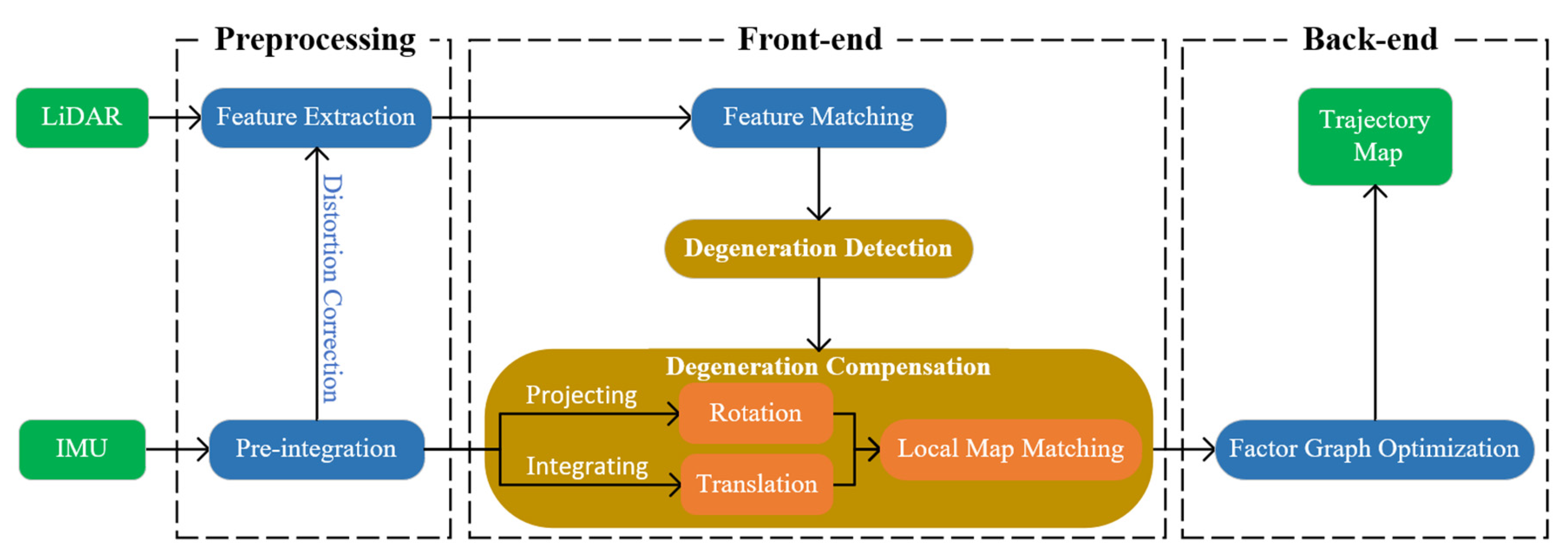
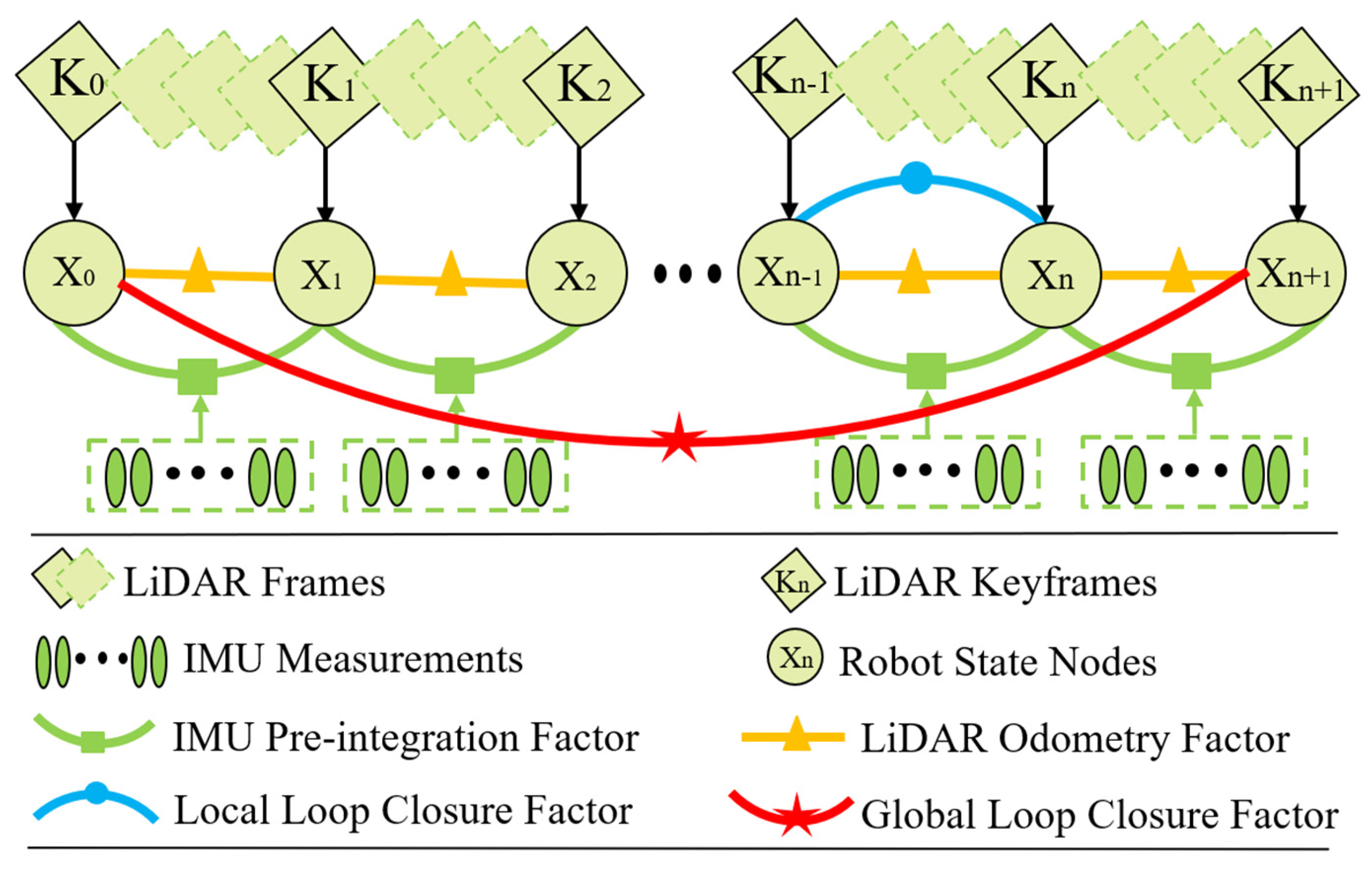
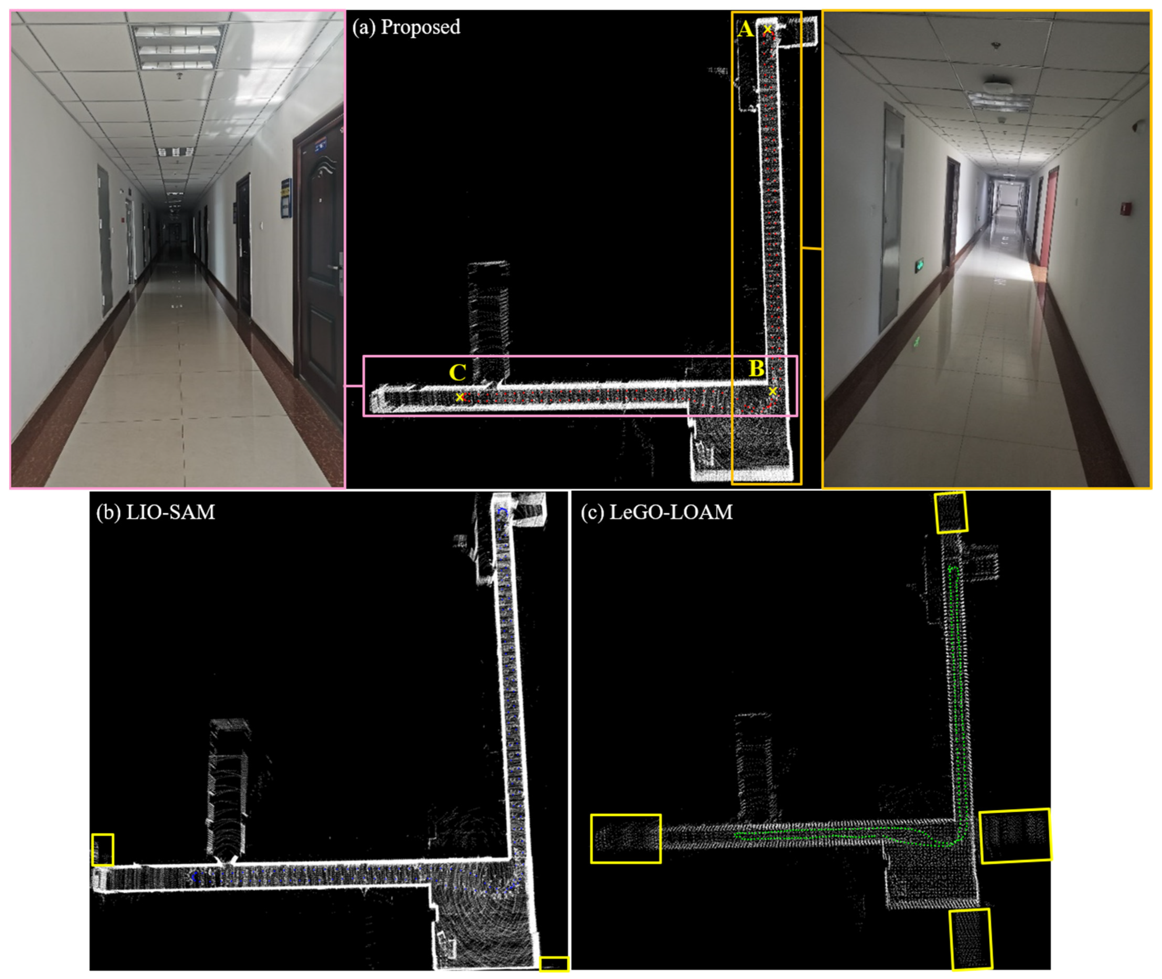
Simultaneous localization and mapping (SLAM) is the key technology for the automation of intelligent mining equipment and the digitization of the mining environment. However, the shotcrete surface and symmetrical roadway in underground coal mines make light detection and ranging (LiDAR) SLAM prone to degeneration, which leads to the failure of mobile robot localization and mapping. To address these issues, this paper proposes a robust LiDAR SLAM method which detects and compensates for the degenerated scenes by integrating LiDAR and inertial measurement unit (IMU) data. First, the disturbance model is used to detect the direction and degree of degeneration caused by insufficient line and plane feature constraints for obtaining the factor and vector of degeneration. Second, the degenerated state is divided into rotation and translation. The pose obtained by IMU pre-integration is projected to plane features and then used for local map matching to achieve two-step degenerated compensation. Finally, a globally consistent LiDAR SLAM is implemented based on sliding window factor graph optimization. The extensive experimental results show that the proposed method achieves better robustness than LeGO-LOAM and LIO-SAM. The absolute position root mean square error (RMSE) is only 0.161 m, which provides an important reference for underground autonomous localization and navigation in intelligent mining and safety inspection.
Keywords: underground coal mine robot; degenerated scene; LiDAR SLAM; intelligent mining underground coal mine robot; degenerated scene; LiDAR SLAM; intelligent mining