Article

Shipborne GNSS-Determined Sea Surface Heights Using Geoid Model and Realistic Dynamic Topography

1
Department of Civil Engineering and Architecture, Tallinn University of Technology, Ehitajate Road 5, 19086 Tallinn, Estonia
2
Chair of Forest and Land Management and Wood Processing Technologies, Estonian University of Life Sciences, Kreutzwaldi 1, 51006 Tartu, Estonia
*
Author to whom correspondence should be addressed.
Remote Sens. 2022, 14(10), 2368; https://doi.org/10.3390/rs14102368
Submission received: 22 March 2022 / Revised: 21 April 2022 / Accepted: 12 May 2022 / Published: 13 May 2022
(This article belongs to the Special Issue Multi-GNSS: Methods, Challenges, and Applications)

Abstract

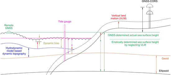
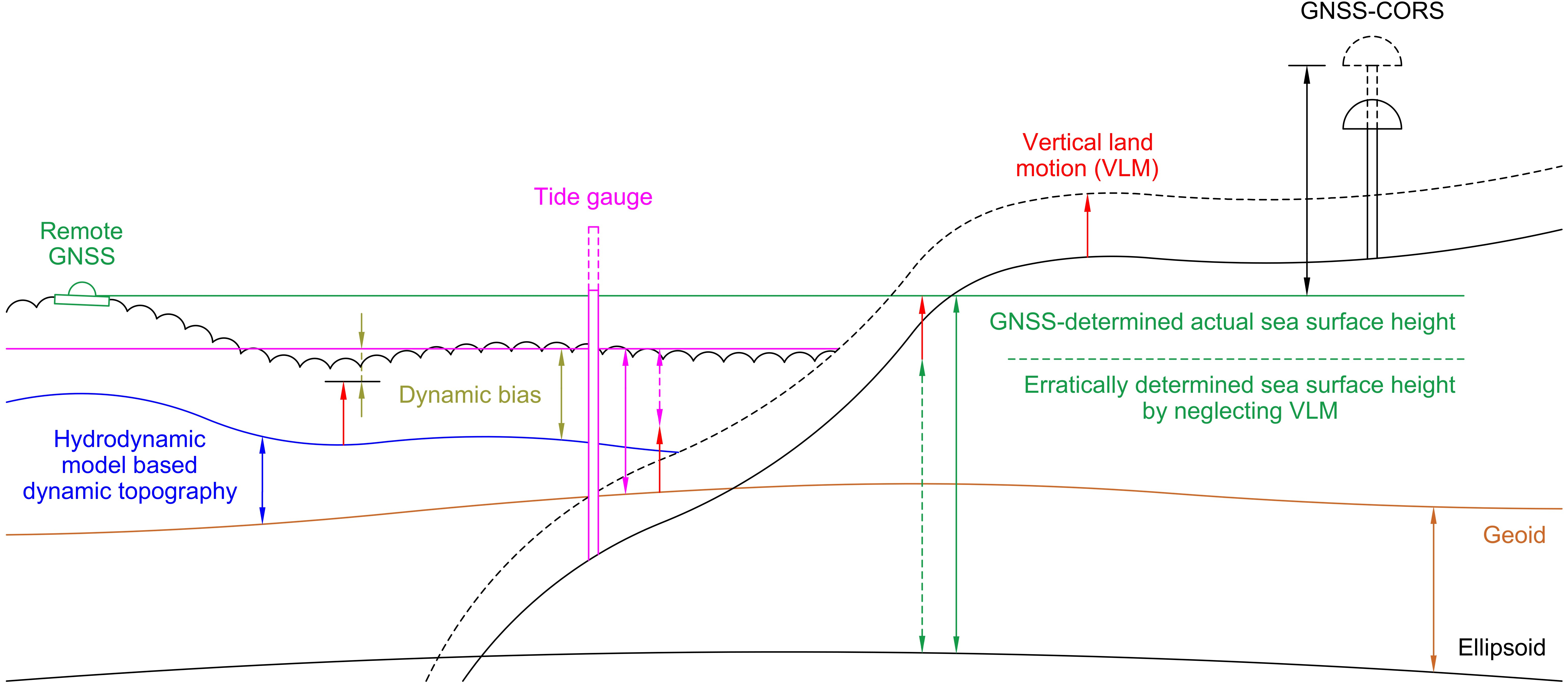
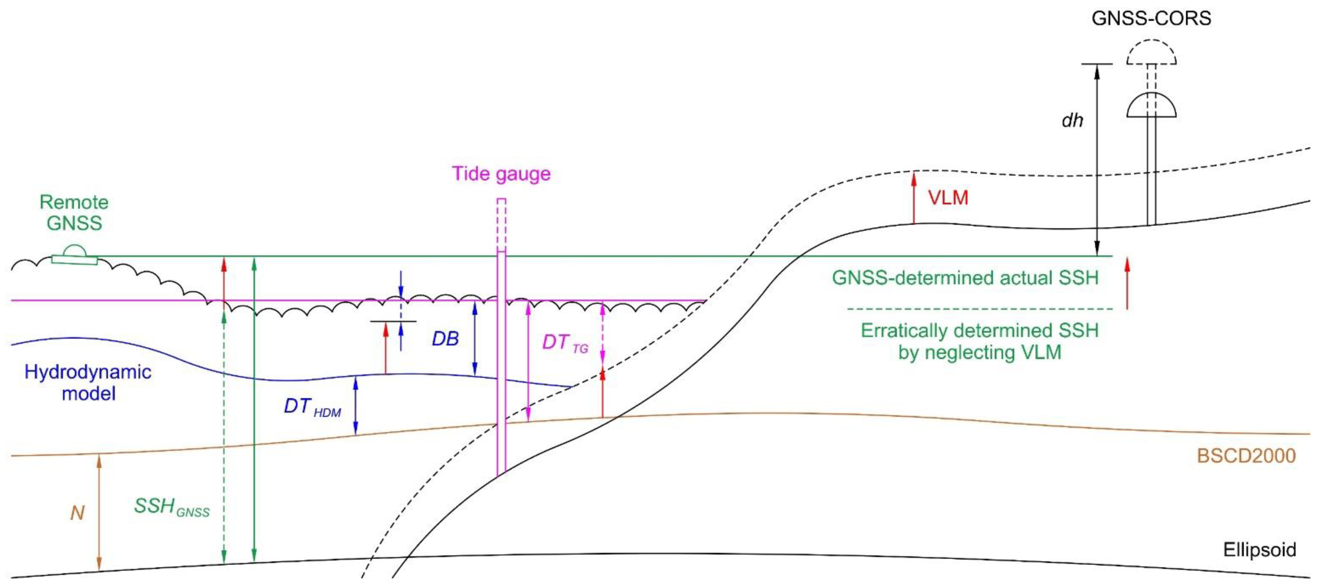
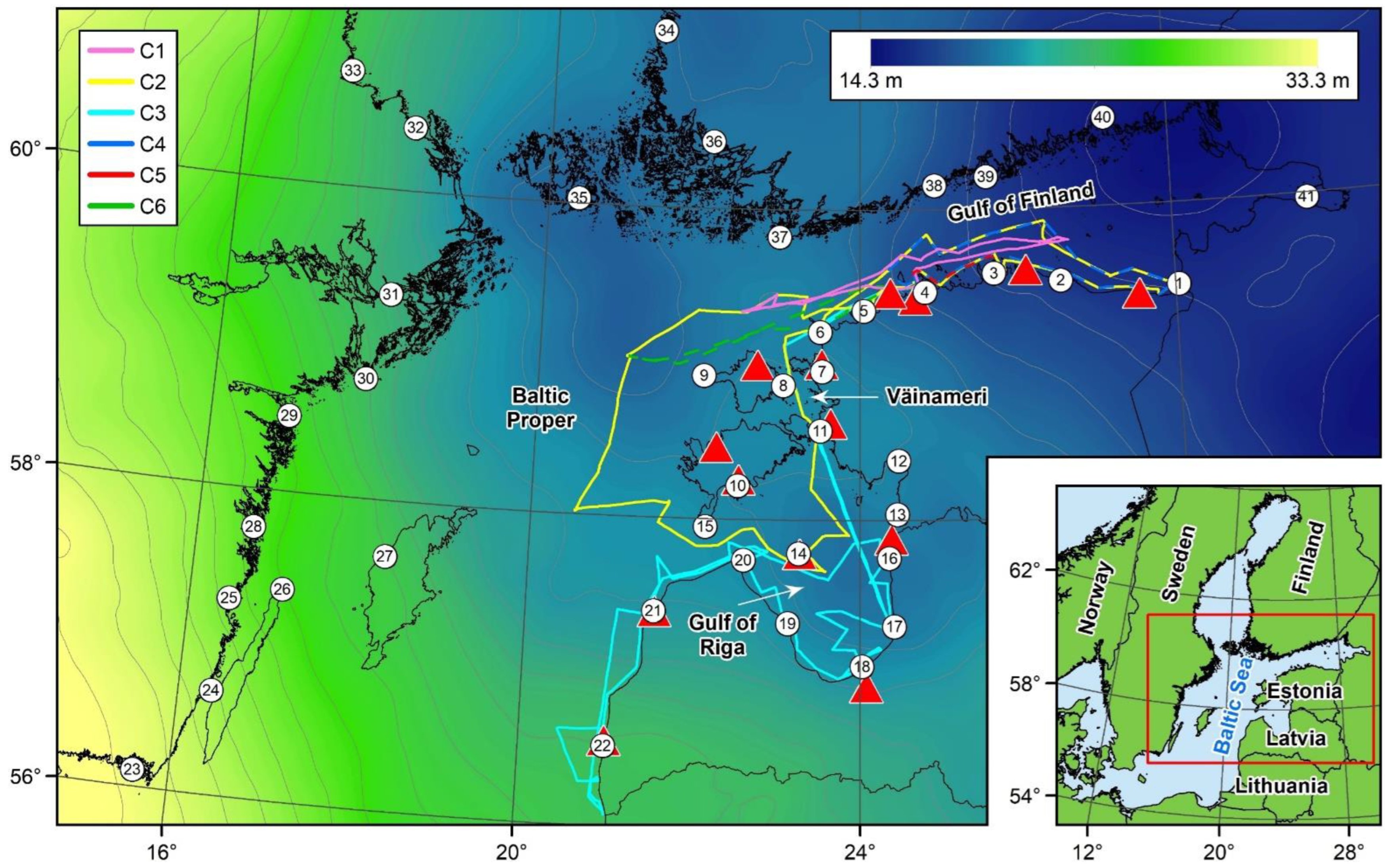
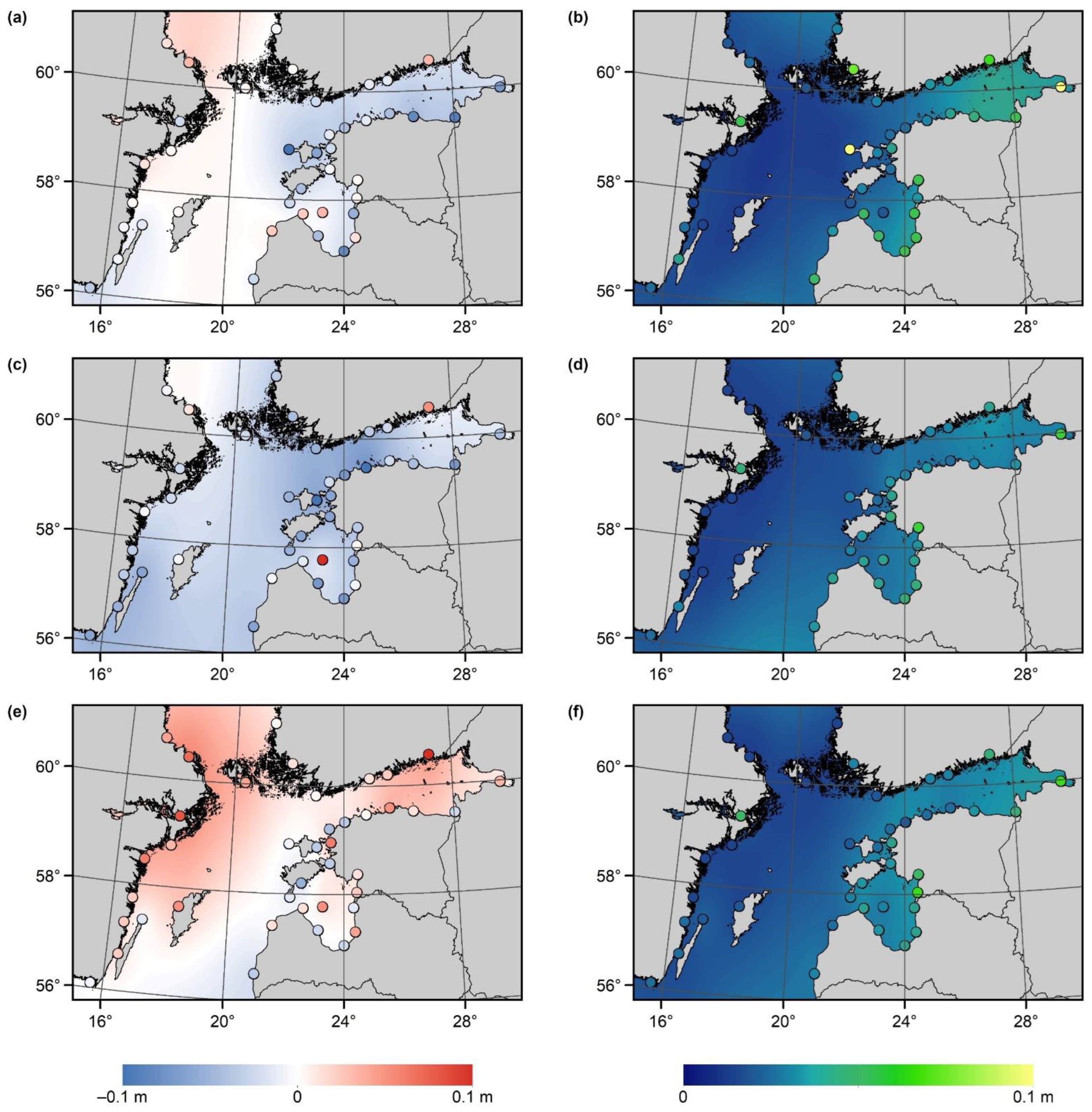
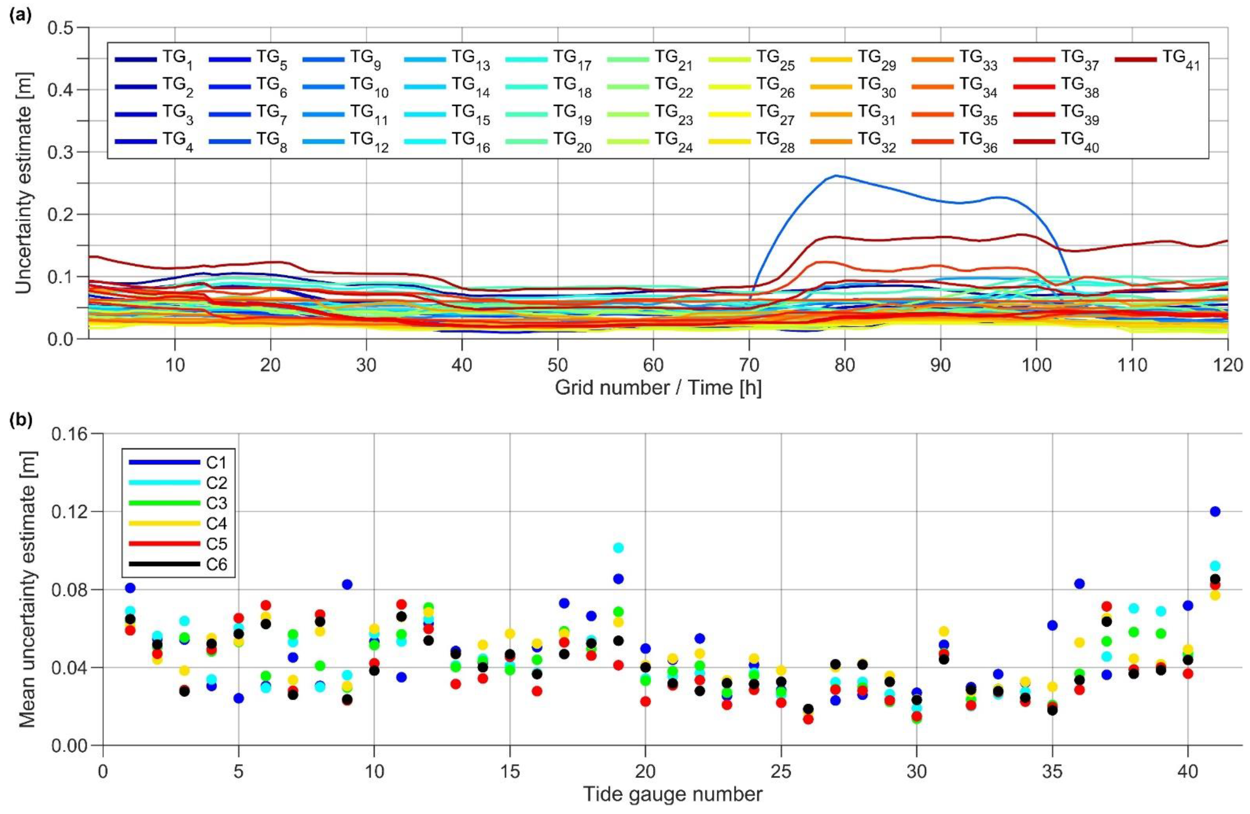
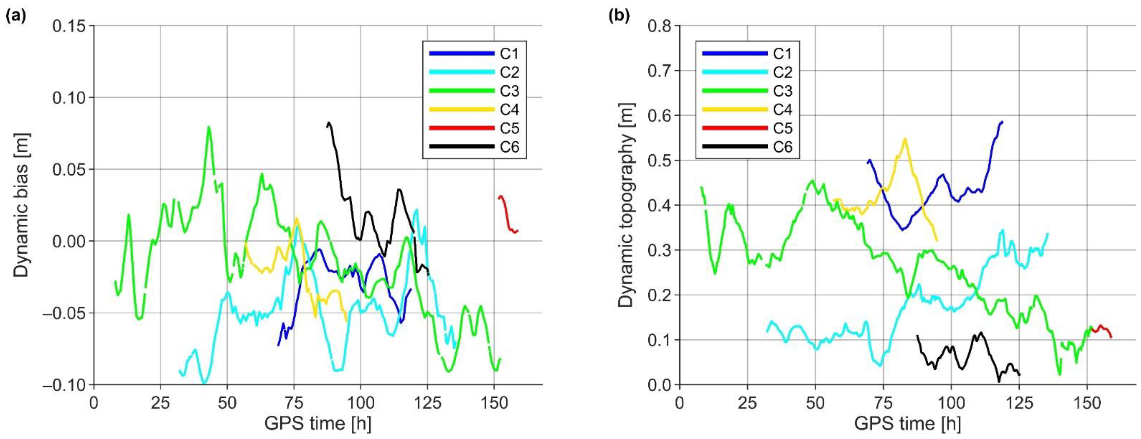
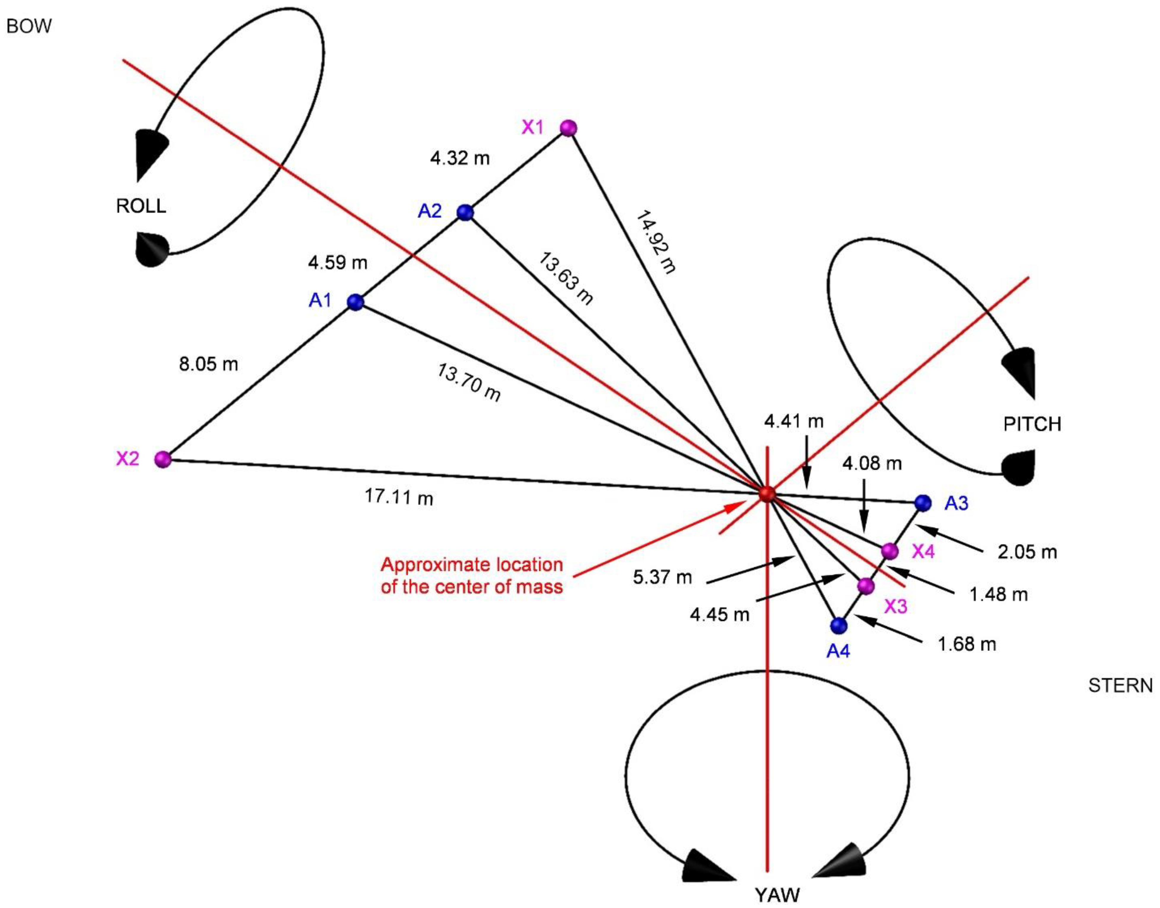
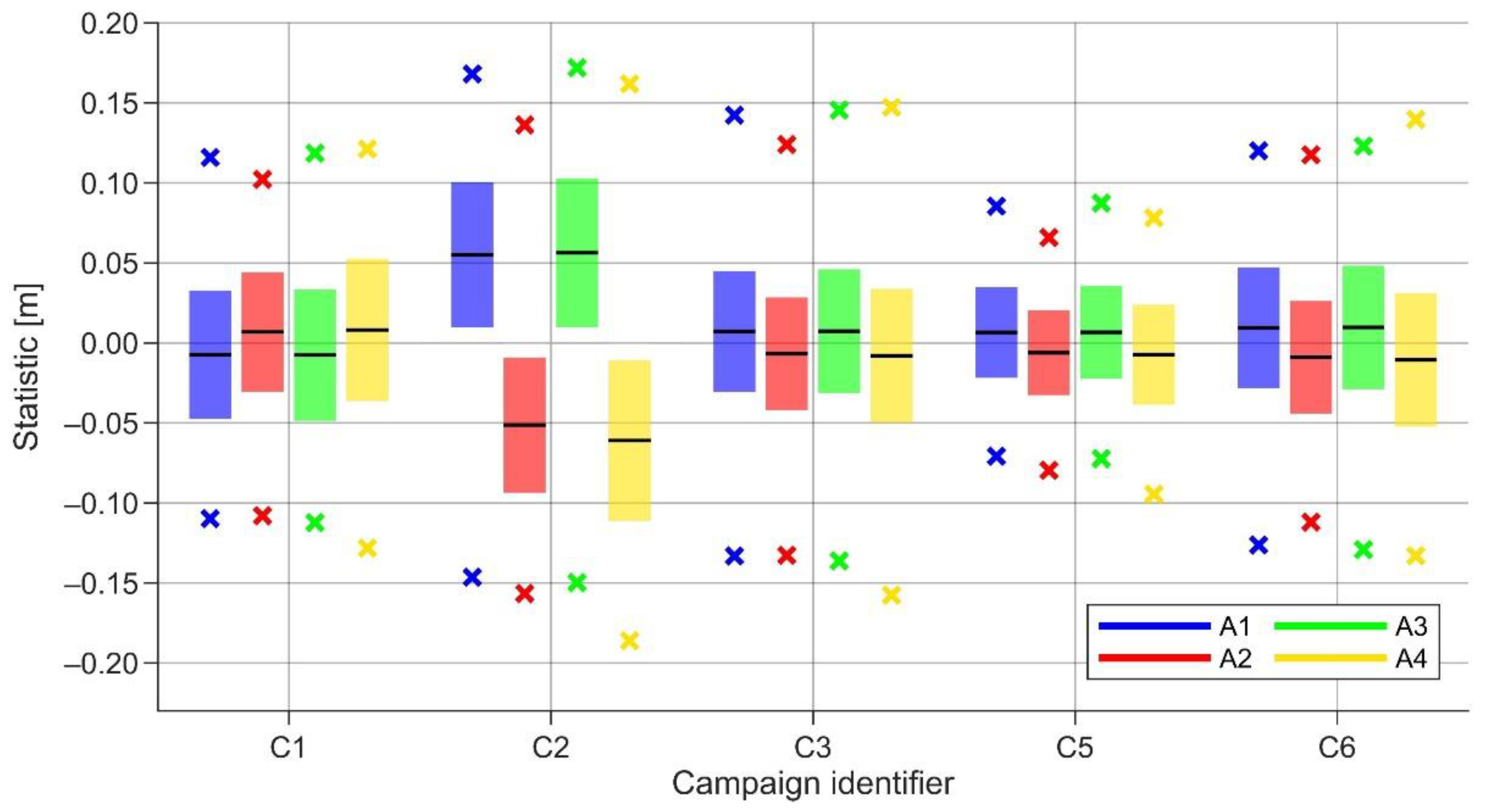
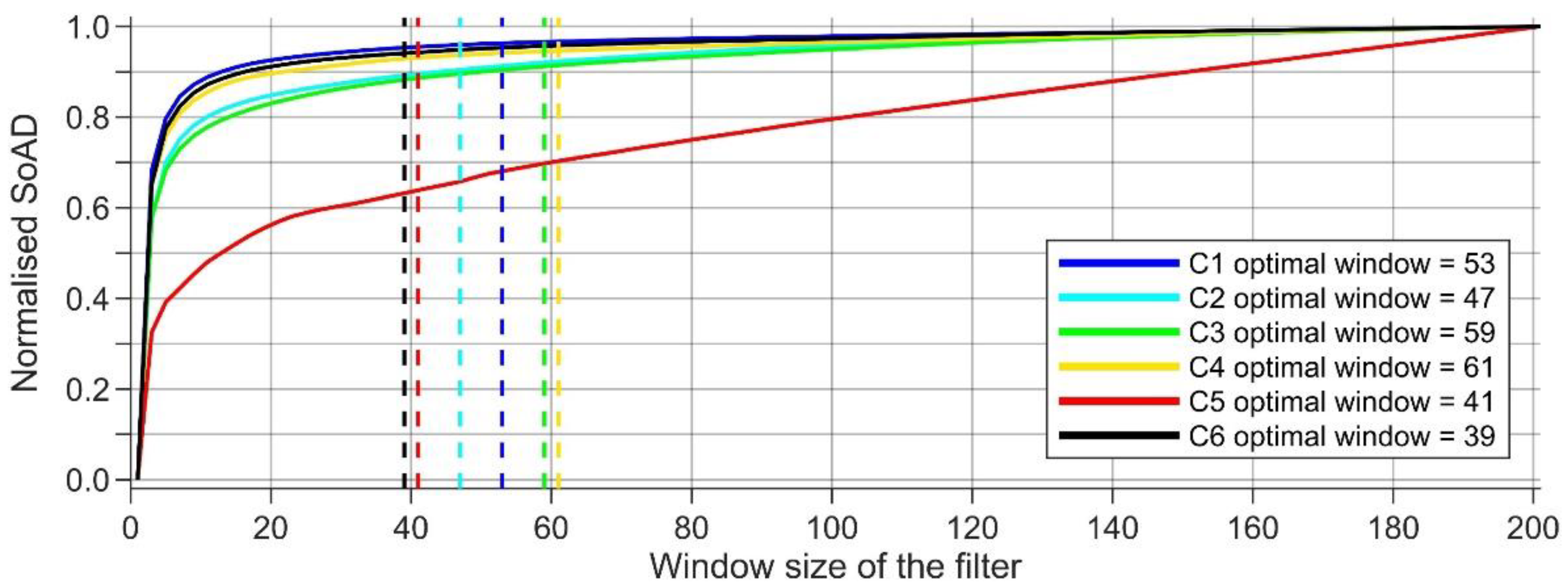
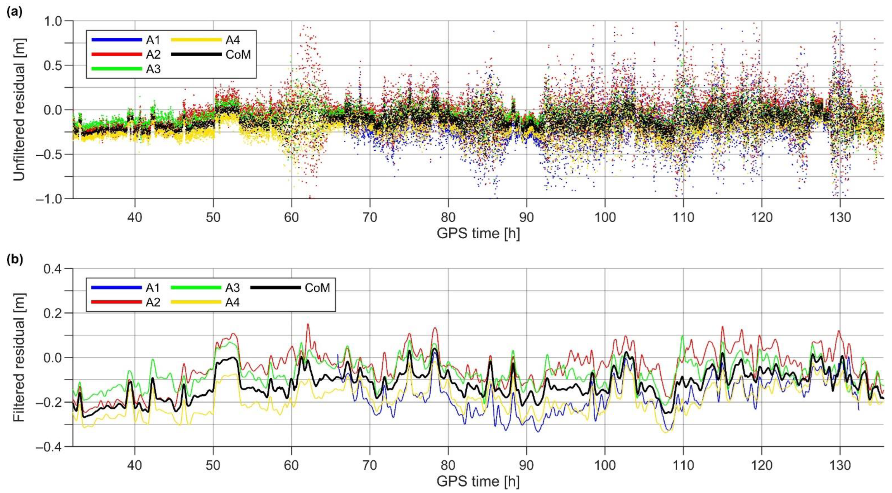
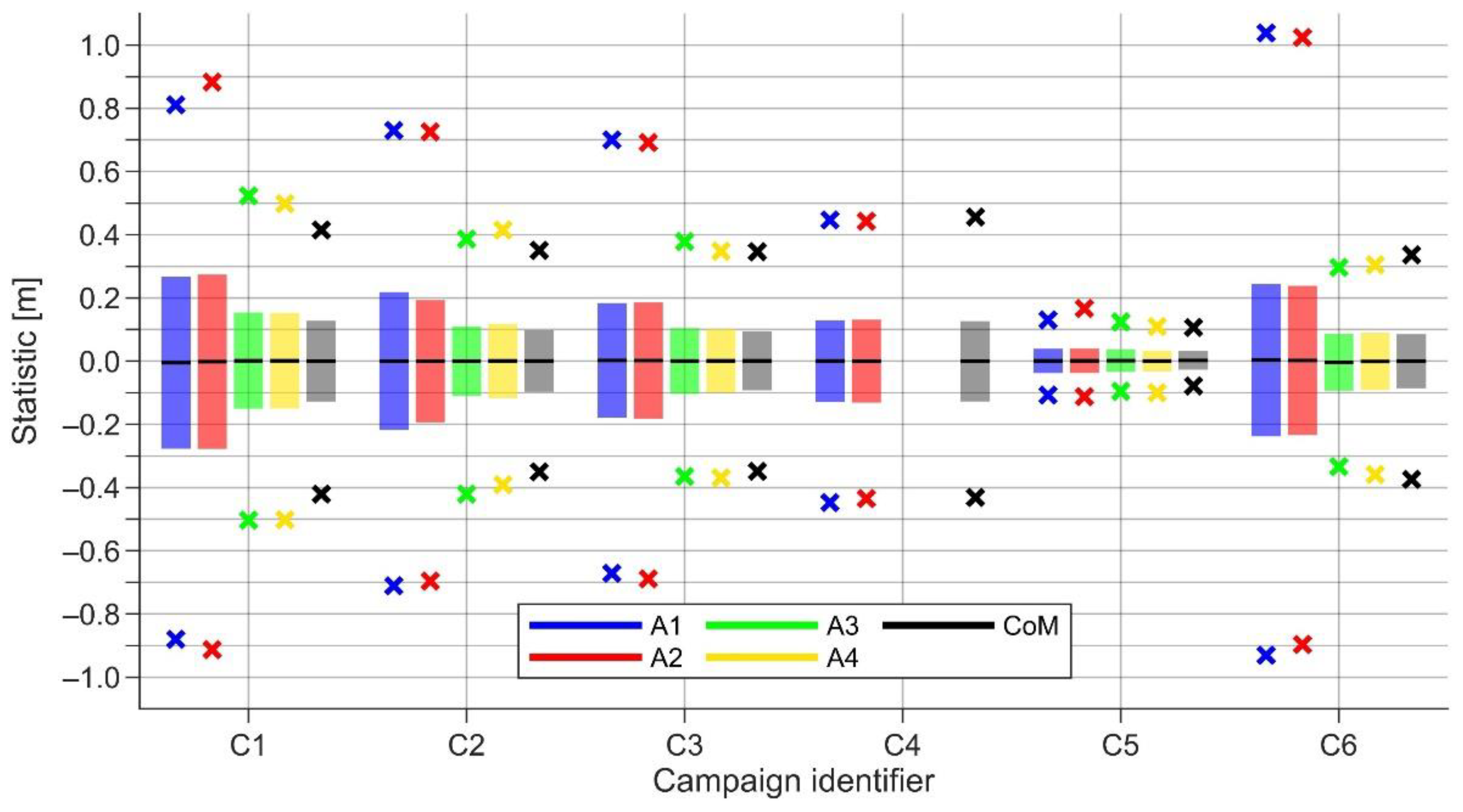
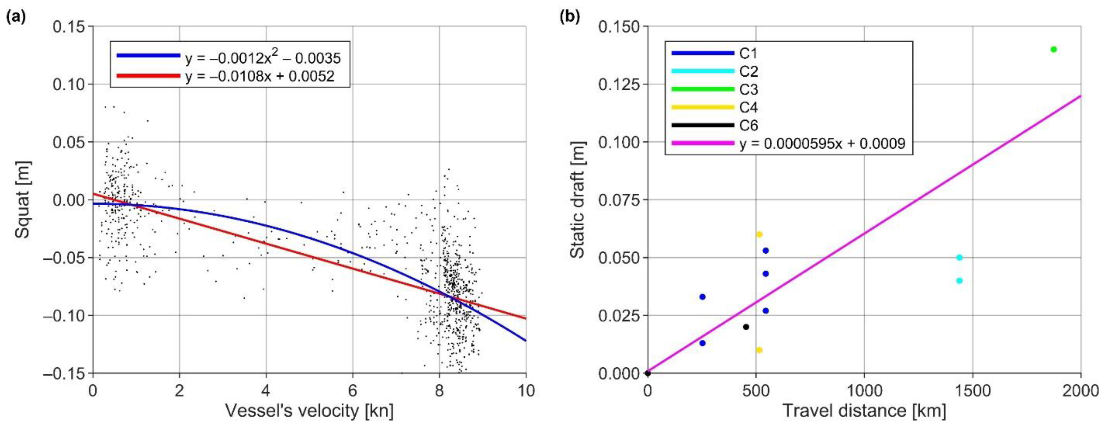
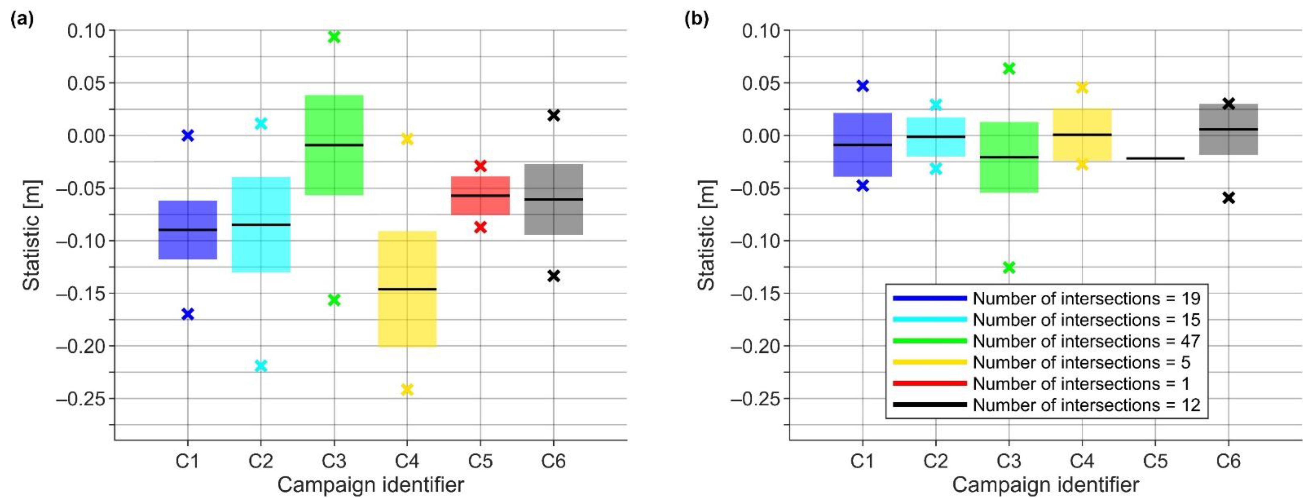
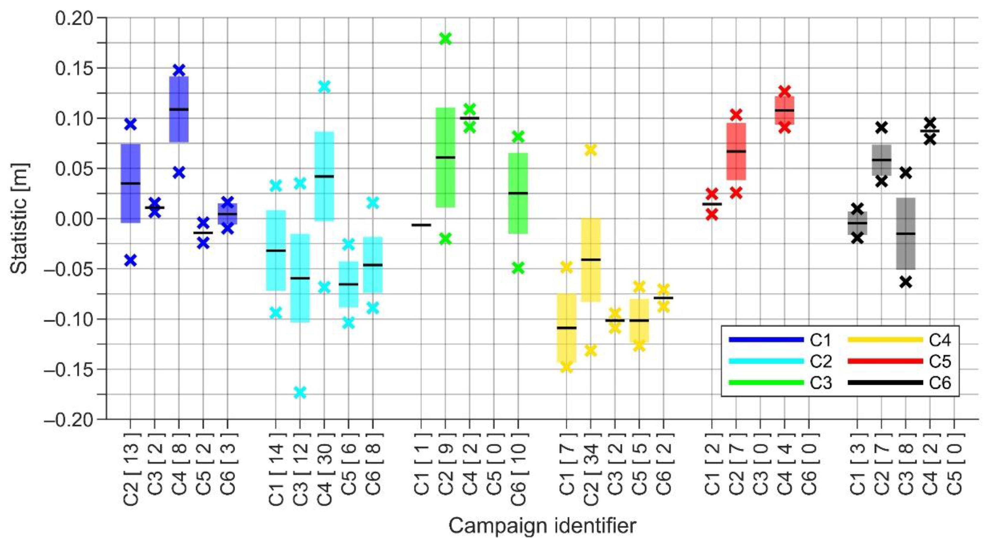
With an increasing demand for accurate and reliable estimates of sea surface heights (SSH) from coastal and marine applications, approaches based on GNSS positioning have become favored, to bridge the gap between tide gauge (TG) and altimetry measurements in the coastal zone, and to complement offshore altimetry data. This study developed a complete methodology for jointly deriving and validating shipborne GNSS-determined SSH, using a geoid model and realistic dynamic topography estimates. An approach that combines the properties of hydrodynamic models and TG data was developed to obtain the latter. Tide gauge data allow estimating the spatiotemporal bias of a hydrodynamic model and, thus, linking it to the used vertical datums (e.g., a novel geoid-based Baltic Sea Chart Datum 2000). However, TG data may be erroneous and represent different conditions than offshore locations. The qualities of spatiotemporal bias are, hence, used to constrain TG data errors. Furthermore, a rigid system of four GNSS antennas was used to ensure SSH accuracy. Besides eliminating the vessel’s attitude effect on measurement data, the rigid system also provides a means for internal validation, suggesting a 4.1 cm height determination accuracy in terms of standard deviation. The methodology also involves eliminating the effect of sea state conditions via a low-pass filter and empirical estimation of vessel sailing-related corrections, such as the squat effect. The different data validation (e.g., examination of residual values and intersection analyses) results, ranging from 1.8 cm to 5.5 cm in terms of standard deviation, indicate an SSH determination accuracy of around 5 cm.
Keywords: Baltic Sea; BSCD2000; dynamic topography; geoid; GNSS; hydrodynamic model; hydrogeodesy; sea surface height Baltic Sea; BSCD2000; dynamic topography; geoid; GNSS; hydrodynamic model; hydrogeodesy; sea surface height
Graphical Abstract