Article

Spatial Correlation between Ecosystem Services and Human Disturbances: A Case Study of the Guangdong–Hong Kong–Macao Greater Bay Area, China

1
Key Laboratory of Ocean and Marginal Sea Geology, Guangzhou Institute of Geochemistry, Chinese Academy of Sciences, Guangzhou 510640, China
2
University of Chinese Academy of Sciences, Beijing 100049, China
3
School of Environment, Jinan University, Guangzhou 511443, China
4
Guangdong Academy of Social Sciences, Guangzhou 510635, China
*
Author to whom correspondence should be addressed.
Remote Sens. 2021, 13(6), 1174; https://doi.org/10.3390/rs13061174
Submission received: 9 January 2021 / Revised: 14 March 2021 / Accepted: 17 March 2021 / Published: 19 March 2021
(This article belongs to the Special Issue Human–Environment Interactions Research Using Remote Sensing)

Abstract

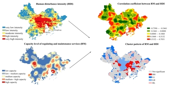
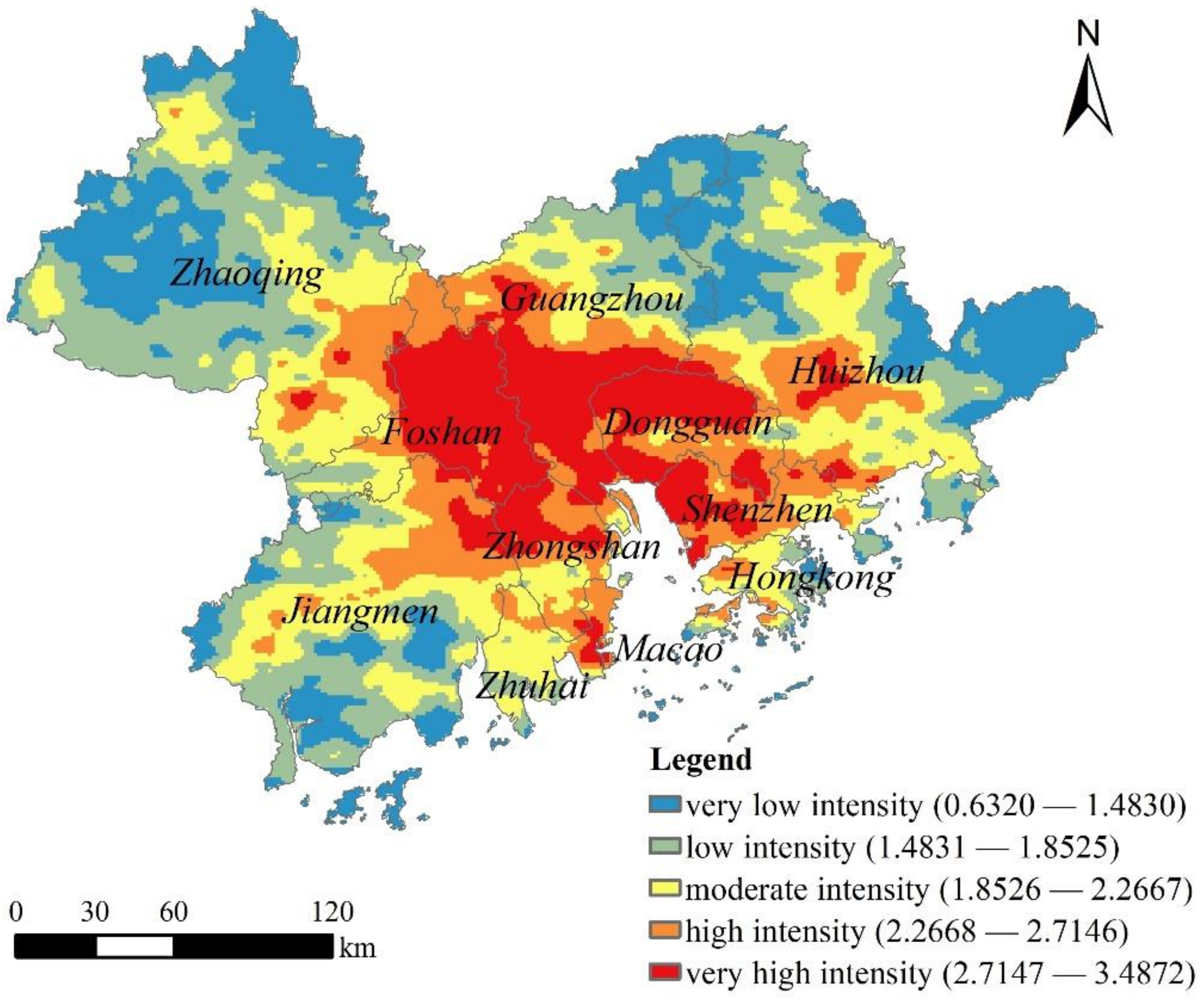
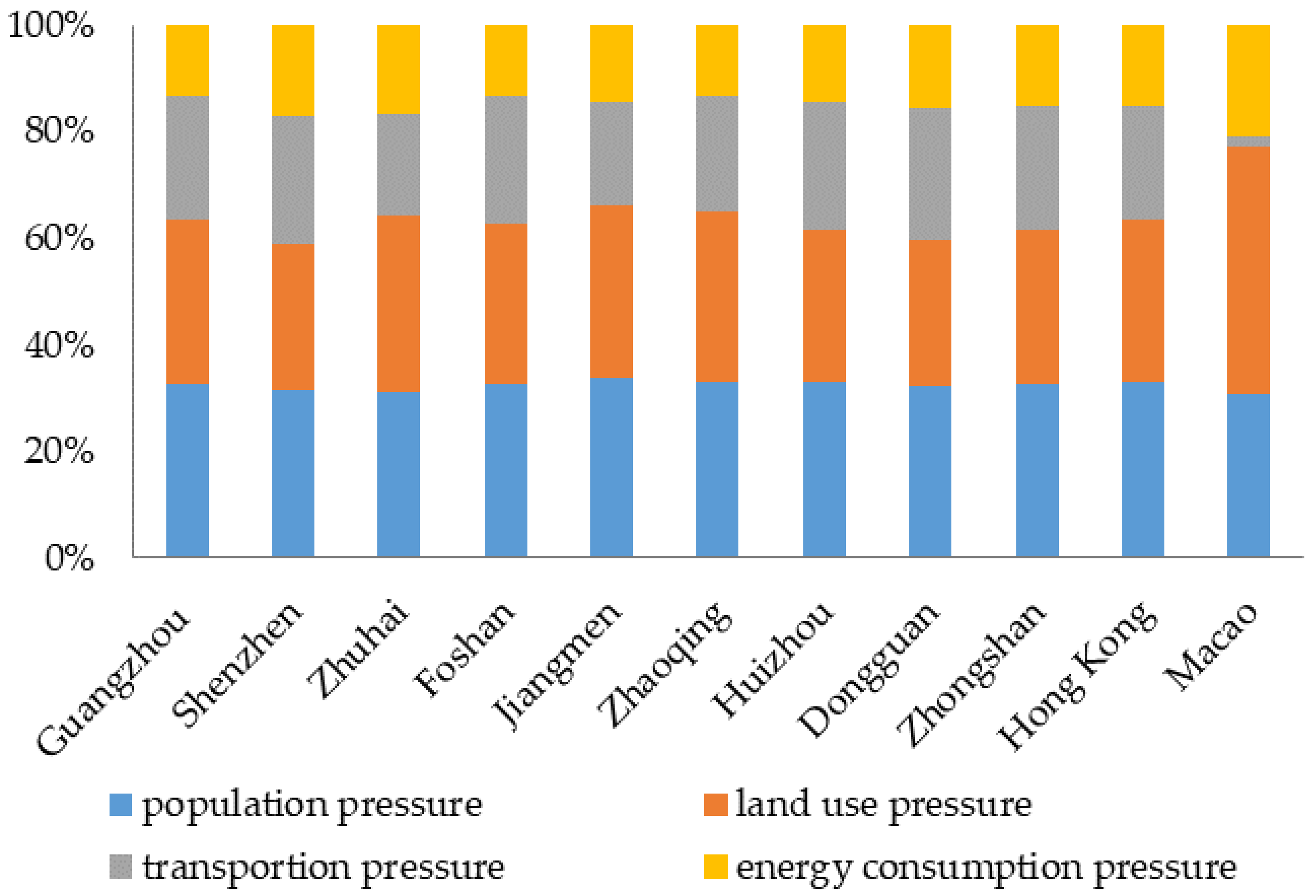
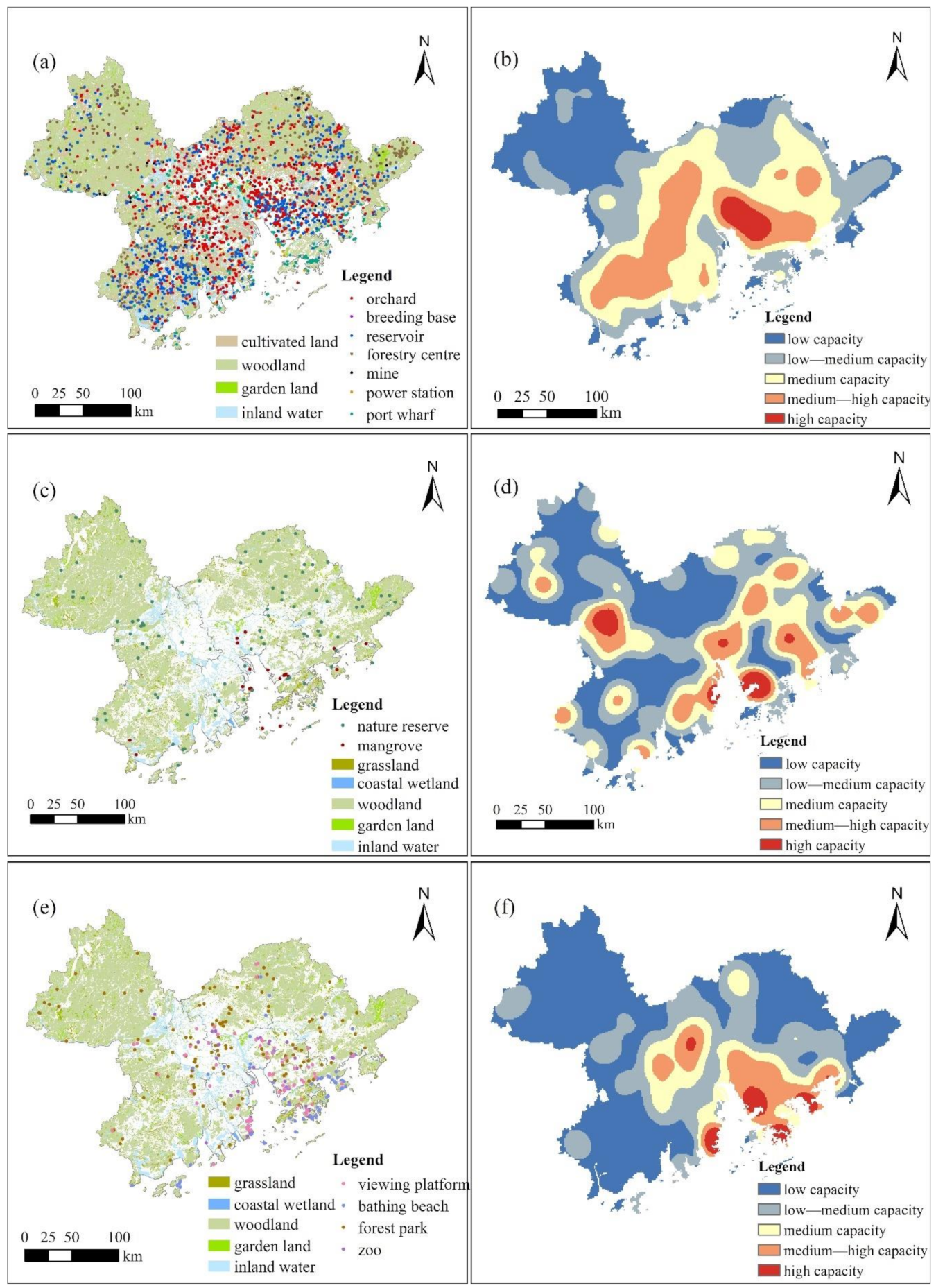
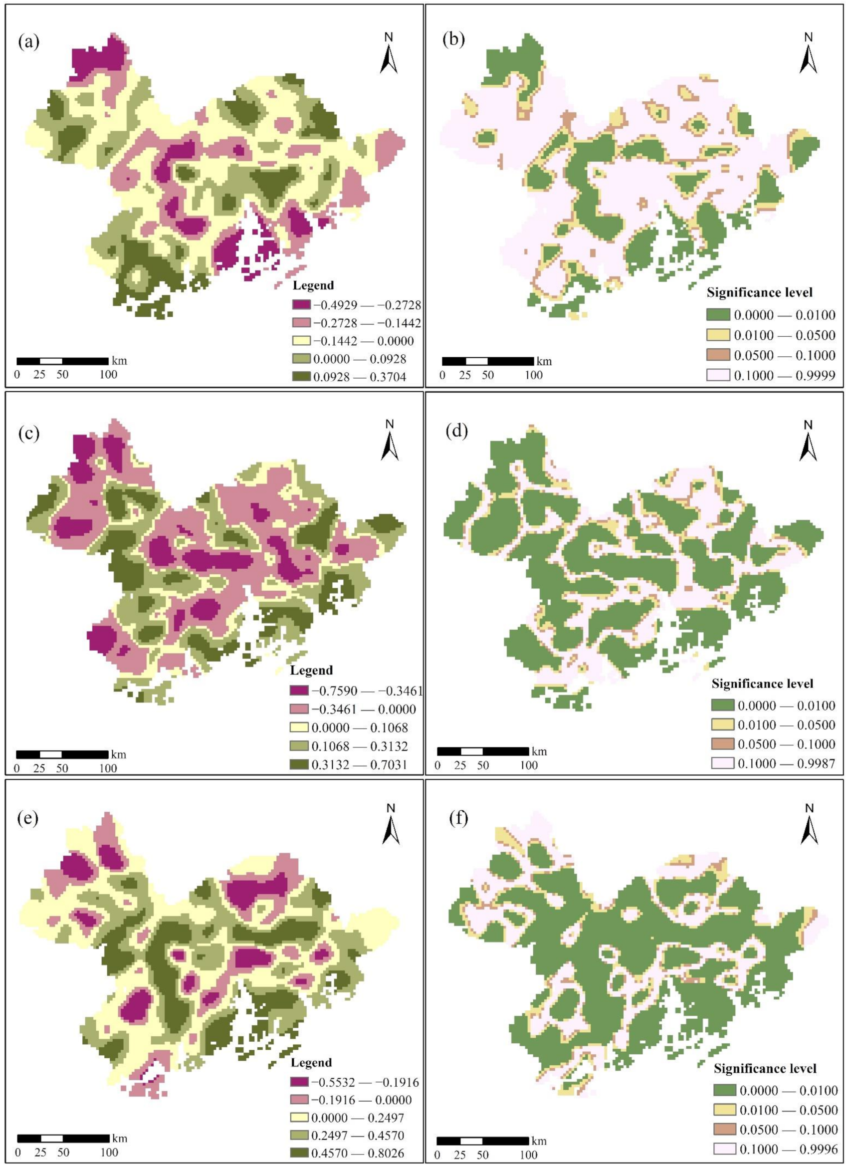
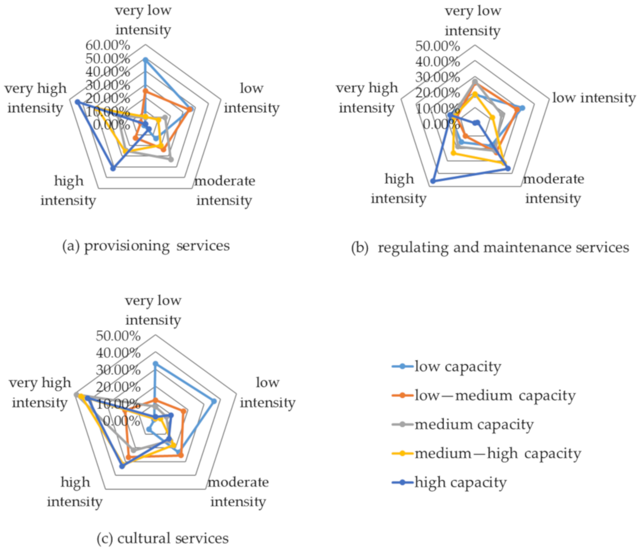
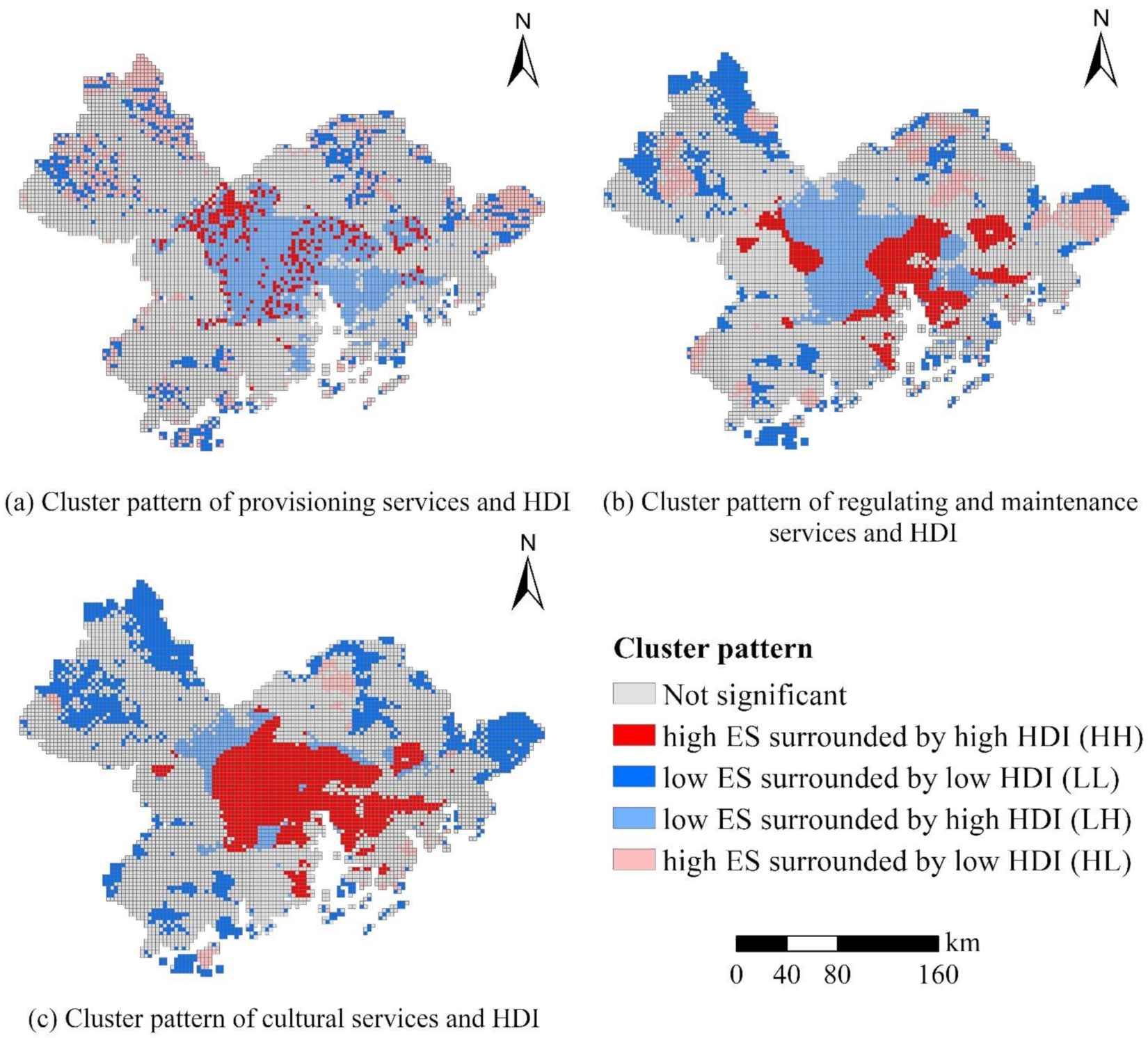
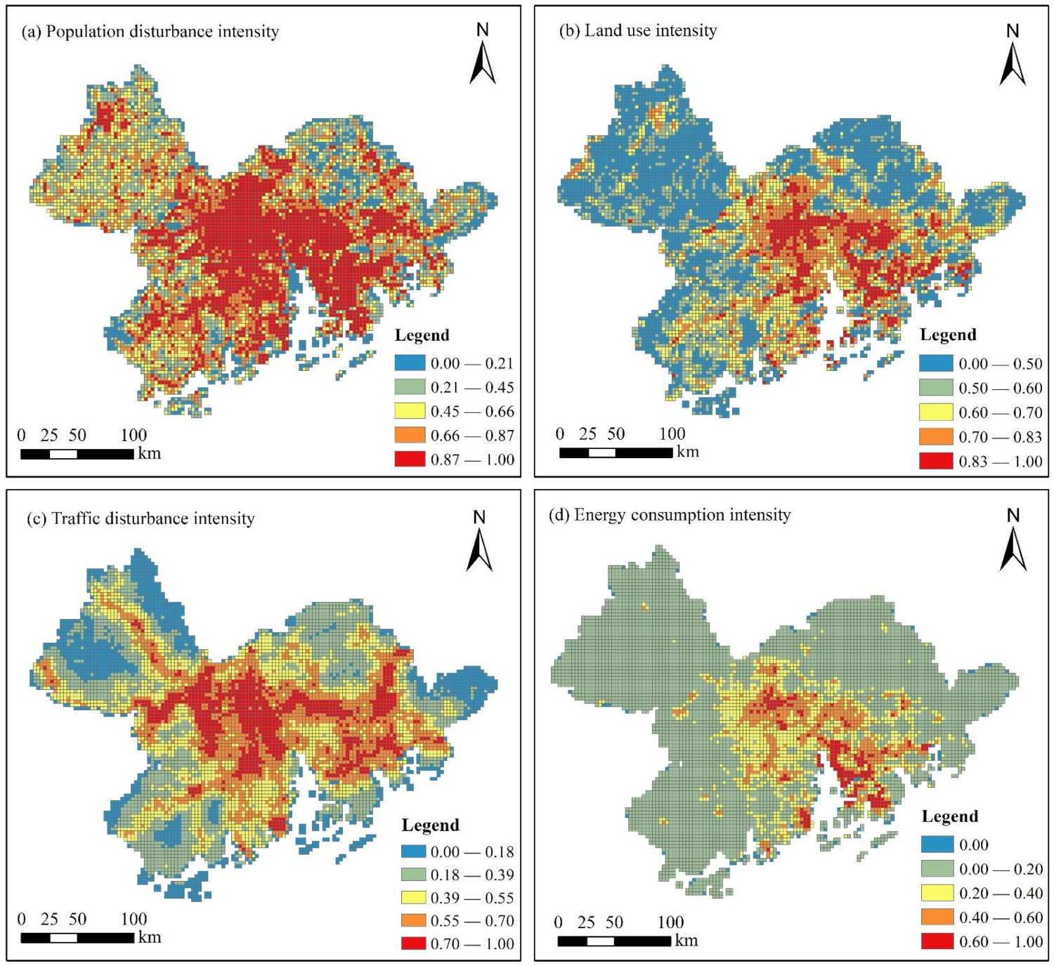
Exploring the spatial relationship between ecosystem services (ES) and human disturbance intensity (HDI) is vital for maintaining regional ecological security. This study aims to explore the spatial correlation between ES and HDI in the Guangdong–Hong Kong–Macao Greater Bay Area (GBA) and provide meaningful implications for coastal ecological planning. Multi-source remote sensing data, remote sensing software, and geographic information system provided initial data and technical support for this research. We integrated four human pressures (population, land-use, traffic, and energy) to map the HDI in the GBA for 2018. Coastal ES were comprehensively considered and spatially visualized by extracting the ES sources. The geographically weighted Pearson correlation coefficient and bivariate local Moran were used to quantitatively reflect and spatially visualize the detailed relationship between ES and HDI. Our study presents several key findings. First, the central and southern parts of the GBA are under strong HDI, dominated by a dense population and intense land utilization. Second, the kernel density of ES sources can better manifest the spatial distribution of ES objectively in comparison to the traditional model calculation. Provisioning services mainly originate from the periphery of the central cities; cultural services are highly concentrated in the heartland of the GBA; and regulating and maintenance services have high density in the outermost regions. Third, ES and HDI have a significant correlation, and the geographically weighted Pearson correlation coefficient and local indicator of spatial association cluster maps illustrate that unlike the global findings, the local correlation is spatially nonstationary as the local scale is affected by specific human activities, natural conditions, regional development, and other local factors. Four, high-capacity regions of ES provision are mainly under high HDI. Areas with high provisioning service values are mainly affected by population and traffic pressure, whereas regulating and maintenance services and cultural services are mainly dominated by high-density populations. Regulating and maintenance services are also affected by land-use pressure. We determine that human disturbance has negative spillover effects on ES, which should be the focus in regional ecological planning.
Keywords: human disturbance; ecosystem service; mapping; geographically weighted Pearson correlation coefficient; local spatial autocorrelation; coastal area human disturbance; ecosystem service; mapping; geographically weighted Pearson correlation coefficient; local spatial autocorrelation; coastal area
Graphical Abstract