Letter

Springtime Upwelling and Its Formation Mechanism in Coastal Waters of Manaung Island, Myanmar

1
Third Institute of Oceanography, Ministry of Natural Resources, Xiamen 361005, China
2
Southern Marine Science and Engineering Guangdong Laboratory (Zhuhai), Zhuhai 519082, China
3
Laboratory for Regional Oceanography and Numerical Modeling, Qingdao National Laboratory for Marine Science and Technology, Qingdao 266237, China
4
State Key Laboratory of Marine Environmental Science, College of Ocean and Earth Sciences, Xiamen University, Xiamen 361102, China
5
Marine Science Department, Pathein University, Pathein 10014, Myanmar
*
Author to whom correspondence should be addressed.
Remote Sens. 2020, 12(22), 3777; https://doi.org/10.3390/rs12223777
Submission received: 30 September 2020 / Revised: 14 November 2020 / Accepted: 16 November 2020 / Published: 18 November 2020
(This article belongs to the Special Issue Remote Sensing Applications in Ocean Observation)

Abstract

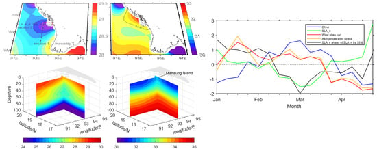
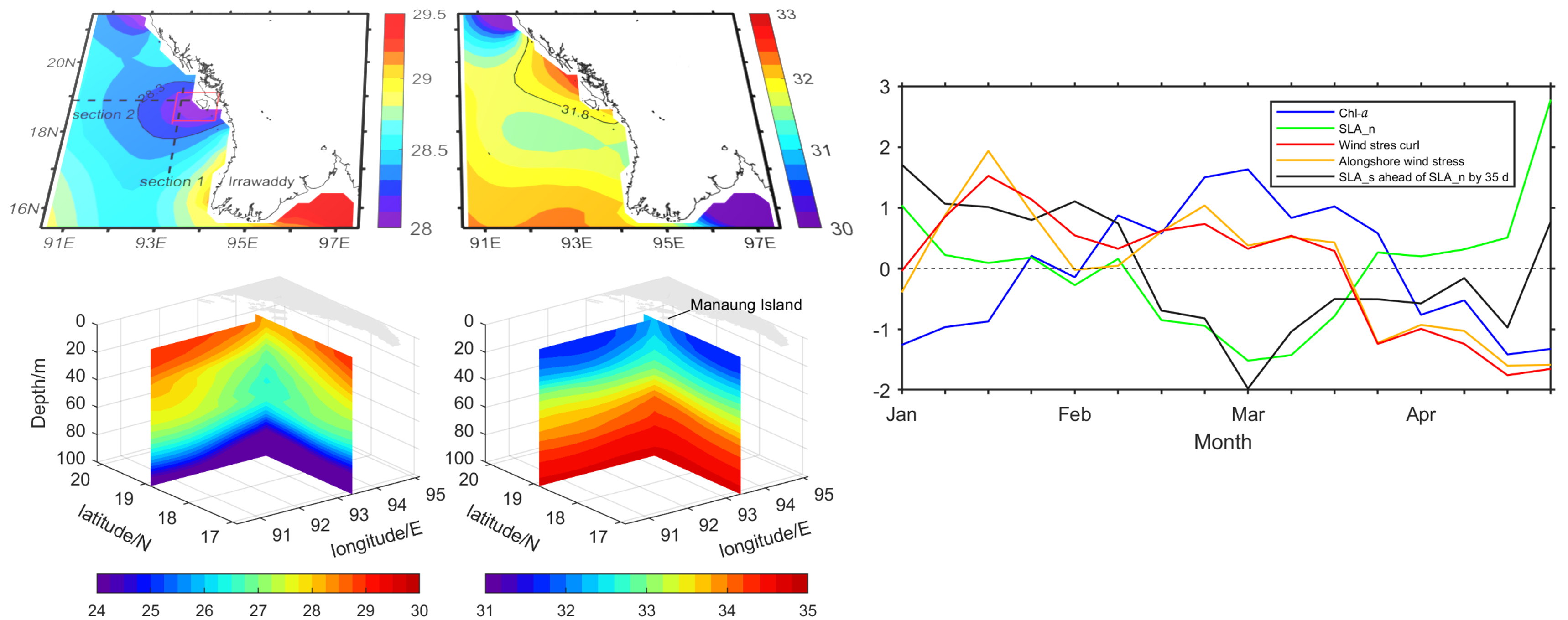
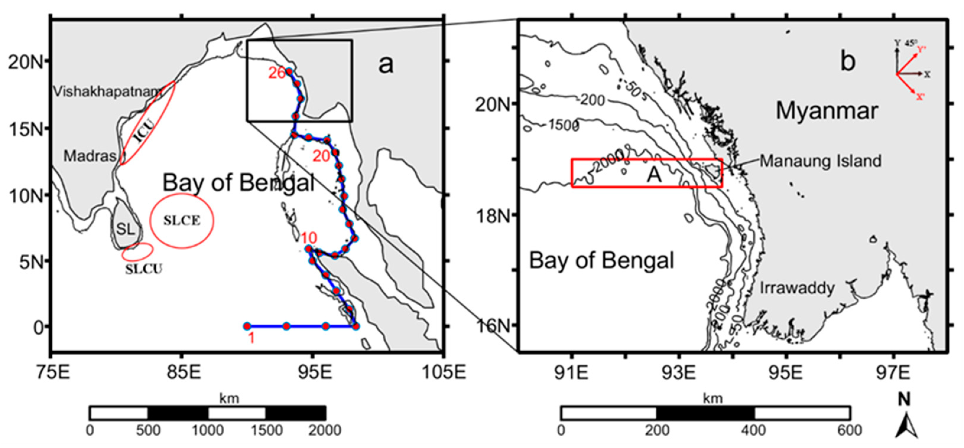
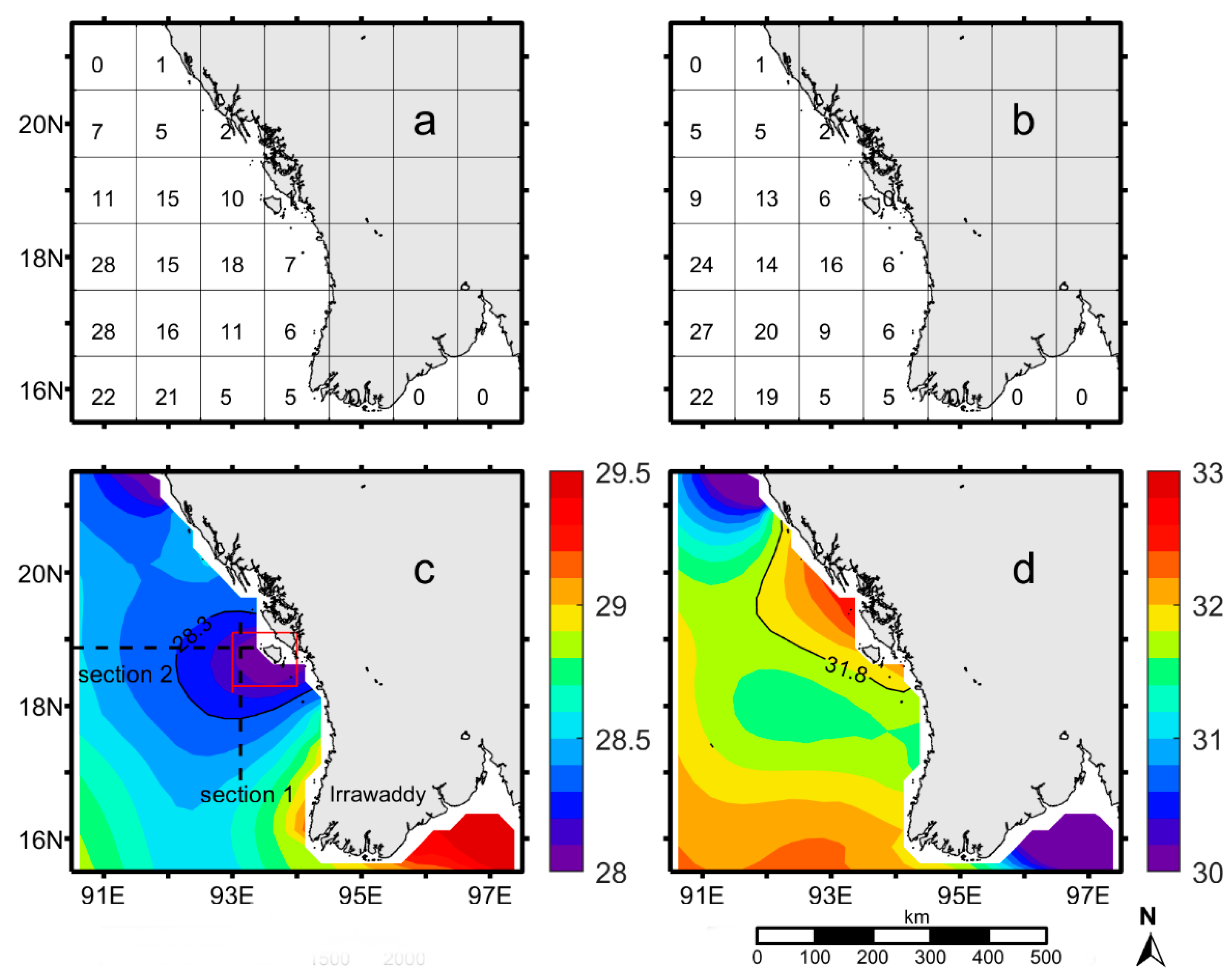
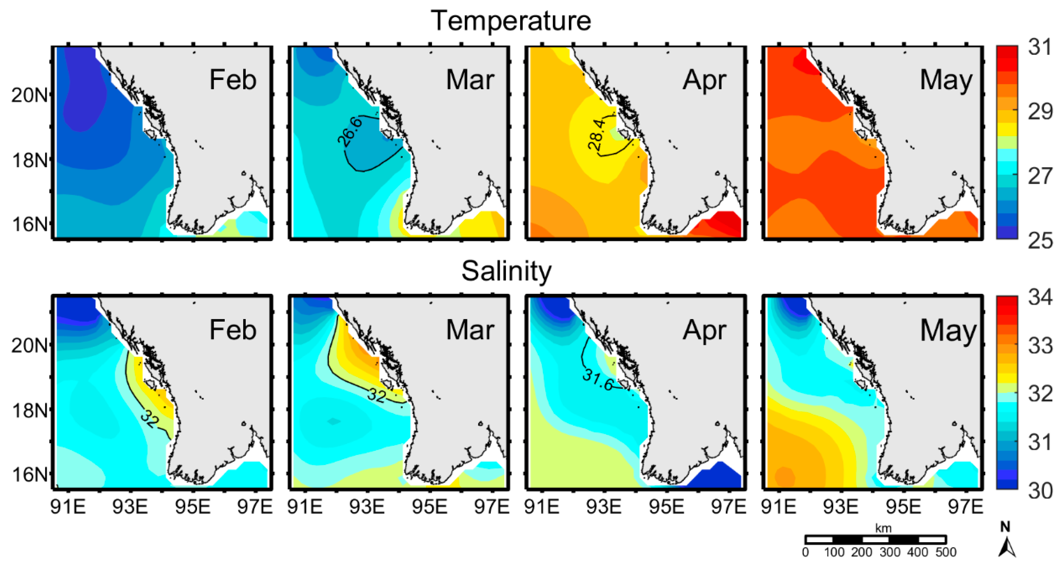
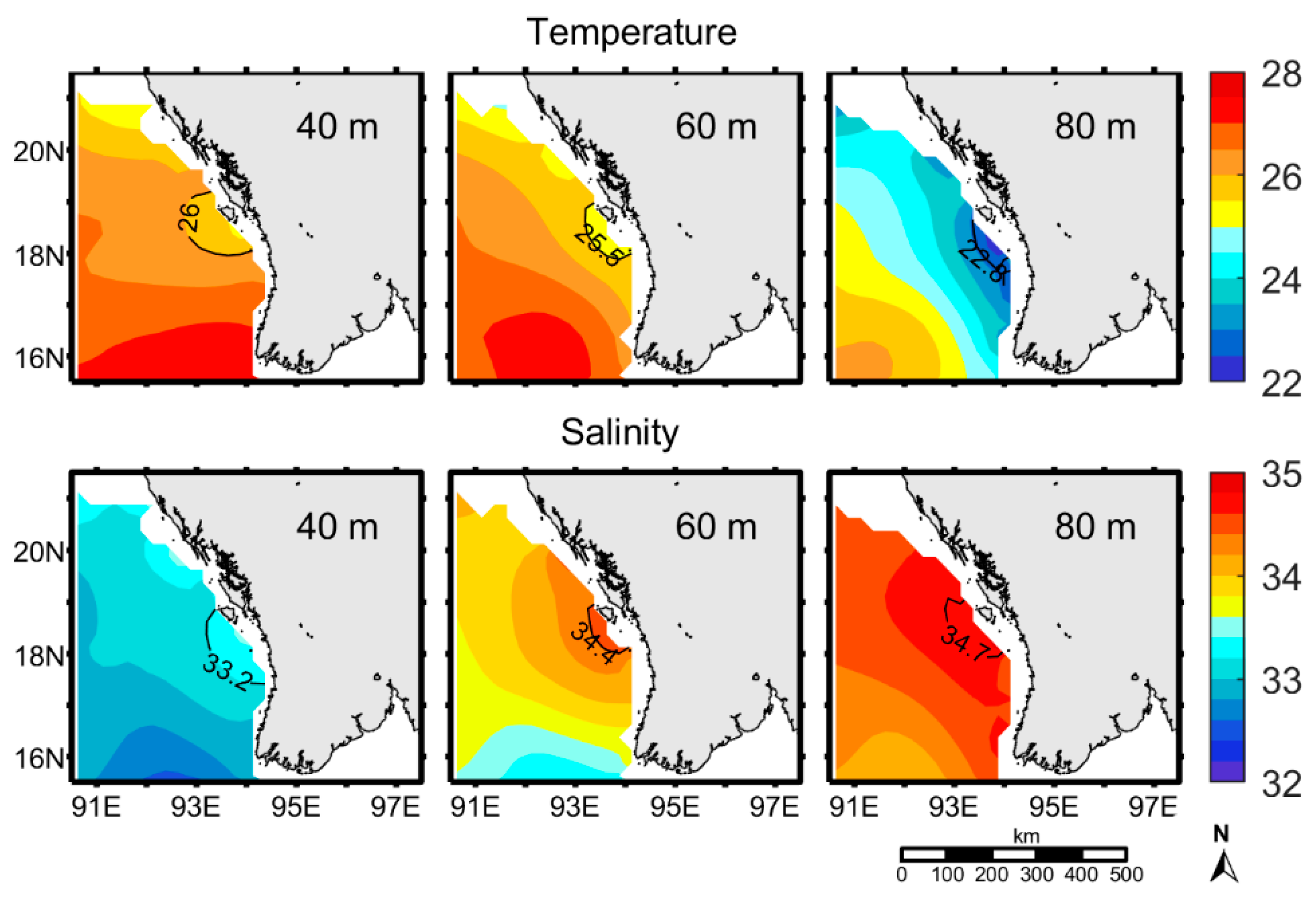
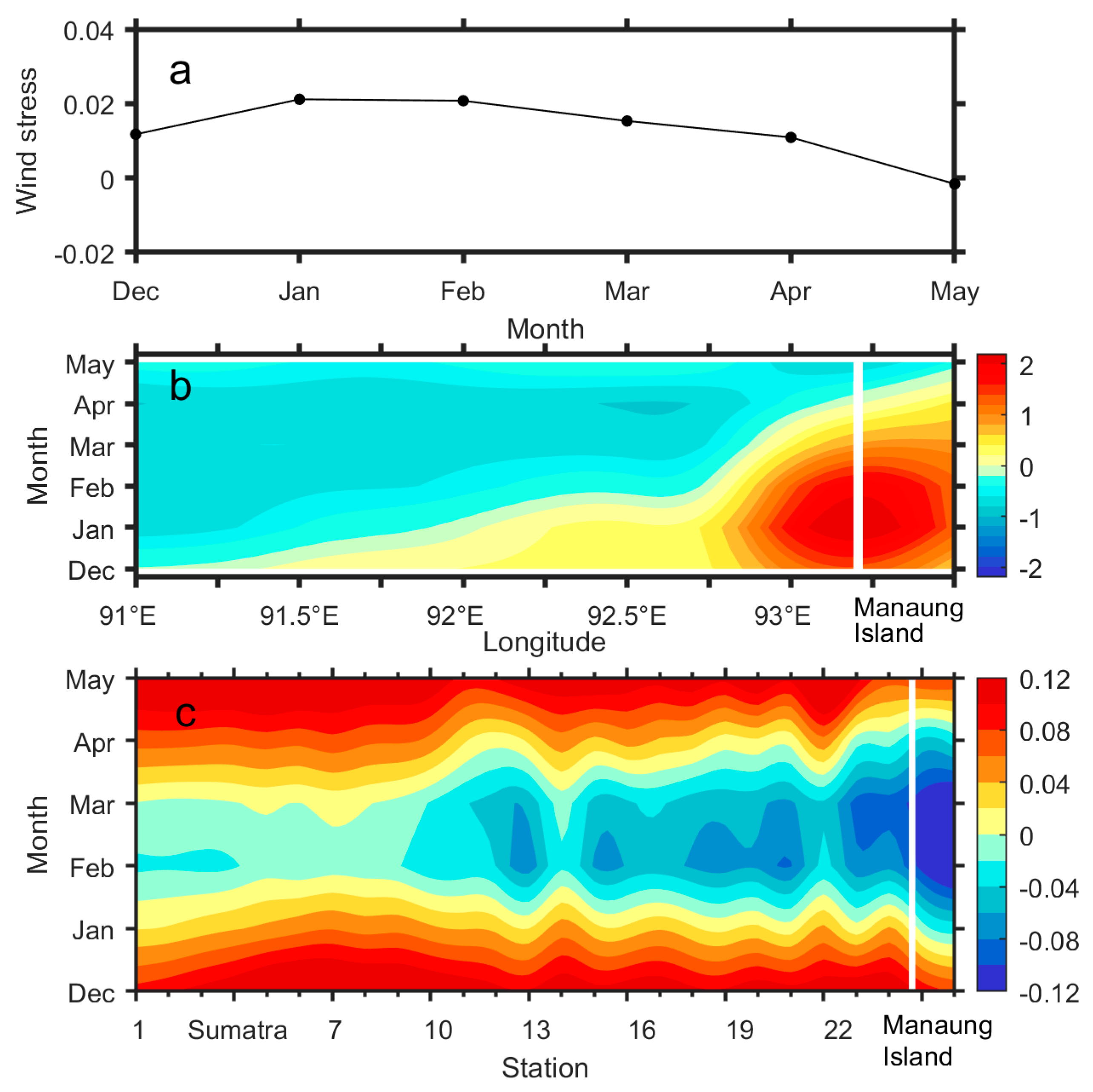
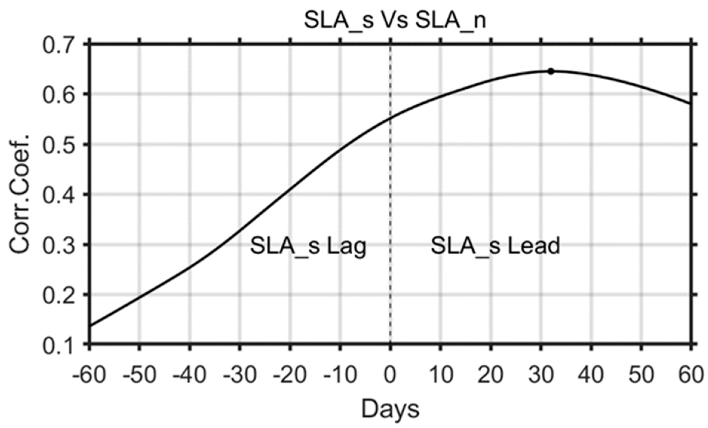
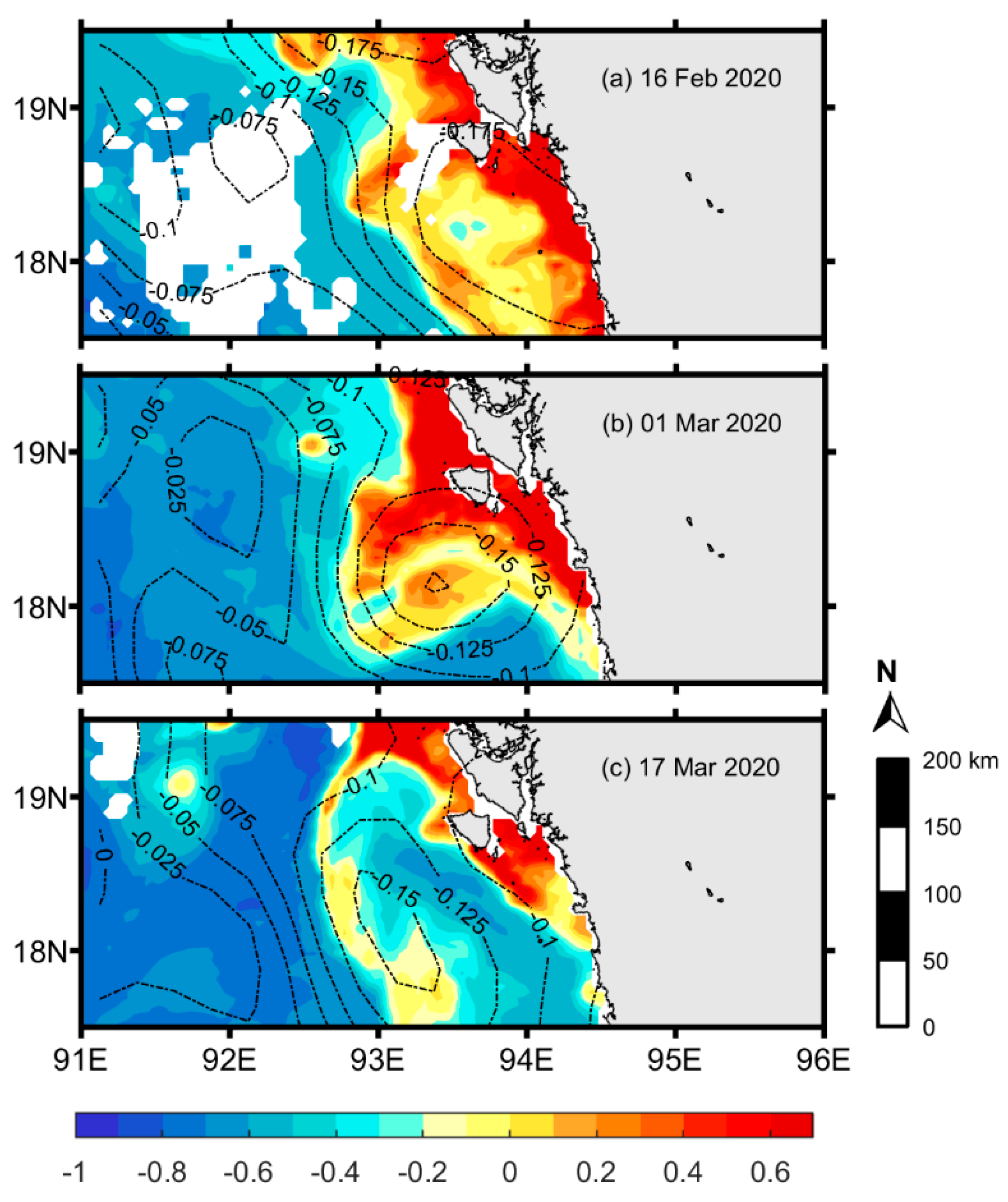
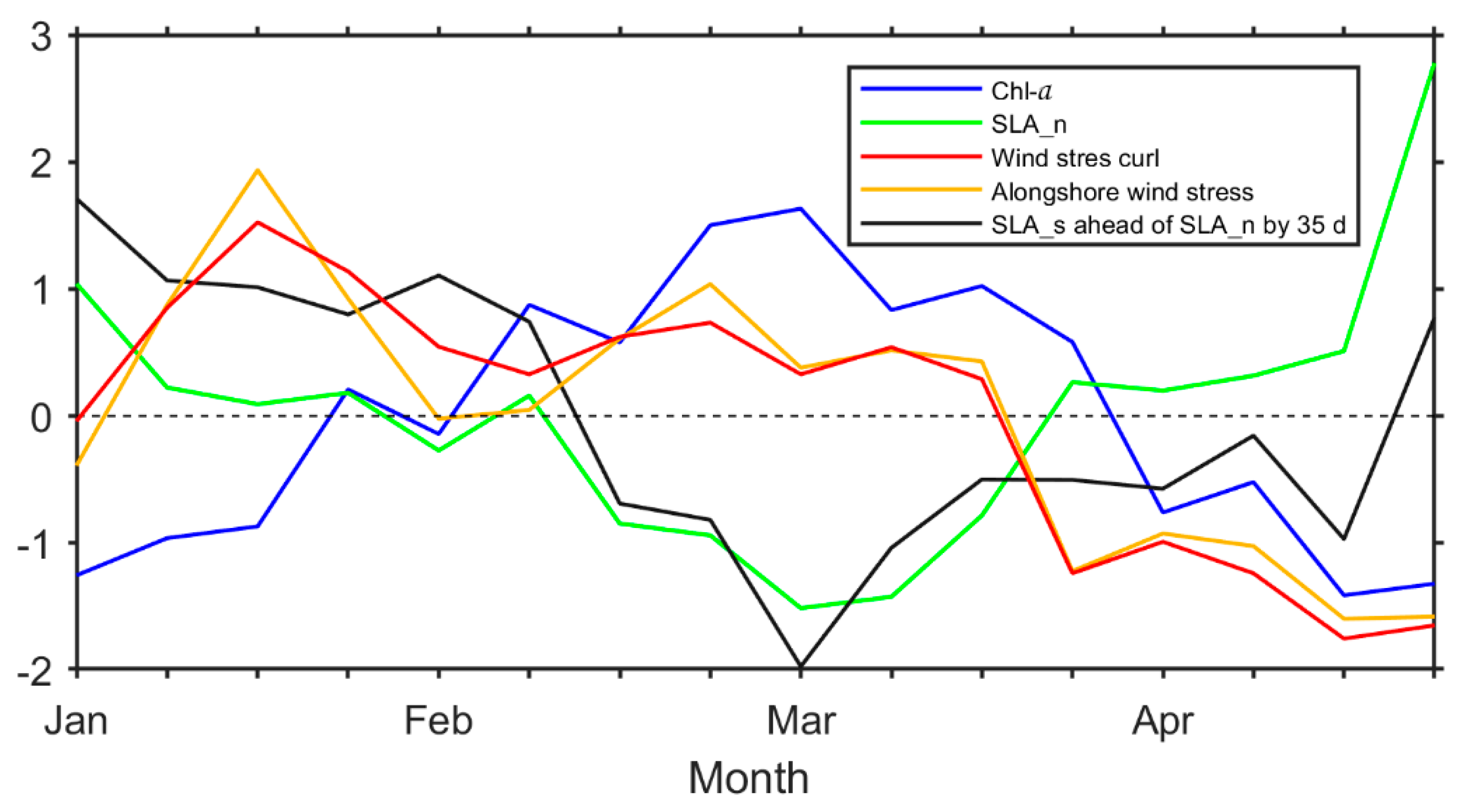
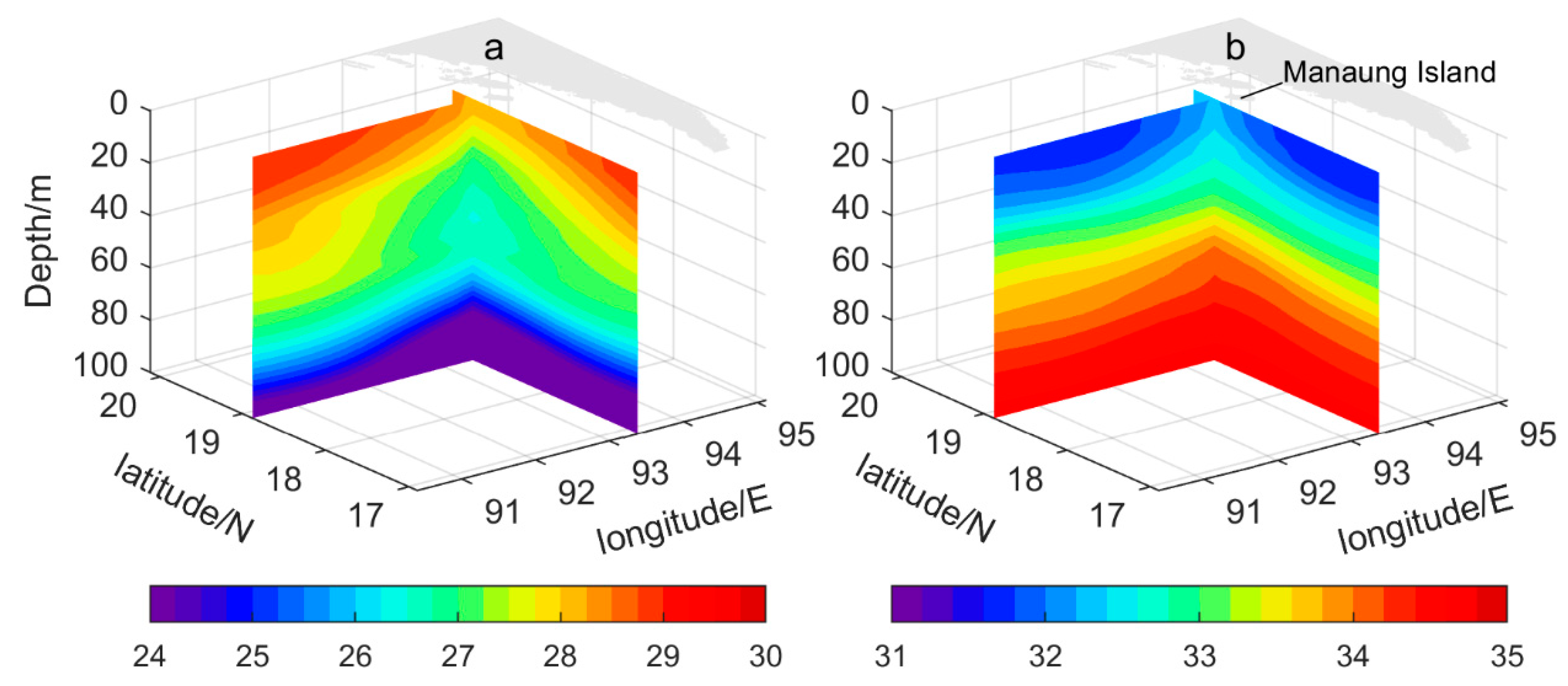
Multisource satellite remote sensing data and the World Ocean Atlas 2018 (WOA18) temperature and salinity dataset have been used to analyze the spatial distribution, variability and possible forcing mechanisms of the upwelling off Manaung Island, Myanmar. Signals of upwelling exist off the coasts of Manaung Island, in western Myanmar during spring. It appears in February, reaches its peak in March and decays in May. Low-temperature (<28.3 °C) and high-salinity (>31.8 psu) water at the surface of this upwelling zone is caused by the upwelling of seawater from a depth below 100 m. The impact of the upwelling on temperature is more significant in the subsurface layer than that in the surface layer. In contrast, the impact of the upwelling on salinity in the surface layer is more significant. Further research reveals that the remote forcing from the equator predominantly induces the evolution of the upwelling, while the local wind forcing also contributes to strengthen the intensity of the upwelling during spring.
Keywords: coastal waters of Myanmar; upwelling; monsoon; remote equatorial forcing coastal waters of Myanmar; upwelling; monsoon; remote equatorial forcing
Graphical Abstract