Computer-Aided Automated Greenery Design—Towards a Green BIM
Abstract
1. Introduction
2. Materials and Methods
2.1. Methods
2.2. Review: Available Software Applied in Landscape Design
- -
- Adobe Photoshop for landscape design, is useful for graphic processing of visualizations and the creation of plans. This program does not have a specific function for this field, its tools are universal, which allows them to be used for many purposes. An example of such a solution could be the use of different brush shapes as symbols of plant species on the set.
- -
- Adobe Illustrator, similar to Photoshop, is a universal program in many design fields. It is useful for creating various types of graphics in vector format. It does not have landscape design features. In this field, a user can create, for example, land plans, and graphic symbols. It allows showing the project in an individual graphical style.
- -
- AutoCAD (and similar ZWCAD, GSTARCAD) is CAAD software aimed at architects, engineers, and construction professionals. It allows the creation of 2D drawings—from sketchy to precise design documentation. The program also enables 3D modeling. For landscaping, it offers a range of graphic symbols of trees and plants to be placed on the plan.
- -
- SketchUp is a 3D modeling program that is very intuitive and versatile; additionally, it has many useful features and add-ons for landscape designers. It gives the possibility of using geo-location, for example, to obtain a terrain model or study the sun setting. Objects of different kinds, for example, specific plant species, can be modeled from scratch or downloaded from the online library.
- -
- Rhinoceros is a CAAD program designed for precise 3D modeling. It gives the possibility to create any shape from small to large scale with the accuracy needed for design, prototyping, construction, analysis, and production. Additional collaborative software and plugins for design, drafting, CAM, engineering, analysis, rendering, animation, and illustration provide many possibilities in effects and project implementation. The Rhino software itself does not propose specific solutions for landscape designers.
- -
- Grasshopper was initially developed as a plug-in for Rhino, which is currently a part of Rhinoceros software. It is mainly used to create algorithms for parametric modeling of 3D geometry in conjunction with data analysis. The software allows for developing individual solutions for different fields of design such as production lighting performance analysis or building energy consumption. The visual language of the software provides an intuitive way to explore projects without having to learn a scripting language.
- -
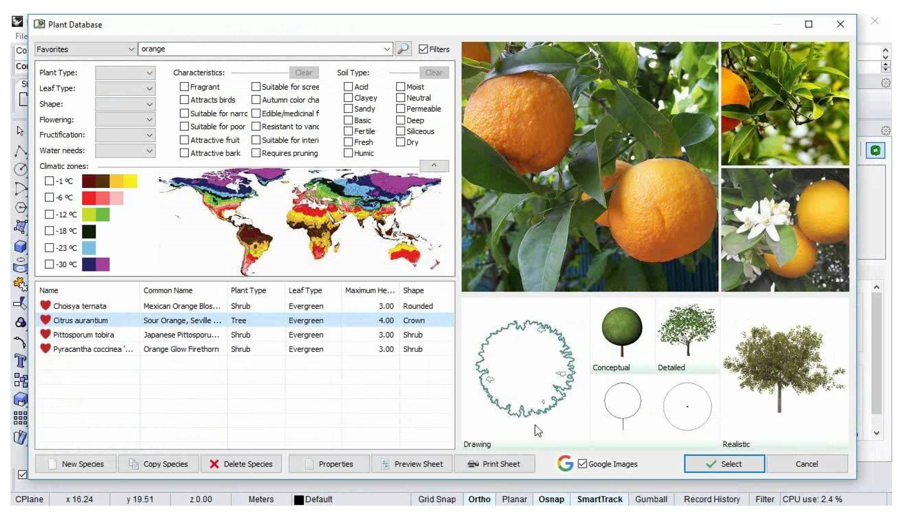
- Landsdesign is strictly dedicated to landscape design. It enables 2D drafting, 3D modeling, and creating a visualization. Additionally, it allows the analysis and evaluation of landscape features. After modifying the site in the project, the program will show operations related to earthworks for execution purposes. To include vegetation in the project, you can use the database with over 1800 species that are represented in 2D and 3D elevations, which are conceptual, detailed, and realistic. Placed vegetation and other design elements detect the topography and are automatically placed on the ground. To find the appropriate plant species, you can use a filter that will adjust the search results based on the given characteristics.
- -
- 3ds Max offers a rich and flexible set of tools for creating projects. It gives the possibility of modeling interiors and 3D objects or even game characters and creating high-quality visualizations or animations. When focusing on the field of landscape design, proxy objects are a useful feature.
- -
- Revit is an example of a BIM program used in many design areas, mainly intended for architecture and engineering but also used in landscape design. The program allows the creation of a project throughout its cycle from conceptual design, visualization, and analysis to production and construction. It gives us the possibility of making 2D drawings, 3D models, documentation, and using data on objects. This allows for the automation of routine and repetitive tasks as well as precision in execution.
- -
- ArchiCAD, similar to Revit, is professional BIM software that offers an intuitive design environment, accurate information management, open collaboration, and automated documentation. It is used for the design and implementation of architectural projects using data analysis. It enables 3D modeling, documentation, and rendering of realistic visualizations.
- -
- LandFX is a BIM plug-in for landscape design targeted at software such as AutoCAD, SketchUp, and Rhino. The program allows the design of details, vegetation, and irrigation, creation of a 2D design by selecting symbols, plantings, and labels, and the actions are automated.
- -
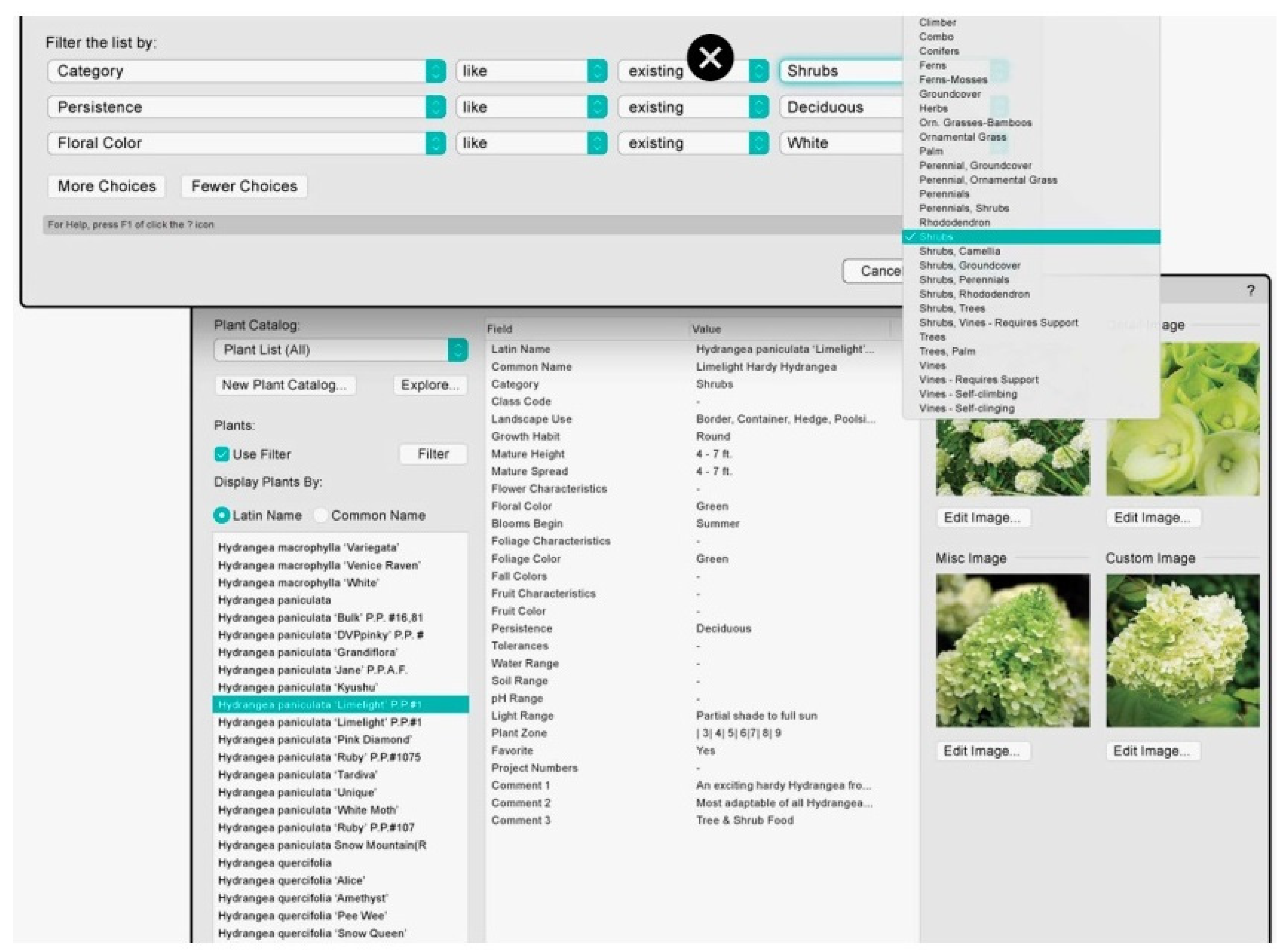
- Vectorworks Landmark is a BIM program aimed at the professional landscape designer, offering project support from start to finish or at any stage. In total, 2D and 3D functions, visualizations, and project documentation are proposed. The program enables creative-free 3D modeling. There are many functions available in the subject of vegetation. Some of them, for example, have access to the species database in the default version, or it is possible to select a catalog from online resources. The designer can specify his expectations regarding the features of the species he wants to include in the project and the program will filter the database proposing a specific range. Plant objects are displayed in 2D and 3D and use parameters assigned by the user. The 3D representations can be schematic or photorealistic forms.
- -
- MicroStation is mainly intended for architectural and construction design. It is a 2D and 3D CAD program with the possibility of using BIM functions and parametric design. The available tools are universal for many design processes: from creating concepts, 2D documentation, and detailed BIM models to creating visualizations with the possibility of using geo-location and lighting analysis.
- -
- Dynascape is a CAD program created for landscape design, based mainly on the basic representative pillars with an emphasis on individual and effective presentation of the project: 2D drawings and documentation, graphic representation of the project, and 3D model and visualizations.
- -
- Lumion allows work between developing the detailed renders of your landscape architecture projects, and working in and updating your models in CAD or 3D modeling software. LiveSync works with all leading CAD programs including SketchUp, Revit, ArchiCAD, Rhino, Vectorworks, and AutoCAD. Going beyond the usual renders that intend to only convey some form of plant life, Lumion’s content library offers a large variety of vegetation, allowing you to create a scene that is richly detailed with specifically chosen nature and vegetation.
2.3. Review: Parameters of Greenery
3. Results
3.1. Theoretical Model of Computer-Aided Greenery Design
3.2. Test Model for Single Scenario
4. Discussion
5. Conclusions
Author Contributions
Funding
Institutional Review Board Statement
Informed Consent Statement
Data Availability Statement
Conflicts of Interest
References
- Lynn, G.; Gage, M.F.; Nielson, S.; Rappaport, N. Composites, Surfaces, and Software: High Performance Architecture; Yale School of Architecture: New Haven, CT, USA, 2010; p. 104. [Google Scholar]
- Urbanowicz, K.; Nyka, L. Interactive and Media Architecture—From Social Encounters to City Planning Strategies. Procedia Eng. 2016, 161, 1330–1337. [Google Scholar] [CrossRef][Green Version]
- Cudzik, J.; Radziszewski, K. Parametric design in architectural education. World Trans. Eng. Technol. Educ. 2019, 17, 448–453. [Google Scholar]
- Liao, L.; Zhou, K.; Fan, C.; Ma, Y. Evaluation of Complexity Issues in Building Information Modeling Diffusion Research. Sustainability 2022, 14, 3005. [Google Scholar] [CrossRef]
- Cameron, R.W.; Taylor, J.E.; Emmett, M.R. What’s ‘cool’ in the world of green façades? How plant choice influences the cooling properties of green walls. Build. Environ. 2014, 73, 198–207. [Google Scholar] [CrossRef]
- Abdel-Razek, S.A.; Marie, H.S.; Alshehri, A.; Elzeki, O.M. Energy Efficiency through the Implementation of an AI Model to Predict Room Occupancy Based on Thermal Comfort Parameters. Sustainability 2022, 14, 7734. [Google Scholar] [CrossRef]
- Gruber, P.; Imhof, B. Patterns of Growth—Biomimetics and Architectural Design. Buildings 2017, 7, 32. [Google Scholar] [CrossRef]
- Yi, H.; Yi, Y.K.; Chan, T. Performance Based Architectural design optimization: Automated 3D space Layout using simulated annealing. In Proceedings of the 2014 ASHRAE/IBPSA-USA Building Simulation Conference, Atlanta, GA, USA, 10–12 September 2014; pp. 292–299. [Google Scholar]
- Wu, G.; Miao, Y.; Wang, F. Intelligent Design Model of Urban Landscape Space Based on Optimized BP Neural Network. J. Sens. 2022, 2022, 9704287. [Google Scholar] [CrossRef]
- Li, C.Z.; Guo, Z.; Su, D.; Xiao, B.; Tam, V.W.Y. The Application of Advanced Information Technologies in Civil Infrastructure Construction and Maintenance. Sustainability 2022, 14, 7761. [Google Scholar] [CrossRef]
- Yokoi, K.; Fukuda, T.; Yabuki, N.; Motamedi, A. Integrating BIM, CFD and AR for Thermal Assessment of Indoor Greenery. In Proceedings of the 22nd International Conference on Computer-Aided Architectural Design Research in Asia (CAADRIA 2017), Suzhou, China, 5–8 April 2017. [Google Scholar] [CrossRef]
- Claypool, M.; Retsin, G.; Garcia, M.J.; Jaschke, C.; Saey, K. Automation and the Discrete: Exploring New Potentials for Streamlining Production in Architectural Design Research. J. Arch. Educ. 2021, 75, 108–114. [Google Scholar] [CrossRef]
- Badidi, E. Edge AI and Blockchain for Smart Sustainable Cities: Promise and Potential. Sustainability 2022, 14, 7609. [Google Scholar] [CrossRef]
- Weber, R.E.; Mueller, C.; Reinhart, C. Automated floorplan generation in architectural design: A review of methods and applications. Autom. Constr. 2022, 140, 104385. [Google Scholar] [CrossRef]
- Wong, N.H.; Tan, C.L.; Kolokotsa, D.D.; Takebayashi, H. Greenery as a mitigation and adaptation strategy to urban heat. Nat. Rev. Earth Environ. 2021, 2, 166–181. [Google Scholar] [CrossRef]
- Albers, M.; Deppisch, S. Resilience in the Light of Climate Change: Useful Approach or Empty Phrase for Spatial Planning? Eur. Plan. Stud. 2013, 21, 1598–1610. [Google Scholar] [CrossRef]
- Russo, A.; Cirella, G.T. Modern compact cities: How much greenery do we need? Int. J. Environ. Res. Public Health 2018, 15, 2180. [Google Scholar] [CrossRef]
- Brink, E.; Aalders, T.; Ádám, D.; Feller, R.; Henselek, Y.; Hoffmann, A.; Ibe, K.; Matthey-Doret, A.; Meyer, M.; Negrut, N.L.; et al. Cascades of green: A review of ecosystem-based adaptation in urban areas. Glob. Environ. Change 2016, 36, 111–123. [Google Scholar] [CrossRef]
- Nyka, L. From structures to landscapes-towards re-conceptualization of the urban condition. Archit. Res. Addressing Soc. Chall. 2017, 1, 509–515. [Google Scholar] [CrossRef]
- European Commission. Directive (EU) 2018/844 of the European Parliament and of the Council of 30 May 2018 Amending Directive 2010/31/EU on the Energy Performance of Buildings and Directive 2021/27/EU on Energy Efficiency; L156/75–91; European Commission (EU): Brussels, Belgium, 2018. [Google Scholar]
- Campiotti, C.A.; Gatti, L.; Campiotti, A.; Consorti, L.; De Rossi, P.; Bibbiani, C.; Muleo, R.; Latini, A. Vertical Greenery as Natural Tool for Improving Energy Efficiency of Buildings. Horticulturae 2022, 8, 526. [Google Scholar] [CrossRef]
- Hermansdorfer, M. BIM for Landscape. In Grading: BIM. landscapingSMART. 3D-Machine Control Systems. Stormwater Management; Birkhäuser: Berlin, Germany; Boston, MA, USA, 2019; pp. 213–220. [Google Scholar] [CrossRef]
- Shashua-Bar, L.; Potchter, O.; Bitan, A.; Boltansky, D.; Yaakov, Y. Microclimate modelling of street tree species effects within the varied urban morphology in the Mediterranean city of Tel Aviv, Israel. Int. J. Clim. 2009, 30, 44–57. [Google Scholar] [CrossRef]
- Picuno, C.A.; Godosi, Z.; Picuno, P. Implementing a Landscape Information Modelling (LIM) toolfor planning leisure facilities and landscape protection. In Proceedings of the Public Recreation and Landscape Protection—with Environment Hand in Hand: Conference Proceeding, Brno, Czech Republic, 9–10 May 2022; pp. 186–190. [Google Scholar] [CrossRef]
- Al Hattab, M.; Hamzeh, F. Simulating the dynamics of social agents and information flows in BIM-based design. Autom. Constr. 2018, 92, 1–22. [Google Scholar] [CrossRef]
- Bonenberg, W.; Rybicki, S.M.; Schneider-Skalska, G.; Stochel-Cyunel, J. Sustainable Water Management in a Krakow Housing Complex from the Nineteen-Seventies in Comparison with a Model Bio-Morpheme Unit. Sustainability 2022, 14, 5499. [Google Scholar] [CrossRef]
- Besir, A.B.; Cuce, E. Green roofs and facades: A comprehensive review. Renew. Sustain. Energy Rev. 2018, 82, 915–939. [Google Scholar] [CrossRef]
- Fernández-Mora, V.; Navarro, I.J.; Yepes, V. Integration of the structural project into the BIM paradigm: A literature review. J. Build. Eng. 2022, 53, 104318. [Google Scholar] [CrossRef]
- Chong, H.; Lee, C.; Wang, X. A mixed review of the adoption of Building Information Modelling (BIM) for sustainability. J. Clean. Prod. 2017, 142, 4114–4126. [Google Scholar] [CrossRef]
- Nyka, L.; Cudzik, J.; Urbanowicz, K. The CDIO model in architectural education and research by design. World Trans. Eng. Technol. Educ. 2020, 18, 85–90. [Google Scholar]
- Wei, X.; Bonenberg, W.; Zhou, M.; Wang, J. Application of BIM Simulation and Visualization in Landscape Architecture Design. Adv. Hum. Factors Archit. Sustain. Urban Plan. Infrastruct. 2020, 1214, 215–221. [Google Scholar] [CrossRef]
- Sanchez-Sepulveda, M.; Fonseca, D.; Franquesa, J.; Redondo, E. Virtual interactive innovations applied for digital urban transformations. Mixed approach. Future Gener. Comput. Syst. 2019, 91, 371–381. [Google Scholar] [CrossRef]
- Kamel, E.; & Memari, A.M. Review of BIM’s application in energy simulation: Tools, issues, and solutions. Autom. Constr. 2019, 97, 164–180. [Google Scholar] [CrossRef]
- Zanni, M.A.; Soetanto, R.; Ruikar, K. Towards a BIM-enabled sustainable building design process: Roles, responsibilities, and requirements. Arch. Eng. Des. Manag. 2016, 13, 101–129. [Google Scholar] [CrossRef]
- Walliss, J.; Rahmann, H. Landscape Architecture and Digital Technologies: Re-Conceptualising Design and Making, 1st ed.; Routledge: London, UK, 2016; pp. 216–217. [Google Scholar] [CrossRef]
- Wong, Y.C.; Chin, K.-Y. Plant Parameters Influencing the Cooling Performance of Vegetated Roofs: A review. Int. J. Sci. Res. Publ. 2018, 8. [Google Scholar] [CrossRef]
- Cantrell, B.; Mekies, A. (Eds.) Codify: Parametric and Computational Design in Landscape Architecture, 1st ed.; Routledge: London, UK, 2018; pp. 98–99. [Google Scholar] [CrossRef]
- Shu, Q.; Middleton, W.; Dörstelmann, M.; Santucci, D.; Ludwig, F. Urban Microclimate Canopy: Design, Manufacture, Installation, and Growth Simulation of a Living Architecture Prototype. Sustainability 2020, 12, 6004. [Google Scholar] [CrossRef]
- Clausen, R. BIM in Landscape Architecture: A Report. J. Digit. Landsc. Archit. 2021, 6, 353–369. [Google Scholar] [CrossRef]
- Wik, K.H.; Sekse, M.; Enebo, B.A.; Thorvaldsen, J. BIM for Landscape: A Norwegian Standardization Project. J. Digit. Landsc. Archit. 2018, 3, 241–248. [Google Scholar] [CrossRef]
- Fenby-Taylor, H. BIM for Landscape, 1st ed.; Routledge: London, UK, 2016. [Google Scholar] [CrossRef]
- Marzouk, M.; Ayman, R.; Alwan, Z.; Elshaboury, N. Green building system integration into project delivery utilising BIM. Environ. Dev. Sustain. 2021, 24, 6467–6480. [Google Scholar] [CrossRef]
- Kolarevic, B. (Ed.) Architecture in the Digital Age: Design and Manufacturing, 1st ed.; Taylor & Francis: Abingdon, UK, 2003. [Google Scholar] [CrossRef]
- Han, B.; Leite, F. Generic extended reality and integrated development for visualization applications in architecture, engineering, and construction. Autom. Constr. 2022, 140, 104329. [Google Scholar] [CrossRef]
- Keibach, E.; Shayesteh, H. BIM for Landscape Design Improving Climate Adaptation Planning: The Evaluation of Software Tools Based on the ISO 25010 Standard. Appl. Sci. 2022, 12, 739. [Google Scholar] [CrossRef]
- Ibrahim, Y.; Kershaw, T.; Shepherd, P. A methodology For Modelling Microclimates: A Ladybug-tools and ENVI-met verification study. In Proceedings of the 35th PLEA Conference. Planning Post Carbon Cities, A Coruña, Spain, 1–3 September 2020. [Google Scholar]
- Arévalo, C.; Amaya-Espinel, J.D.; Henríquez, C.; Ibarra, J.T.; Bonacic, C. Urban noise and surrounding city morphology influence green space occupancy by native birds in a Mediterranean-type South American metropolis. Sci. Rep. 2022, 12, 4471. [Google Scholar] [CrossRef] [PubMed]
- Badach, J.; Dymnicka, M.; Baranowski, A. Urban Vegetation in Air Quality Management: A Review and Policy Framework. Sustainability 2020, 12, 1258. [Google Scholar] [CrossRef]
- Badach, J.; Voordeckers, D.; Nyka, L.; Van Acker, M. A framework for Air Quality Management Zones-Useful GIS-based tool for urban planning: Case studies in Antwerp and Gdańsk. Build. Environ. 2020, 174, 106743. [Google Scholar] [CrossRef]
- Bottalico, F.; Chirici, G.; Giannetti, F.; De Marco, A.; Nocentini, S.; Paoletti, E.; Salbitano, F.; Sanesi, G.; Serenelli, C.; Travaglini, D. Air Pollution Removal by Green Infrastructures and Urban Forests in the City of Florence. Agric. Agric. Sci. Procedia 2016, 8, 243–251. [Google Scholar] [CrossRef]
- Baldauf, R. Roadside vegetation design characteristics that can improve local, near-road air quality. Transp. Res. Part D Transp. Environ. 2017, 52, 354–361. [Google Scholar] [CrossRef]
- Buccolieri, R.; Santiago, J.-L.; Rivas, E.; Sanchez, B. Review on urban tree modelling in CFD simulations: Aerodynamic, deposition and thermal effects. Urban For. Urban Green. 2018, 31, 212–220. [Google Scholar] [CrossRef]
- Janhäll, S. Review on urban vegetation and particle air pollution—Deposition and dispersion. Atmos. Environ. 2015, 105, 130–137. [Google Scholar] [CrossRef]
- Voordeckers, D.; Meysman, F.; Billen, P.; Tytgat, T.; Van Acker, M. The impact of street canyon morphology and traffic volume on NO2 values in the street canyons of Antwerp. Build. Environ. 2021, 197, 107825. [Google Scholar] [CrossRef]
- Xue, F.; Li, X. The impact of roadside trees on traffic released PM 10 in urban street canyon: Aerodynamic and deposition effects. Sustain. Cities Soc. 2017, 30, 195–204. [Google Scholar] [CrossRef]
- Buccolieri, R.; Gromke, C.; Di Sabatino, S.; Ruck, B. Aerodynamic effects of trees on pollutant concentration in street canyons. Sci. Total Environ. 2009, 407, 5247–5256. [Google Scholar] [CrossRef]
- Baldauf, R. Recommendations for Constructing Roadside Vegetation Barriers to Improve Near-Road Air Quality; 600/R-16/0; United States Environmental Protection Agency: Washington, DC, USA, 2016.
- Greater London Authority Using Green Infrastructure to Protect People from Air Pollution. Available online: https://www.london.gov.uk/WHAT-WE-DO/environment/environment-publications/using-green-infrastructure-protect-people-air-pollution (accessed on 5 August 2020).
- Badach, J.; Dymnicka, M.; Załęcki, J.; Brosz, M.; Voordeckers, D.; Van Acker, M. Exploring the Institutional and Bottom-Up Actions for Urban Air Quality Improvement: Case Studies in Antwerp and Gdańsk. Sustainability 2021, 13, 11790. [Google Scholar] [CrossRef]
- Johnny, W.K.W.; Zhou, J. Enchencing environmental sustainability over building life cycles through green BIM: A review. Autom. Constr. 2015, 57, 156–165. [Google Scholar]
- Qin, Z.; Song, Y. Symbol Matters: A Sequential Mediation Model in Examining the Impact of Product Design with Buddhist Symbols on Charitable Donation Intentions. Religions 2022, 13, 151. [Google Scholar] [CrossRef]
- Luo, J.; Zhang, Y.; Song, Y. Design for Pandemic Information: Examining the Effects of Grahps on Anxiety and Social Distancing Intention in the COVID-19. Front. Public Health 2022, 10, 800789. [Google Scholar] [CrossRef]
- Bonenberg, W.; Wei, X. Green BIM in Sustainable Infrastructure. Procedia Manuf. 2015, 3, 1654–1659. [Google Scholar] [CrossRef]
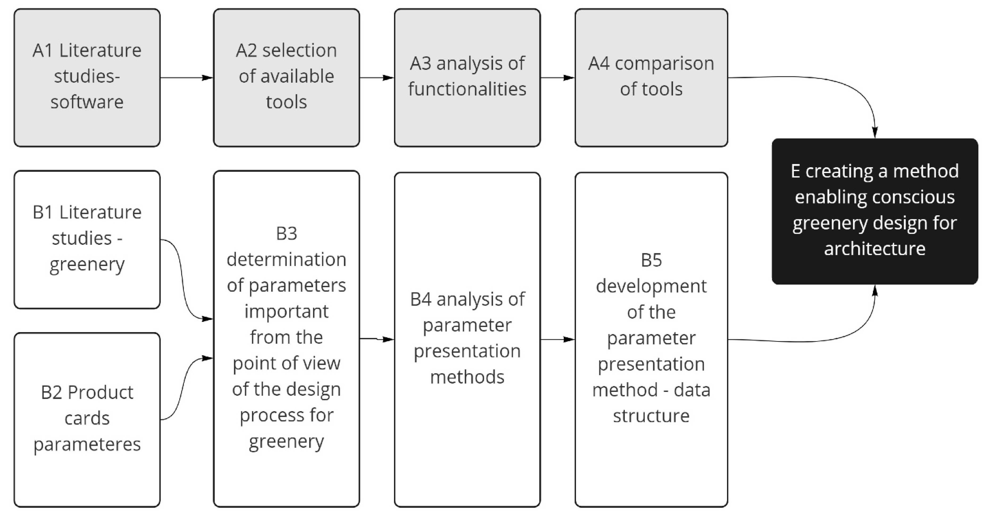

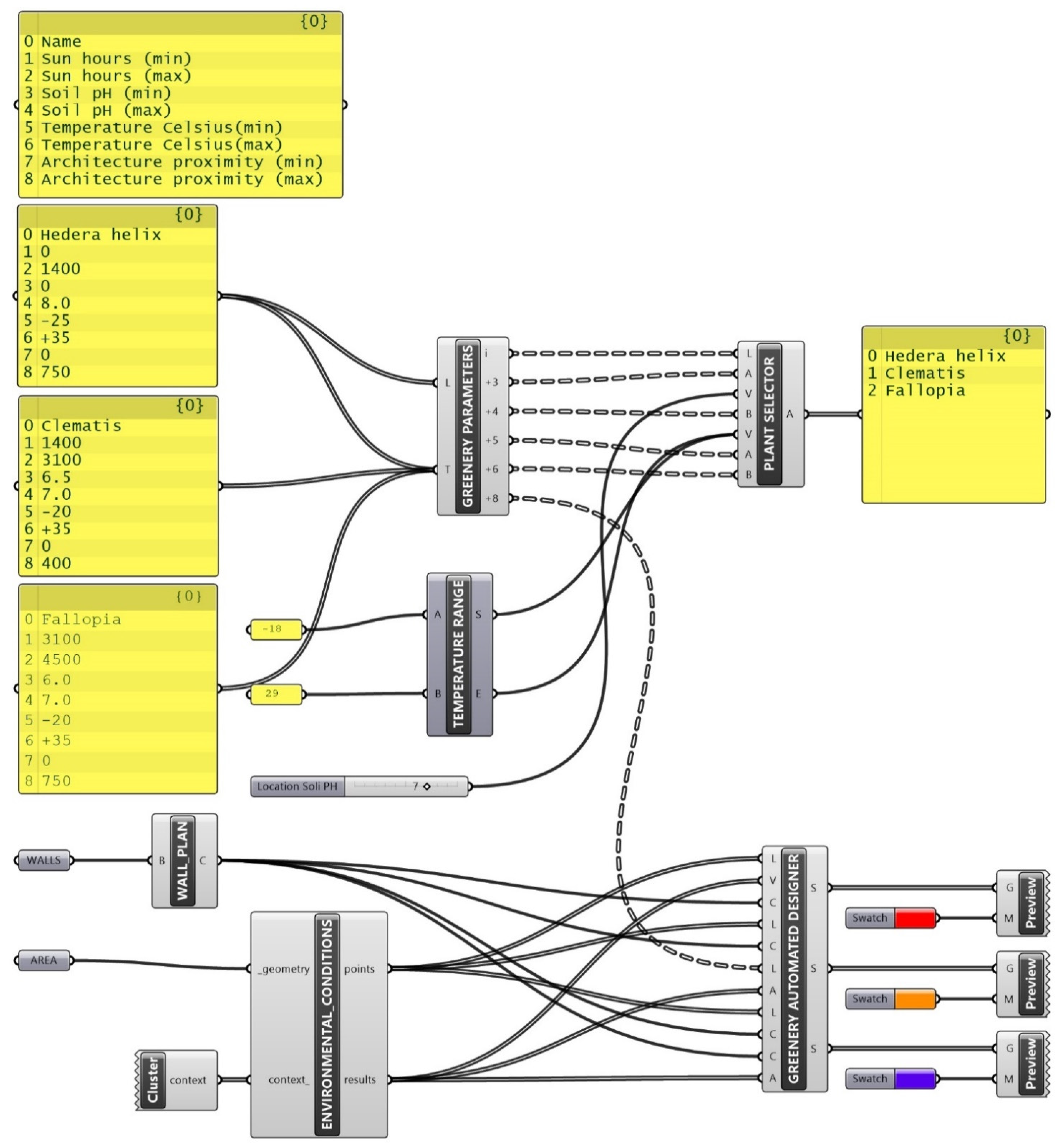
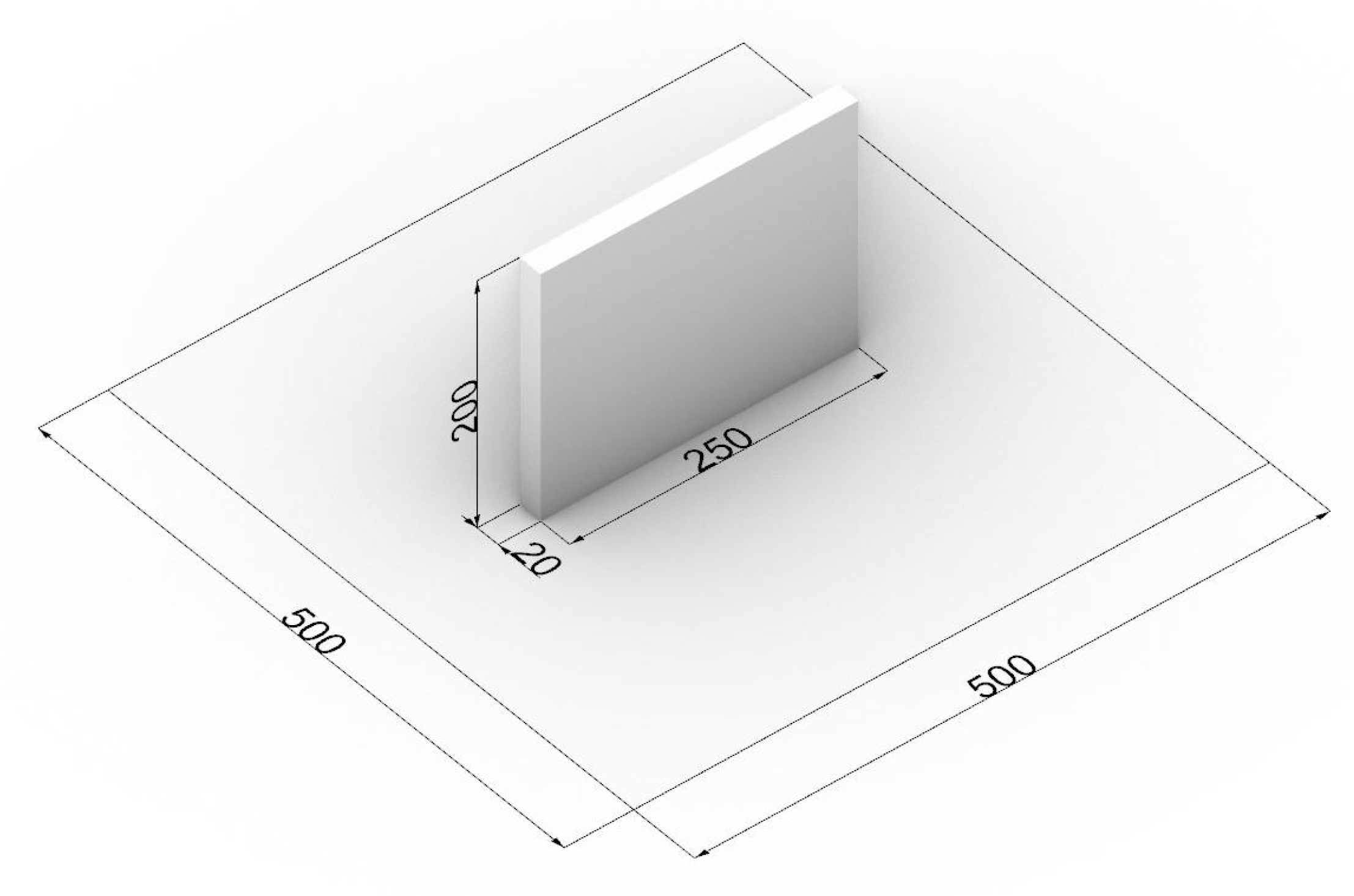
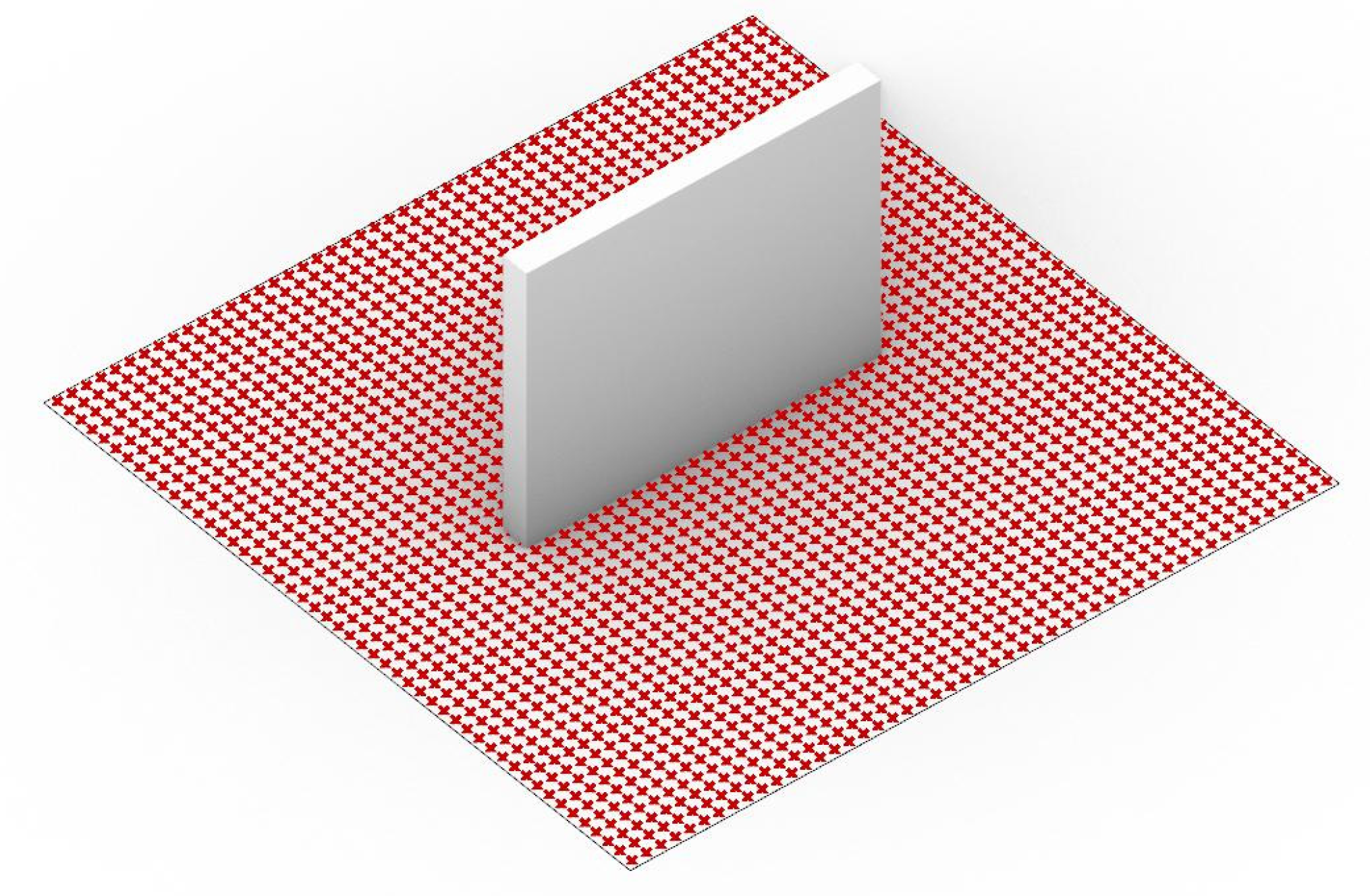
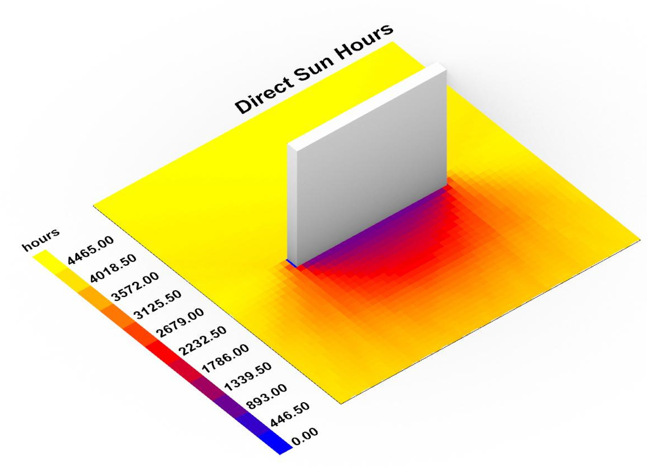
| Name | Manual Landscape Design | Visual Representation of Greenery | Plant Library | Climatic Data from External Sources | Climatic Analysis | Sunhours Analysis | Airing Analysis | Simulation of Growth | Selection of Species | Automatic Plant Selection | Result |
|---|---|---|---|---|---|---|---|---|---|---|---|
| Adobe Photoshop | + | + | − | − | − | − | − | − | − | − | 2/10 |
| Adobe Illustrator | + | + | − | − | − | − | − | − | − | − | 2/10 |
| AutoCAD | + | + | − | − | − | − | − | − | − | − | 2/10 |
| SketchUp | + | + | − | + | − | − | − | − | − | − | 3/10 |
| Rhinoceros | + | + | − | − | − | − | − | − | − | − | 2/10 |
| Grasshopper | + | + | + | + | + | + | + | + | + | − | 9/10 |
| Landsdesign | + | + | + | + | + | + | − | − | + | − | 7/10 |
| 3ds Max | + | + | + | − | − | − | − | − | − | − | 3/10 |
| Revit | + | + | + | + | − | + | − | − | + | − | 6/10 |
| ArchiCAD | + | + | + | + | − | − | − | − | − | − | 4/10 |
| LandFX | + | + | + | + | − | − | − | − | + | − | 5/10 |
| Vectorworks Landmark | + | + | + | + | + | − | − | − | + | − | 6/10 |
| MicroStation | + | + | + | − | − | − | − | − | − | − | 3/10 |
| Dynascape | + | + | + | − | − | − | − | − | − | − | 3/10 |
| Lumion | + | + | + | + | − | − | − | − | − | − | 4/10 |
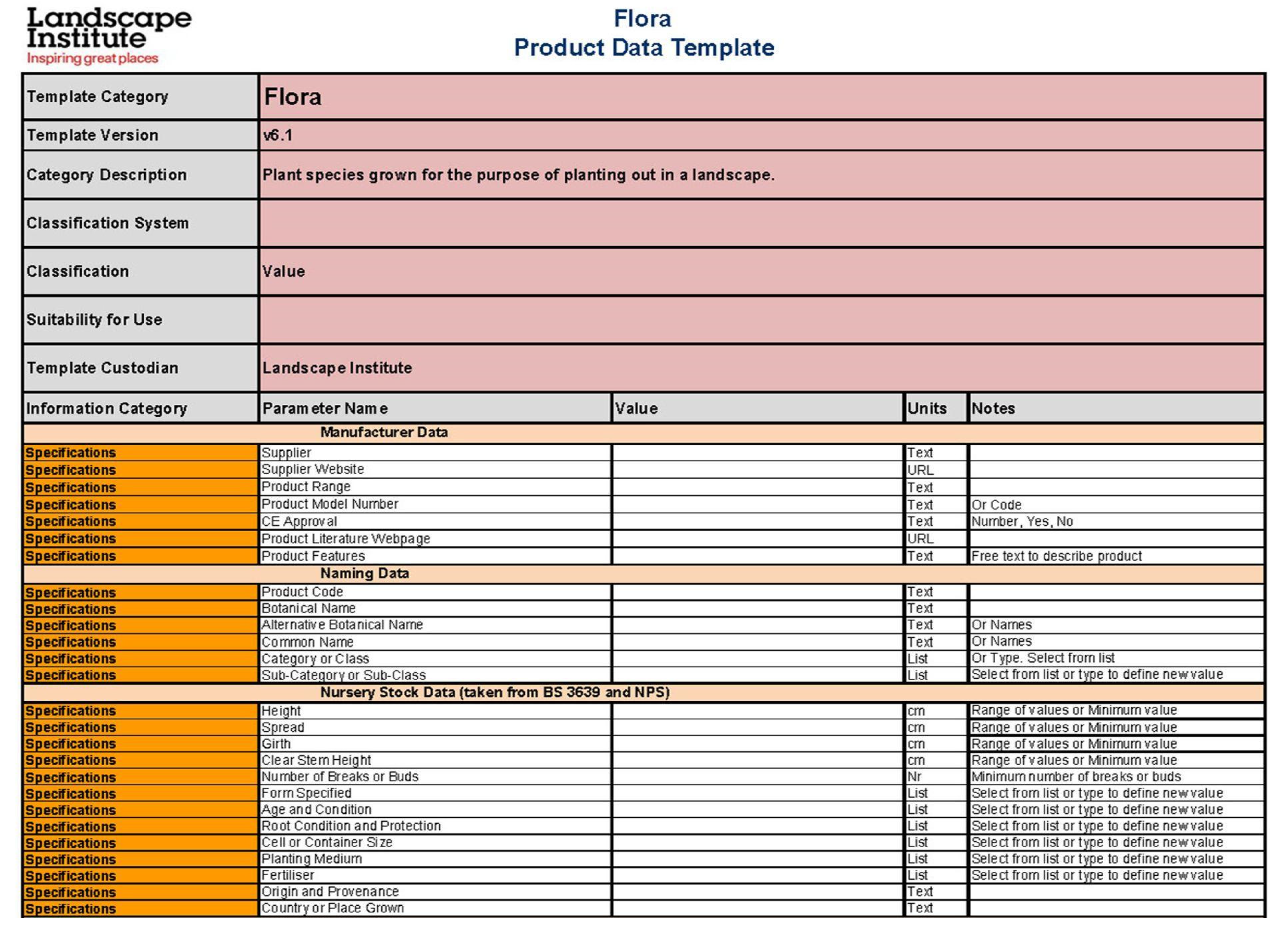
| Number | Name | Nursery | Grown | Type of Value | Unit |
|---|---|---|---|---|---|
| 1. | Category | text | - | ||
| 2. | Name | text | - | ||
| 3. | 3D Representation | brep | - | ||
| 4. | 2D representation | spline/point | - | ||
| 5. | Photo | image | - | ||
| 6. | Height | number domain | cm/inch | ||
| 7. | Spread | number domain | cm/inch | ||
| 8. | Solar exposure | number domain | Sun hours | ||
| 9. | Humidity | number | % | ||
| 10. | Soil | number domain | ph | ||
| 11. | Maintenance | 1–10 low-hight | 1–10 low-hight | number | integer |
| 12. | Root volume | number | Cubic meters | ||
| 13. | Temperature range | number domain | C/F | ||
| 14. | Life expectancy | number domain | integer | ||
| 15. | Planting distance | number | cm/inch | ||
| 16. | Architecture proximity | number domain | cm/inch |
| Number | Name | Nursery | Grown | Type of Value | Unit |
|---|---|---|---|---|---|
| 1. | Category | climber | climber | text | - |
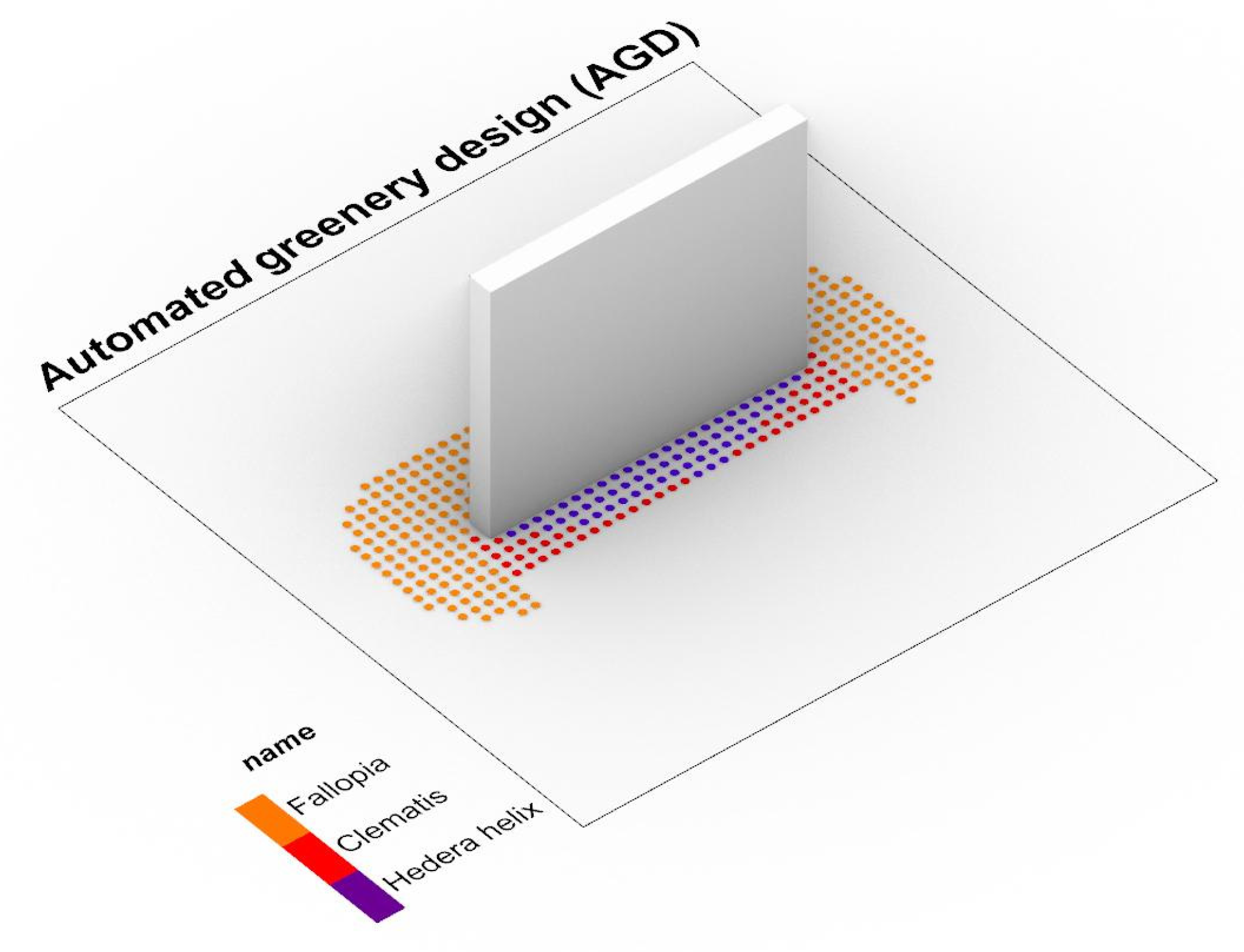
| 2. | Name | Hedera helix | Hedera helix | text | - |
| 3. | 3d Representation | Violet dot | Violet dot | brep | - |
| 4. | 2d representation | Violet dot | Violet dot | spline/point | - |
| 5. | Photo |  | 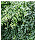 | image | - |
| 6. | Height | 80 cm–120 cm | <30,000 cm | number domain | cm/inch |
| 7. | Spread | 10 cm–30 cm | <10,000 cm | number domain | cm/inch |
| 8. | Solar exposure | 0–1400 | 0–1400 | number domain | Sun hours |
| 9. | Humidity | 85% | 85% | number domain | % |
| 10. | Soil | <pH 8.0 | <pH 8.0 | number domain | ph |
| 11. | Maintenance | 2 | 1 | number | integer |
| 12. | Root volume | 0.3 m3 | 6 m3 | number | Cubic meters |
| 13. | Temperature range | (−25)–(+35) | (−25)–(+35) | number domain | C/F |
| 14. | Life expectancy | 500 years | 500 years | number domain | integer |
| 15. | Planting distance | 200 cm | 500 cm | number | cm/inch |
| 16. | Architecture proximity | 0 cm–75 cm | 0 cm–500 cm | number domain | cm/inch |
| Number | Name | Nursery | Grown | Type of Value | Unit |
|---|---|---|---|---|---|
| 1. | Category | climber | climber | text | - |
| 2. | Name | Clematis | Clematis | text | - |
| 3. | 3d Representation | Red dot | Red dot | brep | - |
| 4. | 2d representation | Red dot | Red dot | spline/point | - |
| 5. | Photo |  | 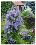 | image | - |
| 6. | Height | 80 cm–120 cm | <10,000 cm | number domain | cm/inch |
| 7. | Spread | 10 cm–30 cm | <6000 cm | number domain | cm/inch |
| 8. | Solar exposure | 1400–3100 | 1400–3100 | number domain | Sun hours |
| 9. | Humidity | 75% | 75% | number domain | % |
| 10. | Soil | pH 6.5–pH 7.0 | pH 6.5–pH 7.0 | number domain | ph |
| 11. | Maintenance | 4 | 3 | number | integer |
| 12. | Root volume | 0.3 m3 | 2 m3 | numer | Cubic meters |
| 13. | Temperature range | (−20)–(+35) | (−20)–(+35) | number domain | C/F |
| 14. | Life expectancy | <100 years | <100 years | number domain | integer |
| 15. | Planting distance | 150 cm | 300 cm | number | cm/inch |
| 16. | Architecture proximity | 0 cm–40 cm | 0 cm–75 cm | number domain | cm/inch |
| Number | Name | Nursery | Grown | Type of Value | Unit |
|---|---|---|---|---|---|
| 1. | Category | climber | climber | text | - |
| 2. | Name | Fallopia | Fallopia | text | - |
| 3. | 3d Representation | Orange dot | Orange dot | brep | - |
| 4. | 2d representation | Orange dot | Orange dot | spline/point | - |
| 5. | Photo |  | 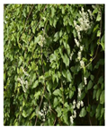 | image | - |
| 6. | Height | 80 cm–120 cm | <12,000 cm | number domain | cm/inch |
| 7. | Spread | 10 cm–30 cm | <8000 cm | number domain | cm/inch |
| 8. | Solar exposure | 3100–4500 | 3100–4500 | number domain | Sun hours |
| 9. | Humidity | 70% | 70% | number domain | % |
| 10. | Soil | pH 6.0–pH 7.0 | pH 6.0–pH 7.0 | number domain | ph |
| 11. | Maintenance | 4 | 3 | number | integer |
| 12. | Root volume | 0.3 m3 | 4 m3 | numer | Cubic meters |
| 13. | Temperature range | (−20)–(+35) | (−20)–(+35) | number domain | C/F |
| 14. | Life expectancy | <100 years | <100 years | number domain | integer |
| 15. | Planting distance | 200 cm | 400 cm | number | cm/inch |
| 16. | Architecture proximity | 0 cm–75 cm | 0 cm–200 cm | number domain | cm/inch |
Publisher’s Note: MDPI stays neutral with regard to jurisdictional claims in published maps and institutional affiliations. |
© 2022 by the authors. Licensee MDPI, Basel, Switzerland. This article is an open access article distributed under the terms and conditions of the Creative Commons Attribution (CC BY) license (https://creativecommons.org/licenses/by/4.0/).
Share and Cite
Sędzicki, D.; Cudzik, J.; Bonenberg, W.; Nyka, L. Computer-Aided Automated Greenery Design—Towards a Green BIM. Sustainability 2022, 14, 8927. https://doi.org/10.3390/su14148927
Sędzicki D, Cudzik J, Bonenberg W, Nyka L. Computer-Aided Automated Greenery Design—Towards a Green BIM. Sustainability. 2022; 14(14):8927. https://doi.org/10.3390/su14148927
Chicago/Turabian StyleSędzicki, Dominik, Jan Cudzik, Wojciech Bonenberg, and Lucyna Nyka. 2022. "Computer-Aided Automated Greenery Design—Towards a Green BIM" Sustainability 14, no. 14: 8927. https://doi.org/10.3390/su14148927
APA StyleSędzicki, D., Cudzik, J., Bonenberg, W., & Nyka, L. (2022). Computer-Aided Automated Greenery Design—Towards a Green BIM. Sustainability, 14(14), 8927. https://doi.org/10.3390/su14148927


