Article

Vegetation Mapping and Scenario Simulation in the Poyang Lake Basin of China

1
State Key Laboratory of Resources and Environment Information System, Institute of Geographical Sciences and Natural Resources Research, Chinese Academy of Sciences, Beijing 100101, China
2
College of Resources and Environment, University of Chinese Academy of Sciences, Beijing 100049, China
3
Jiangsu Center for Collaborative Innovation in Geographical Information Resource Development and Application, Nanjing 210023, China
*
Author to whom correspondence should be addressed.
Forests 2025, 16(3), 430; https://doi.org/10.3390/f16030430
Submission received: 12 February 2025 / Revised: 26 February 2025 / Accepted: 26 February 2025 / Published: 27 February 2025
(This article belongs to the Special Issue Forest Inventory: The Monitoring of Biomass and Carbon Stocks)

Abstract

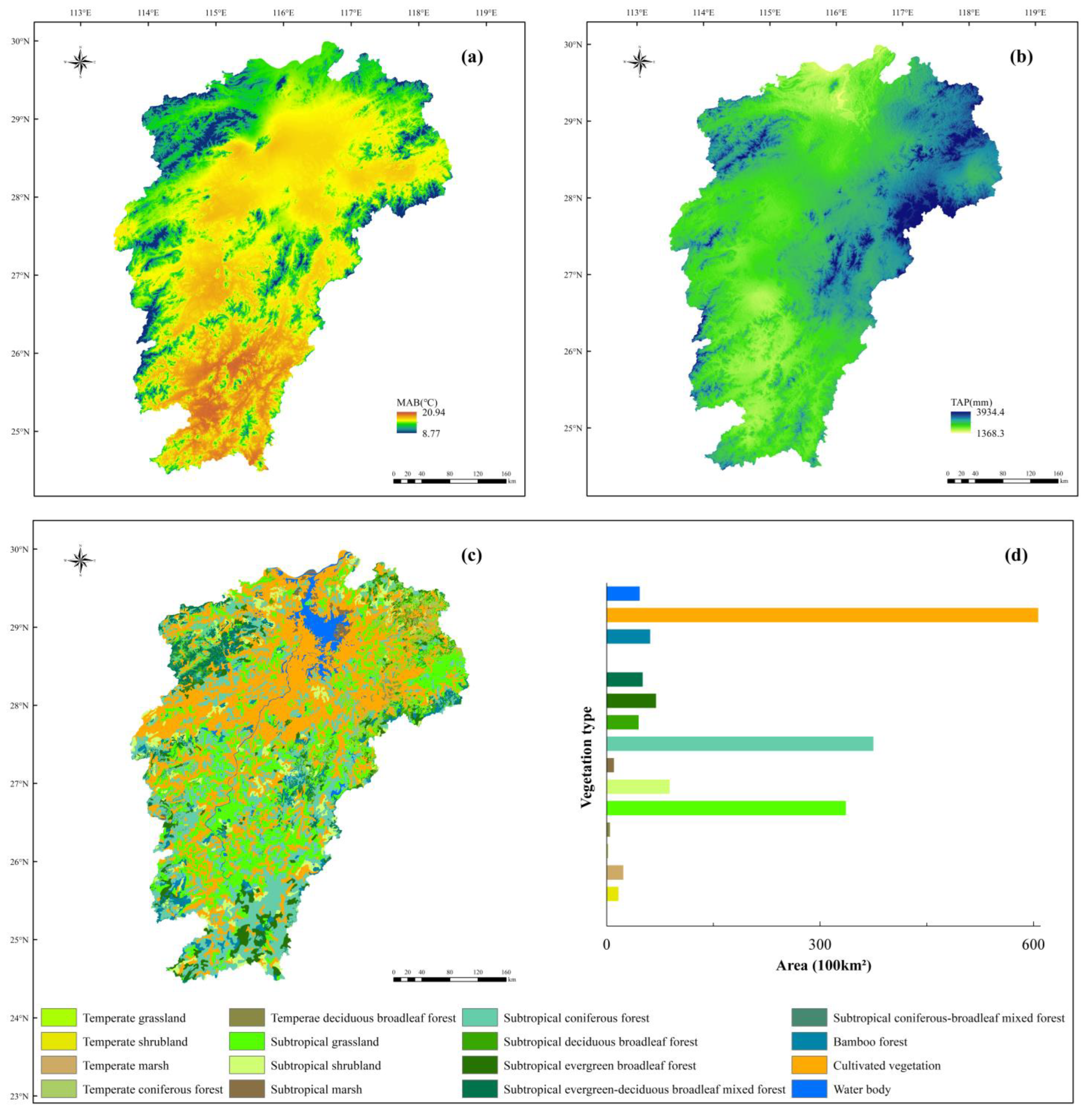
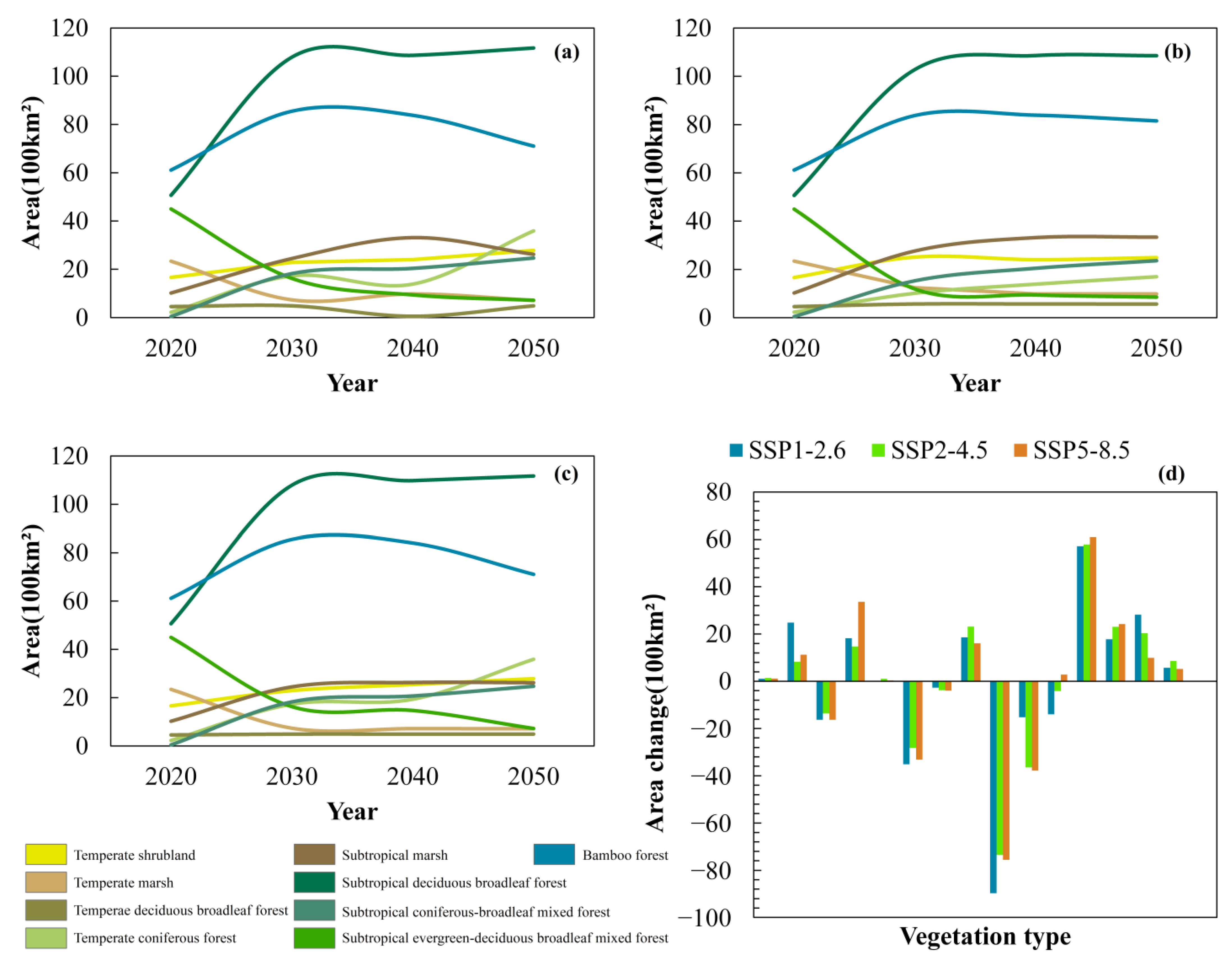
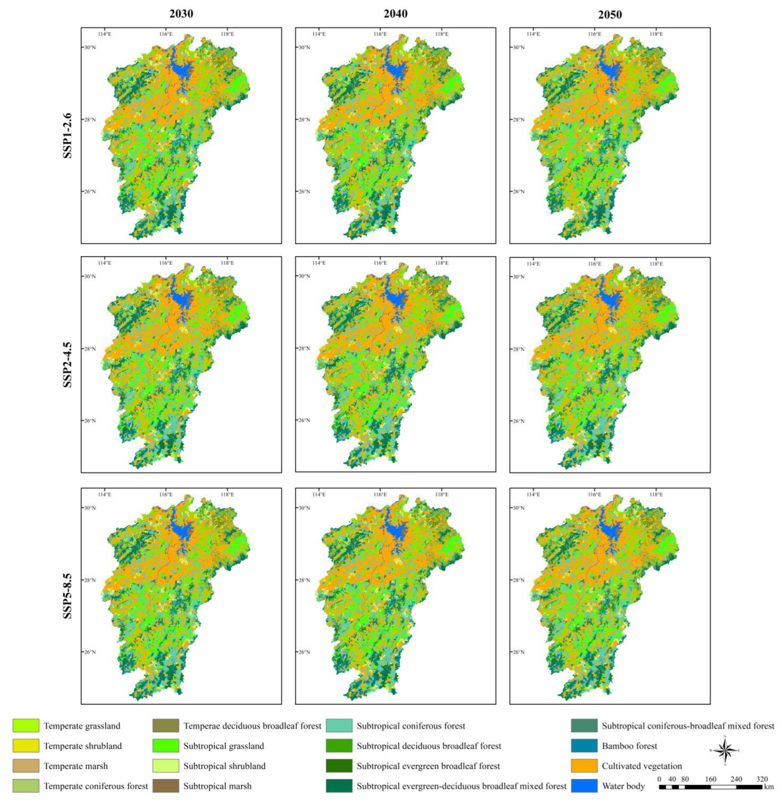
Climate change has significantly altered plant habitats within the Earth’s surface system, reshaping the global distribution and succession of vegetation. The spatiotemporal simulation of vegetation dynamics is essential for effective ecosystem management and conservation at regional scales. In this study, an improved method is developed to analyze the vegetation patterns and scenarios in the Poyang Lake basin, based on the High-Accuracy Surface Modeling (HASM) method and the improved Holdridge Life Zone (HLZ) ecosystem model. HASM is applied to generate high-resolution (250 m × 250 m) spatial grid data for key climate parameters, including mean annual biotemperature (MAB), total annual precipitation (TAP), and potential evapotranspiration ratio (PER), for each decade from 1961 to 2050. The distribution thresholds of vegetation types are calculated based on current vegetation data, MAB, TAP, PER, longitude, latitude, and elevation datasets. In the improved HLZ ecosystem model, the classification parameters of vegetation types have been expanded from three to six. The simulation results indicate that cultivated vegetation, subtropical coniferous forest, and subtropical grassland are the dominant vegetation types, accounting for 75.88% of the total area. Between 2020 and 2050, subtropical coniferous forest is projected to experience the greatest decrease in area, shrinking by an average of 2.65 × 10³ km2 per decade. In contrast, subtropical evergreen–deciduous broadleaf mixed forest is expected to undergo the largest increase, expanding by an average of 1.96 × 10³ km2 per decade. Vegetation types in high-altitude regions exhibit the most rapid changes, with an average decadal variation of 15.26%, whereas low-altitude regions show relatively slower changes, averaging 0.52% per decade. Overall, subtropical grassland, subtropical coniferous forest, and subtropical evergreen–deciduous broadleaf mixed forest in the Poyang Lake basin demonstrate high sensitivity to projected climate change scenarios.
Keywords: vegetation type; spatial pattern; dynamic change; climate change; scenario analysis vegetation type; spatial pattern; dynamic change; climate change; scenario analysis