Article

Unoccupied-Aerial-Systems-Based Biophysical Analysis of Montmorency Cherry Orchards: A Comparative Study


by
Grayson R. Morgan
* and
Lane Stevenson
Department of Geography, Brigham Young University, Provo, UT 84602, USA
*
Author to whom correspondence should be addressed.
Drones 2024, 8(9), 494; https://doi.org/10.3390/drones8090494
Submission received: 31 August 2024 / Revised: 10 September 2024 / Accepted: 17 September 2024 / Published: 18 September 2024
(This article belongs to the Special Issue Recent Advances in Crop Protection Using UAV and UGV)

Abstract

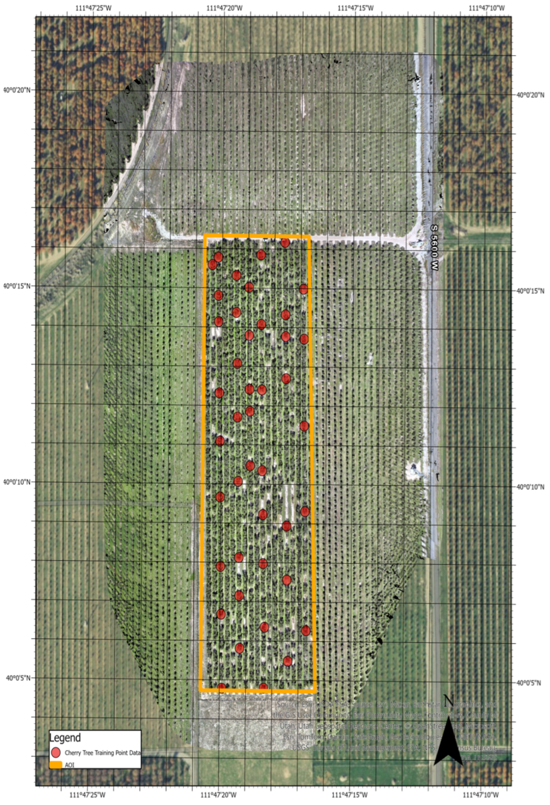
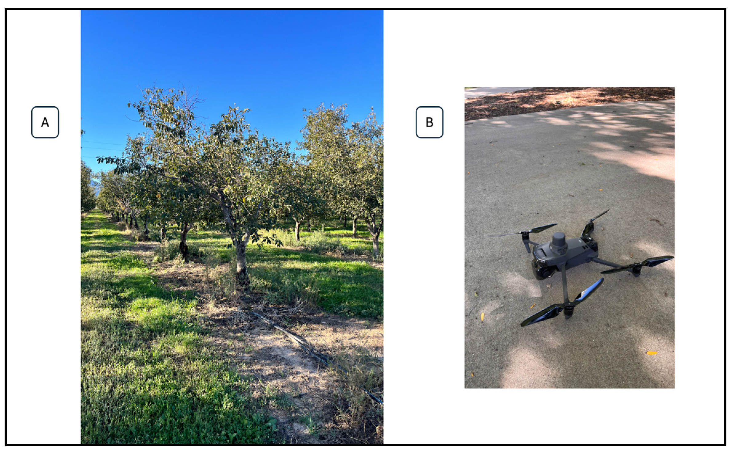
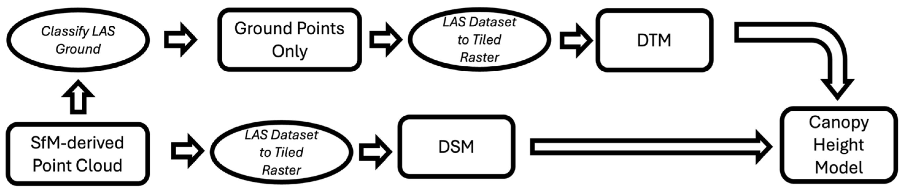
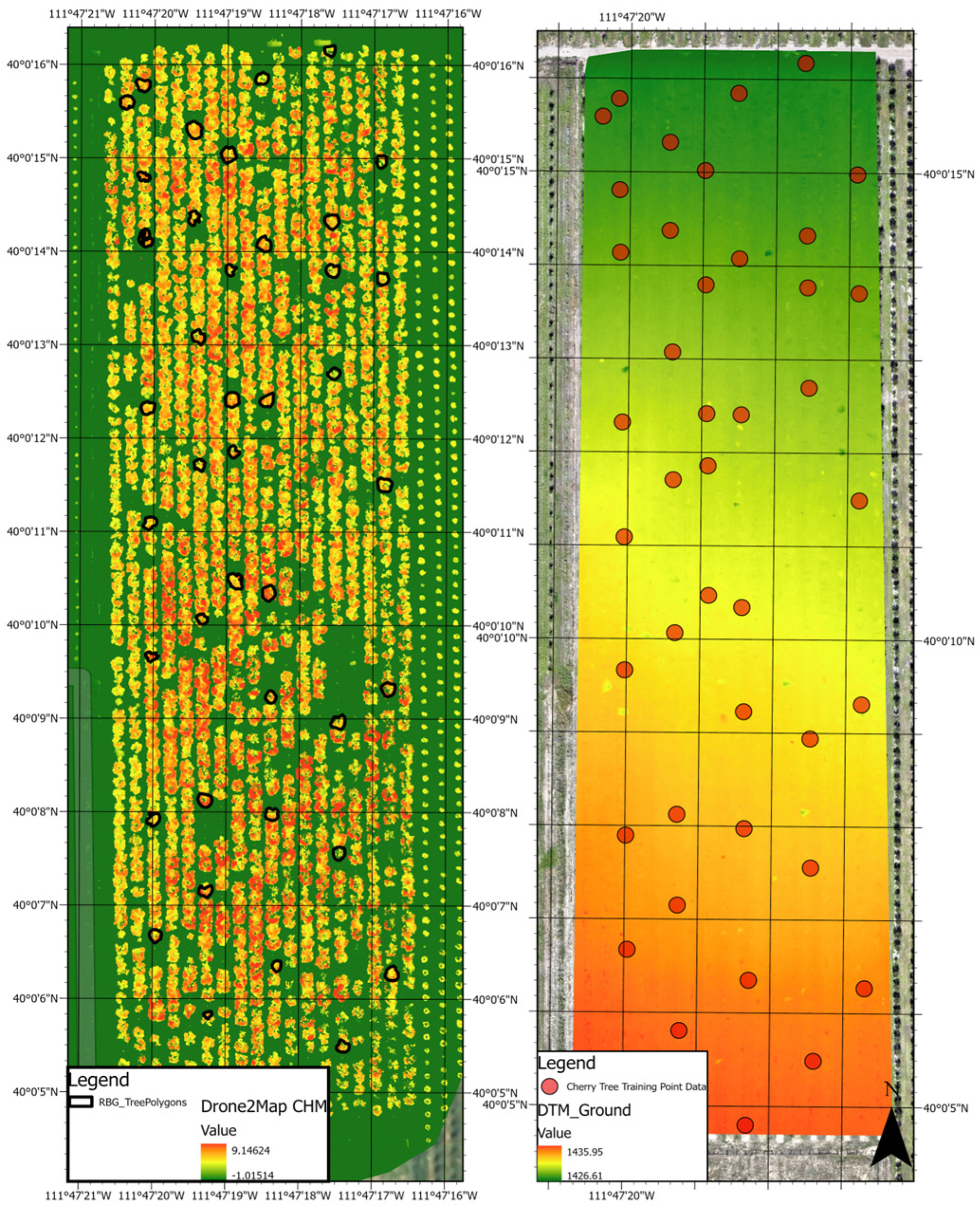
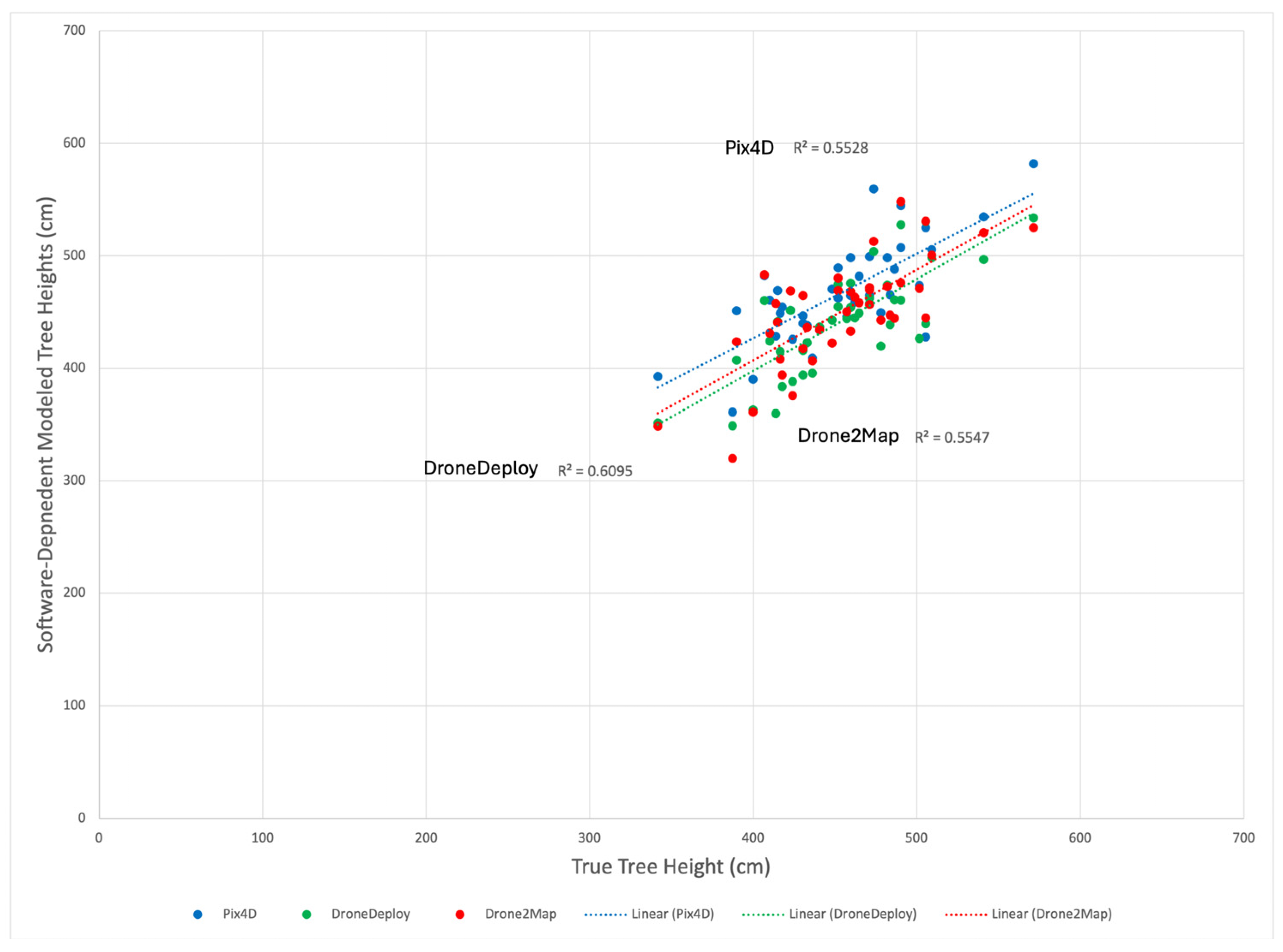
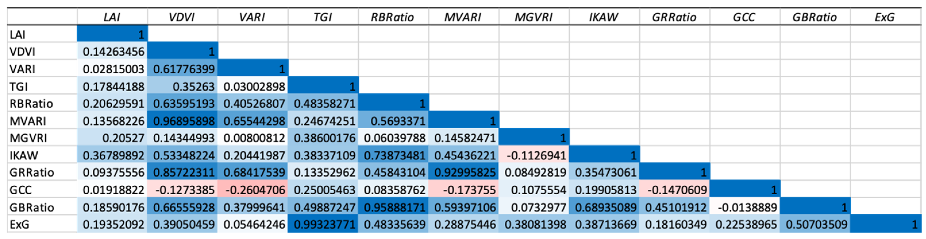
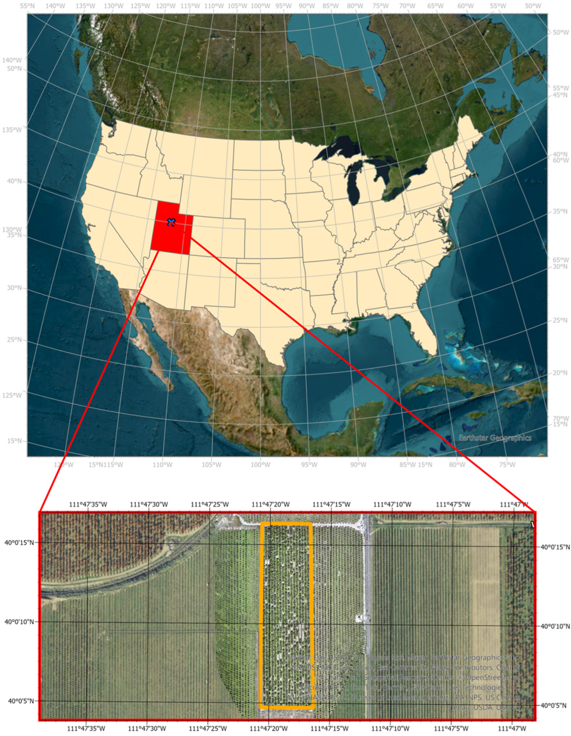
With the global population on the rise and arable land diminishing, the need for sustainable and precision agriculture has become increasingly important. This study explores the application of unoccupied aerial systems (UAS) in precision agriculture, specifically focusing on Montmorency cherry orchards in Payson, Utah. Despite the widespread use of UAS for various crops, there is a notable gap in research concerning cherry orchards, which present unique challenges due to their physical structure. UAS data were gathered using an RTK-enabled DJI Mavic 3M, equipped with both RGB and multispectral cameras, to capture high-resolution imagery. This research investigates two primary applications of UAS in cherry orchards: tree height mapping and crop health assessment. We also evaluate the accuracy of tree height measurements derived from three UAS data processing software packages: Pix4D, Drone2Map, and DroneDeploy. Our results indicated that DroneDeploy provided the closest relationship to ground truth data with an R2 of 0.61 and an RMSE of 31.83 cm, while Pix4D showed the lowest accuracy. Furthermore, we examined the efficacy of RGB-based vegetation indices in predicting leaf area index (LAI), a key indicator of crop health, in the absence of more expensive multispectral sensors. Twelve RGB-based indices were tested for their correlation with LAI, with the IKAW index showing the strongest correlation (R = 0.36). However, the overall explanatory power of these indices was limited, with an R2 of 0.135 in the best-fitting model. Despite the promising results for tree height estimation, the correlation between RGB-based indices and LAI was underwhelming, suggesting the need for further research.
Keywords: UAS; drones; agriculture; precision agriculture; remote sensing; orchards; cherry; fruit UAS; drones; agriculture; precision agriculture; remote sensing; orchards; cherry; fruit