Article

A One-Dimensional Blocking Index Becomes Two-Dimensional Using GIS Technology

1
Atmospheric Science Program, School of Natural Resources, Missouri Climate Center, University of Missouri, Columbia, MO 65211, USA
2
Department of Meteorological Engineering, University of Samsun, 19 Mayis, Samsun 55420, Turkey
*
Author to whom correspondence should be addressed.
Submission received: 28 December 2022 / Revised: 16 March 2023 / Accepted: 21 March 2023 / Published: 3 April 2023
(This article belongs to the Section Computer Science, Mathematics and AI)

Abstract

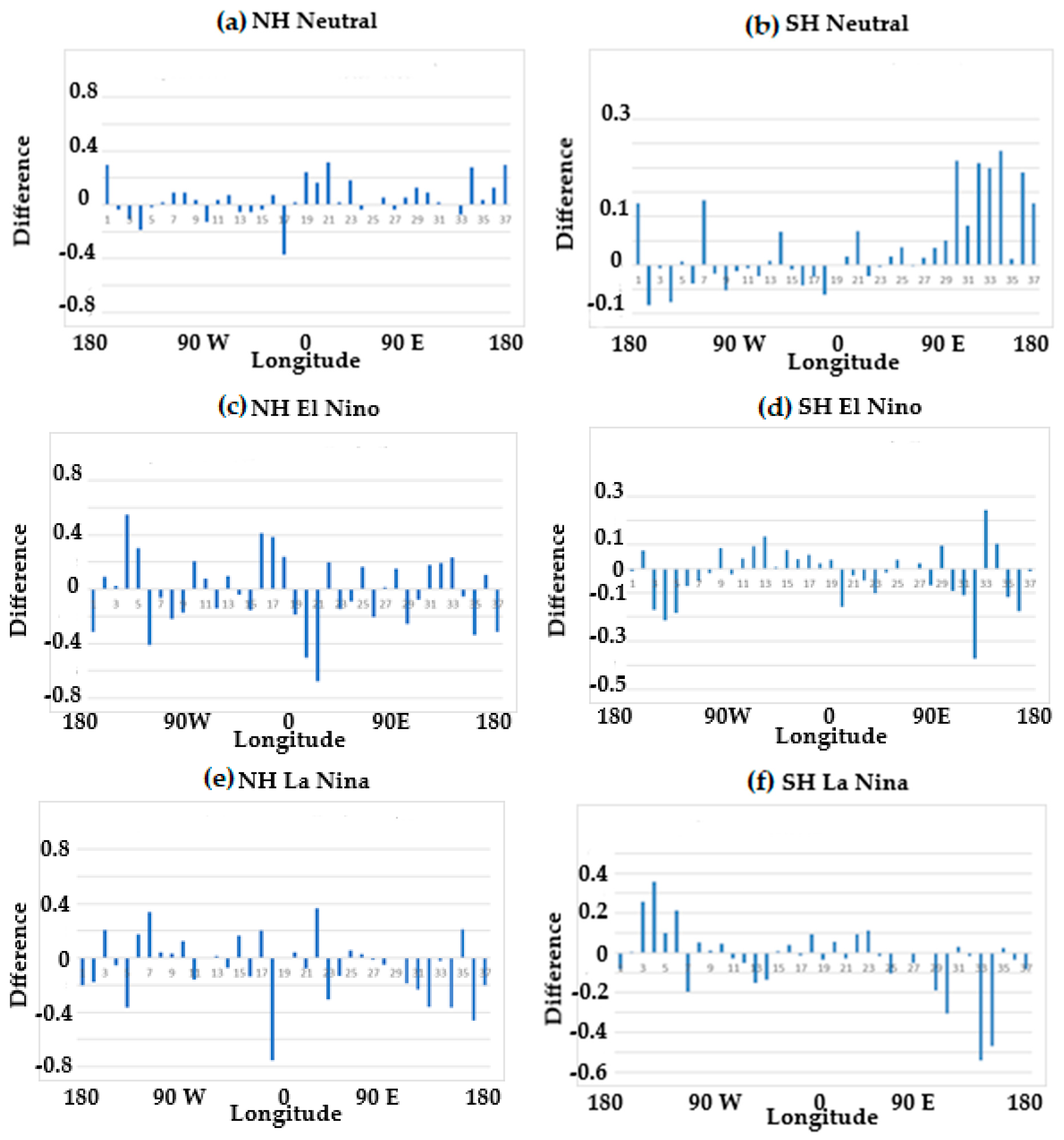
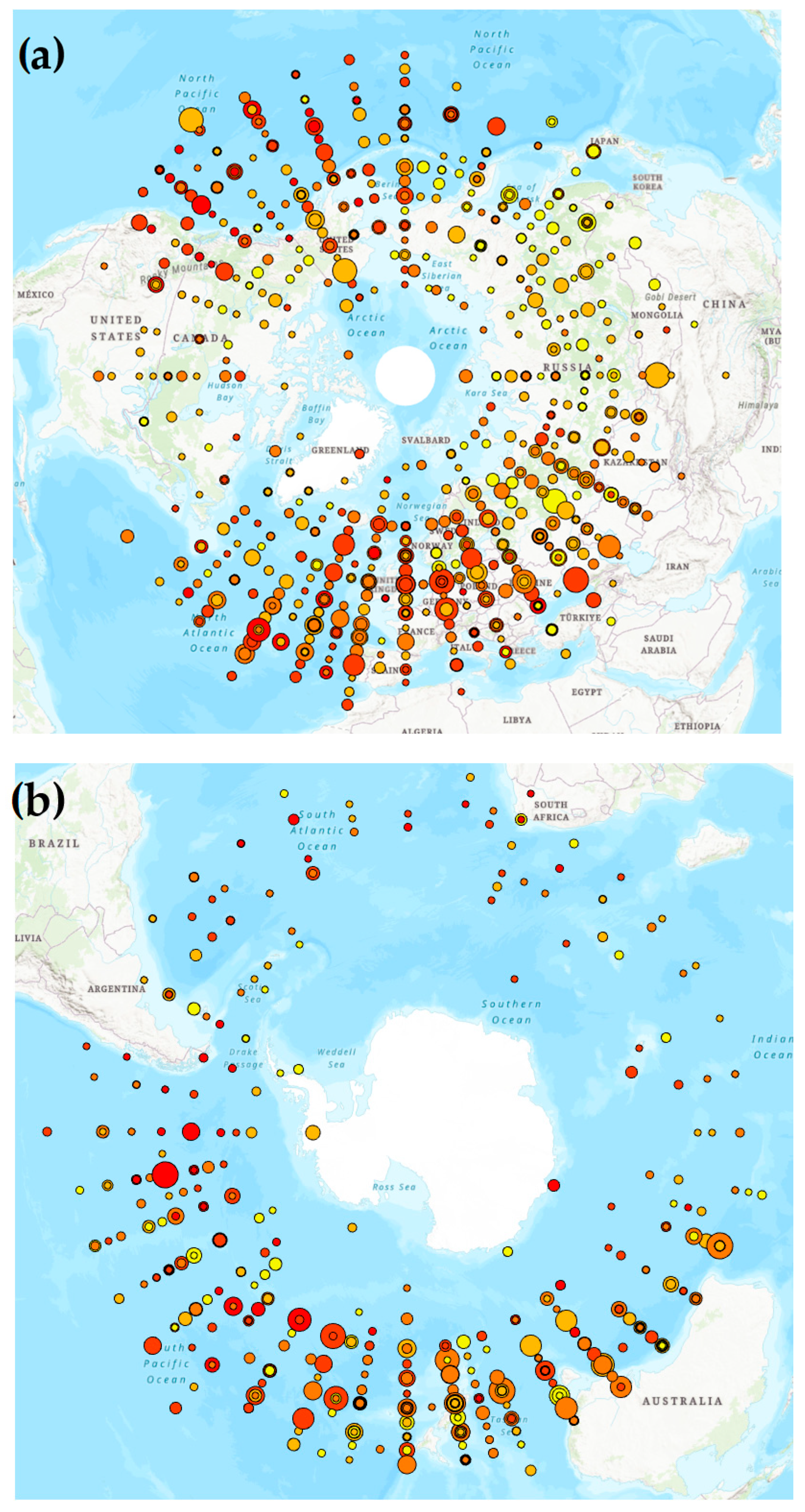
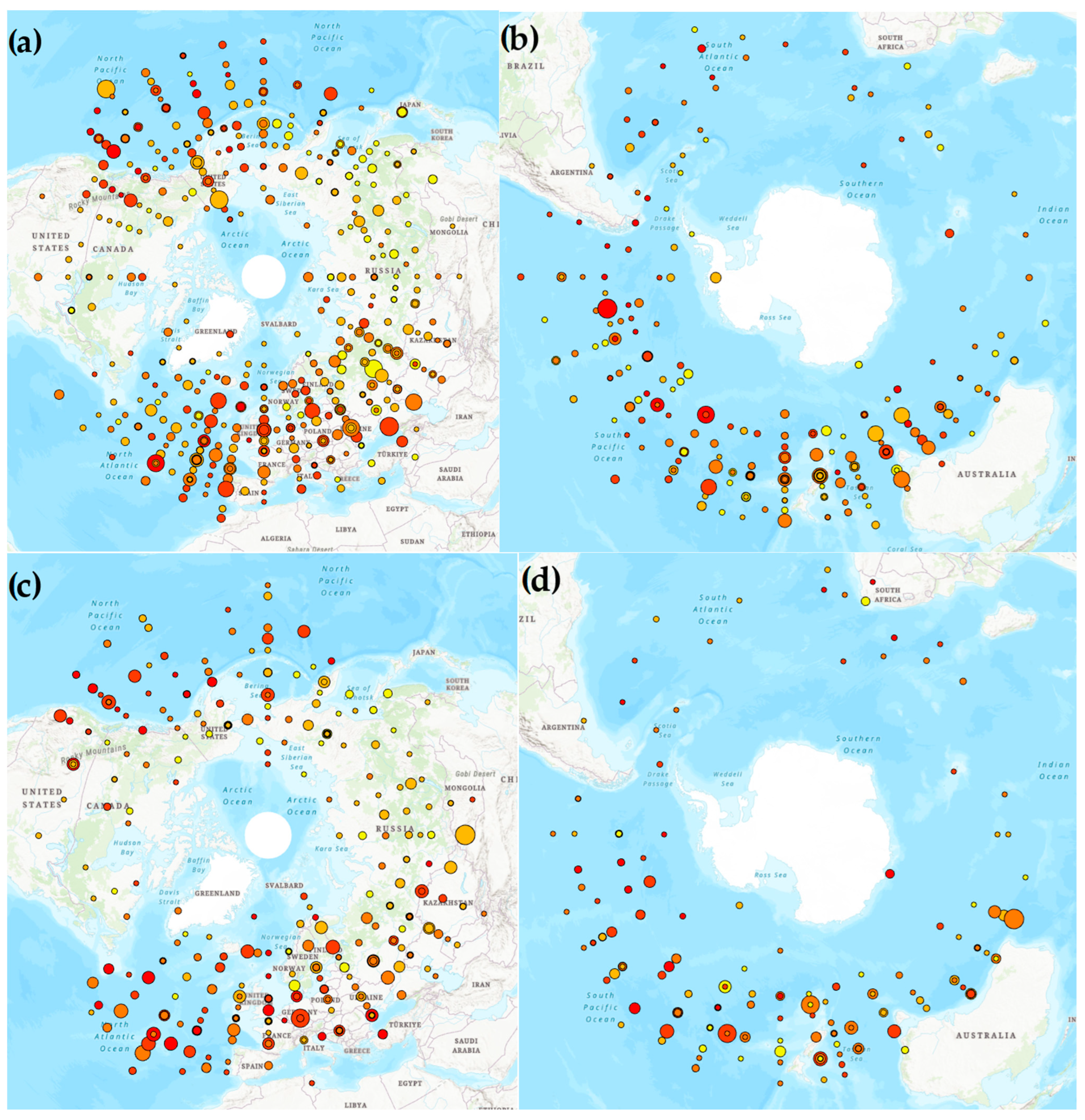
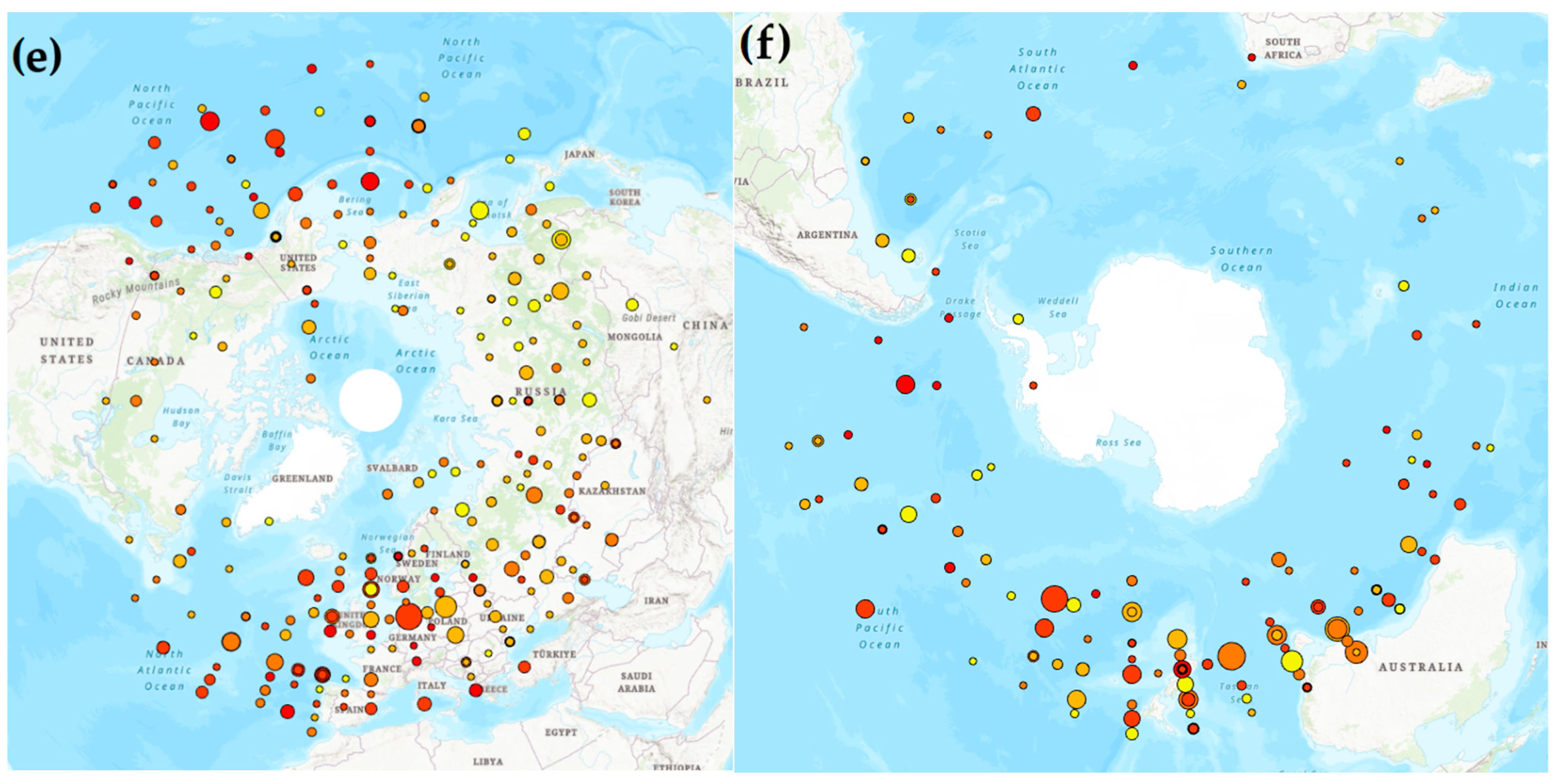
Many previous studies of the occurrence of blocking anticyclones, their characteristics, and dynamics have defined the onset longitude using the one-dimensional zonal index type criterion proposed by Lejenas and Okland. In addition to examining the blocking event itself, the onset longitude was determined to start at the nearest five degrees longitude using the National Centers for Environmental Prediction/National Center for Atmospheric Research Reanalyses that were used to identify the events. In this study, each blocking event in the University of Missouri Blocking Archive was re-examined to identify an onset latitude, and this information was added to the archive. The events were then plotted and displayed on a map of the Northern or Southern Hemisphere using Geographic Information System (GIS) software housed at the University of Missouri as different colored and sized dots according to block intensity and duration, respectively. This allowed for a comparison of blocking events in the archive above to studies that used a two-dimensional index. Then the common onset regions were divided by phase of the El Nino and Southern Oscillation (ENSO), and the typical onset of intense and persistent blocking events could be examined. The results found a favorable comparison between the onset regions identified here and those found in previous studies that used a two-dimensional blocking index. Additionally, there was variability identified in the onset regions of blocking in both hemispheres by ENSO phase, including the location of more intense and persistent events.
Keywords: blocking onset; GIS software; EL Nino and Southern Oscillation; block intensity; block persistence; two-dimensional blocking onset; GIS software; EL Nino and Southern Oscillation; block intensity; block persistence; two-dimensional