Article

Aggregated Epidemic Localization and Spatiotemporal Diffusion Modeling Considering Road Network-Constrained Spatial Clustering and Tensor Field Analysis: A Case Study of COVID-19

1
School of Big Data, Liaoning Finance & Trade College, Huludao 125105, China
2
Henan Guodou Data Information Technology Co., Ltd., Zhengzhou 450000, China
3
College of Information Systems Engineering, University of Information Engineering, Zhengzhou 450000, China
4
Gree Electric Appliances, Inc. of Zhuhai, Zhuhai 519070, China
*
Author to whom correspondence should be addressed.
ISPRS Int. J. Geo-Inf. 2026, 15(9), 429; https://doi.org/10.3390/ijgi15090429 (registering DOI)
Submission received: 10 June 2026 / Revised: 13 September 2026 / Accepted: 17 September 2026 / Published: 20 September 2026

Abstract

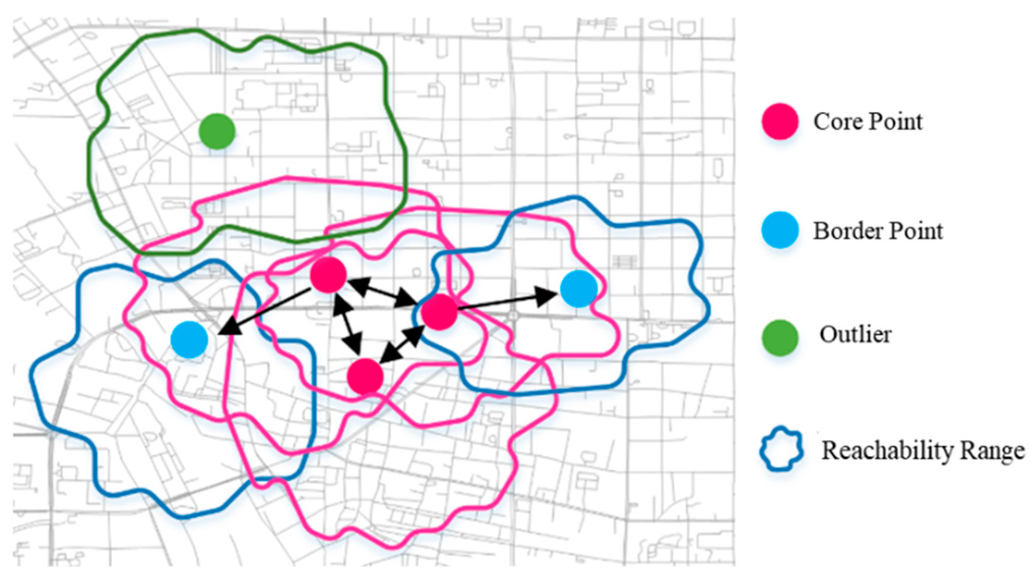
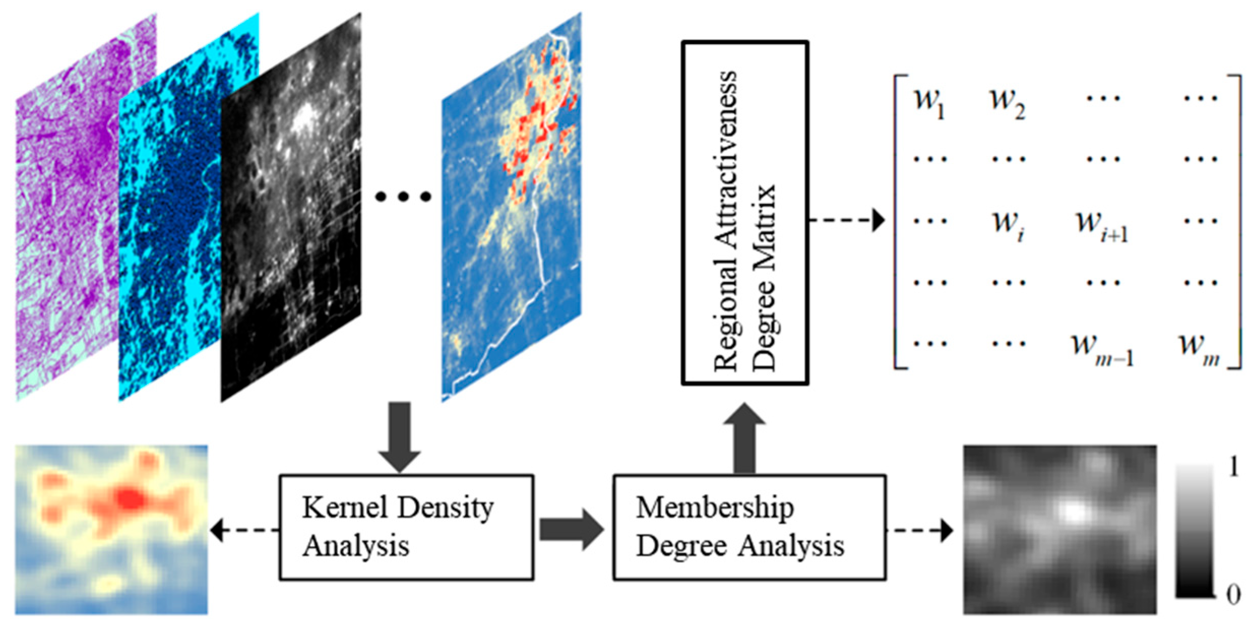
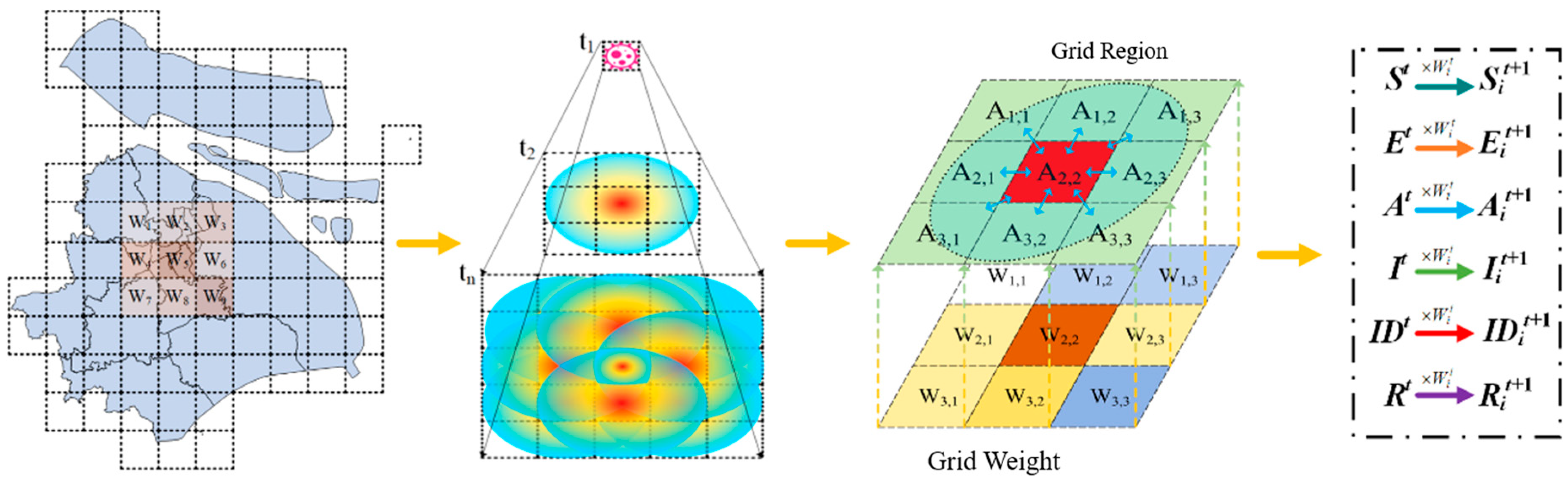
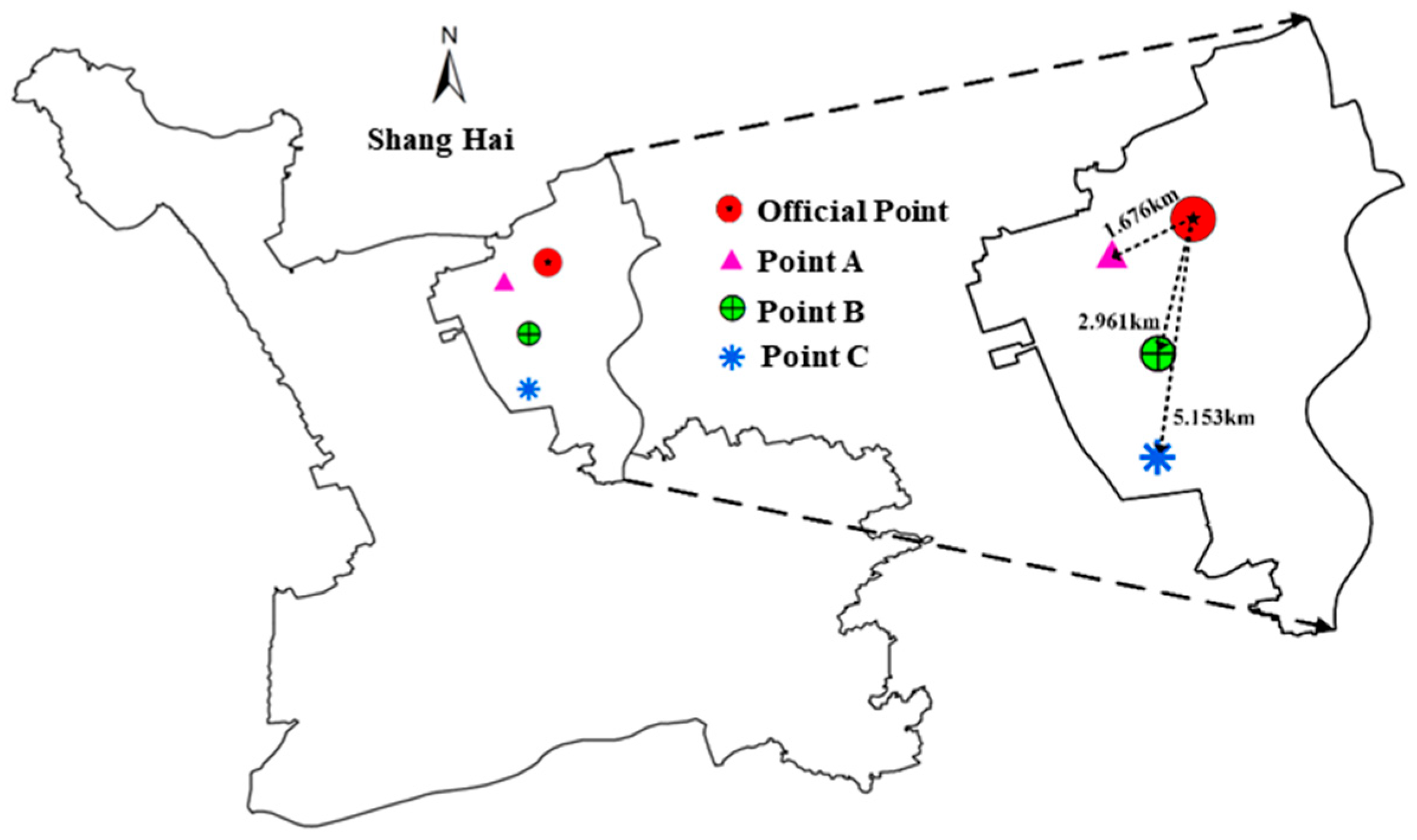
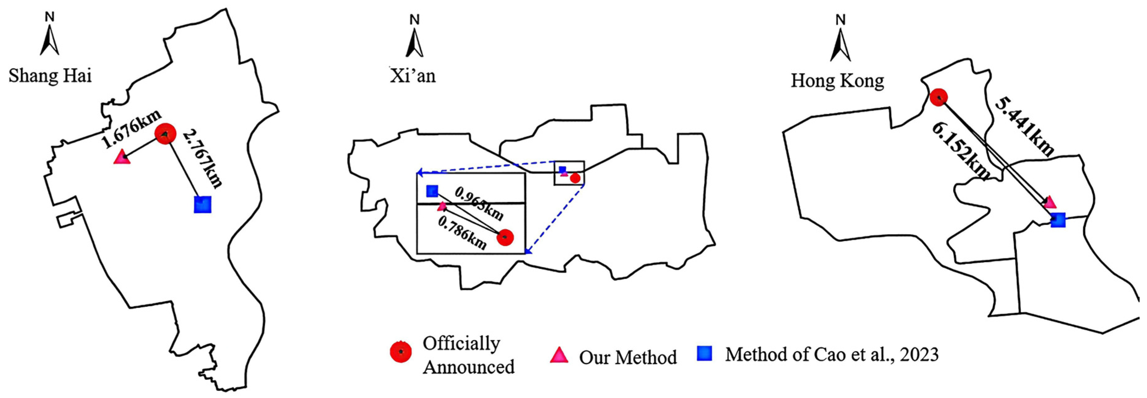
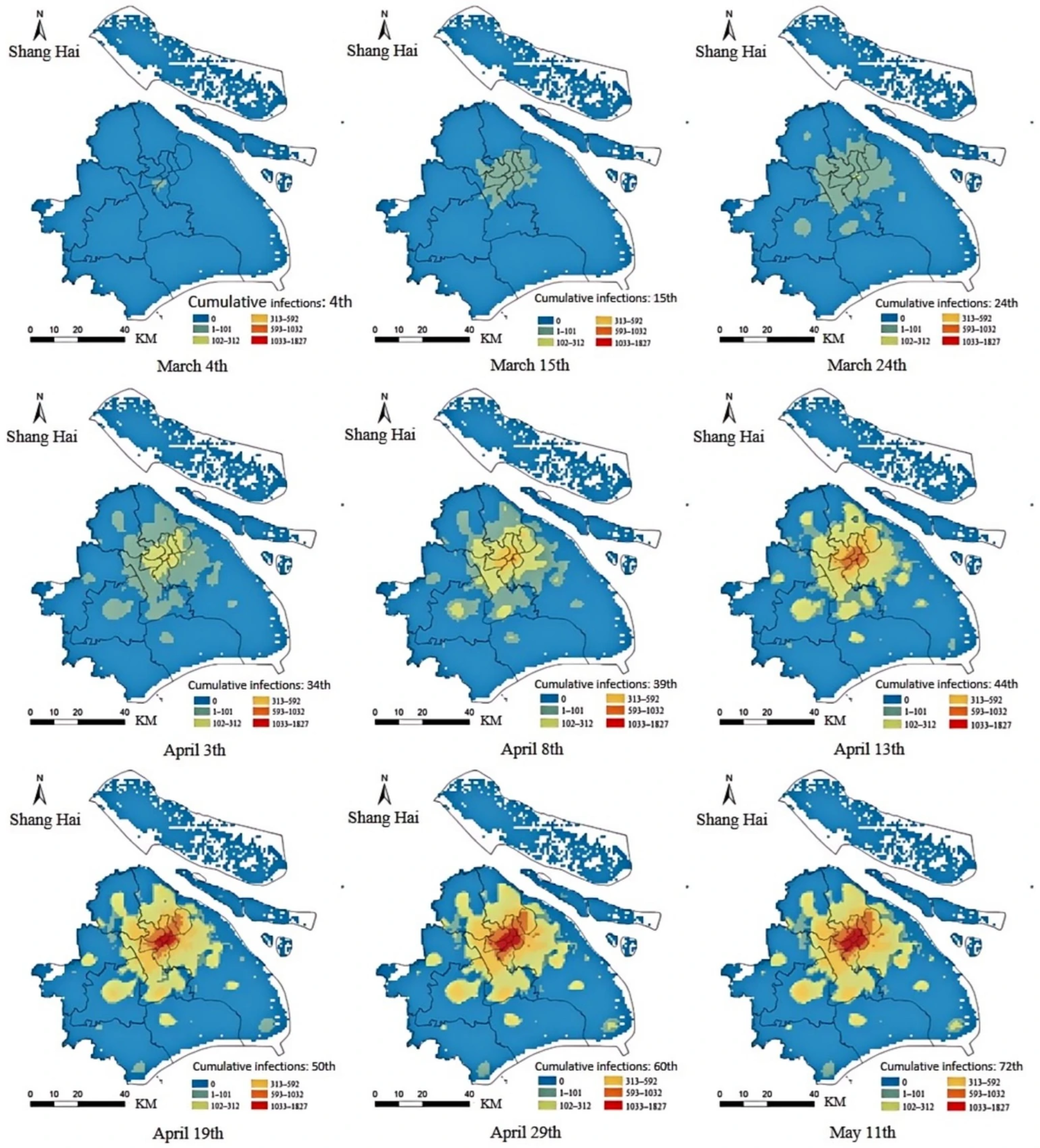
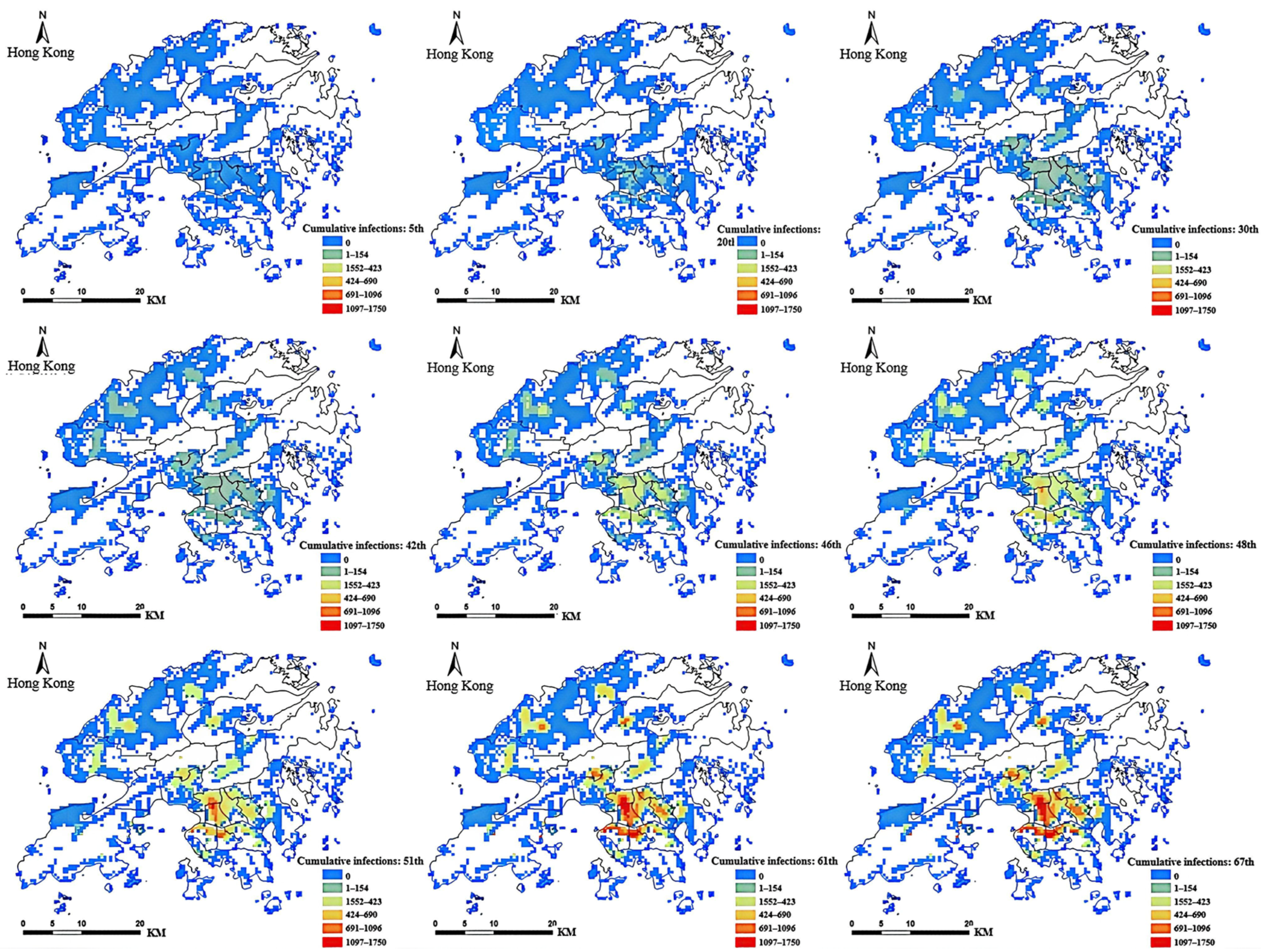
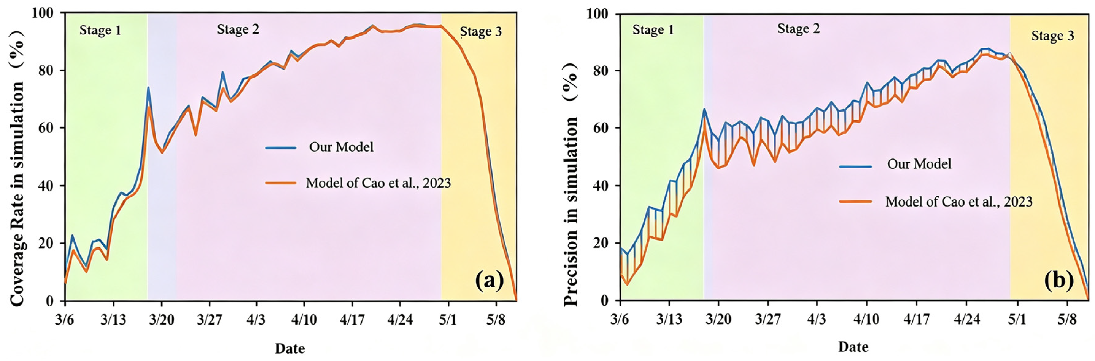
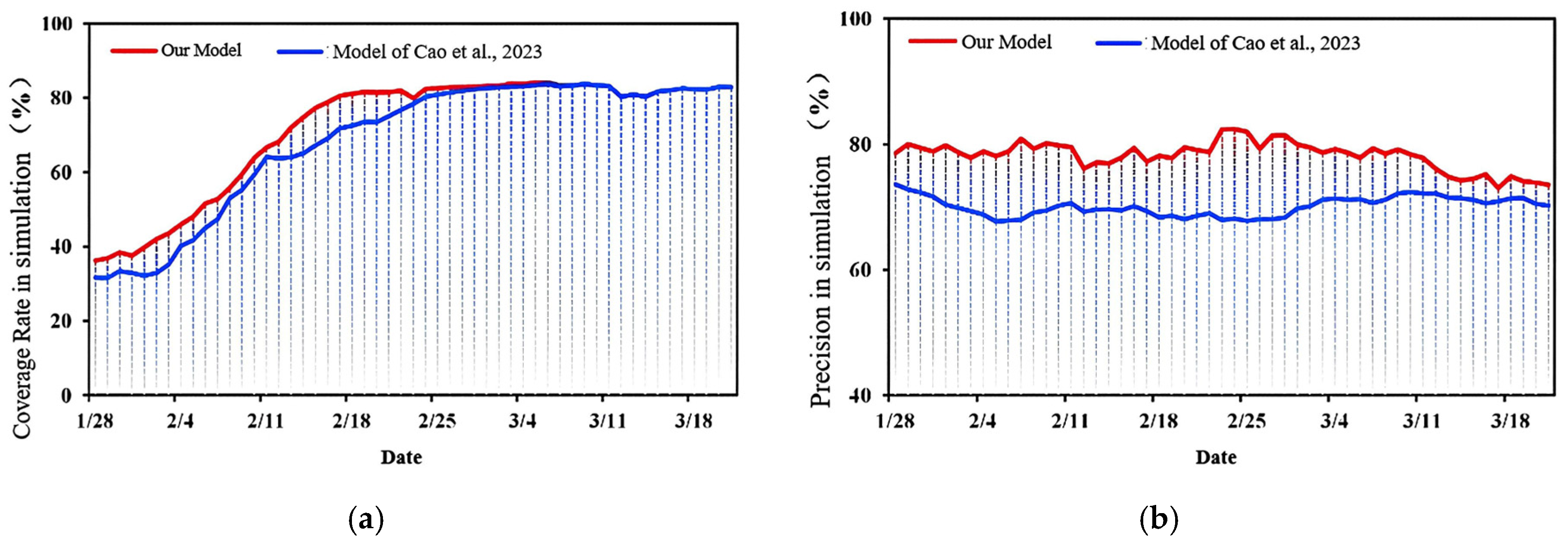
Aggregated epidemics, characterized by rapid transmission over short periods, pose severe threats to public health security, necessitating the development of precise source tracing and simulation methods to support efficient prevention and control. However, existing studies suffer from three major gaps: (1) predominant focus on national/regional scales with limited urban-scale analysis; (2) reliance on proprietary mobile data that are often inaccessible; and (3) NP-hard computational complexity in traditional source tracing methods. To bridge these gaps, this paper proposes an integrated spatiotemporal diffusion model comprising two core components: outbreak point estimation and spatial diffusion simulation. The model first uses the SEAIR infectious disease dynamics model to predict trends, combines the 3-Sigma criterion and viral incubation period to screen early epidemiological survey data, employs a road network-constrained DBSCAN algorithm for spatial clustering, and locates the outbreak point via an improved inverse distance weighting method incorporating time and POI density weights. Subsequently, using the estimated outbreak point as the initial transmission center, and based on the “cell-type” living structure hypothesis of populations, it fuses multi-source geographic data to quantify regional attractiveness and simulate viral diffusion in grid space. The model is validated using COVID-19 epidemic data from Xi’an, Shanghai, and the Hong Kong Special Administrative Region of China. Results show that the proposed outbreak point estimation method effectively estimates the initial transmission center, with distances between estimated points and officially announced points of 0.786 km, 1.676 km, and 5.441 km, respectively—shortened by 179 m, 1091 m, and 711 m compared to related studies. The spatiotemporal diffusion model effectively simulates daily incidence patterns, achieving average coverage rates of 67.32% and 72.9% and average precision rates of 60.67% and 78.84% in Shanghai and Hong Kong, respectively, with significantly better simulation accuracy than traditional methods in the early and middle stages of the epidemic. This study provides a scientifically robust, data-parsimonious framework for precise source tracing, early warning, and resource allocation in urban epidemics, with strong generalizability to other resource-limited settings.
Keywords: outbreak point estimation; road network-constrained clustering; spatiotemporal diffusion model outbreak point estimation; road network-constrained clustering; spatiotemporal diffusion model