Article

A Time Series Investigation to Assess Climate Change and Anthropogenic Impacts on Quantitative Land Degradation in the North Delta, Egypt


by
Mohamed A. E. AbdelRahman
1,*,
Ahmed A. Afifi
2 and
Antonio Scopa
3
1
Division of Environmental Studies and Land Use, National Authority for Remote Sensing and Space Sciences (NARSS), Cairo 11769, Egypt
2
Soils and Water Use Department, National Research Centre, Giza 12622, Egypt
3
Scuola di Scienze Agrarie, Forestali, Alimentari ed Ambientali (SAFE), Università degli Studi della Basilicata, Viale dell’Ateneo Lucano, 10, 85100 Potenza, Italy
*
Author to whom correspondence should be addressed.
ISPRS Int. J. Geo-Inf. 2022, 11(1), 30; https://doi.org/10.3390/ijgi11010030
Submission received: 31 October 2021 / Revised: 26 December 2021 / Accepted: 28 December 2021 / Published: 31 December 2021
(This article belongs to the Special Issue Integrating GIS and Remote Sensing in Soil Mapping and Modeling)

Abstract

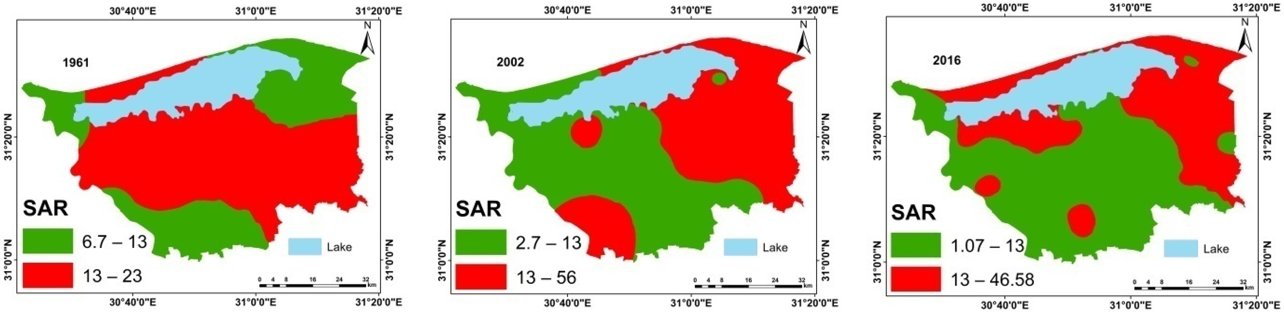
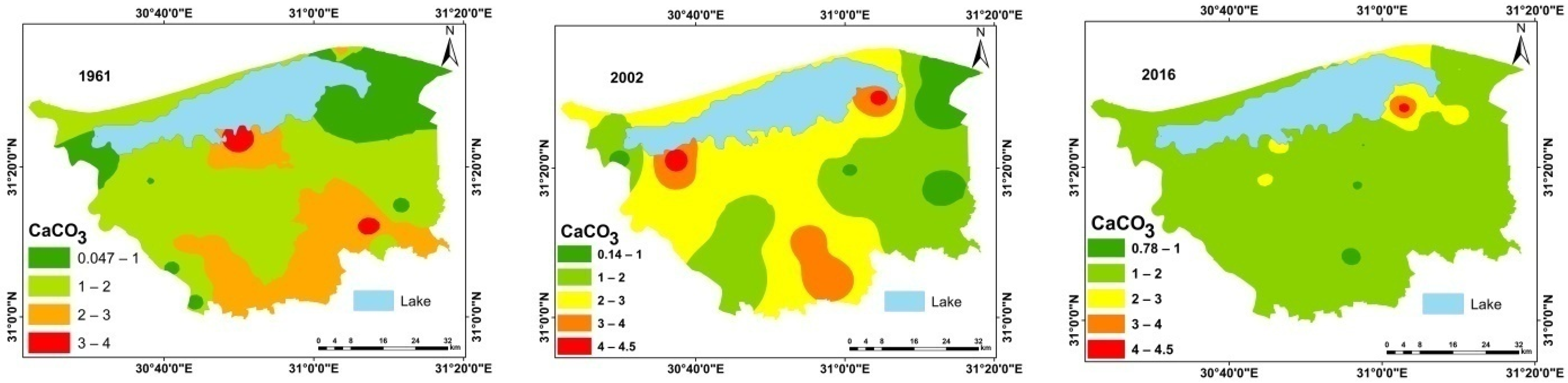
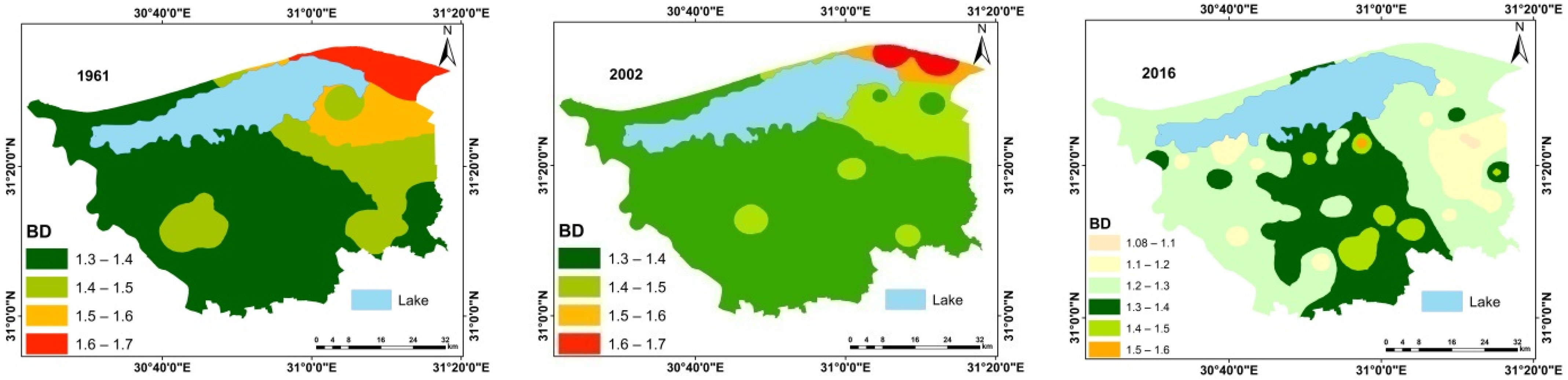
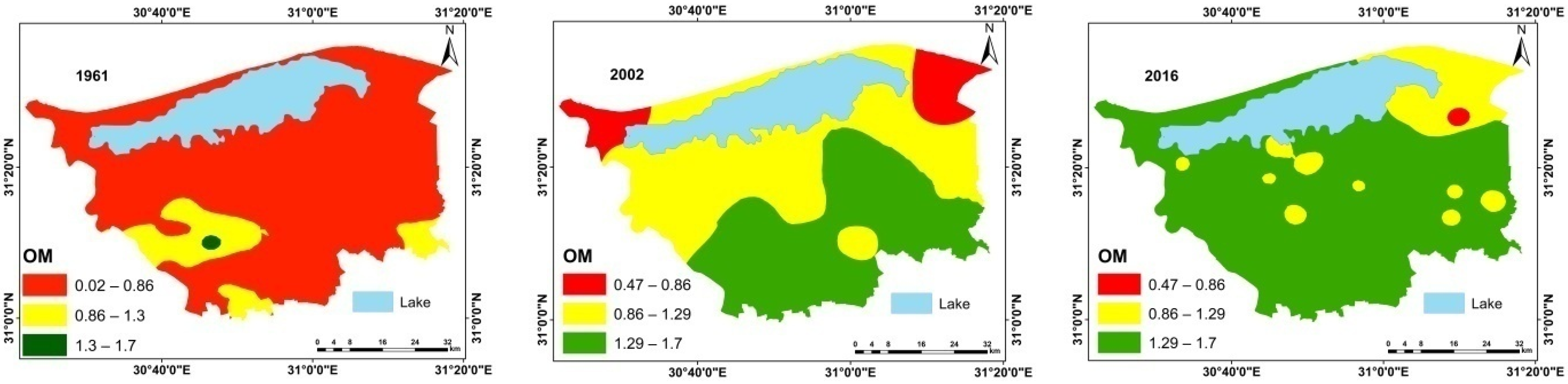
In the current study the processes of soil deterioration over the past five decades was evaluated. Land degradation risk, status, and rate were assessed in Kafr El-Sheikh Governorate, Egypt, in 2016 using OLI and ETM (2002) remote sensing data, and soil data from 1961.A quantitative deterioration was produced based on the comparative study approach in the integrated weighted sum, weighted overlay, and fuzzy model. The parameters used were soil depth, texture, pH, EC, OM, SAR, ESP, CEC, CaCO3, BD, N, P, K. The variables were based on the measurements derived from the Universal Soil Loss Equation (USLE). The results of the implemented USLE in the GIS model-builder revealed the prevalence of severe soil deterioration processes in the region, and include four main deterioration risks: water-logging, soil compaction, salinization, and alkalization. During 2002–2016, soil sealing took place on 36,297.87 ha of the study area (9.7% of the total area). Urban sprawl was one of the most noticed problems that became apparent during the fieldwork during the inventory of land resources in the investigation area. Soil sealing is one of the hidden manifestations of desertification, and it is the implicit explanation for the lost land for the agricultural production process. The study showed that the investigated soil, as a part of north Nile Delta, is a very fragile system that needs to be protected, especially under the effect of climate change in areas overloaded with population, and because of their negative effects on soil properties. According to the results of this study, it is recommended that the same approach be applied to similar agricultural semi-arid regions to help in building a database of land resources for agricultural use that will be very useful for the decision-maker to monitor changes on agricultural lands.
Keywords: climate changes; dynamic land degradation; ArcGIS model builder; remote sensing climate changes; dynamic land degradation; ArcGIS model builder; remote sensing