Article

Multi-Criteria GIS-Based Analysis for Mapping Suitable Sites for Onshore Wind Farms in Southeast France


1
Faculty of Geography and Planning, University of Strasbourg, 3, rue de l’Argonne, 67000 Strasbourg, France
2
Mathematics and Computer Science Research Training Unit, 7, rue René Descartes, 67084 Strasbourg, France
3
Department of Earth Sciences, Faculty of Sciences and Techniques of Tangier, University Abdelmalek Essaadi, Tetouan 93000, Morocco
4
Institute of Applied Technology, Thu Dau Mot University, Thu Dau Mot 75000, Binh Duong Province, Vietnam
5
Remote Sensing Laboratory (2GRNT), Department of Geology, Geoscience, Geotourism, Natural Hazards, Faculty of Sciences Semlalia, University of Cadi Ayyad, BP 2390, Marrakesh 40000, Morocco
*
Author to whom correspondence should be addressed.
Land 2022, 11(10), 1839; https://doi.org/10.3390/land11101839
Submission received: 14 September 2022 / Revised: 13 October 2022 / Accepted: 14 October 2022 / Published: 19 October 2022
(This article belongs to the Special Issue Feature Papers for Land Innovations – Data and Machine Learning)

Abstract

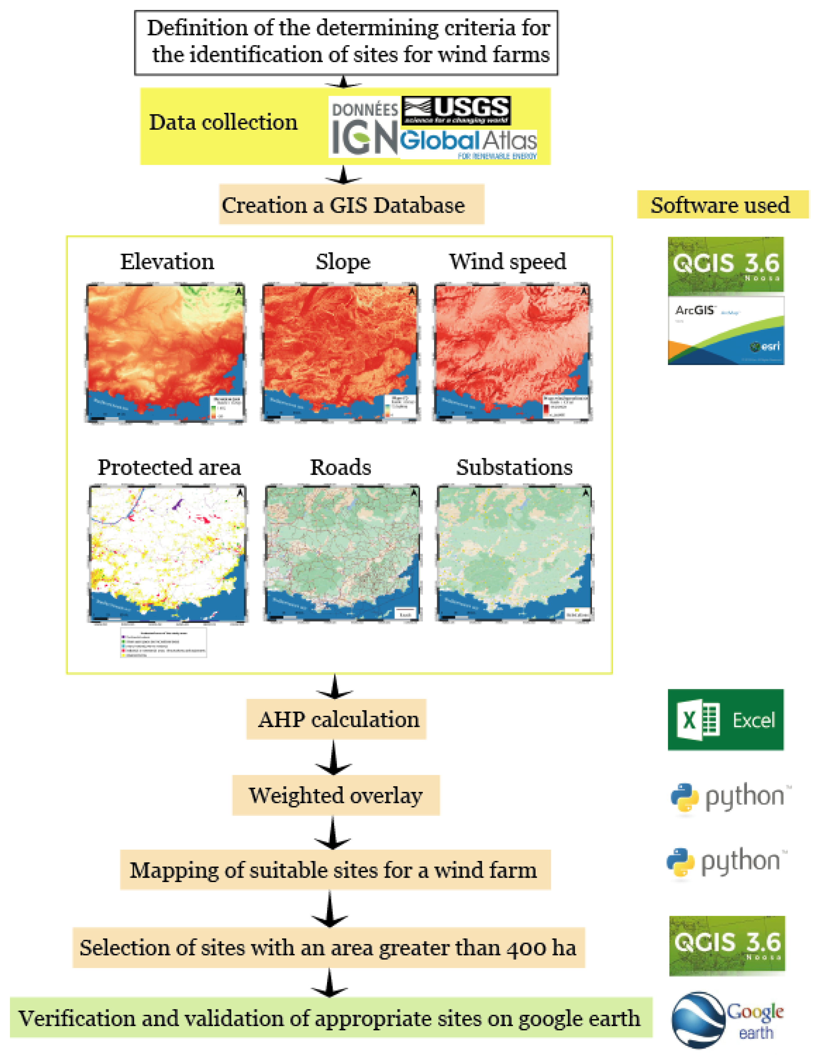
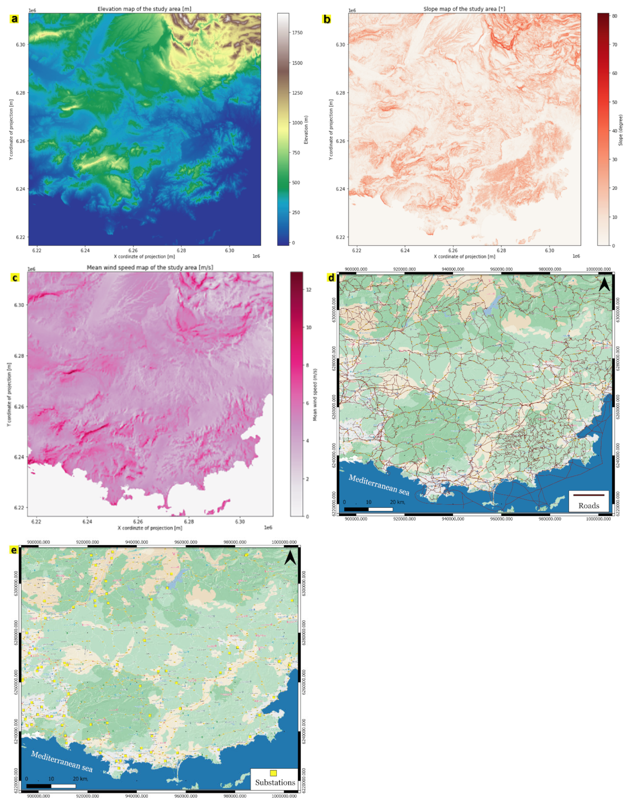
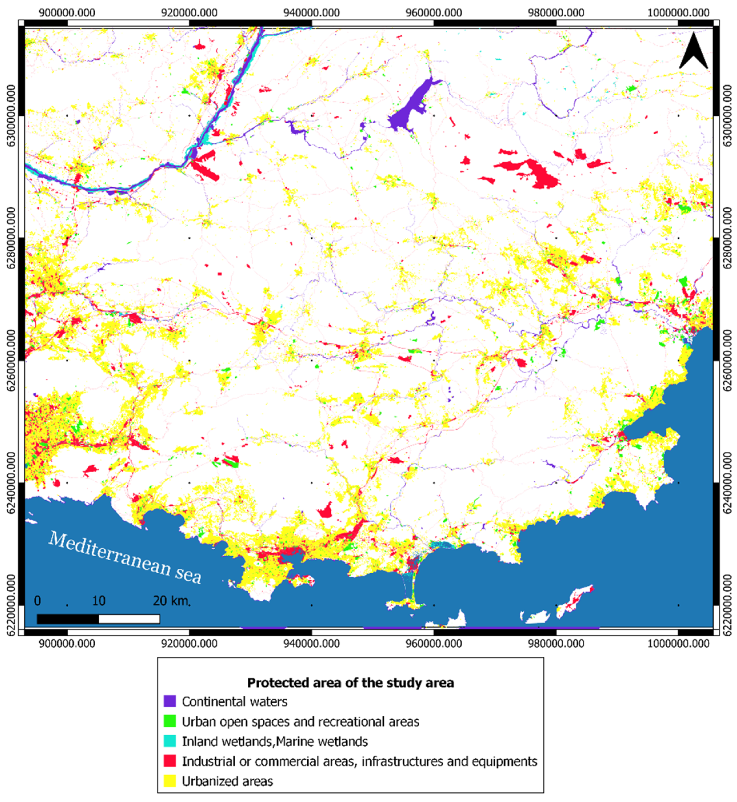
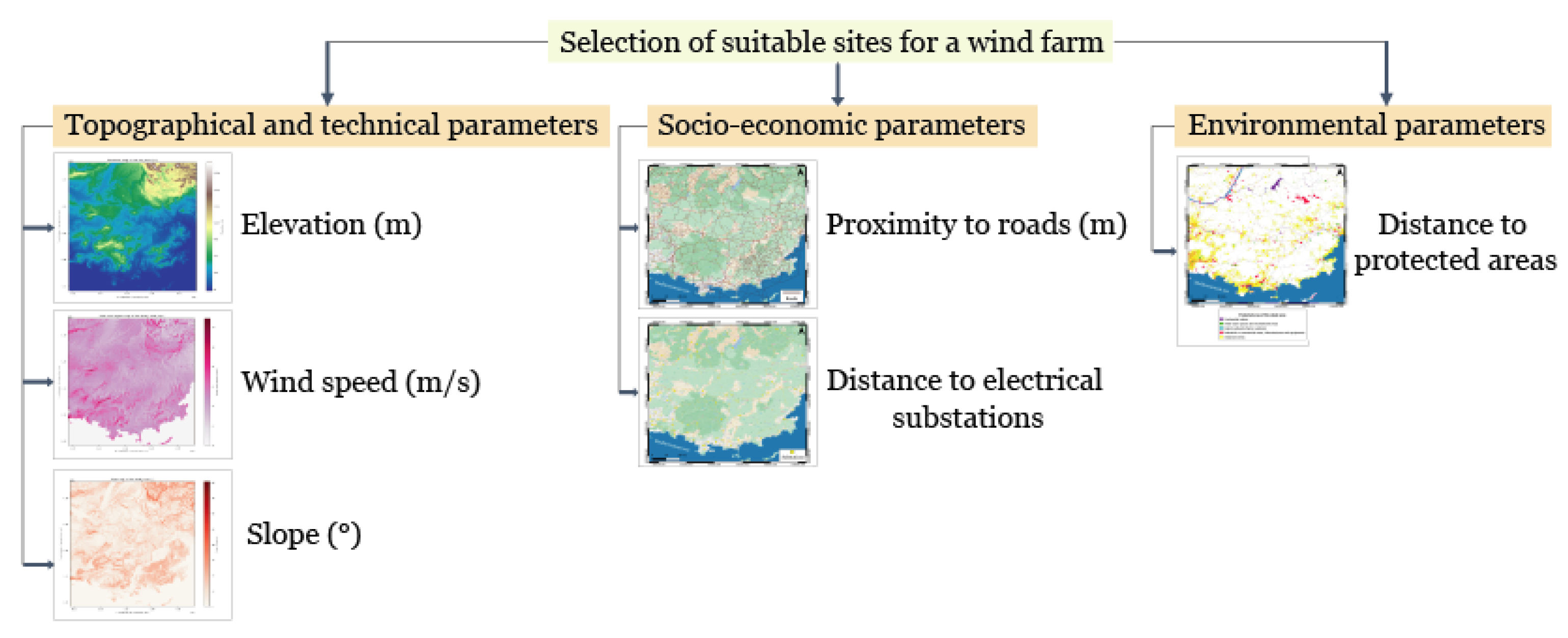
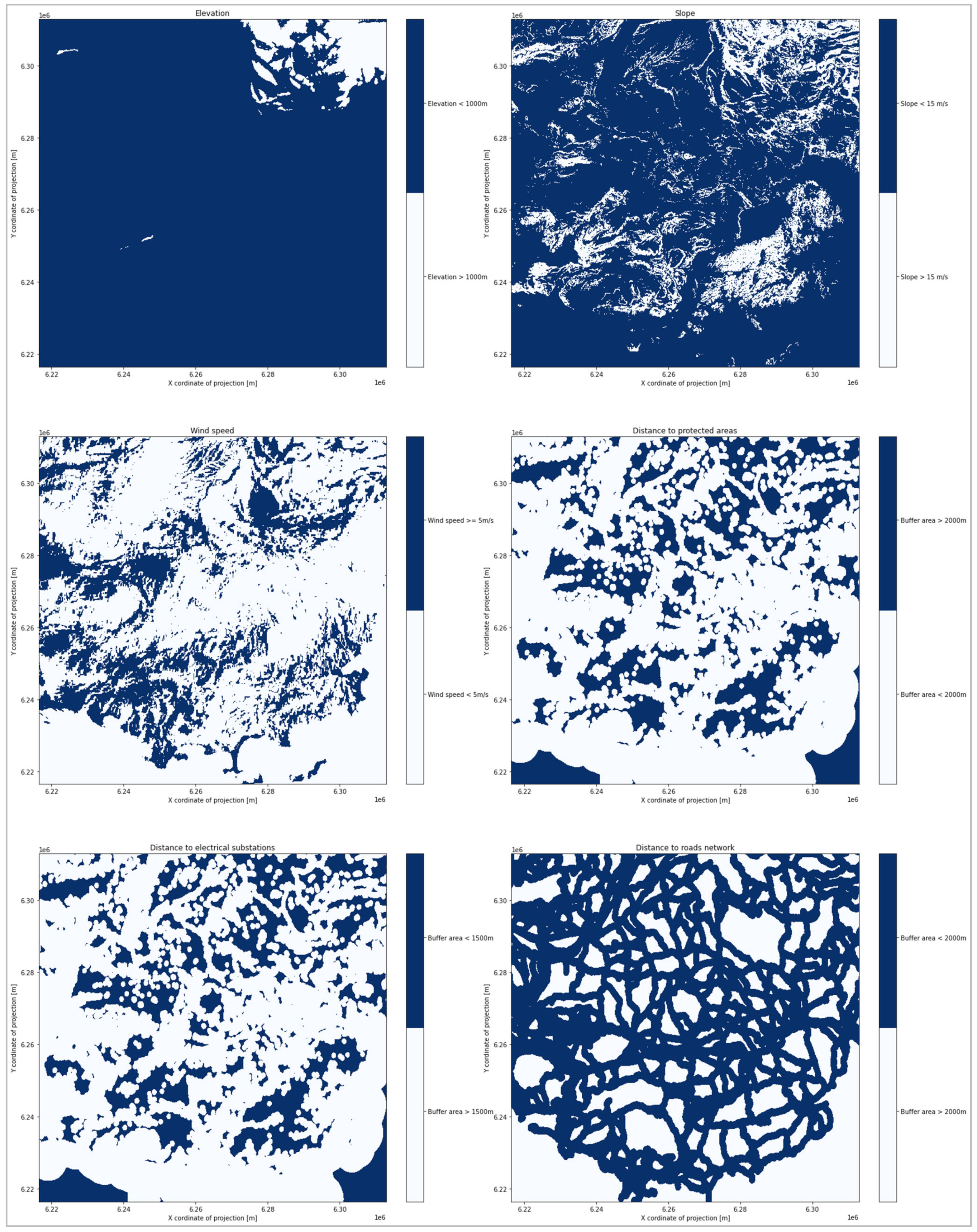
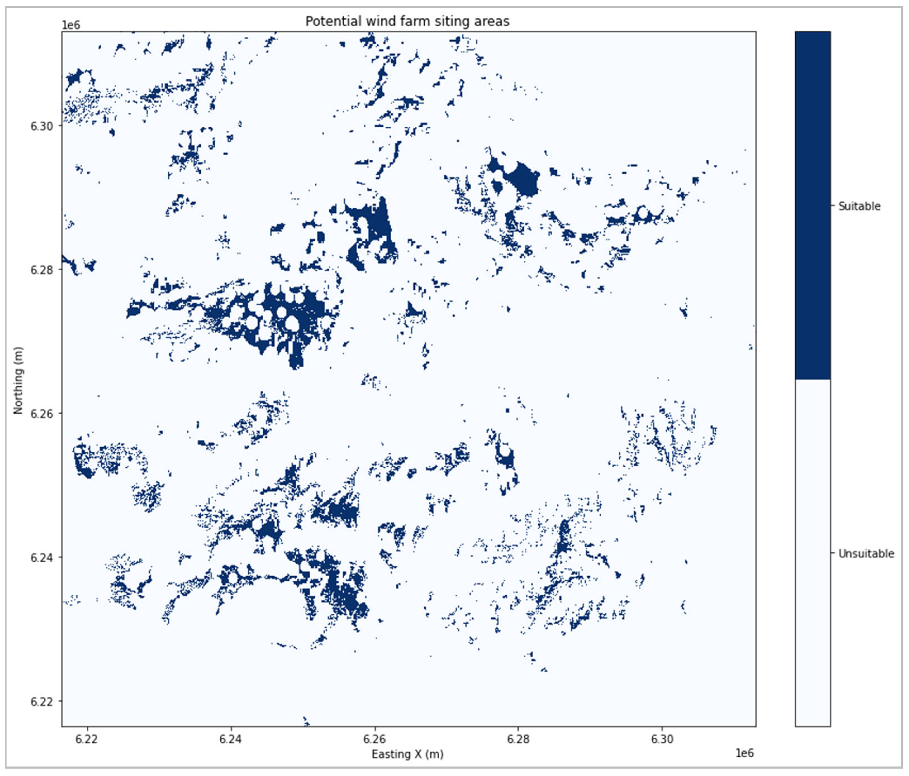
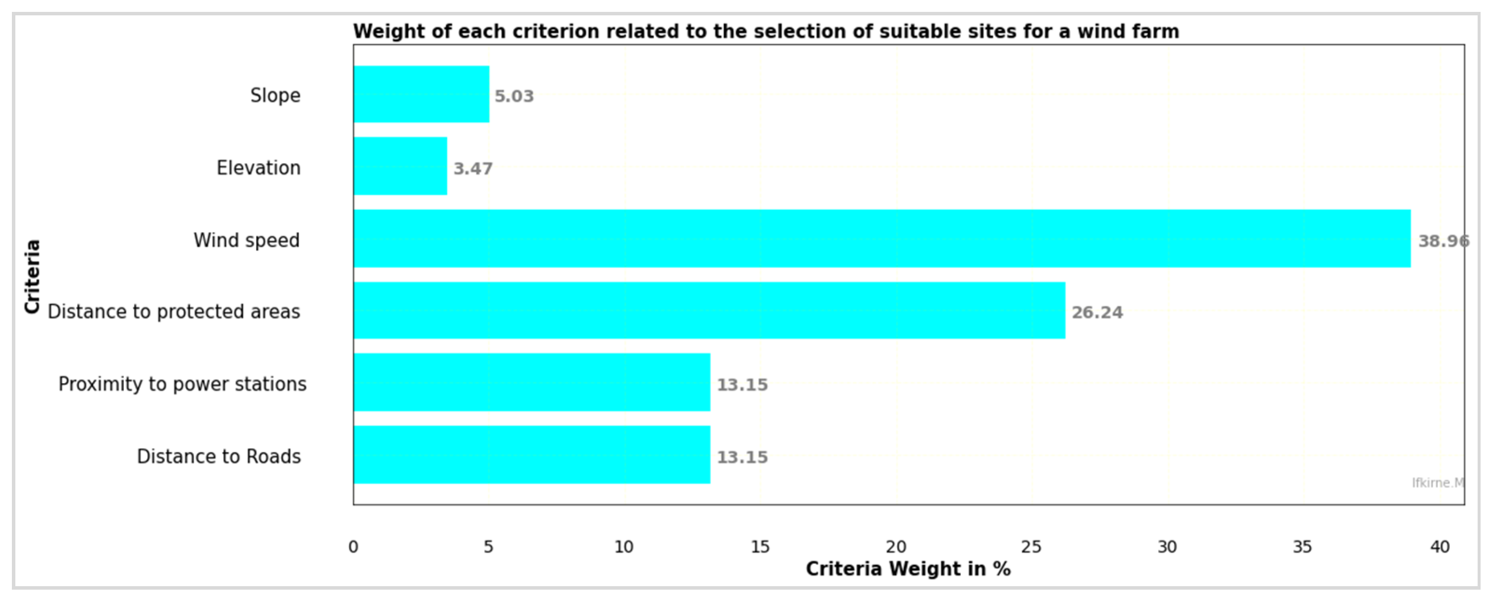
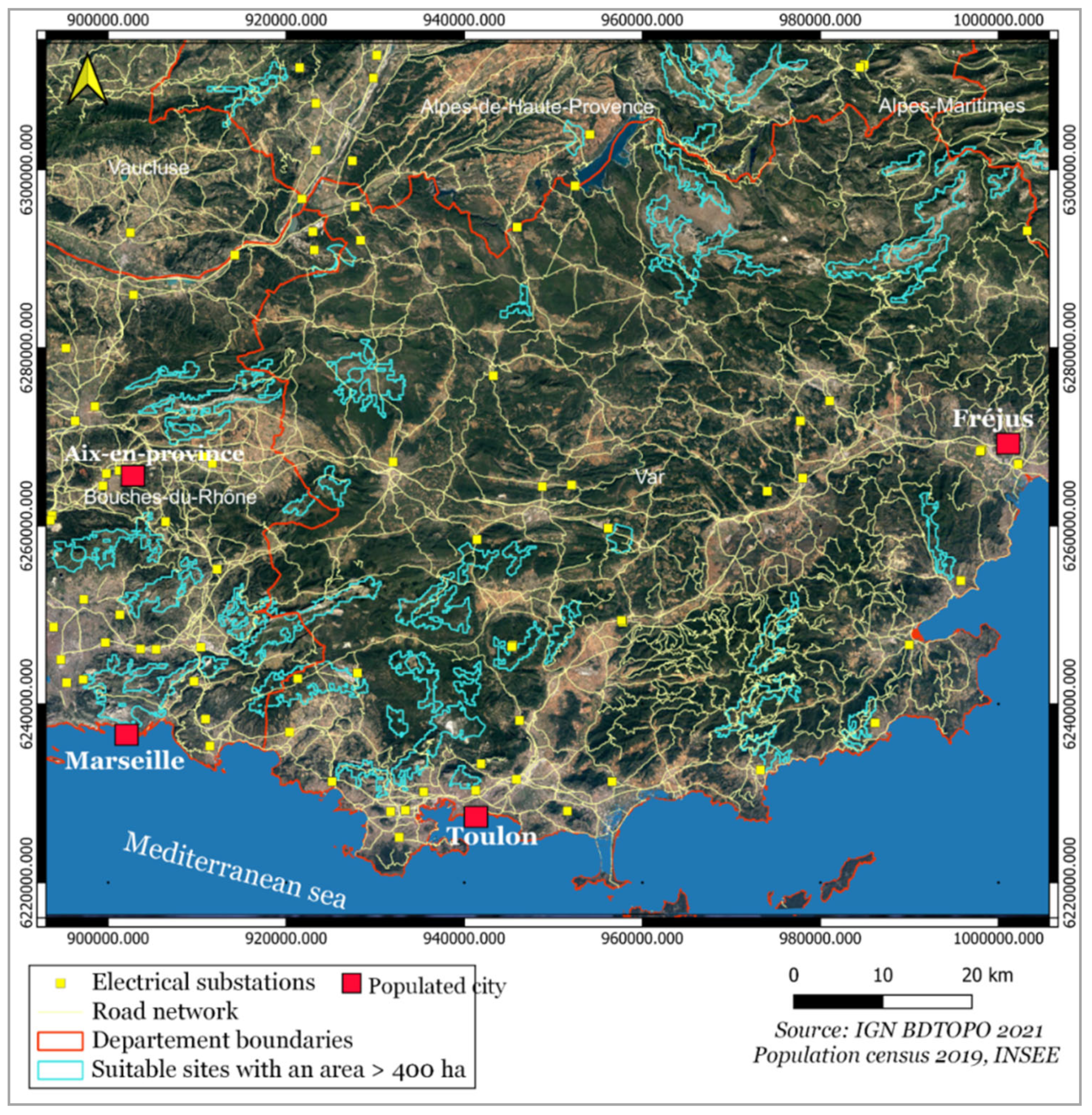
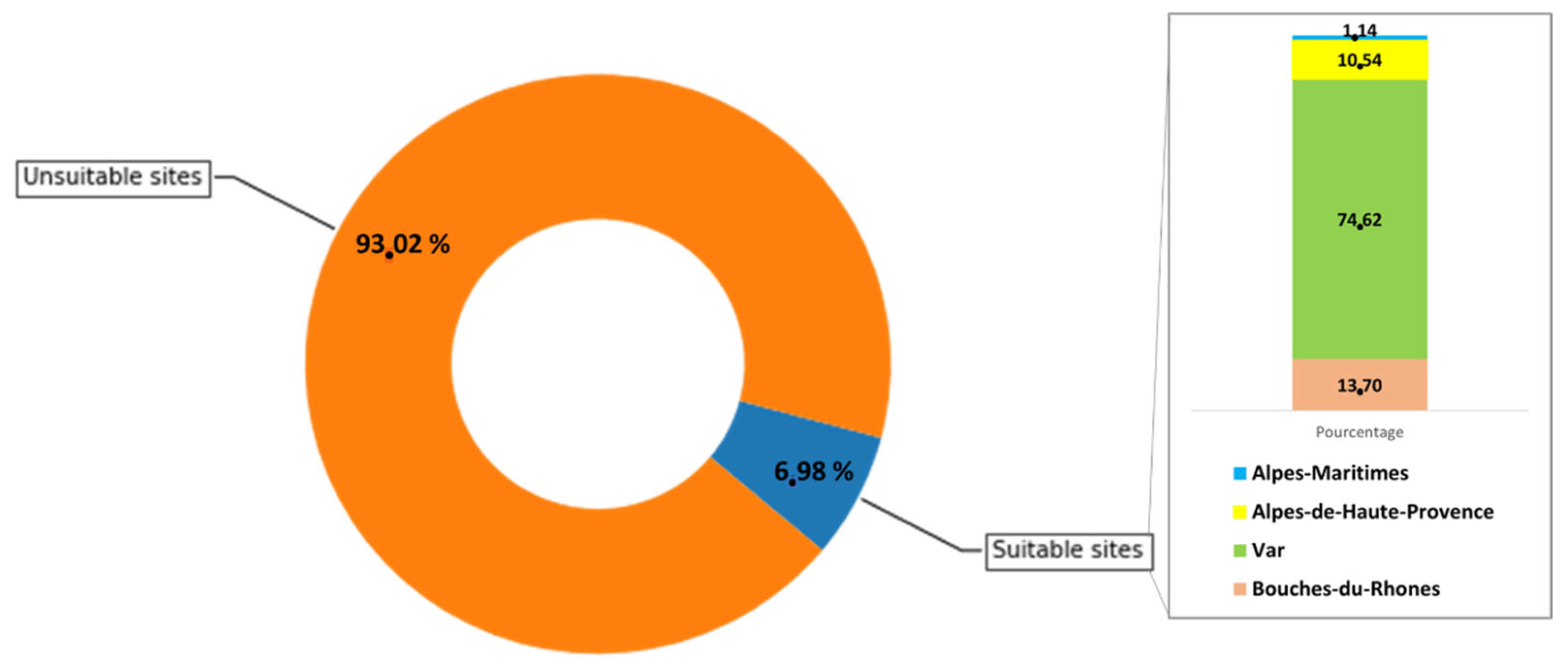
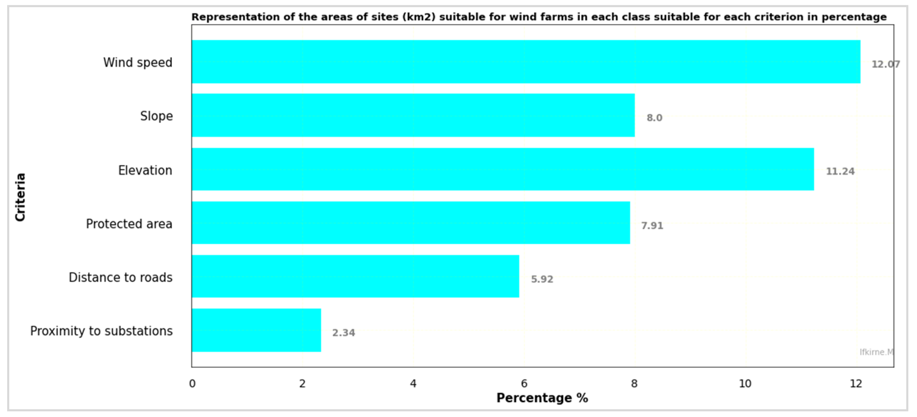
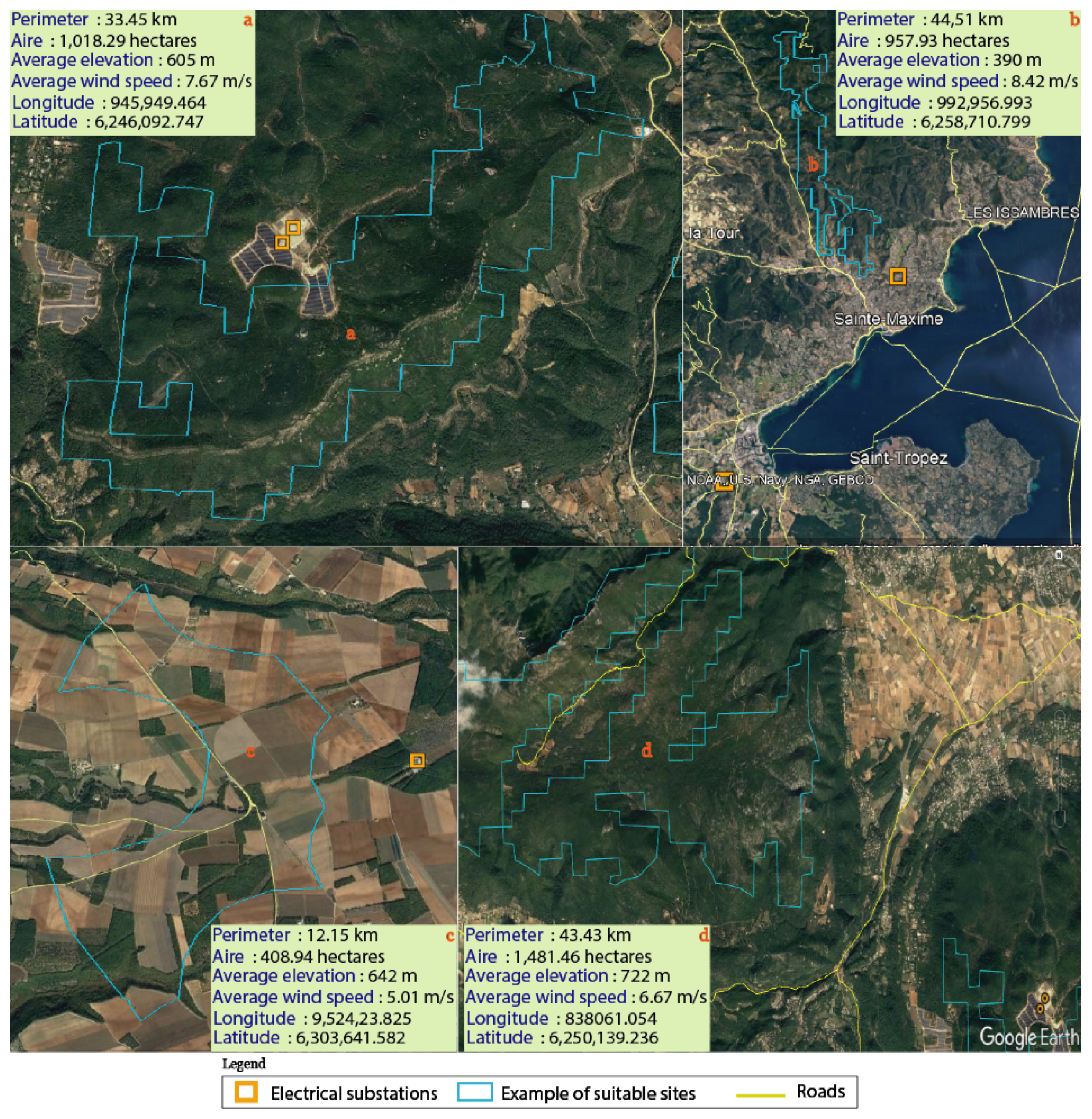
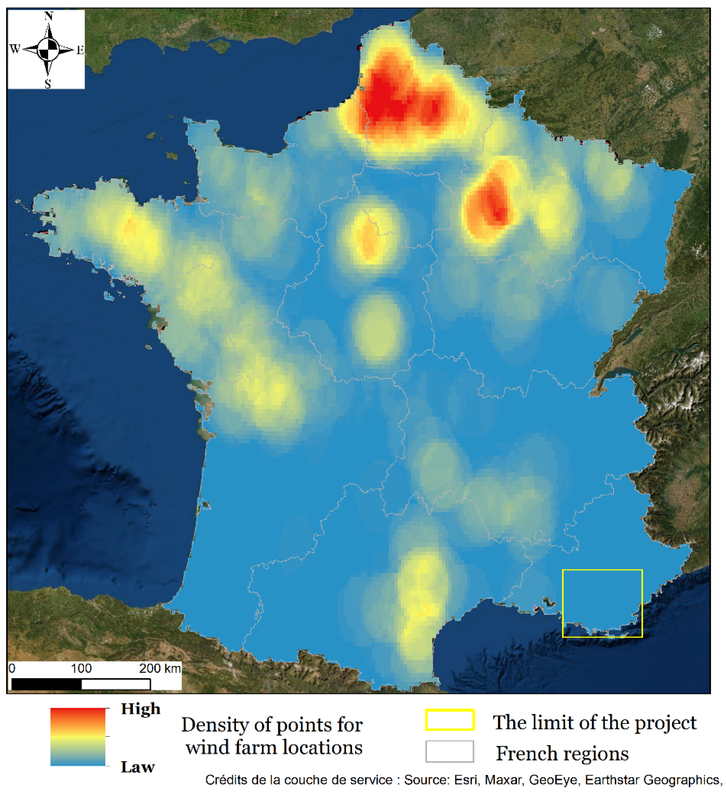
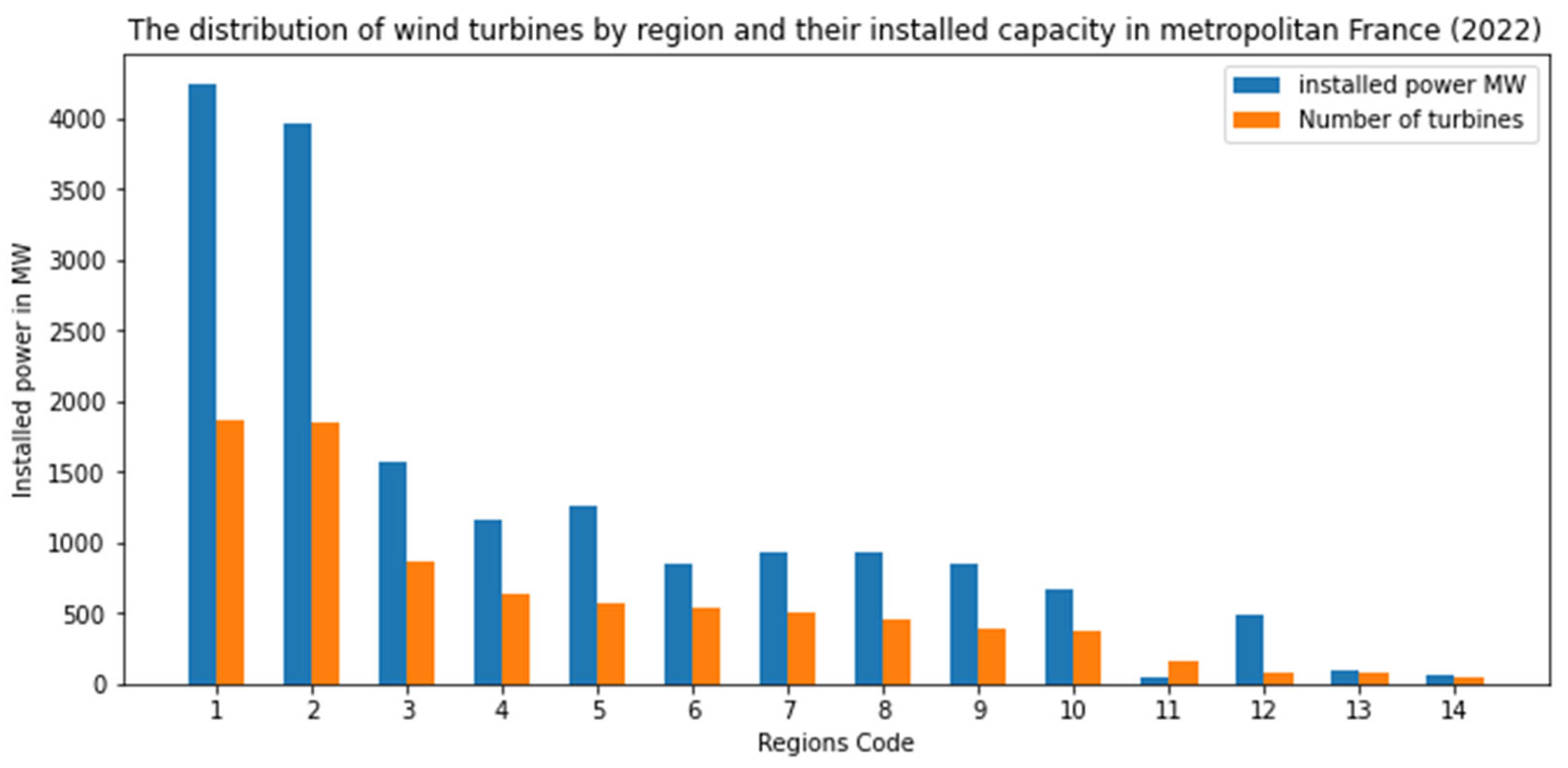
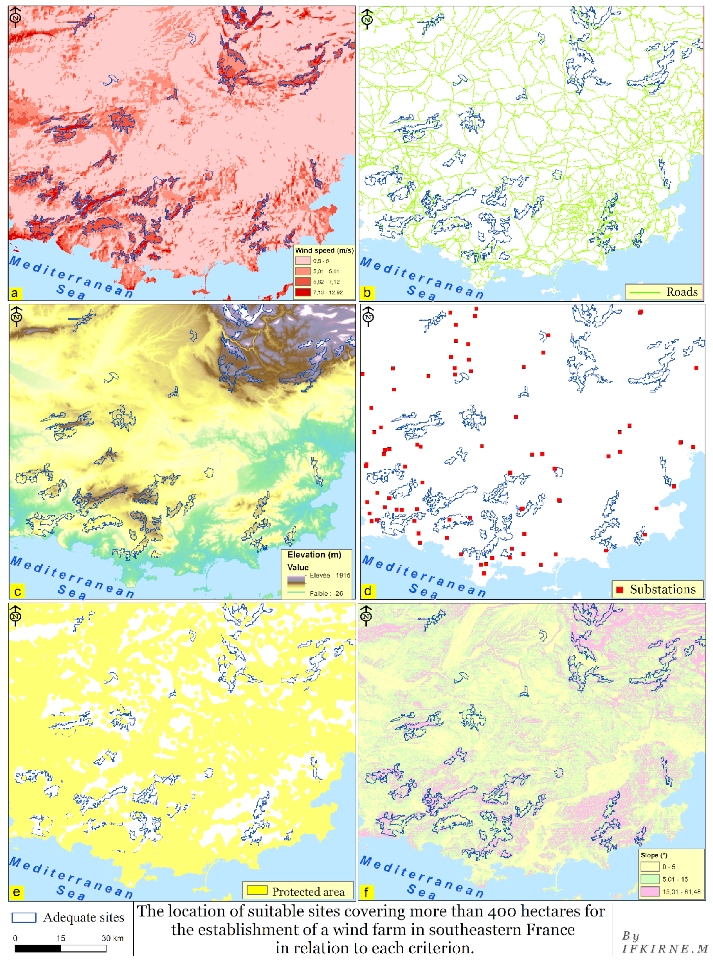
Wind energy is critical to traditional energy sources replacement in France and throughout the world. Wind energy generation in France is quite unevenly spread across the country. Despite its considerable wind potential, the research region is among the least productive. The region is a very complicated location where socio-environmental, technological, and topographical restrictions intersect, which is why energy production planning studies in this area have been delayed. In this research, the methodology used for identifying appropriate sites for future wind farms in this region combines GIS with MCDA approaches such as AHP. Six determining factors are selected: the average wind speed, which has a weight of 38%; the protected areas, which have a relative weight of 26%; the distance to electrical substations and road networks, both of which have a significant influence on relative weights of 13%; and finally, the slope and elevation, which have weights of 5% and 3%, respectively. Only one alternative was investigated (suitable and unsuitable). The spatial database was generated using ArcGIS and QGIS software; the AHP was computed using Excel; and several treatments, such as raster data categorization and weighted overlay, were automated using the Python programming language. The regions identified for wind turbines installation are defined by a total of 962,612 pixels, which cover a total of 651 km2 and represent around 6.98% of the research area. The theoretical wind potential calculation results suggest that for at least one site with an area bigger than 400 ha, the energy output ranges between 182.60 and 280.20 MW. The planned sites appear to be suitable; each site can support an average installed capacity of 45 MW. This energy benefit will fulfill the region’s population’s transportation, heating, and electrical demands.
Keywords: spatial energy planning; France; GIS; MCDA-AHP; suitability map; onshore wind farms spatial energy planning; France; GIS; MCDA-AHP; suitability map; onshore wind farms