Article

Evaluating the Efficacy of Sentinel-2B and Landsat-8 for Estimating and Mapping Wheat Straw Cover in Rice–Wheat Fields


1
Key Laboratory of Modern Agricultural Equipment and Technology of Ministry of Education, Jiangsu University, Zhenjiang 212013, China
2
School of Agricultural Engineering, Jiangsu University, Zhenjiang 212013, China
3
Faculty of Agricultural Engineering, Sindh Agriculture University, Tandojam 70060, Pakistan
4
Key Laboratory for Theory and Technology of Intelligent Agricultural Machinery and Equipment, Jiangsu University, Zhenjiang 212013, China
5
Agricultural Engineering Department, Faculty of Agriculture, Mansoura University, Mansoura 35516, Egypt
*
Author to whom correspondence should be addressed.
Agronomy 2023, 13(11), 2691; https://doi.org/10.3390/agronomy13112691

Submission received: 25 September 2023 / Revised: 20 October 2023 / Accepted: 23 October 2023 / Published: 26 October 2023

Abstract

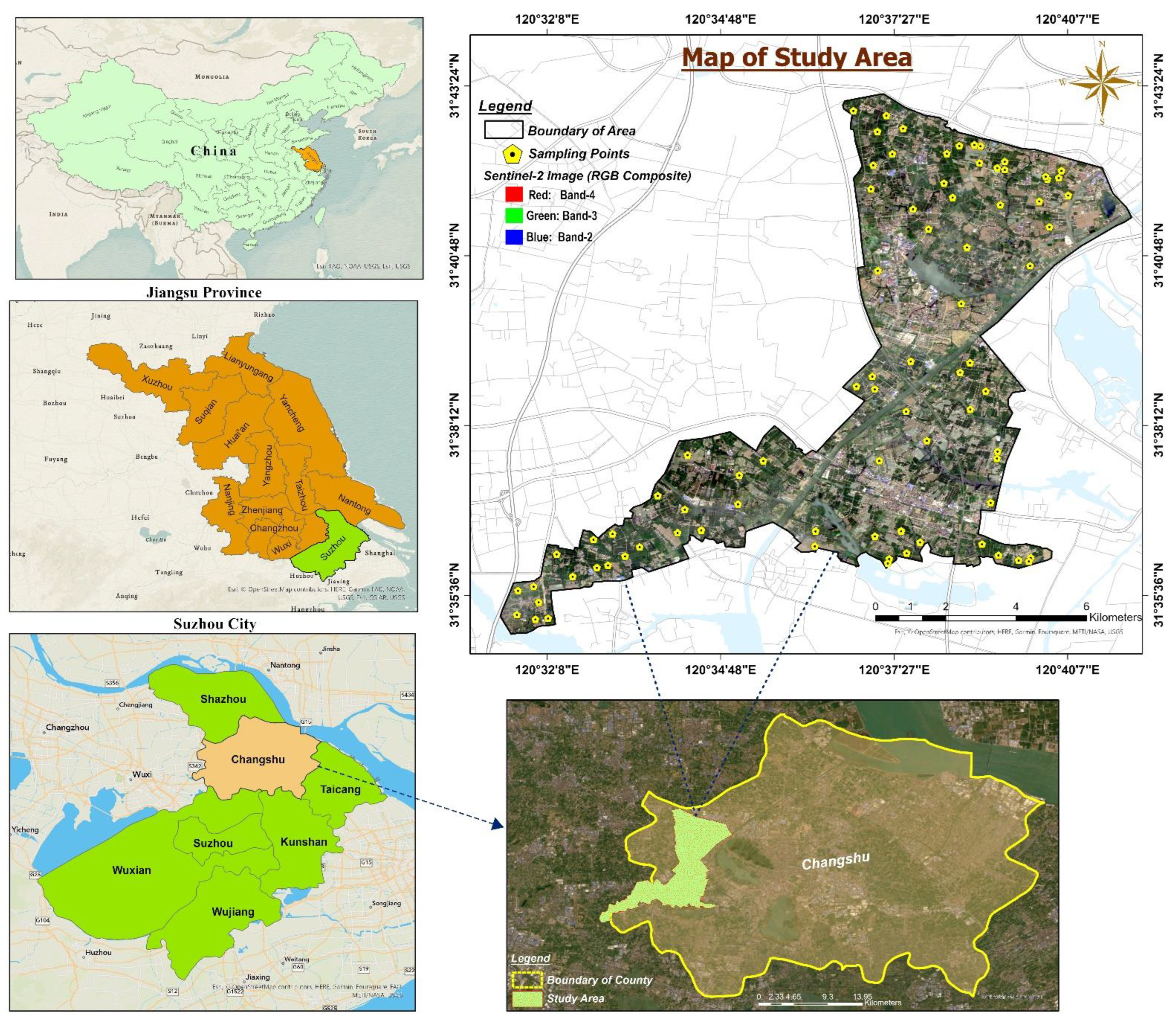
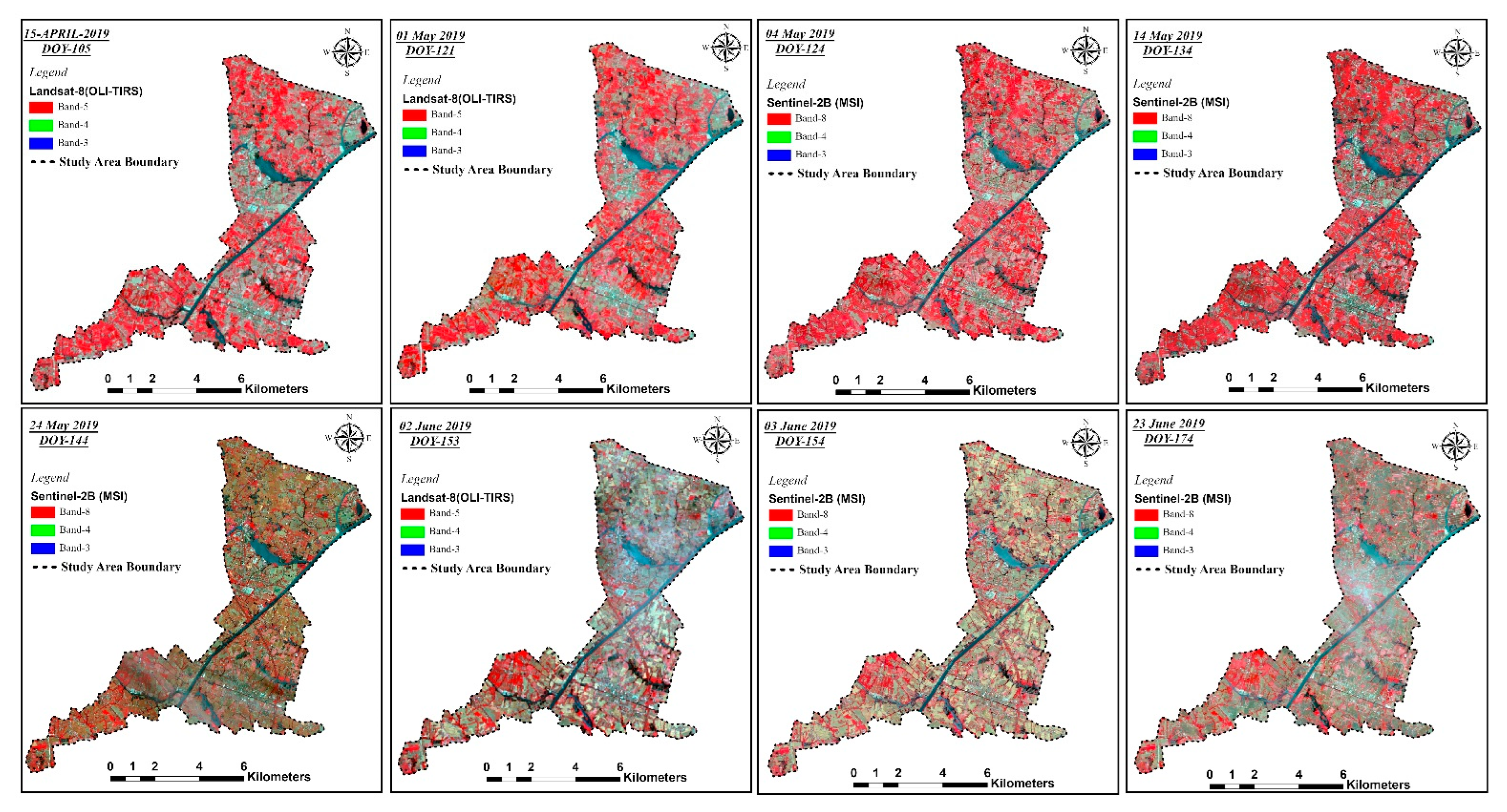
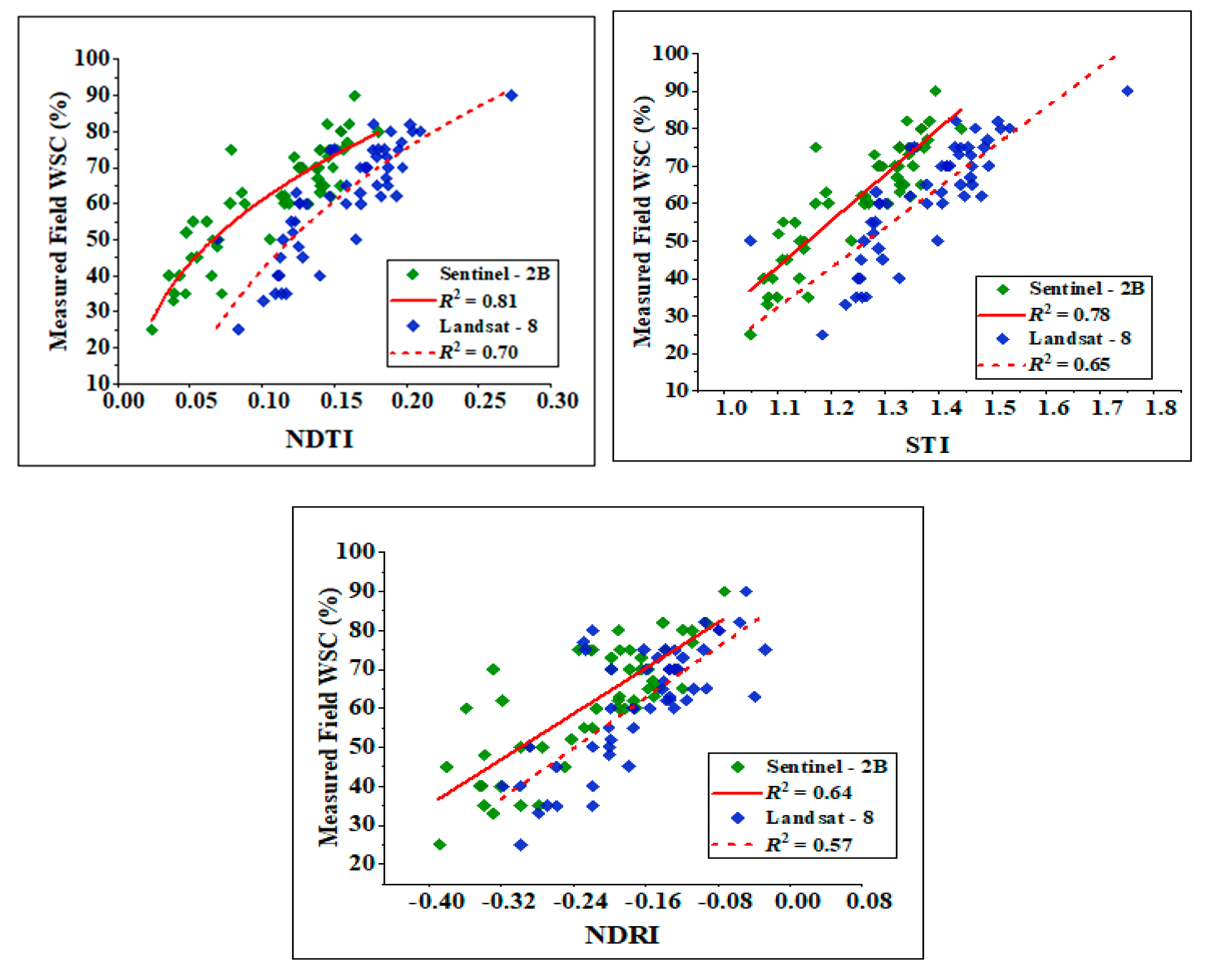
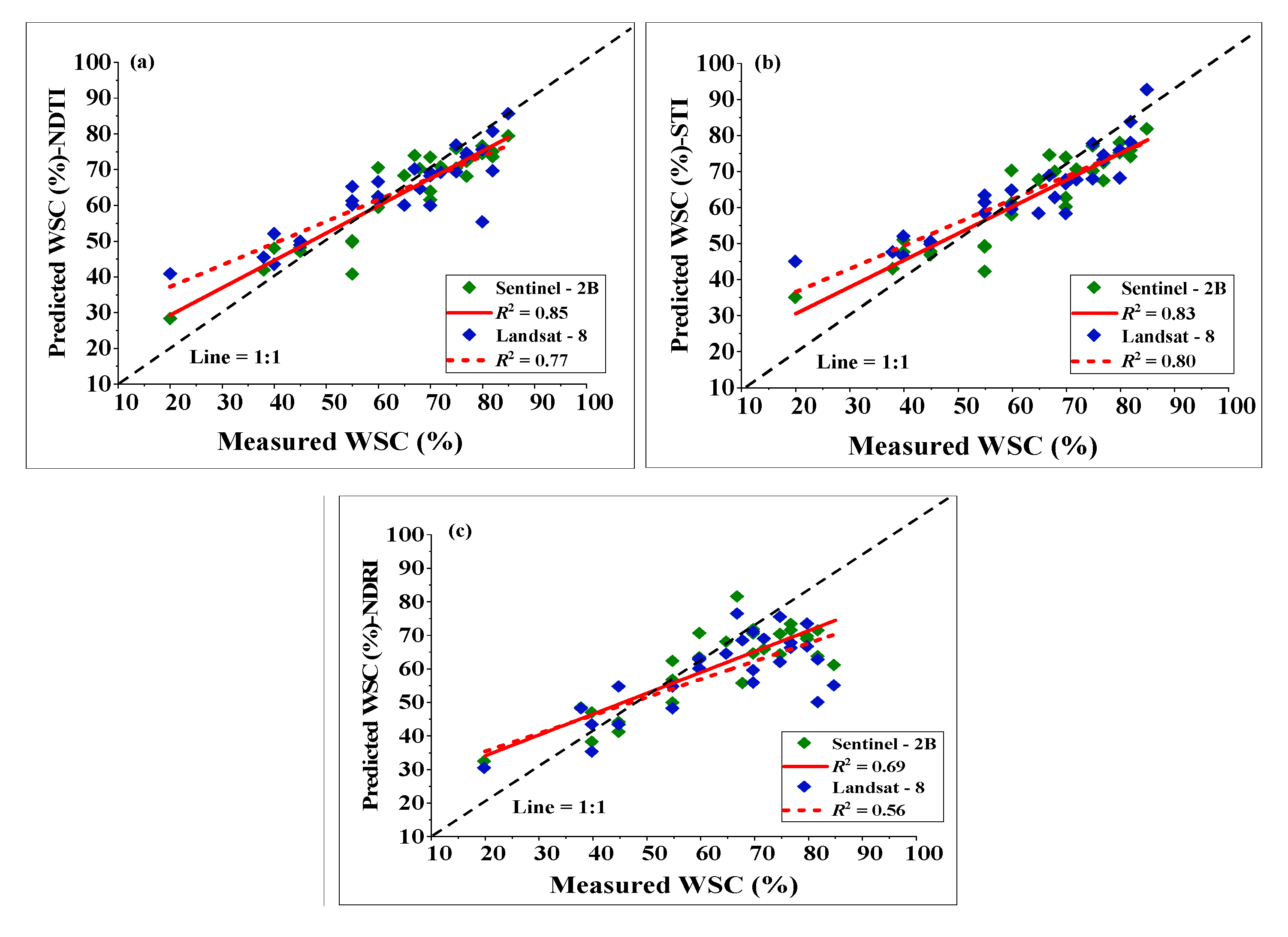
Sustainable agriculture and soil conservation methods are integral to ensuring food safety and mitigating environmental impacts worldwide. However, crop residue/straw serves many vital functions from tillage to harvest, so that quantifying the appropriate amount of Crop Straw Cover (CSC) on the soil surface is crucial for monitoring tillage intensity and crop yield performance. Thus, a novel research study is conducted to develop an innovative approach for accurately estimating and mapping the Wheat Straw Cover (WSC) percentage through two different multispectral satellites (Sentinel-2B MSI and Landsat-8 OLI-TIRS), using remote sensing-based techniques in Changshu County, China. The field measurements were collected from 80 distinct sites and eight images were acquired through both satellites for the analysis process by applying Crop Residue Indices (CRIs). The results indicate that the coefficients of determination (R2) of the Normalized Difference Tillage Index (NDTI) computed by Sentinel-2 and Landsat-8 were 0.80 and 0.70, respectively, and the root-mean-square deviation (RMSD) values were in the range from 6.88 to 12.04% for CRIs for both satellite data. Additionally, the comparative analysis of the developed model revealed that NDTI was R2 = 0.85 and R2 = 0.77, followed by STI, R2 = 0.82 and R2 = 0.80 and NDRI, R2 = 0.69 and R2 = 0.56 for Sentinel-2B and Landsat-8 data, respectively. Hence, the correlation strength of NDTI, STI and NDRI with WSC percentages was markedly superior by using Sentinel-2B spectral data compared to Landsat-8 ones. Moreover, the NDTI of Sentinel-2B data was the most accurate in mapping the WSC percentage in four categories, with an overall accuracy of 86.53% (κ = 0.78), surpassing the other CRI indices. Therefore, these findings suggest that the multispectral imagery of Sentinel-2B bolstered with enhanced temporal and spatial data was superior for precisely estimating and mapping the WSC percentage compared to Landsat-8 data over a large-scale agricultural region.
Keywords: precision agriculture; remote sensing; crop residues; Landsat-8; rice–wheat cropping; Sentinel-2; vegetation indices; sustainability precision agriculture; remote sensing; crop residues; Landsat-8; rice–wheat cropping; Sentinel-2; vegetation indices; sustainability