Article

A Feature-Optimized Deep Learning Framework for Mapping and Spatial Characterization of Tea Plantations in Complex Mountain Landscapes

1
Key Laboratory of Spatio-Temporal Information and Ecological Restoration of Mines of Natural Resources of the People’s Republic of China, Henan Polytechnic University, Jiaozuo 454000, China
2
Moganshan Geospatial Information Laboratory, Huzhou 313299, China
3
Henan Institute of Surveying and Mapping, Zhengzhou 450003, China
*
Author to whom correspondence should be addressed.
Remote Sens. 2026, 18(9), 1281; https://doi.org/10.3390/rs18091281
Submission received: 20 March 2026 / Revised: 12 April 2026 / Accepted: 20 April 2026 / Published: 23 April 2026

Abstract

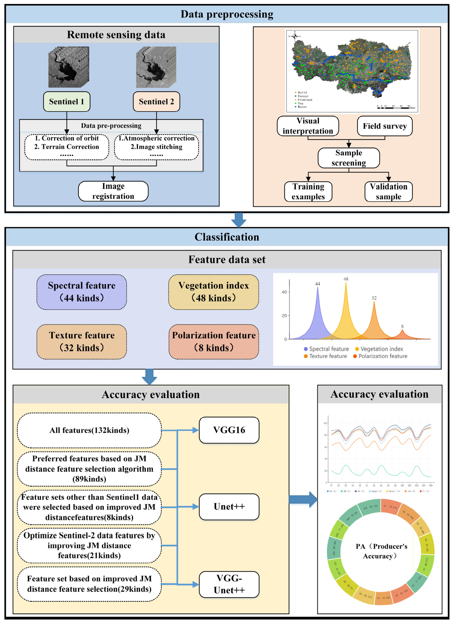
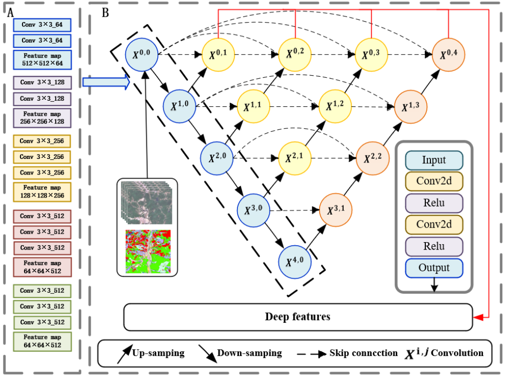
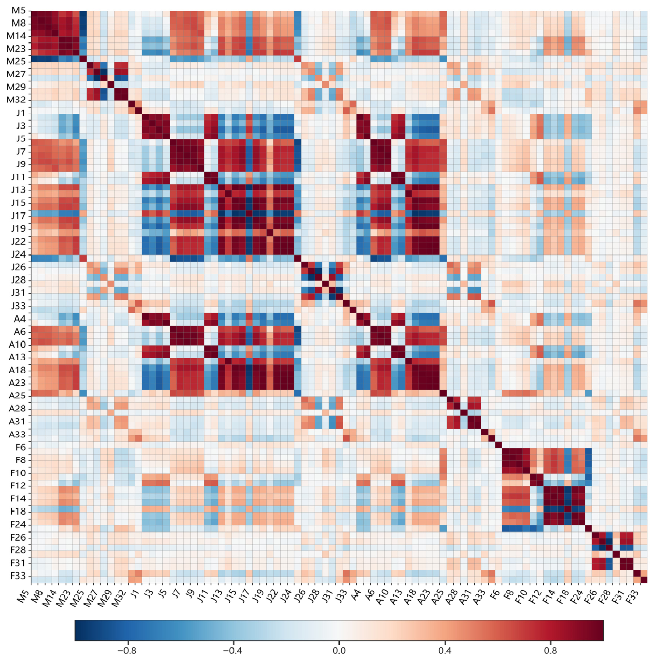
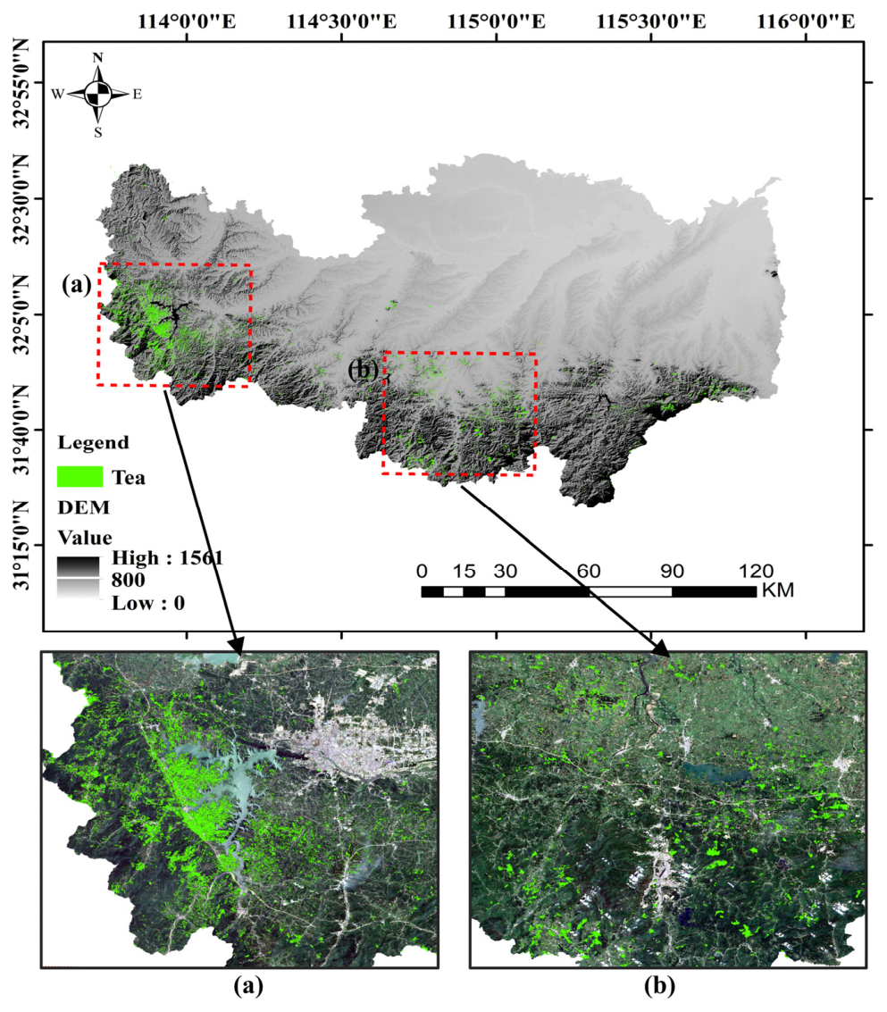
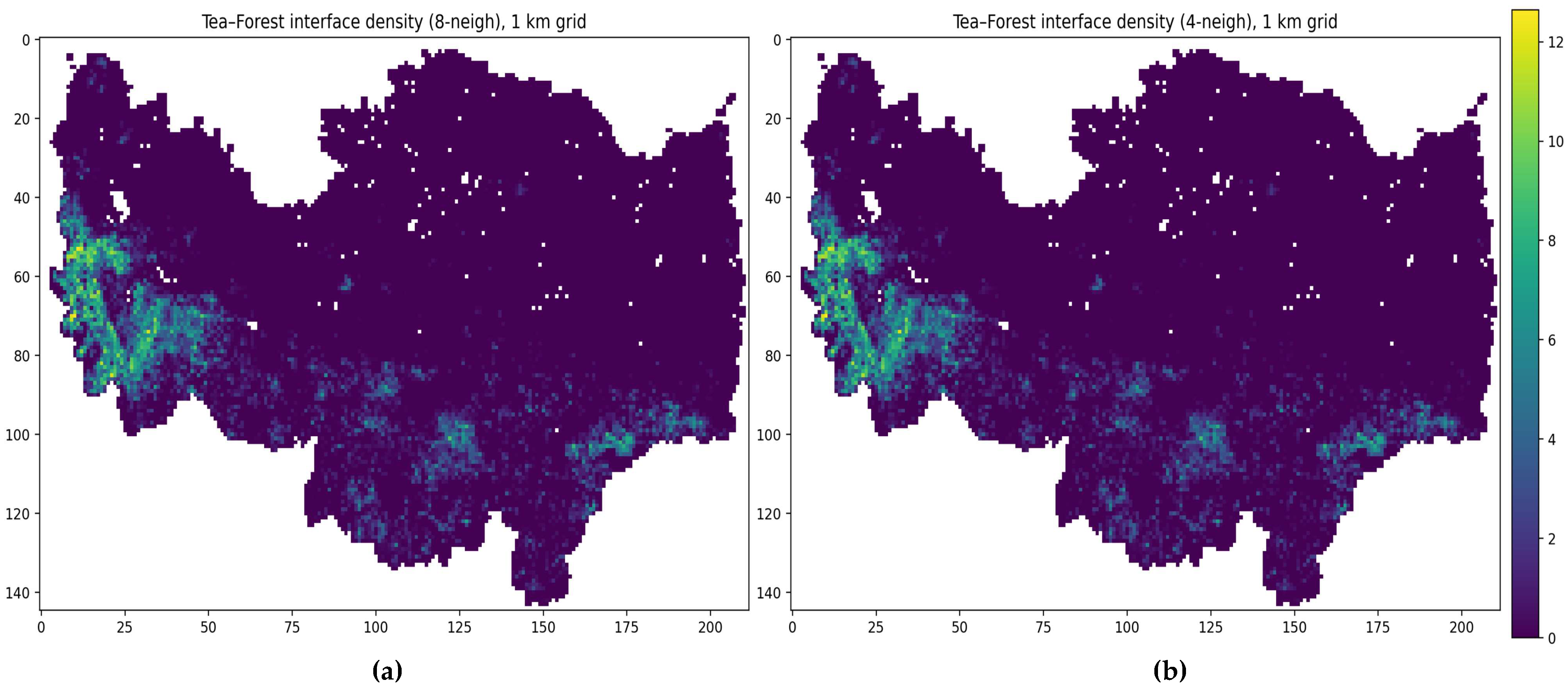
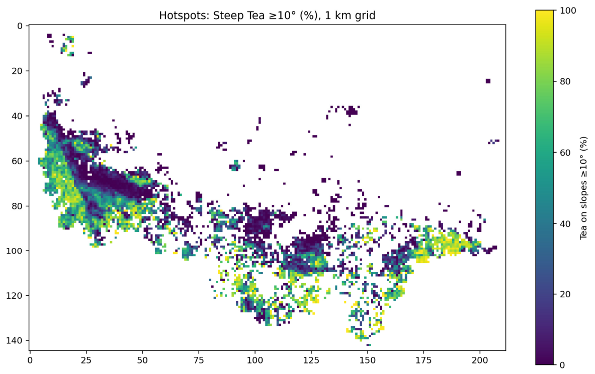
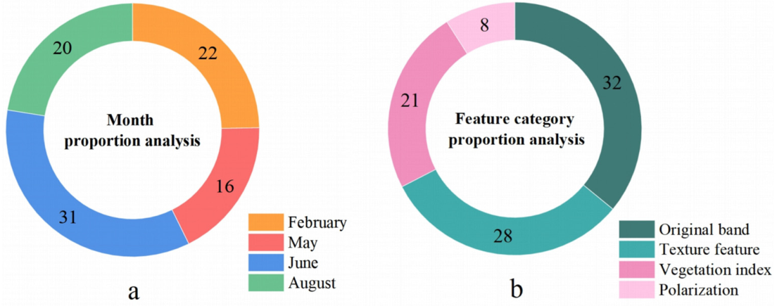
The unchecked expansion of tea plantations onto steep, forest-adjacent slopes in subtropical mountains engenders a conflict between agricultural productivity and ecosystem integrity, particularly by exacerbating habitat fragmentation and soil erosion. While precise monitoring is essential to navigate this trade-off for sustainable management, accurate inventorying remains a challenge due to the plantations’ strong phenological variability, heterogeneous canopy structures, and high spectral confusion with surrounding vegetation. This study proposes a feature-optimized deep learning framework for mapping and characterizing tea plantations in complex landscapes, using Xinyang City, China, as a study area. The framework integrates multi-temporal Sentinel-1/2 observations with a sequential Jeffries-Matusita (JM)-Pearson feature filtering strategy. This approach effectively condenses a 132-variable high-dimensional pool (including optical spectra, vegetation indices, textures, and SAR polarimetry) into a compact 28-feature subset (a 78.8% reduction), preserving critical phenological and structural cues while minimizing redundancy. These optimized predictors drive a hybrid VGG16–UNet++ segmentation network, which couples transfer-learning-based semantic encoding with detail-preserving dense skip fusion. Extensive experiments across 18 model–feature configurations demonstrate that the optimal setting achieves an Overall Accuracy of 97.82%, an F1-score of 0.9093, and a mean IoU of 0.7968. Notably, the method significantly reduces misclassification in rugged, cloud-prone terrain, yielding a User’s Accuracy of 91.14% for tea. Based on the generated wall-to-wall map, we derived two decision-support indicators: multi-threshold steep-slope exposure and a normalized tea–forest interface density. This framework provides actionable, high-precision spatial products to support slope-based zoning, ecological restoration, and sustainable management in fragile mountain agroforestry systems.
Keywords: land cover; Sentinel-1/2 imagery; feature optimization; deep learning; mountain agroforestry; spatial characterization land cover; Sentinel-1/2 imagery; feature optimization; deep learning; mountain agroforestry; spatial characterization