Article

Predicting LiDAR-Derived Canopy Leaf Area Index in Loblolly Pine Plantations with Sentinel-2 Imagery Using a Convolutional Neural Network Approach


1
Department Forestry and Environmental Resources, North Carolina State University, Raleigh, NC 27695, USA
2
Department of Forest Resources and Environmental Conservation, Virginia Polytechnic Institute and State University, Blacksburg, VA 24061, USA
*
Author to whom correspondence should be addressed.
Remote Sens. 2026, 18(16), 2814; https://doi.org/10.3390/rs18162814
Submission received: 12 June 2026 / Revised: 3 August 2026 / Accepted: 18 August 2026 / Published: 20 August 2026
(This article belongs to the Special Issue Remote Sensing and Smart Forestry (Third Edition))

Abstract

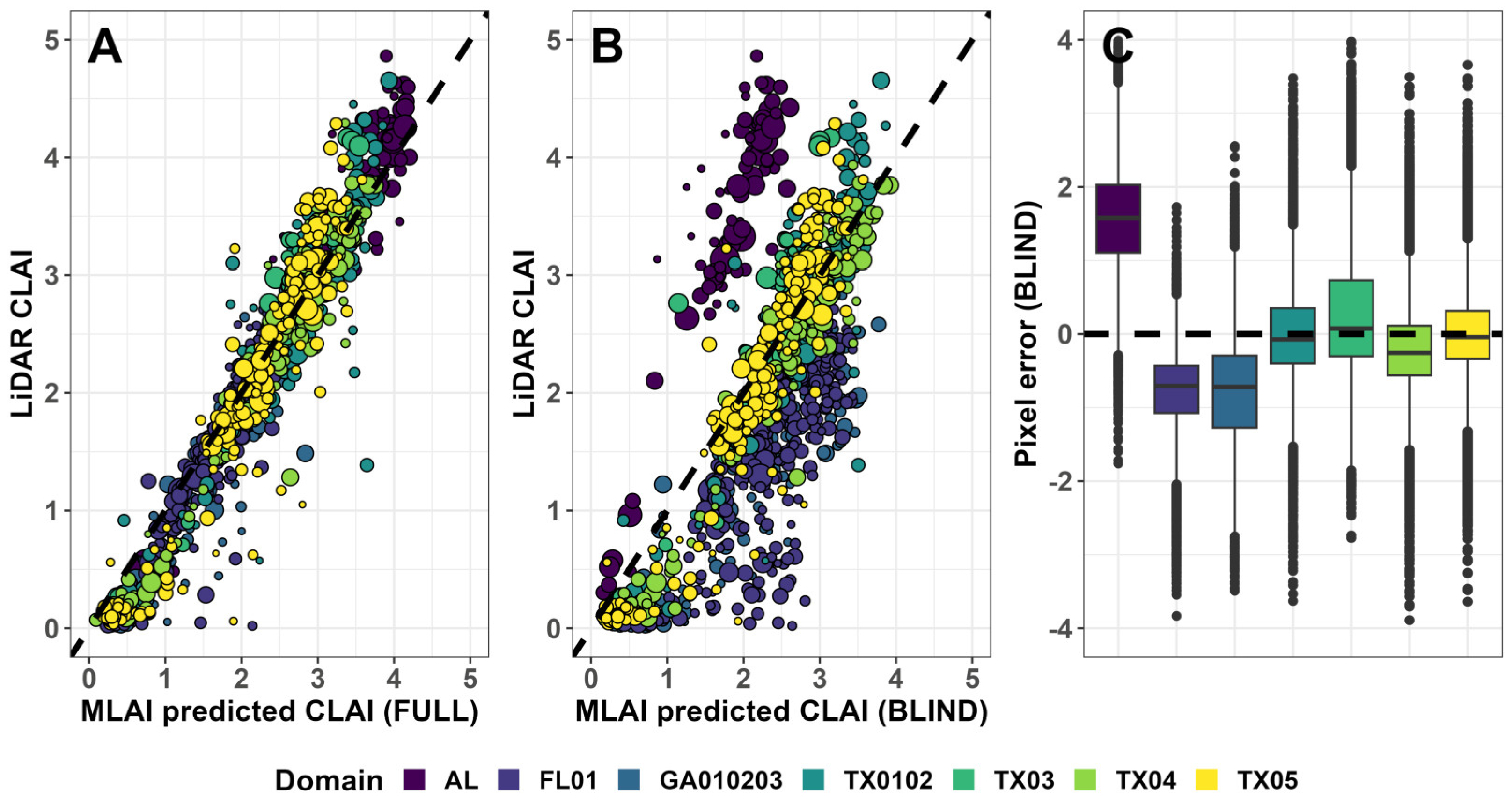
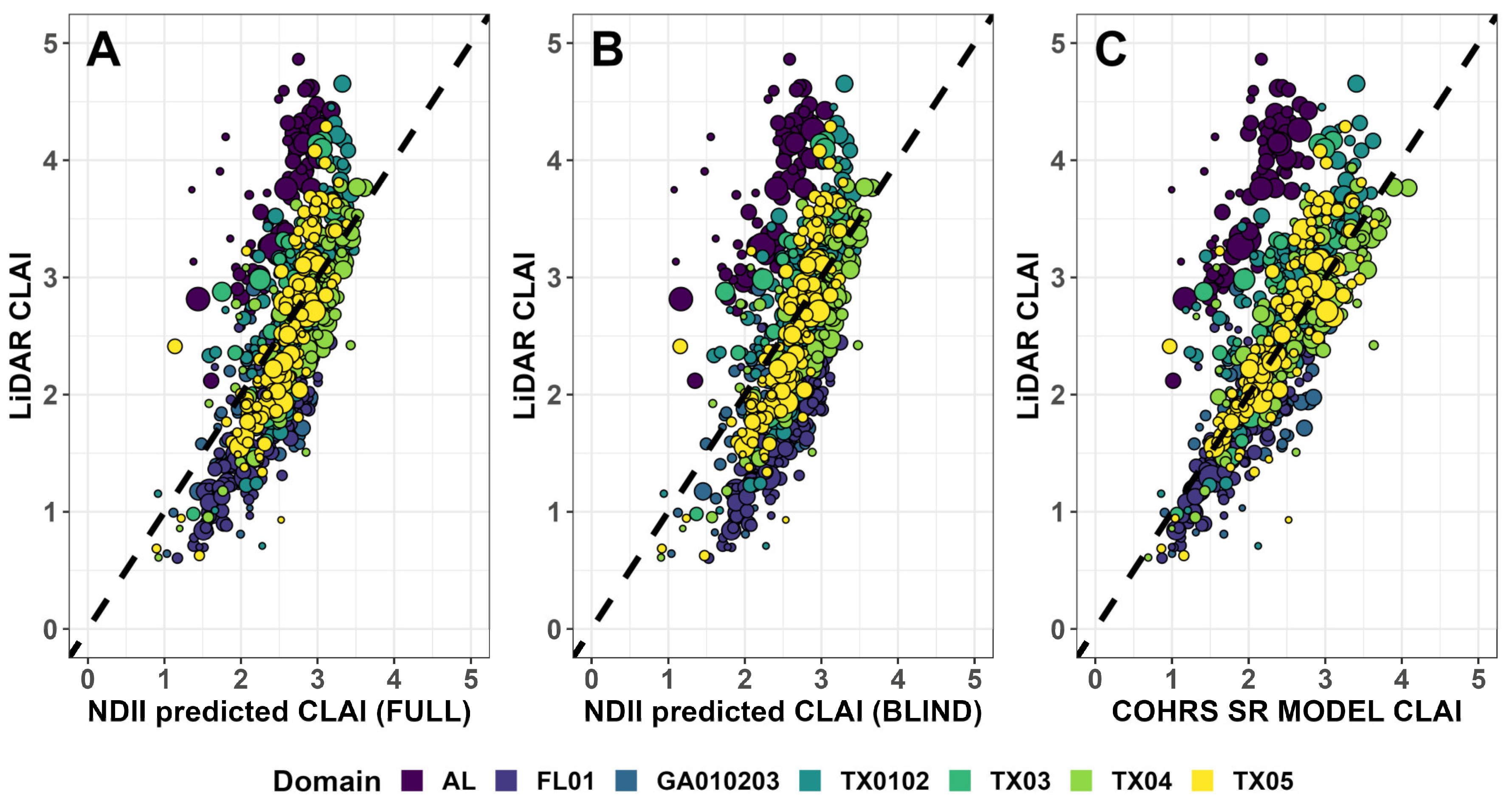
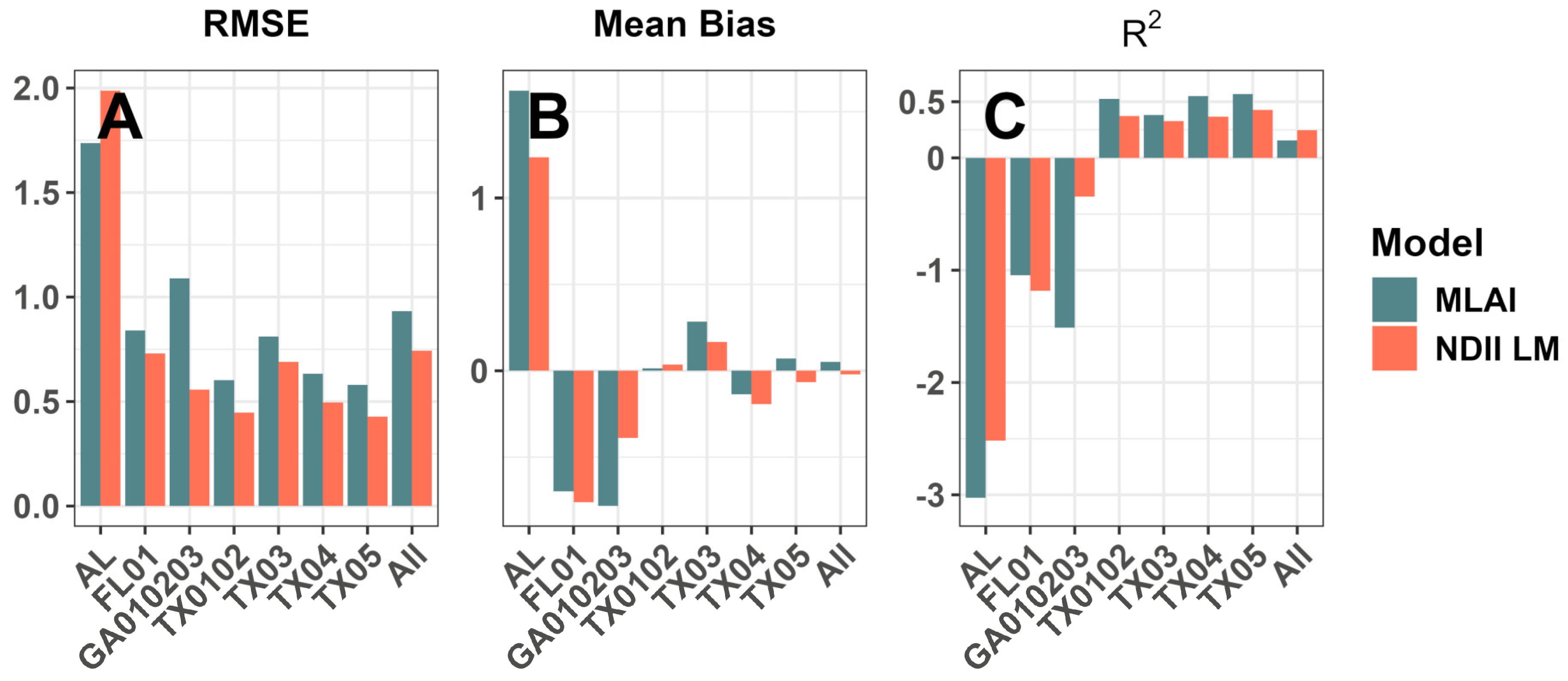
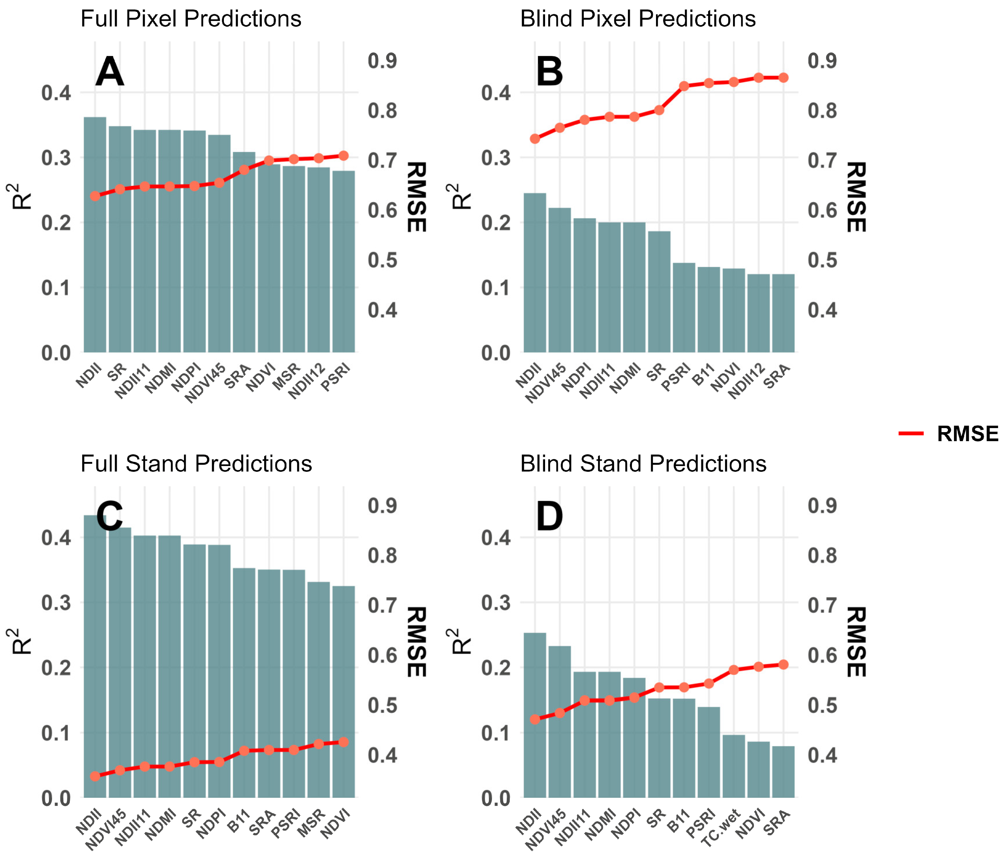
Canopy Leaf Area Index (CLAI) is a stand attribute containing information on the real-time health and growth potential of managed pine plantations. Current remote sensing techniques for quantifying CLAI rely on simple linear models applied to satellite multispectral imagery, or on techniques based on light detection and ranging (LiDAR) data that are costly and less frequently collected. This study demonstrates a convolutional neural network (CNN) approach to retrieving CLAI from 10 m Sentinel-2 multispectral imagery with a model trained on gridded LiDAR-based CLAI estimates. We demonstrate large gains in accuracy with the CNN compared to traditional linear models based on vegetation indices (e.g., Simple Ratio), but also clear shortfalls in model skill when predicting “blind” in some spatial domains that were completely excluded during model training. Pixel-scale root mean squared error ranged from 0.34 to 0.64 by domain when exposed to CLAI training data from all available spatial domains, but rose to 0.58–1.74 when predicting without prior domain-specific training. Prediction accuracy was consistently lower when applied to completely unobserved USGS LiDAR-based CLAI estimates. Traditional linear models, in contrast, had the advantage of usually lower prediction error across unobserved spatial domains (0.43–1.98), but with lower maximum accuracy. These results demonstrate a potential route for deploying more complex models for LiDAR “mimicry”, e.g., between data acquisitions widely separated in time, but advocate for the development and use of more stable generalized approaches for use in unobserved managed pine stands.
Keywords: Leaf Area Index (LAI); convolutional neural network; loblolly pine; vegetation index; domain shift Leaf Area Index (LAI); convolutional neural network; loblolly pine; vegetation index; domain shift