Article

Detection of Invasive Species (Siam Weed) Using Drone-Based Imaging and YOLO Deep Learning Model


1
Geospatial Science, School of Science, RMIT University, Melbourne, VIC 3000, Australia
2
Department of Lands, Planning and Environment, NT Government, Palmerston, NT 0831, Australia
3
EcOz Environmental Consulting, Darwin, NT 0800, Australia
4
Department of Climate Change, Energy, the Environment and Water, Supervising Scientist Branch, Darwin, NT 0820, Australia
5
Biosecurity Queensland, Department of Agriculture and Fisheries, Townsville, QLD 4820, Australia
*
Author to whom correspondence should be addressed.
Remote Sens. 2025, 17(1), 120; https://doi.org/10.3390/rs17010120
Submission received: 31 October 2024 / Revised: 6 December 2024 / Accepted: 26 December 2024 / Published: 2 January 2025
(This article belongs to the Special Issue Remote Sensing for Management of Invasive Species)

Abstract

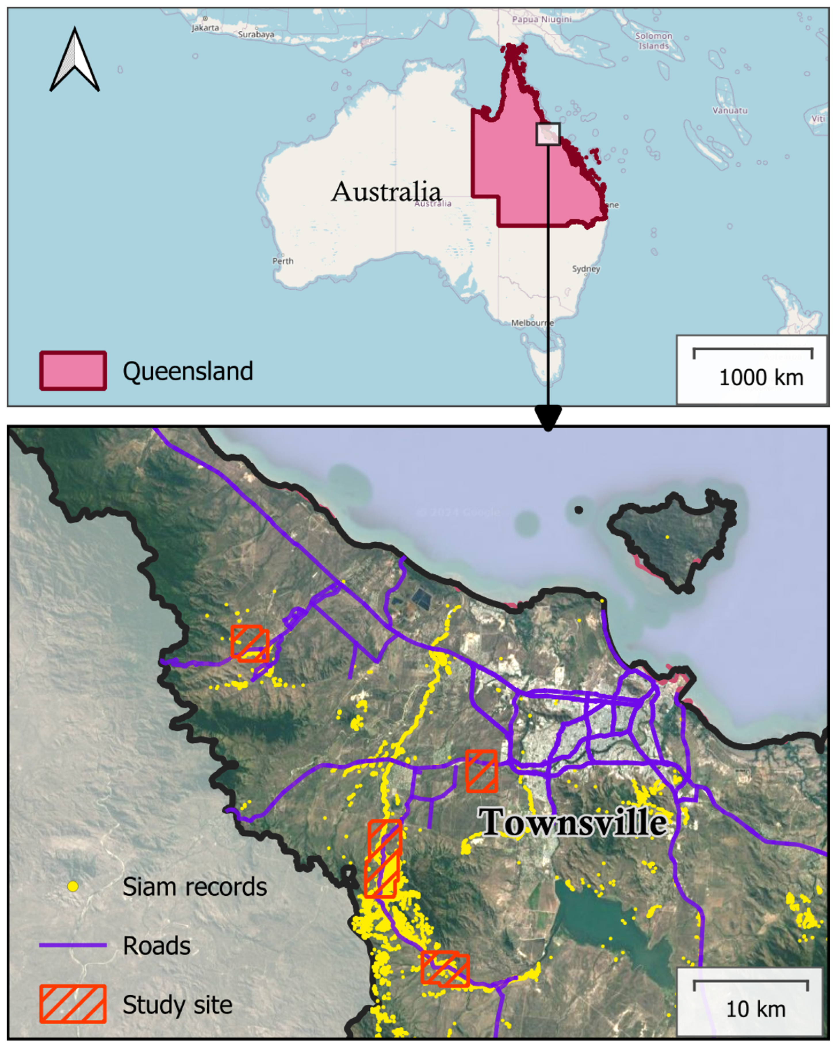
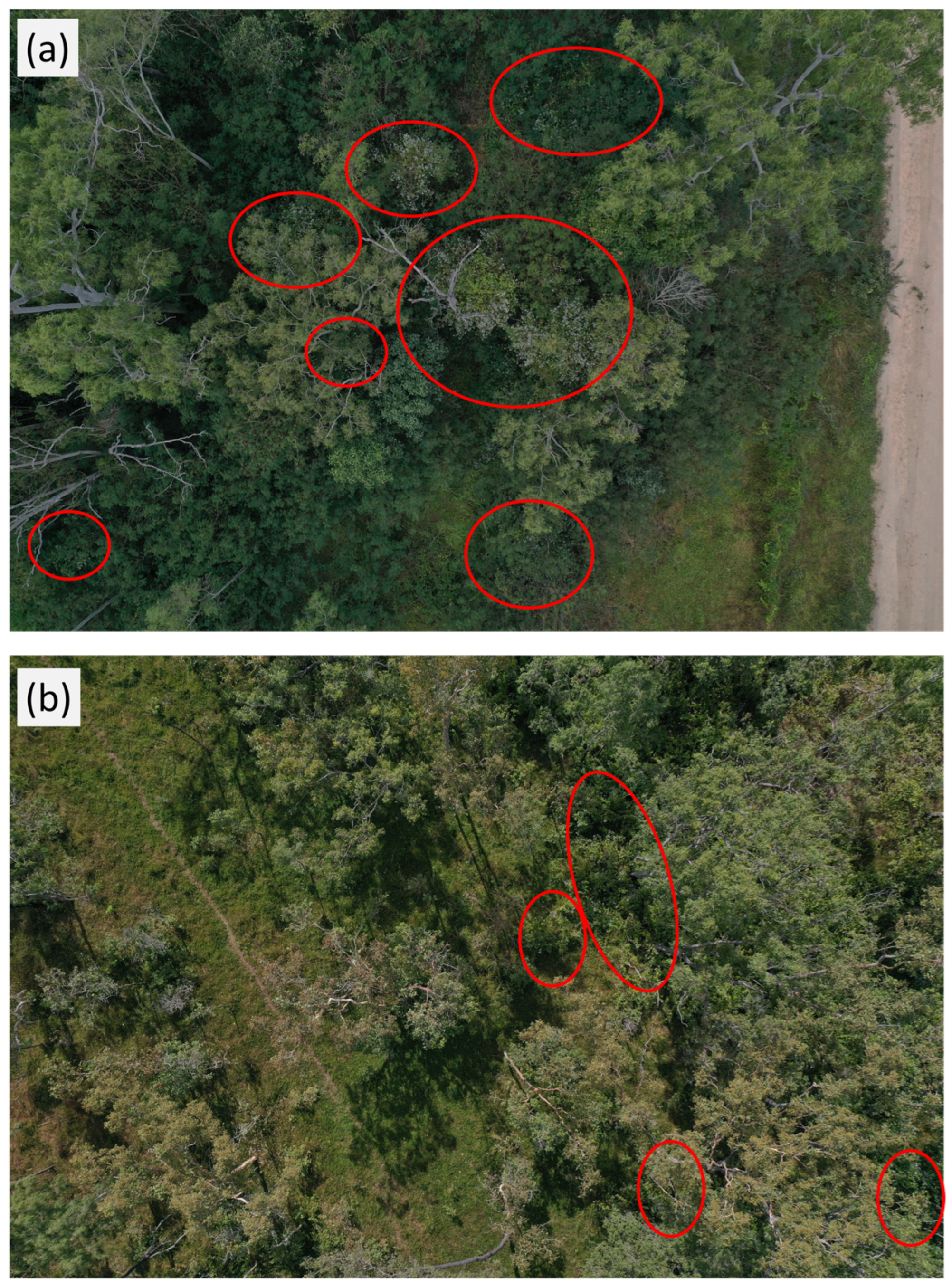
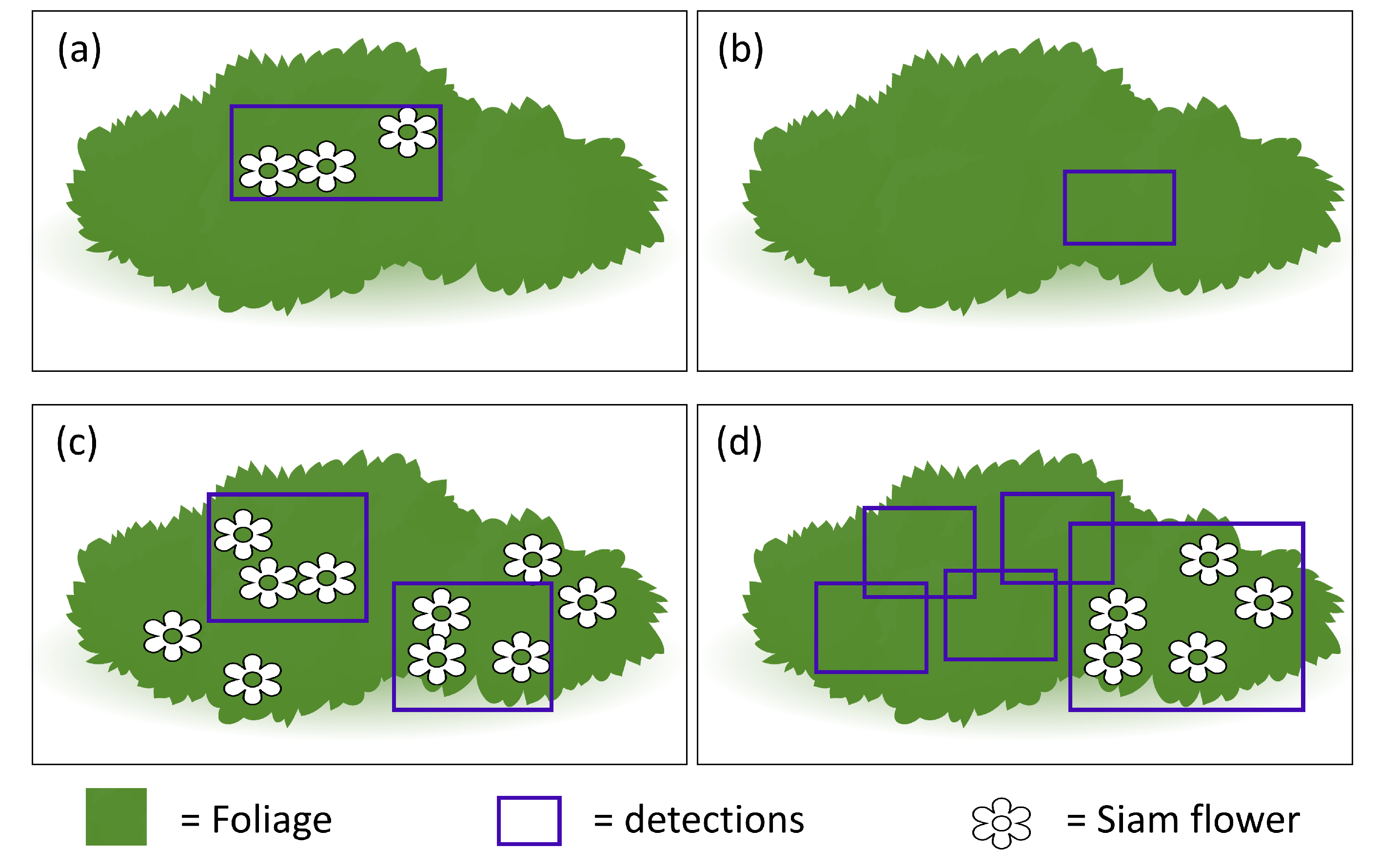
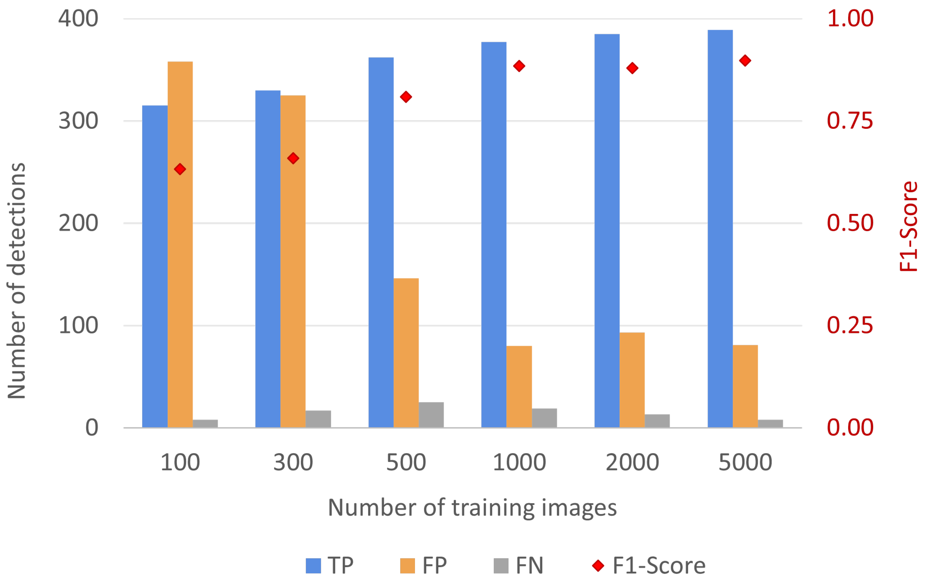
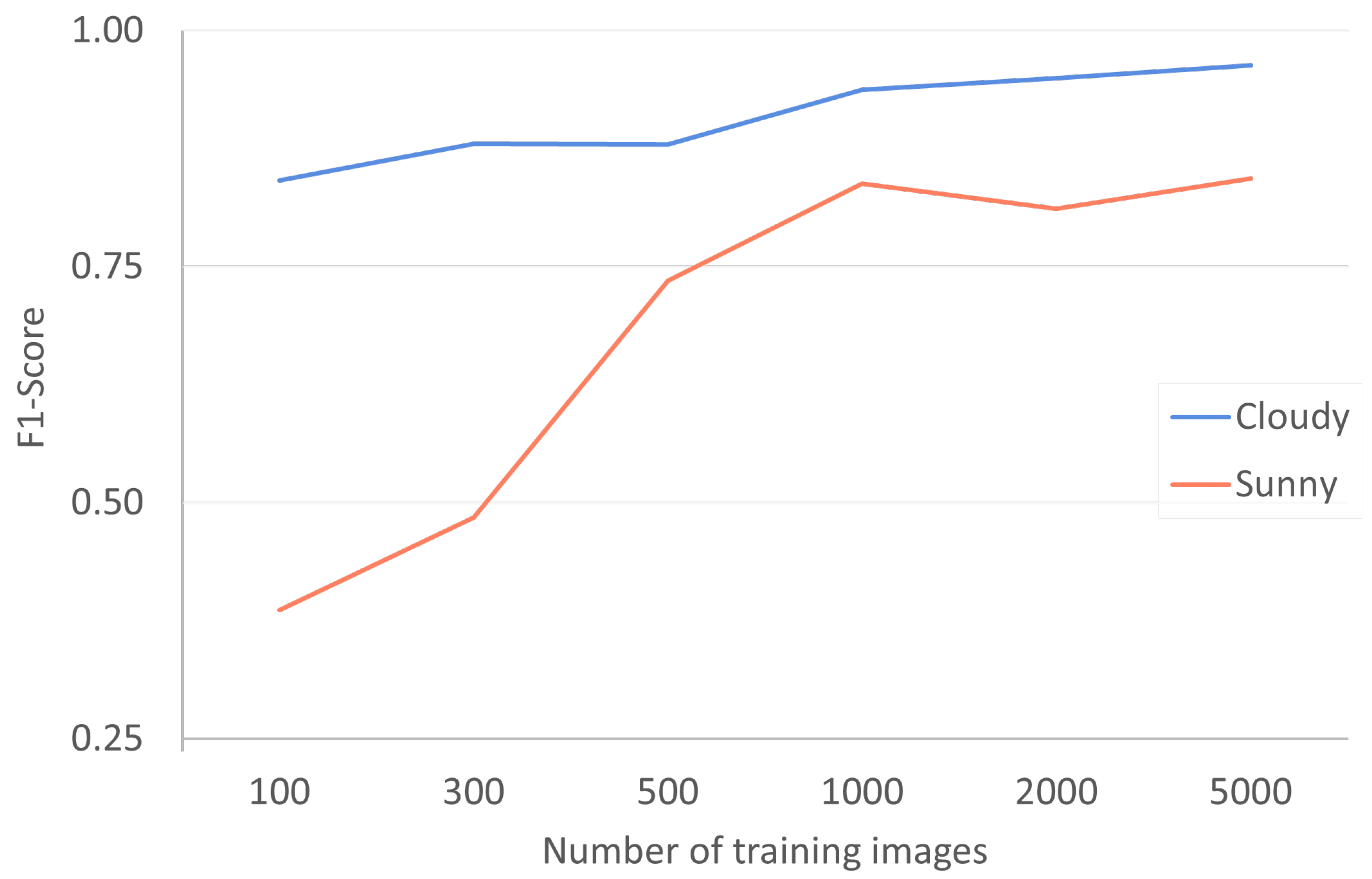
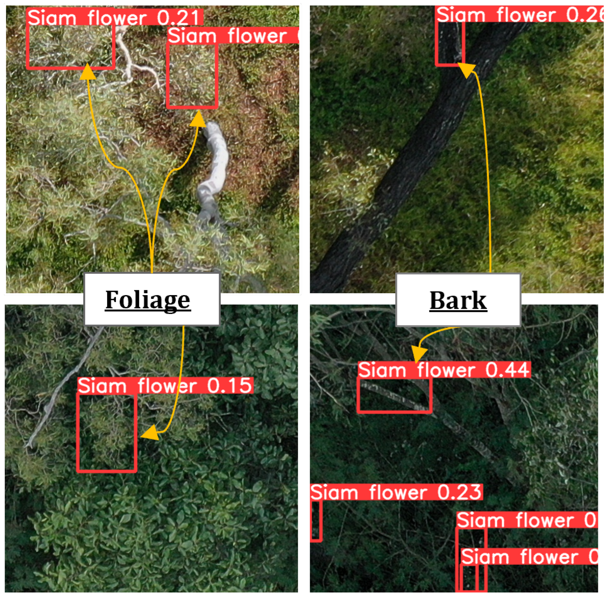
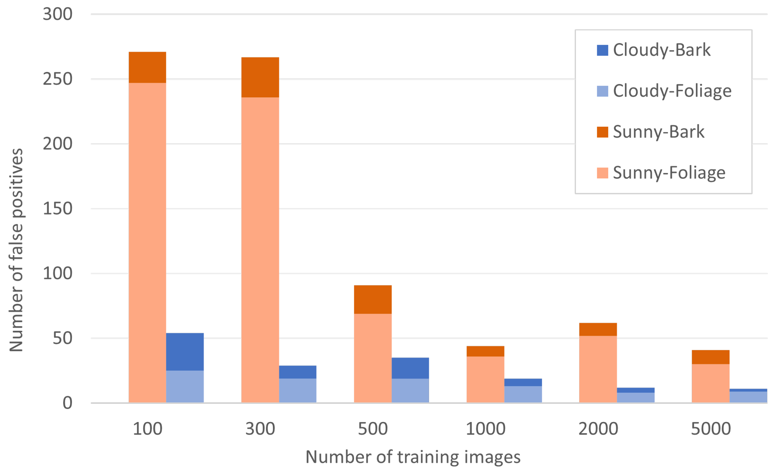
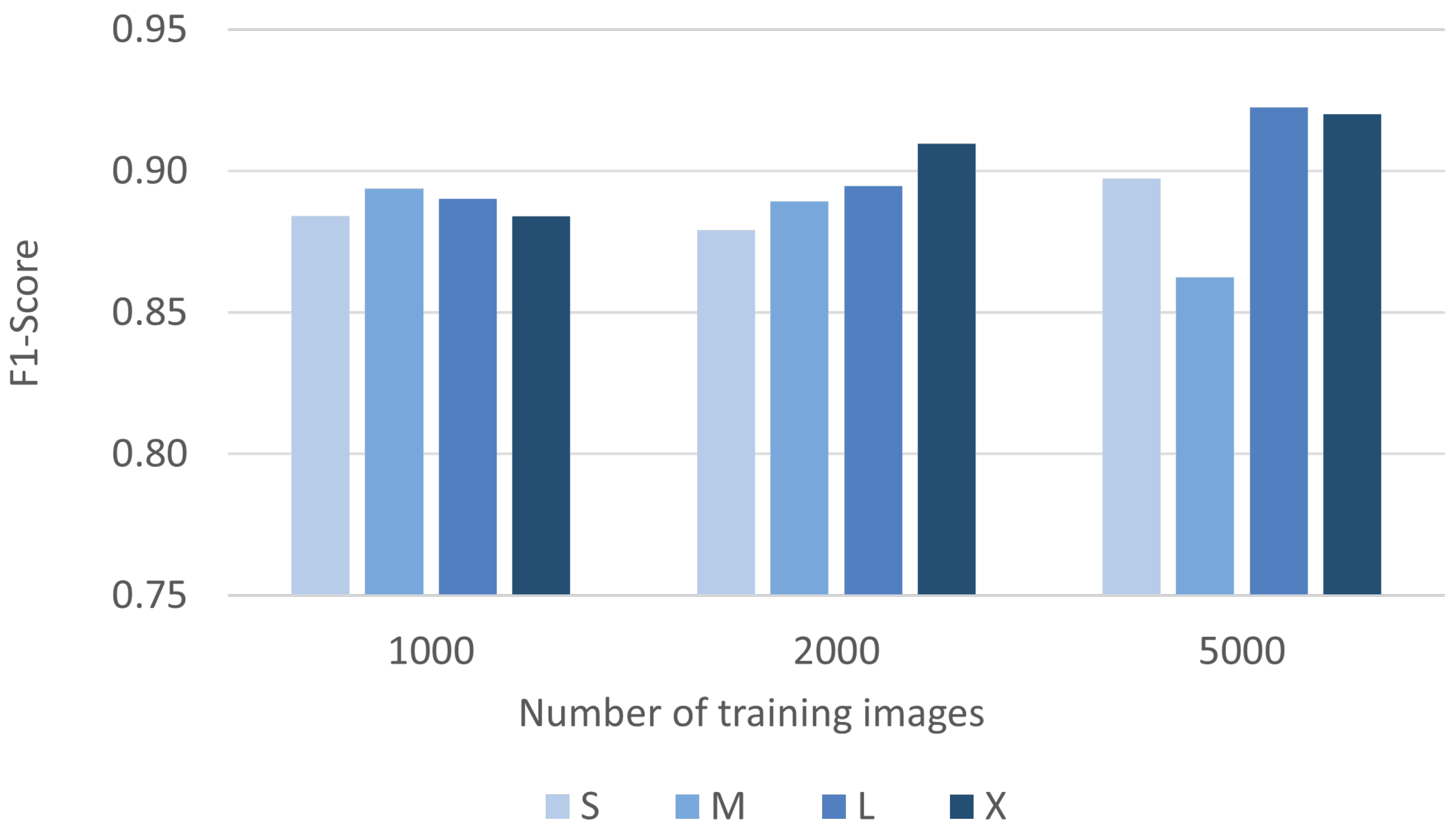
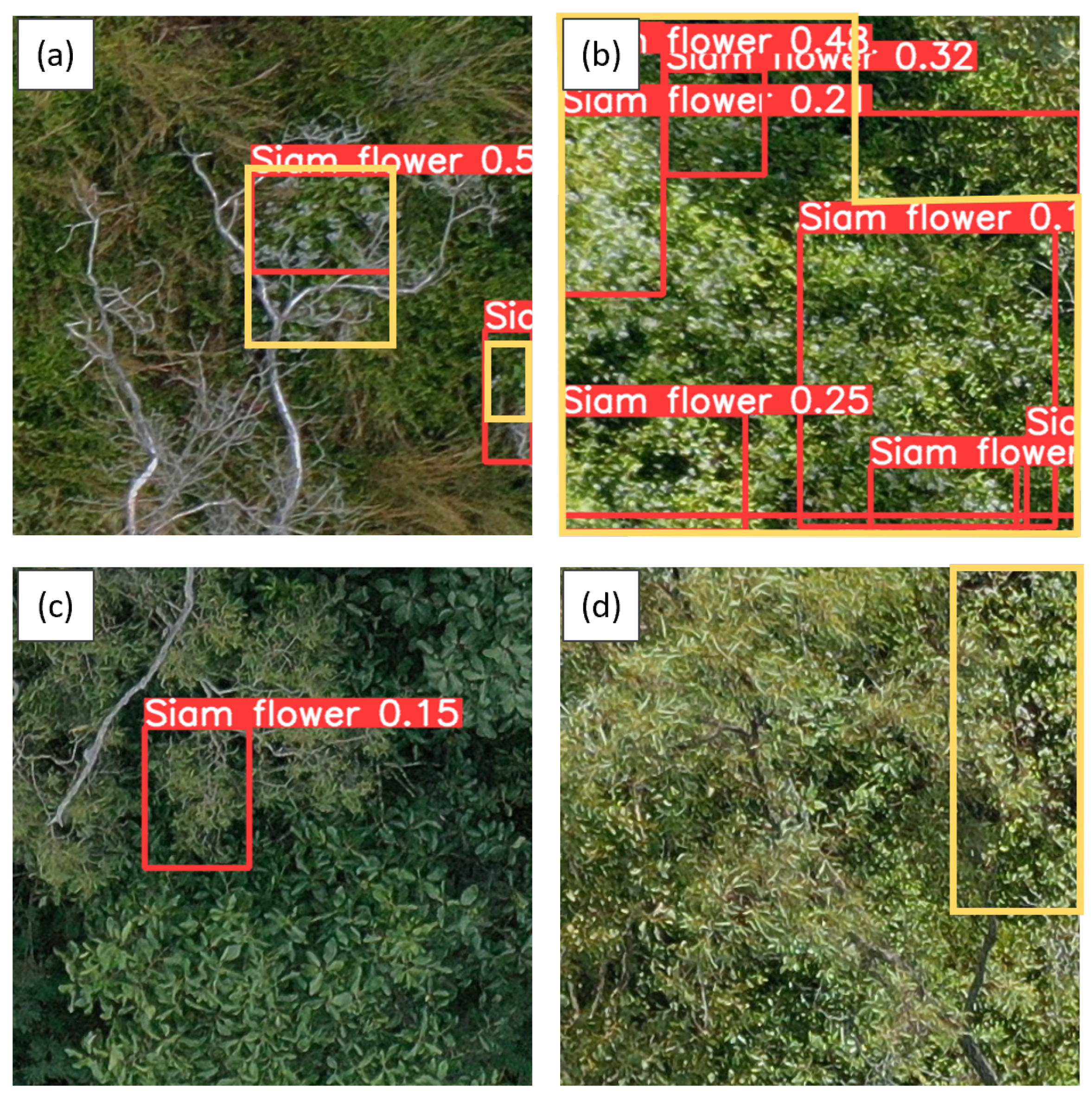
This study explores the efficacy of drone-acquired RGB images and the YOLO model in detecting the invasive species Siam weed (Chromolaena odorata) in natural environments. Siam weed is a perennial scrambling shrub from tropical and sub-tropical America that is invasive outside its native range, causing substantial environmental and economic impacts across Asia, Africa, and Oceania. First detected in Australia in northern Queensland in 1994 and later in the Northern Territory in 2019, there is an urgent need to determine the extent of its incursion across vast, rugged areas of both jurisdictions and a need for distribution mapping at a catchment scale. This study tests drone-based RGB imaging to train a deep learning model that contributes to the goal of surveying non-native vegetation at a catchment scale. We specifically examined the effects of input training images, solar illumination, and model complexity on the model’s detection performance and investigated the sources of false positives. Drone-based RGB images were acquired from four sites in the Townsville region of Queensland to train and test a deep learning model (YOLOv5). Validation was performed through expert visual interpretation of the detection results in image tiles. The YOLOv5 model demonstrated over 0.85 in its F1-Score, which improved to over 0.95 with improved exposure to the images. A reliable detection model was found to be sufficiently trained with approximately 1000 image tiles, with additional images offering marginal improvement. Increased model complexity did not notably enhance model performance, indicating that a smaller model was adequate. False positives often originated from foliage and bark under high solar illumination, and low exposure images reduced these errors considerably. The study demonstrates the feasibility of using YOLO models to detect invasive species in natural landscapes, providing a safe alternative to the current method involving human spotters in helicopters. Future research will focus on developing tools to merge duplicates, gather georeference data, and report detections from large image datasets more efficiently, providing valuable insights for practical applications in environmental management at the catchment scale.
Keywords: invasive species; deep learning; weed management; machine learning; drone; UAV; UAS invasive species; deep learning; weed management; machine learning; drone; UAV; UAS