Article

Spatial-Temporal Evaluation of Satellite-Derived Rainfall Estimations for Water Resource Applications in the Upper Congo River Basin

School of Climate Change & Adaptation, University of Prince Edward Island, Charlottetown, PE C1A 4P3, Canada
Remote Sens. 2024, 16(20), 3868; https://doi.org/10.3390/rs16203868
Submission received: 8 August 2024 / Revised: 10 October 2024 / Accepted: 10 October 2024 / Published: 18 October 2024
(This article belongs to the Special Issue Synergetic Remote Sensing of Clouds and Precipitation II)

Abstract

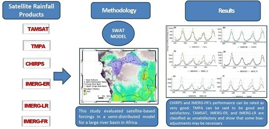
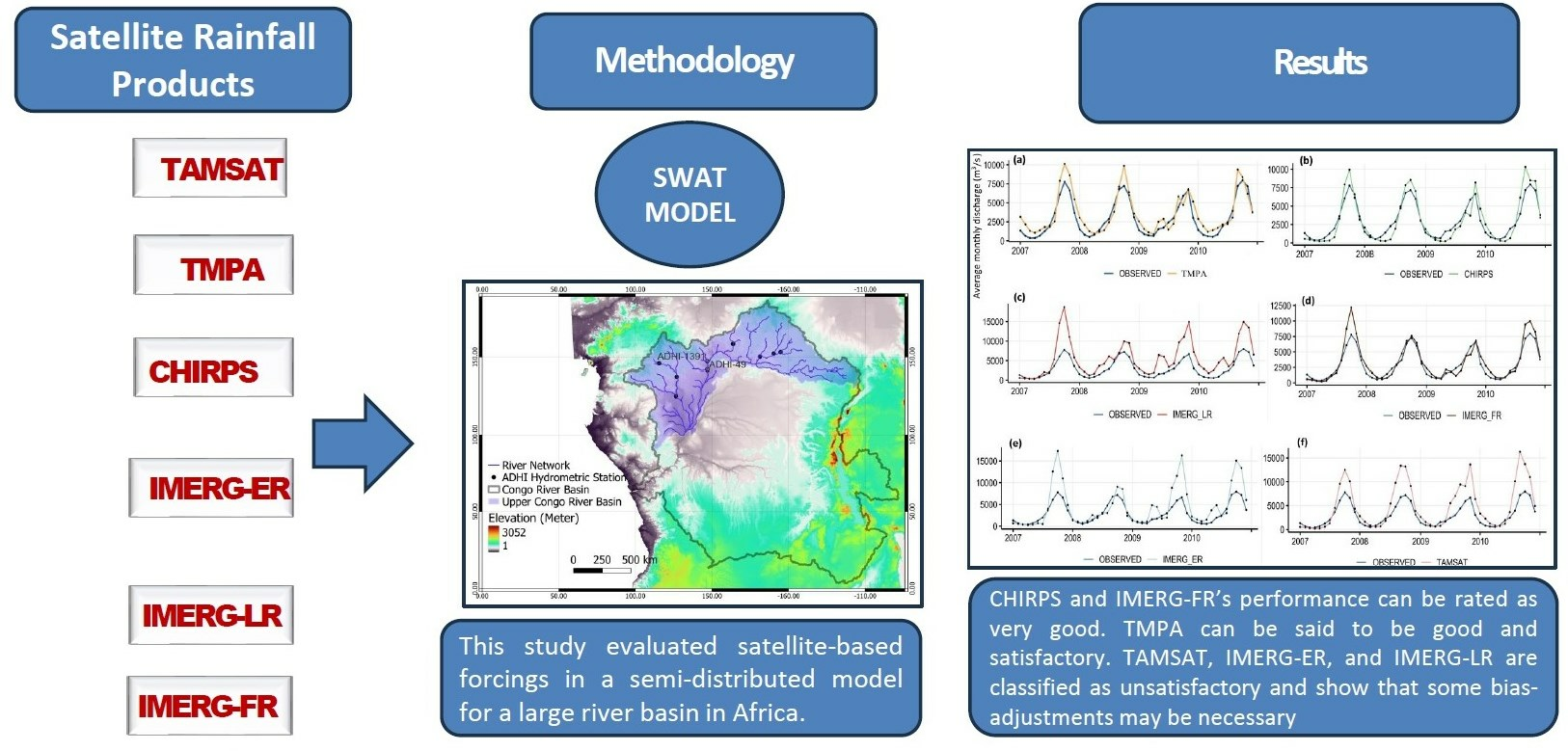
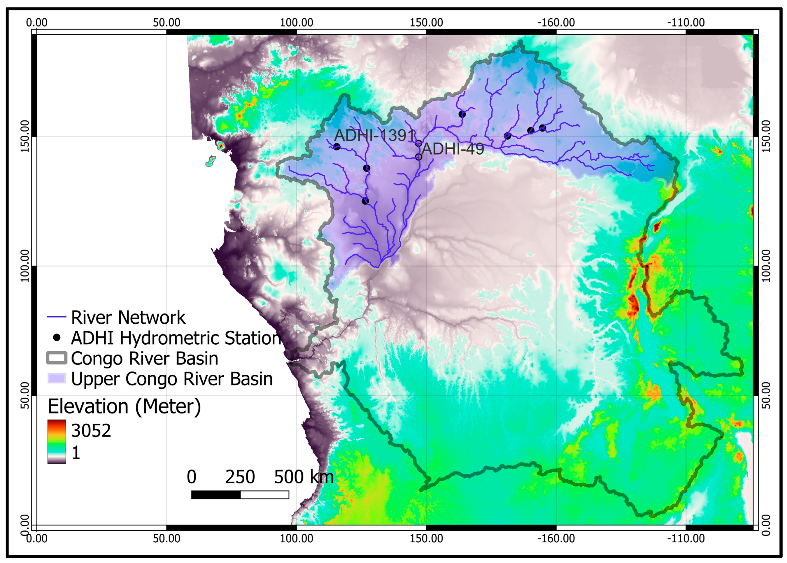
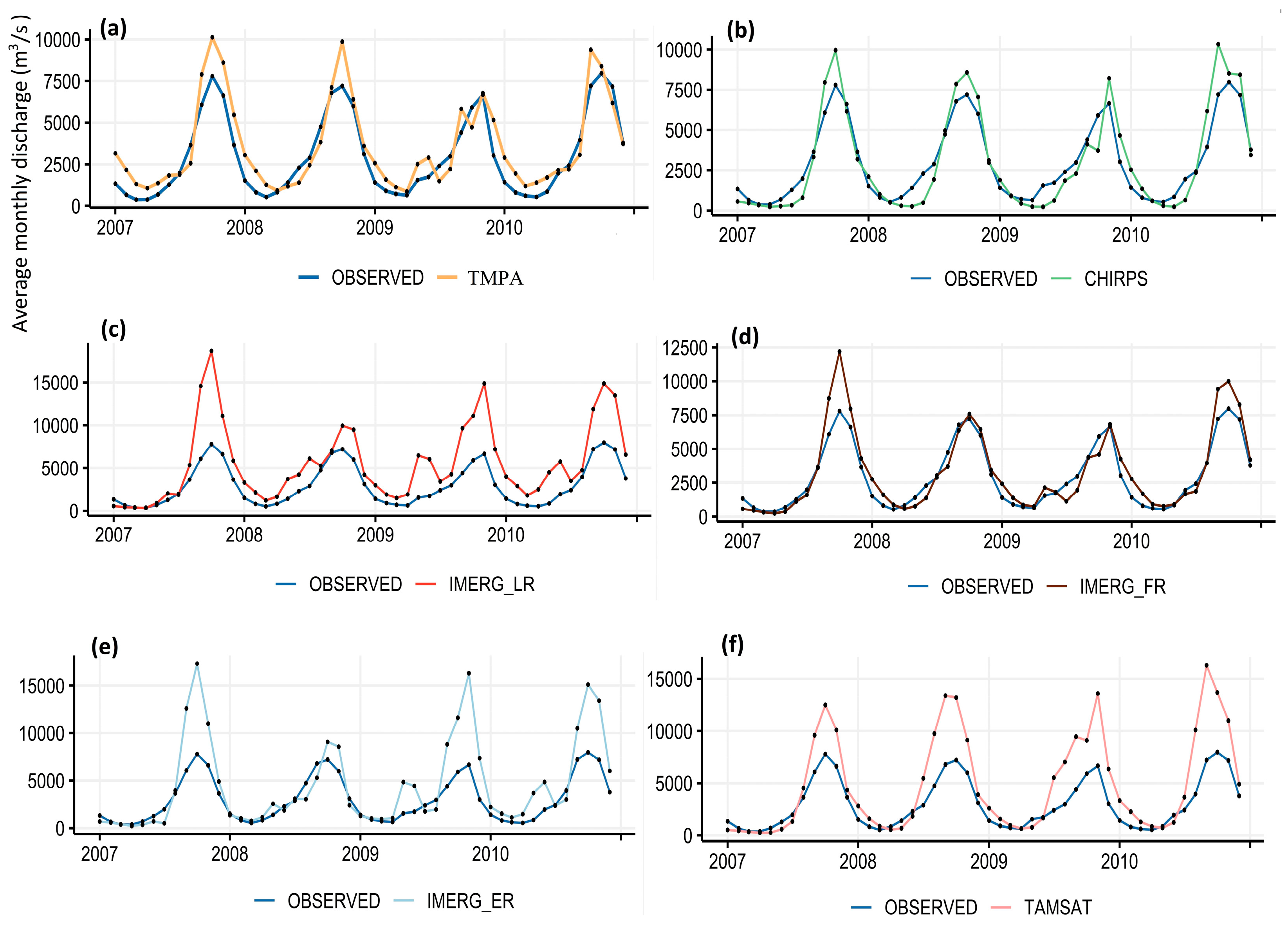
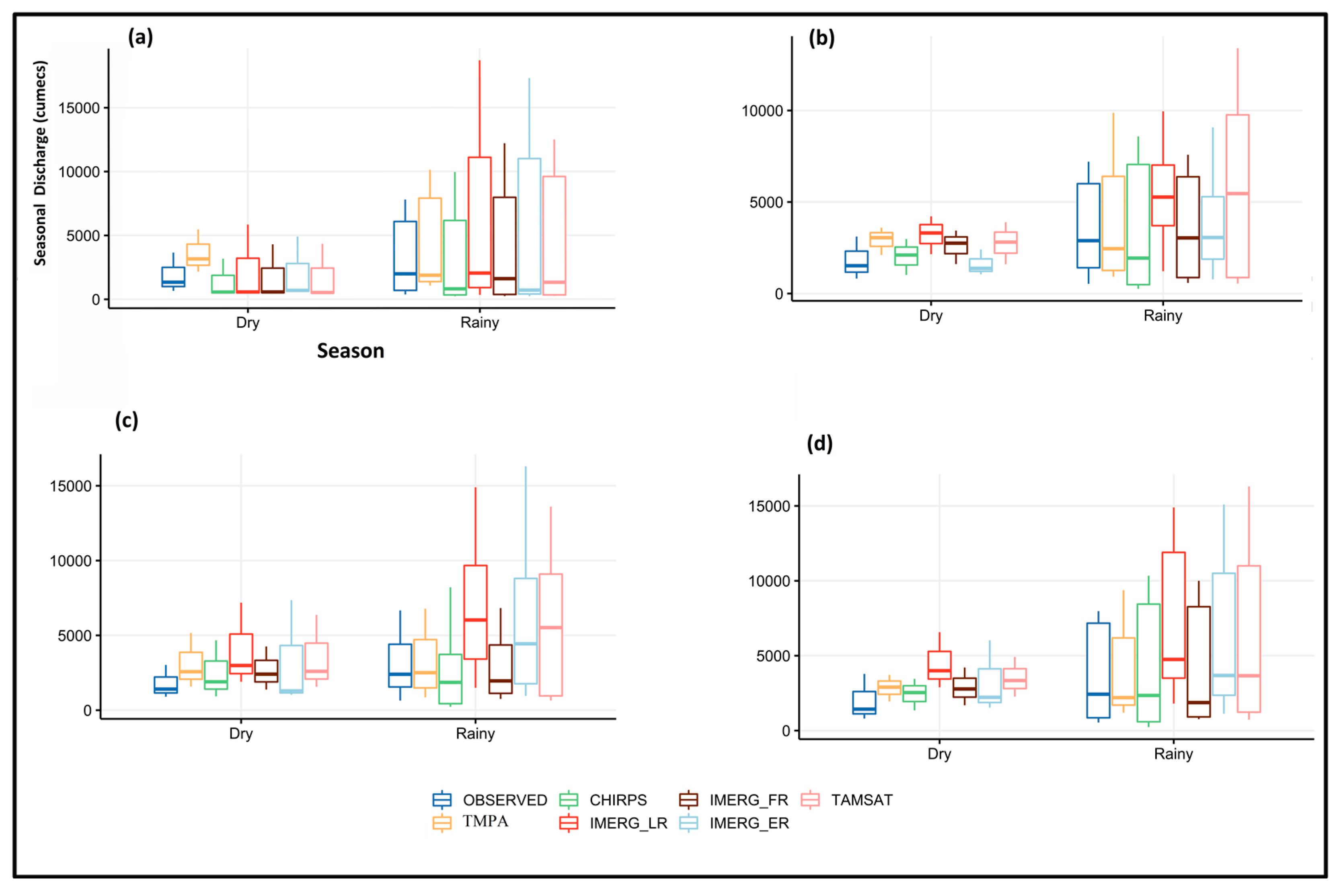
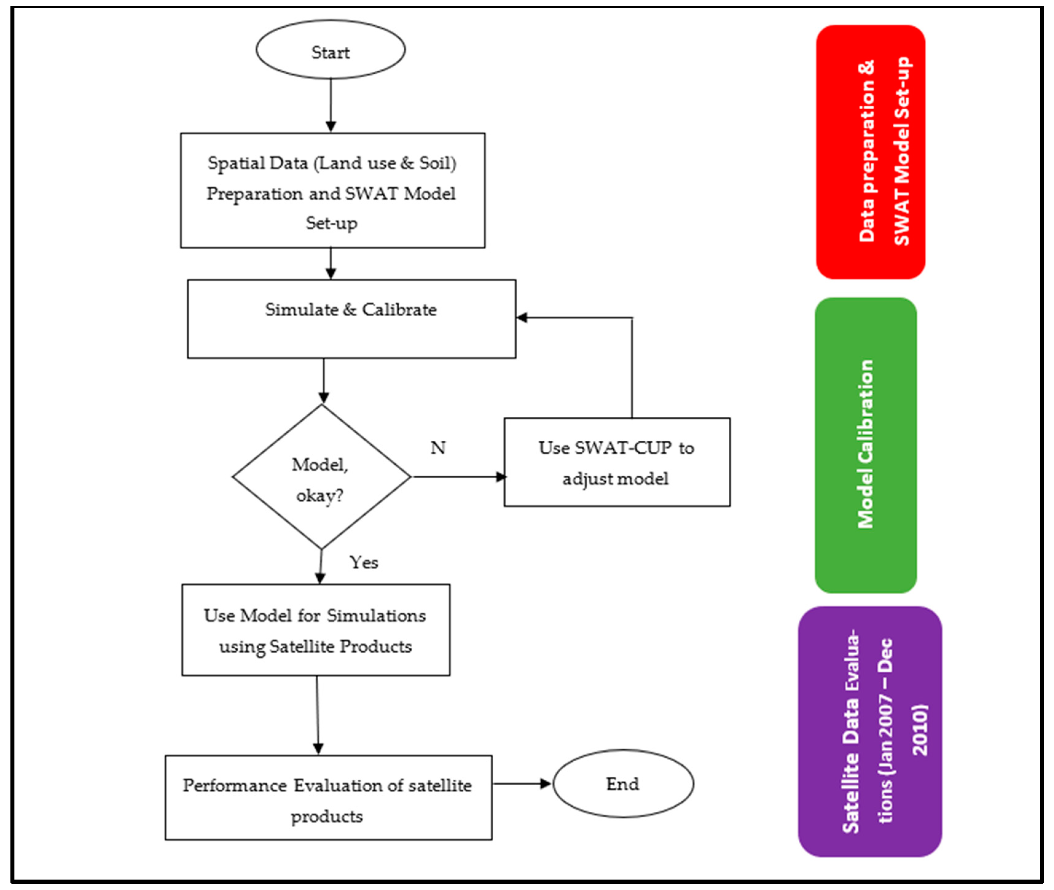
Satellite rainfall estimates are robust alternatives to gauge precipitation, especially in Africa, where several watersheds and regional water basins are poorly gauged or ungauged. In this study, six satellite precipitation products, the Climate Hazards Group Infrared Precipitation with Stations (CHIRPS); Tropical Applications of Meteorology Using Satellite and Ground-based Observations (TAMSAT); TRMM Multi-satellite Precipitation Analysis (TMPA); and the National Aeronautics and Space Administration’s new Integrated Multi-SatellitE Retrievals for Global Precipitation Measurement (GPM) early run (IMERG-ER), late run (IMERG-LR), and final run (IMERG-FR), were used to force a gauge-calibrated Soil & Water Assessment Tool (SWAT) model for the Congo River Basin, Central Africa. In this study, the National Centers for Environmental Prediction’s Climate Forecast System Reanalysis (CFSR) calibrated version of the SWAT was used as the benchmark/reference, while scenario versions were created as configurations using each satellite product identified above. CFSR was used as an independent sample to prevent bias toward any of the satellite products. The calibrated CFSR model captured and reproduced the hydrology (timing, peak flow, and seasonality) of this basin using the average monthly discharge from January 1984–December 1991. Furthermore, the results show that TMPA, IMERG-FR, and CHIRPS captured the peak flows and correctly reproduced the seasonality and timing of the monthly discharges (January 2007–December 2010). In contrast, TAMSAT, IMERG-ER, and IMERG-LR overestimated the peak flows. These results show that some of these precipitation products must be bias-corrected before being used for practical applications. The results of this study will be significant in integrated water resource management in the Congo River Basin and other regional river basins in Africa. Most importantly, the results obtained from this study have been hosted in a repository for free access to all interested in hydrology and water resource management in Africa.
Keywords: SWAT; Congo River Basin; surface water; afforestation; water resources management; satellite precipitation; Africa SWAT; Congo River Basin; surface water; afforestation; water resources management; satellite precipitation; Africa
Graphical Abstract