Article

Assessing the Potential of UAV for Large-Scale Fractional Vegetation Cover Mapping with Satellite Data and Machine Learning

1
College of Forestry, Fujian Agriculture and Forestry University, Fuzhou 350002, China
2
College of JunCao Science and Ecology, Fujian Agriculture and Forestry University, Fuzhou 350002, China
3
National Positioning Observation and Research Station of Red Soil Hill Ecosystem in Changting, Fuzhou 350002, China
4
Key Laboratory of State Forestry and Grassland Administration on Soil and Water Conservation of Red Soil Region in Southern China, Fuzhou 350002, China
5
Cross-Strait Collaborative Innovation Center of Soil and Water Conservation, Fuzhou 350002, China
*
Author to whom correspondence should be addressed.
These authors contributed equally to this work.
Remote Sens. 2024, 16(19), 3587; https://doi.org/10.3390/rs16193587
Submission received: 11 July 2024 / Revised: 21 September 2024 / Accepted: 24 September 2024 / Published: 26 September 2024

Abstract

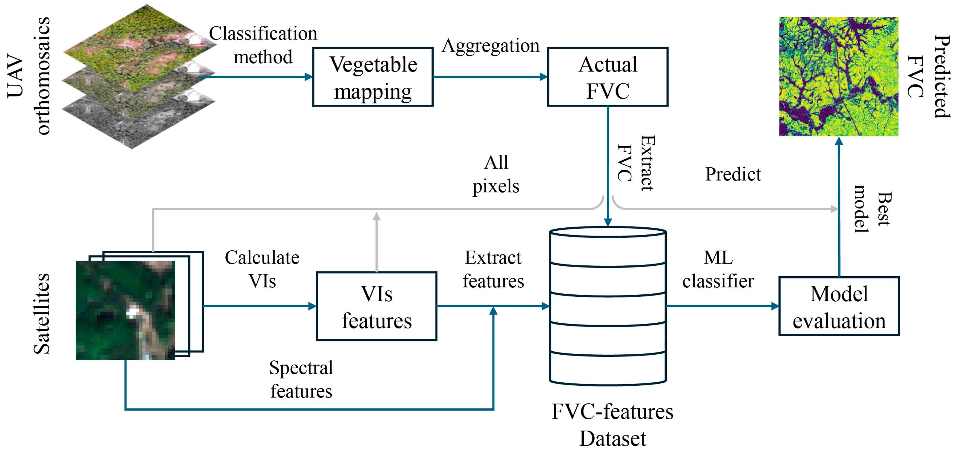
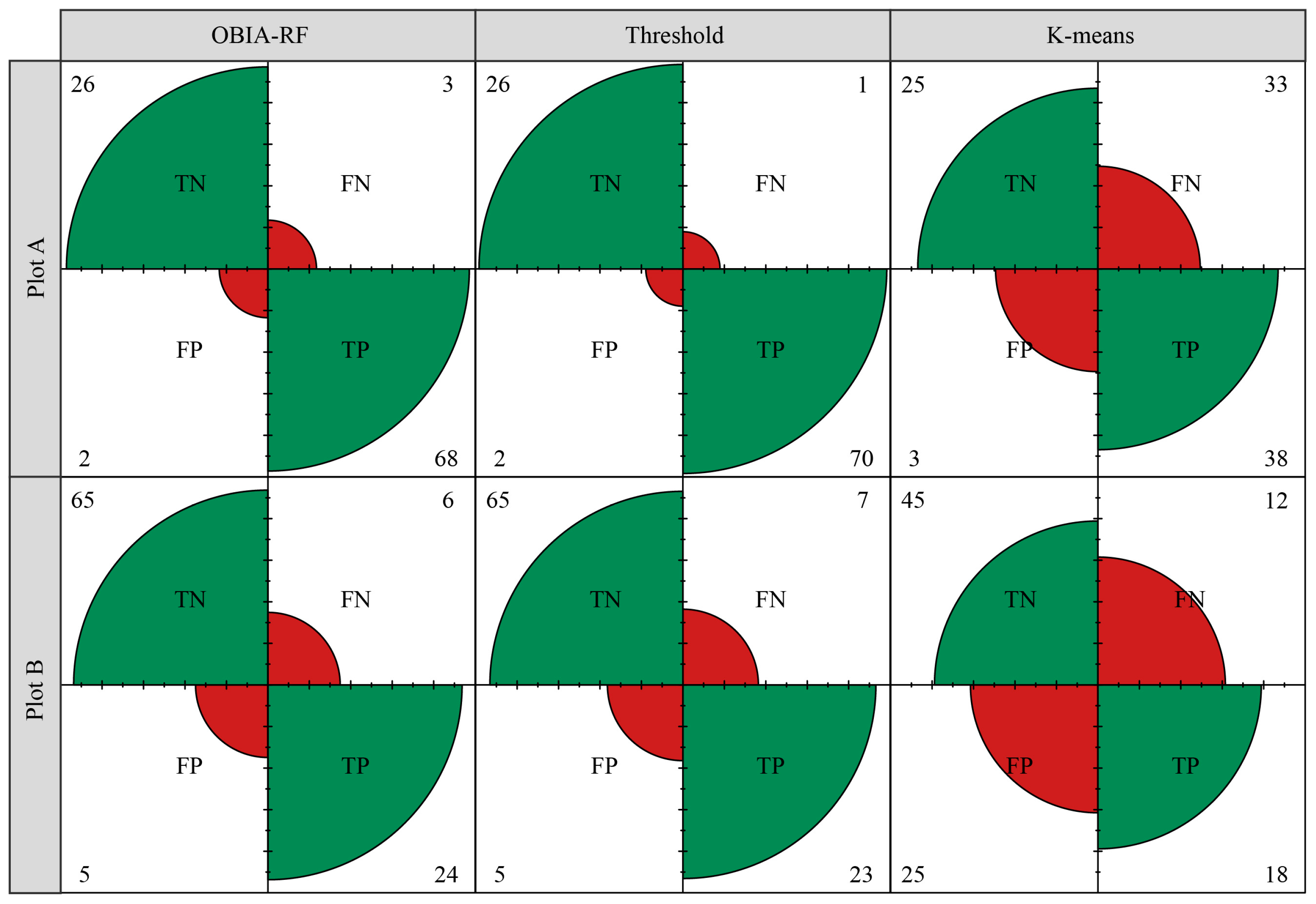
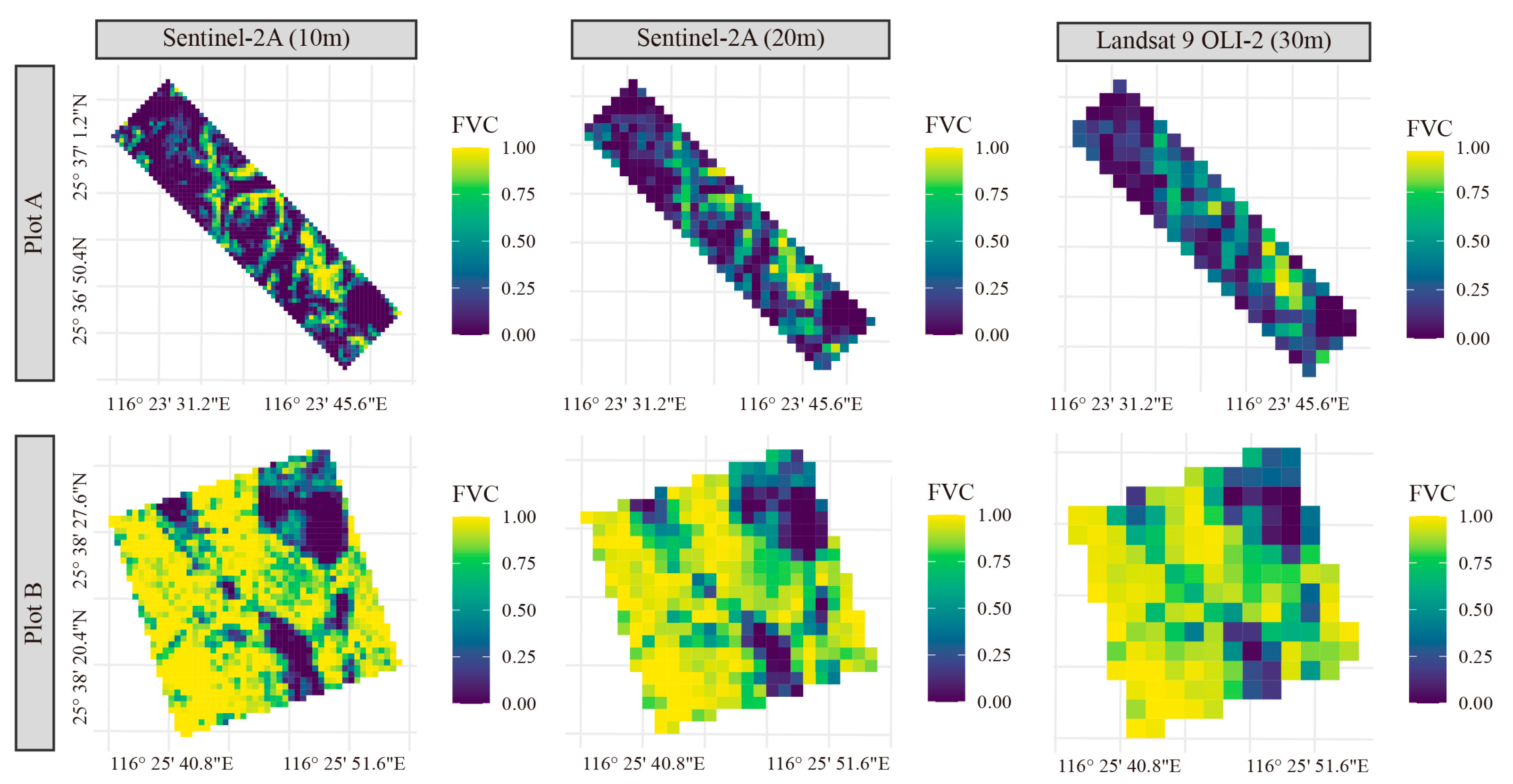
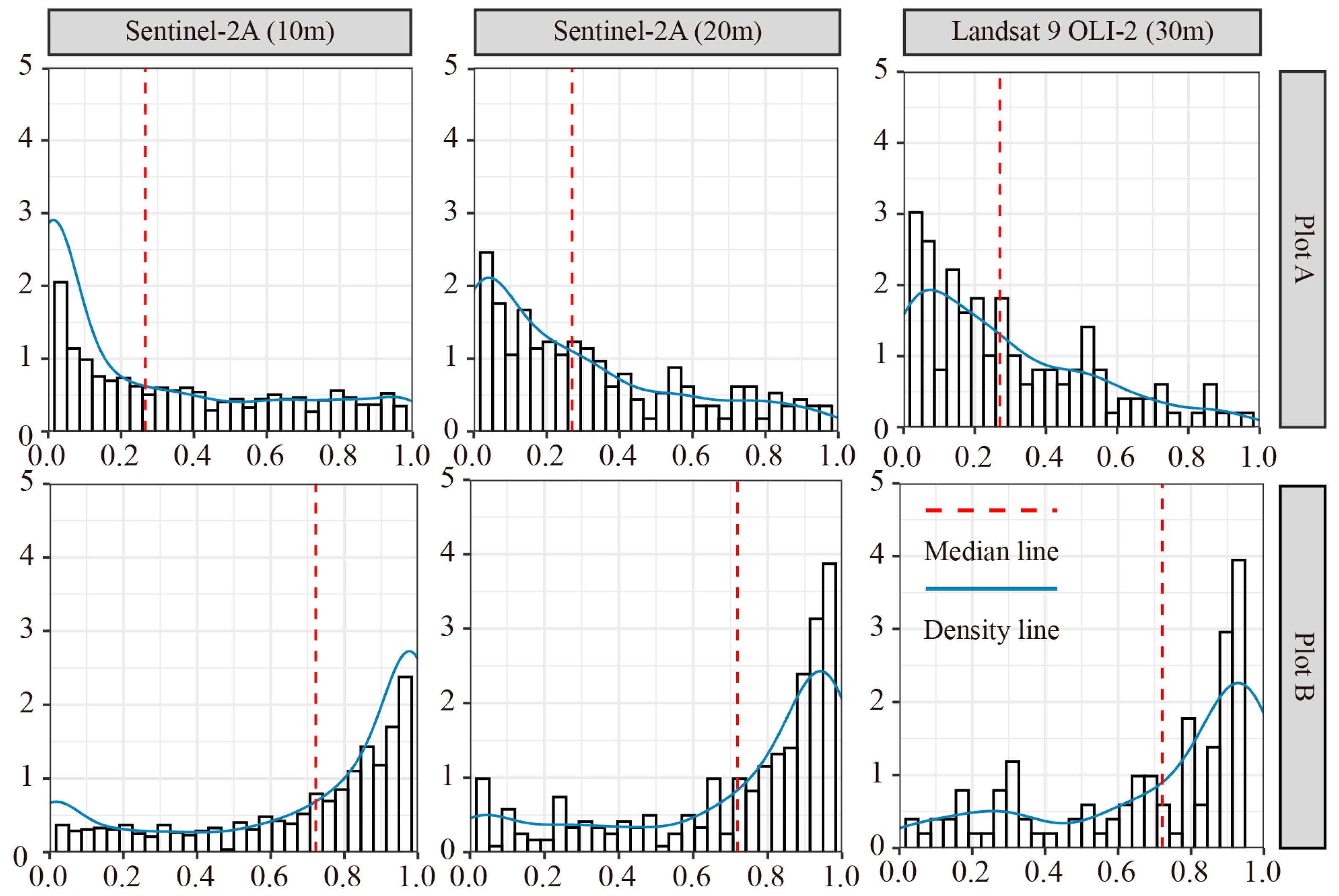
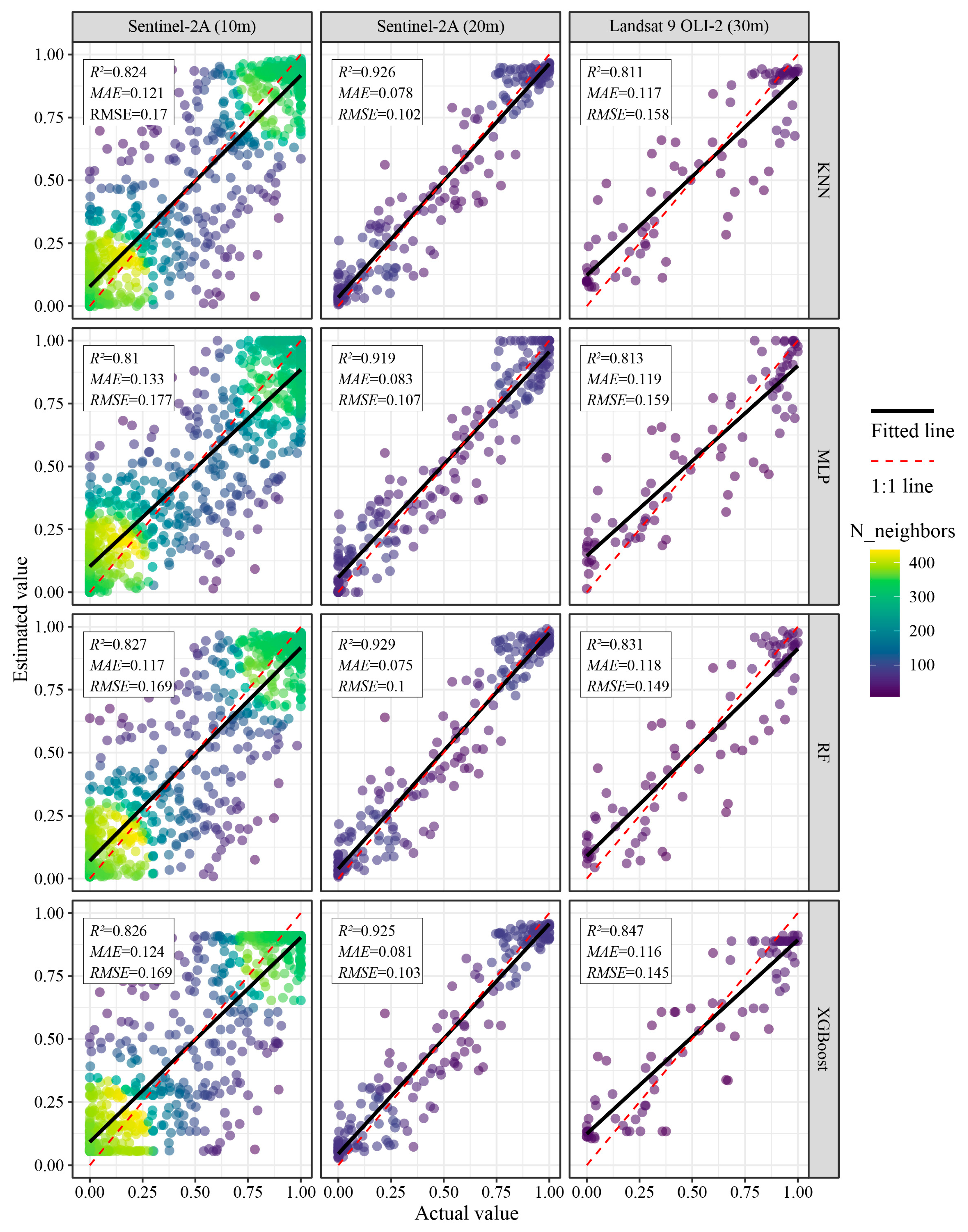
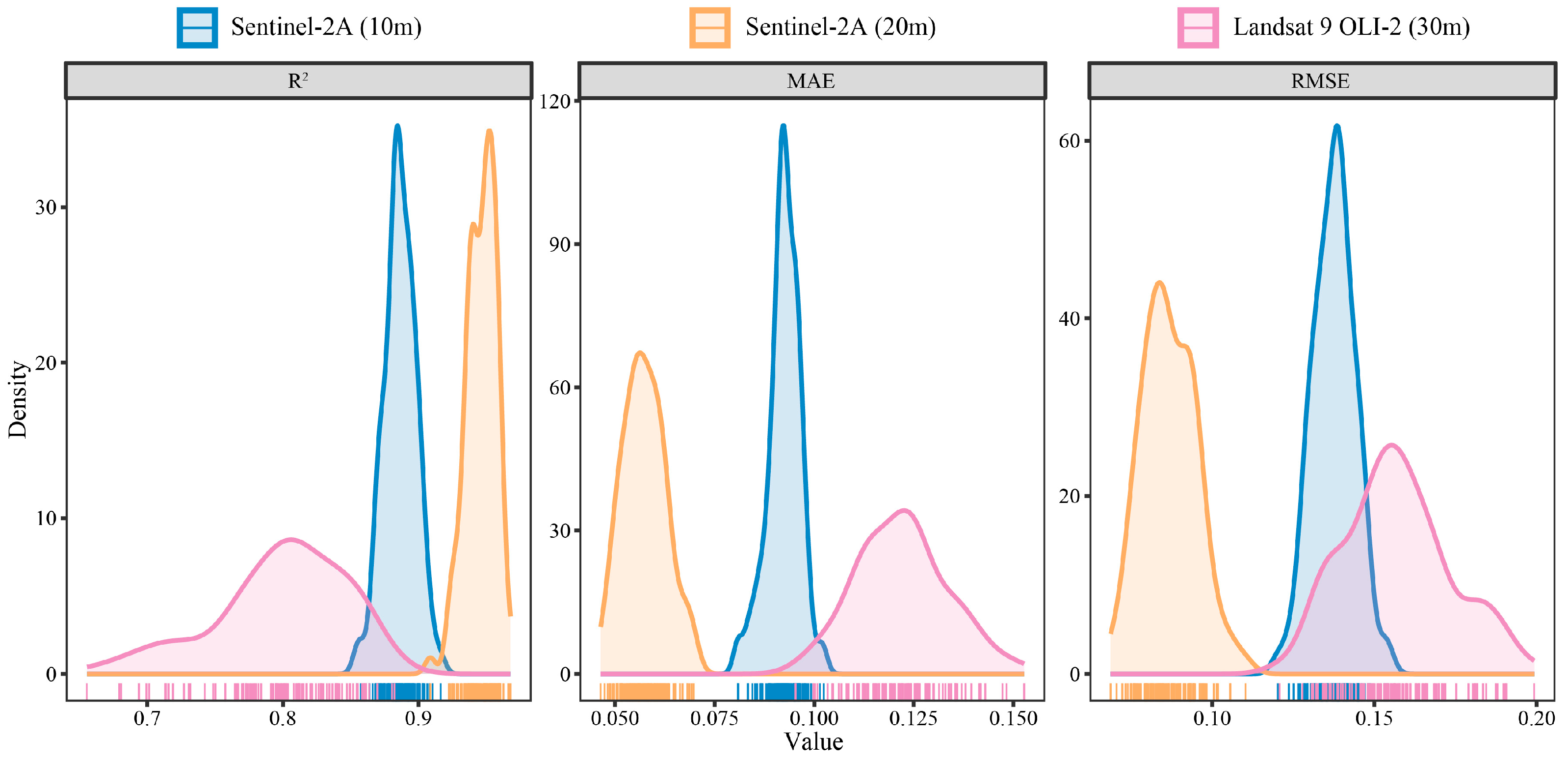
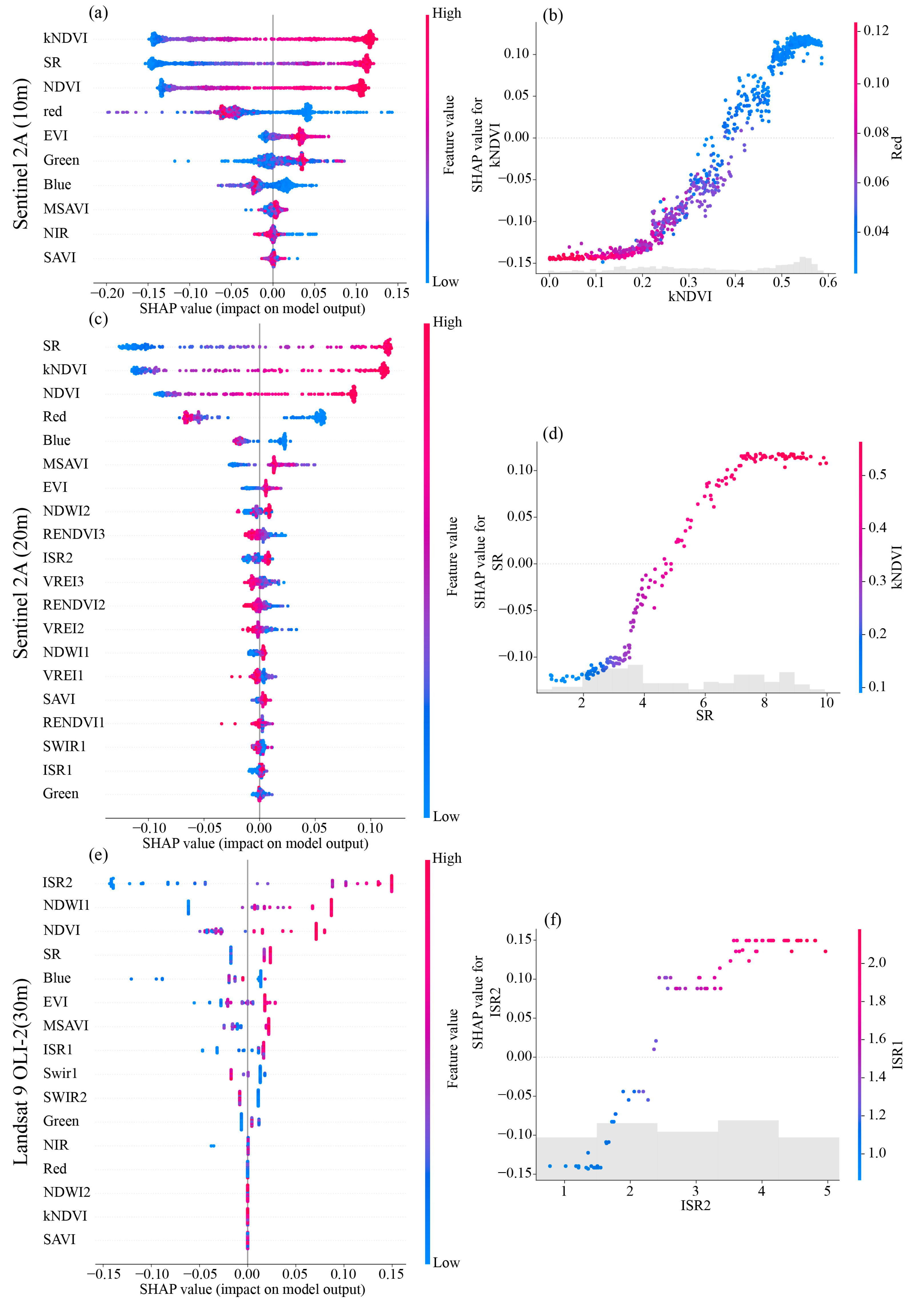
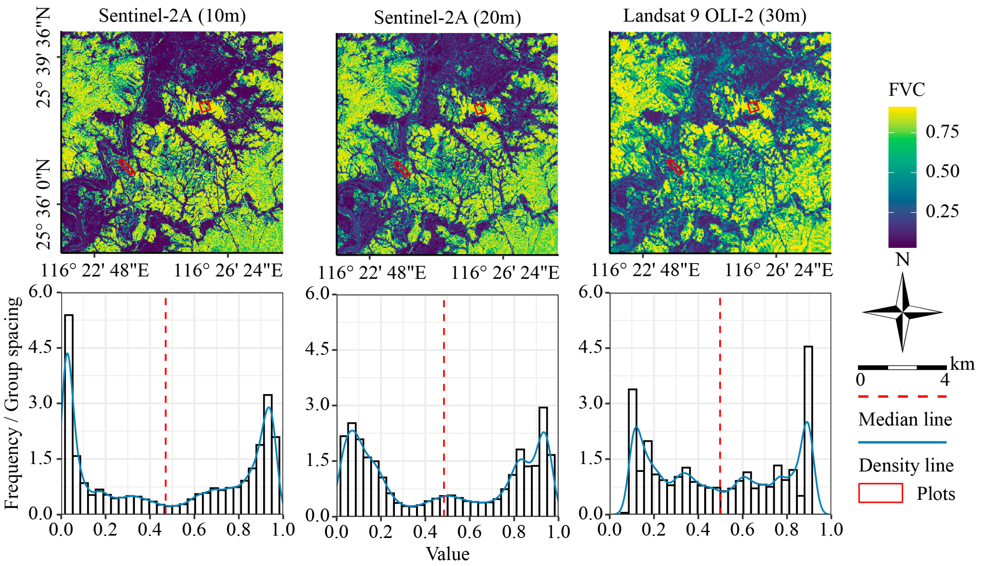
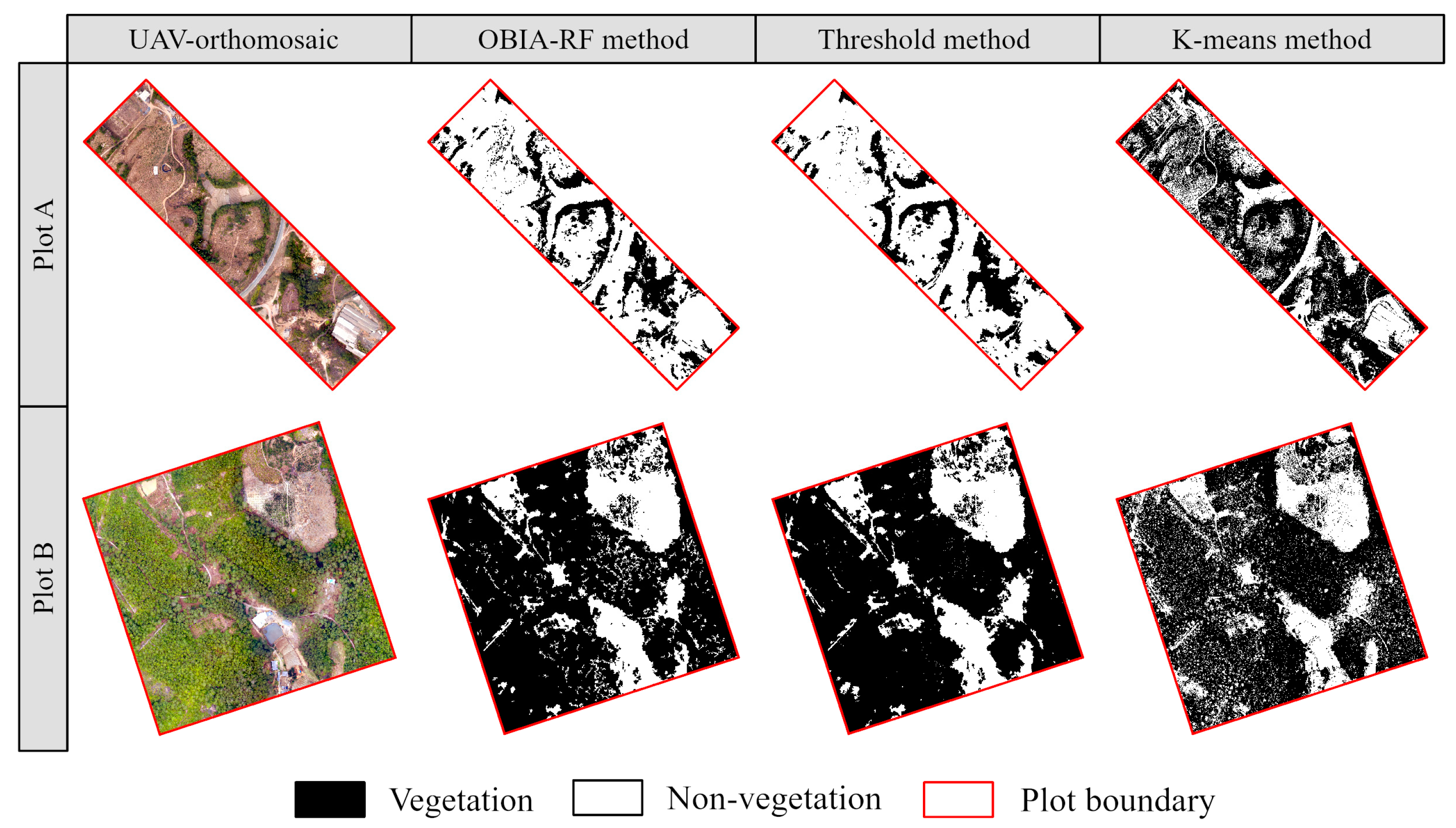
Fractional vegetation cover (FVC) is an essential metric for valuating ecosystem health and soil erosion. Traditional ground-measuring methods are inadequate for large-scale FVC monitoring, while remote sensing-based estimation approaches face issues such as spatial scale discrepancies between ground truth data and image pixels, as well as limited sample representativeness. This study proposes a method for FVC estimation integrating uncrewed aerial vehicle (UAV) and satellite imagery using machine learning (ML) models. First, we assess the vegetation extraction performance of three classification methods (OBIA-RF, threshold, and K-means) under UAV imagery. The optimal method is then selected for binary classification and aggregated to generate high-accuracy FVC reference data matching the spatial resolutions of different satellite images. Subsequently, we construct FVC estimation models using four ML algorithms (KNN, MLP, RF, and XGBoost) and utilize the SHapley Additive exPlanation (SHAP) method to assess the impact of spectral features and vegetation indices (VIs) on model predictions. Finally, the best model is used to map FVC in the study region. Our results indicate that the OBIA-RF method effectively extract vegetation information from UAV images, achieving an average precision and recall of 0.906 and 0.929, respectively. This method effectively generates high-accuracy FVC reference data. With the improvement in the spatial resolution of satellite images, the variability of FVC data decreases and spatial continuity increases. The RF model outperforms others in FVC estimation at 10 m and 20 m resolutions, with R2 values of 0.827 and 0.929, respectively. Conversely, the XGBoost model achieves the highest accuracy at a 30 m resolution, with an R2 of 0.847. This study also found that FVC was significantly related to a number of satellite image VIs (including red edge and near-infrared bands), and this correlation was enhanced in coarser resolution images. The method proposed in this study effectively addresses the shortcomings of conventional FVC estimation methods, improves the accuracy of FVC monitoring in soil erosion areas, and serves as a reference for large-scale ecological environment monitoring using UAV technology.
Keywords: fractional vegetation cover (FVC); uncrewed aerial vehicle (UAV); multi-scale satellite; machine learning (ML) fractional vegetation cover (FVC); uncrewed aerial vehicle (UAV); multi-scale satellite; machine learning (ML)