Article

InSAR-Based Early Warning Monitoring Framework to Assess Aquifer Deterioration

1
Department of Civil, Building and Environmental Engineering (DICEA), Sapienza University of Rome, 00185 Rome, Italy
2
Department of Water Resources, Faculty of Agricultural Engineering, University of Concepción, Chillan 3780000, Chile
3
Department of Civil Engineering, University of Concepcion, Concepcion 4070409, Chile
4
Water Resources Center for Agriculture and Mining (CRHIAM), University of Concepcion, Concepcion 4089100, Chile
*
Author to whom correspondence should be addressed.
Remote Sens. 2023, 15(7), 1786; https://doi.org/10.3390/rs15071786
Submission received: 21 February 2023 / Revised: 16 March 2023 / Accepted: 22 March 2023 / Published: 27 March 2023
(This article belongs to the Special Issue Remote Sensing Approaches to Groundwater Management and Mapping)

Abstract

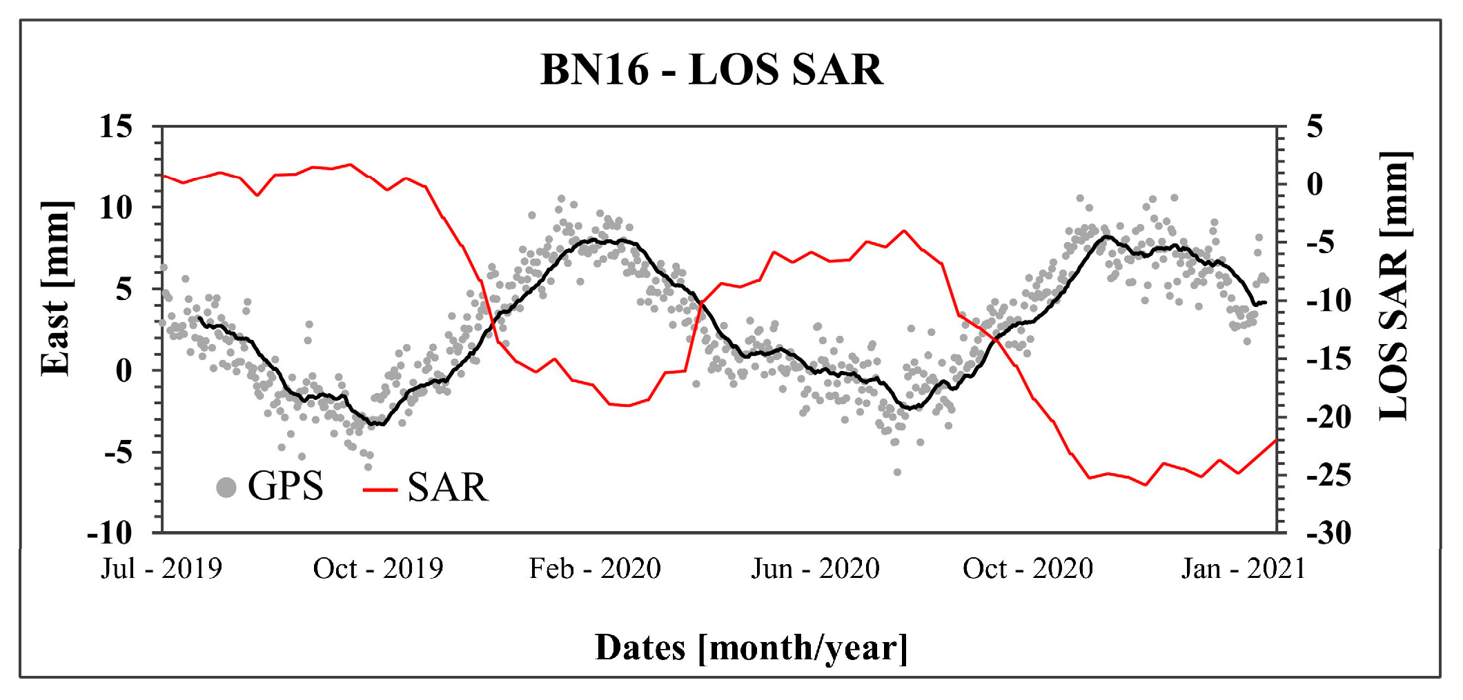
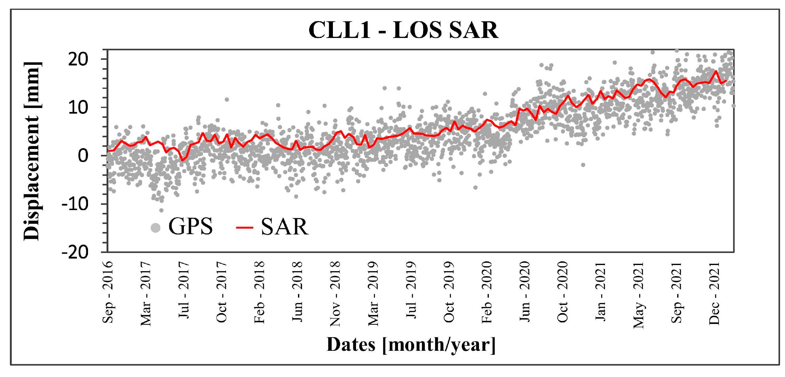
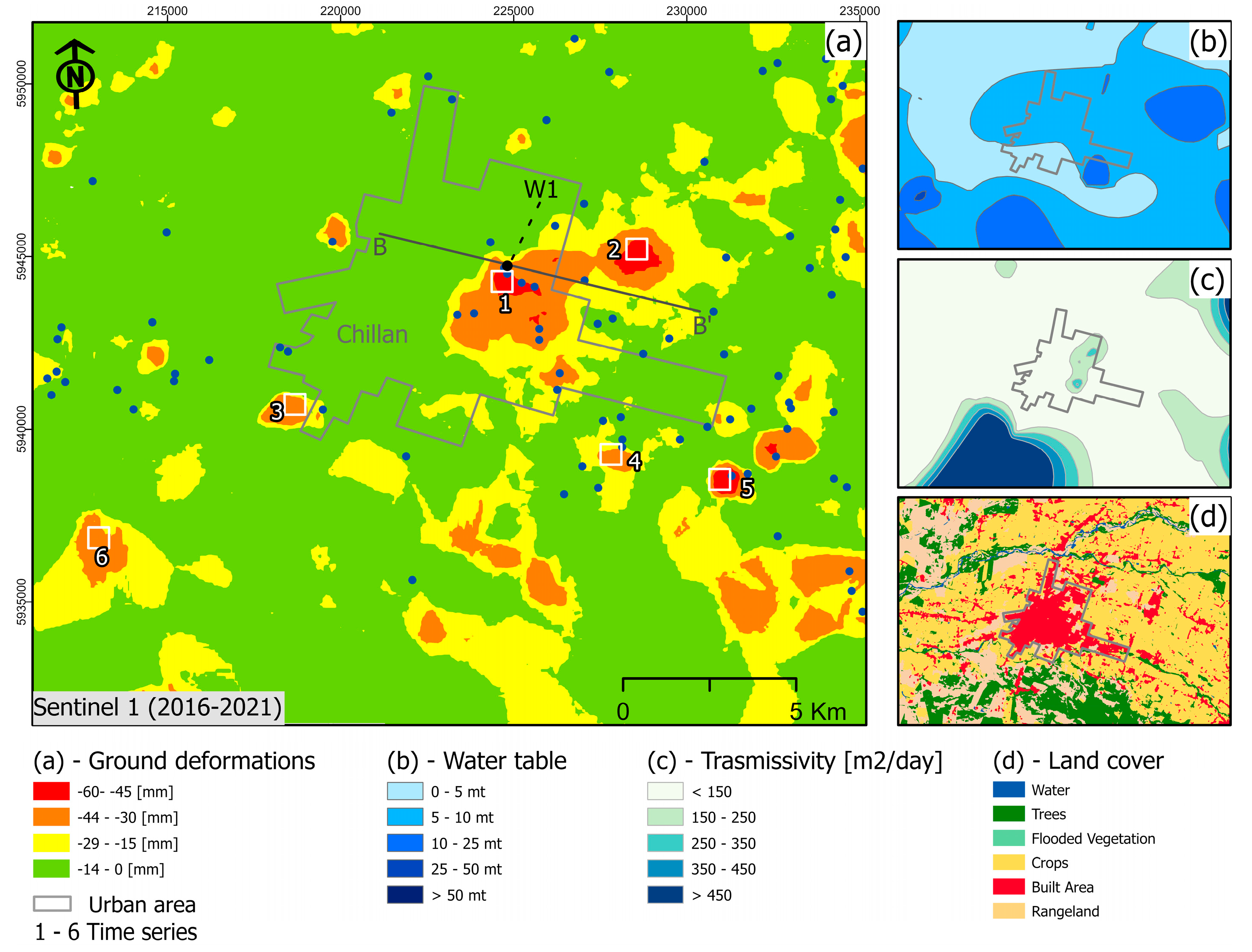
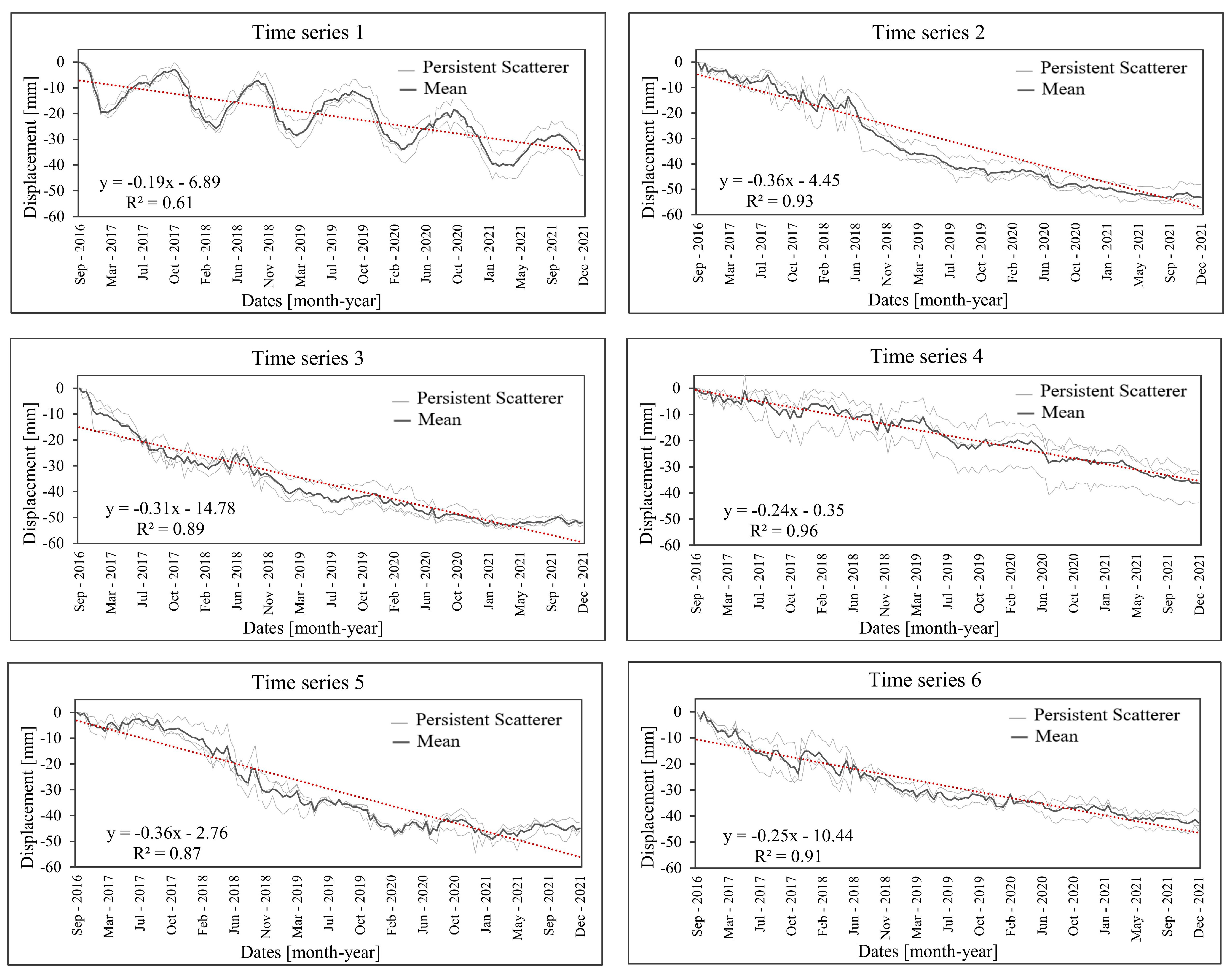
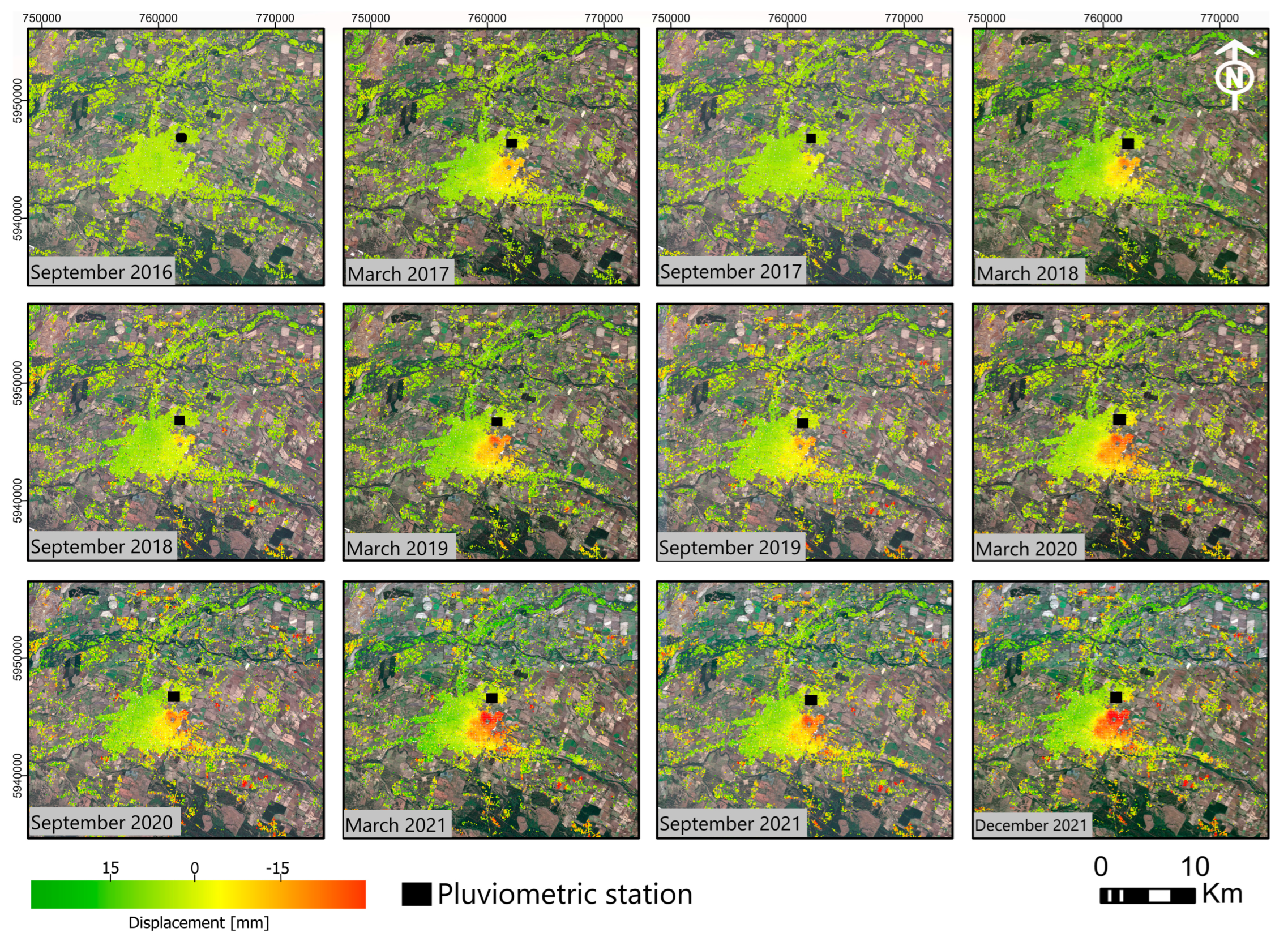
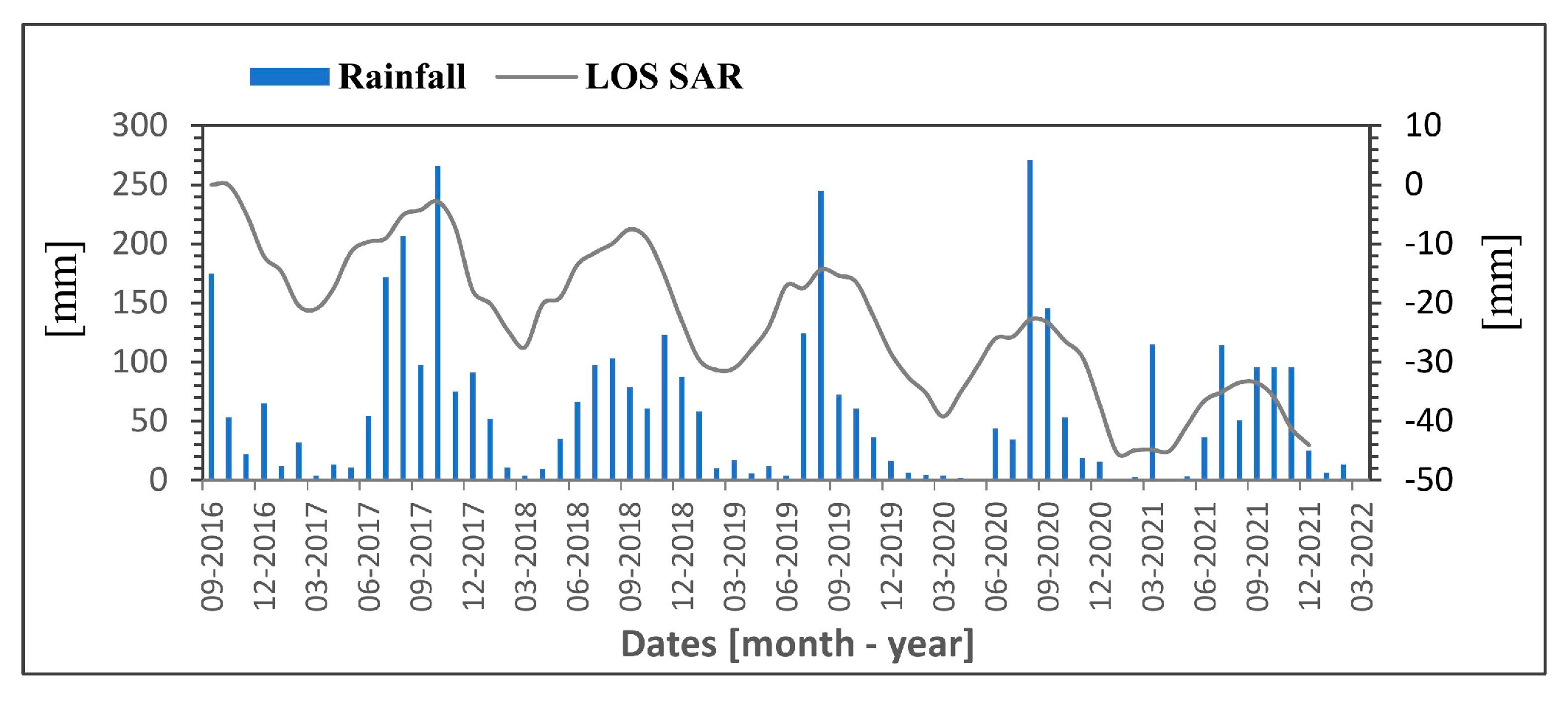
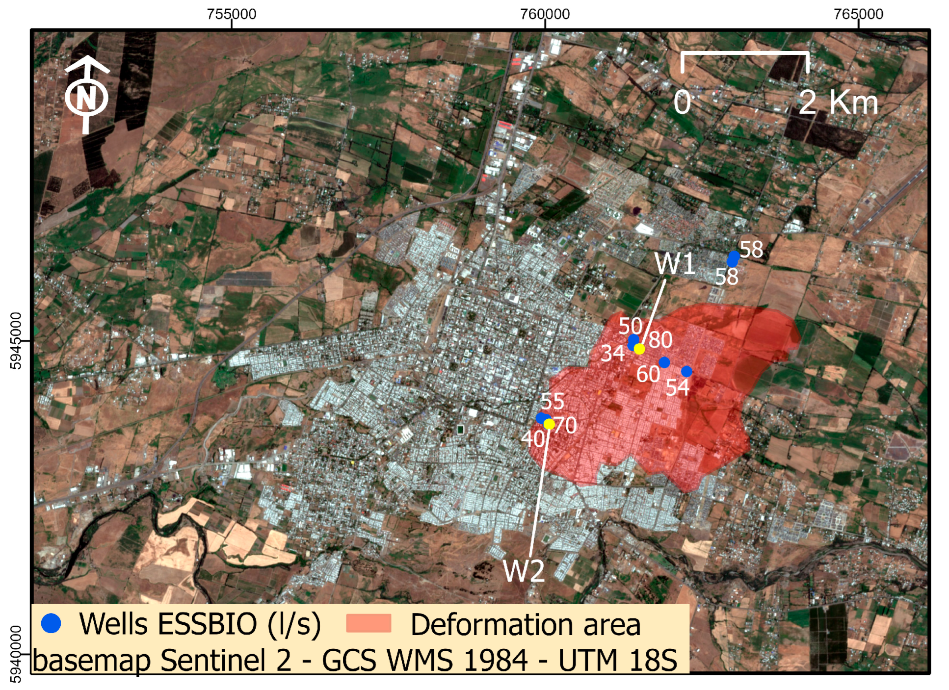
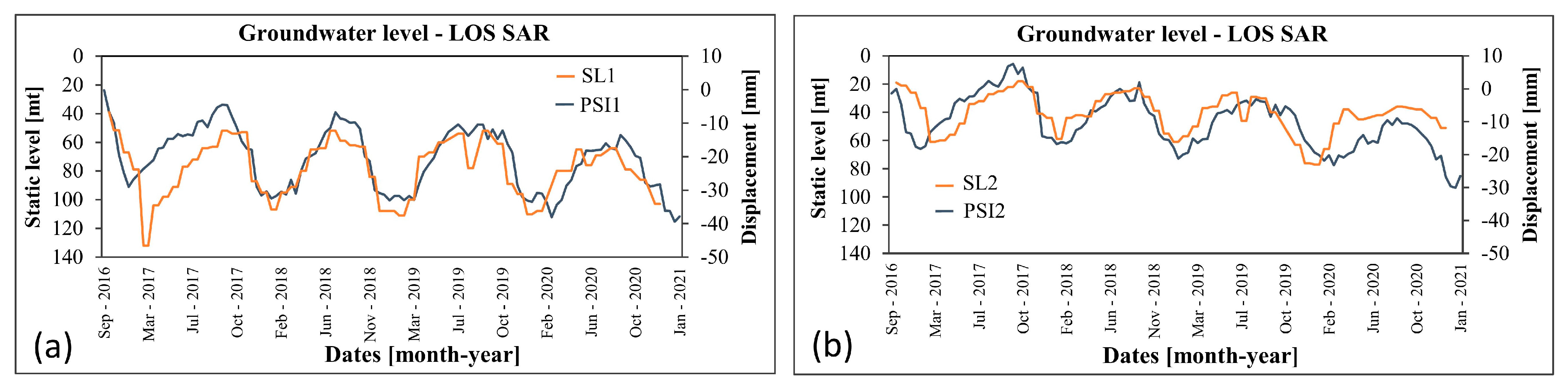
Aquifer surveillance is key to understanding the dynamics of groundwater reservoirs. Attention should be focused on developing strategies to monitor and mitigate the adverse consequences of overexploitation. In this context, ground surface deformation monitoring allows us to estimate the spatial and temporal distribution of groundwater levels, determine the recharge times of the aquifers, and calibrate the hydrological models. This study proposes a methodology for implementing advanced multitemporal differential interferometry (InSAR) techniques for water withdrawal surveillance and early warning assessment. For this, large open-access images were used, a total of 145 SAR images from the Sentinel 1 C-band satellite provided by the Copernicus mission of the European Space Agency. InSAR processing was carried out with an algorithm based on parallel computing technology implemented in cloud infrastructure, optimizing complex workflows and processing times. The surveillance period records 6-years of satellite observation from September 2016 to December 2021 over the city of Chillan (Chile), an area exposed to urban development and intensive agriculture, where ~80 wells are located. The groundwater flow path spans from the Andes Mountain range to the Pacific Ocean, crossing the Itata river basin in the Chilean central valley. InSAR validation measurements were carried out by comparing the results with the values of continuous GNSS stations available in the area of interest. The performance analysis is based on spatial analysis, time series, meteorological stations data, and static level measurements, as well as hydrogeological structure. The results indicate seasonal variations in winter and summer, which corresponds to the recovery and drawdown periods with velocities > −10 mm/year, and an aquifer deterioration trend of up to 60 mm registered in the satellite SAR observation period. Our results show an efficient tool to monitor aquifer conditions, including irreversible consolidation and storage capacity loss, allowing timely decision making to avoid harmful exploitation.
Keywords: aquifer; water withdrawal; ground deformation; surveillance; InSAR aquifer; water withdrawal; ground deformation; surveillance; InSAR
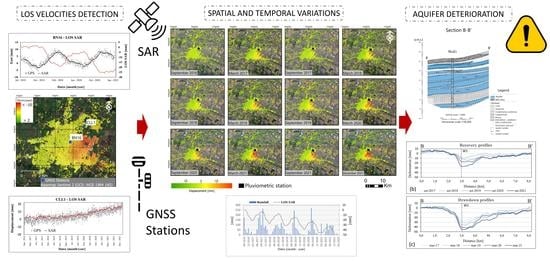

Graphical Abstract