Article

Vegetation Cover Dynamics in the High Atlas Mountains of Morocco

1
Organic Plant Production and Agroecosystems Research in the Tropics and Subtropics, University of Kassel, 37213 Witzenhausen, Germany
2
Fundamental and Applied Geosciences, Department of Geology, Faculty of Sciences Aïn Chock, University Hassan II-Casablanca, B.P 5366Maarif, Casablanca 20100, Morocco
*
Author to whom correspondence should be addressed.
These authors contributed equally to this work.
Remote Sens. 2023, 15(5), 1366; https://doi.org/10.3390/rs15051366
Submission received: 20 December 2022 / Revised: 12 February 2023 / Accepted: 20 February 2023 / Published: 28 February 2023
(This article belongs to the Special Issue Advances in Agricultural Remote Sensing and Artificial Intelligence)

Abstract

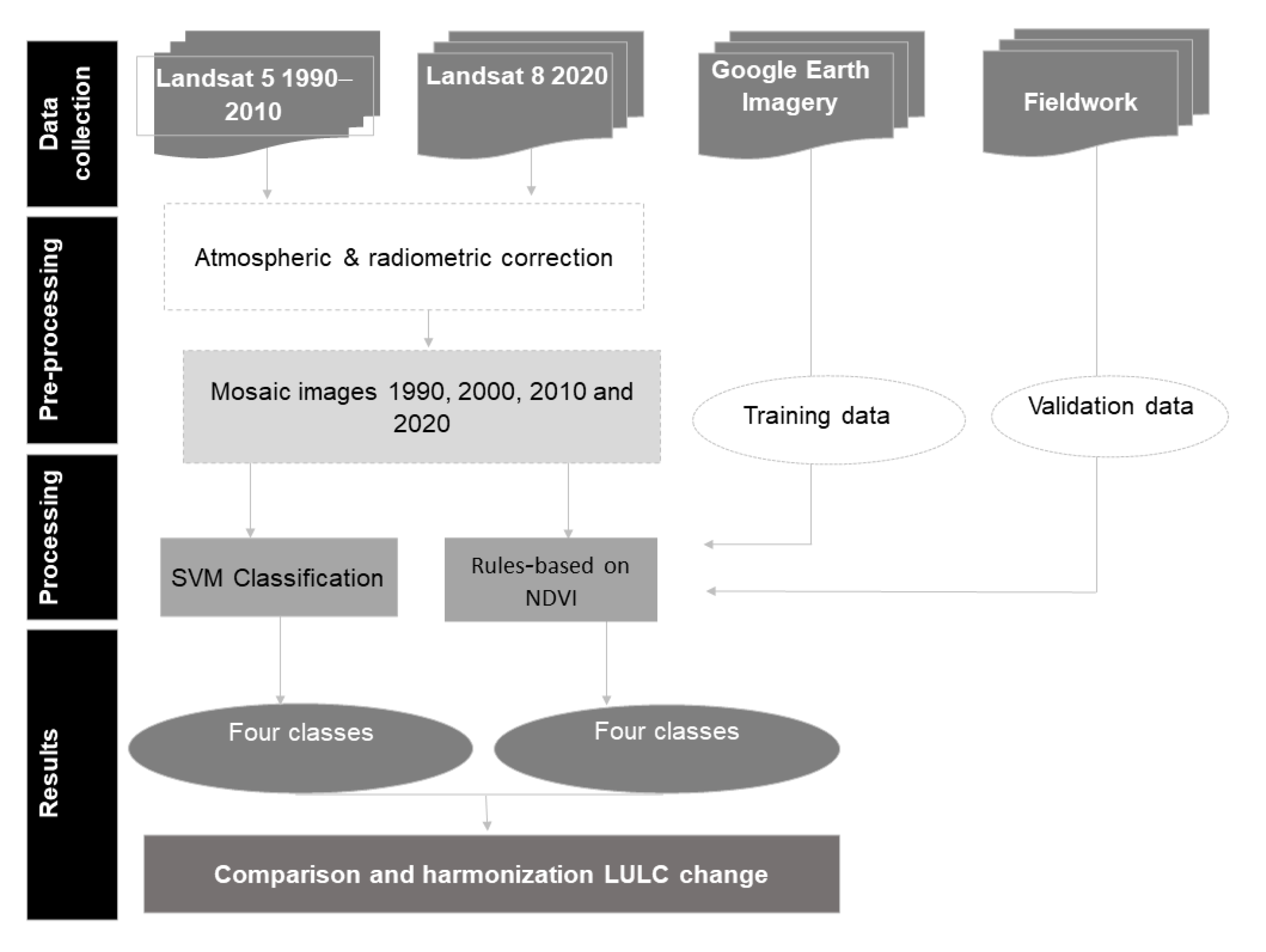
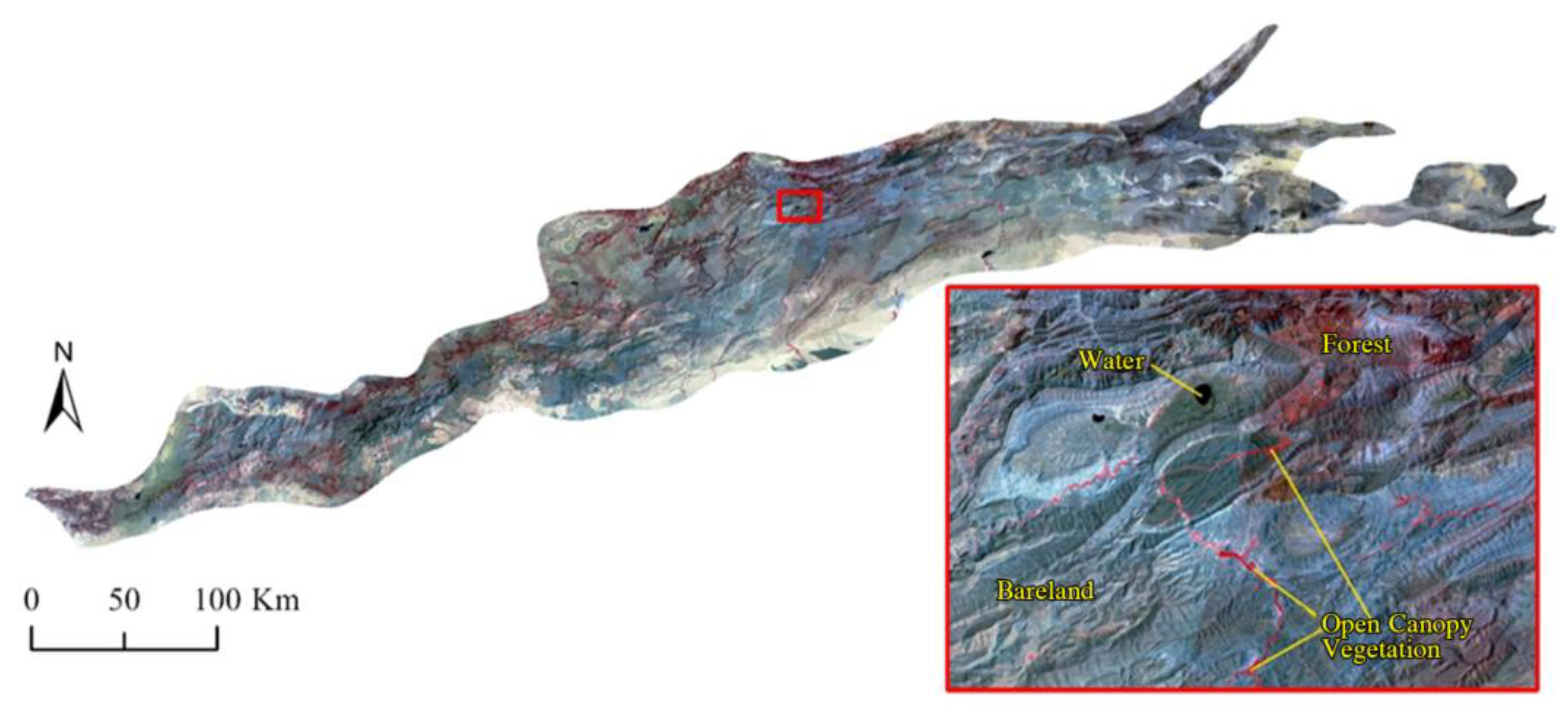
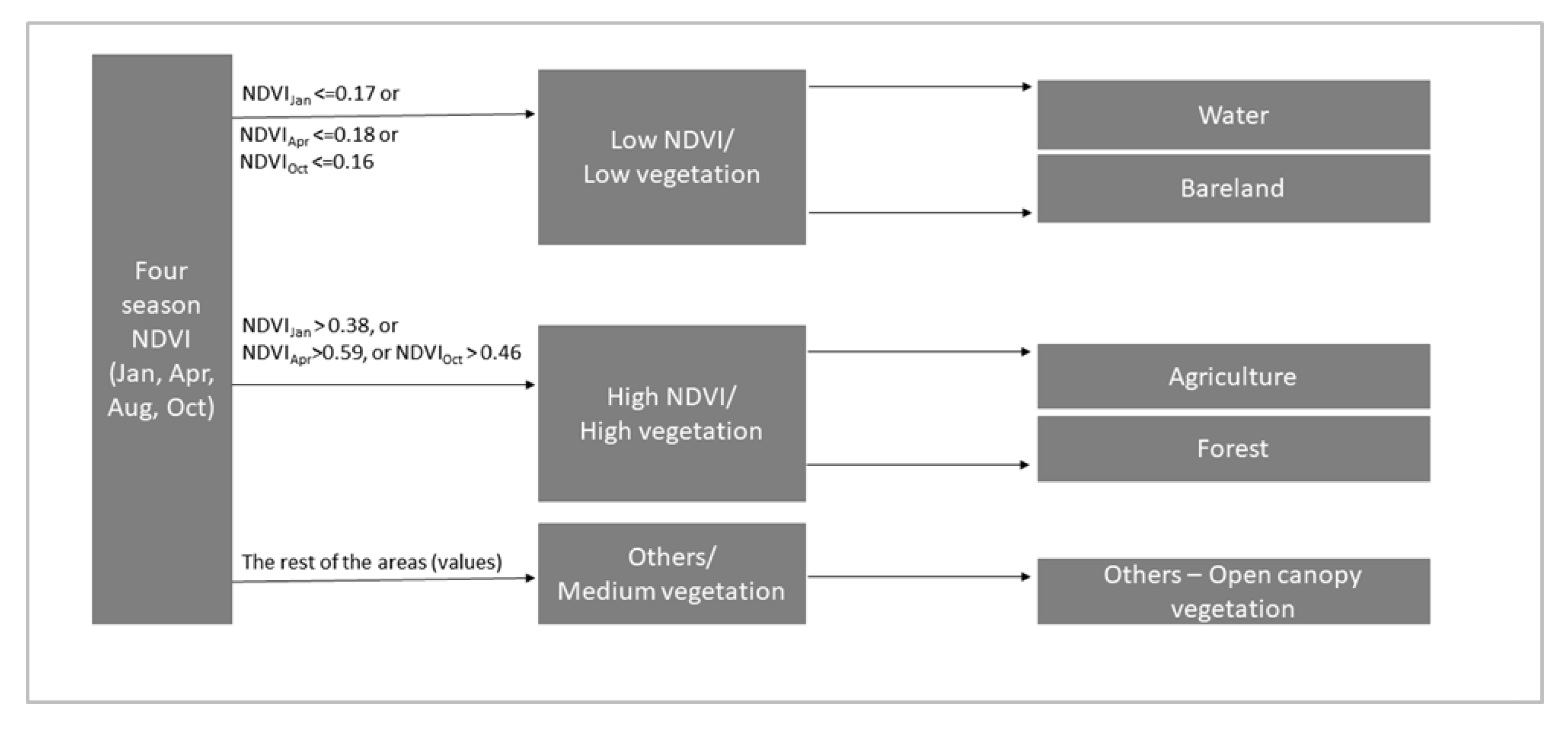
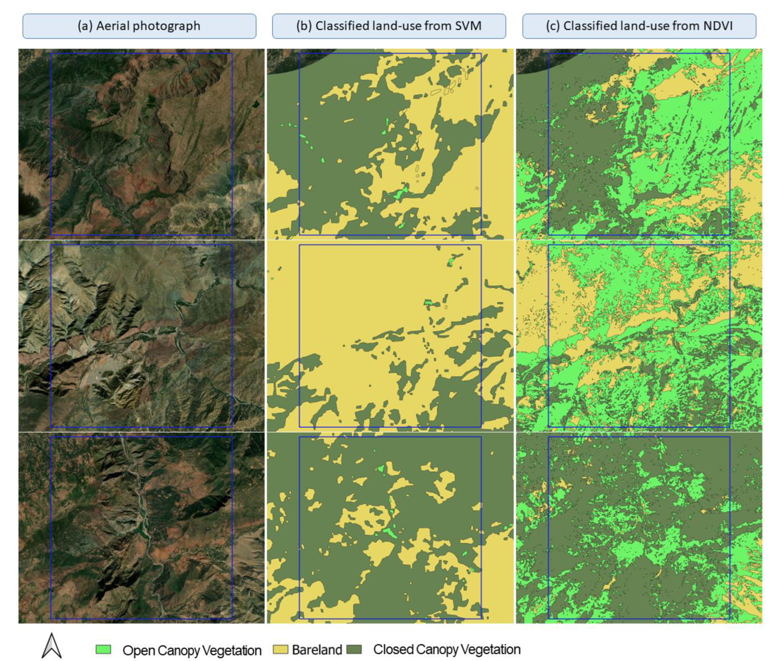
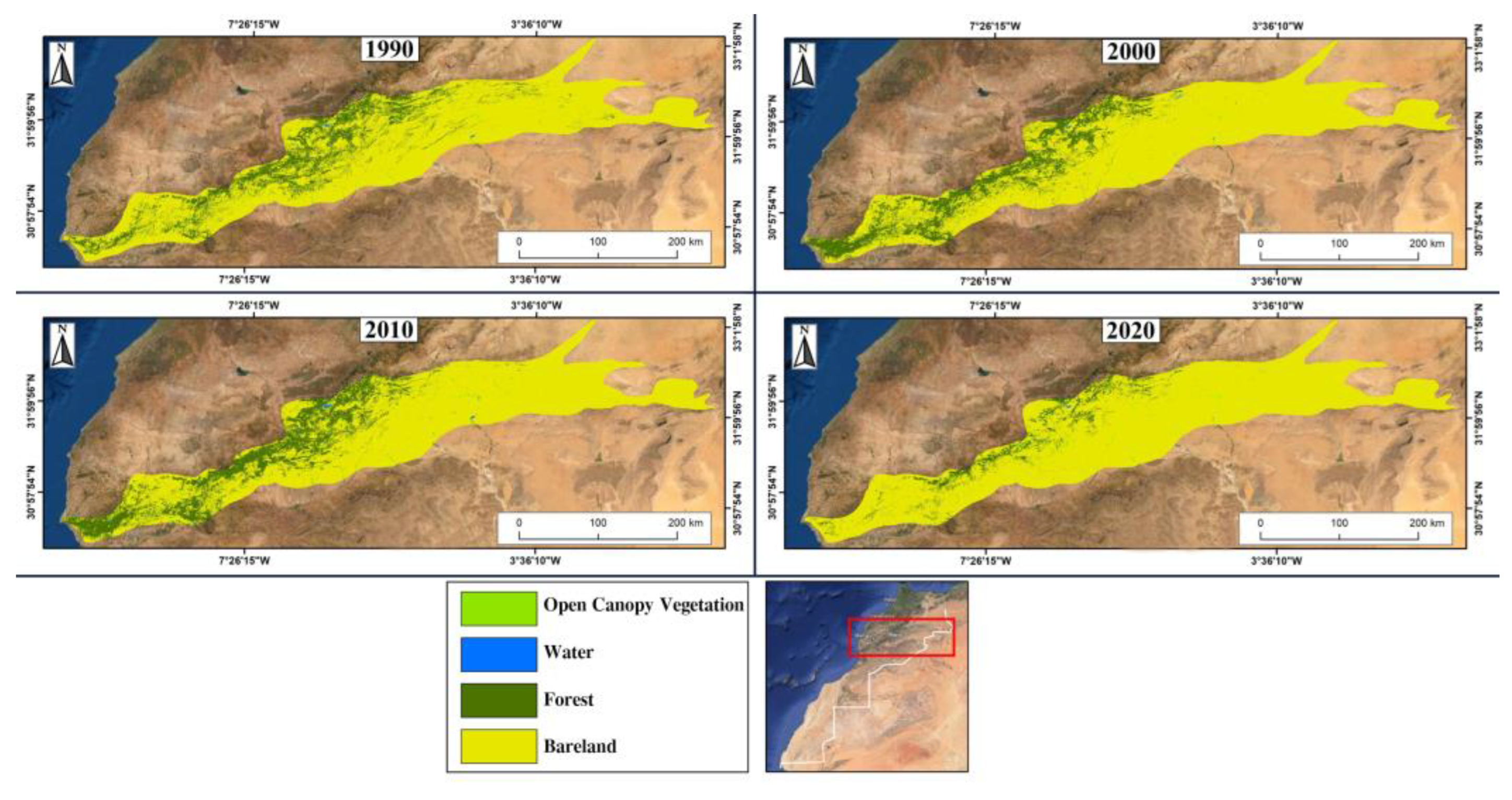
Since the 1990s, Morocco’s agriculture has been characterized by the co-existence and transformation of both modern and traditional smallholder systems. In the Atlas Mountains, the effects of rural–urban transformation have led to intensified irrigated agriculture in some agricultural areas, while others were abandoned. To better understand these effects, this study aimed at (1) analyzing the land use and land cover (LULC) changes, (2) assessing the structure and dynamics of vegetation, and (3) comparing a Support Vector Machine (SVM) classification approach with a seasonal rules-based approach. We, therefore, employed a semi-automatic supervised classification of LULC using Landsat data from the 1990s to the 2020s to distinguish between Open Canopy Vegetation, Bareland, Forest, and Water. Overall accuracies achieved ranged from 88% to 90% in 1990, 2000, 2010, and 2020. SVM results indicated the share of Bareland as >80% of the landscape in all periods. With the seasonal rules-based approach, 10% less Bareland was detected than with the SVM approach. Our findings indicate the limitation of detecting vegetation reflectance in semi-arid mountainous regions such as that prevailing in Morocco using a single machine learning method.
Keywords: season effect; remote sensing; land cover change; vegetation season effect; remote sensing; land cover change; vegetation